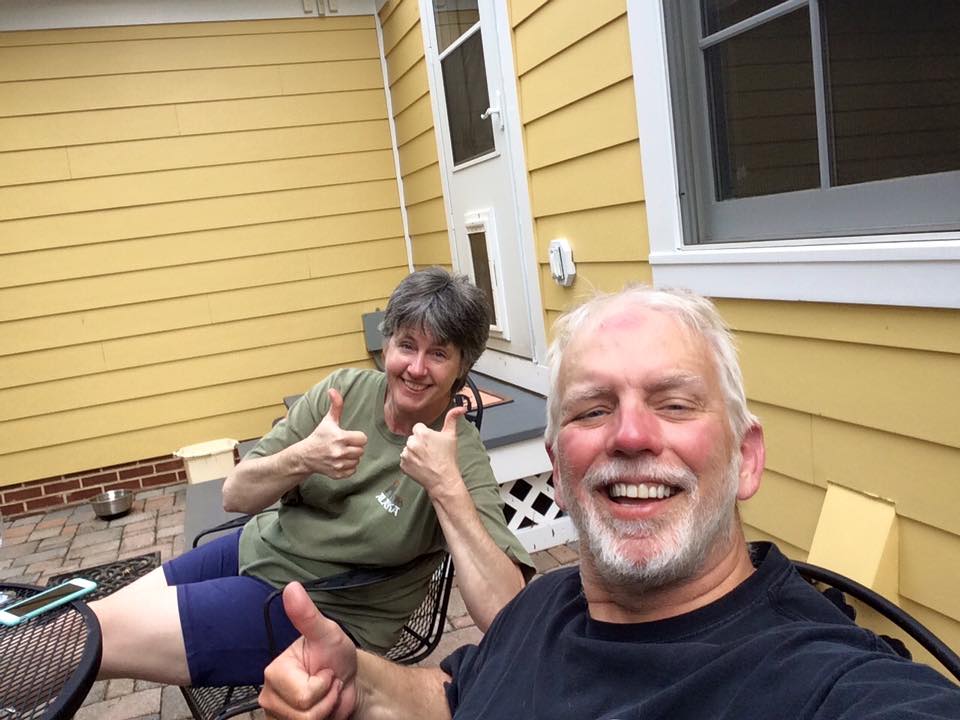
Twenty-three years ago today, I married the love of my life. It’s been a long road, filled with ups and downs, joy and sorrow, happiness and pain. But it’s been a fabulous ride. Hopefully we’ll have many more years together.
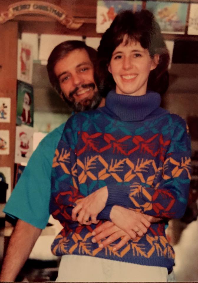
Mike and Me, Christmas 1992
Look how young we looked. That picture was taken in 1992, about four months before we tied the knot.
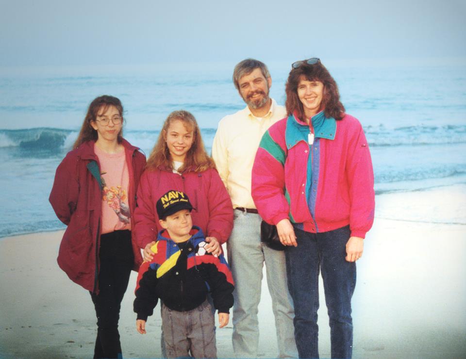
We didn’t make any children together, but together we raised three fabulous kids.
Family trip to VA Beach, about 1994.
We’ve had lots of fun over the years. And together have shared many adventures, big and small.
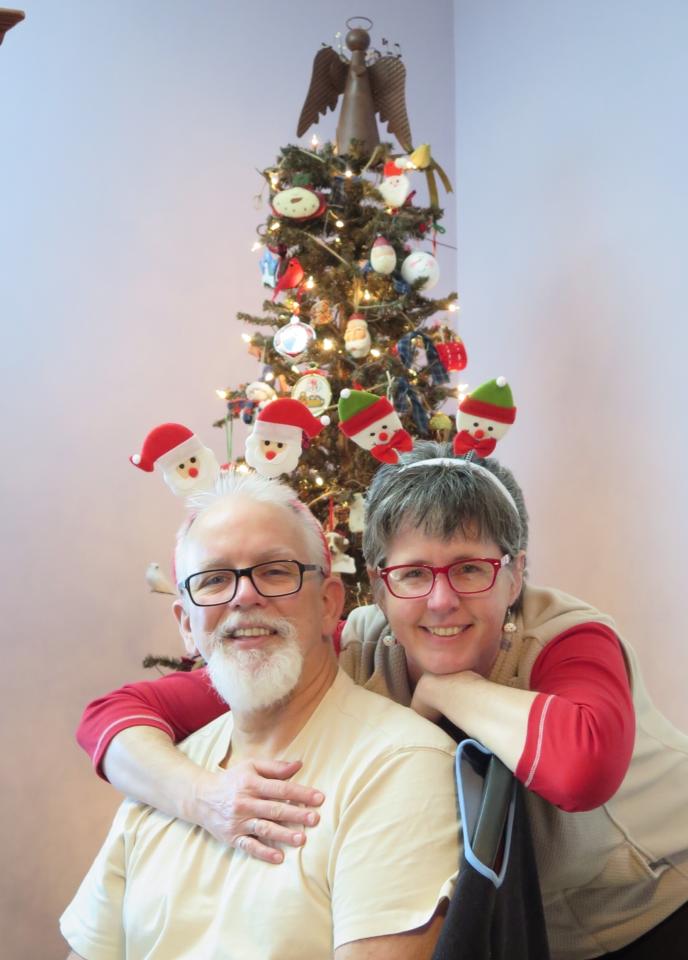
Christmas 2014
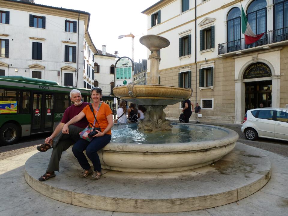
We’ve enjoyed lots of travel together, too.
Mike and I at the not-so-famous Treviso Fountain.
Me and Mike upon his completion of his ride around the US.
We are both lucky to have each other. Not only have we been blessed with three children, we have three grandchildren, too.
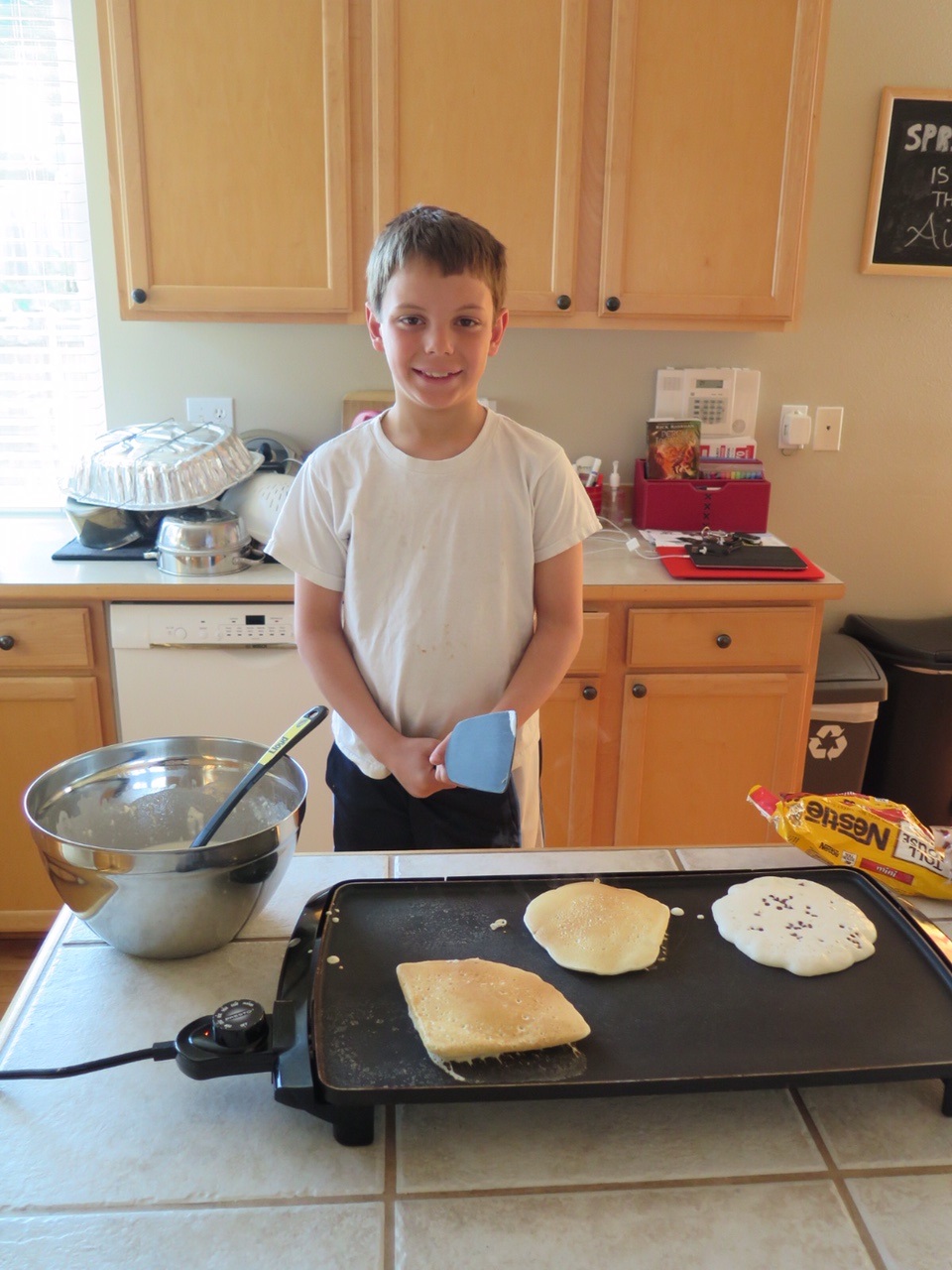
One of those, Joseph, age 8, made use a special anniversary breakfast this morning.
Chef Joseph
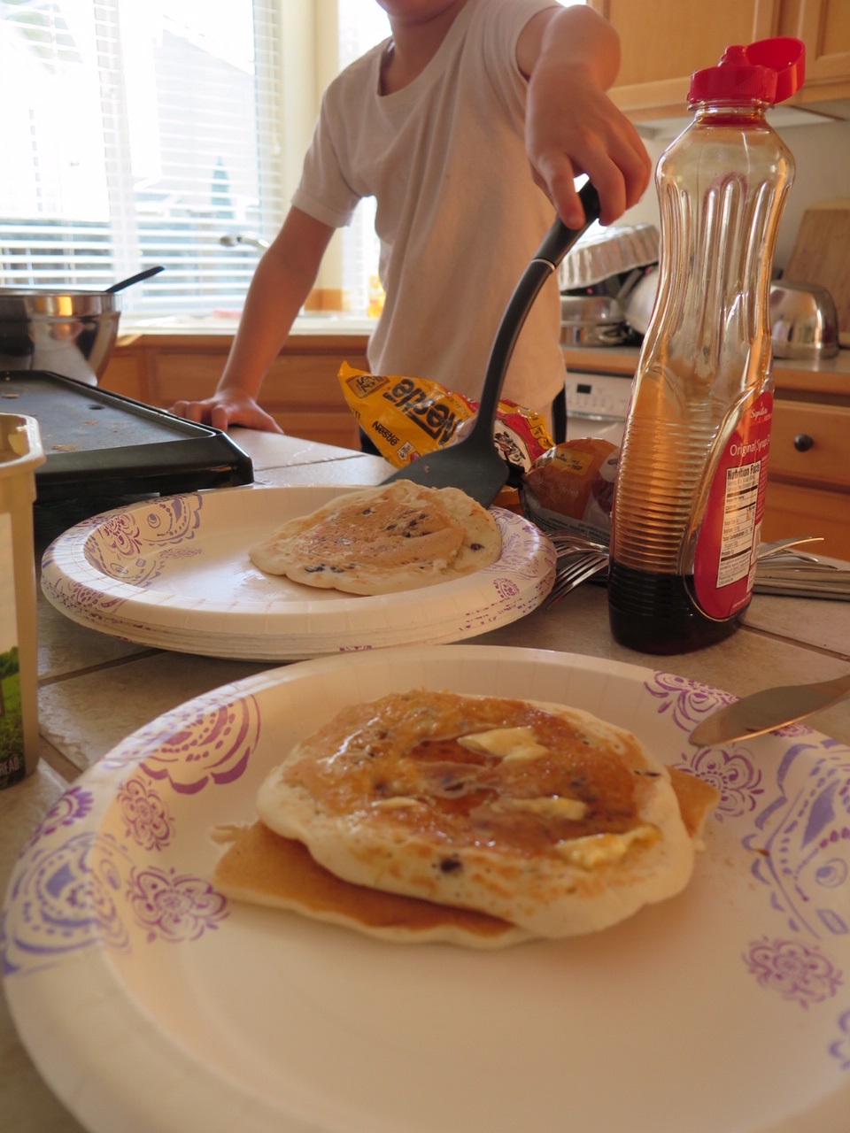
Chocolate chip pancakes. My favorite.
Chocolate Chip Pancakes
I am a lucky, lucky lady. I have a beautiful family and a wonderful husband who loves me. I love him right back.
Here’s to many more very happy years. And a whole lot more laughter.
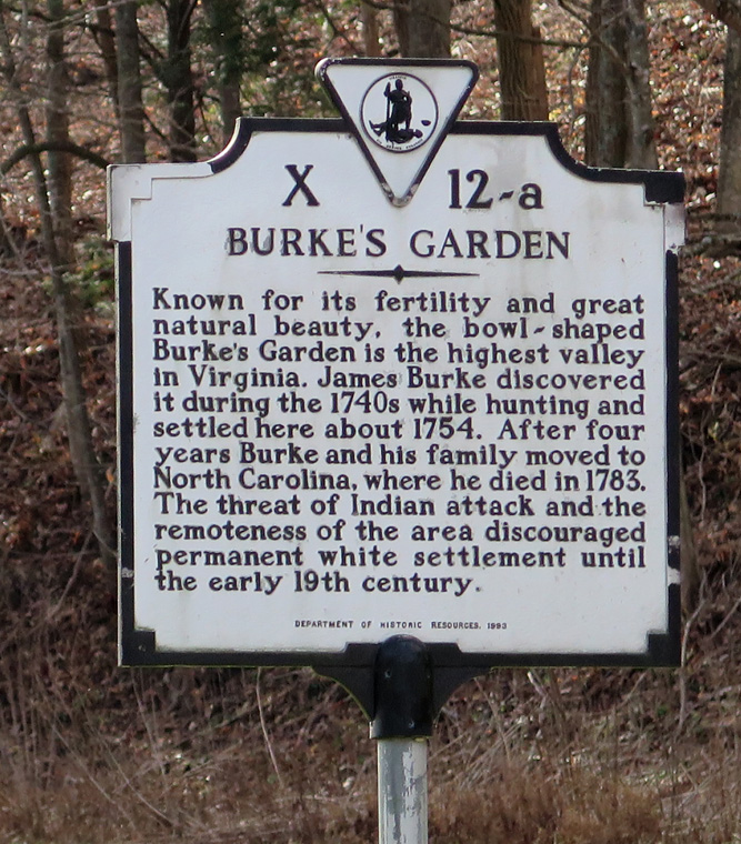
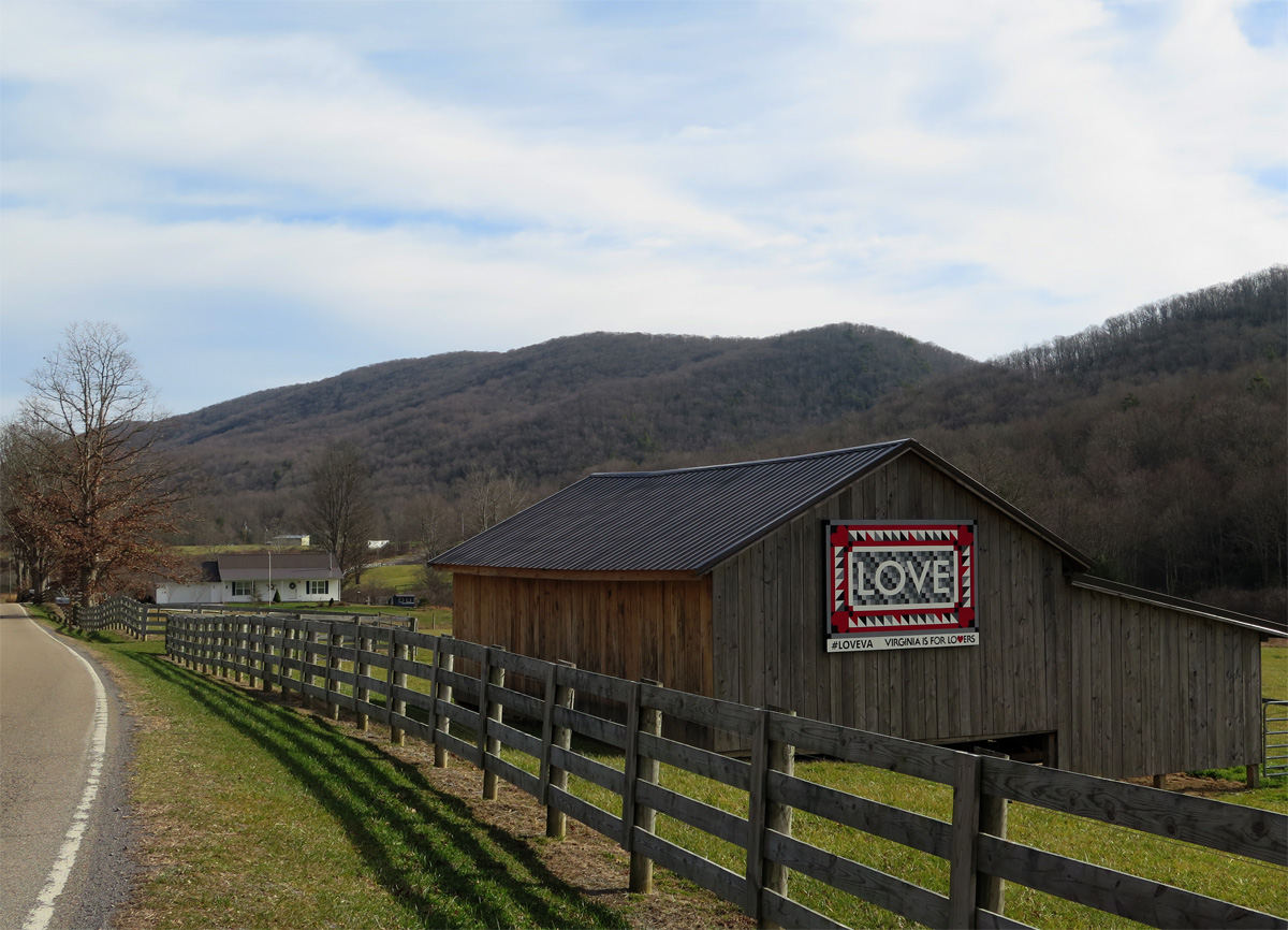
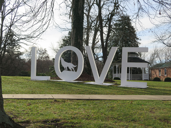
Hubby and I ended up in the coolest place while looking for the LOVEwork listed as being in Tazewell, which is really in Burke’s Garden, about 15 miles east of Tazewell.
The Garden, as residents call it, isn’t just a town, it’s a mountain valley (the highest mountain valley in Virginia at about 3,000 feet or 915 m above sea level) surrounded by one very large mountain. How does a valley get surrounded by one mountain? According to geologists, the mountain, mostly composed of limestone with a sandstone cap, was once 6,500 feet (1,981 m) tall. Over time, the center of the sandstone cap eroded, exposing the softer, underlying limestone to the weather. Then, as the limestone eroded, the mountain basically collapsed. The softer rock formed the valley, while the edges of the cap formed ridges.
It doesn’t sound like a huge deal until you see it from above, as shown in this aerial photo from Lost World Ranch (located in Burke’s Garden, the ranch raises Bactrian Camels and Llamas). The ranch has an interesting history piece on the Garden if you’re interested.
…Burke’s Garden is a beautiful land that, to a certain degree, time forgot. The place is completely off the grid of modern life: There is no newspaper delivery in the town, and no cable television; no stoplights and no working post office. And no cell phone service. Many of the residents are retired, a few of them farm, and lots drive out to work in nearby towns, constantly challenged by often-sketchy road conditions leading in and out of Burke’s Garden.
Not only did they have my new favorite LOVEwork, there were also quite a few barn quilts, interesting road signs, and plenty of beautiful scenery.
Here are my favorite captures from the Garden.
Tazewell LOVEwork in Burke’s Garden
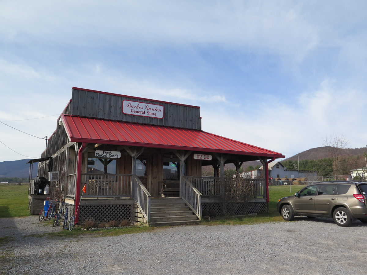
General Store
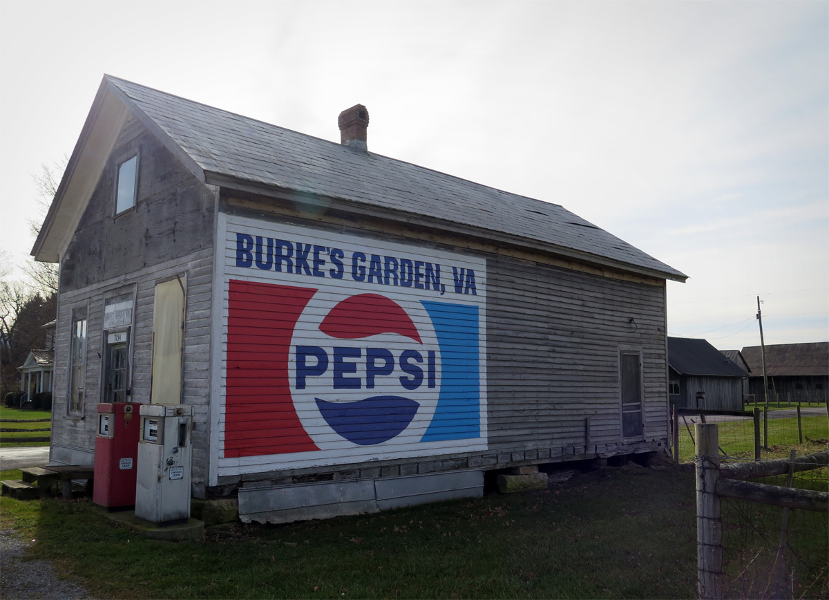
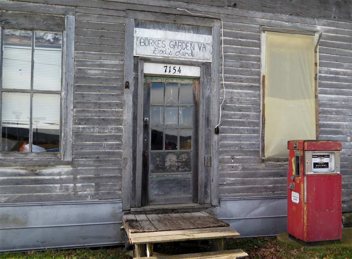
This building reportedly serves as the unofficial post office.
Old Building
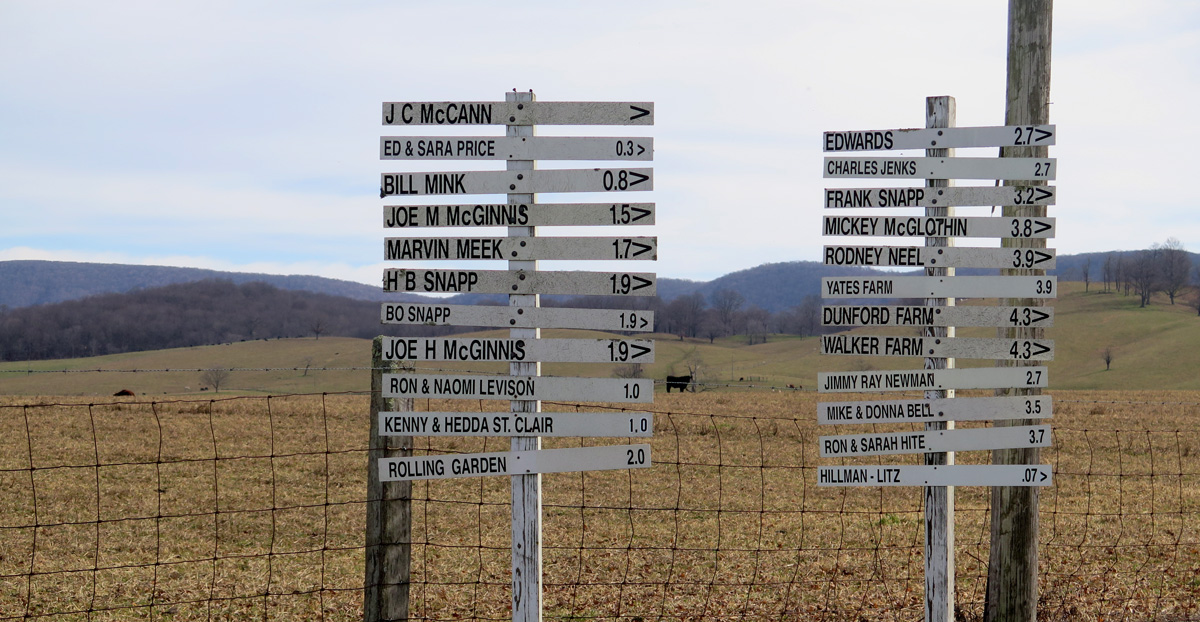
The Most-interesting Wayfinding Signs Ever (there were several)
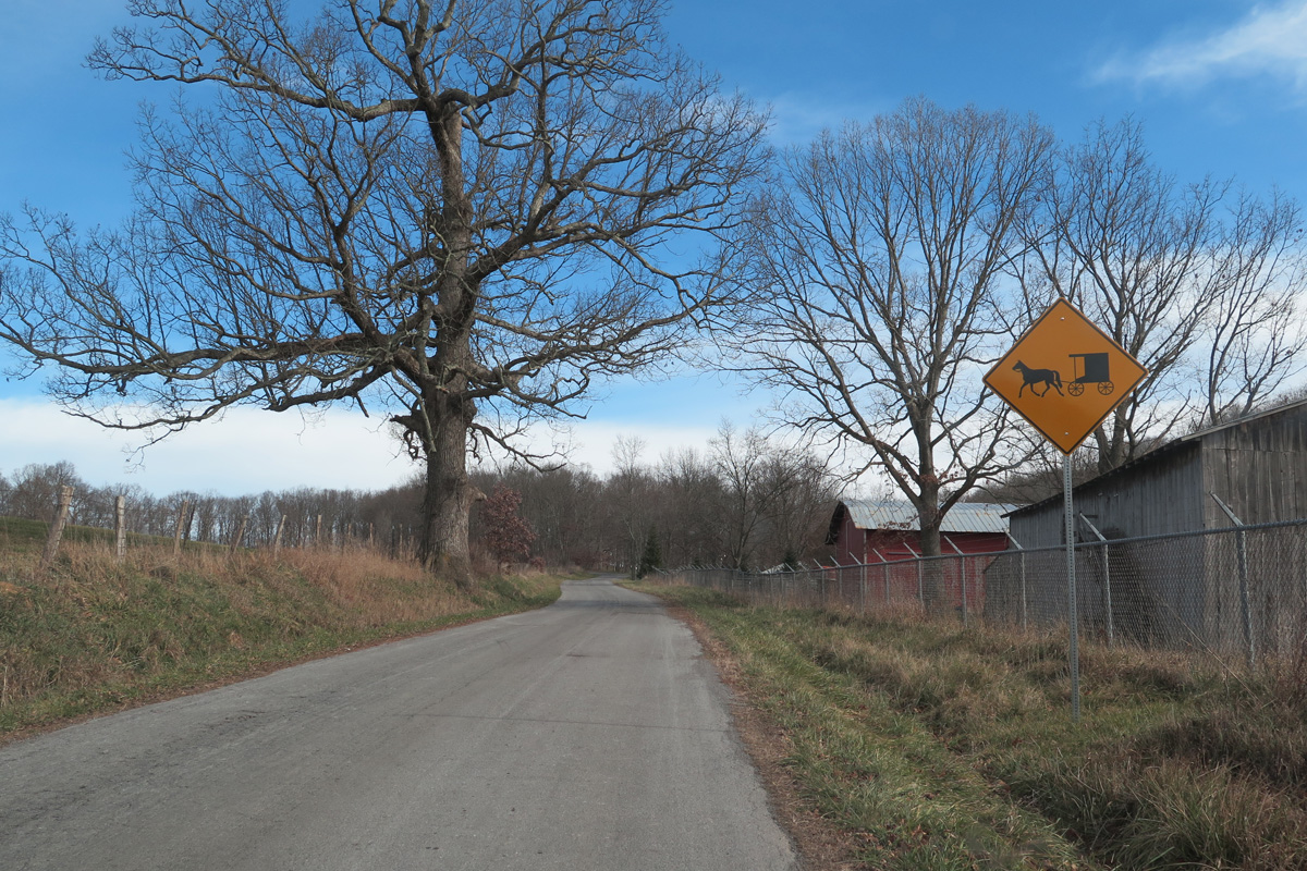
Amish Buggy Warning Sign
It’s a very pretty place.
And a happy place.
It felt like we were out West.
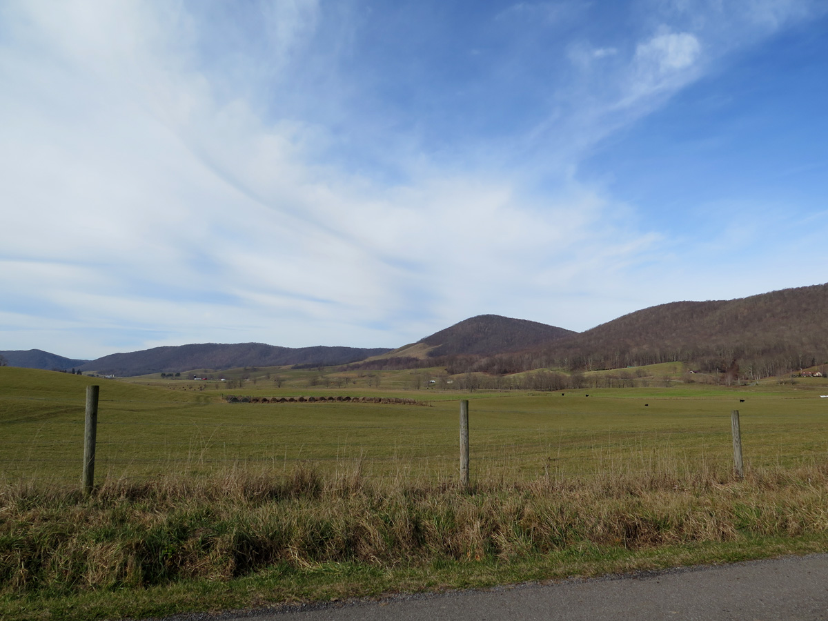
Surrounded by Mountains
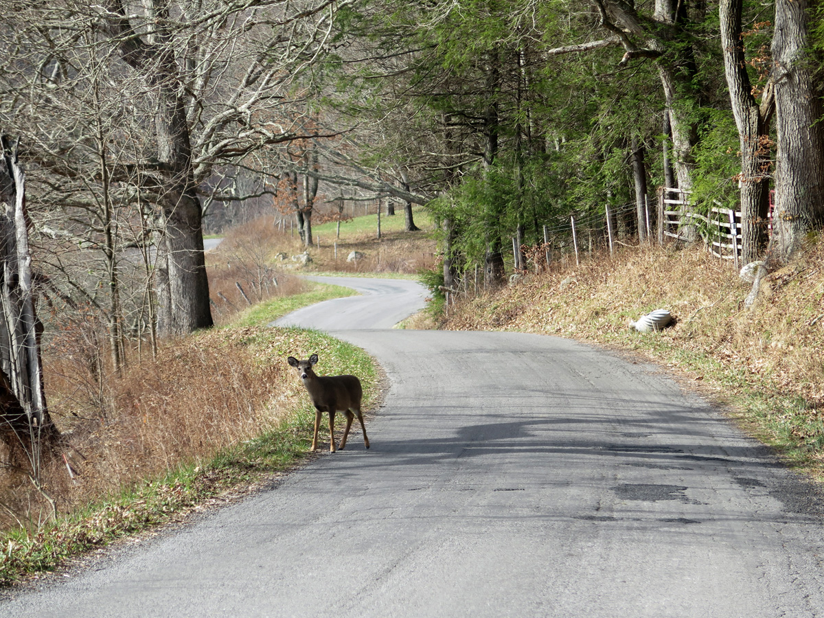
Deer!
We happened upon that little gal, who didn’t want to give up the road. We followed her slowly as she trotted along, finally exiting to the left after rounding that far bend in the background.
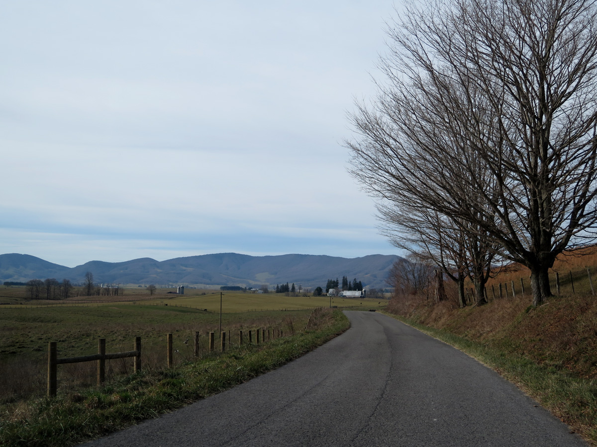
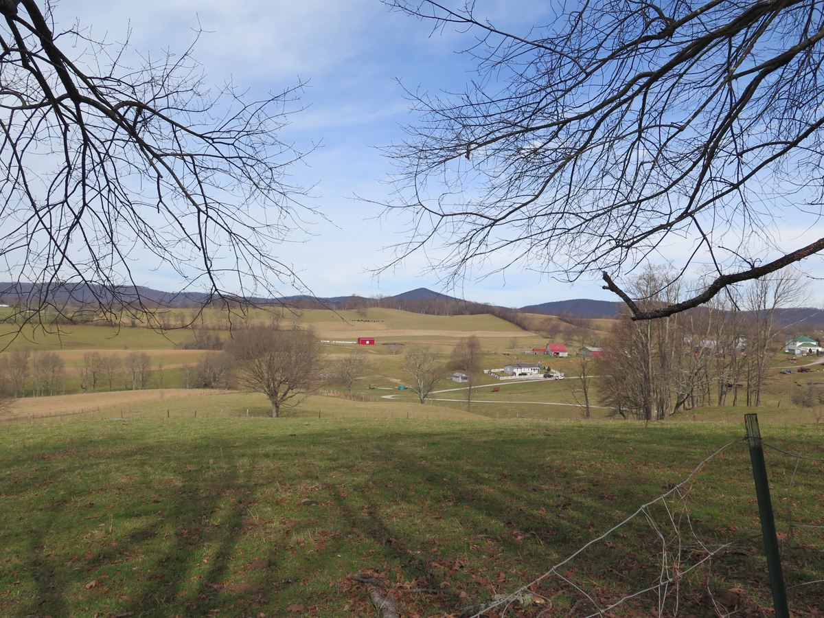
View from the southern end of Burke’s Garden.
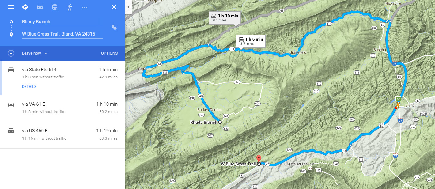
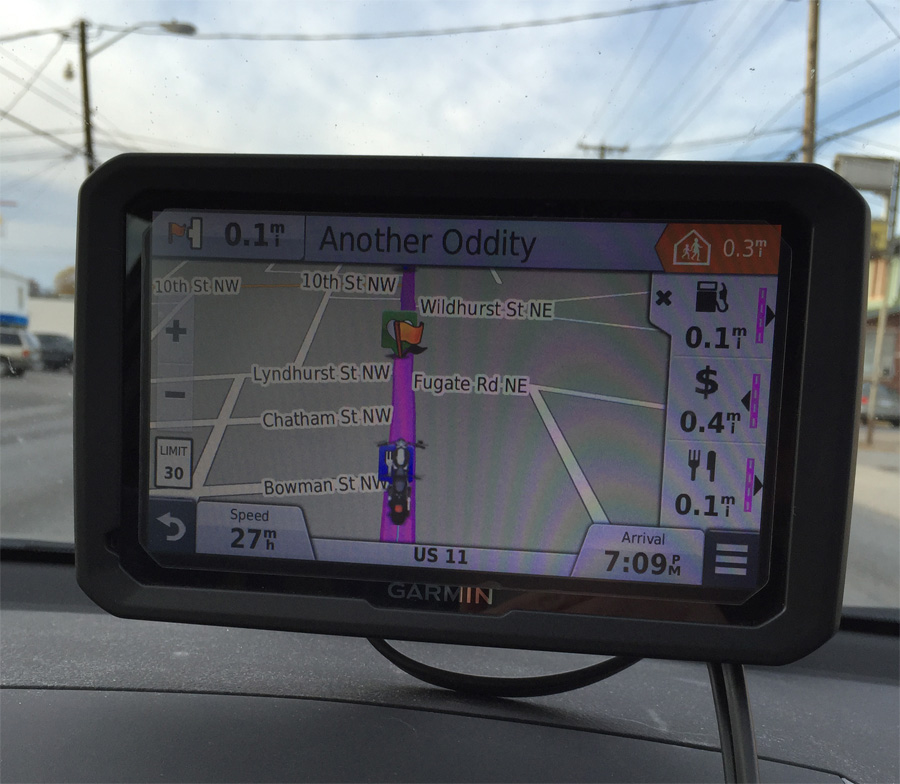
When I mapped the route, which Hubby later put into his GPS, I had intended for us to enter the valley from the north and exit on a very curvy road to the south. The GPS software apparently didn’t like that idea, and made us turn left, looping around the Burke’s Garden valley instead. It was a lucky detour that gave us the opportunity to see more of the lovely place. But I wanted to take the curvy route out of the valley.
Burke’s Garden isn’t an easy place to reach. The route into the valley from the north is the only paved road. Hubby had apparently had the mapping software set to avoid gravel roads when he entered the route.
Google Maps doesn’t like the curvy gravel road either. It wanted to send me along the loop shown.
The GPS didn’t like the curvy road!
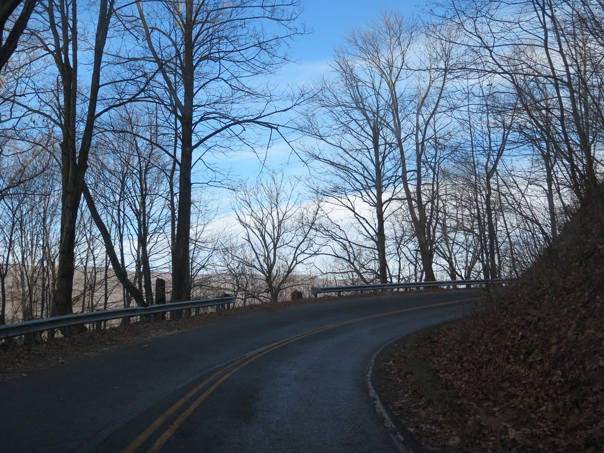
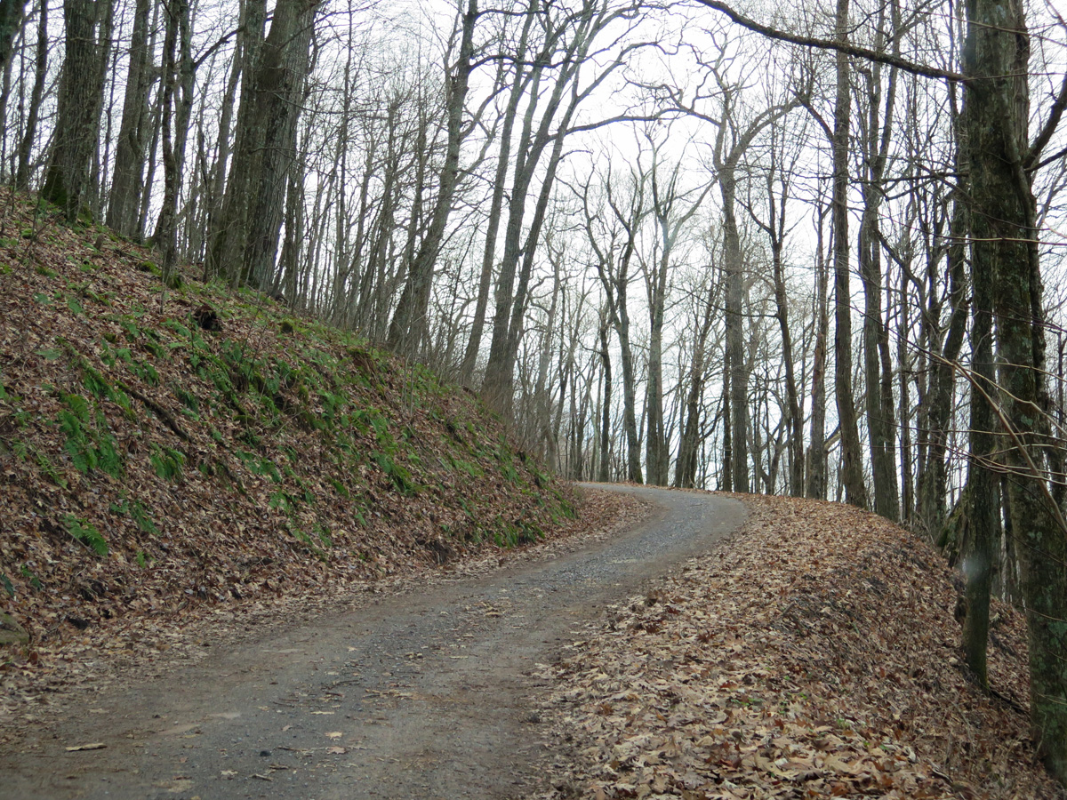
VA-623 heading into the valley from the north.
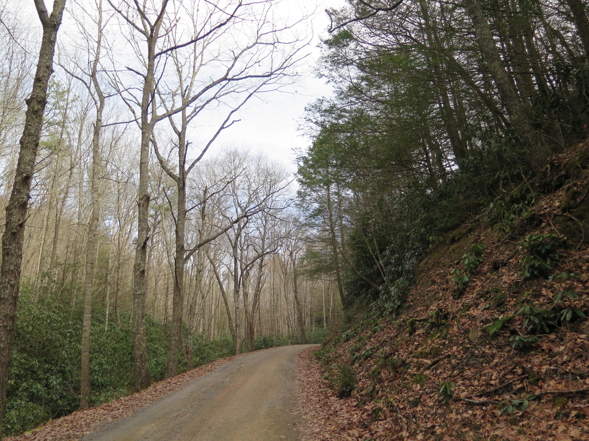
VA-623 exiting the valley from the southern end.
Yes, the road was as narrow, steep, and curvy as it looks.
View from a little ways up the road.
Look at all the rhododendron!
Hubby and I were divided on whether or not we’d want to revisit the road in the Spring. I’d love to see the rhododendron in bloom, but that’s definitely NOT a road for his big Victory. There are quite a few very tight turns and even a few hairpins, all very narrow.
If any of you would like to visit Burke’s Garden, I recommend driving in from the north. The southern portion can be treacherous during Winter, with icy patches lingering into late Spring. Followed by mud. It took us about an hour to cover the 10 or so miles (~16 km) of gravel road, not because conditions were bad, but because we were enjoying the scenery. 🙂
It’s definitely a nice place to visit and is well worth the trip if you like pretty scenery. And especially if you like barn quilts.
I hope you folks in the US enjoyed your Thanksgiving. Ours was interesting.
As I mentioned the other day, we didn’t have any meal plans for turkey day. A couple of weeks ago, when I was cataloging VA LOVEworks I still needed to capture, I mentioned planning a trip in the car, since Winter is approaching. Hubby said he’d go along, so I suggested doing it on Thanksgiving.
Hubby started a diet recently, and I knew we wouldn’t be preparing a traditional meal for the two of us. So I figured a road trip would be better than sitting around the house.
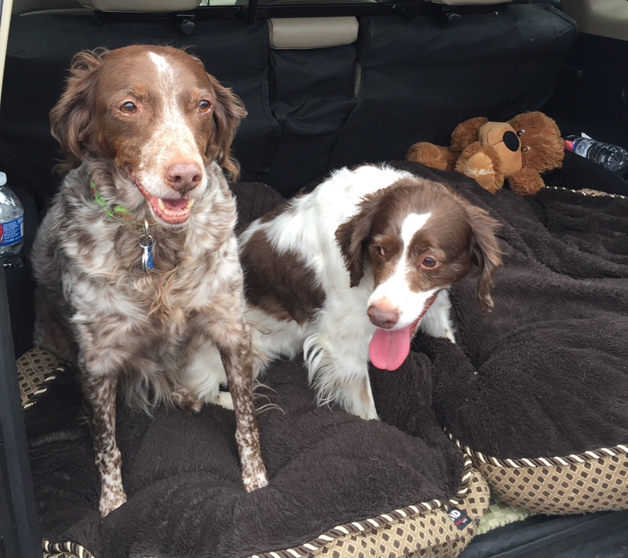
Not only did Hubby go along, we took the furkids, too. That’s something we rarely do. In fact, we’ve never spent the night in a hotel with these two. K is a good car rider. Belle doesn’t like car rides. Neither of them gets carsick, thank goodness, but Belle does a lot of panting unless we’re on an interstate or other smooth, fast-moving road. I was a bit worried that they’d be a real nuisance, but they actually did good on the ride.
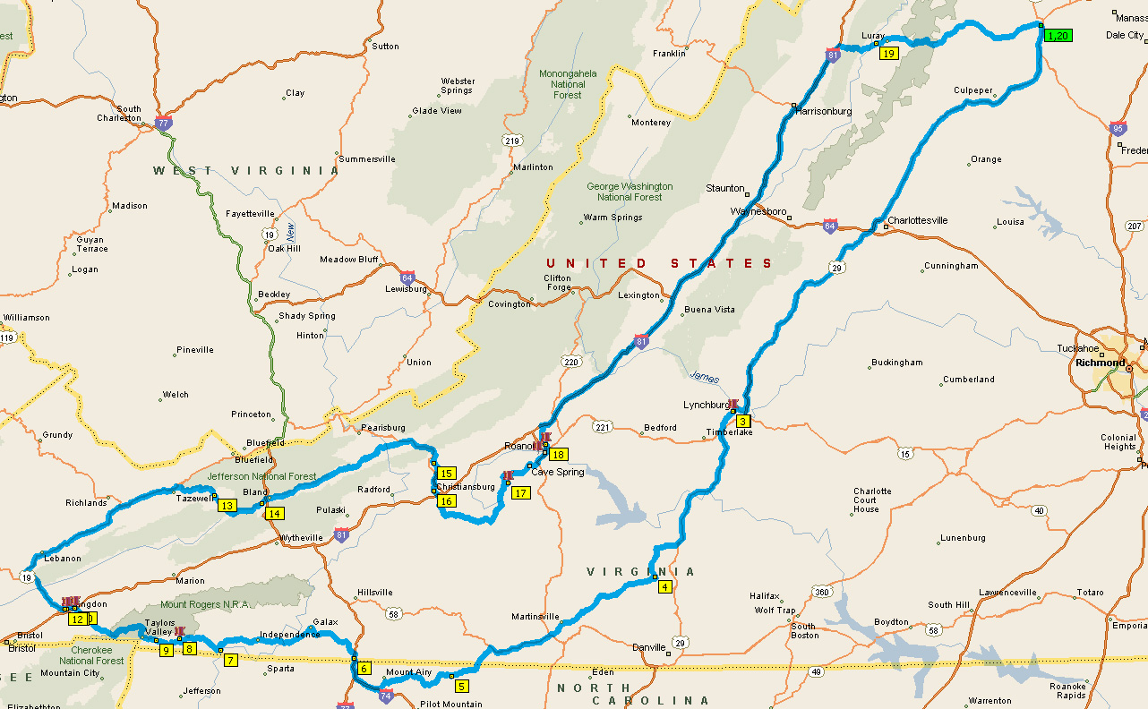
Overview Map
I’d planned on capturing seven of the large LOVEworks and one smaller one, which I knew to be indoors. I also included two roadside oddities, which I knew wouldn’t be enjoyed by all participants. But, since both were in areas we’d be passing through anyway, I included them.
Traveling in a clockwise direction, our first stop was in Lynchburg. Wait, I mean our first planned stop was in Lynchburg, we first had to stop at Wal-Mart to buy a dog leash. We’d forgotten to grab the leashes before leaving home and could only find one in the car.
My Traveling Companions at the Lynchburg LOVEwork
Mike, being a good sport, tried to get both of the girls to look at me for a pic. I took about ten shots before giving up.
Not knowing when, if ever, I’d get back to Lynchburg, I wanted to see the shoes. There were other oddities, like an enema collection, large metal water pitcher, and Easter Island head, but I didn’t want to push it.
Crazy Clouds
From there, we headed south and west toward Lambsburg. The LOVEwork is actually located at the Virginia Welcome Center along the northbound side of I-77, so we dipped down into North Carolina then headed north on the interstate.
The weather was warm — mid-60s F / about 18 C — dry, and partly cloudy, which made for some interesting skies.
Lambsburg LOVEwork
That’s my favorite LOVE image from the trip. The light was perfect and there was a break in the clouds.
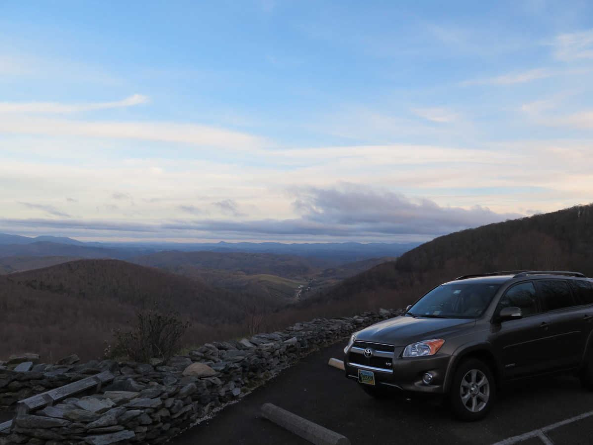
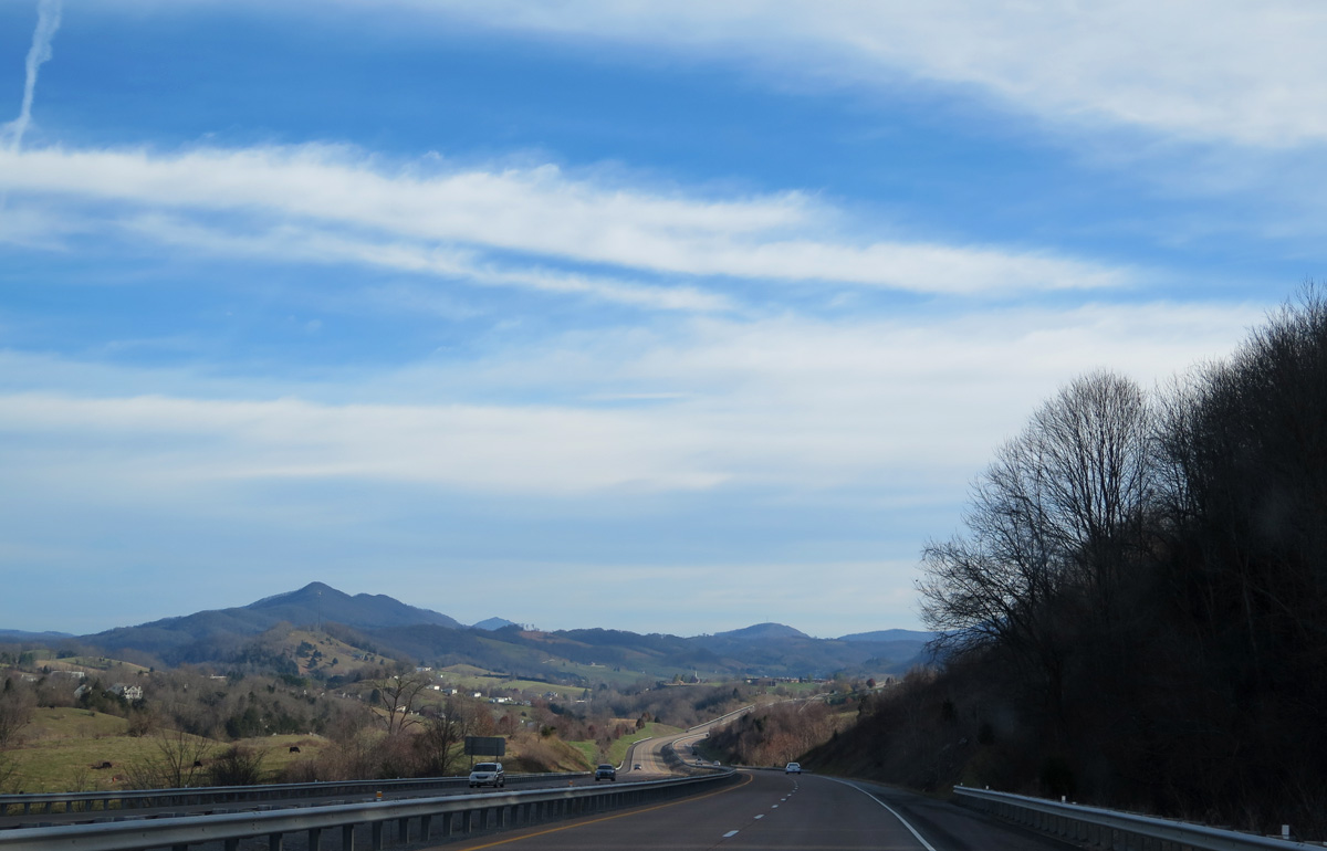
From there, we headed west toward Abingdon, where we’d reserved a hotel room for the night. A good bit of the Lambsburg-to-Abingdon leg was along The Crooked Road Trail (a portion of US-58), which goes past Grayson Highlands State Park, a place I’d been wanting to visit. I’d read there was a pretty good view from the park. As it turns out, the Internet was right.
View from Grayson Highlands State Park
I’d hoped to see downtown Abingdon’s Main Street at night, but Hubby was tired after those 380 miles in the car. The girls needed some people time, too. So, we got a mediocre-to-crappy meal at Cracker Barrel, which was right next to the hotel, then hunkered down for the night. (By sheer coincidence, Abingdon was almost exactly the halfway point of our journey.)
After a yummy breakfast, we were off.
Abingdon LOVEwork
I’d stopped in Abingdon in July, but the sculpture had been damaged during a storm and removed for repair, so I missed it. I’m glad I got the chance to go back. Not capturing the Abingdon piece wouldn’t have been a huge deal, but it’s a pretty town in a very nice area.
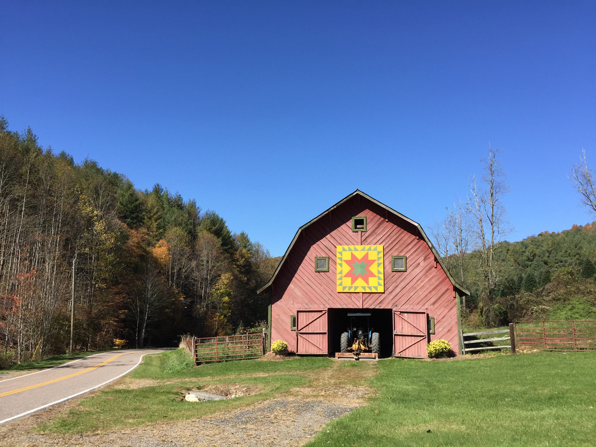
We also stopped at Holston Mountain Artisans, a craft co-op which has an indoor LOVEwork I’d hoped to see. They have a barn quilt on the outside of their building, so I actually got a chance to see a full-size barn quilt up close for the first time. (The standard side on a big barn is 8′ by 8′ (about 2.5 x 2.5 meters) square.
Holston Mountain Artisans’ Barn Quilt
Hubby actually discovered a second, smaller barn quilt behind the building, which I’ll share later. Sadly, the shop didn’t open for another hour or so and we had a lot of ground to cover, so off we went.
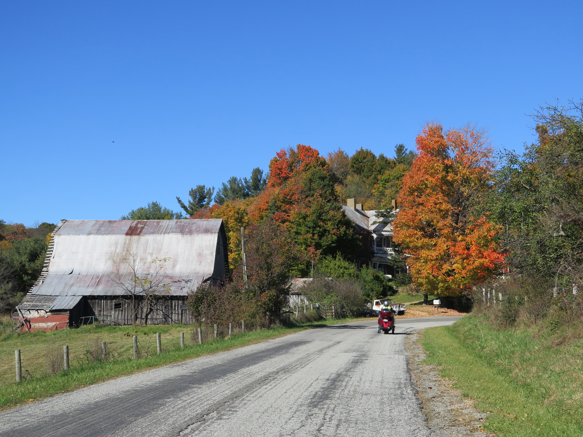
Driving northeast toward Tazewell
I forgot to mention earlier that it was a very pretty day for a drive.
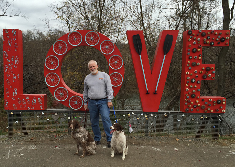
The next planned stop was Tazewell, where we’d capture the piece I was most excited about seeing.
Seen along the drive to Tazewell.
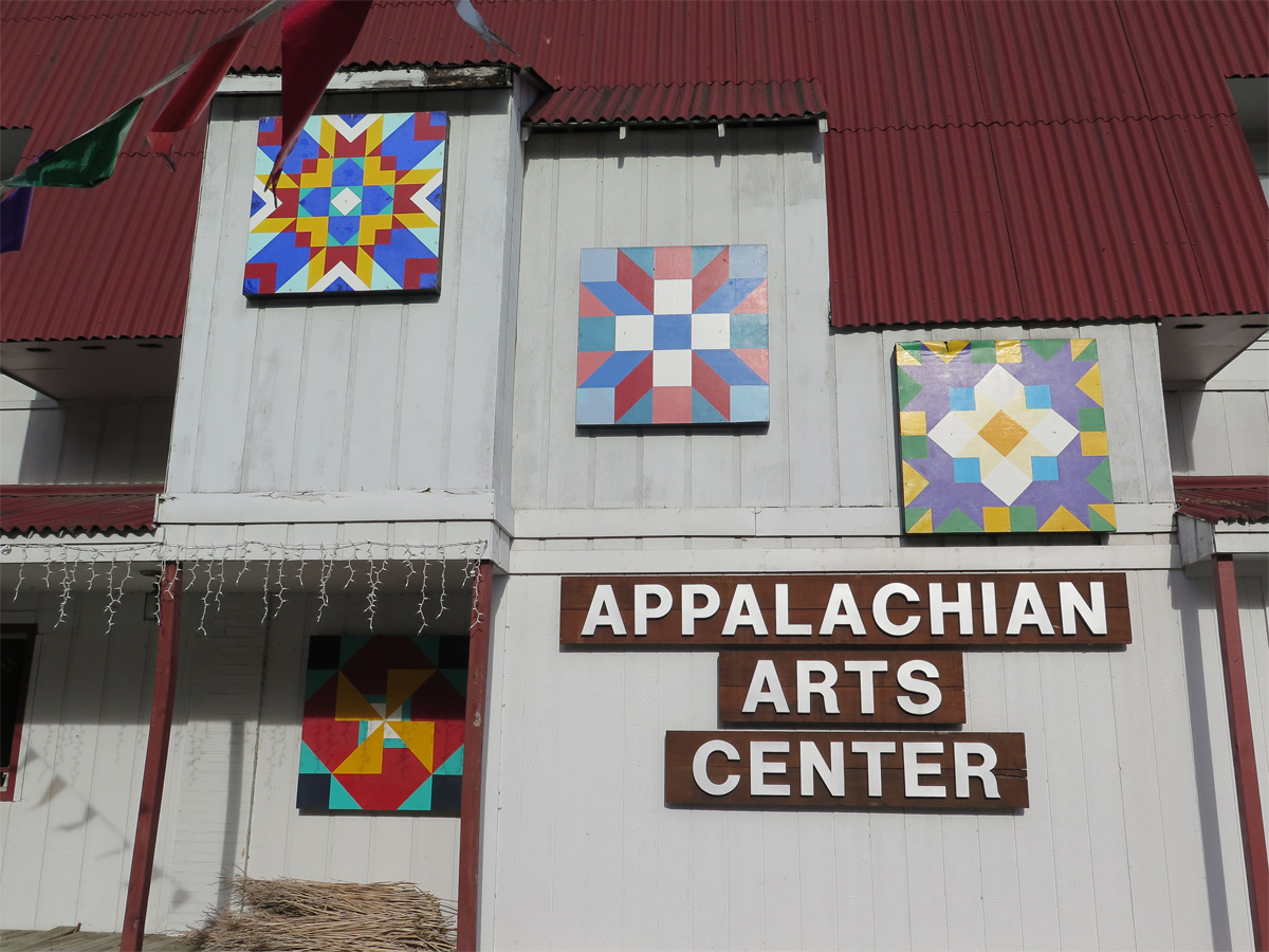
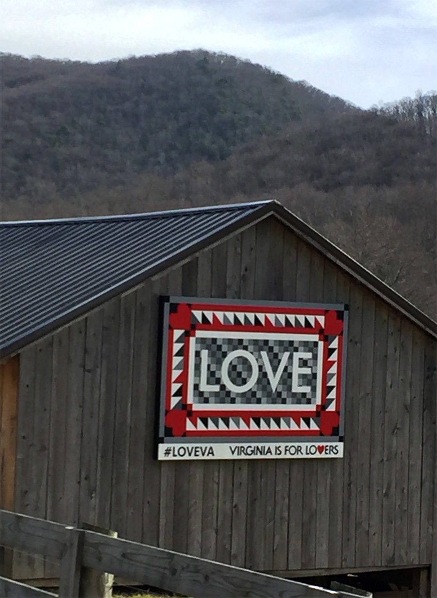
I couldn’t resist stopping to see the barn quilts on this not-yet-open arts center. Speaking of barn quilts… wanna know why I was so excited about seeing the Tazewell piece, which was also added very recently?
It is a barn quilt LOVEwork! I’m not doing a barn quilt scavenger hunt, I just really enjoy seeing them.
Tazewell LOVEwork
That piece is in a really, really cool location, too, which I’ll tell you about in a separate post.
Blacksburg LOVEwork
Not all LOVEworks have to be standalone art works. The Blacksburg piece is a very nicely done mural.
We also revisited neighboring Christiansburg to capture a pic of the piece we’d ridden past in July because it was rush hour and too dang hot to stop.
Again, not seeing it wouldn’t have been a big deal. There are no hard and fast rules to this self-imposed scavenger hunt, but since we were in the area, we stopped.
Christiansburg LOVEwork
We were supposed to see a seventh LOVEwork. Unfortunately, I’d failed to notice that the LOVEwork at the Silver Hearth Lodge, which was one of the more-recent additions to the growing list of sites, is on private property and you’re supposed to make a appointment to see the thing. We took our chances and drove up to the lodge anyway, but didn’t see the LOVEwork.
I don’t think pieces should be included on the official/master list of LOVEworks unless they are publicly accessible around the clock. I can’t be the only person to have driven to see a specific piece only to be thwarted because a piece was behind closed gates and/or doors.
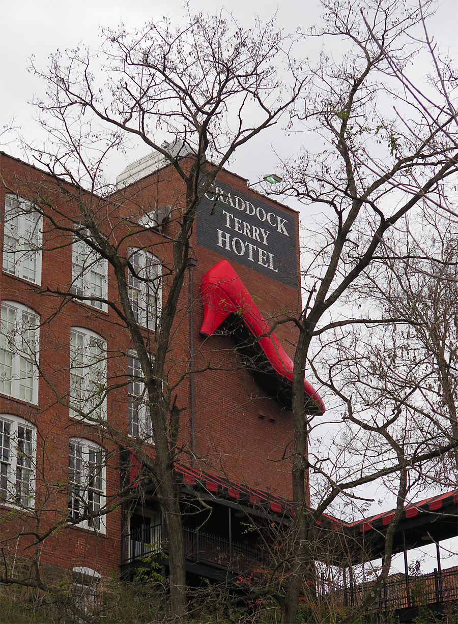
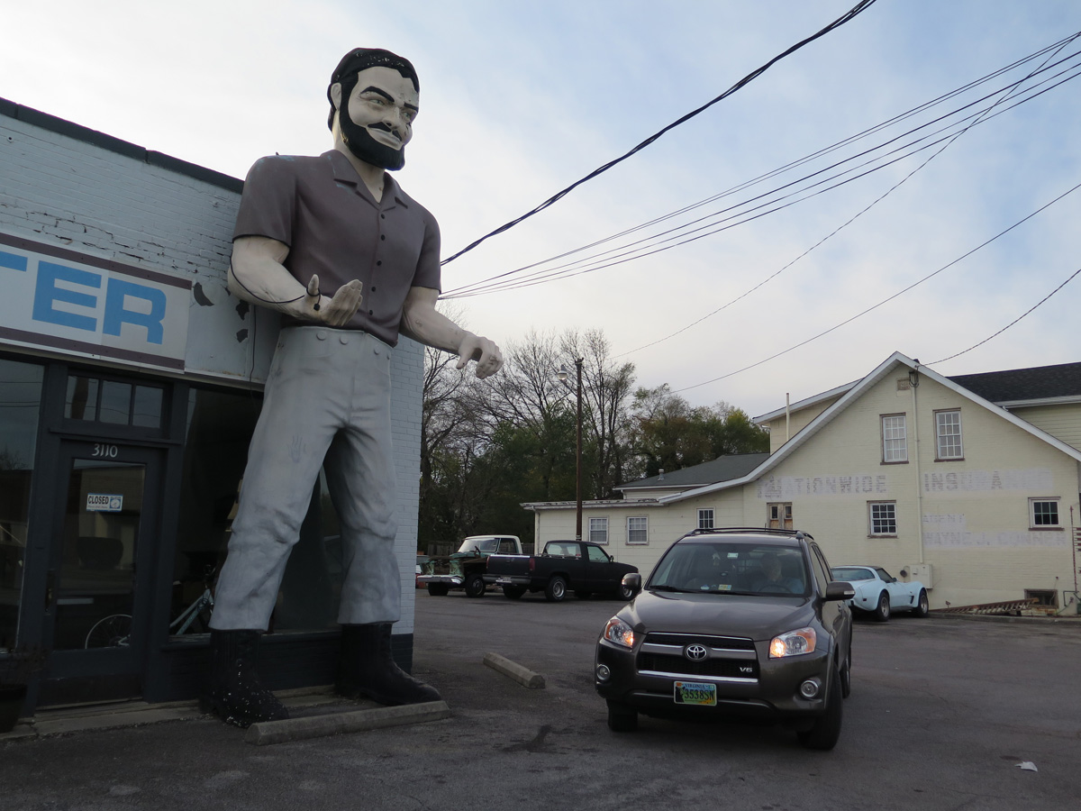
The next-to-last planned stop for the day was a must-see for me. I missed it the first time I visited Roanoke.
I had planned the route, but Hubby was in charge of entering it into the GPS. His label for the next stop should tell you how unexcited he was about that one.
Just another stupid roadside oddity…
I was excited, but the girls were ambivalent.
My first Paul Bunyan Muffler Man
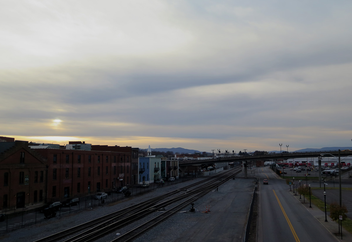
I should have made the girls get out of the car, but sunset was fast approaching and I wanted Hubby to see downtown Roanoke. As it turns out, he wasn’t impressed.
Looking west from Roanoke, just before sunset.
That was the end of day two. Not counting the uneventful drive home from Roanoke. I think it was just before 8:00 p.m. when we got back to Warrenton. The girls were especially excited to be back home. We were, too.
Now, if I could just muster up an iota of Christmas spirit, I might get something done today.
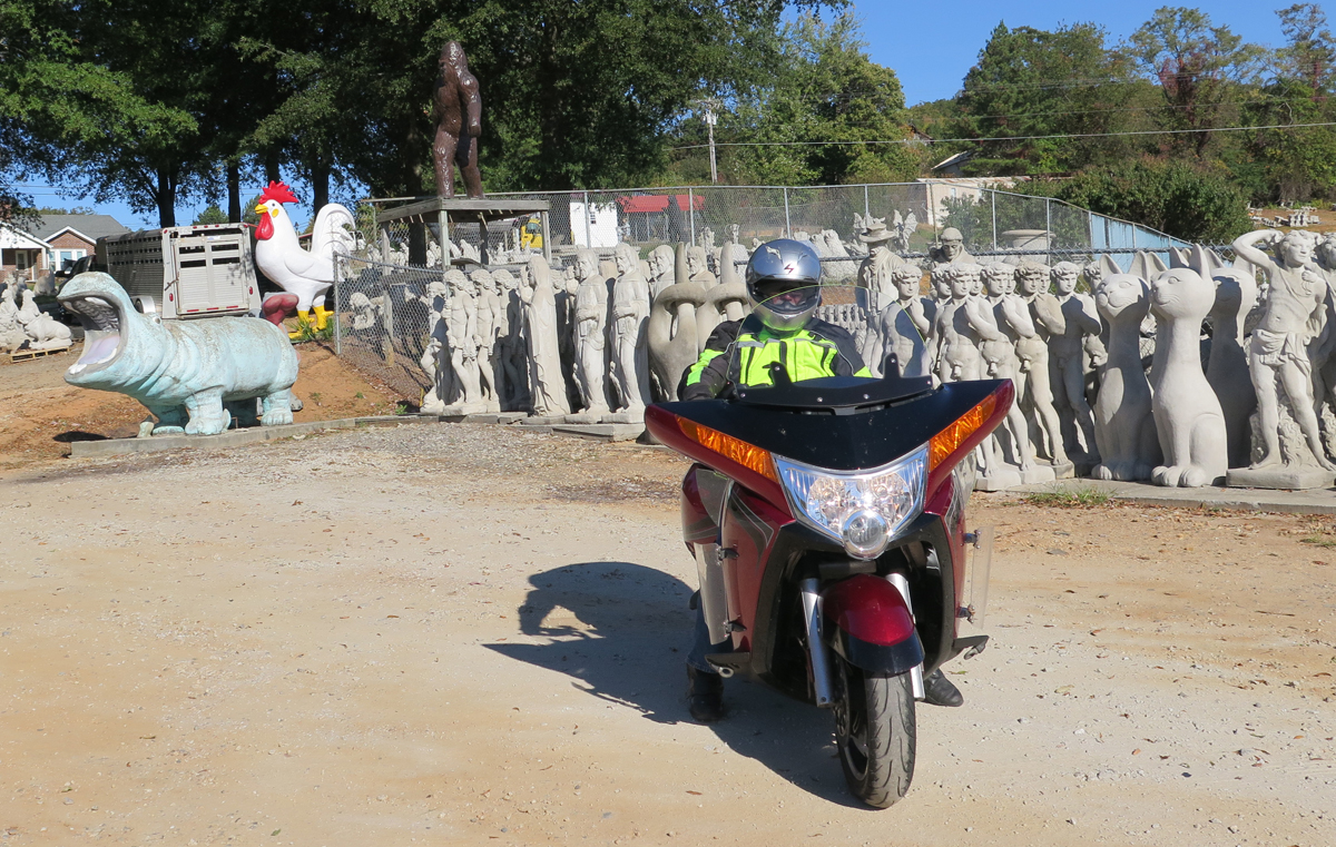
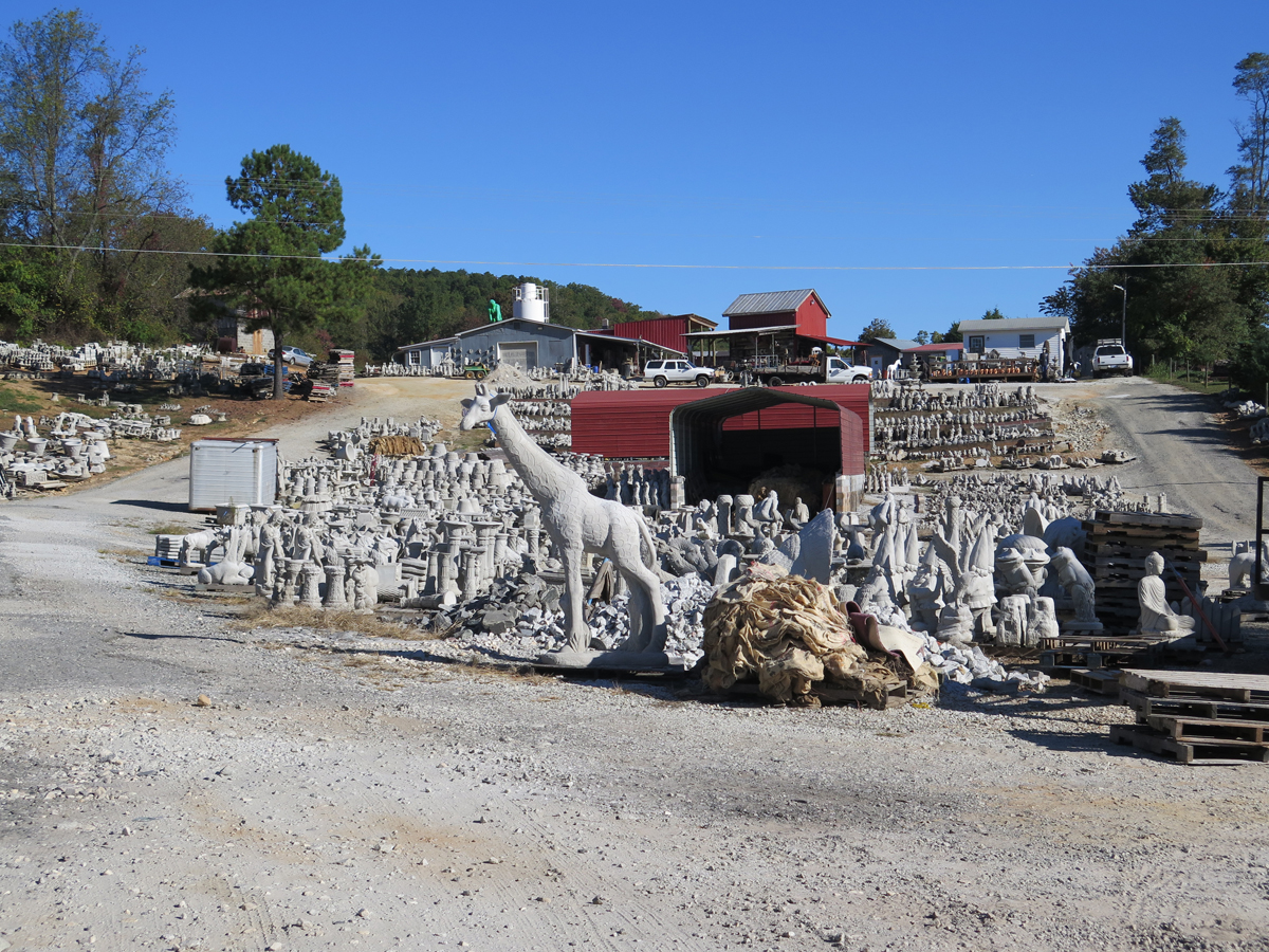
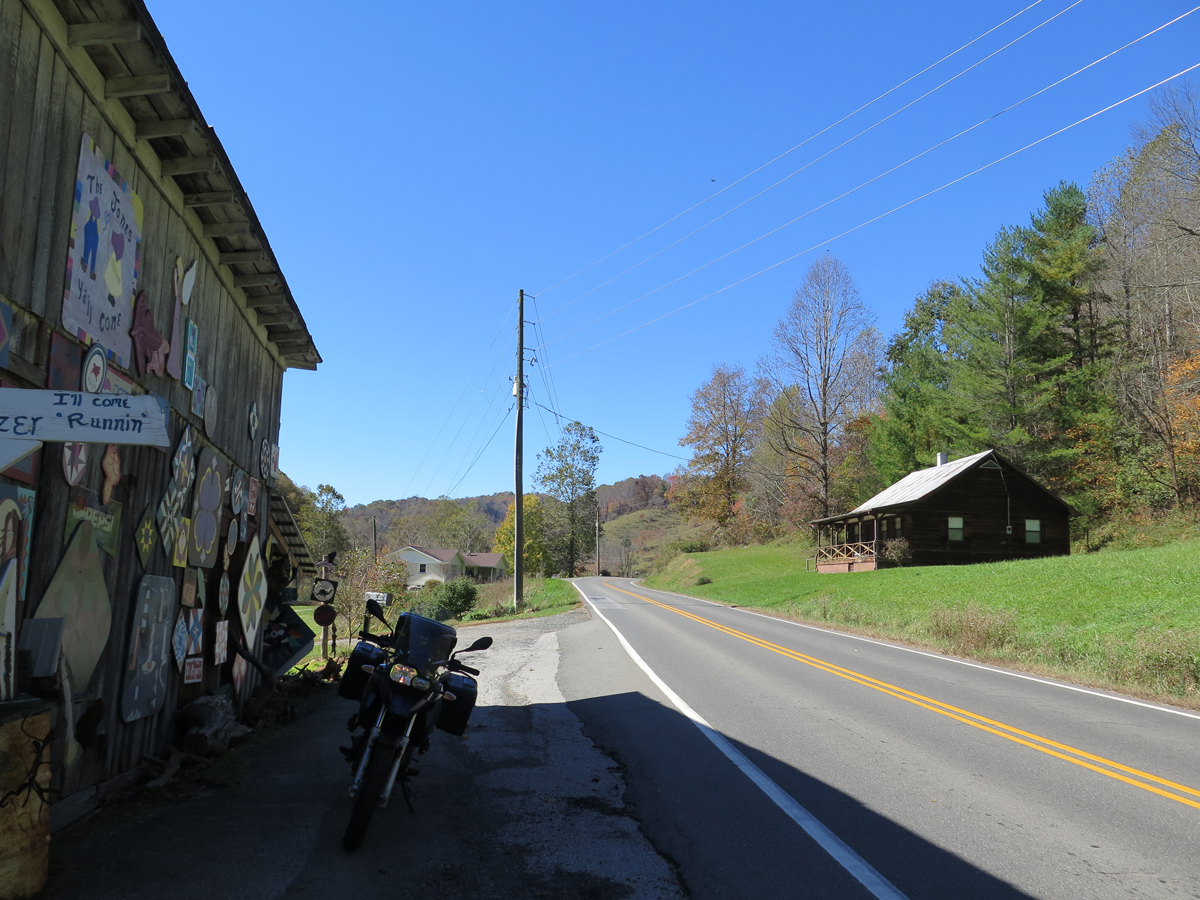
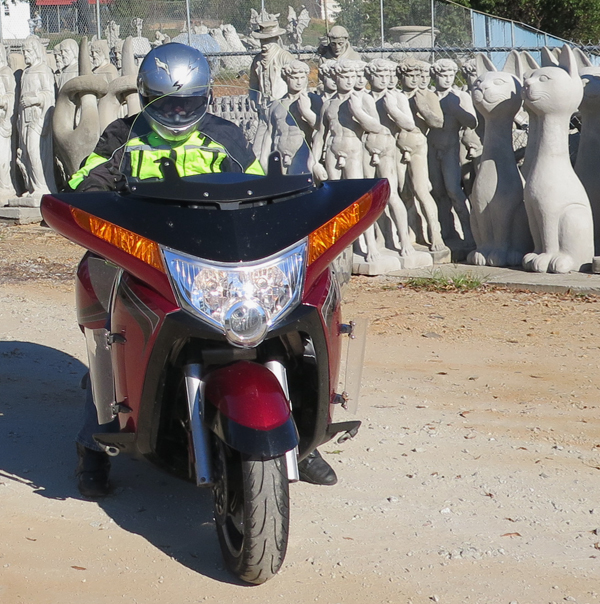
Y’all know I don’t usually subject my Hubby to really weird stuff that I know he won’t appreciate or enjoy, right? But sometimes, I can’t help myself. Especially when there’s something that is just SO up my amusement alley, in a location we’re not likely to re-visit anytime soon. Which is why, after leaving Mount Airy, North Carolina on our recent trip, I included a stop at Slick’s Pottery in the neighboring town of Slate Mountain. I may or may not have planned the route specifically because it passed through that particular locale. 🙂
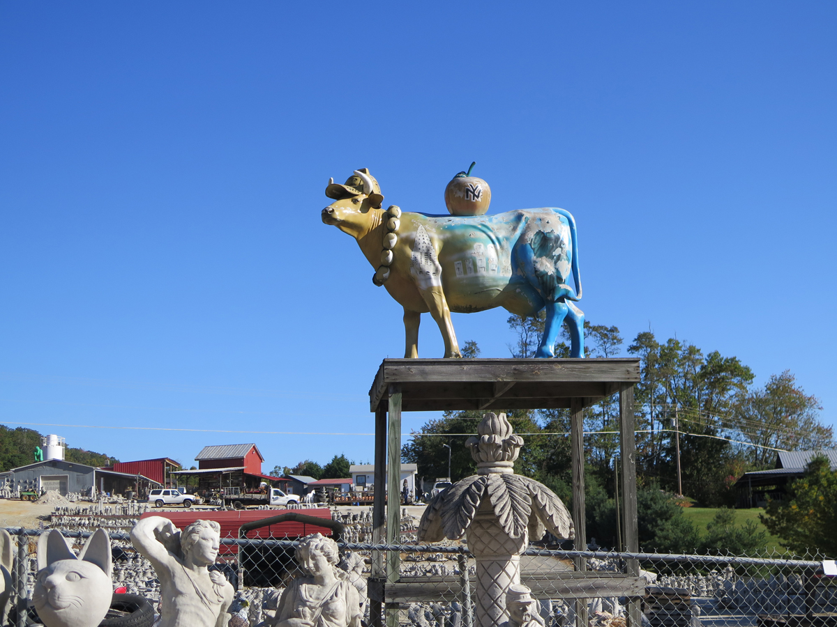
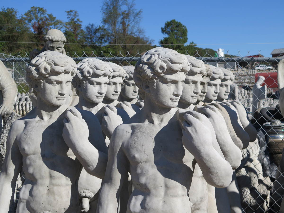
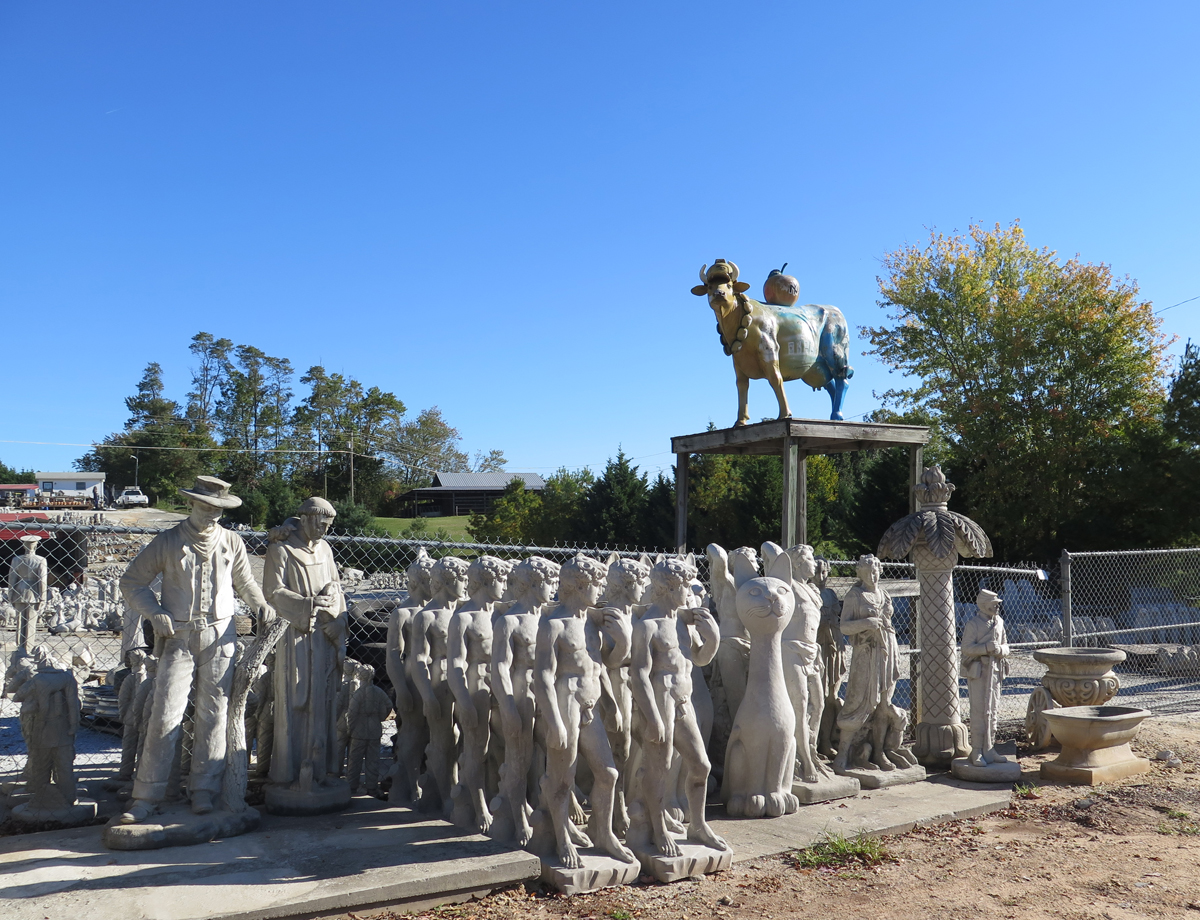
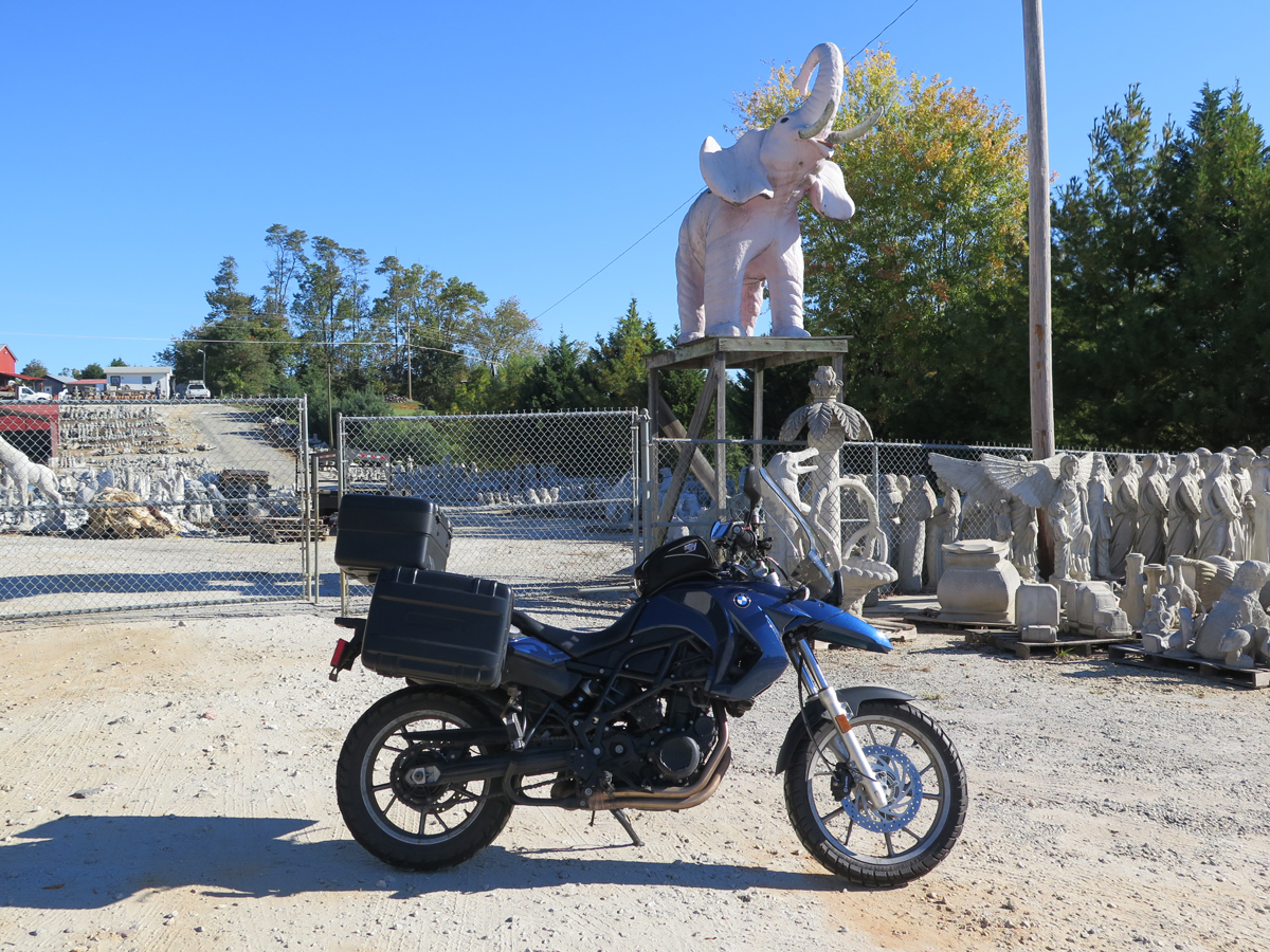
Along a rural road, an unexpected army of concrete warriors, animals, and Jesi crowd a hillside below a concrete statue factory. The selection no doubt varies continually, but on the day that we stopped by we saw what Americans apparently crave for their lawns and gardens: a dragon, lion, eagle, Indian chiefs, enraptured worshippers, armless Venuses, a pink elephant, an Amish buggy, and a cow up on a pole painted as a tribute to New York City. And there were many more statues arrayed in ordered battalions back from the road, up to the factory. It’s all about the latest ironic juxtaposition waiting to be photographed.
How could I pass THAT up? I would’ve been kicking myself indefinitely if we hadn’t stopped, always wondering what amazing wonders we could have seen.
And, in the end, we only spent five minutes there.
Yes, I can work fast when required.
I think he even enjoyed the visit. A little, anyway.It really was a small hillside full of statues.
The business was closed while we were there (a Sunday morning). 🙁
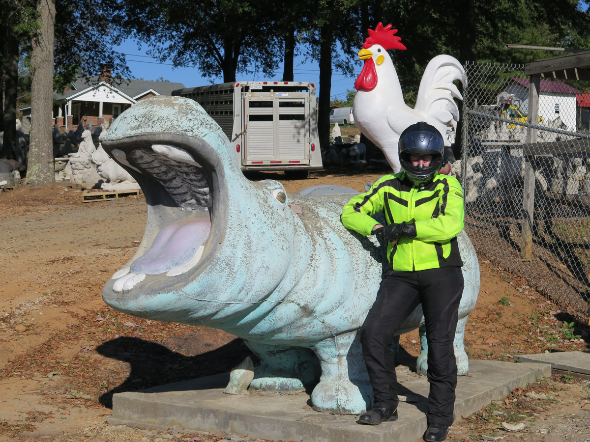
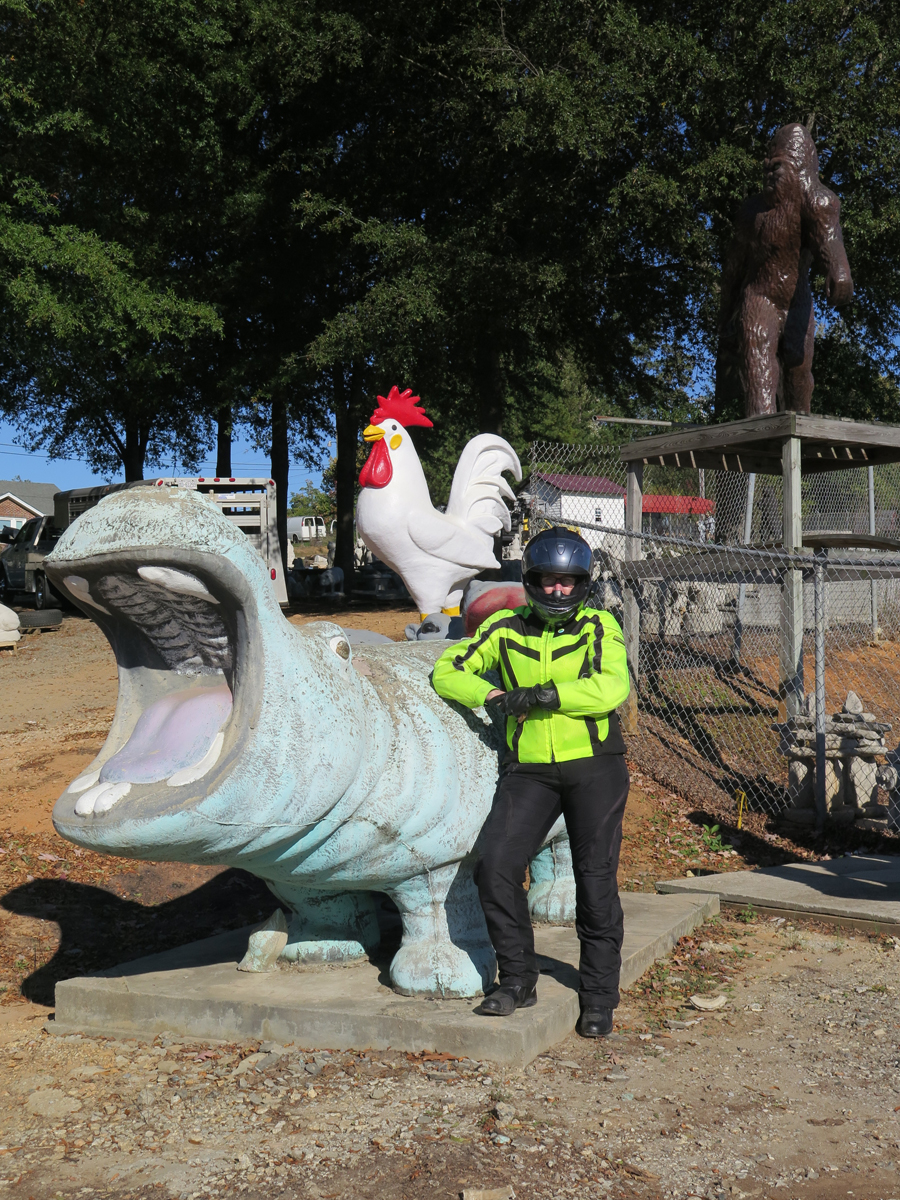
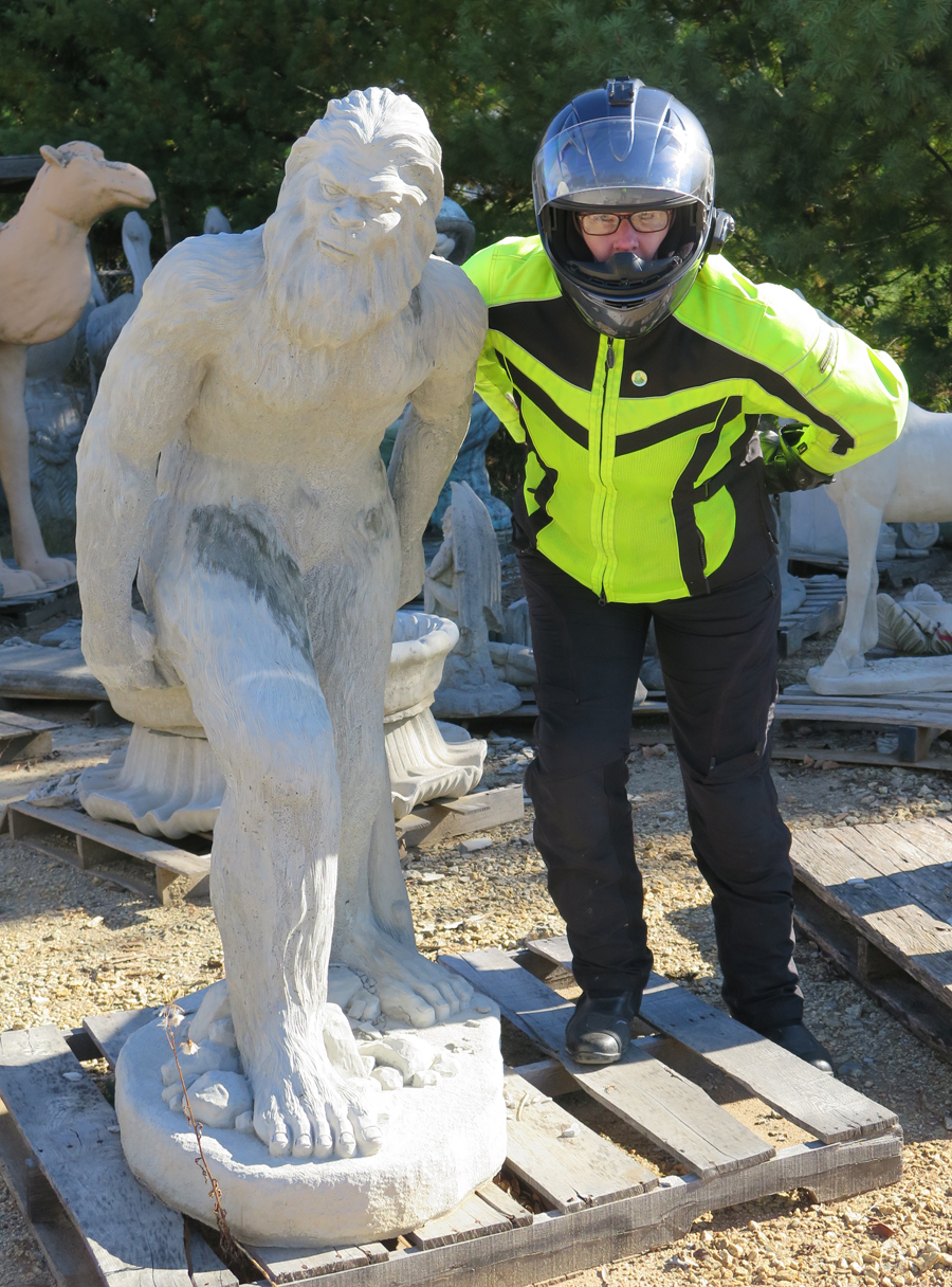
ToadMama with Hippo and Chicken
Of course, when I saw the above picture of me was missing an important third component, I requested a re-do.
ToadMama with Hippo, Chicken, and SasquatchYankee CowArtsy ShotThere was quite an assortment.Obligatory Bike ShotToadMama with Soldier (and mooning photobomber on left)I found one for my yard!This is actually the mooning photobomber.
I read somewhere that the four-foot-tall Sasquatch is one of their biggest sellers.
Hubby spotted the giant green rooftop ape.Another concrete hippo. And a camel.Pink Elephant on Platform
Wasn’t that a fun stop? If only Slick’s place wasn’t so far from home.
I’m woefully behind on blog posts. Hubby’s birthday ride feels like it was ages ago. Jeez.
I’ll spare you the lame excuses. And, because there’s a backlog, I won’t bog this post down with commentary. Basically, we woke up on Saturday, packed up, ate, and rode. It was a glorious day.
I didn’t take nearly as many pictures as I could have. It was a beautiful area. Truly.
I just HAD to stop for this one.
Looking out over the Grayson Highlands.
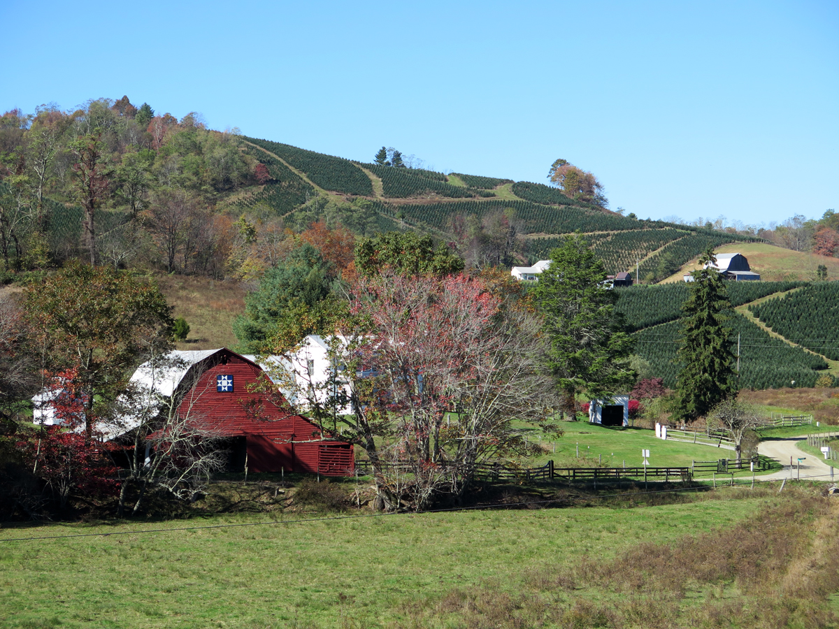
Country
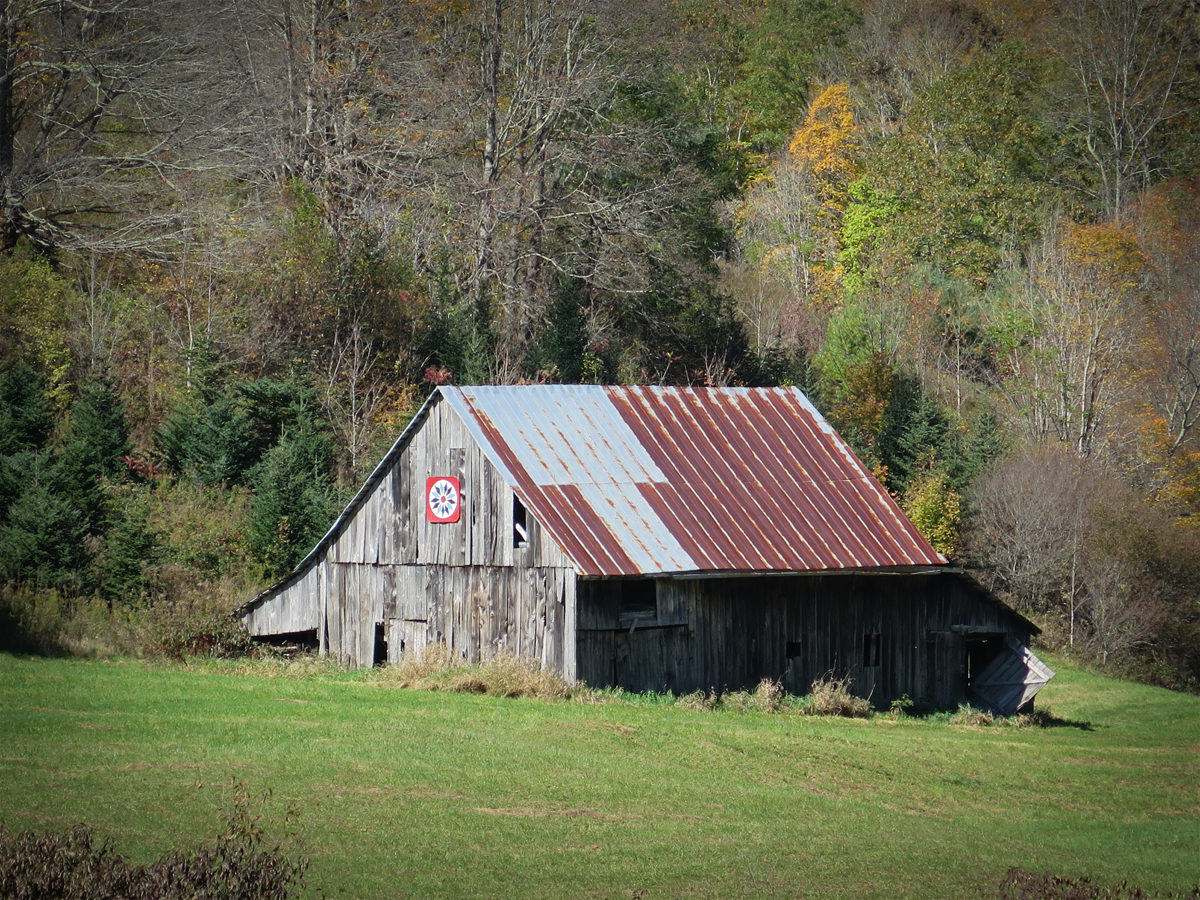
Barn Quilt and Tree Farm
More Barn Quilts
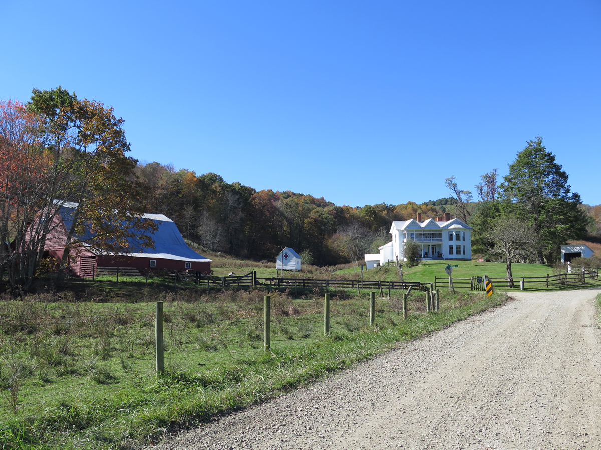
Grayson Highlands in Virginia
We were very close to the VA/NC border. I have no idea which state this was in.
A Closer Look at the Barn Quilt
Pretty Barn Quilt
Along a North Carolina Road
Barn Quilt on a Hardware Store in West Jefferson, NC
Giant Cows in West Jefferson, NC
I don’t make Hubby stop much, but I knew we HAD to stop in West Jefferson to see the giant cows at the only cheese factory in NC. I’m glad, too. The town is adorable. It’s on my list of places I absolutely must re-visit.
Perfect end to a fabulous day.
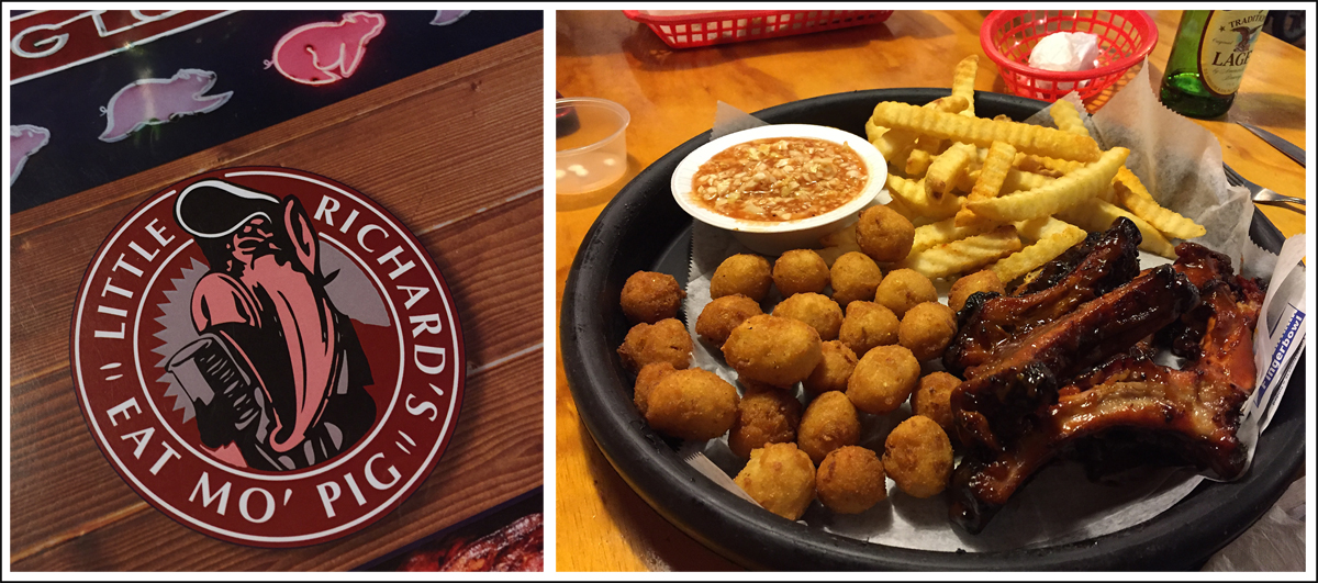
I actually chose our lodging for the night because it was within easy walking distance of this BBQ place, which had great Yelp! reviews. We weren’t disappointed. The food was delicious.
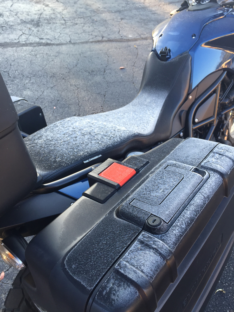
Frost!?!
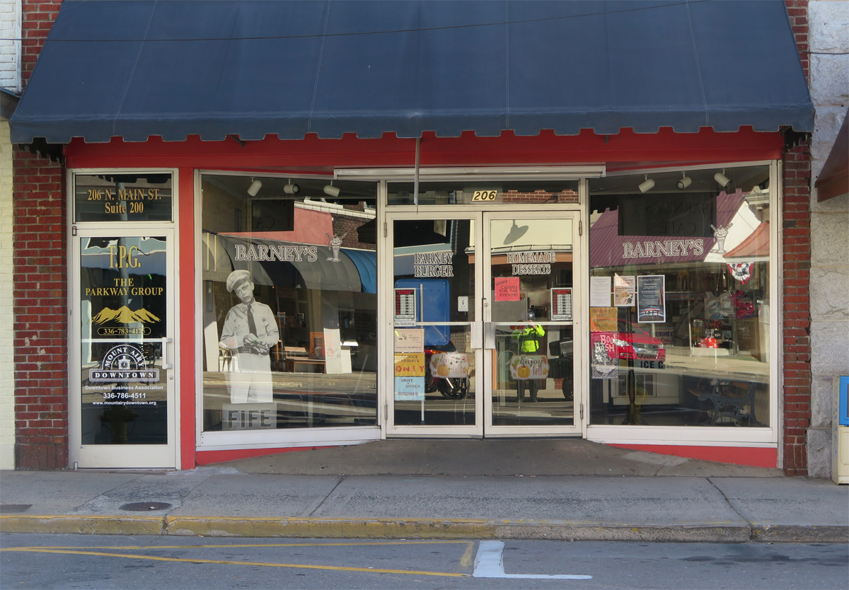
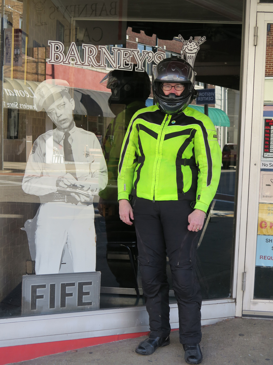
Mount Airy, NC (Any Griffith’s birthplace and inspiration for the fictional Mayberry)
Flashback
Kitsche
Dork
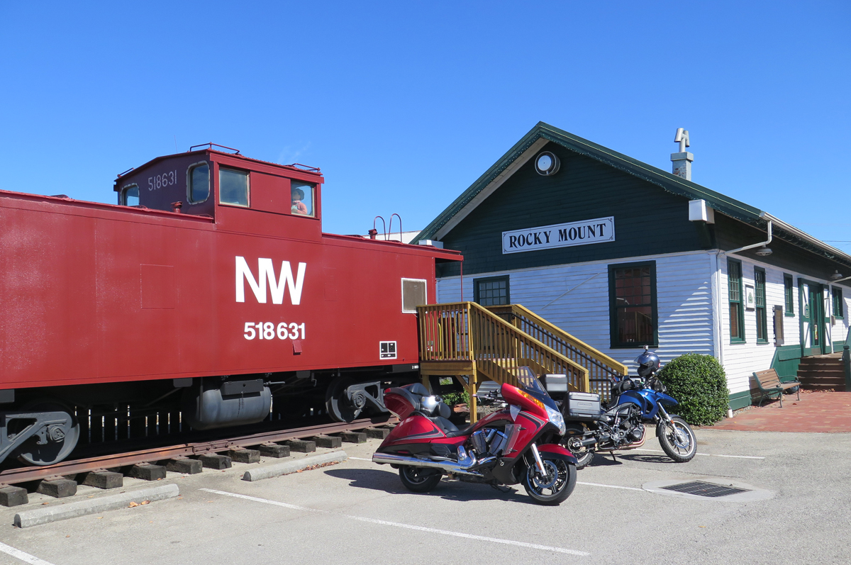
Nice spot for a stretch break.
We were going to visit the D-Day Memorial in Bedford, but we were hungry, I was a bit chilled, and daylight was waning. It’s another place we must re-visit.
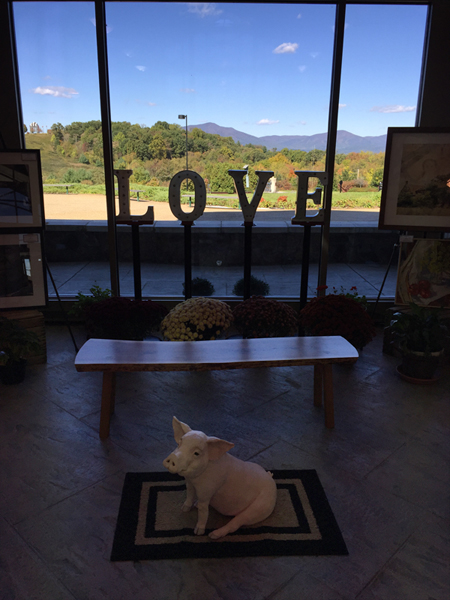
I did pop into the visitor’s center to see if their bathrooms worked and was quite tickled to see this mini-LOVEwork with a cool pig in the foreground.
Mini LOVEwork at Bedford’s D-Day Memorial … suh-WEET!
Next up… the other place we HAD to stop. Hubby wasn’t thrilled, but it was early in the day and we’d just eaten breakfast, so he humored me.
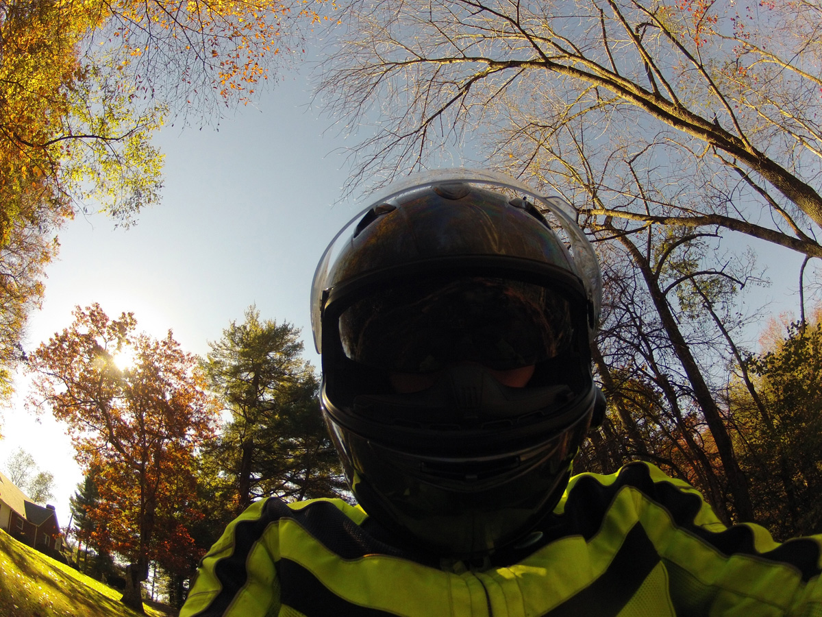
There are pros and cons to using a helmet camera while riding. One of the cons being that you end up with a TON of images to sort through, which takes time. That’s why some of my images never get viewed by anyone other than me.
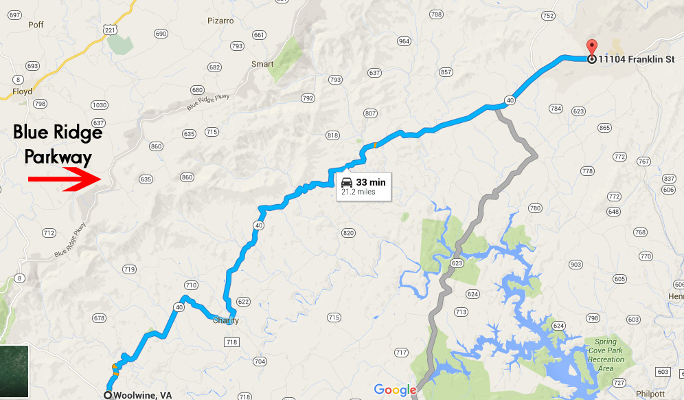
Yesterday, as I sorted through pics captured on October 18, the last day of Hubby’s birthday weekend ride, I came across a series of shots showing Virginia’s Charity Highway.
It is definitely one of my favorite stretches of road enjoyed that weekend. The 21 or so miles from Woolwine, the western end of VA-40, to just before the town of Ferrum were the best. We only went as far as Rocky Mount, so I can’t tell you whether the other end of the highway is good or not.
Like many roads, that “highway” got its name because it passes through the town of Charity. The posted speed limit was 55 MPH, but it was so curvy, I can’t imagine being able to maintain that speed for long.
That section of VA-40 parallels the Blue Ridge Parkway (BRP). It would be a great alternate route on days that the BRP is fogged-in, too darn crowded, or you just need a change of pace. Remember, the 45 MPH speed limit on the BRP is strictly enforced.
When riding, I am often amazed at how little traffic uses many of the back roads we enjoy. Some folks have even asked, after watching another of my slideshows/videos, if we even have traffic.
The answer is yes, we do. I just usually omit slides/video segments where I’m stuck behind some other vehicle. Who wants to look at the ass-end of a car or truck?
This time, I decided to keep it real and include ALL of the 330+ slides from that stretch of road. Images were captured every 5 seconds, so it’s about 28 minutes of ride time condensed into a slideshow that’s 3:28 in length. You’ll get to see all of the traffic we encountered and the annoying sun glare as well as the road and some pretty nice scenery.
The slideshow is relatively quick. I added music, so you may want to mute your speakers if you’re watching in stealth mode.
For you map lovers, here’s a link to GOOGLE Map: Charity Highway, ~21-mile portion of VA-40 between Woolwine and Ferrum, Virginia. I have no idea how long those links stay active so, if it’s broken, just open GOOGLE Maps and search for Woolwine, Virginia.