Why?
 You’re going to ride around the country in 21 days or less? Why? Are you crazy?
If I heard that once, I heard it a hundred times. All endurance riders have their own reasons for the extreme rides they undertake so there is no easy answer that everyone will understand. For me, it’s about having the mental and physical stamina to push myself far beyond the limits of my 40 hour a week desk job. I’m no jock by any stretch of the imagination; I’m a perpetually dieting, overweight guy that hopes to see the start of my 60th year in October.
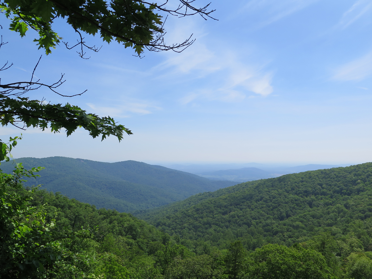
This is endurance riding. It’s not about sightseeing or “flower sniffing.” It’s not about finding the tastiest taco in Texas. Will I see some fantastic scenery? Absolutely. But it’ll be going by at 65 miles per hour or more. Many of the regions on my itinerary I’ve already visited numerous times (or plan to with Kathy) so sightseeing was simply not a preference for this trip.
Planning
In 2006, a friend and I rode our bikes to the Black Hills of South Dakota and earned a Saddle Sore 1000 award from the Iron Butt Association. The Iron Butt Association is, as you likely suspect, an organization dedicated to the sport of long distance motorcycle riding. Yes, I said sport. If you’re in poor shape, long distance riding is not something you should think about attempting. Physically, it can be very demanding. A Saddle Sore 1000 is awarded for riding 1000 miles within a 24 hour period. On the return trip a week later, we earned a Bun Burner 1500 for riding 1500 miles within 36 hours. I wasn’t too crazy about the 1500 mile portion, but the 1000 miles was easy.
For this trip, my first-day goal was ambitious, as it should be. For a long distance rider, the first day is often the best day when you can ride to your maximum potential. Generally, subsequent riding days decrease to 70-80% of the first day’s total.
Yes, the Black Hills trip was nearly 10 years ago, but I was comfortable with the idea of riding up to 1000 miles the first day with the thought that I would maintain 600-800 miles on subsequent days.
I plotted my route in Tyre® (which uses Google maps), downloaded it to an Excel spreadsheet and analyzed each segment, making guesstimates as to where I’d be at the end of each riding day. Sometimes this worked very well. Sometimes not, primarily because I’d make changes to the Tyre® map and forget to update the Excel spreadsheet. Ooops.
Day One
 The first day was, as expected, a long one. My plan was to make it as far south as somewhere between Leesburg and Palmdale, FL. Although I’m always cognizant of the fact that rain happens while on long rides, I tend to steer away from the weather forecast the day before a trip starts so it can’t scare me out of leaving. I had no idea when I left at 4:00 AM that rain clouds were awaiting me not too far to the south. I was just about 3 hours into the trip, North of Danville VA, when the occasional spit of rain became a heavy downpour. I put the raingear on and continued riding (albeit a bit slower). The rain continued the rest of the way through Virginia and at various times all of the way through North Carolina meaning that I had either rain or wet roads. Upon my arrival in South Carolina, the rain immediately ceased and someone cranked the heat up to 90°. Too hot, but at least it was dry, so I accepted it. Hot dry weather continued through Georgia and into Florida. I eventually called it a day in Clermont Florida after bouncing around the area for 15 or 20 minutes trying to find a hotel. It wasn’t as easy as I had hoped to find a room and I was, honestly, a bit frayed.
Daily Stats – 5/21
Miles: 900
Fuel used: 19.41 Gallons / $48.99
Day Two
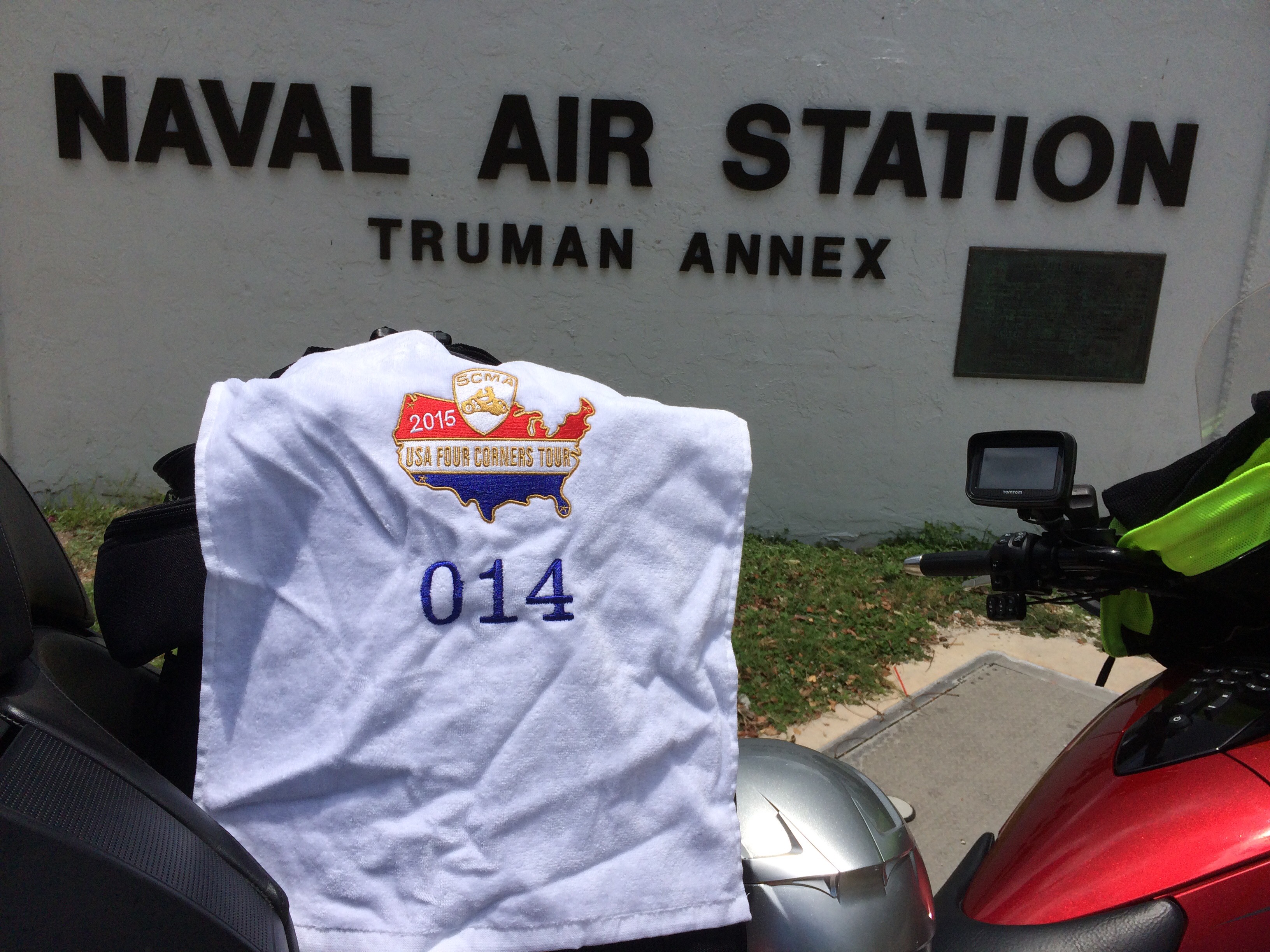
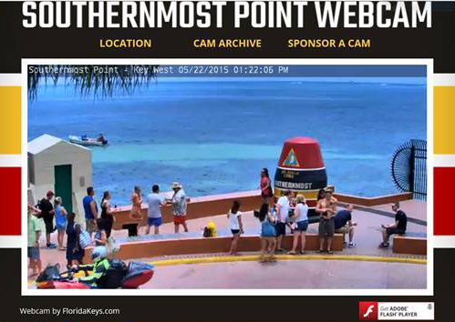
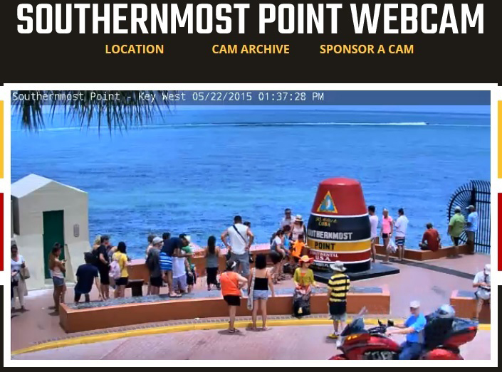
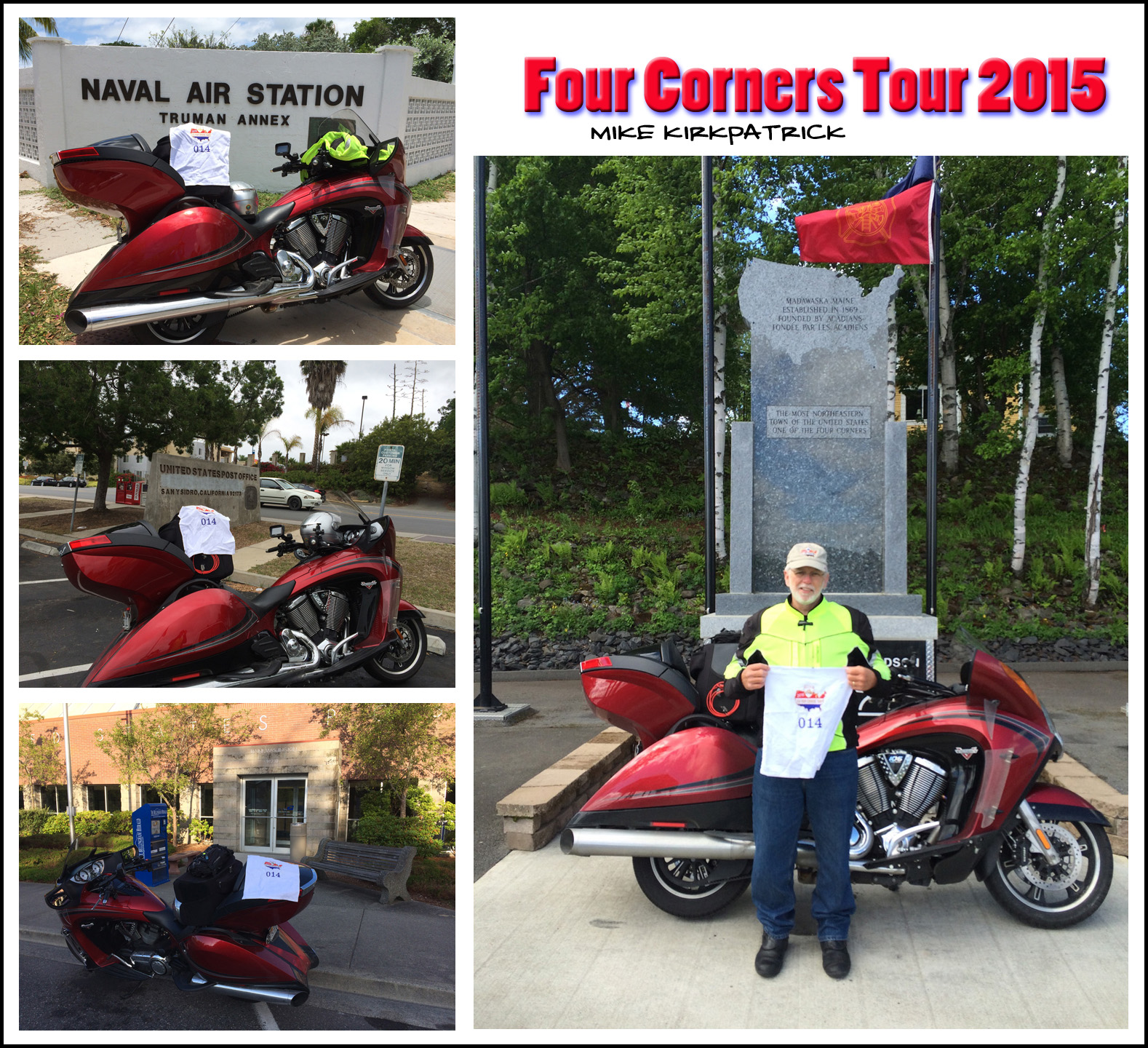
Ahh. I awaken in Clermont, Florida (near Orlando). All I’ve got to do is shoot down to Miami, zip out to the Keys, take a quick picture or two and get out of there. Simple, right? Not so fast, fella. As you may know, the Keys, specifically Key West, is at the end of a 150-mile-long road that traverses multiple islands (keys) and includes numerous bridges (at times seemingly never ending bridges). The vast majority of this roadway is wide enough for a single lane of traffic in each direction and the speed limit is rarely above 35 MPH. I could be wrong here, maybe the average speed limit is higher and the road wider but when it’s 90°+ and you are on a large, air cooled motorcycle, I assure you that it is never-endingly slow. Even though I was there on Friday, the Memorial Day holiday had apparently already started and the place was very crowded. Those annoying little rental scooters were everywhere – kids in bathing suits and flip flops zipping around and through traffic like they were invincible. I managed to make it to my goal, the buoy at Whitehead and South Streets, however, there was a line of about 30 people waiting to take their picture in front of the buoy. Thirty! Nah. I’m not waiting for that. I just need to have a picture of my bike with a recognizable landmark. The Truman Annex (US Navy property) is right next door and made for a much easier picture. Corner One reached, leaving me 21 days to visit the remaining three. I left Key West headed north with plans or making it to the Brooksville / Tampa area before the end of the day.
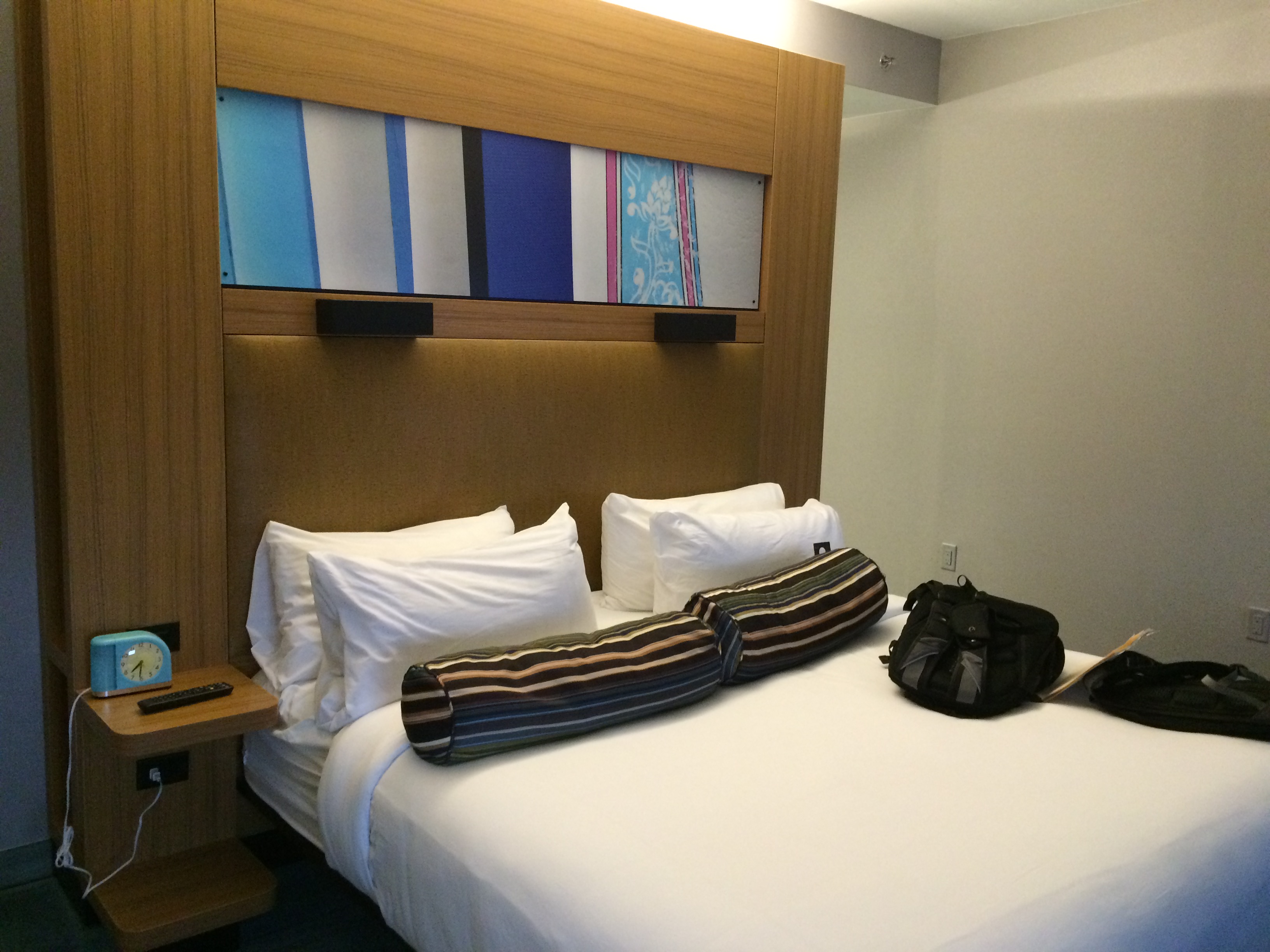
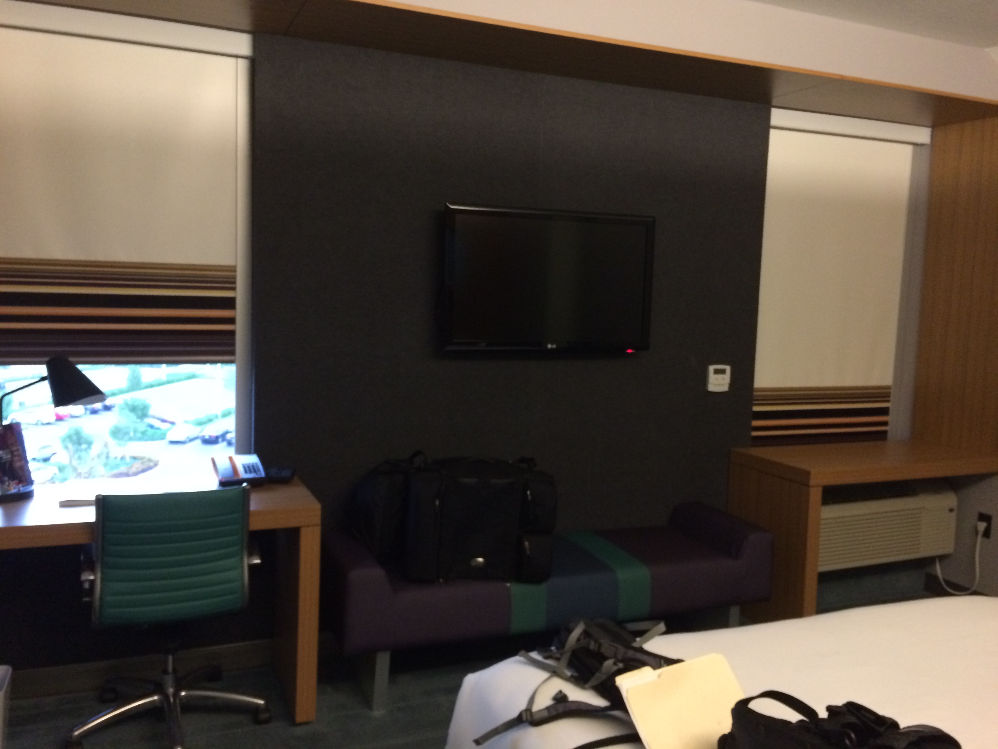
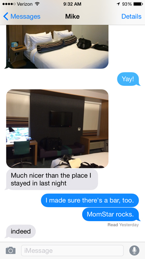
Nope. By the time I’d reached Miami, it was already 6:00 PM and storms were brewing. I don’t mind riding through the rain, but I draw the line at thunderstorms. The wind gusts were significant as well. With my 900 pound motorcycle getting blown around (in traffic!), I thought it was best to just call it a day. This is about the time when I activated MOMstar, a free, remote personal navigation service provided by my supportive wife. Kathy always does all of our vacation planning and she’s gotten really good at it. She can find lodging in the perfect spots. She booked a room for me in an Aloft hotel not far from where I was eating dinner. It was a very nice place.
Side note – there are a couple of toll roads near Miami. If you have the “Sunpass” electronic toll collection gizmo, you’re good to go. If not, you can apparently drive through the toll booth (according to the posted signs) and you will be billed for the toll plus an administrative fee. We’ll see how that goes. I felt a little bit guilty blowing through the toll booth knowing that I didn’t have the Sunpass.
Daily Stats – 5/22
Miles: 575
Fuel used: 14.33 Gallons / $39.64
Day Three
 My slug-like pace in and out of the Keys yesterday combined with my early layover in Miami put me way behind schedule (about 4.5 hours – 300 miles). I wasn’t too concerned as I had allocated a couple of extra days for unexpected delays, but it was discouraging that the delay happened so early in the trip. Oh well, saddle up and ride on.
My original goal was to ride 700 miles on the third day and end at the Louisiana / Texas border. That wasn’t happening but, all in all, since it wasn’t raining I decided that riding wasn’t too bad. It was hot, damned hot in fact, and I do believe that Florida is the most boring spot to ride in the states. Hot, flat and straight. Ugh. The high point of the entire day? Zipping along I-10 (which is at this point was a heat absorbing black, asphalt surface) I came to a body of water with a concrete bridge over it. The temperature dropped instantly and for a fleeting moment it was pleasant. Oh, so fleeting…
MOMstar found me nice accommodations in Daphne, Alabama to spend the night but the long days, unbelievably hot temperatures and being 300 miles behind schedule had me questioning my ability, in fact my desire, to complete the ride. I was exhausted and seriously considered calling it quits.
Daily Stats – 5/23
Miles: 750
Fuel used: 23.46 Gallons / $65.19
Day Four
I awoke refreshed and with a new outlook. I began the day early, determined to make up some of the time that I’d lost. Maybe the thoughts of seeing the kids and grandkids in the next two corners snapped me out of the doldrums. My goal for the day – Del Rio, Texas some 825 miles away. Getting there would put me back on schedule!
We all know that Texas is huge, but you really appreciate just how big it is when you ride across it. When I entered Alabama on I-10, the mile markers (which decrease as you go west) were around 60. Entering Mississippi, mile markers started at around 75. Louisiana, 250 or so. Entering Texas – 880. Yes, I-10 is 880 miles from east Texas to west Texas. My favorite piece of trivia about Texas is this: If you start on the east side of Texas driving to California, when you get half way to California, you’ll still be in Texas.
 You heard, I’m sure, about the Texas rainfalls that flooded Houston? They had a couple of days of record setting rainfall over a three or four day period? As I approached Texas, ominous clouds awaited. Louisiana? Fine. Texas? Uh-oh. I stopped at the Texas Welcome Center (along with a half dozen other motorcyclists) and put on my rain gear. Since I had been on the road for a couple of days, I had not heard about the drenching that Texas had been experiencing nor about what was to come. I’m not afraid to ride in the rain, as a motorcyclist it’s just something you get used to. You ride a little differently, but you ride. I’ve learned that if I just relax and not overthink the situation, riding in the rain is a piece of cake. Well, I do have one little secret. I listen to classical music during the rain. To me, classical music is very calming and soothing and it eases the tensions that stressful conditions can create. Hard driving rock and roll would be absolutely the worst thing for me.
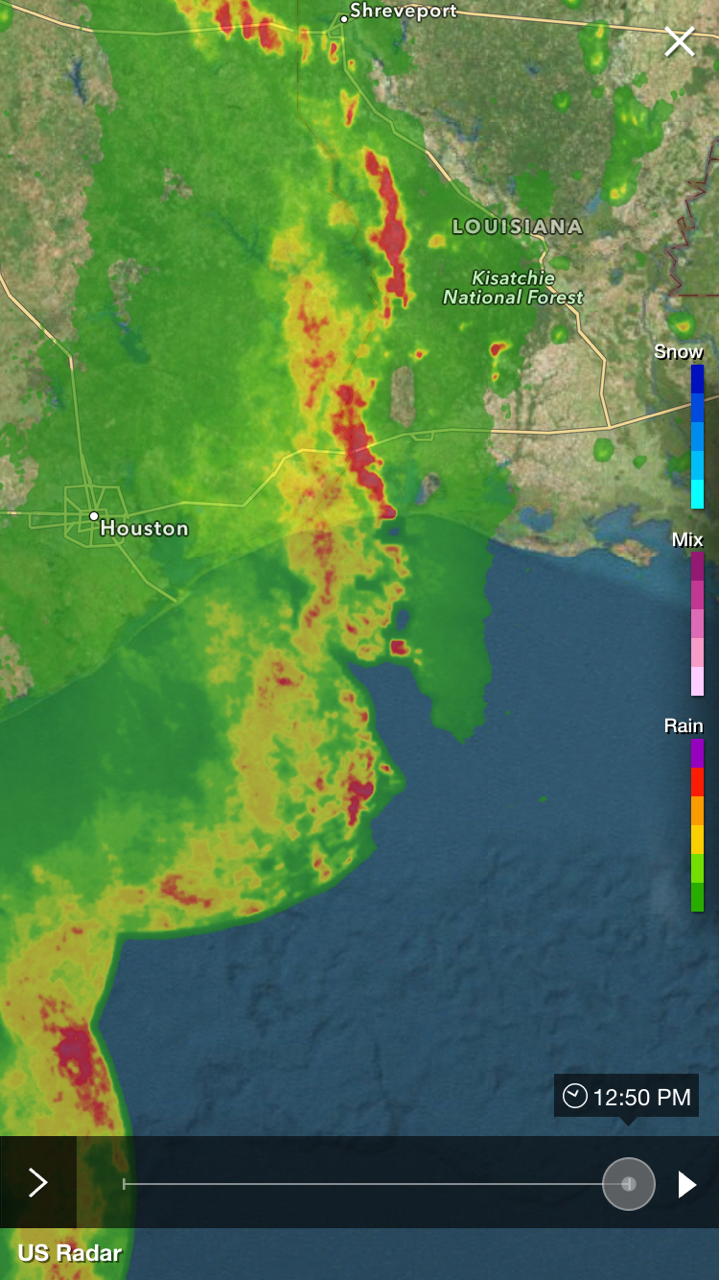
Anyway, Holy Cow. The rain started literally minutes after I left the welcome center and continued until I hit Houston a little more than 100 miles later. It was the most intense rainstorm that I’ve ever experienced on two wheels. Ever. I’ve driven in worse storms, but I’ve never ridden in worse, especially not for a hundred miles! Once past Houston the rain continued sporadically, but wasn’t a problem. At times I was able to take complete advantage of Texas’s 80 MPH speed limit (which at times appears to be a “suggestion” rather than a “limit”). In San Antonio, I finally ditched the rain gear and consulted with MOMstar. She’d located a room for me in Del Rio, Texas about 150 miles west. Making it there would put me back on track and right on schedule! I was excited about the trip again!
Daily Stats – 5/24
Miles: 825
Fuel used: 20.39 Gallons / $50.85
Day Five
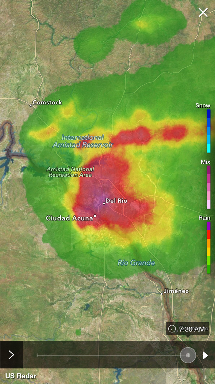 I’d planned to leave Del Rio at about 6 AM so I woke up around 5 AM to go looking for some breakfast. It was raining. Hard. Really Hard! My room had an interior corridor entry as well as a pool-side entry so I used the interior entry to make my way to the lobby. Once at the lobby, I sat with my coffee and bagel watching some significant rain come down and wondering how long this would delay me. Then the thunder and lightning started. Then the hail – grape sized or a little larger – and strong winds. Our power was lost. My cell phone sounded a warning about a nearby tornado (It touched down 6 miles away in Mexico). There was so much rain that it overfilled the swimming pool outside my room to the point where water was coming into my room. Hmmm. So much for my early start. I eventually got on the road close to 9 AM and it looked like I’d lost the time that I’d just made up the day before. Not far outside of Del Rio, the weather turned around completely – you’d never know that the storms in Del Rio had even happened. Beautiful riding weather at last!
Those that live close to the US/Mexico border probably think nothing of it, but to me, stopping within the US for a border patrol check was just weird. I didn’t cross any borders, just riding down a lonely highway when all of a sudden there is a permanent Border Patrol checkpoint. Once I had pulled up close enough that they could see that I was an old white guy, they waved me through. I understand their mission and support them in their work, but it just seemed weird to me.
I was riding through what many consider to be a “barren wasteland”, but what I consider one of the prettiest places on earth. I just love the desert southwest.
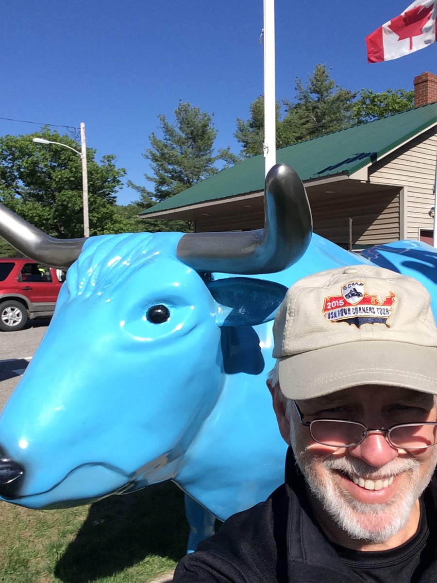
Shortly after taking the loop around El Paso and reconnecting with I-10, I entered New Mexico to a sight like I’ve never seen before. Cows. Miles and miles of cows. There is no doubt in my mind that I saw more cows (cattle?) at that time than I have in my entire life up until then. Seriously. There must have been millions of them. I’m guessing that it was a staging area or auction house and that I was looking at future hamburgers. Directly across the interstate were open fields as far as you could see. The thought came to mind that back east; they’d put in housing subdivisions there and then sue the cattle company for the stink it created. It was quite aromatic.
I deviated from the interstate highway for an excursion into New Mexico, we’ve not traveled there much (yet!) and I’m always on the lookout for that perfect little town for retirement. I stopped briefly in Silver City to consult with MOMstar, and it became apparent that I had an error in my planning that meant that my planned stopping point – Casa Grande, AZ was not possible. I’d traveled nearly 600 miles so far and Casa Grande was still 300 miles away. I did not intentionally plan for a 900 mile day at this point! The good news was that MOMstar found lodging for me in Safford, AZ, a mere 100 miles away.
I did find a very nice motorcycle route on the way to Safford; from Silver City US180 to NM /AZ78 was very pretty with lots of great vistas. It traverses national forest and tribal lands.
Daily Stats – 5/25
Miles: 700
Fuel used: 21.43 Gallons / $46.73
Day Six
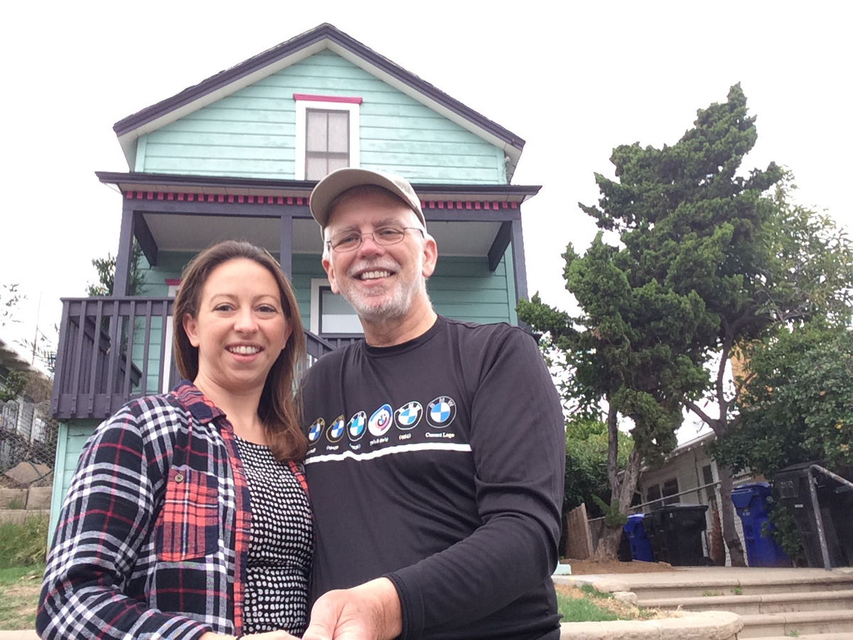
I’m getting excited! Today is the day I plan to reach the second corner in San Ysidro – it’s only a little over 500 miles away. I’m not excited because of the corner as much as I am about seeing Shannon and Chris (who just happen to live right next door in San Diego). It’s always good to see your kid. Always. Especially when they live far away and you don’t get to see them often.
 The plan was for Shannon and Chris to ride their bikes out and meet me somewhere along the route, but the weather interfered. Unlike her dad, Shannon is not a seasoned “rain rider” and since they were getting intermittent precipitation, I told her that we’d ride together some other time. Oddly, she didn’t push back?
Near Casa Grande, Arizona I broke away from I-10 and got on I-8. The ride was pretty much uneventful. Hot, but uneventful. Riding through California’s Imperial Valley and the miles upon miles of farms was interesting and scary. Interesting because of the magnitude of the farming, scary because those farms feed the nation and California’s drought is a very real problem for all of us.
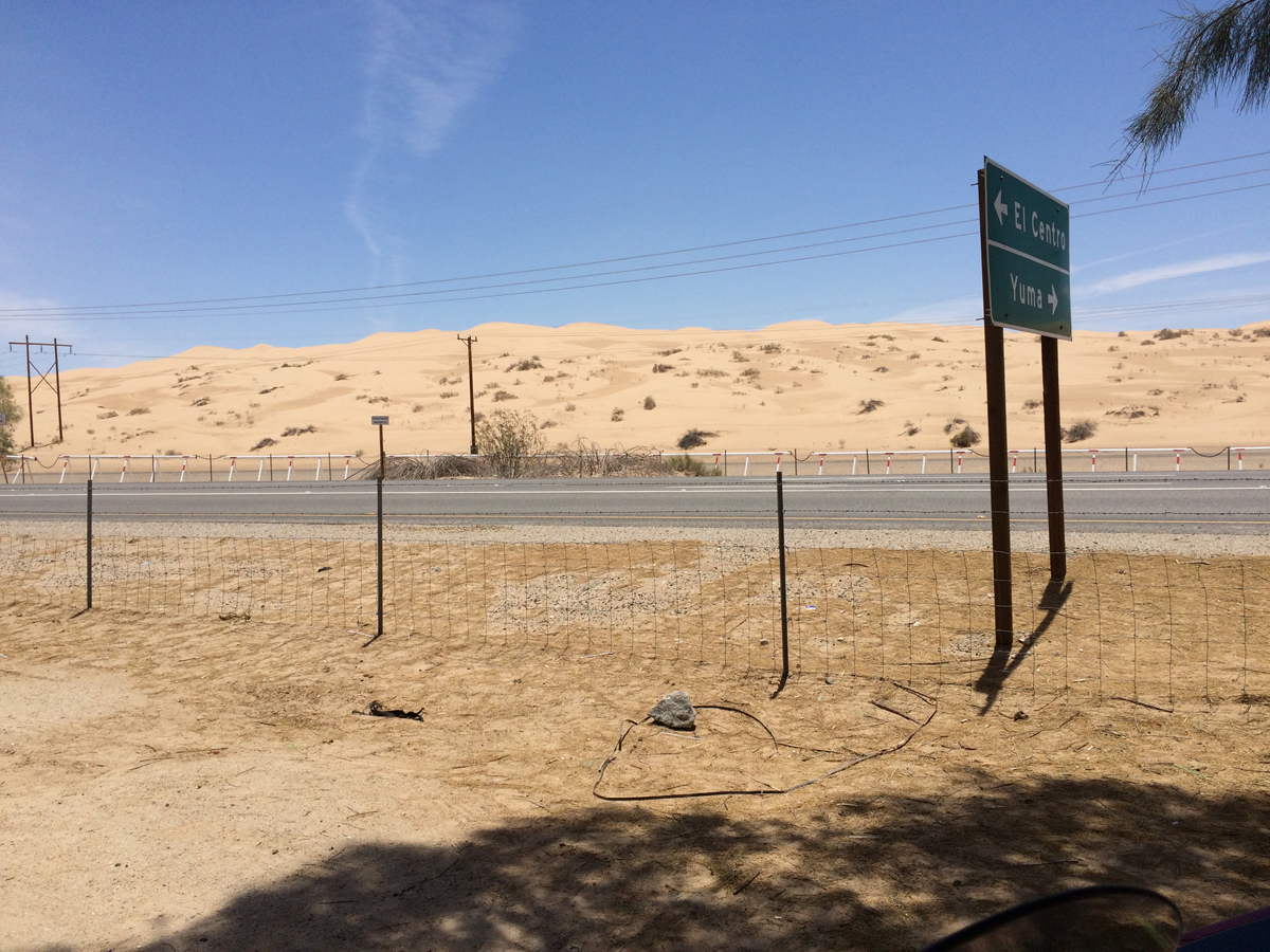
Adjacent to the Imperial Valley is the giant cat box known as the Imperial Dunes. There was not much going on there since it was so hot. Peak season is in the winter when dune buggies and ATVs rule.
Near Boulevard, CA I jumped off of I-8 in favor of CA94. What a wonderful road! Traversing the Campo Reservation and then a multitude of small towns, it has plenty of twists and turns and was a very enjoyable ride. I’d go back again just for that 40 mile stretch of road.
I zipped into the San Ysidro post office parking lot, snapped a quick picture, grabbed some gas and zipped right back out of there. By the way, somewhere between CA94 and San Ysidro I was on another toll road which I also blew through. Anyone have any idea what the penalty is for that?
Shannon was watching my Spotwalla track and waiting with a big hug for me when I arrived at her house. Yay! Kid visit and day of rest tomorrow!
Daily Stats – 5/26
Miles: 556
Fuel used: 13.63 Gallons / $45.54
Day Eight (day 7 was spent loafing)
After a thoroughly enjoyable day visiting with Shannon and Chris, I hit the road at 5 AM thinking that I was early enough that I’d miss most of the rush hour traffic. Nope. Apparently southern California is a lot like Washington DC, rush hour starts really early. It wasn’t long before I was in bumper to bumper traffic. Motorcycle after motorcycle took advantage of California’s lane splitting law (or lack thereof actually) and zipped on by me. I’m aware of lane splitting and have comfortably done so on multiple occasions in Europe. But I’m also aware that I’m astride a huge motorcycle. I mean HUGE. It has a wingspread of 45 inches mirror to mirror. (Your average sedan is something like 70 inches wide and Kathy’s BMW is about 36 inches at its widest point.) There was no way I wanted to attempt large cruiser lane splitting. “Was” being the key word there. After I saw a couple of large bikes go by and that the car drivers were actually accommodating by keeping to one side of the lane, I figured that it was time to attempt large cruiser lane splitting. It worked really well. A few tight spots had me audibly gulping, but mostly, smooth as silk. I want lane splitting everywhere.
I opted for US395 instead of I-5 (or “the 5” in California speak) or the beautiful Pacific Coast Highway because I wanted to avoid some traffic and I wasn’t trying to get any sightseeing in. US395, on its Southern end (north of San Bernardino) starts out with lots of traffic lights and traffic but after Victorville becomes a long straight road with minimal traffic. It skirts the edge of Death Valley and is pretty desolate, but soon is in a beautiful valley east of the Sierra Nevada mountain range where it remains for a few hundred miles. There is just something special about passing snow-capped mountains, especially while on a motorcycle.
US395 continues on, cutting through the westernmost part of Nevada (my 13th state so far). Honestly, my only prior experience with Nevada was around the Vegas area and I was underwhelmed. I’m not into the glitz and glimmer of the strip and found the area north of Vegas somewhat…ugly. This part of Nevada was very different. The Gardnerville area was very nice as were a number of smaller towns along the way. Reno was nice, but a bit too busy for me.
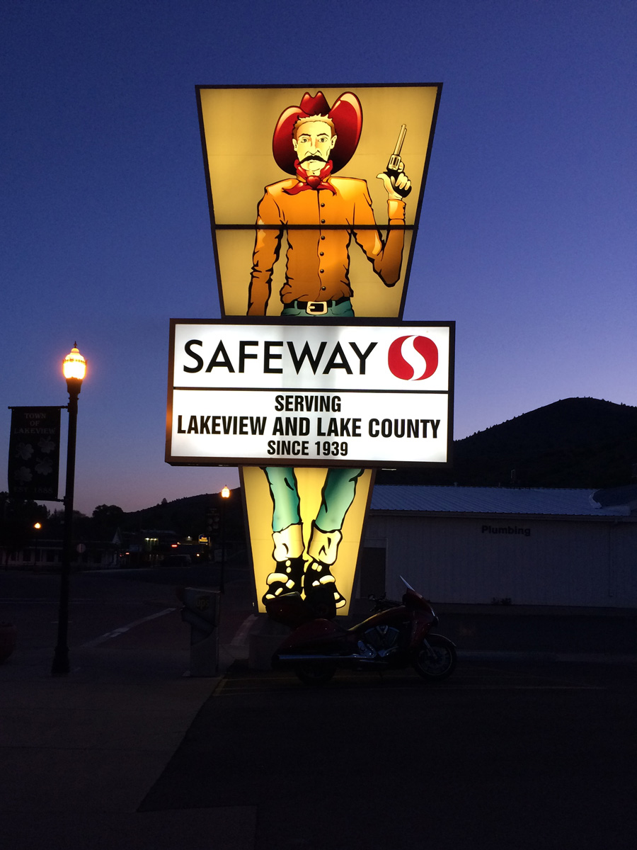
I continued on, stopping for gas in Alturas, California. Initially I was thinking that it was a nice town as well, but all it takes is for one toothless crackhead trying to bum money from you to change your opinion quite quickly. MOMstar set me up with a room in Lakeview, Oregon 50 miles further on; I was happy once again for her assistance.
I had a great day of riding with really good weather (even though it did start out on the chilly side).
Daily Stats – 5/28
Miles: 800
Fuel used: 18.8 Gallons / $70.66
Day Nine
First, I do believe that the good people of the states of Oregon and Washington owe me a huge thank you for annihilating the insect population in the western regions of their states.
Leaving Lakeview (I don’t believe that I ever did get a view of a lake – maybe because it was dark) the next town of any significance is Burns, OR about 125 miles away. Wow. I thought that Texas was desolate. The “Outback” of Oregon (as they call this area) is just as desolate, only it’s green. I saw less than a dozen. That’s a dozen in total of everything I saw – cows, humans, cars, everything. Desolate but at the same time, beautiful. If I’d had a breakdown of some sort, I’d probably still be waiting for help. I was very nearly out of gas as I approached Burns and my TomTom GPS, for whatever reason, decided that the best route for me was around the town totally by-passing the tiny burg and all the civilization it contained. I had to double back for gas.
Although I didn’t need to use it during this particular stretch, I was happy that I carry a gallon of gas in one of the saddlebags. Later in the day, the need would arise.
My bike averages about 40 miles per gallon and it holds 6 gallons of gas. Simple math says that at about 200 miles after the last fill up, I should be looking for the next one. My attention span fails me at times and as I entered Mount Rainier National Park 175 miles after my last fill up in Pendleton, OR I found that this was one of those times. As I would later calculate, Buckley, WA is about 80 miles northwest of where WA 410 enters the park. Riding through the park, climbing mountains and coasting down the other side, it became obvious that what little bit of fuel I had left in my tank was not going to get me out of the park. I broke out the spare and put it in the tank. When I eventually bought gas, refilling the spare and the tank took 6.3 gallons. In other words, without the spare gas, I would have run out something like 10-12 miles before the gas station. Ever try pushing a 900 pound motorcycle?
I guess I didn’t realize just how close Amy and her gang are to Mount Rainier because in no time at all I was pulling into her driveway. She too, had been following me on Spotwalla and was waiting in the driveway when I got there!
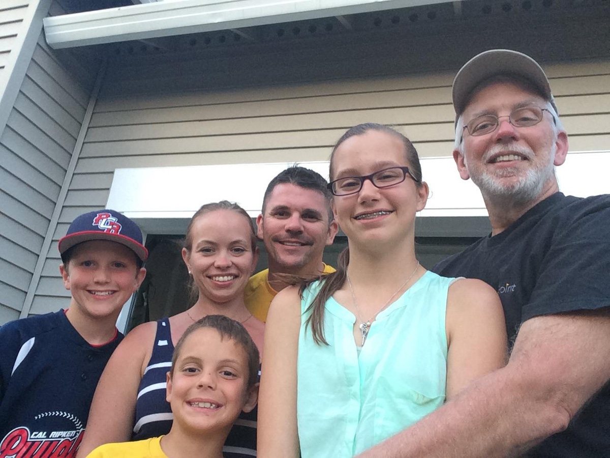
Once again, it’s good to see your kids. And their kids!
Daily Stats – 5/29
Miles: 605
Fuel used: 15.91 Gallons / $49.42
Day Twelve (days 10 & 11 spent loafing)
It was such a pleasure visiting with Amy and her family! I managed to spend some quality time with Amy and TJ and yet still find time to attend 2 of Joe’s and 1 of Gaige’s baseball games and Brianna’s lacrosse tournament. Oh. And I serviced the bike with an oil change kit that I had earlier had shipped to Amy’s.
Departure was tough, especially since I really enjoyed my visit and I knew what the weather looked like ahead.
When I left in the morning (again around 5 AM) my music (which is played through an iPod connected to the bike which is then Bluetooth connected to my Sena headset) wasn’t functioning. Not a big deal, I can ride in silence until I figure it out. I made it to my 3rd corner – Blaine, Washington in pretty good time and the weather was holding up for me. There was a little bit of traffic around Seattle, Redmond and Bellingham but the 140 miles went pretty quickly. I was in, photographed, gassed up and out of there within 30 minutes. It looks like a nice little town, but I was not able to find a restaurant or café for some breakfast. Drat.
Leaving the northwest corner, my route had me riding through one of my favorite parks, North Cascades National Park. Such a beautiful place. Having learned my lesson at Mount Rainier, I stopped to gas up prior to the park.
While at the gas station I decided to take some time and see if I could get the headset music working again. (The speakers on the bike were working fine but I hate it when some clown rides by on a bike with his music blaring, so this clown was not going to do that.)
This motorcycle, with its unique looks, sometimes draws attention. If I sit still long enough – like I was here, fixing the Bluetooth – inevitably someone will stop and start up a conversation. Sometimes these conversations are enjoyable, sometimes you’re talking to an idiot. Here, I had the idiot. This particular guy was quite obviously not a motorcyclist. He had no clue what it was all about. He proceeded to tell me that he was getting ready to move to Florida and when he got there he was going to buy a motorcycle, like mine maybe. When he said that Florida was a great place to ride and that he was going to be able to ride all year ‘round, I nearly laughed out loud. Florida is a horrible place to ride, all year long. It’s flat and the roads are straight. In the summer it’s so godawful hot that an air cooled bike like mine can be very uncomfortable, especially in traffic. Yes, you can usually ride on your flat, straight roads in December, but I’ll take one day in the Virginia mountains over an entire winter month of Florida riding. Florida has earned a place on one of my top lists – of the 30+ states that I’ve ridden in, I hated Florida the most.
Bluetooth temporarily repaired I was back on my way winding through the beautiful Cascades. I’d been though here before in a car, but this time, on the bike, I was quite surprised by the wind! It rips through there like nobody’s business! It’s unsettling having a huge cruiser getting pushed around like it was.
As I got further east, the clouds began to appear, gradually worsening until I stopped in Kellogg, Idaho to look at my weather app. My plan was to make it to Missoula, Montana today but the clouds did not make that look possible. While stopped in Kellogg chatting with MOMstar, she suggested that I make tracks for Wallace, a short stretch further along. We had stayed there years ago while on vacation. I was gearing up when a local stopped in (to admire the bike) and I asked about the weather. He mentioned that he normally rides but didn’t today because the forecast was for rain of “biblical” magnitude. Great.
I made it to Wallace before any rain hit, but it was not looking good. Neither was the lodging outlook. MOMstar was not able to find suitable lodging but, she said that there were plenty of options in Missoula. OK, I decide to saddle up and ride on. This was probably the worst stretch I would endure for the entire journey. The unusually heavy rain began shortly after I departed Wallace and continued all the way into Missoula, a distance just shy of 100 miles. Rain is no big deal, right? Oh, but it was cold too, in the high 40’s. Not to mention that the road ascended to a mountain pass (Lookout Pass) at an elevation of 4700 feet (it got colder). I should also mention that the road was under construction and choked down to a single lane. And yes, I was (of course) stuck behind a tractor trailer and had to deal with the road spray that he was throwing at me. Yeah. A miserable stretch of road to end an otherwise perfect riding day.
Daily Stats – 6/1
Miles: 715
Fuel used: 12.15 Gallons / $39.11
Day Thirteen
On my iPad I have pdf files of my bikes owner’s manual, factory service manual, various factory options that I added and for the Sena headset. You never know when that kind of information is going to come in handy because, for example, as intuitive as Bluetooth can sometimes be, remembering how each gadget works is nearly impossible. With the manual, it didn’t take me long to reset the Bluetooth for everything and get it back into working order. Yay!
New problem surfaces. Boo. Leaving Missoula I find that my cruise control has quit working. Cruise control on a motorcycle? Yes, and for trips like this one you really don’t want to be without. There is probably a proper medical term for what I call “positional cramping”. This cramping is the result of maintaining the same position for an extended period of time. Having cruise control allows you to take the right hand off of the throttle and move the right arm and hand to avoid cramps in those areas. Needless to say, I was very disappointed that I wasn’t going to have cruise for the extremely long, straight stretch of road ahead of me.
You know that they call Montana “Big Sky Country”, right? If you’ve never been there, in some areas the terrain is super flat and it seems like there is a huge “sky” dome over you. Picture this – you lay on the ground looking up and in your peripheral vision from left to right you see nothing but sky. That is Big Sky Country. On a perfect blue sky day, it’s an amazing sight. On an overcast, rainy day, it is literally, the cloudiest day or your life.
Leaving Missoula, I opted for MT200 over the interstate I-94, initially because I thought that it would be more scenic. It ended up being the best choice because there was little to no truck traffic which, given the weather, was a good thing.
Through most of Montana, it rained. And rained some more. And then it rained. Again. You remember when you were a little kid and stayed in the bathtub so long that your fingers turned prune-like? Apparently that happens when you ride in the rain for a long time too. Parts of Montana are absolutely spectacular; I know this from having been there a few times – breathtaking in its beauty, particularly in the west and southwestern regions. One wouldn’t know this if they only visited on June 2, 2015. It is still one of my favorite places on earth but, seriously. I was so tired of rain. I did listen to enough classical music through this state to realize that I like Vivaldi far more than Mozart.
At the end of the day, I’d reached West Glendive, Montana. It was right about where I wanted to be, so I was still on schedule. Through no fault of my spectacular lodging facilitator, MOMstar, my hotel reservation in West Glendive was screwed up. Booking.com had overbooked the place, “creating” a room where one didn’t exist. MOMstar jumped right on it and secured me a room directly across the street. Truth be told, the second place was a step or two above the first one, so I was happier.
Daily Stats – 6/2
Miles: 515
Fuel used: 17.39 Gallons / $45.06
Day Fourteen
I was really missing my cruise control so I decided to spend a little bit of time before departing (for what I just knew was going to be a long flat state). I did some basic troubleshooting using the factory service manual but all that I learned was that I needed a meter to verify circuitry. Well, that wasn’t happening.
My goal for today was to make it through North Dakota and Minnesota and into the Superior/Parkland area of Wisconsin. Compared to the previous day in and out of the rain and on wet roads all day long, North Dakota was a bit of a relief. It was gray, but no rain and mostly dry roads. It wasn’t always as flat and featureless as my previous visit had led me to think it would be and, in fact, the first part of the state was quite picturesque. Entering North Dakota on I-94 it isn’t long before you begin to see why Theodore Roosevelt National Park is where it is. Very similar to the Painted Desert of Arizona and the Badlands of South Dakota, the park contains the Painted Canyons. It’s the Badlands all over again, but painted with a different palette. It was one of those times during this trip (and there were a few) that I wished that I had more time to stop and look around.
No, North Dakota does not have the beauty of some of its neighbors. And yes, I’m quite sure that the cows outnumber the humans by some substantial margin. It’s largely a flat, open state. There are 29 states with higher elevations, among them South Carolina and Kansas (Kansas!). For a motorcyclist, it’s not the best state to ride in, but it’s certainly nowhere near the worst. As a tourist, it’s worth a visit. I’d like to back and see Teddy’s place.
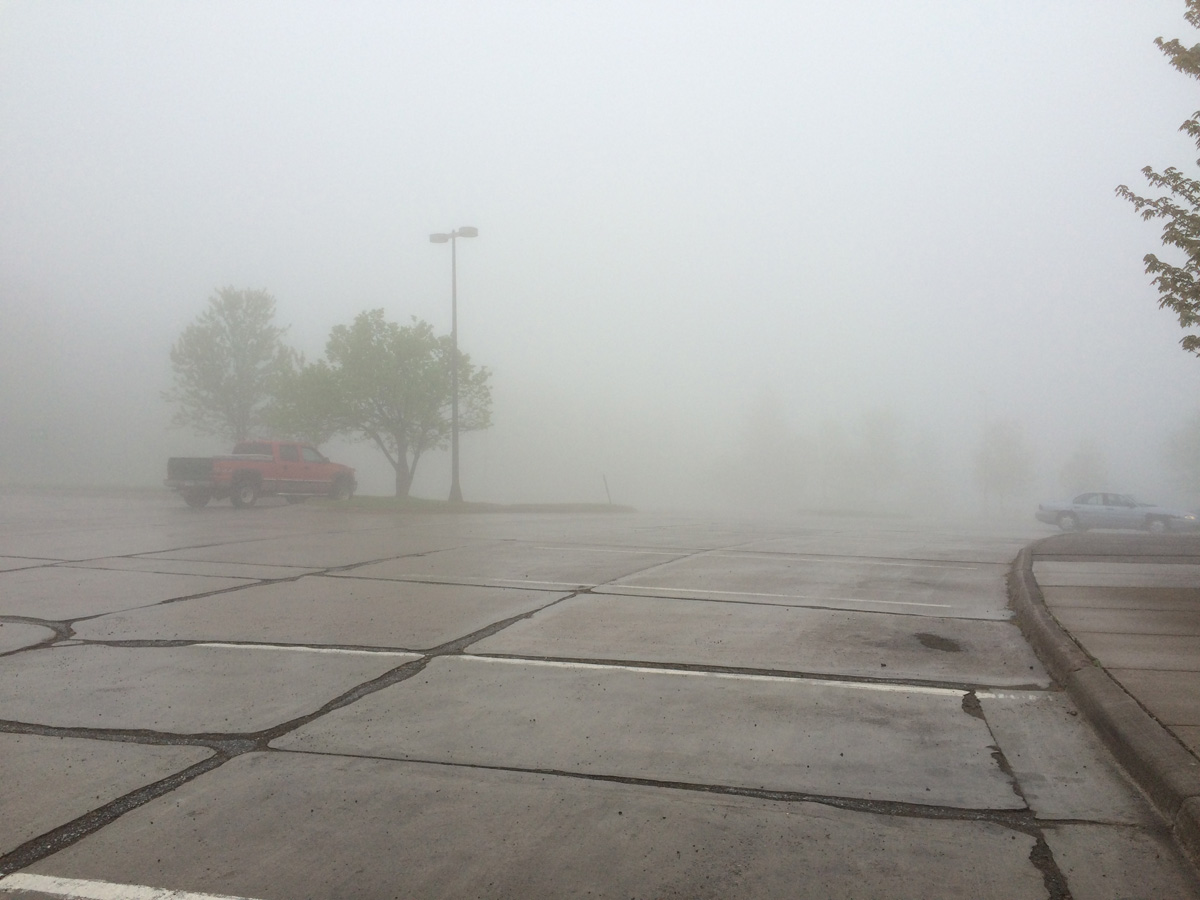
 Minnesota brought back the sporadic rain, off and on for the remainder of the day. Minnesota is another pretty flat place (flatter than ND, in fact) but very, very green. All in all, the ride through Minnesota was uneventful until the end. And then, butt cheek pucker! Duluth, Minnesota and Superior, Wisconsin face each other across the Saint Louis Bay. The bay is fed from the adjacent Lake Superior. Approaching this area from the south on I-35 there is a pretty big hill – Thompson Hill. Thompson Hill was completely socked-in with fog. A very dense fog, making visibility poor at best. Being unfamiliar with the area, I did the prudent thing; I slowed to a crawl, and had the flashers blinking away. What was prudent to me was obviously not prudent to the locals as they went flying by me like I was sitting still. I pulled into the rest area to try and get a feel for what was ahead of me. The attendant said that the fog was unpredictable in its duration but that it would probably dissipate at the bottom of the hill. But then again, maybe not. Gulp. I wasn’t worried about me running into anything in the fog; I was worried about someone running into me though. Ride on…
Entering Wisconsin brought, surprise, more rain, but fortunately my stopping point was only a few miles in.
Daily Stats: 6/3
Miles: 625
Fuel used: 14.96 Gallons / $46.45
Day Fifteen
Would this rain ever stop? I start this day in the rain gear with an end of day goal in Quebec City, Canada. Calculation error number two. Similar to my snafu in Arizona, I somehow screwed this one up, too – I mistakenly planned a 1000 mile day today.
Yeah. Anyway, I wasn’t in Wisconsin very long before I entered the UP of Michigan. They call the folks that live up there Yoopers in case you were wondering. A very large portion of US 41 in that area runs through national or state forest lands so it is not only very green, it’s like standing in a pine forest. Very aromatic, but not in a bad way – quite enjoyable actually. In this area, snowmobiling is not only a huge recreational activity, it’s an important means of transportation in the winter so there is an extensive trail system for them. Accordingly, provisions are made for them to cross the roads and highways and this is usually done at grade. To keep from tearing up the snowmobile skis and tracks on the asphalt or concrete roadway, across the entire crossing they apply the same material that a lot of places use for crosswalk and stop lines. It’s a kind of a plastic stuff that they adhere to the road surface that is pretty durable. It’s also very slippery when it is wet. Did I mention that it was raining? I never did have any real issues with the crossings but it’s one of those things that you can’t help but think about every single time you cross them – don’t touch the brakes or change direction until you’re passed it.
Oh, Canada
I left Sault Ste. Marie, Michigan (my 21st state) and entered Sault Ste. Marie, Ontario, the first of 3 Canadian Provinces on this tour. There is a toll bridge at Sault Ste. Marie (pronounced Soo sant marie) but I don’t know if I was paying to get out of the US or into Canada.
The rain appeared to have stopped and the skies looked clear so I took the rain gear off.
The travel plan through Canada was to primarily stay on the Trans-Canada Highway all the way to Maine, exiting only as needed for gas and whatnot. The first part of this highway was akin to US routes as opposed to interstate highways. Basically, it was a two lane road that periodically runs through towns along the way. Those towns provided some relief from the empty wilderness the road passed through. The road was quite obviously not well traveled as traffic in either direction was rare.
I’d traveled maybe 30 miles before the rain returned and I stopped to gear-up. Again.
It was probably not a bad thing because not too long after I put the rain gear on, I came upon some road construction. They do things differently up there. The entire road surface was removed and replaced with dirt (remember it was raining) and they allow you to proceed slowly although some segments you needed to be behind a pilot car. Periodically, I’d have to stop and wait for a pilot car. The mosquitoes saw this as the perfect opportunity to come out and feed. There were, right in front of my face where I could see them, a dozen mosquitoes trying to drain me but, fortunately for me, the rain gear saved me. I was so well covered (wearing gloves now because it was cold) that they were fruitless in their feeding endeavor. I have no idea how many of the things were flying around other parts of my body, but as far as I know I had no bites.
The three miles of mud road was exhausting – keeping a big cruiser upright in the mud can be challenging.
It was obvious that I was not going to make Quebec City, which confirmed once again that for me, pre-planning stops is OK, making advance reservations isn’t.
I was approaching Sudbury, a fairly large town, but further east accommodations were somewhat sparse for quite a ways. MOMstar fixed me up in yet another perfect hotel. Funny thing here was that as I entered the hotel, the man checking in in front of me recognized me from earlier in the day – we’d both stopped at the Sault Ste. Marie rest stop some 200 miles earlier.
Daily Stats:6/4
Miles: 575
Fuel used: 14.35 Gallons / $38.20 (Converted to US units)
Day Sixteen
Today begins the last official day of the journey; my plan is to spend tonight in Madawaska, Maine. (The 21 days allowed for the Four Corners Tour does not include the time to and from your home from the first and last corners.)
To start the day…
Surprise! Rain! I set off early on the final leg, a distance of about 775 miles – I was on the road at 5 AM. Beginning right before Sudbury, the majority of the remaining route was to be on multi-lane interstate-like highways. However, it was also going to be far more congested. The traffic really picked up near Ottawa, and pretty much stayed that way until I passed Quebec City. I was somewhat pleased to see that my Canadian neighbors pay as much attention to the 100 KPH speed limit (62 MPH+/-) as the Texans did theirs. After riding across the country and usually seeing speed limits of 70-80 MPH for this kind of highway, 62 MPH is downright pokey!
I zipped right along with the flow of traffic (and sometimes sat still in it). There was a good bit of construction going on around Ottawa and they have a different way of calling your attention to it. In addition to the orange and white (sometimes orange and black) barrels we’re all used to, here, they also paint all of the road markings orange. When you’re not expecting it and all of a sudden the stripes are an odd color, your first impulse is to reach up and remove your polarized lenses – even when you don’t have them on.
I soon passed into Quebec Province. The funny thing about Canada is that in the Ontario province everything is bilingual. All signs are in both French and English. If you go into a business, they may greet you in French but once they hear you speaking English, they automatically switch. In Quebec, the very clear inference is “Screw you. We speak French here.” OK, no problem. I can muddle through, and I did, and I won’t try to decipher the politics behind it.
Traffic was pretty heavy for pretty much the entire stretch from Ottawa to beyond Montreal. I was hitting Montreal at just about rush hour so it took me two hours to get through there, making my Madawaska goal that much harder to obtain. The good thing about hitting Montreal’s rush hour was that it meant that I’d miss the Quebec City rush by hours at least!
As I drew nearer to the US and then through the small towns along the Saint Laurence River, the sun was rapidly setting and the “Watch for Moose” signs began appearing with increasing frequency. The rain began again in earnest complicating matters all the more. The absolute last thing that I want to do at this point in time is hit a moose. I never want to hit one actually; those things are massive and will do some serious damage to anything less than an 18 wheeler. Thus, my defense against a moose strike was formulated. It was not easy, but for the last 50 miles or so into New Brunswick and until I exited for Madawaska, I shadowed an 18 wheeler. I stayed right behind him and took whatever road spray he tossed at me. I took the wind buffeting. I knew that the chances of me hitting a moose (or anything else for that matter) were significantly lessened behind him. I hated it but I would do it again just the same way.
Because of the traffic in Ottawa and Montreal, together with the rain all over the place, I didn’t arrive in Madawaska until somewhere around 9 PM. An hour outside of Quebec City, my cell phone (and thus my tracking software) died. I need to rearrange things in my trunk to prevent this in the future.
I guess that the US customs guys were either bored or suspicious of my arrival time (After 9PM on a motorcycle, in the rain?! There’s something fishy here…). Anyway, after they rooted through my stuff for a while they decided that I really was a motorcyclist returning to the states without any contraband and allowed me to enter.
It was too late (and dark) to make my way to any landmarks to record my completion so I headed straight for the motel – a nice, little old place right in town, Martins. Stay there if you’re in town.
Daily Stats: 6/5
Miles: 775
Fuel used: 18.88 Gallons / $68.29 (Converted to US units)
Day Seventeen
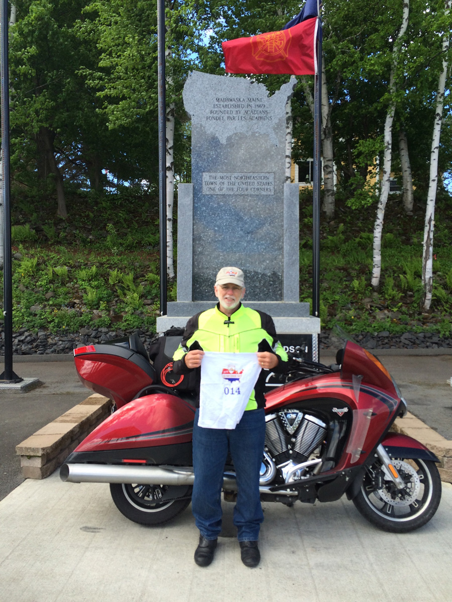
When I awoke, I came to realize that I was nearly “officially” done. All that remained was to take my picture, get my gas receipt and that was it. It was all over. Well, except for the 900 mile ride home, that is! Of the acceptable Madawaska picture spots available, I chose the Four Corners Park located on Main Street a few blocks away. This park is somewhat unique in that it was founded and maintained by a long distance motorcyclist and it is dedicated to the sport. Although the town of Madawaska has pledged to maintain the park in the future, volunteers and donors cover all costs associated with it.
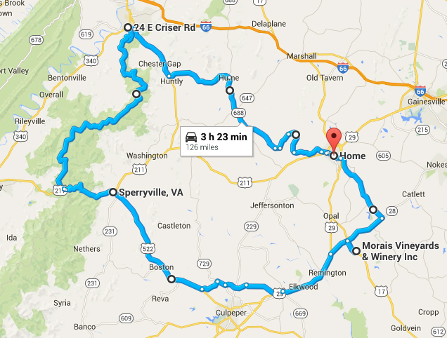
Early on in the ride planning, the thought was that Kathy would meet me somewhere on the final leg and we finish the ride together. That was not to be, her workload was just too hectic so I proceed to follow my “leisurely” route home.
I spent a little bit of time on I-95 however in Maine, it a totally different road than it is in the Mid-Atlantic area – 75 MPH and zero traffic.
The road through the White Mountain National Forest is regarded as one of the finest in the region by local motorcyclists. It may very well be but, it sure wasn’t for me. I hit it at the wrong time of day and the sun was blinding me for the majority of the ride. All of the guys headed in the opposite direction seemed to be having lots of fun though. I briefly toyed with the thought of riding to the top of Mt. Washington but it was a bit on the cool side on the base of the mountain, I knew that the temperature at the top was going to be far lower than I wanted to deal with so I rode on by.

I was through New Hampshire and into Vermont pretty quickly. The majority of the day was spent on secondary roads so my average speed was way down for the day. MOMstar fixed me up with room in Brattleboro, VT and it was dark long before I got there.
At least once a day, usually more, I would try to use the cruise control although I didn’t expect it suddenly start working again. Expect the unexpected, I guess because today, the cruise control started working again. I have no idea what the cause of the failure was, but I rode through so much rain, I’m thinking that it may have been water related.
The hotel that Momstar® booked for me was nice but, I had an experience that would have freaked me out. I checked in, carried all my stuff to my room and when I opened the door, I found that the chain lock was locked from the inside of the room. Yes, they booked me into an occupied room! If I was the one inside the room, I would have freaked. Fortunately for both of us, the room occupant had the chain in place saving both of us from an uncomfortable situation.
Daily Stats: 6/6
Miles: 550
Fuel used: 16.13 Gallons / $44.58
Day Eighteen
The last day on the road.
I departed Brattleboro about 5:30 in the morning headed south on I-91, into Massachusetts where I then shot across the Massachusetts Turnpike and into New York. Once in New York I jumped on the Taconic State Parkway where I was blessed with the three things motorcyclists appreciate most – beautiful weather, no traffic and a good road. It was not a spectacular road, but when coupled with the great weather and no traffic, was wonderful.
Soon I was passing through Pennsylvania and for some reason, the tracking app on my phone quit working about mid-way through the state. I didn’t know it but my mom and my wife were not happy that I all of a sudden dropped off the map. Oops. Sorry. I have no idea what when wrong but as soon as I restarted the app (when I got home) it remembered the final 200 miles of the trip and posted it to the Spotwalla website.
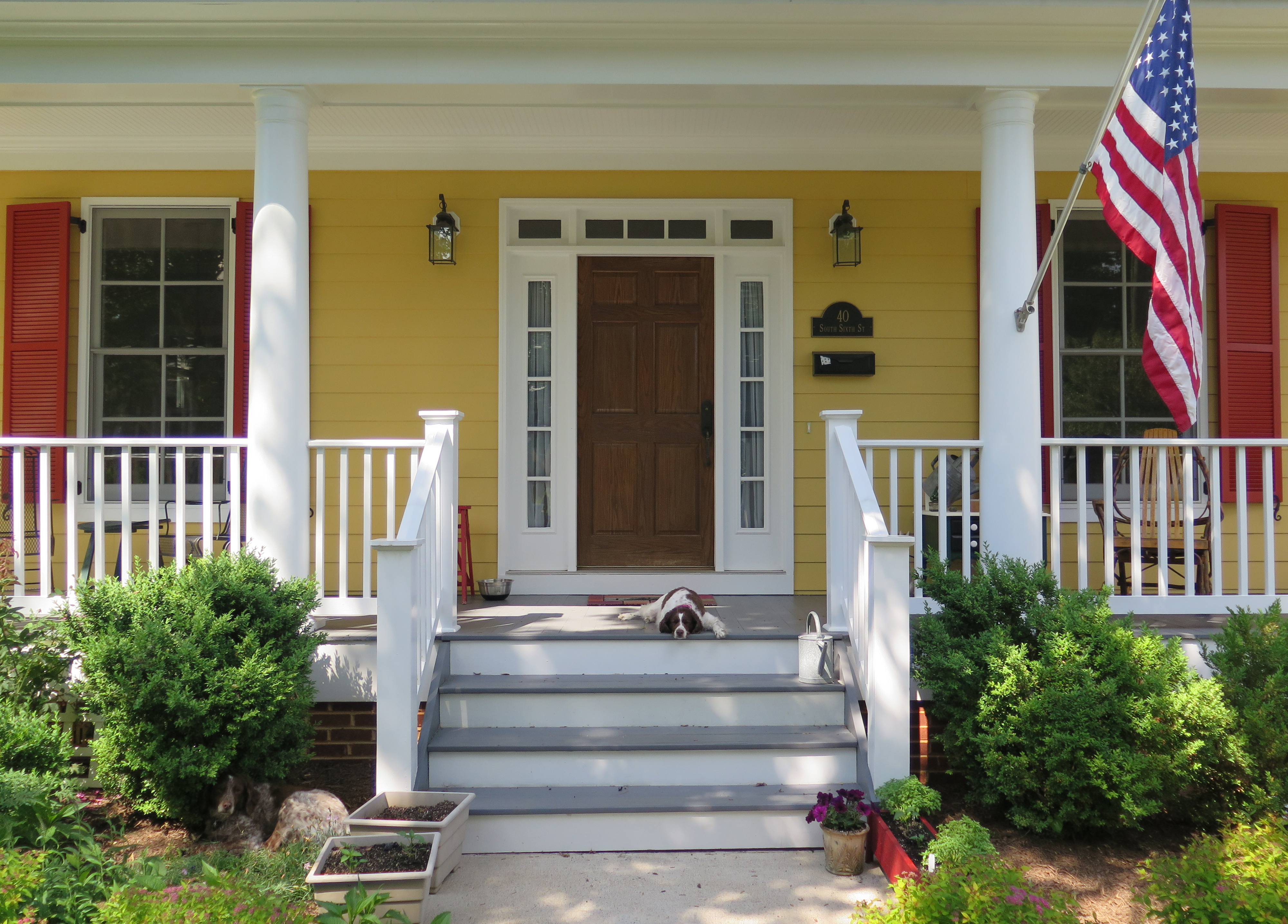
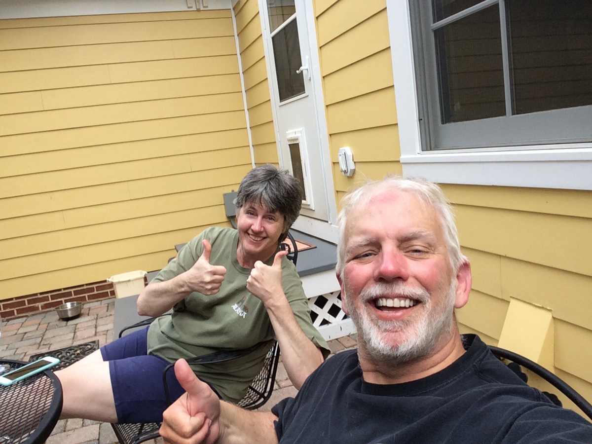
I arrived home at about 3:30 PM to a warm welcome from Kathy and the dogs, and I’m pretty sure that I heard a sigh of relief from the direction of my mom’s house.
Daily Stats: 6/7
Miles: 575
Fuel used: 15.83 Gallons / $44.65
Summary
This journey was, as I had anticipated for so many years, very rewarding. Including my home state, I rode through more than half of the continental states on this trip (28 if you’re counting). There are many adults that never see as much in a lifetime as I saw in about two weeks. I know that I’m a very lucky guy to have good health and the financial means to undertake such a trip and a family that supports me while doing so. Would I do it again? My thought at the moment is no, there is no need to. Will I do more long distance touring? Yes, but It’ll be more of a single region ride instead of all over the country like this one was. I still have nearly a dozen states that I haven’t ridden in!
I’ve not tallied my lodging expenses but I think the average was about $80 to $90 per night during the trip (with the exception of the five nights that I spent at the kids houses) so all told it was probably about $1000.
Totals:
Distance
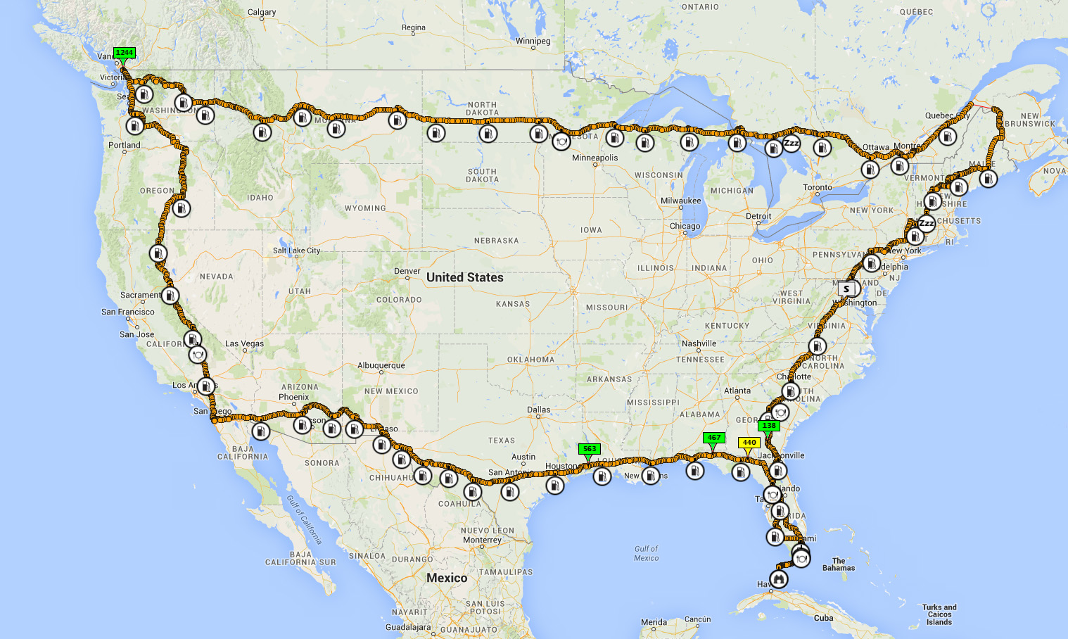
Miles (map): 10,041
Miles (odometer): 10,116
The miles listed for each daily entry are approximate based on map distances; the total miles are based on actual odometer readings. Motorcycles are notorious for conservative odometer readings so it doesn’t surprise me that there is a disparity here.
Average miles per day: 10, 100 / 15 = 673 miles per day.
Fuel
Used: 257.05 gallons
Cost: $743.09
Based on the total miles/gallons, it appears that I averaged 39.35 miles per gallon and the gasoline cost was little more than 7 cents per mile. Given the speeds common on interstate highways and the vehicle, 39 MPG is not too shabby.
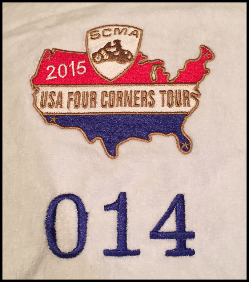
I received an email from the Southern California Motorcycling Association one week after I mailed in my documentation that they have reviewed my paperwork and certified me as a finisher!
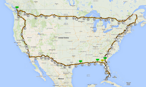
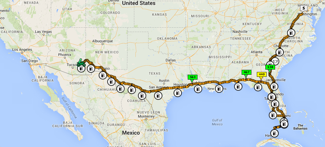
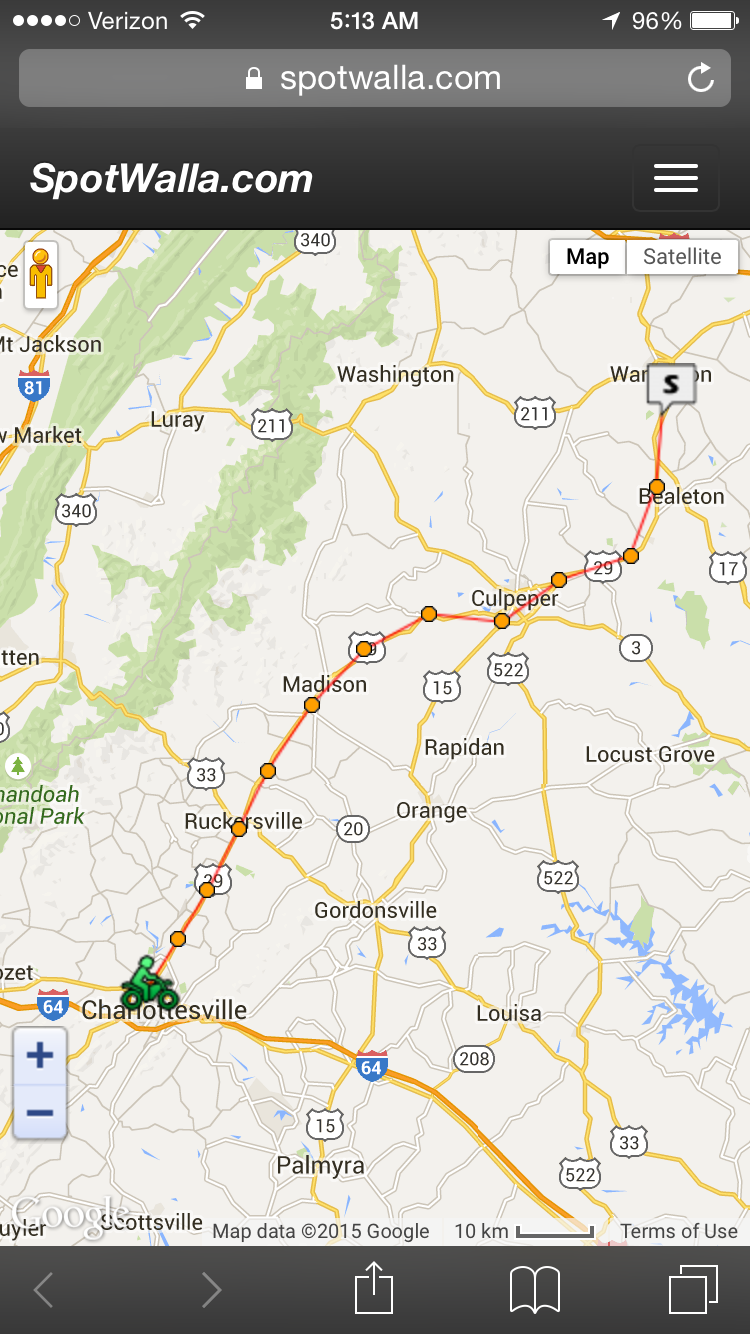
Link to the Spotwalla track.
Screen capture of the Spotwalla track.
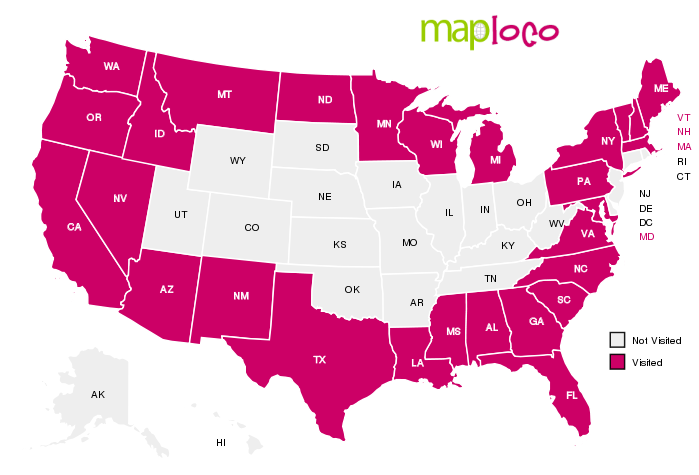
States Visited During the Ride