Seriously. I haven’t posted for an entire month. I knew it had been a little while, but a month!?! So much for trying to stay on track!
For the first three weeks of June, work was crazy-busy. This past week has allowed me to do a bit of catch-up at the office. I have thoroughly enjoyed logging off at a decent hour. Last night was the “latest” night of the week, I didn’t log off until 6:00 p.m. Now, I can do a little personal catch-up.
I haven’t been riding much. We had a bit of a heat wave for most of June, too. But that’s okay. I’ve been doing other stuff. And I have some exciting times on the horizon. Having fun stuff in the near future to look forward to is great medicine for me. Especially when that fun stuff enjoys fun with friends, a beautiful beach, a boat, and back-to-back long weekends. A bit further off is a very happy life event for one of our kids, more travel, multiple beaches, great food, and more new stuff to see. And, at the tail-end of the current plan, is a trip to Europe for which I FINALLY bought tickets (airfare had been insanely high for months).
I’m headed to North Carolina this afternoon. Hubby is staying home with the bitches. The next week or so is sort of a blank slate. Or, more accurately, a multiple choice list of options, most of which involve fun and relaxation. MAYBE I’ll even have time to craft a blog post or two.
People who don’t ride motorcycles or drive sportscars don’t always “get” the notion that a road can be a destination. Or that a vacation doesn’t have to include a specific place as a goal.
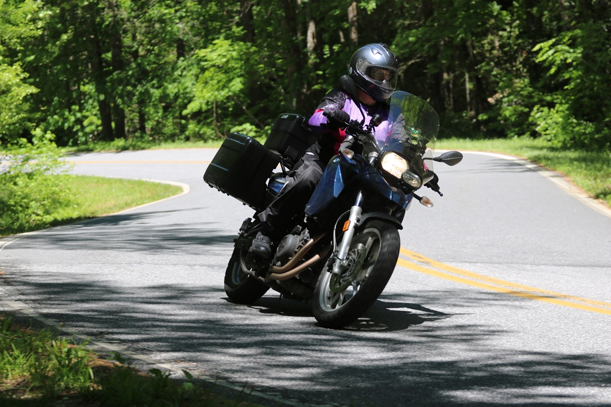
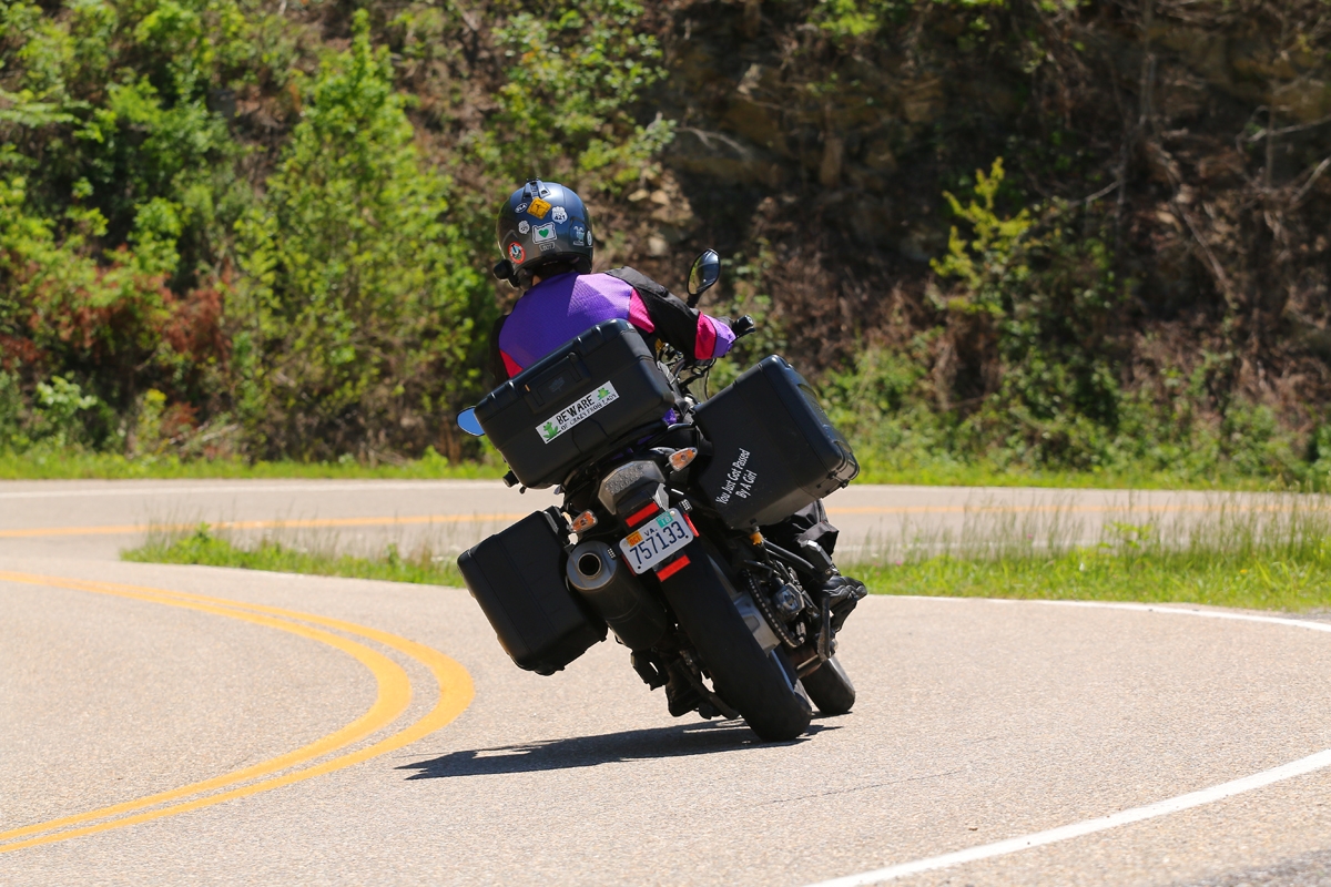
When I left home, I knew the general areas I might be visiting, but had few specific locations or place objectives. I did have one destination road in mind, however, the Cherohala Skyway. (A “destination road” is a road people travel to specifically to experience. There are actually quite a few destination roads in the Great Smoky Mountains region. All destination roads have a name, not just a government-assigned route number.)
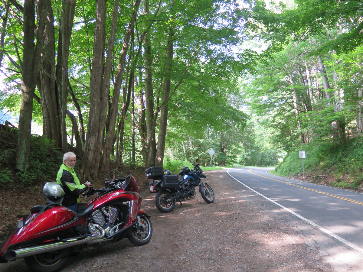
As I planned each day’s route, I kinda-sorta had to think about where I might end up when finished riding for the day. When traveling by bike, it’s sort of important to me to stay in a place within walking distance of eateries. Because I’m usually either too tired or too hot to want to get back on the bike to ride someplace for dinner. Plus, alcohol — even a little bit — is a big no-no for me when riding the bike.
When I left Pigeon Forge, I had no idea where I’d be that evening, but I did know it wouldn’t be in Tennessee at the end of the Cherohala Skyway. Of course, that meant I’d have to ride the Skyway twice — out and back — which was not an unpleasant prospect. But first, I had to get to the North Carolina end of the road.
Great Smoky Mountains National Park
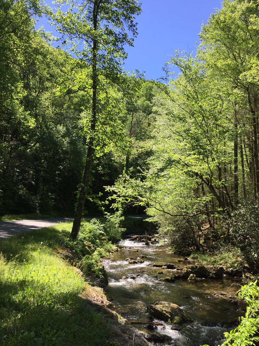
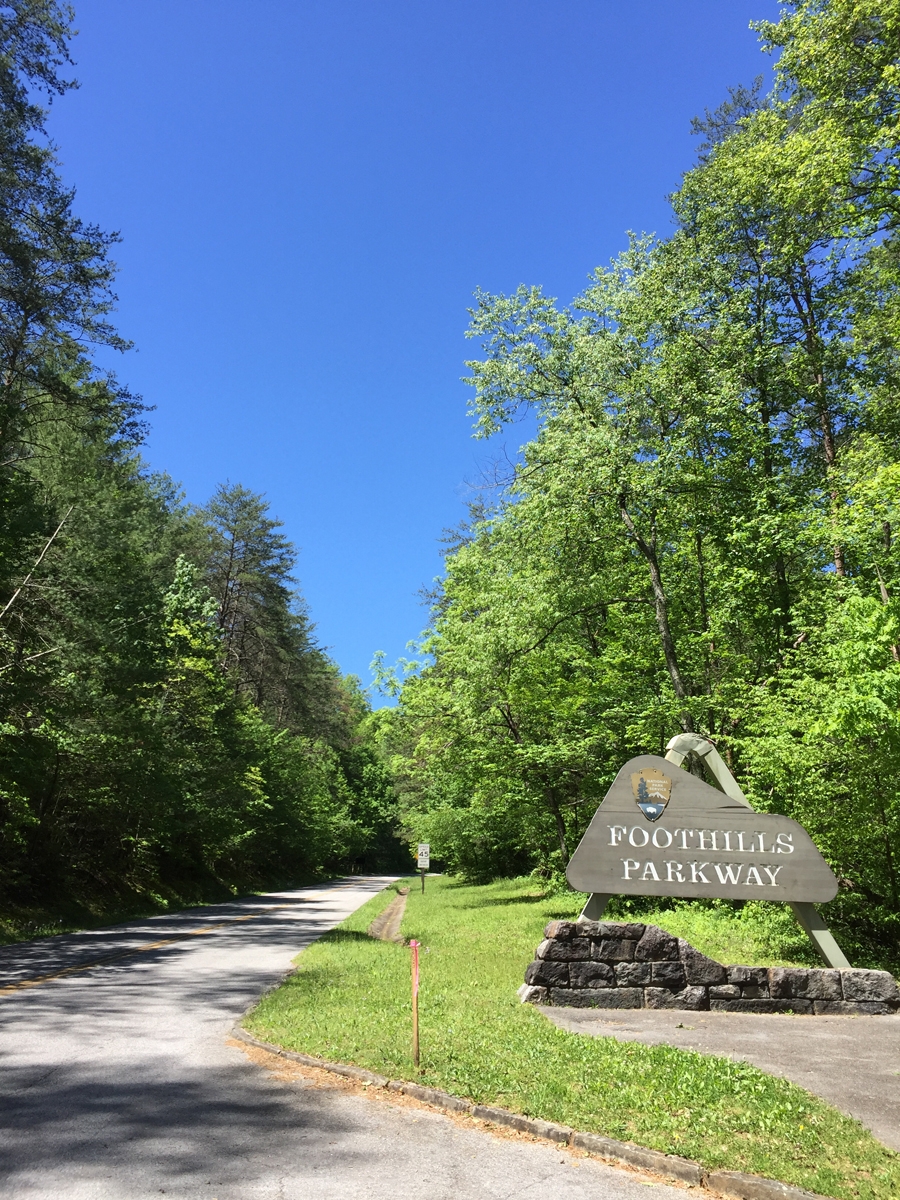
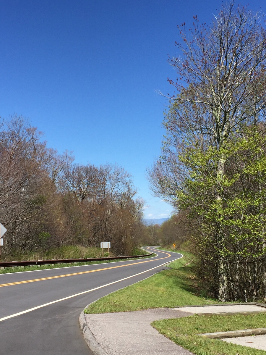
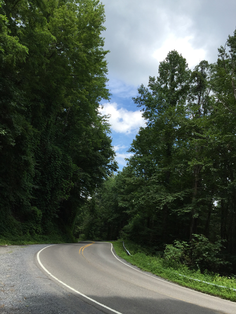
The NC end of the Skyway is in Robbinsville, sort of on the complete opposite side of the mountains from Pigeon Forge. I could have cut straight across the park, but decided to head around the western edge of the park instead. That meant skirting just inside the northern edge of the park — an altogether lovely road — then taking the Foothills Parkway to US-129 at Chilhowee.
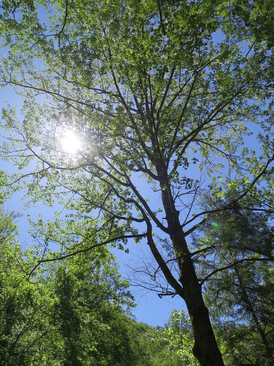
Gorgeous Blue Sky
The weather was perfect. Low 60s and not a cloud in the sky.
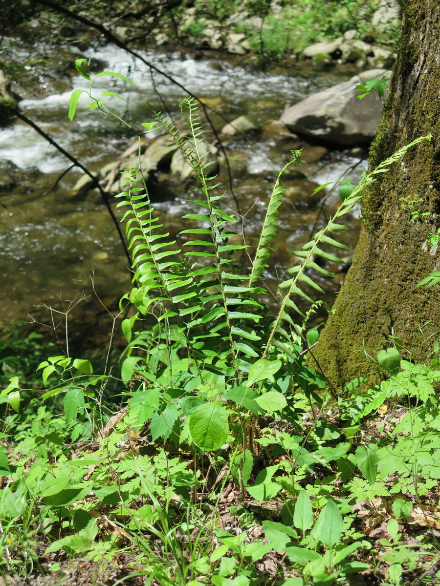
Fern
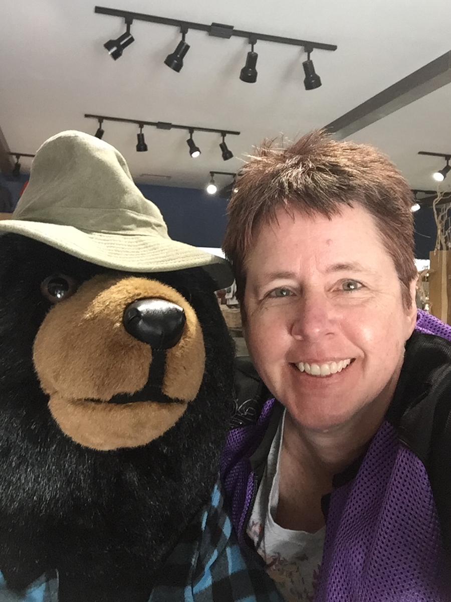
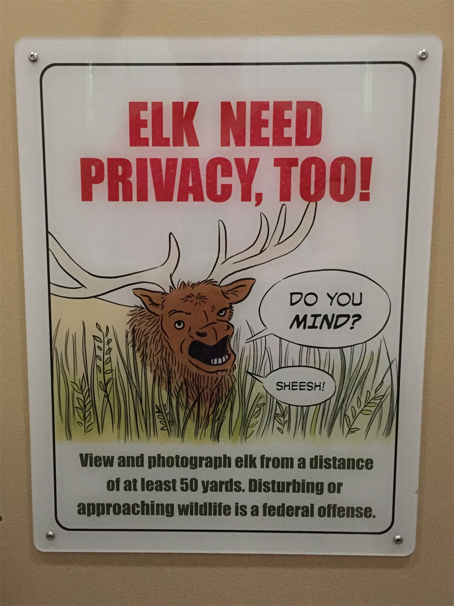
I stopped at the Cades Cove store (inside the park) for a potty break and some snacks. That’s where I met the bear you see in the first photo. And where I saw the sign featured in the following image. It was hanging in a bathroom stall.
Because people can be idiots.
Cades Cove wasn’t as busy as the last time I’d visited, but there were still way too many cars for my liking, so I continued on my way.
I exited the park at the Townsend entrance and hopped on the Foothills Parkway. It took me to US-129, not far north of where the Tail of the Dragon (THE most-famous destination road in the area) starts/ends.
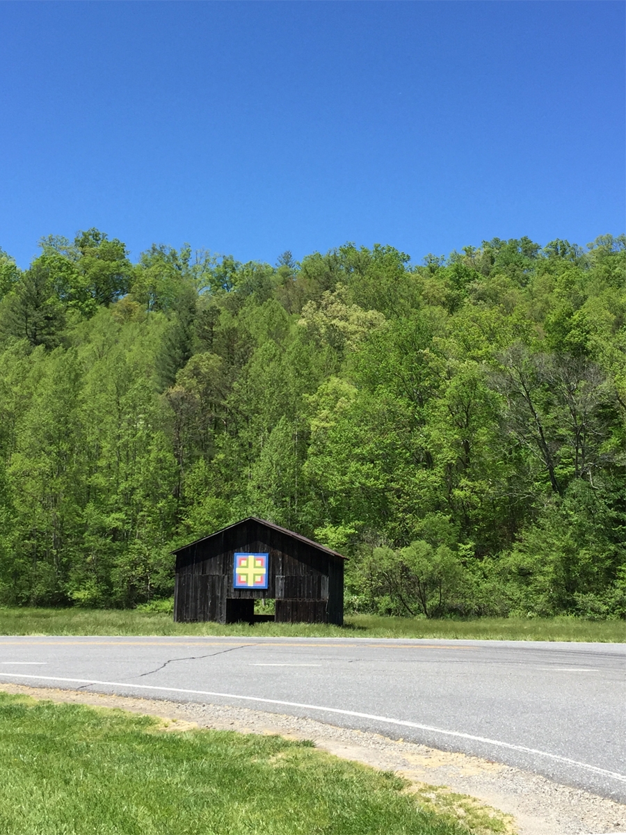
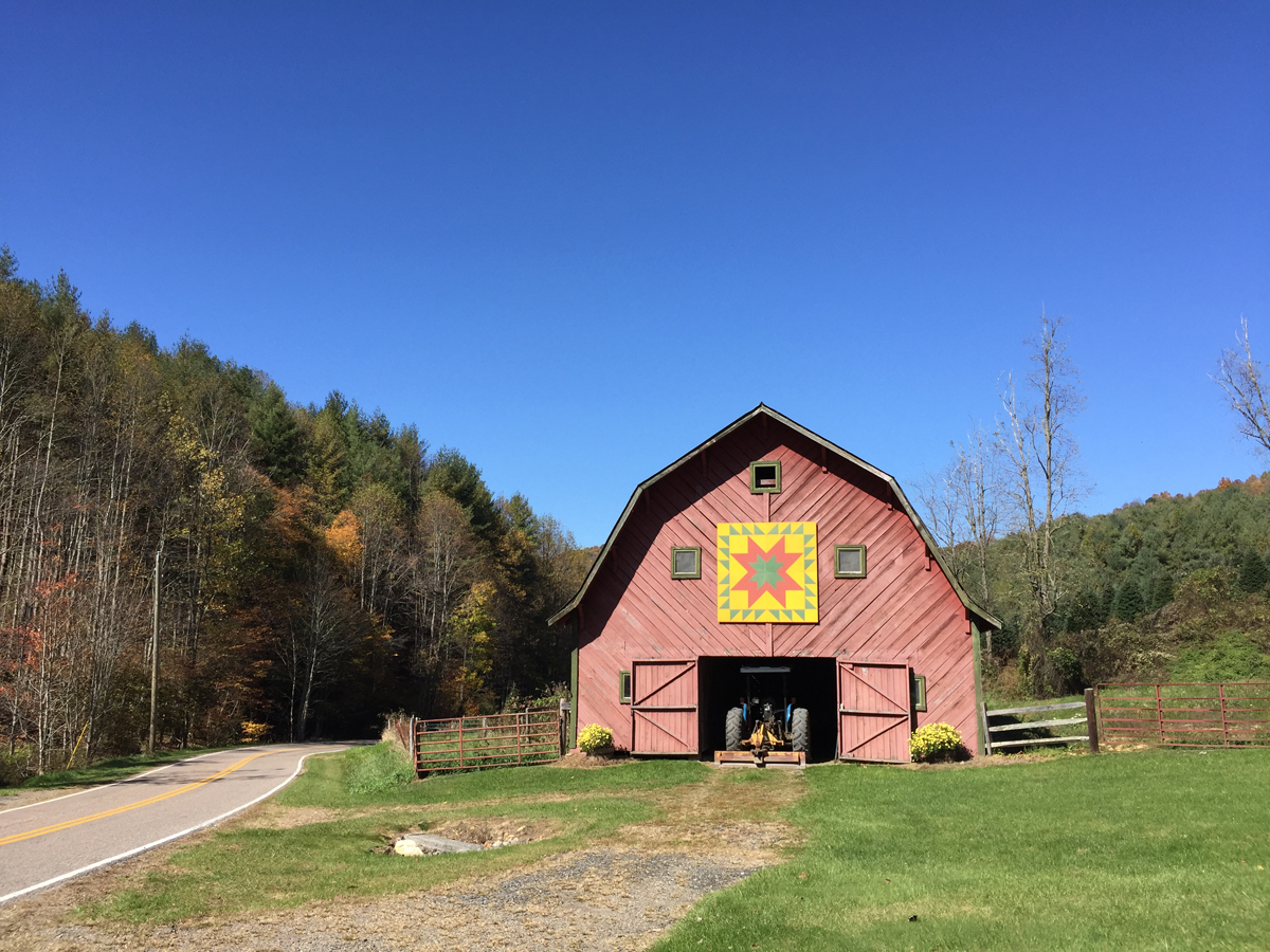
Look what I spotted along the way…
Barn Quilt
…somewhere between exiting the park and entering the Foothills Parkway.
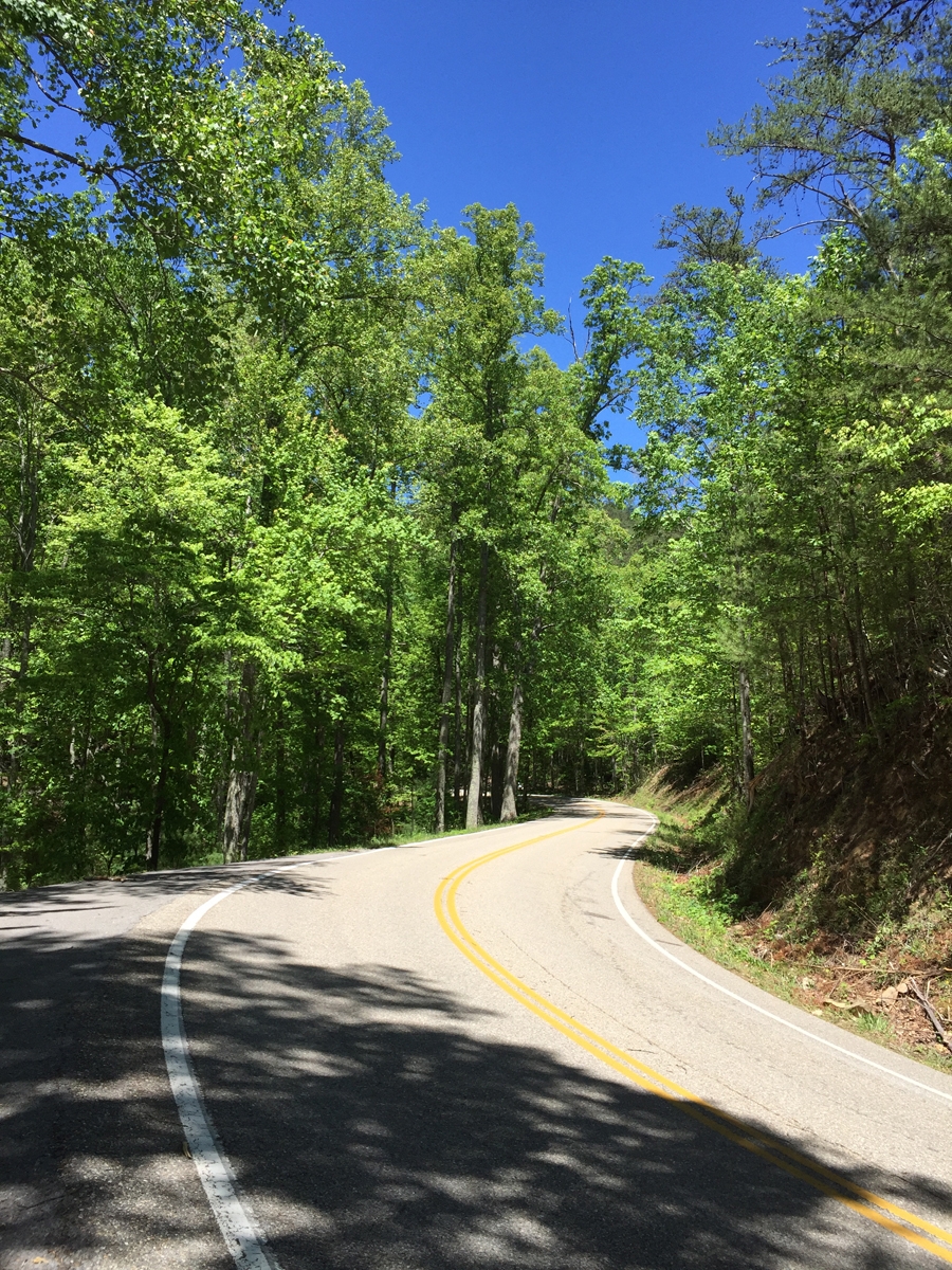
I had the road all to myself.
I’ve ridden The Dragon on a few different occasions now. It is a nice road, but there are many nicer ones in the area with higher speed limits — it’s only 30 mph on The Dragon — that don’t attract tons of people.
I actually managed to zip into a pull-off to grab a couple of pictures.
As seen along Tail of the Dragon
As seen along Tail of the Dragon
Because The Dragon is such a popular road, there are several spots along the route where photographers station themselves and take pictures to sell. Killboy.com was the pioneer of that practice at The Dragon. I decided to buy a couple of the images, which are shared below.
It’s a great business idea, really. How often does one get to capture good images of oneself actually riding? Killboy has done so well he has his own store at the intersection of US-28 and US-129 selling all kinds of cool stickers, t-shirts, and other stuff. It’s right across from the original store/restaurant/motel complex at The Dragon.
Killboy’s Dragon Sculpture
I wasn’t going to stop at the other store, but that’s where the real potty is, so…
The other Dragon.
I HAD to get a selfie there, too.
Then it was on to the Cherohala Skyway via the northernmost leg of the Moonshiner 28. I did say there are lots of destination roads in the area, right? In my opinion, it’s actually WAY more fun than The Dragon. So much so, that I had to double back and enjoy it a second time for Hubby.
Another giant chicken.
I gassed-up in Robbinsville at a station that also had a Subway restaurant AND sold fried chicken. Great photo op, eh?
Then it was on to the real fun. Finally.
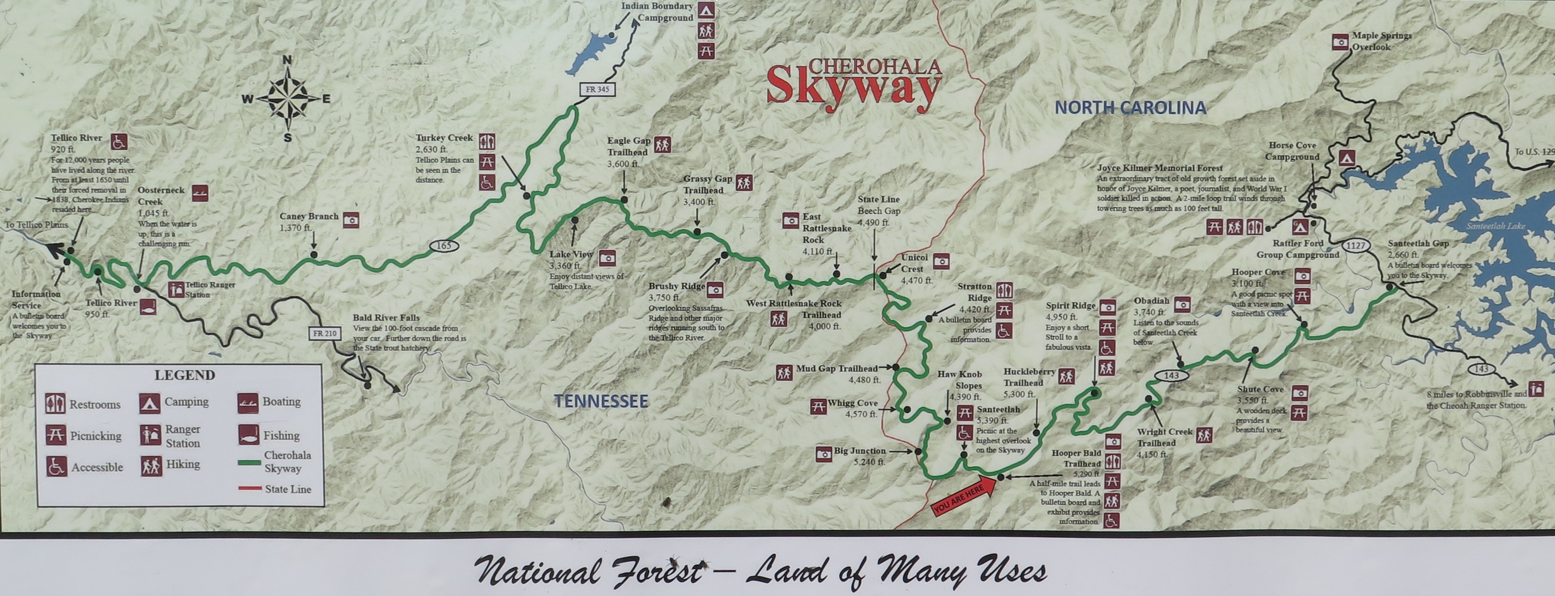
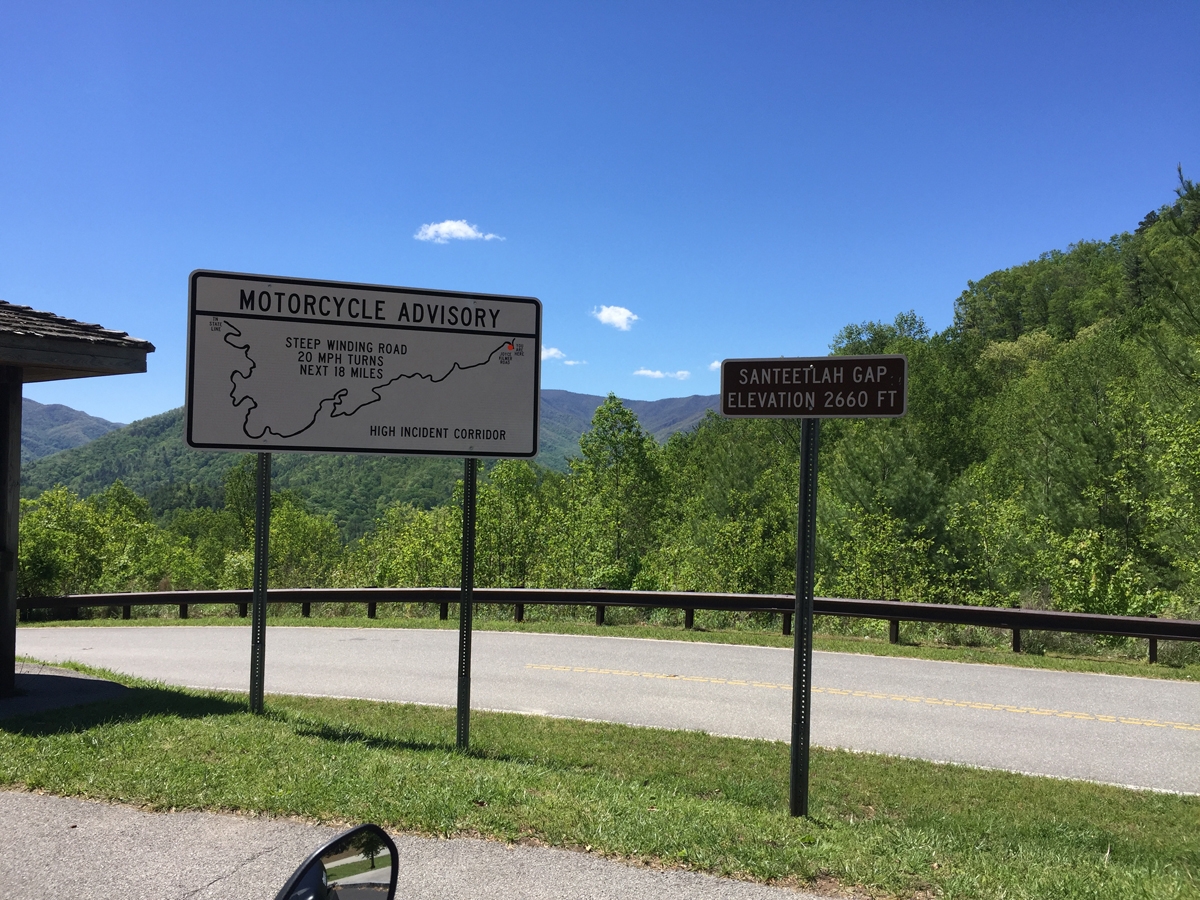
Info Sign
Near the Robbinsville, NC entrance.
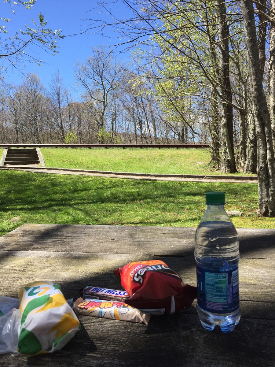
The weather really was perfect. I rode for quite a while before finally giving in to the complaints from my rumbling belly.
This pretty much exemplifies the entire route.
Great day for a picnic.
I took my trip before prime season. The whole time I sat there and enjoyed my leisurely picnic lunch, NO vehicles rode past. Not one. It was only when I was ready to start off again that another bike or two rode by.
No Tractors or Scuba Divers Allowed!
Yes, I know what the sign really means. I just find it funny.
At another rest area/overlook, later in the day.
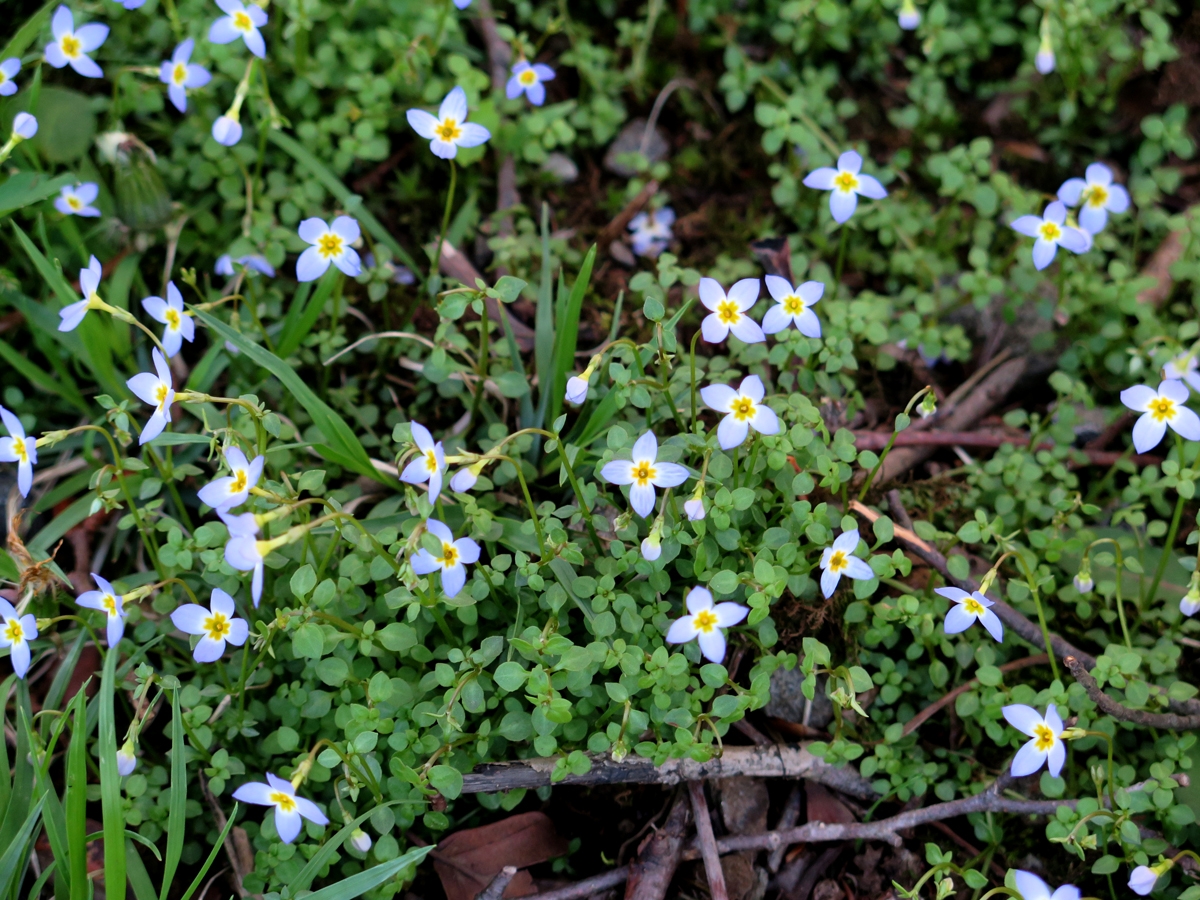
Teeny-tiny Flowers
I reversed direction at the Tennessee end of the Skyway and returned to Robbinsville. I think it was around 4:00 or maybe 5:00 by then. Too early to call it a day.
Actually, I could have called it a day, but there isn’t didn’t seem to be enough going on in Robbinsville, when compared to other locations, to make me want to stay for the night. So I stopped at the Giant Chicken again — free wifi — secured a hotel via phone, and rode to Bryson City. That’s where my day officially ended.
Question for y’all… do you care to see videos? I captured some in the hollers of West Virginia AND on the Cherohala Skyway. They take a bit of time to edit. Raw footage is REALLY boring. If no one really wants to watch them, I won’t bother. If some of you would like to see them, I will make time. So please let me know.
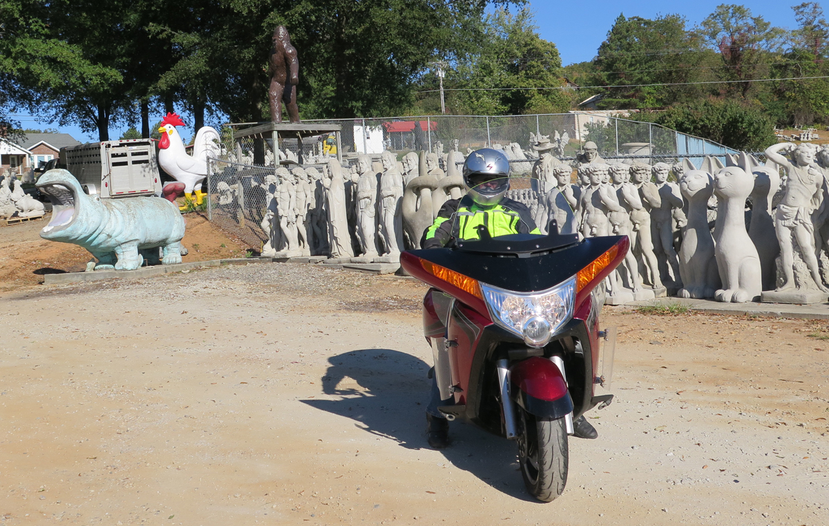
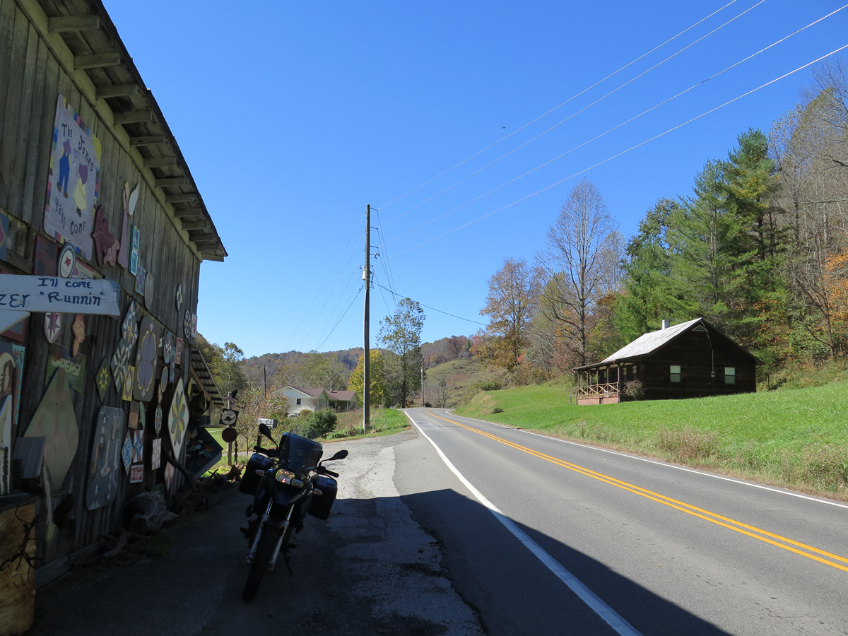
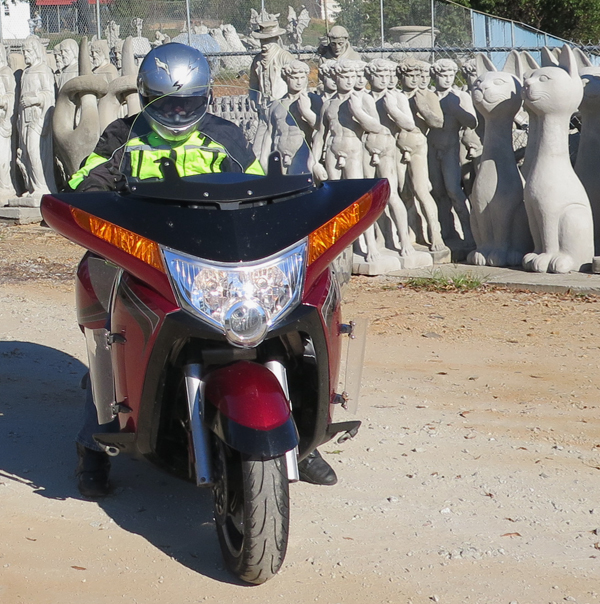
Y’all know I don’t usually subject my Hubby to really weird stuff that I know he won’t appreciate or enjoy, right? But sometimes, I can’t help myself. Especially when there’s something that is just SO up my amusement alley, in a location we’re not likely to re-visit anytime soon. Which is why, after leaving Mount Airy, North Carolina on our recent trip, I included a stop at Slick’s Pottery in the neighboring town of Slate Mountain. I may or may not have planned the route specifically because it passed through that particular locale. 🙂
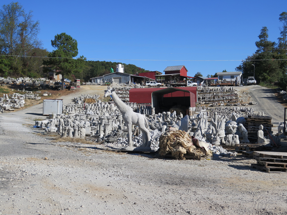
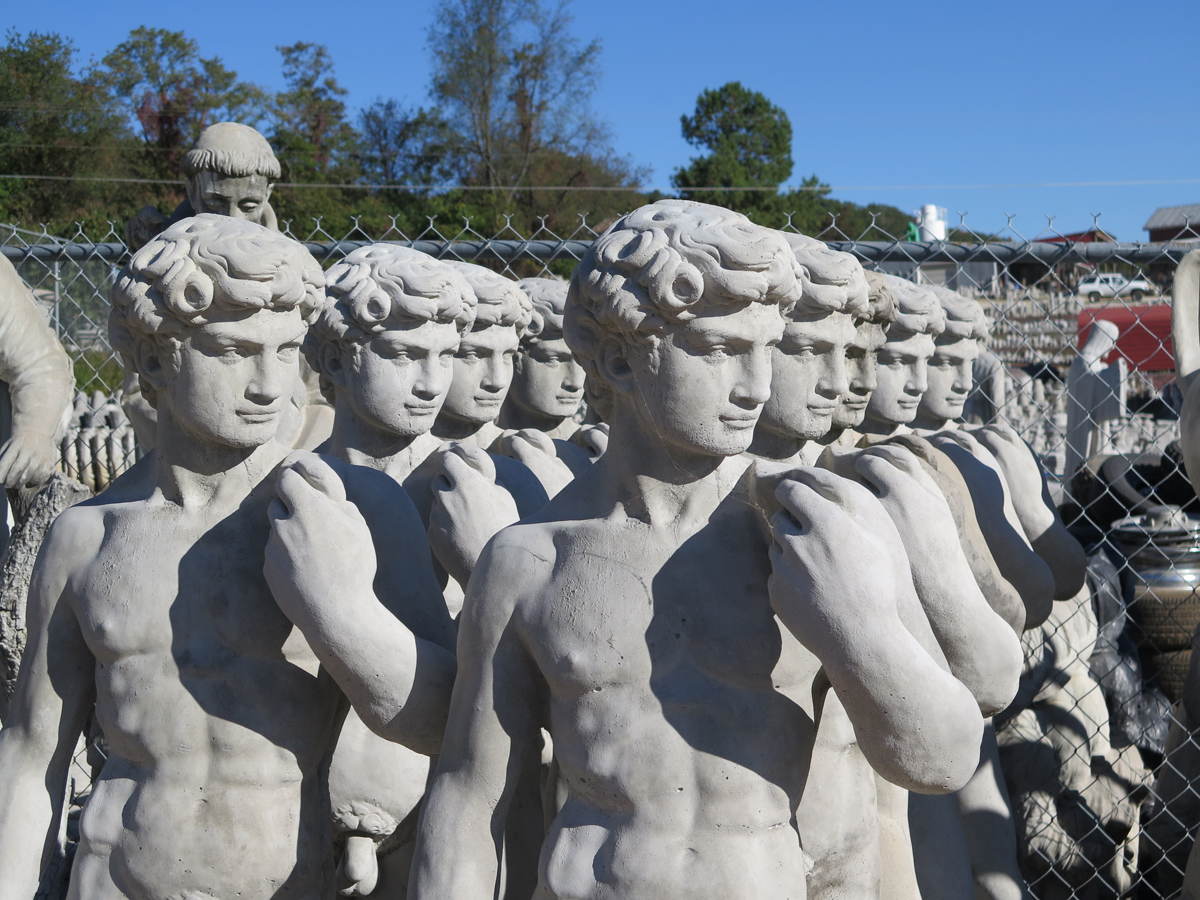
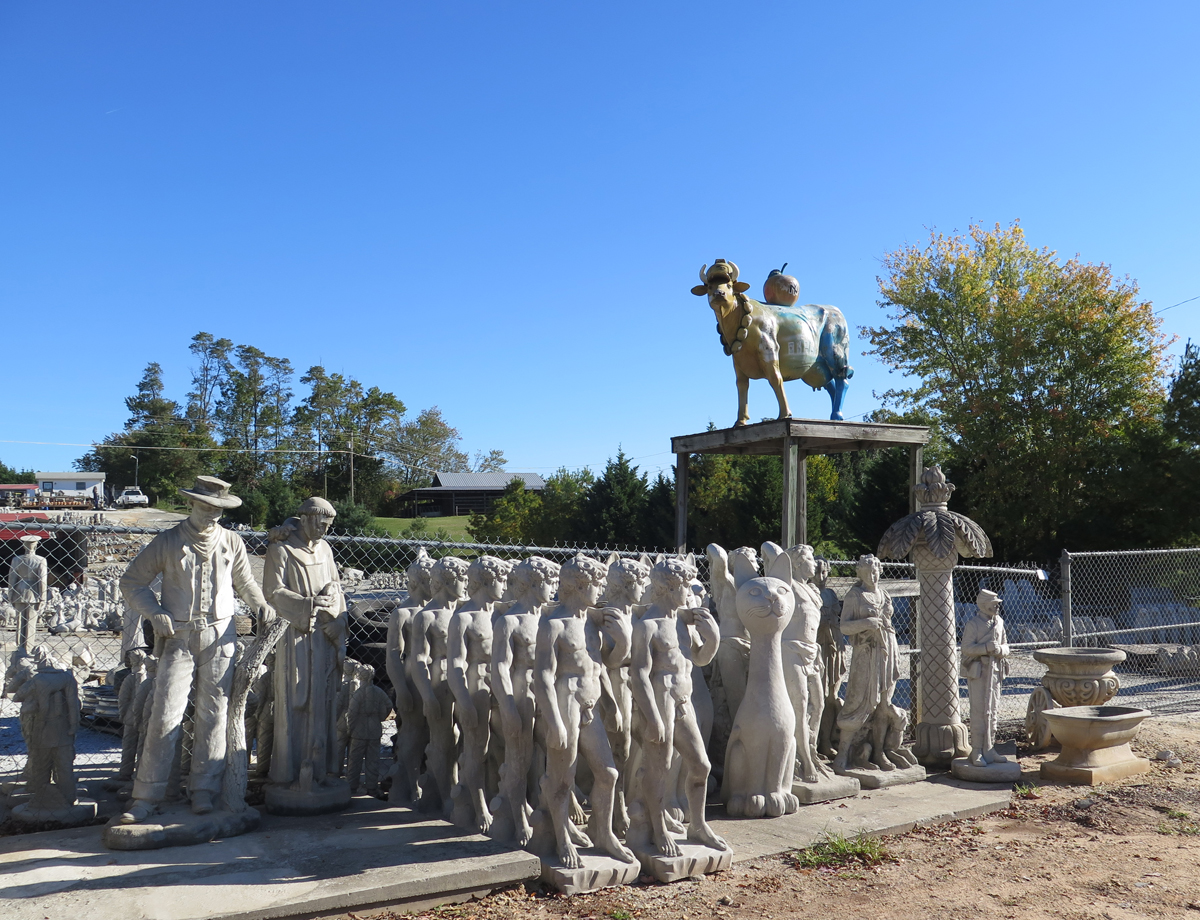
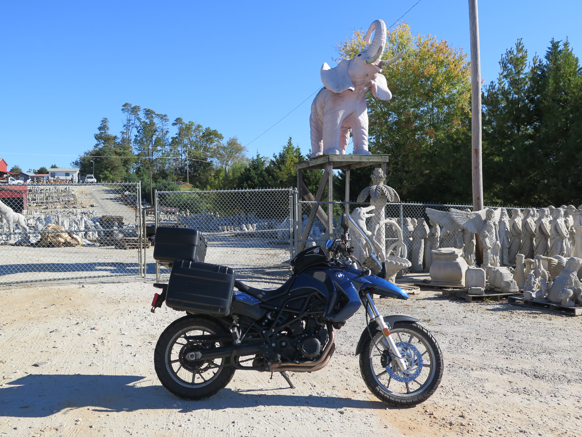
Along a rural road, an unexpected army of concrete warriors, animals, and Jesi crowd a hillside below a concrete statue factory. The selection no doubt varies continually, but on the day that we stopped by we saw what Americans apparently crave for their lawns and gardens: a dragon, lion, eagle, Indian chiefs, enraptured worshippers, armless Venuses, a pink elephant, an Amish buggy, and a cow up on a pole painted as a tribute to New York City. And there were many more statues arrayed in ordered battalions back from the road, up to the factory. It’s all about the latest ironic juxtaposition waiting to be photographed.
How could I pass THAT up? I would’ve been kicking myself indefinitely if we hadn’t stopped, always wondering what amazing wonders we could have seen.
And, in the end, we only spent five minutes there.
Yes, I can work fast when required.
I think he even enjoyed the visit. A little, anyway.It really was a small hillside full of statues.
The business was closed while we were there (a Sunday morning). 🙁
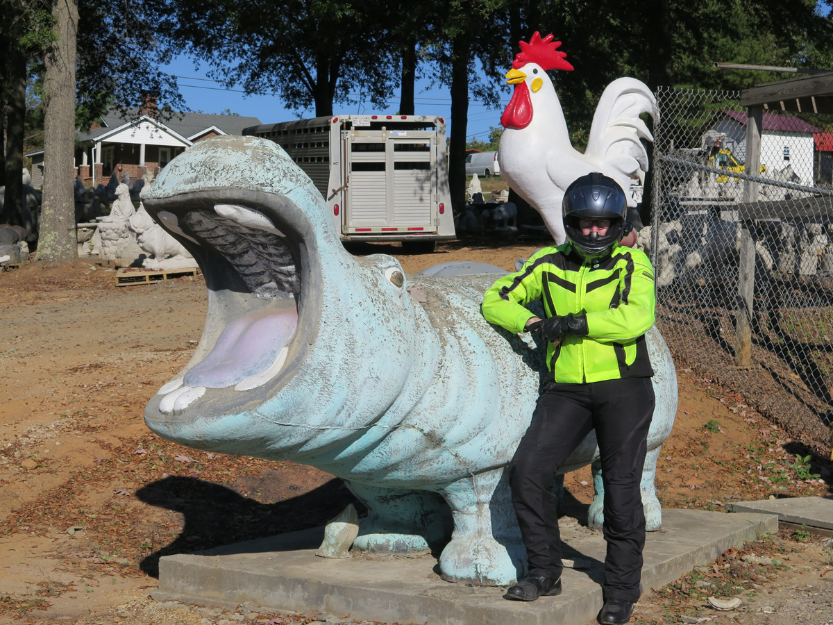
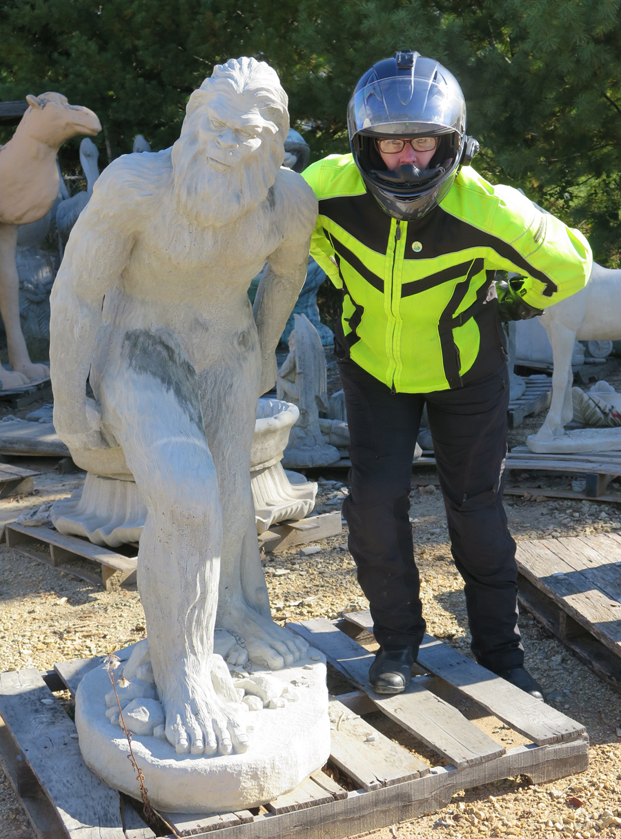
ToadMama with Hippo and Chicken
Of course, when I saw the above picture of me was missing an important third component, I requested a re-do.
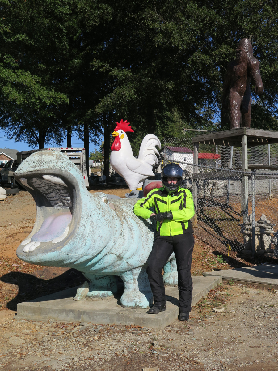
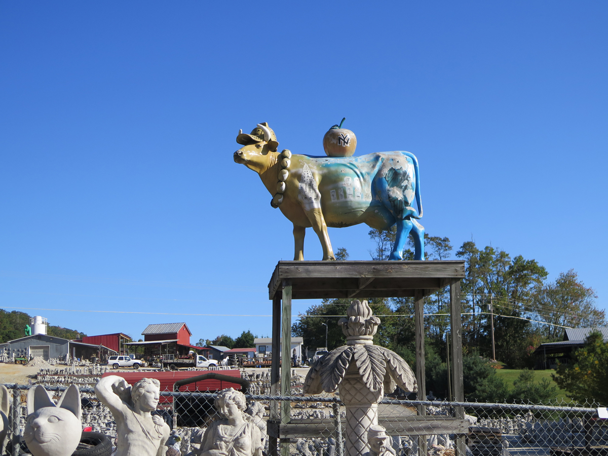
ToadMama with Hippo, Chicken, and SasquatchYankee CowArtsy ShotThere was quite an assortment.Obligatory Bike ShotToadMama with Soldier (and mooning photobomber on left)I found one for my yard!This is actually the mooning photobomber.
I read somewhere that the four-foot-tall Sasquatch is one of their biggest sellers.
Hubby spotted the giant green rooftop ape.Another concrete hippo. And a camel.Pink Elephant on Platform
Wasn’t that a fun stop? If only Slick’s place wasn’t so far from home.
I’m woefully behind on blog posts. Hubby’s birthday ride feels like it was ages ago. Jeez.
I’ll spare you the lame excuses. And, because there’s a backlog, I won’t bog this post down with commentary. Basically, we woke up on Saturday, packed up, ate, and rode. It was a glorious day.
I didn’t take nearly as many pictures as I could have. It was a beautiful area. Truly.
I just HAD to stop for this one.
Looking out over the Grayson Highlands.
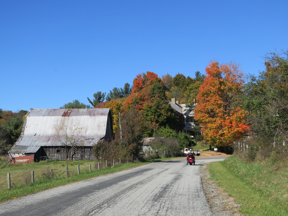
Country
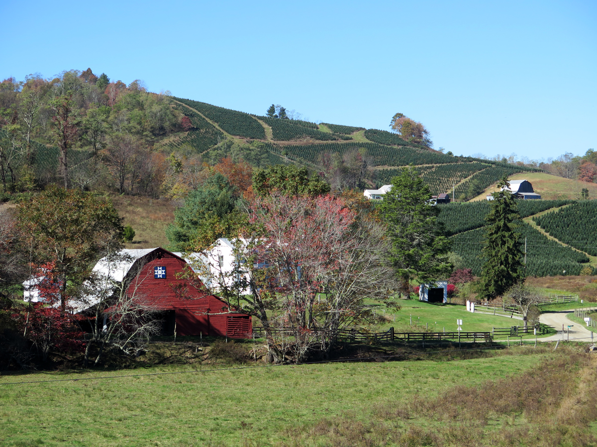
Barn Quilt and Tree Farm
More Barn Quilts
Grayson Highlands in Virginia
We were very close to the VA/NC border. I have no idea which state this was in.
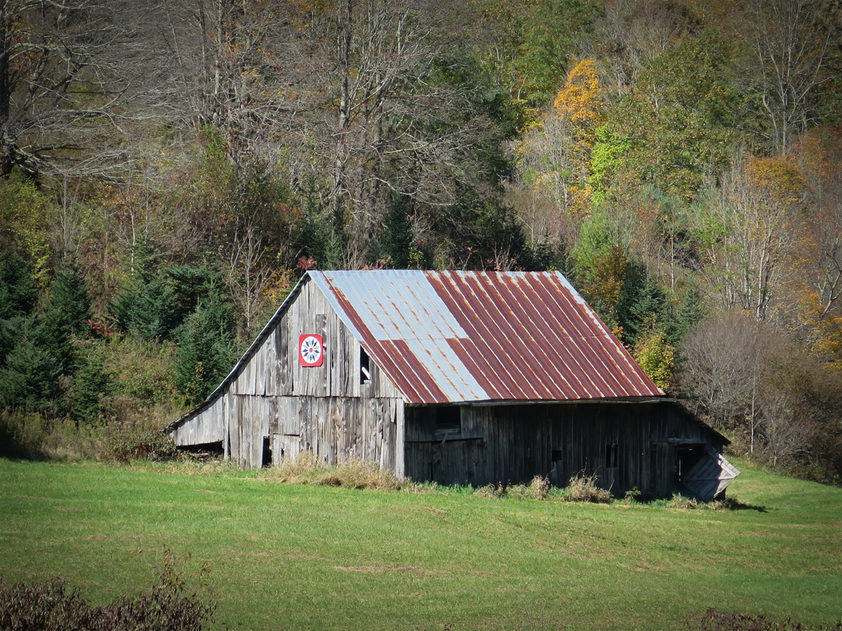
A Closer Look at the Barn Quilt
Pretty Barn Quilt
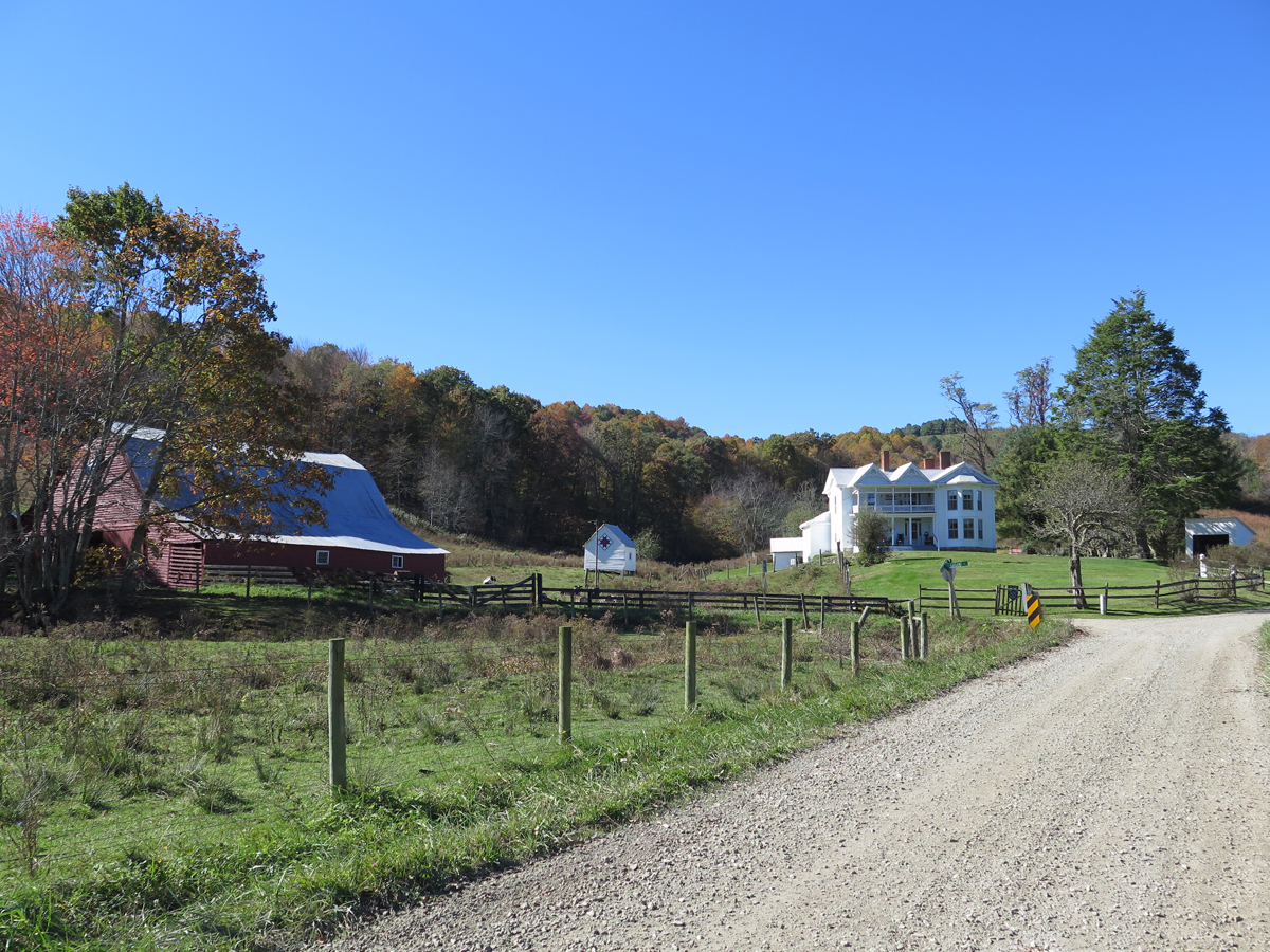
Along a North Carolina Road
Barn Quilt on a Hardware Store in West Jefferson, NC
Giant Cows in West Jefferson, NC
I don’t make Hubby stop much, but I knew we HAD to stop in West Jefferson to see the giant cows at the only cheese factory in NC. I’m glad, too. The town is adorable. It’s on my list of places I absolutely must re-visit.
Perfect end to a fabulous day.
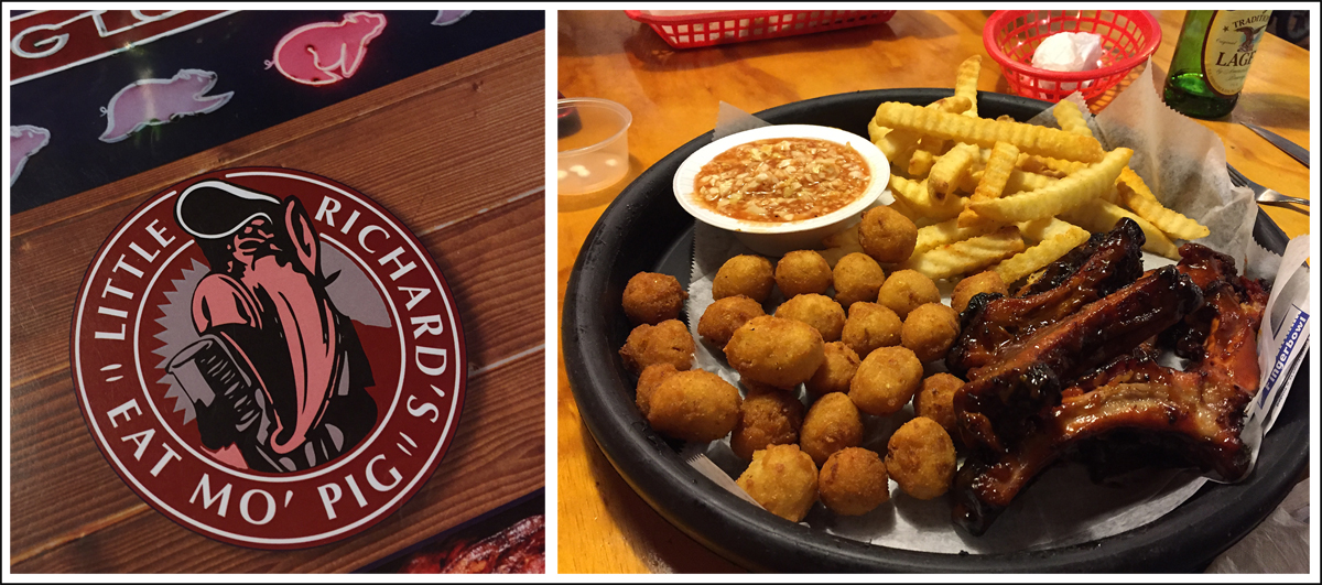
I actually chose our lodging for the night because it was within easy walking distance of this BBQ place, which had great Yelp! reviews. We weren’t disappointed. The food was delicious.
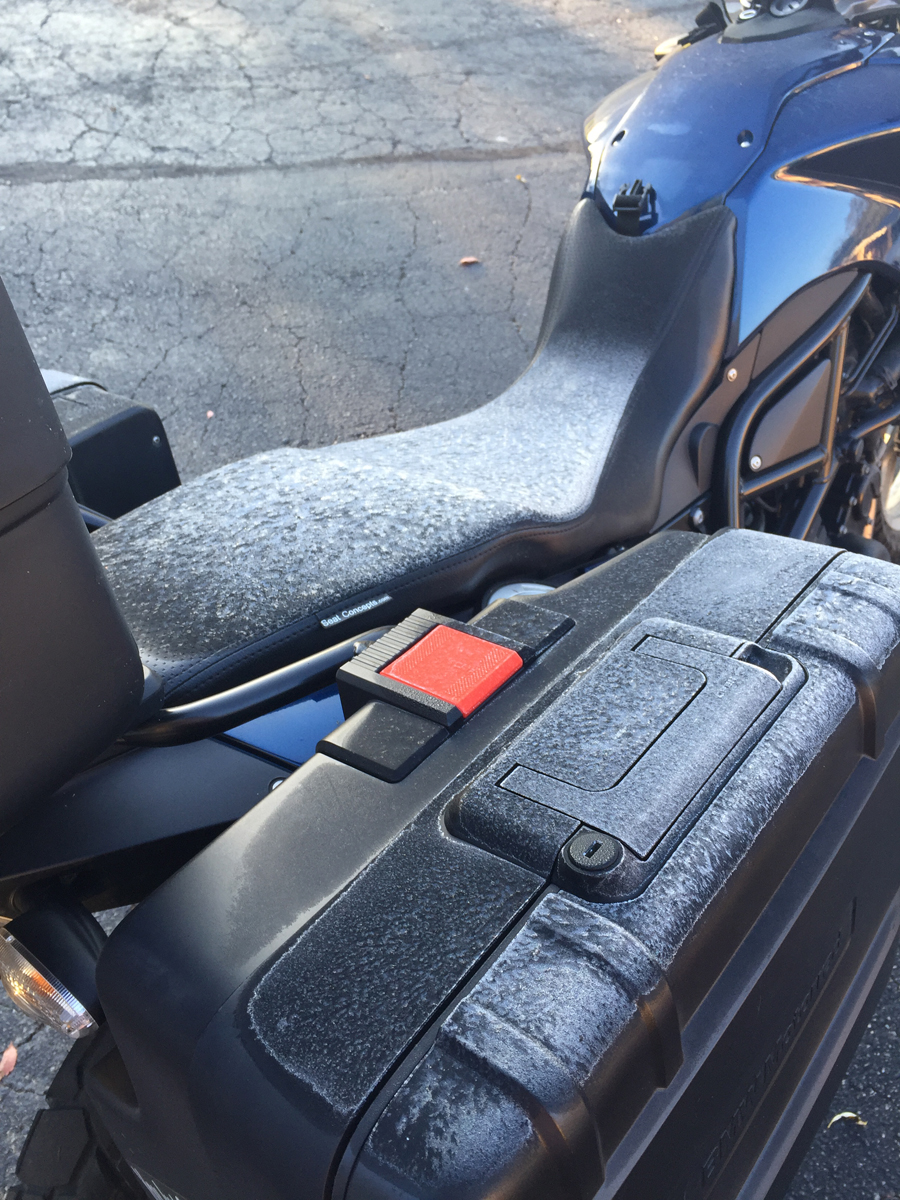
Frost!?!
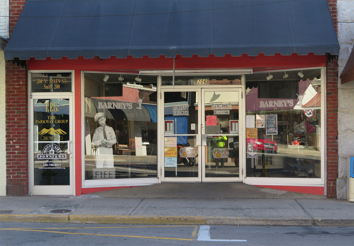
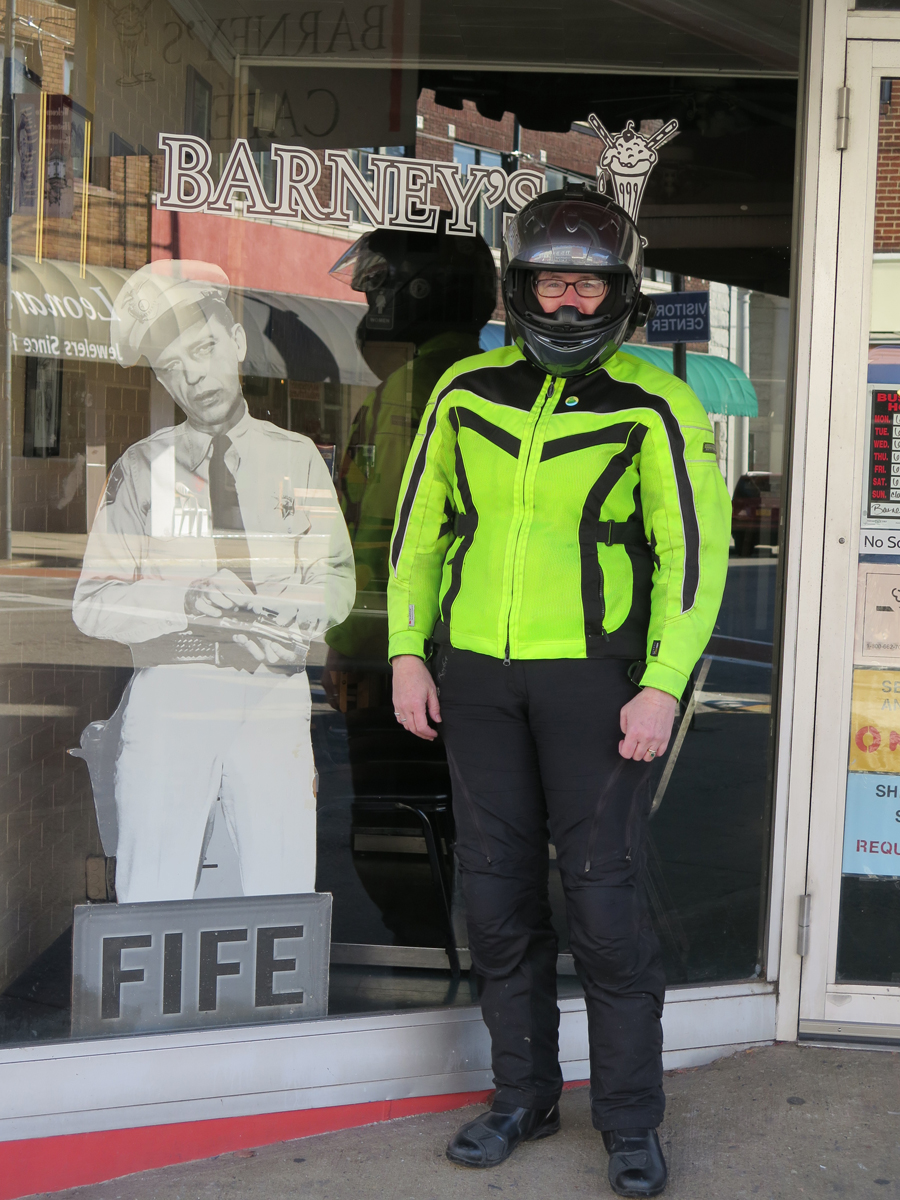
Mount Airy, NC (Any Griffith’s birthplace and inspiration for the fictional Mayberry)
Flashback
Kitsche
Dork
Nice spot for a stretch break.
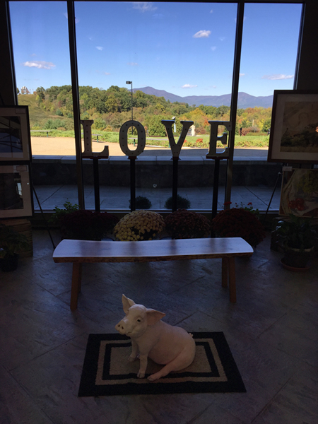
We were going to visit the D-Day Memorial in Bedford, but we were hungry, I was a bit chilled, and daylight was waning. It’s another place we must re-visit.
I did pop into the visitor’s center to see if their bathrooms worked and was quite tickled to see this mini-LOVEwork with a cool pig in the foreground.
Mini LOVEwork at Bedford’s D-Day Memorial … suh-WEET!
Next up… the other place we HAD to stop. Hubby wasn’t thrilled, but it was early in the day and we’d just eaten breakfast, so he humored me.
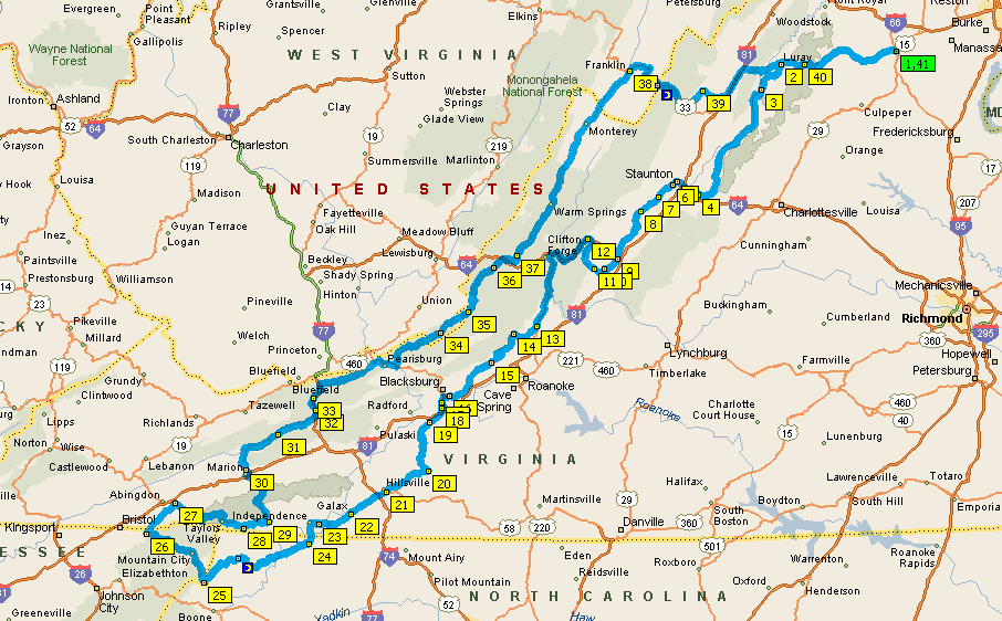
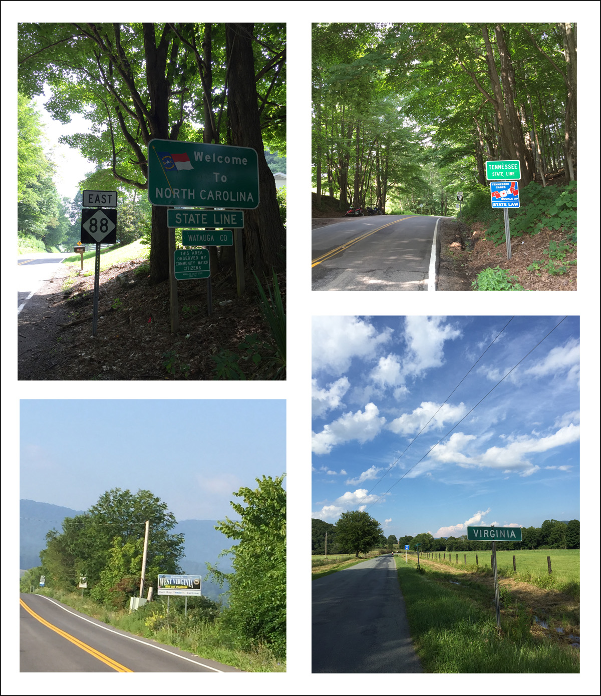
This past weekend Hubby and I enjoyed a fabulous three-day ride south and west of our home in Virginia. We covered 850 miles on wonderful motorcycle roads in Virginia, North Carolina, Tennessee, and even parts of West Virginia.
I’d been wanting to really put those maps to the test. And guess what? They passed with flying colors. Really. We spent three days riding a series of really awesome motorcycle roads. It was tons of fun. We were having so much fun, in fact, that I didn’t even think about taking a picture until late in the day on Friday, after we’d already been on the road for many hours. You know I’m having fun when I don’t think about pictures, right?
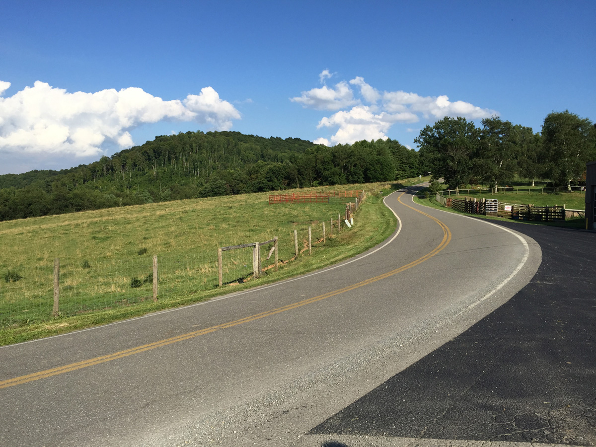
Along Indian Valley Road in Floyd County, Virginia.
We ended up staying in Hillsville, Virginia Friday night.
Sunset from Hillsville, VA.
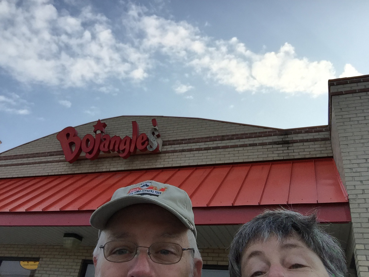
Lucky for us, there was a Bojangle’s about 15 minutes from our hotel, so we both enjoyed a nice breakfast on Saturday.
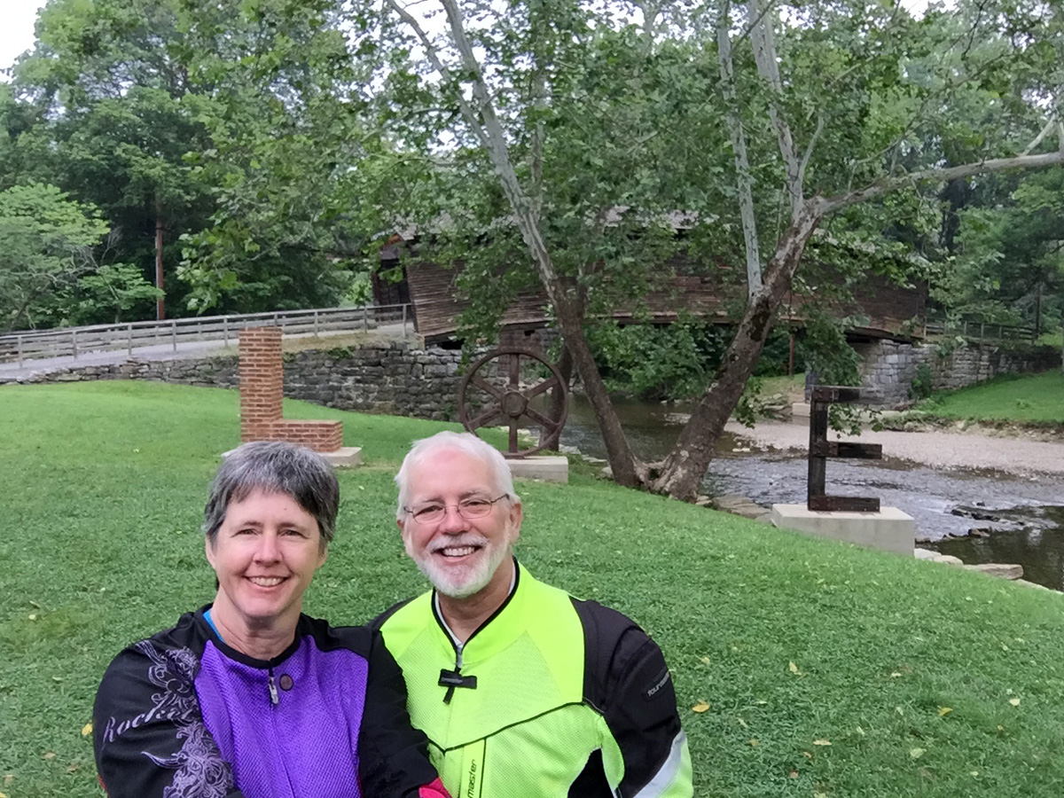
Hubby and Me
It wasn’t even hard to convince Hubby to pose for a goofy selfie with me.
From there, we rode into downtown Galax, looking for LOVE. (Since it was along the way, I figured we ought to stop.)
Galax, VA LOVEwork
Fortunately, the LOVEwork was right where it was supposed to be.
For the record, I saw the LOVEwork in Christiansburg, but it was hot, there was rush hour traffic, and it was on the opposite side of a busy street, so I opted not to stop for a photo. But I saw it. That counts in my book.
My Real Love
After a brief break, we continued south into North Carolina and then west and north to Mountain City, Tennessee.
Four States in Three Days
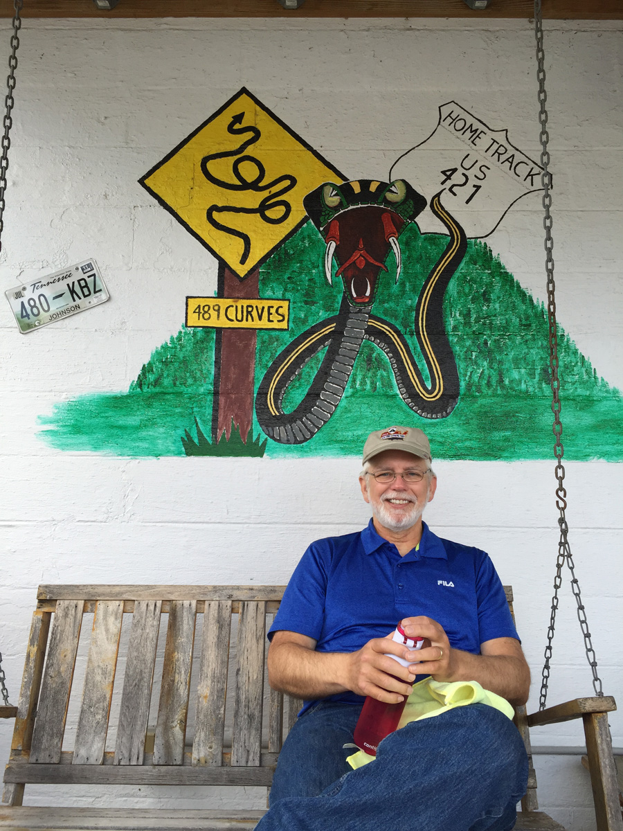
Why Mountain City? That’s where The Snake begins. 🙂
Hubby at the NC/TN border.
I missed The Snake on my solo trip earlier this year, so I figured it would be a good destination road that both of us could enjoy.
The Snake totally lives up to all the hype.
And enjoy it we did. Seriously, it’s a FUN road. That road alone was worth the trip.
The Snake
Shady Valley Country Store, about midway on The Snake.
From there, we headed north into Virginia, to Abingdon then East on 58 through the Jefferson National Forest. A repeat road for me that I really, REALLY enjoyed during my solo trip. We then followed 16 into Marion where we stopped for lunch before continuing north on the Back of the Dragon.
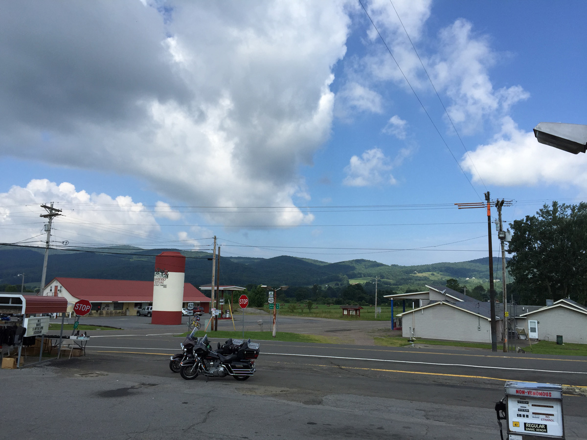
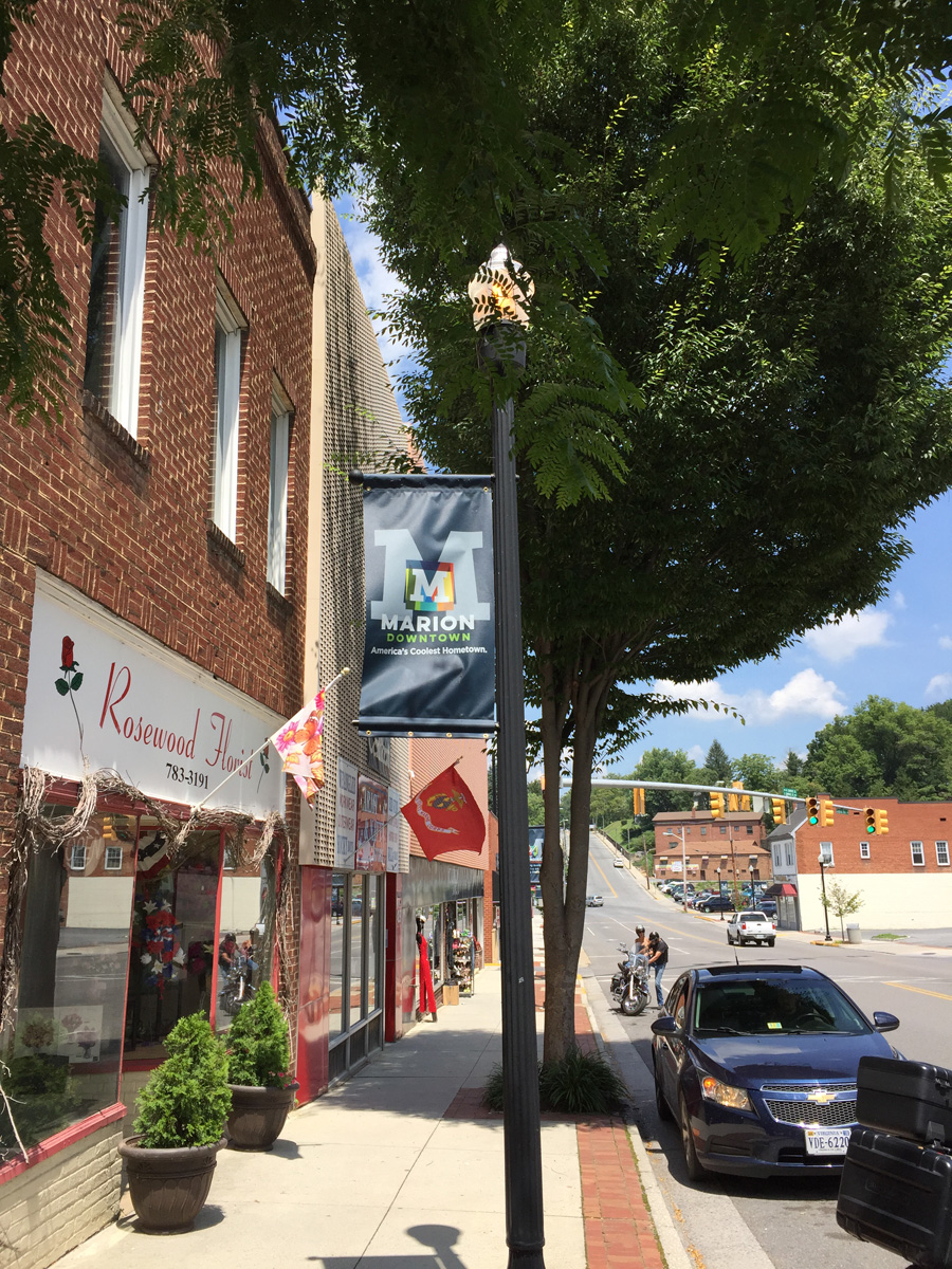
Marion, Virginia
My not-so-observant Hubby.
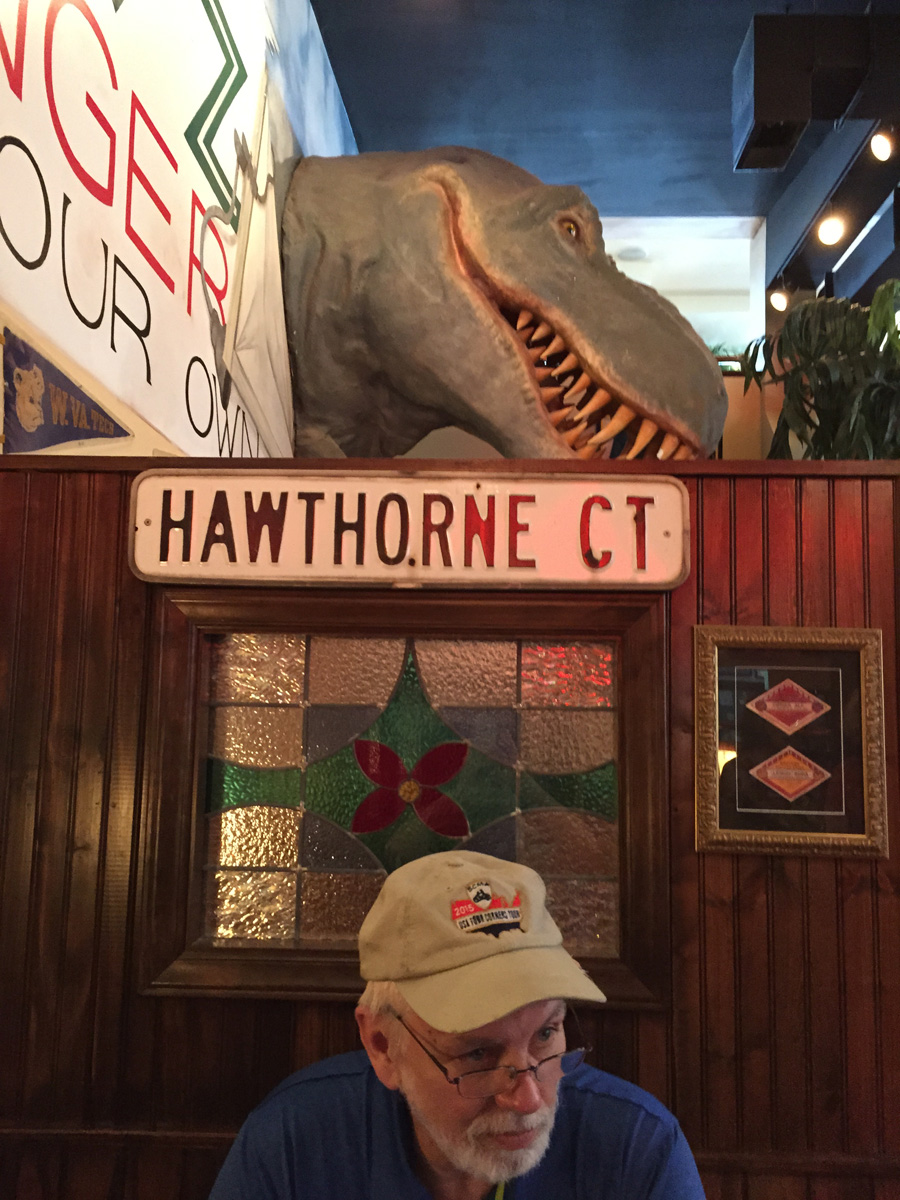
We chose Macados for lunch after discovering that the BBQ place we’d really headed for was closed.
After we were seated, I said to Mike, “Did you see the giant dinosaur head on the wall?”
His response? “What dinosaur?” Sigh…
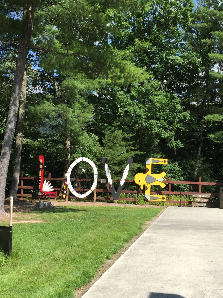
We continued making our way north and east toward Paint Bank, Virginia, where I’d reserved a room at the quaint Depot Lodge. En route, we stopped at the Wolf Creek Indian Village near Bastian for some more LOVE.
Bastian LOVEwork
Yet another lovely road.
Hubby enjoyed the ride just as much as I did. The weather verged on hot at times, but was very pleasant for the most part.
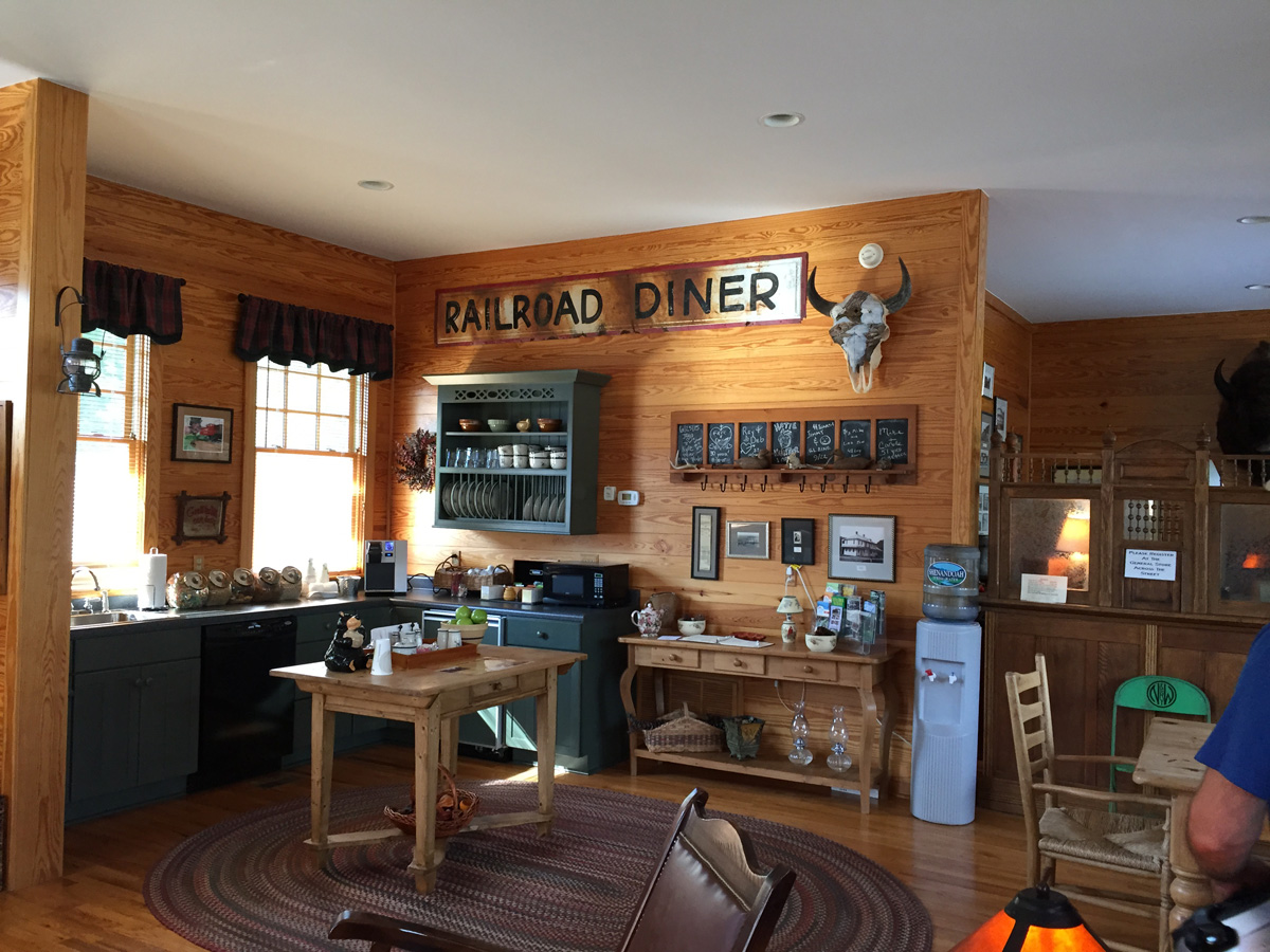
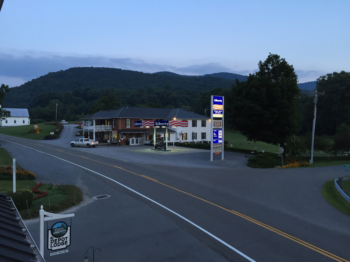
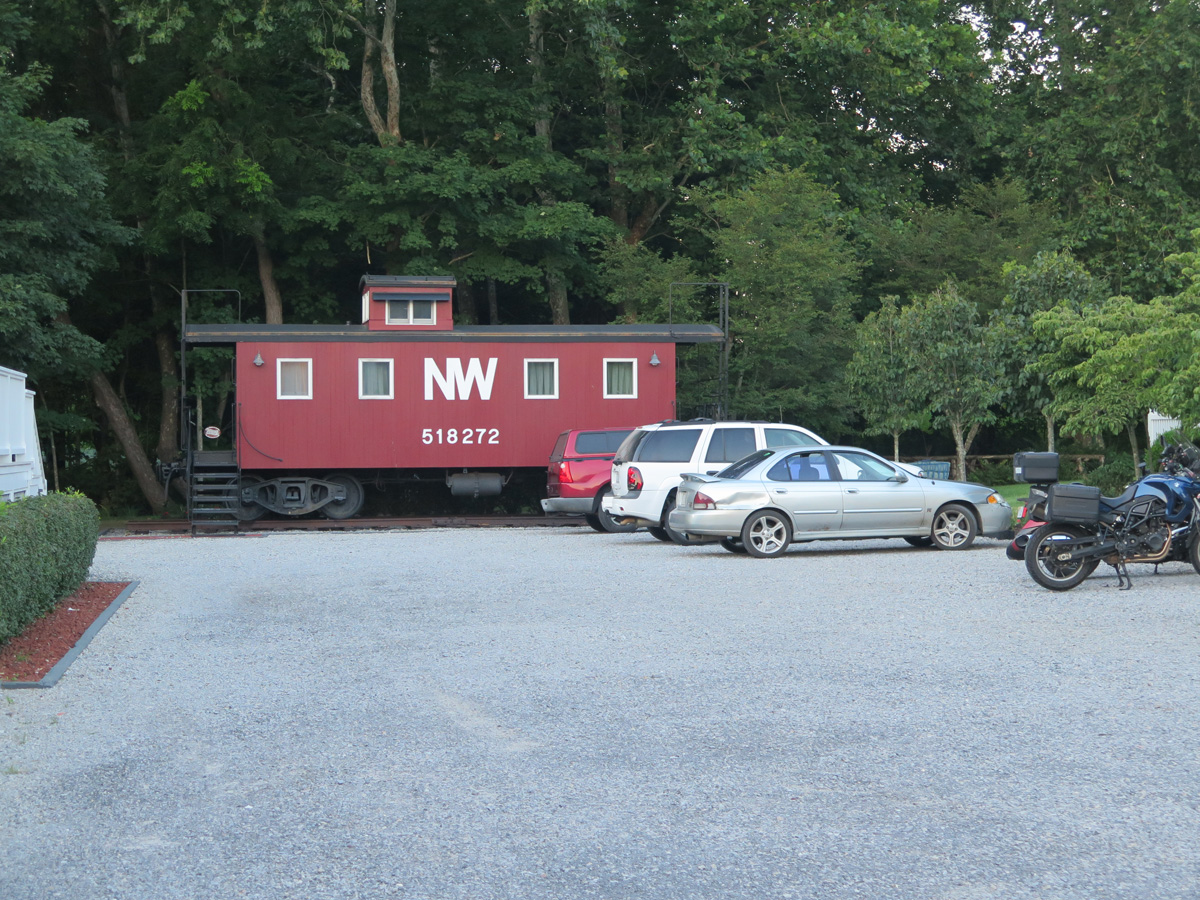
The Depot Lodge in Paint Bank, Virginia
Lobby at The Depot Lodge
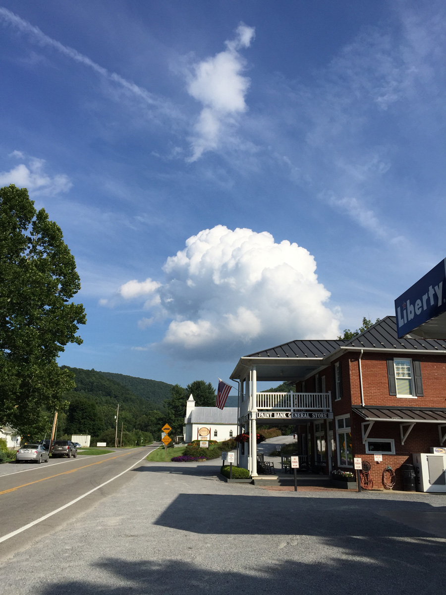
Paint Bank General Store
View of the store from our second floor porch.
Chillaxin’ on the porch.
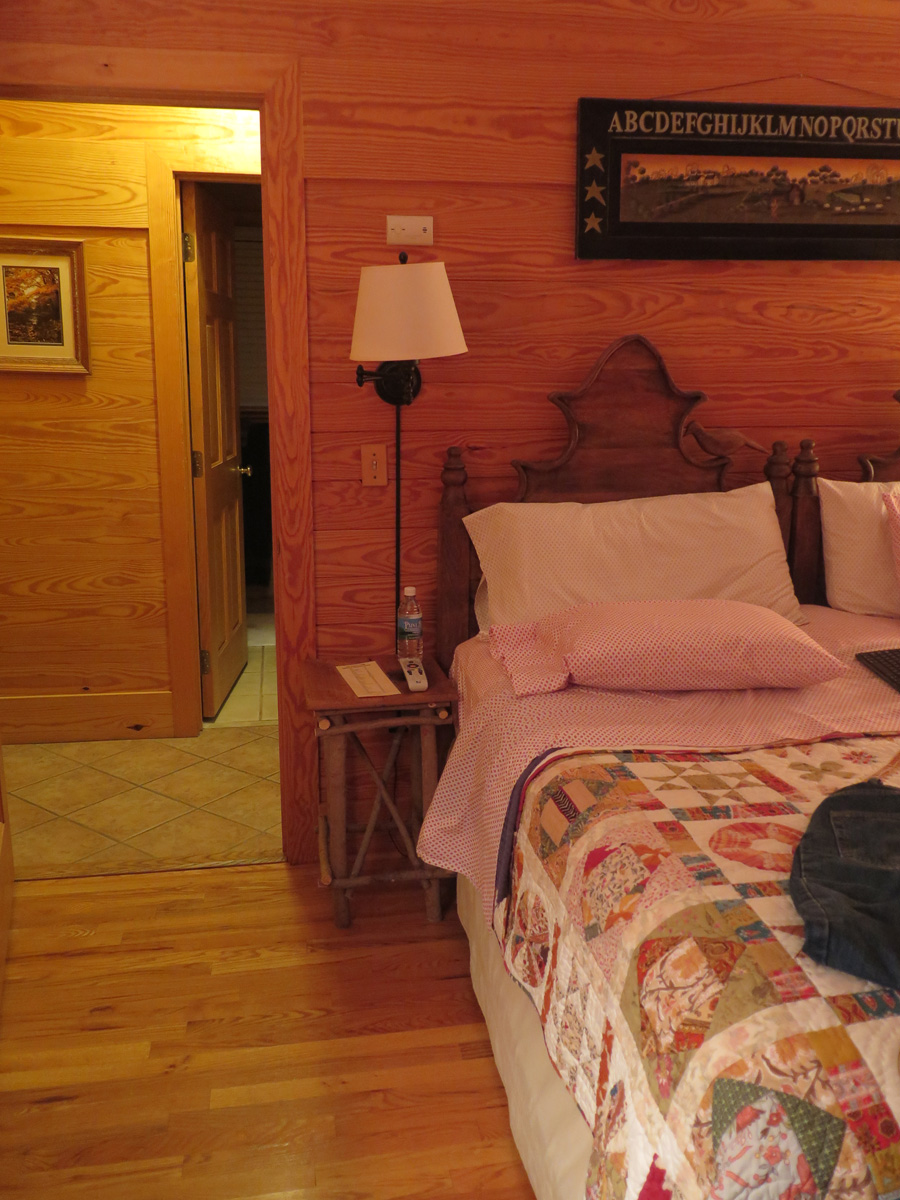
Our room at The Depot Lodge
Sadly, the caboose was already booked.
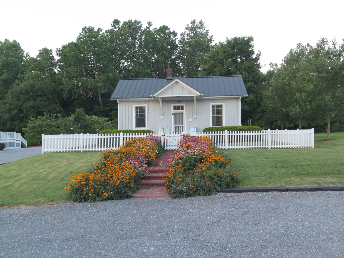
Outbuilding at The Depot Lodge
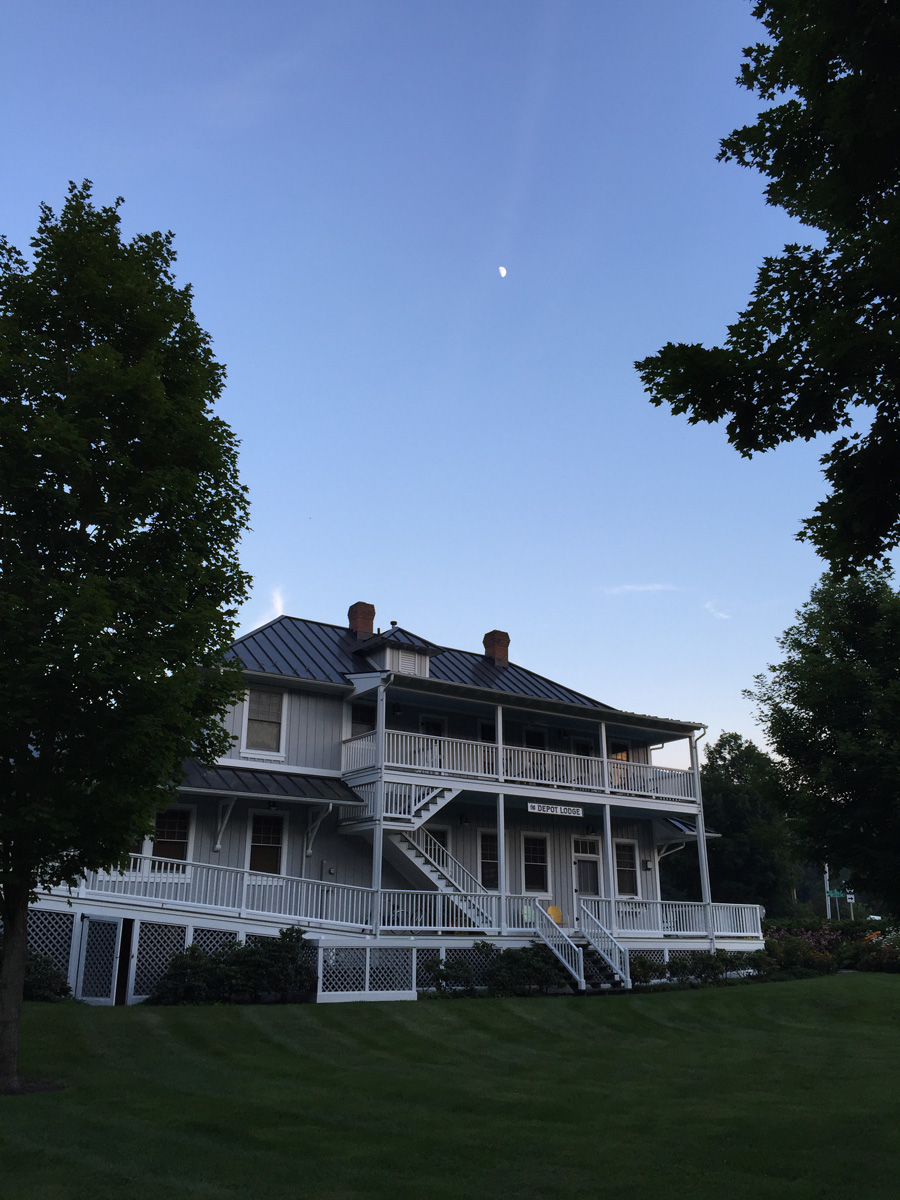
View of the lodge from the rear lawn.
Sunday, we had to hurry home to get the dogs from the kennel and so I could get ready to head off to Rockville, MD for work.
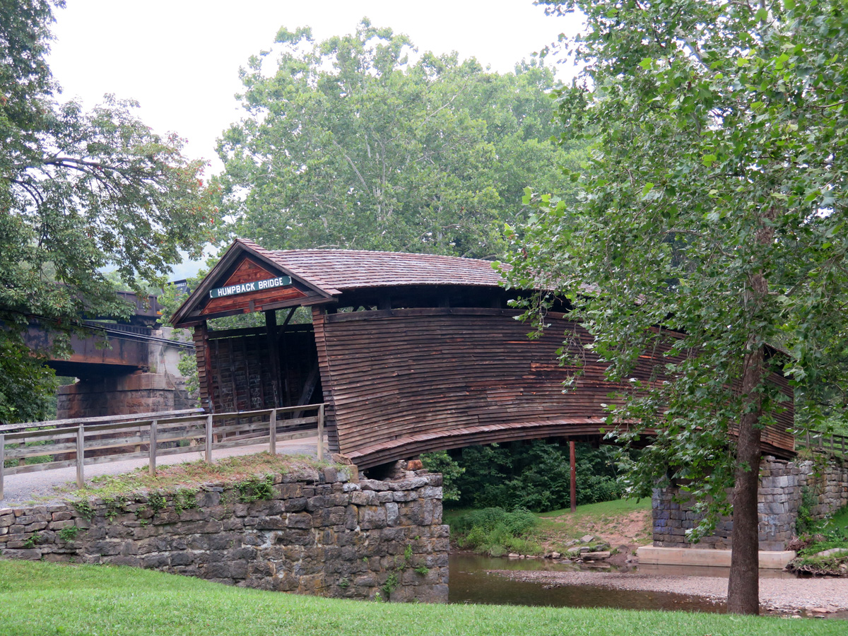
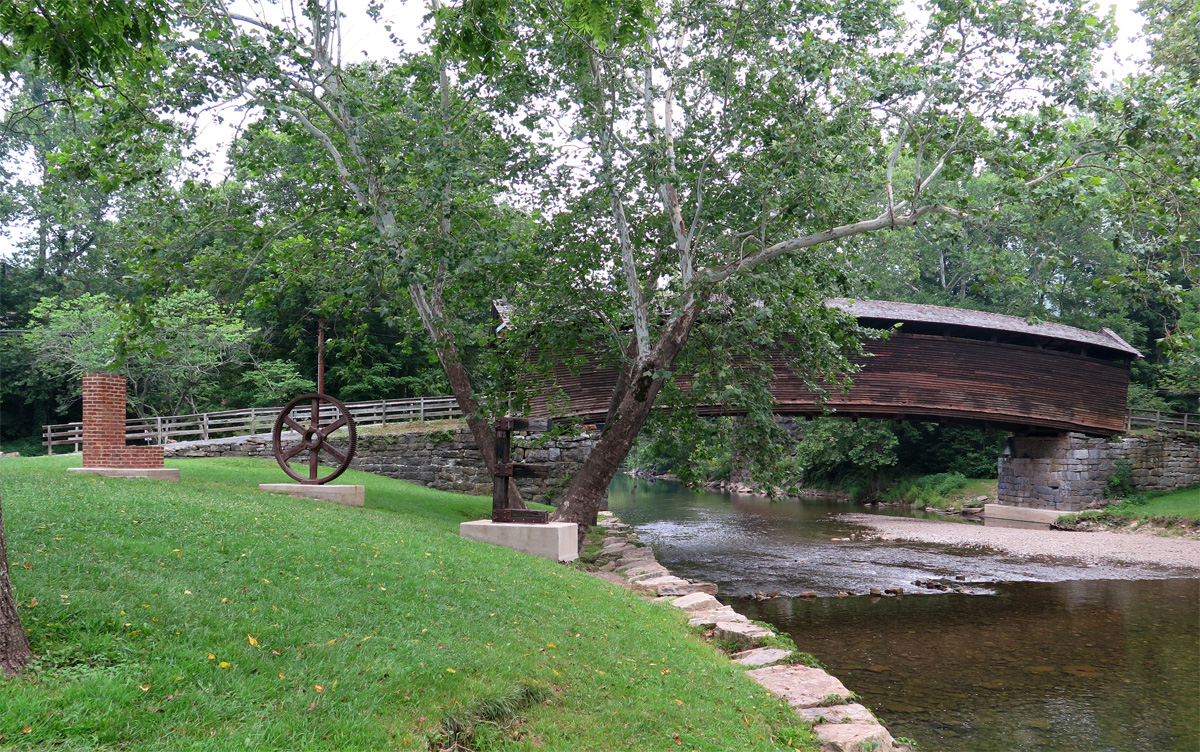
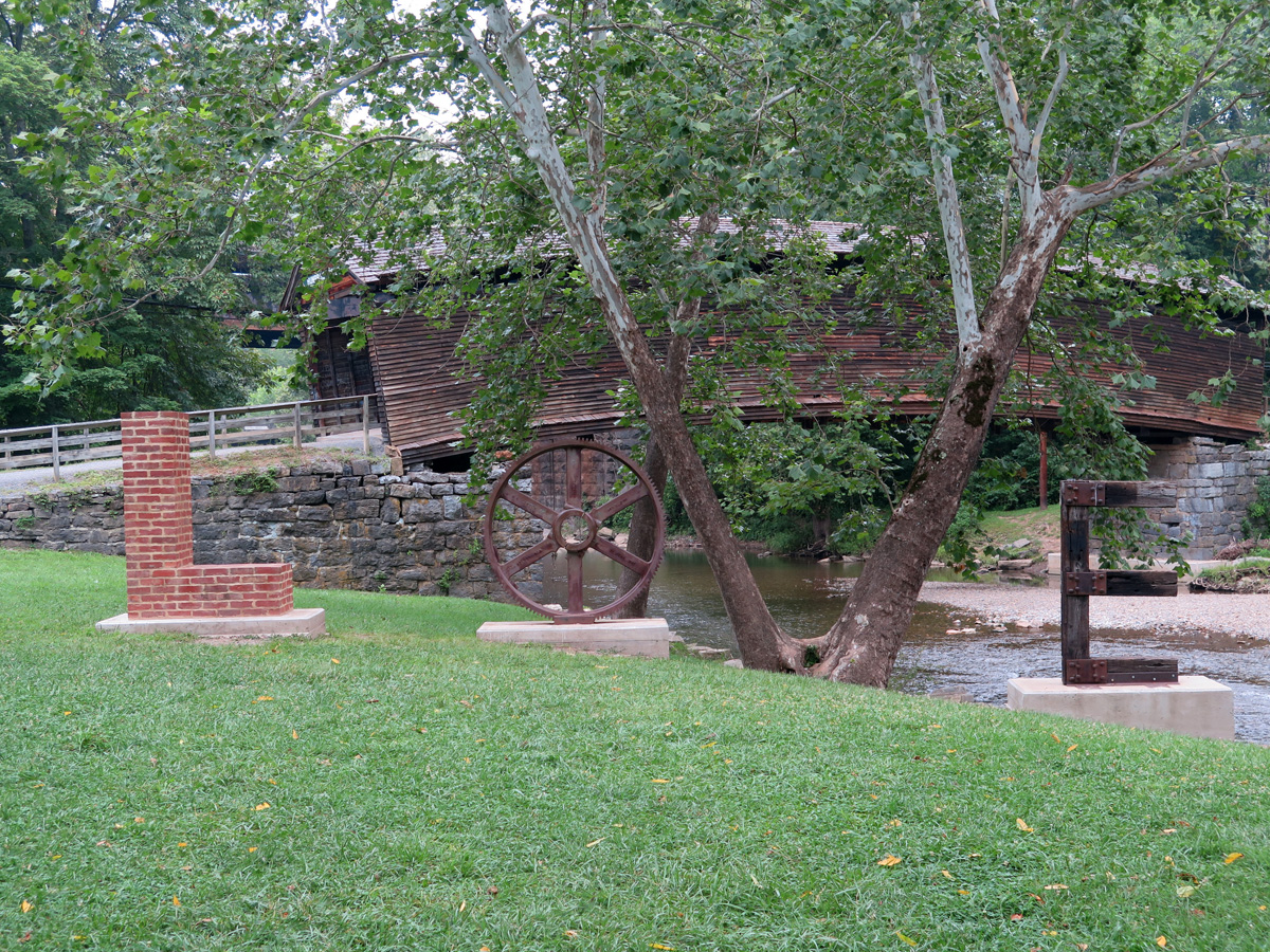
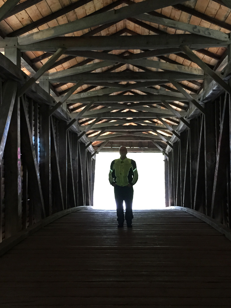
Humpback Bridge near Covington, Virginia.
I’d read about the bridge in a pamphlet at the hotel. A pamphlet which did NOT clue me in on a special bonus we’d also find at that location.
Humback Bridge (notice anything odd?)
We’d accidentally found another LOVEwork. How cool is that?
Covington LOVEwork
Hubby, reflecting inside the bridge.
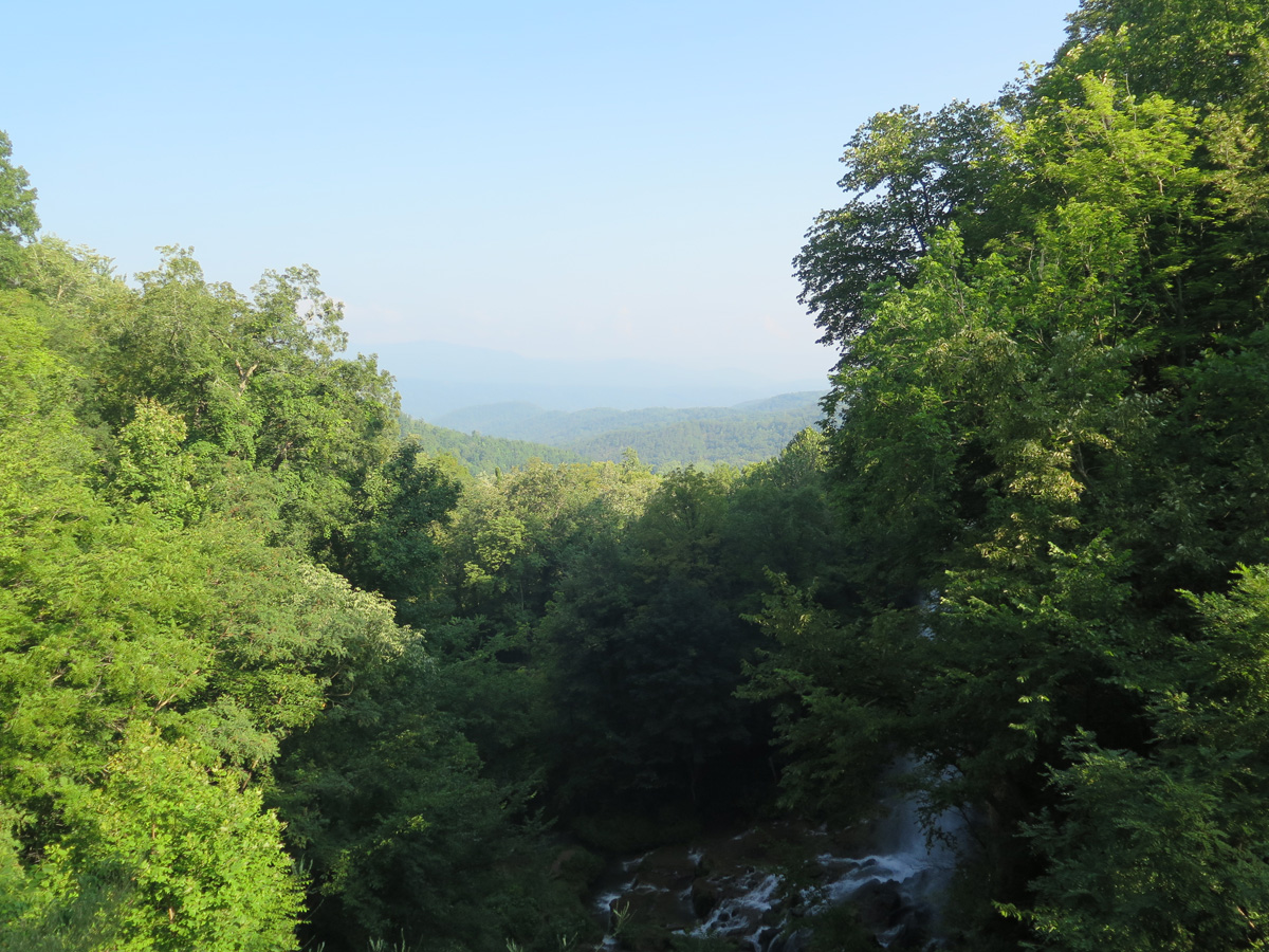
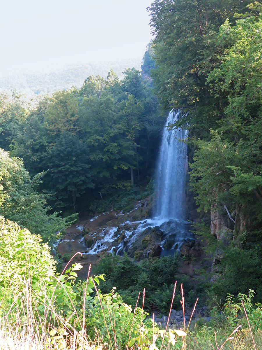
A bit further north, we stopped at this Falling Springs overlook.
This may be the largest waterfall in Virginia.
That waterfall was easily visible from the overlook along 220 north of Covington, yet another AMAZING stretch of road.
Road south of the overlook.
We continued north on 220, all the way to Franklin, West Virginia. It was a beautiful, scenic ride alternating between mountains and valleys. Spectacular, really.
Feanklin, WV
From there, we headed east on US-33 — one of Hubby’s favorite roads — north and east through the Shenandoah Valley, and then, at New Market, east on US-211 to Warrenton.
It may sound repetitive, but that particular series of roads we covered overed three days was probably the best series of roads we’d ever ridden together. Except for maybe in the Italian/Swiss/Austrian Alps. Really. It’s a route we WILL be revisiting.
Here’s a link to my Spotwalla tracker map with a couple little caveats. I forgot to start the app on my phone, so it looks like we started in Elkton, Virginia. Also, my phone battery died just east of Luray, so it appears that we never made it home.
I hope you enjoyed the recap. Now, I have to get to work.