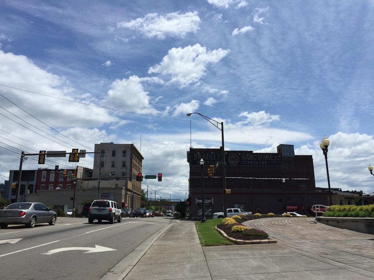
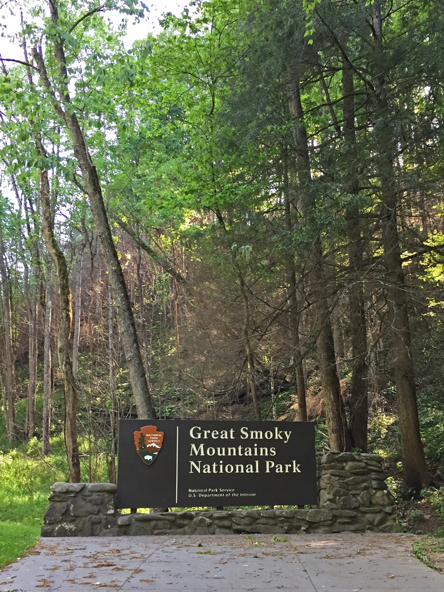
What a weird name for a town, right? I got so used to it over the years, I forgot how unusual a name it was. Not that I had ever been there before, I just knew it was close to the Great Smoky Mountains National Park (GSMNP). And home to Dollywood, the amusement park Dolly Parton financed and built in/near the town.
I never did see Dollywood. The last time I was in the area, I stayed in nearby Gatlinburg. And that’s how I missed the particular attraction that drew me to Pigeon Forge this time around.
But I am getting ahead of myself…
About an hour after leaving Gate City, VA and entering Tennessee, the weather got MUCH better.
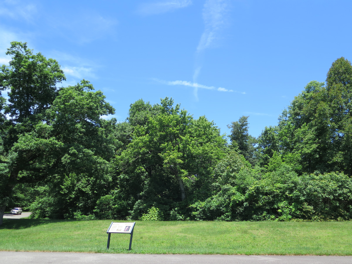
Town in Tennessee
I was glad the rain had left the area, but it actually got a bit warmer than I would’ve liked.
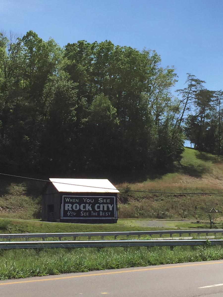
An old bit of Americana.
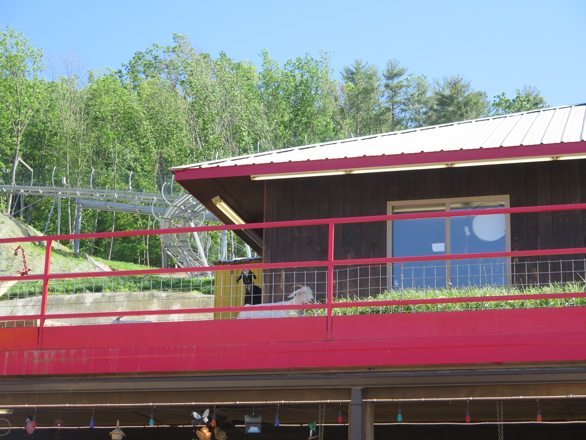
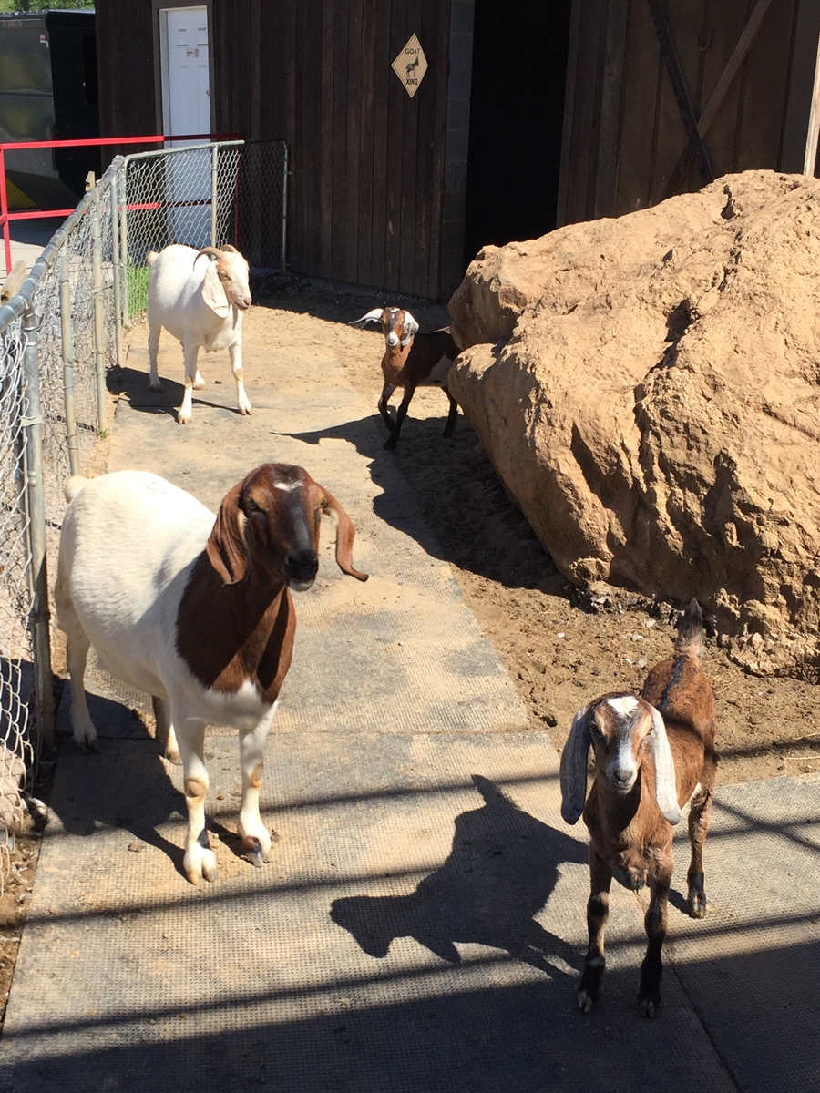
Goats On The Roof!
It was around 3:00 PM when I finally reached my destination. This fun souvenir/gift shop called Goats on the Roof. Why?
Because they have goats on the roof.
Goats on the Roof
Real goats, hanging out on the roof.
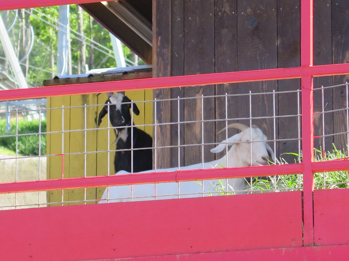
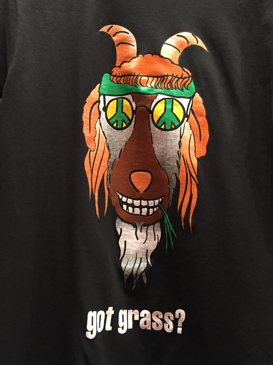
I’m glad I finally saw it, but it wasn’t nearly as fun as I thought it would be. They did have lots of fun t-shirts, though.
Goats
My friend, Tracey, has much cuter goats.
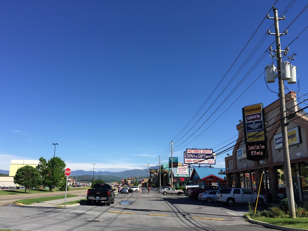
From there, it was on to the town of Pigeon Forge. “Town” may be a stretch for the bit of geography I visited while there. It was all a bit over-the-top if you ask me.
The Pigeon Forge strip.
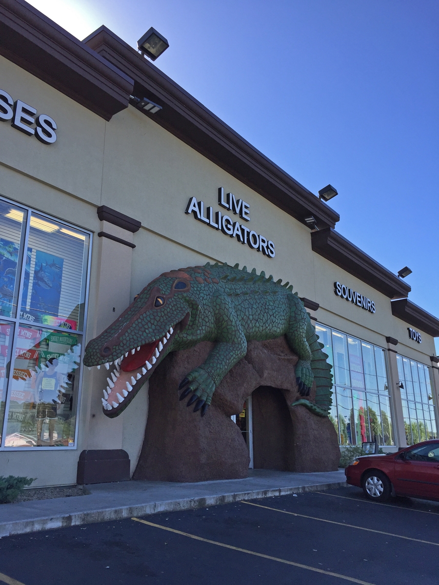
Like most national park gateway towns, it was chock-full of retail stores, attractions, souvenir shops, restaurants, hotels, etc. And all of them try very hard to grab folks’ attention.
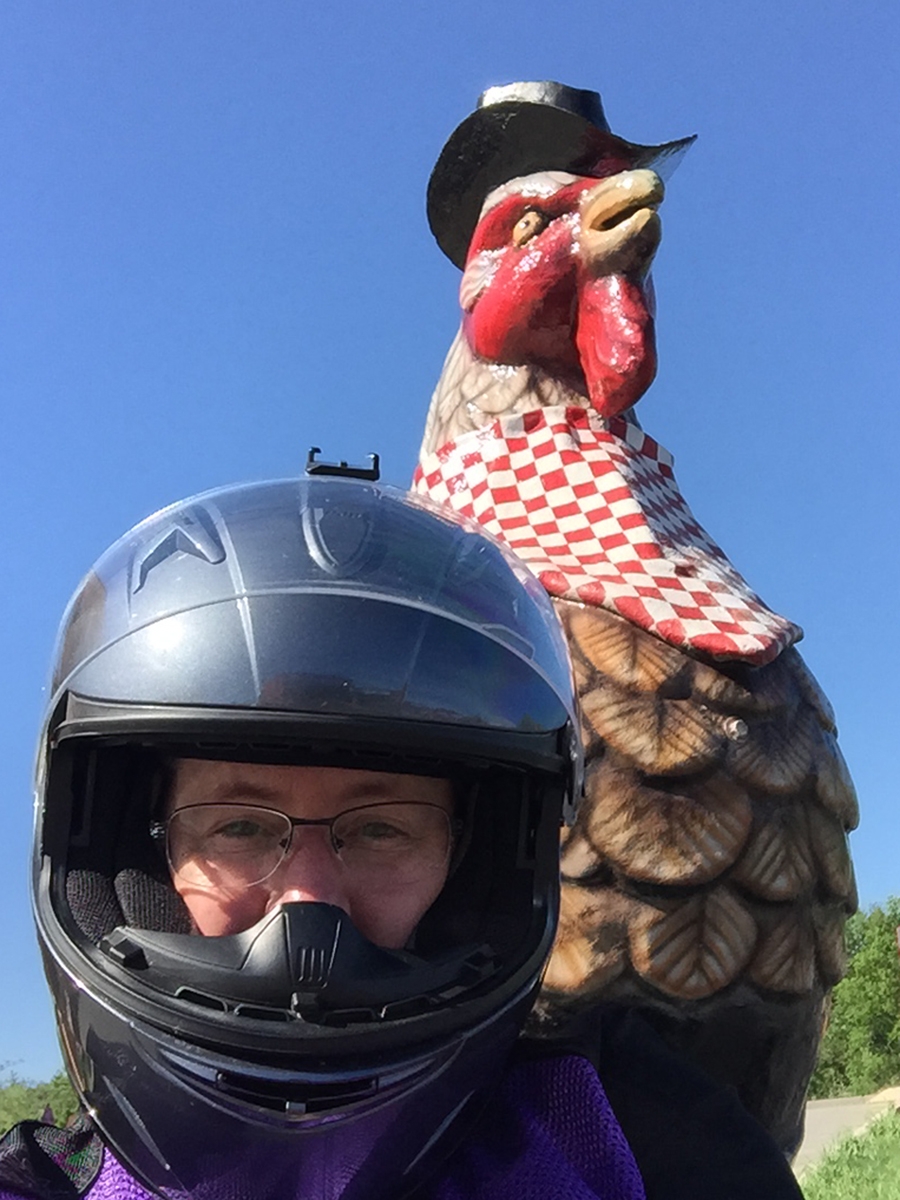
They did have very nice giant chickens.
It seemed rude not to grab a selfie while there. I mean, they’d gone to great lengths to make their cocks attractive.
I scoped-out the lodging options as I drove through Pigeon Forge on my way to GSMNP.
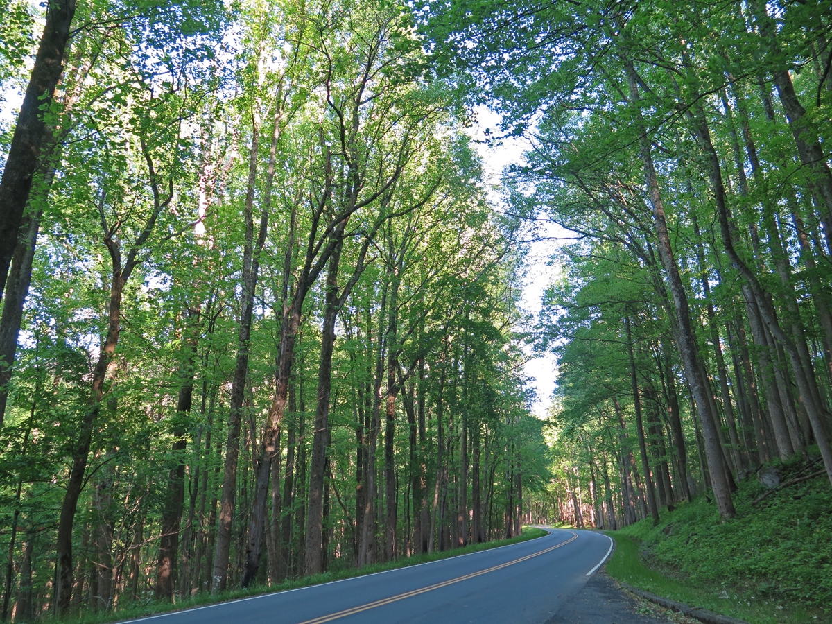
I’d much rather hang out here any day.
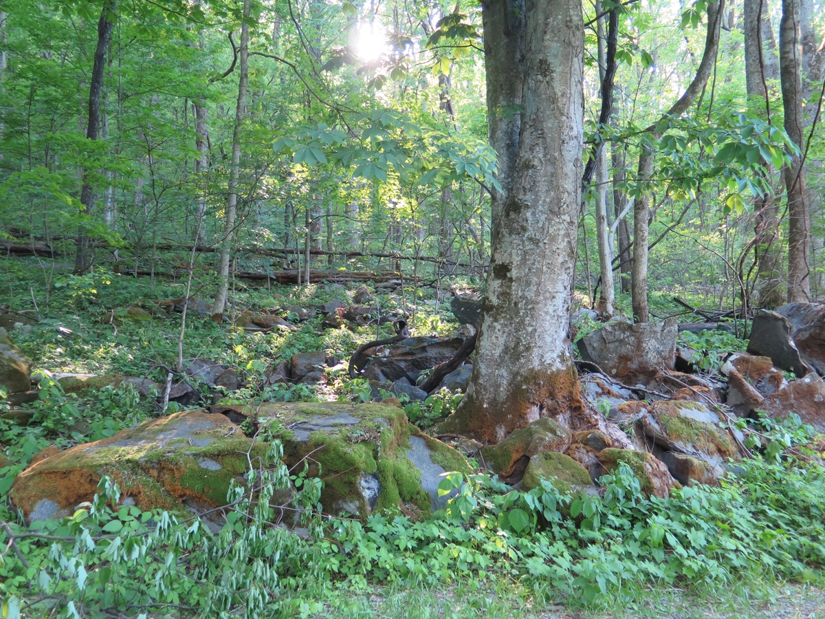
It was significantly cooler among the trees.
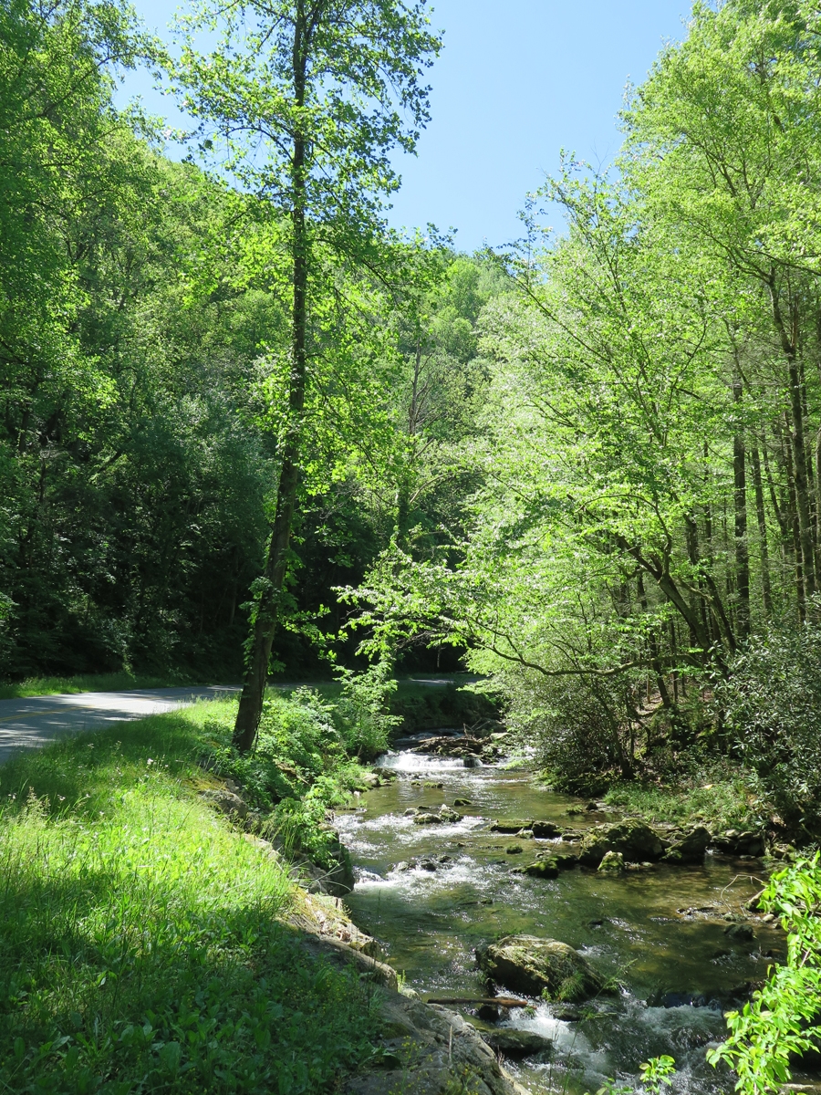
The stream beside the road helped.Lovely Scene
There was a tiny stream gurgling loudly through those big, moss- and lichen-covered boulders. I sat and listened for a while, disturbed only occasionally by a passing vehicle.
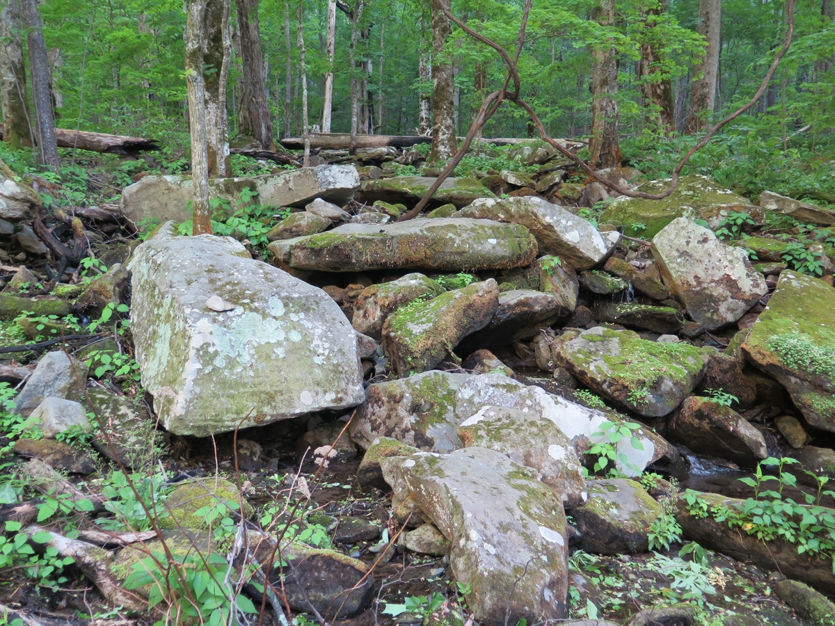
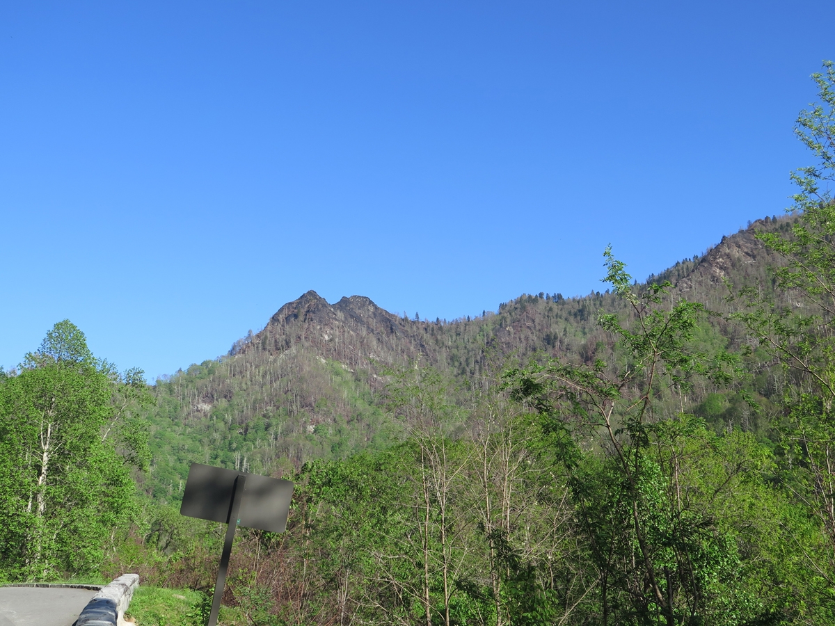
A few small remnants of fires.
My favorite boulder/stream again.
Below is a larger reminder of forest fires in the not too distant past.
Fire Damage
I was going to ride further into the park, but it was getting colder. So I decided to head back to the visitor’s center where I could use the free wifi and my phone to book a hotel room. I chose a place close to the park, on the edge of all the touristy madness.
Once I’d checked in and unpacked, I realized I didn’t feel like walking anywhere, or riding, to get dinner. So I ordered a pizza from a place the lady at the front desk recommended. It was actually delicious.
Shortly after that, I retired for the evening, and slept like a rock.
There’s a natural way to get high that not enough people experience.
When’s the last time you went to a national park “just because”? Or stopped to smell a flower, sit quietly by a babbling brook, or simply look at the sky?
Heady stuff, really.
Even though my recent Appalachian ramble was mostly about riding, I appreciate natural stuff, too. And, heck, the Blue Ridge Parkway (BRP) is a national park of sorts. As explained on the BRP’s FAQ page…
Is the Blue Ridge Parkway a national park? The National Park Service administers a variety of kinds of areas. Some of these are “parks”, some are called “seashores”, some are called “monuments” or “historic sites”, and some are called “parkways.” We wear the same uniform and operate under basically the same rules as Yellowstone, Gettysburg, or Cape Hatteras. Our agency web site at http://www.nps.gov will give you the entire list!
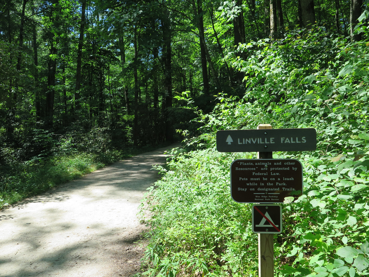
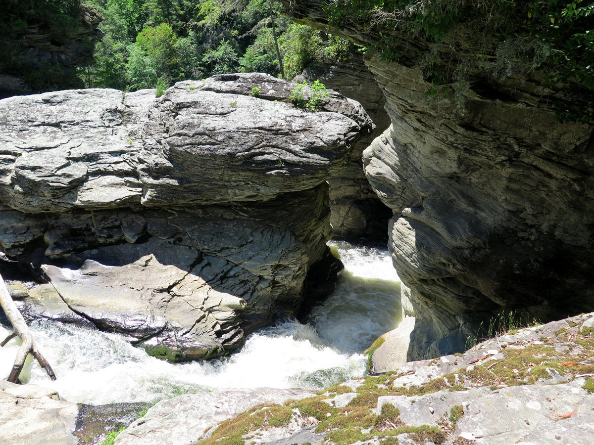
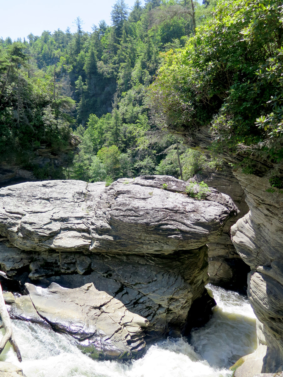
I wasn’t exactly dressed for a hike, but the walk from the parking lot was relatively short, and well worth the sweat it induced.
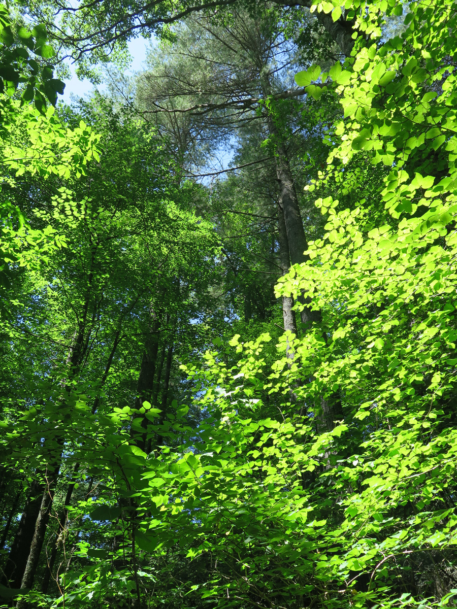
It sure was green.
Lower part of the waterfall.
Different angle.
Middle section of the falls.
Upper, twin cascades. (I made up all of these names.)
There were actually quite a few people around, I just framed my shots carefully to exclude the strangers.
I found THE spot!
And, look at this, you can literally and legally get high, too. For free.
Couldn’t resist stopping here.
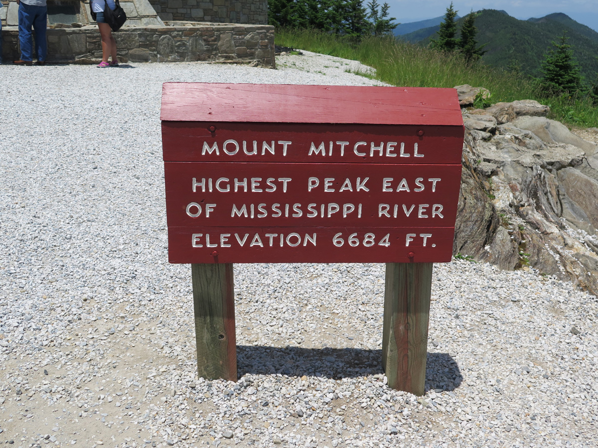
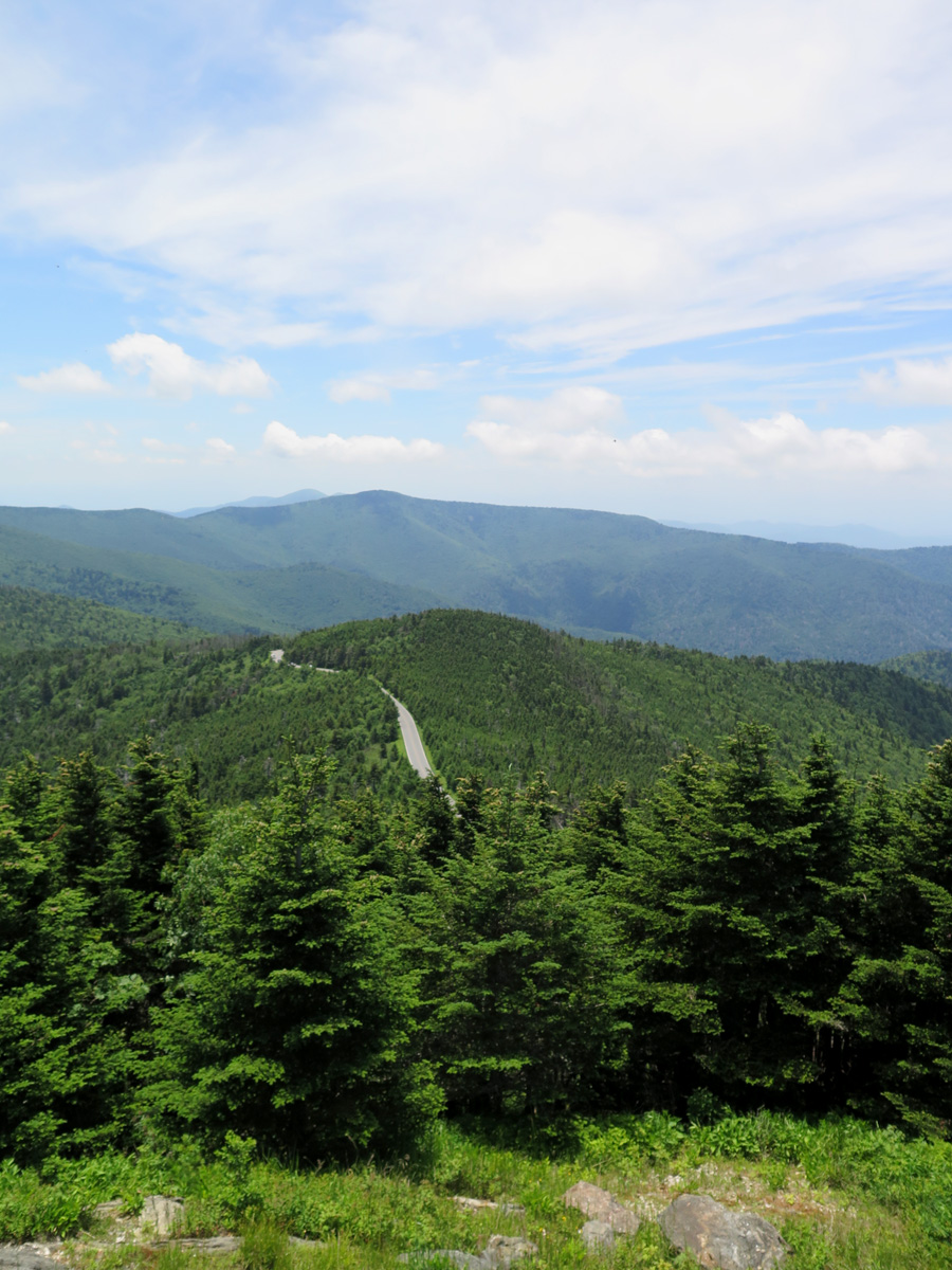
This is the place that was inundated with weevils. You actually get to drive most of the way to the summit. From the parking lot a short, but steep, walk gets you to the high point.
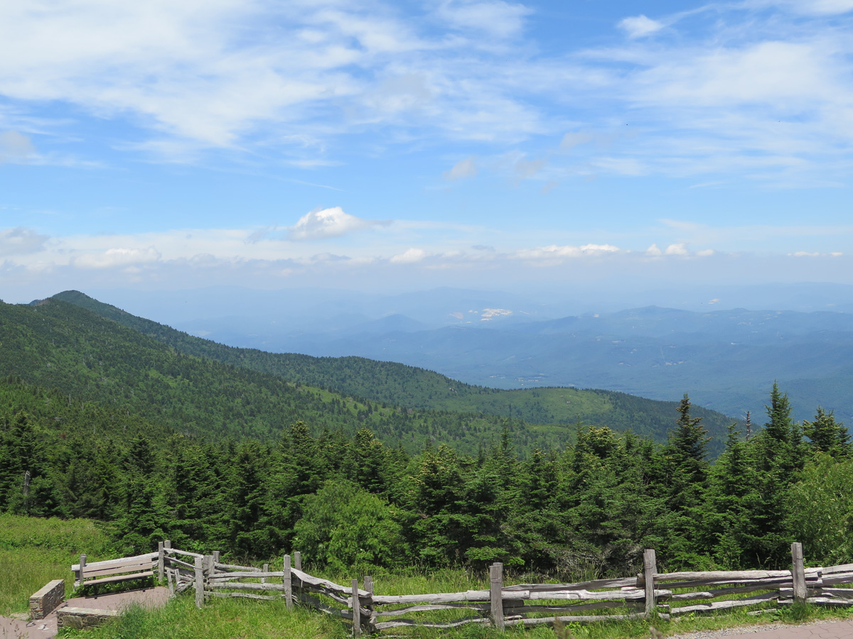
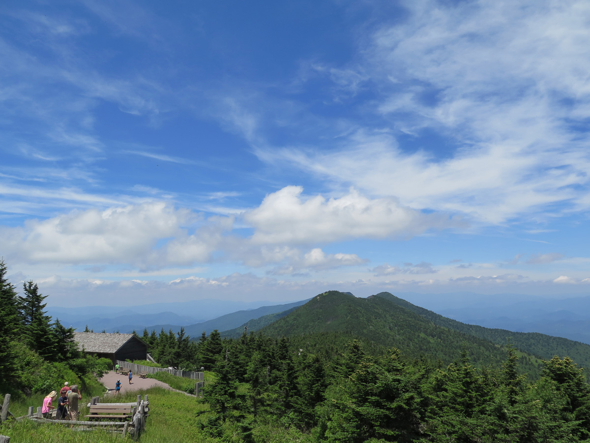
View from Mount Mitchell
View from Mount Mitchell
The road leading back to the BRP.
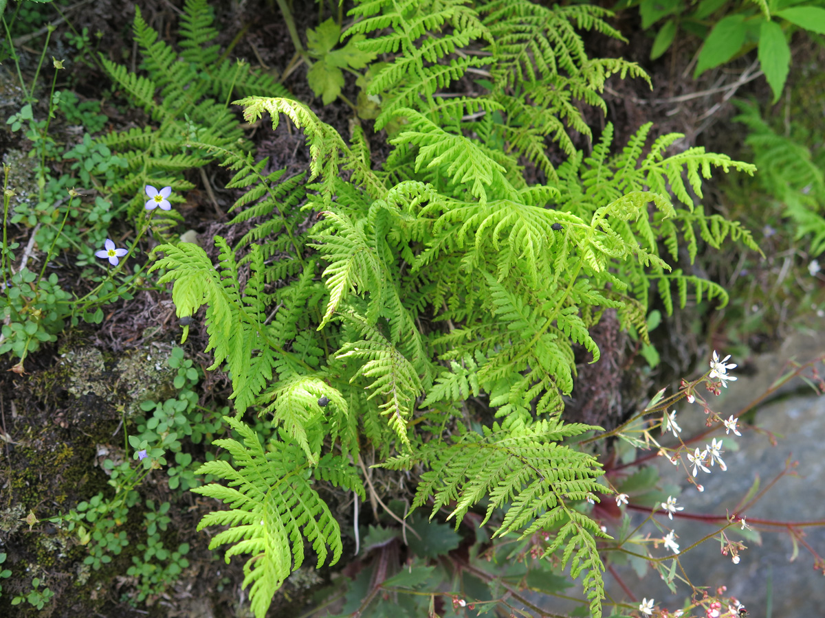
Micro Ferns (I made that name up, too.)
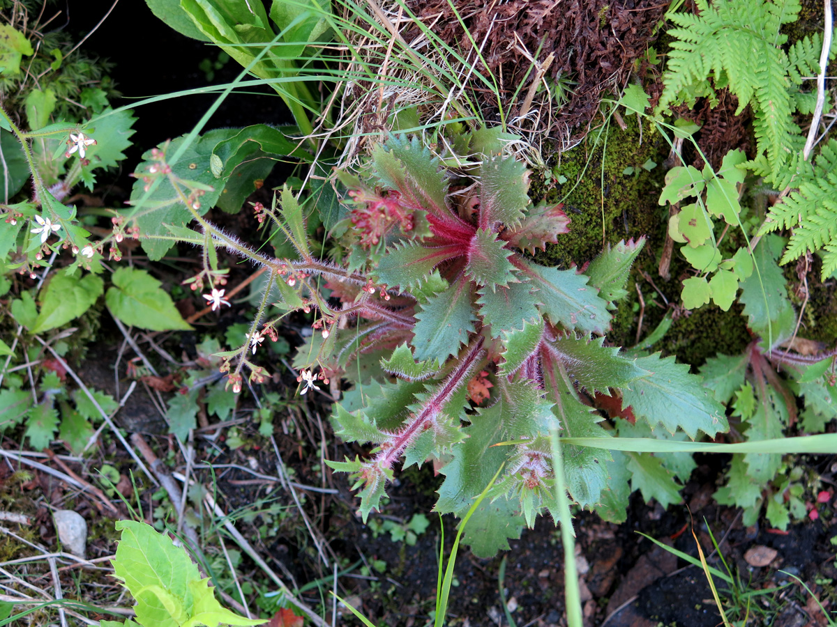
Interesting Plant
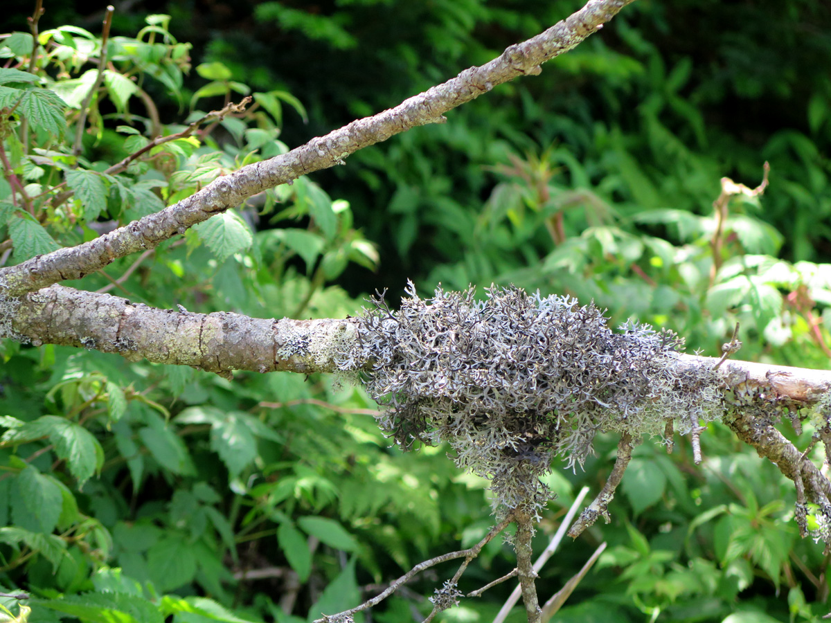
Lichen on a branch.
The plant pics were all taken between the parking lot and the mountain’s actual summit. It was a great way to stop and catch my breath without looking like a total wuss that couldn’t make that short, steep trek without getting winded.
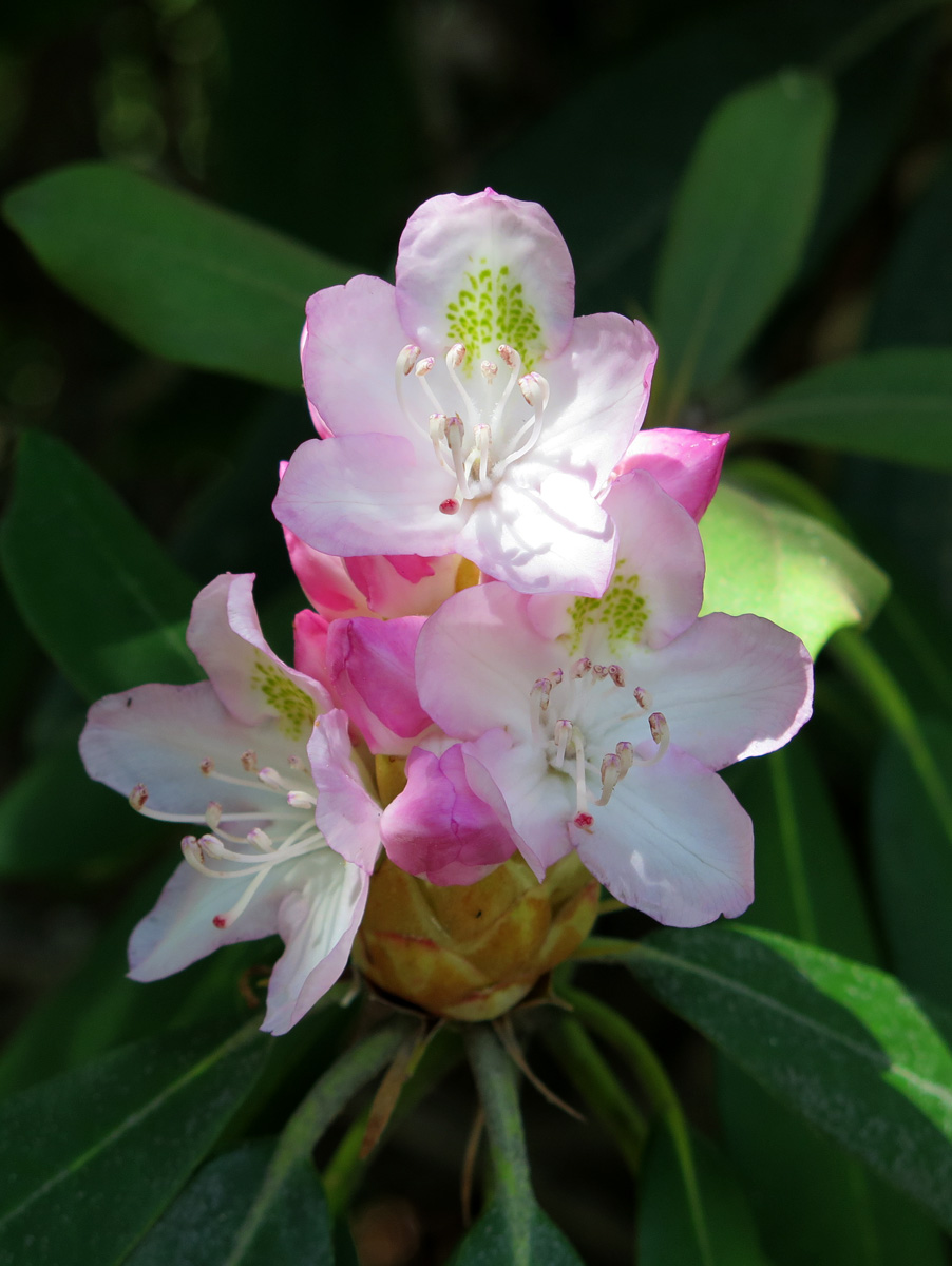
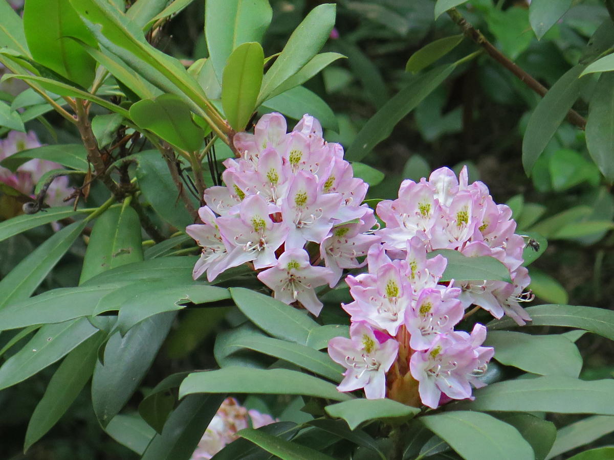
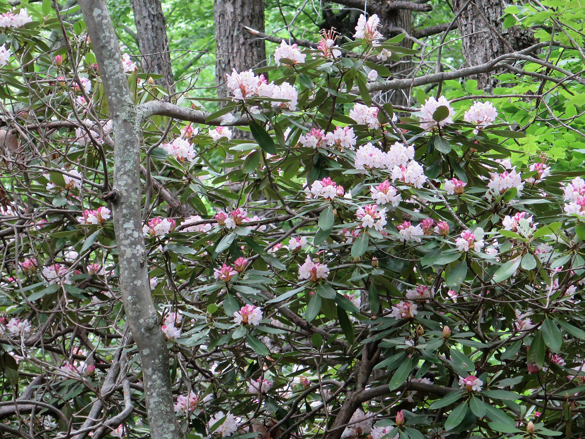
After enjoying the view and having to ask some stranger to brush all the bugs off of my back, I hopped on the bike and headed back to the BRP. A bit later, I stopped at one of the visitors’ centers/exhibit halls to stretch and use the facilities. That’s where I saw this beautiful, huge rhododendron.
Rhododendron
Rhododendron
Rhododendron
Rhododendron
Rhododendron
Yes, that’s a lot of pictures of the same flower, but I thought it was pretty.
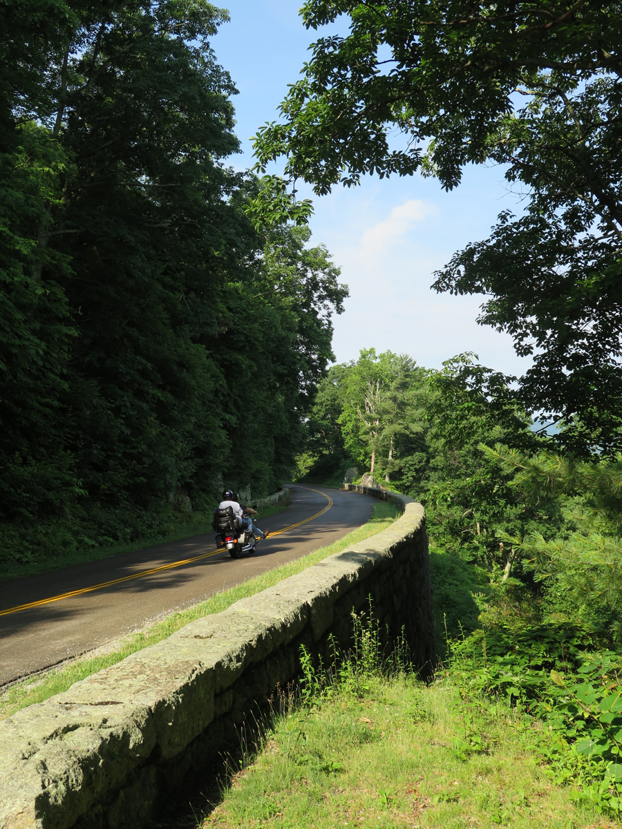
On the road again.
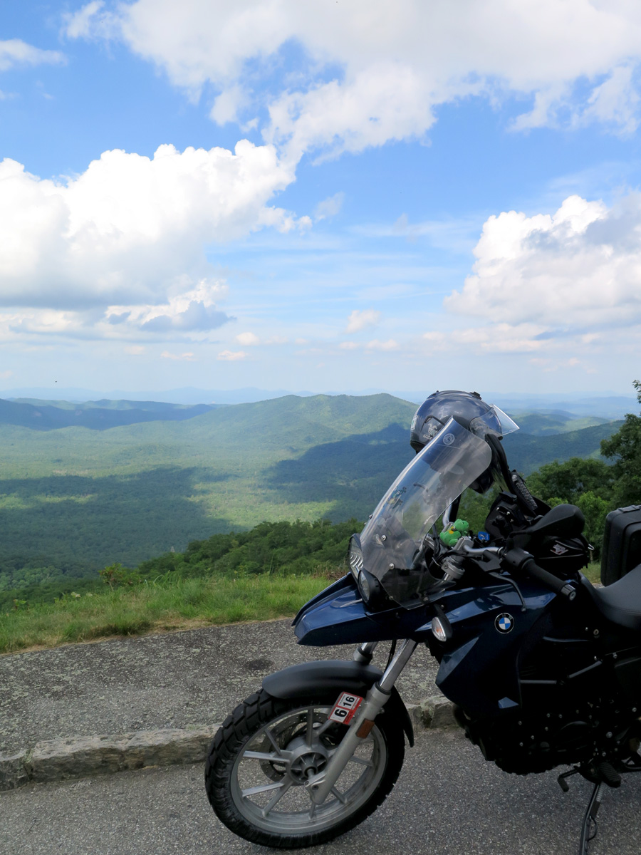
It really was a pretty day. I’ll close this post with another of my favorite bike shots.
High Overlook
There are times when the BRP, being in the mountains, is completely fogged in, making it impossible to enjoy the stunning views that seem to be around most corners.
The weather Gods were certainly smiling upon me that day.
The reactions I get from people when I tell them I am embarking on a solo road trip, whether it be short or long, on the bike or in a car, never cease to amuse me. The “you’re going alone, what’s wrong with you” and “why would you even want to” themes seem to be common across all modes of transport, but the “you’re brave” sentiment seems to come only from women, and applies only to motorcycle travel.
I love people, I do. And I also enjoy doing things in groups. But I don’t have to be with people to have fun. I know how to entertain myself. I don’t find anything unusual in that, but I guess I’m a bit biased, and I’ve been that way as long as I can remember.
I can understand why some people think solo travel is odd, but I don’t understand the “brave” thing. Maybe it’s because they think, me being a woman, if there were some sort of mechanical failure, I wouldn’t know how to make repairs. They’d be right. I wouldn’t know how to make repairs, but a lot of men wouldn’t either. And, even if I were mechanically inclined, there’s only room to carry the most rudimentary tools on a motorcycle. That’s why we have roadside assistance and towing coverage on our insurance. Like Hubby said when he and I were discussing this, the only difference between encountering a breakdown when traveling with someone or traveling solo is that I wouldn’t have to wait for the tow truck by myself.
And it’s not like I was ever far from civilization. In the mountains, yes, but I stuck to regularly traveled roads. Even I have enough sense to avoid gravel and/or dirt-surfaced Forest Service roads that are NOT regularly used and where self-rescue, i.e., extracting myself and/or the bike out of a muddy ditch or unsuccessfully forded stream, could pose a significant challenge. I was not trekking alone through a vast, unexplored wilderness.
Perhaps the women who think I’m brave are directionally challenged and think I’d get lost? I have a great sense of direction, and I’ve always loved maps. In fact, I still prefer to use maps and plot my own routes as opposed to relying on a GPS. Even when I do use a GPS, I tend to make it follow certain paths rather than rely on the recommended route. Maps are always more reliable for me than quirky GPS software.
I don’t know. I’ve given up trying to understand it. I just chalk it up to people being different, having different preferenes, or different outlooks. And I’ve learned to just sorta nod or brush it off when people say or act like they think I’m brave or odd for traveling alone. Some people will never understand the joys of solo travel, just as I can’t begin to comprehend why anyone would want to board a floating city with several thousand other people and follow someone else’s schedule for days at a time. They’ll also never experience the joy of accidentally discovering very special places like the one I’m about to describe.
I like going different places. I like encountering the unexpected, too. One of the most delightful experiences during my recent Appalachian ramble happened one day along a route I’d only just decided to travel that morning. Why? Because it looked interesting on the map. Granted, I was using one of my America Rides Maps, which ranks roads for their quality and appeal to motorcyclists, so I knew it would probably be a good series of roads, but it was what I encountered along the route that really tickled me.
I’d ended up in Princeton, WV the previous evening. I figured I’d stick to the higher elevations to avoid, or at least minimize, the oppressive heat and humidity. From Princeton, I chose to take US 460 east to just past Ripplemead, VA, to get onto VA-635/Big Stony Creek Road. From there, I’d head roughly north get on WV-17/Waiteville Road, which become VA-600 when it re-enters Virginia, and then head east on VA-311 at Paint Bank, VA. The plan was to go through Clifton Forge, Virginia, an area I’d been wanting to explore. I had no idea what to expect prior to Clifton Forge. But, for many motorcyclists, the destination isn’t usually as important as the road or roads one travels.
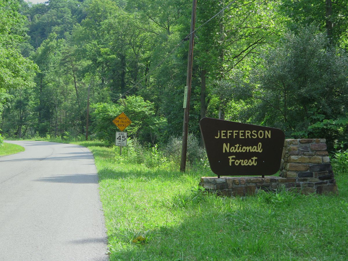
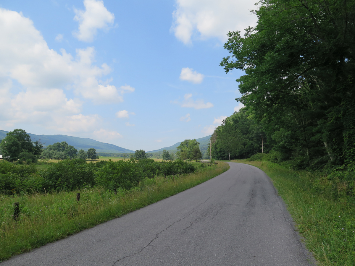
Entering the Jefferson National Forest
My only goal that day, other than covering as much of my route as possible, was to find a post office to mail some postcards I’d addressed before setting off. I thought for sure I’d have hit one before Big Stony Creek Road. When I saw this sign, indicating I was entering the national forest, I remember thinking those cards wouldn’t be getting mailed on that day.
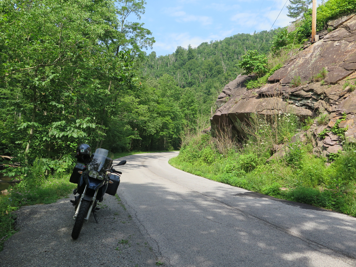
I really enjoy roads through national forests. They’re typically not very heavily traveled and they’re in, um, forests, which means lots of shade as you travel through the trees.
Boulder along Big Stony Creek Road.
There are usually lots of flowers and such, too.
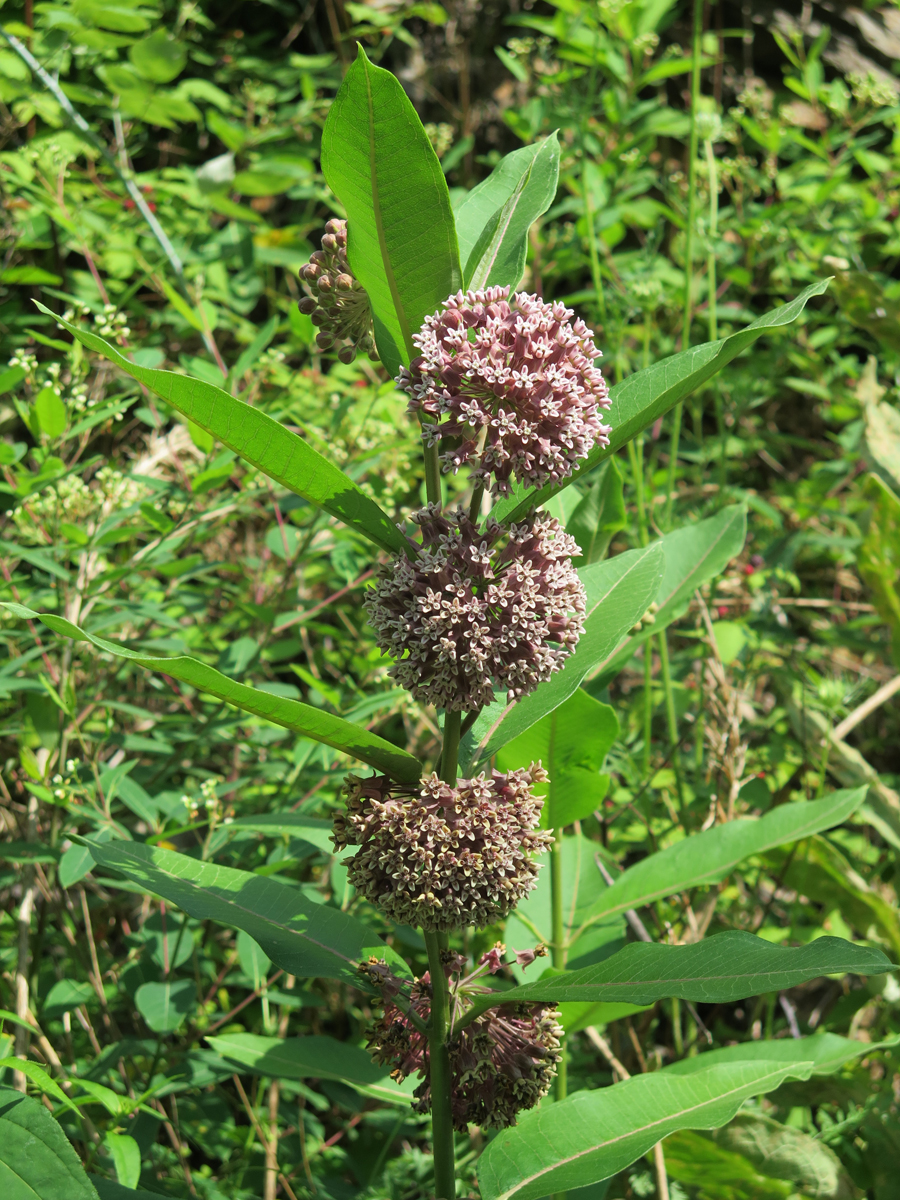
Interesting Wildflower
I believe the flower pictured above is a variety of milkweed.
National forest roads are usually good for shady break spots, too. Like this one…
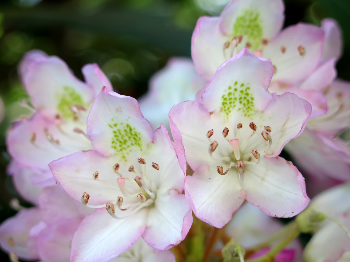
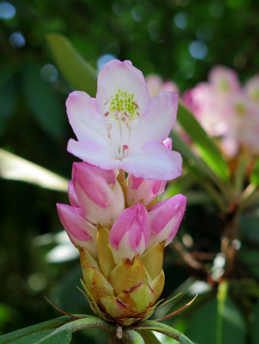
On my southward BRP trip, I’d kinda-sorta loosely planned to re-visits segments on my way back north, mainly to see the rhododendron forests again. I was a bit sad knowing I’d miss that, but one can’t see everything, right? So, imagine my delight when I started seeing these…
Rhododendron
I wasn’t just seeing one or two. There were rhododendron everywhere. On very large bushes, just like I’d seen along the BRP, only more of these were in bloom.
Not the best pic, sorry. The light was challenging.
Not only were they along the road, the forest floor was rich with rhododendron. It was cool. I hadn’t missed anything after all. 🙂
Not the best pic, sorry. The light was challenging.
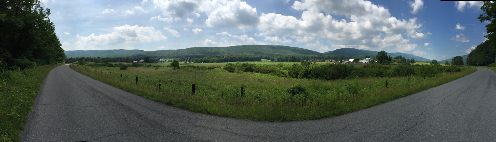
As I continued north and east, the forest opened up a bit and soon enough I found myself in one of the most picturesque valleys.
Rough panoramic shot of Potts Creek Valley (click on image for larger view).
I just love roads like that. It’s a classic example of what I call a putt-putt road. Average speed is usually only about 45 m.p.h. (72 km/h), which means there’s plenty of time to look around. That’s a pretty relaxed pace on a motorcycle.
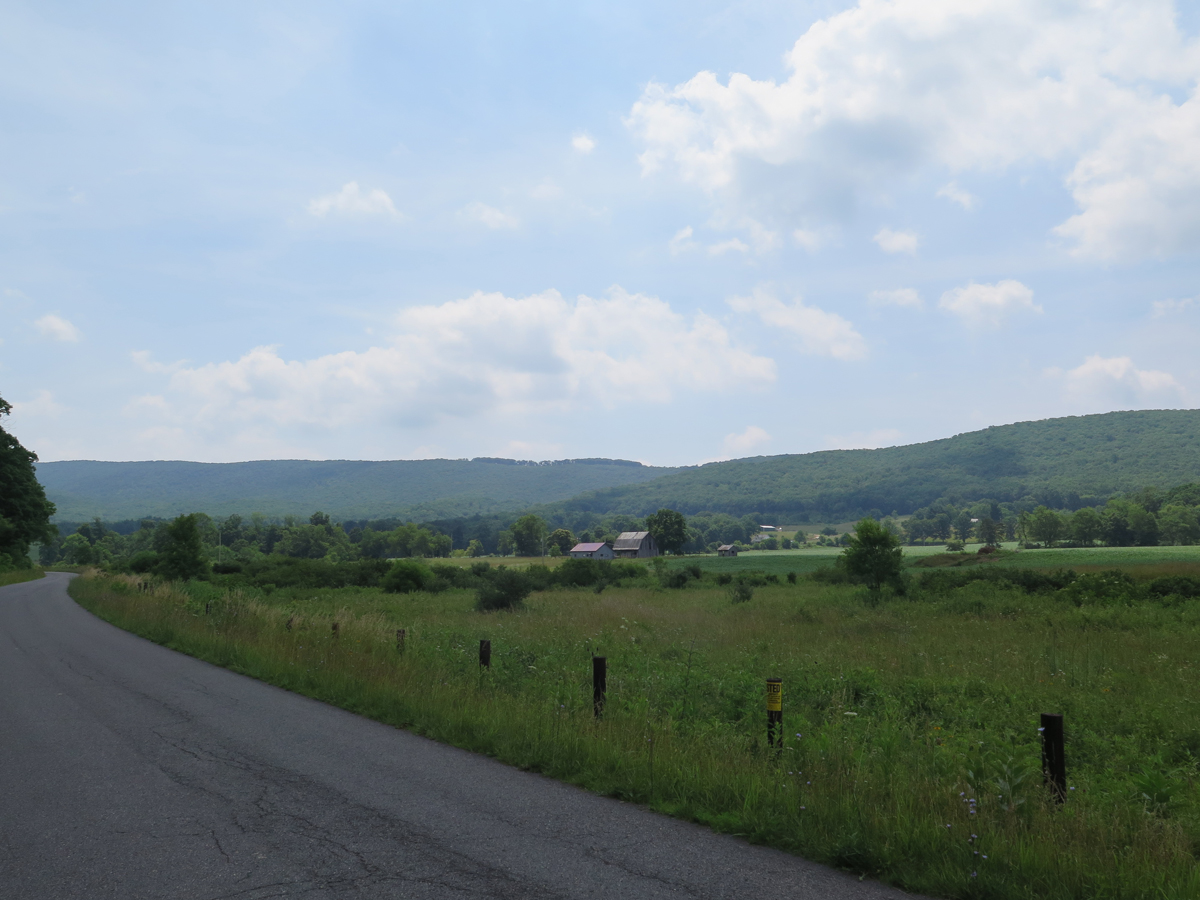
Potts Creek Valley
There were big curves every now and then, but it was relatively straight.
Potts Creek Valley
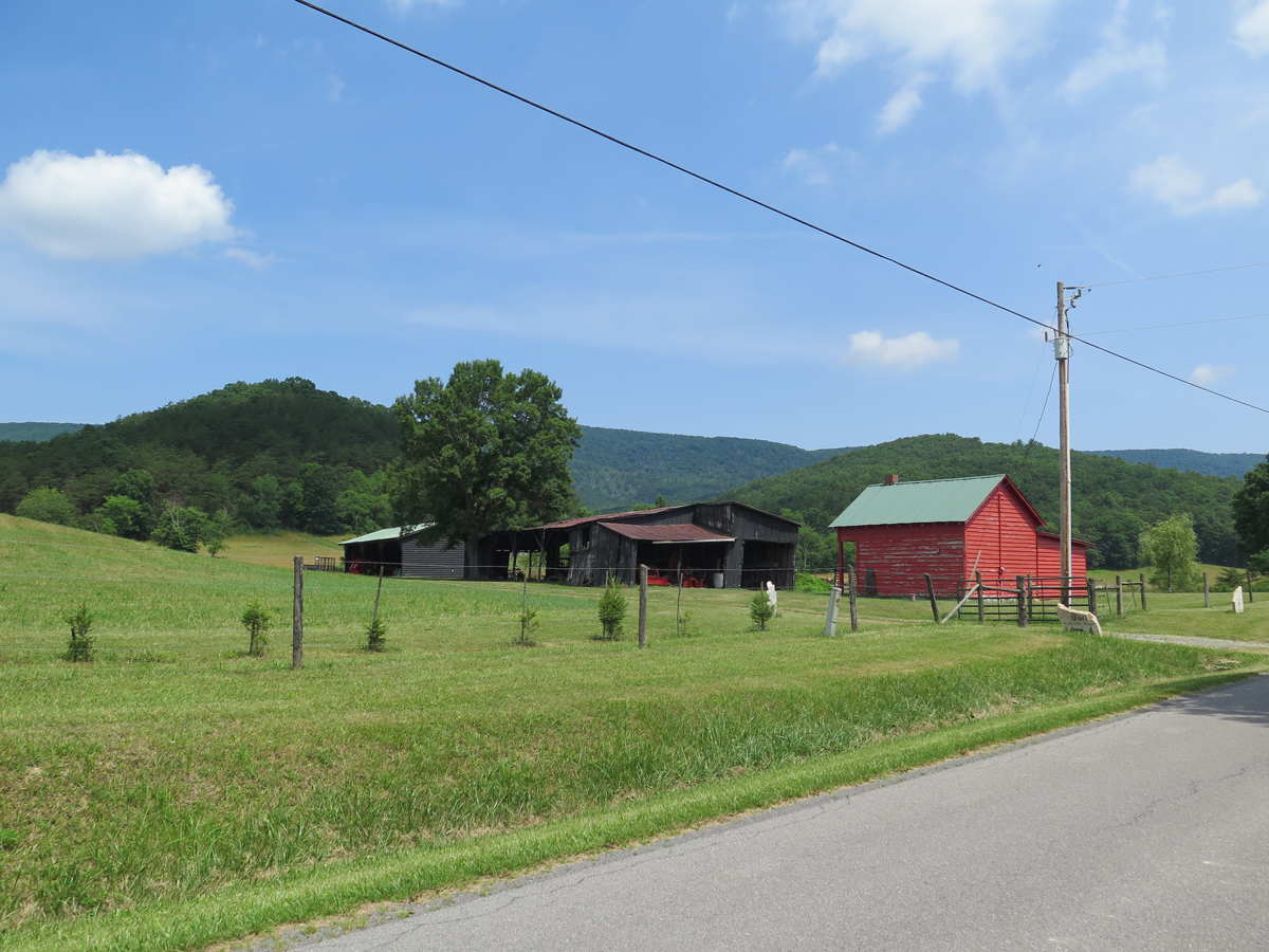
Small farm in Potts Creek Valley.
There were lots of pretty little farms interspersed with bigger farms. I saw a bunch of cows, too, but not particularly close to the road.
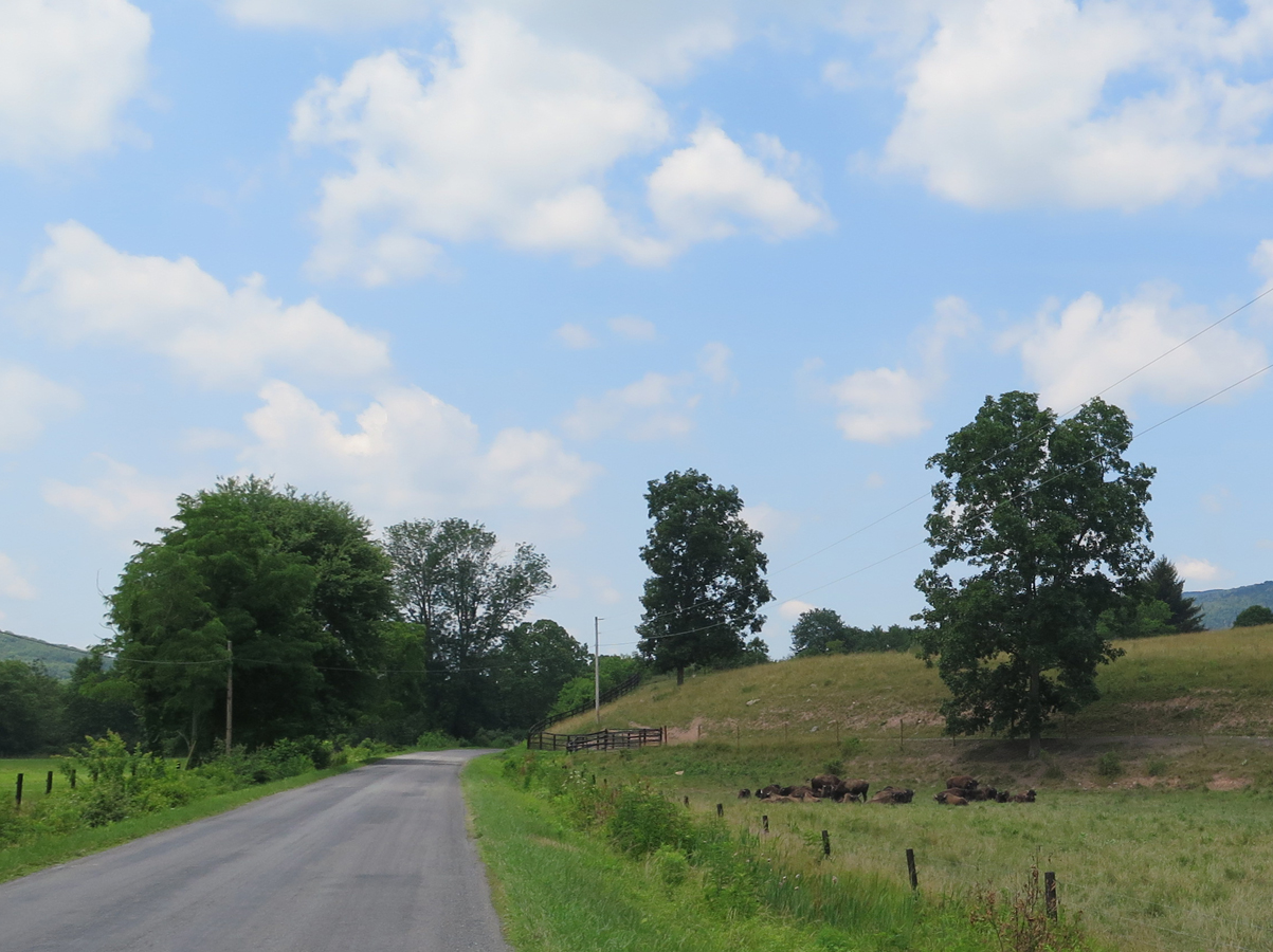
And then I passed these. I had to turn around and go back to get a closer look.
Cows! No, wait, what?
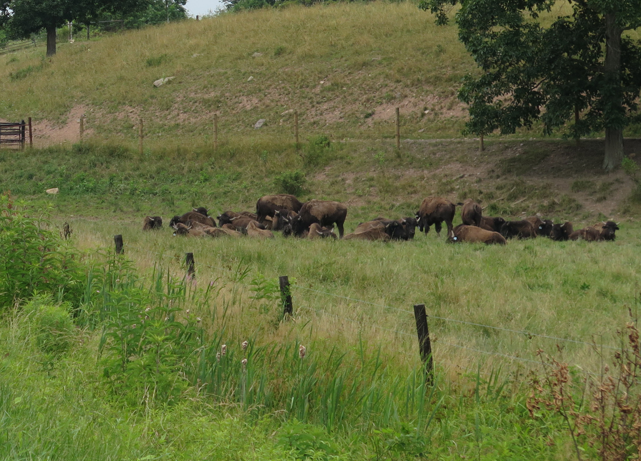
Those weren’t cows, as in regular run-of-the-mill cattle, it was bison.
Bison!
Imagine encountering a herd of bison in a very isolated part of West Virginia!
Sadly, my first thought was, “Wow, I could really go for a buffalo burger right about now.” Not very likely considering I was in the middle of nowhere, and had been for some time.
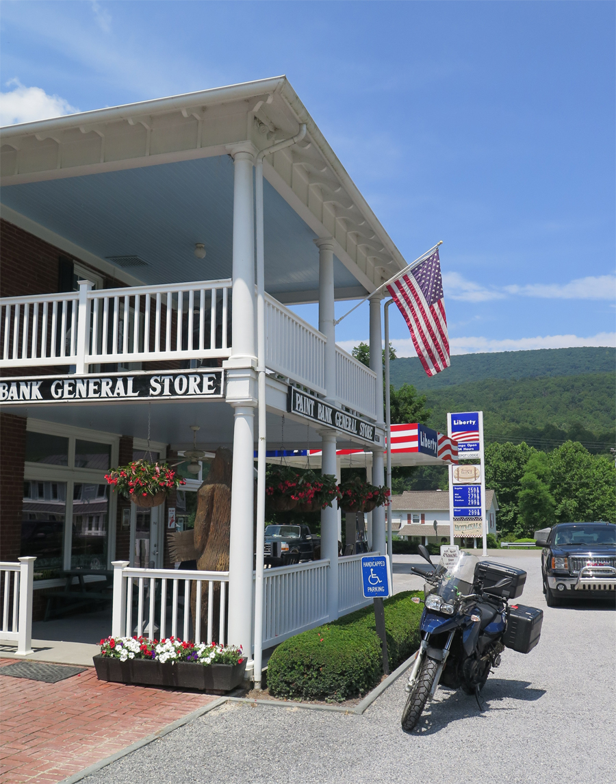
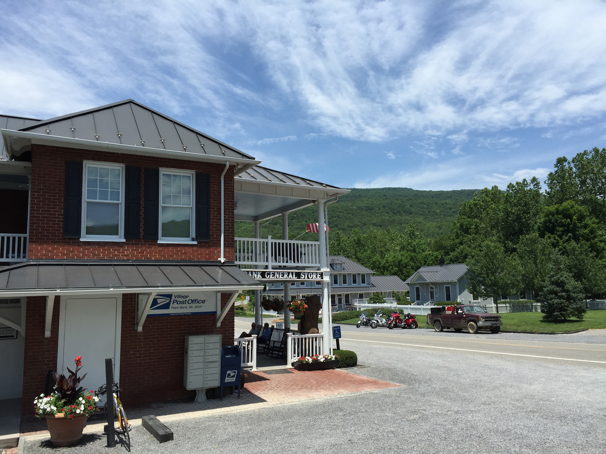
But every road leads somewhere, right? As it turns out, I was back in Virginia. And, soon enough, I reached Paint Bank, Virginia, which is home to the Paint Bank General Store.
An adorable general store!
I swear, it was like I’d stumbled upon a little country oasis.
I parked out front, thinking I’d just run in and grab a drink, maybe a snack, and make sure the restroom was in working order.
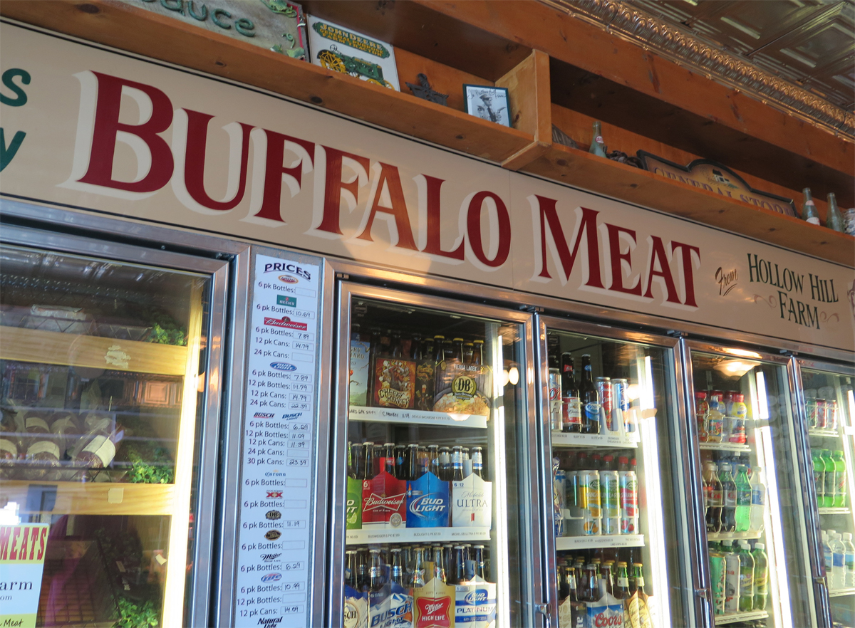
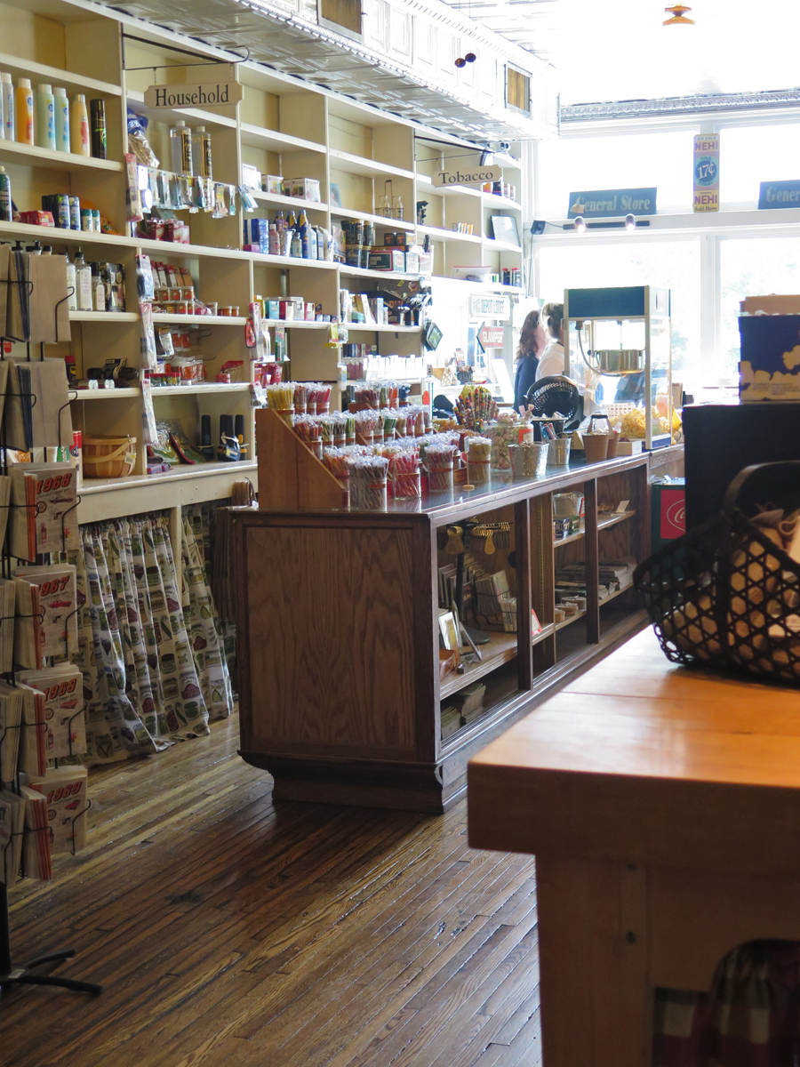
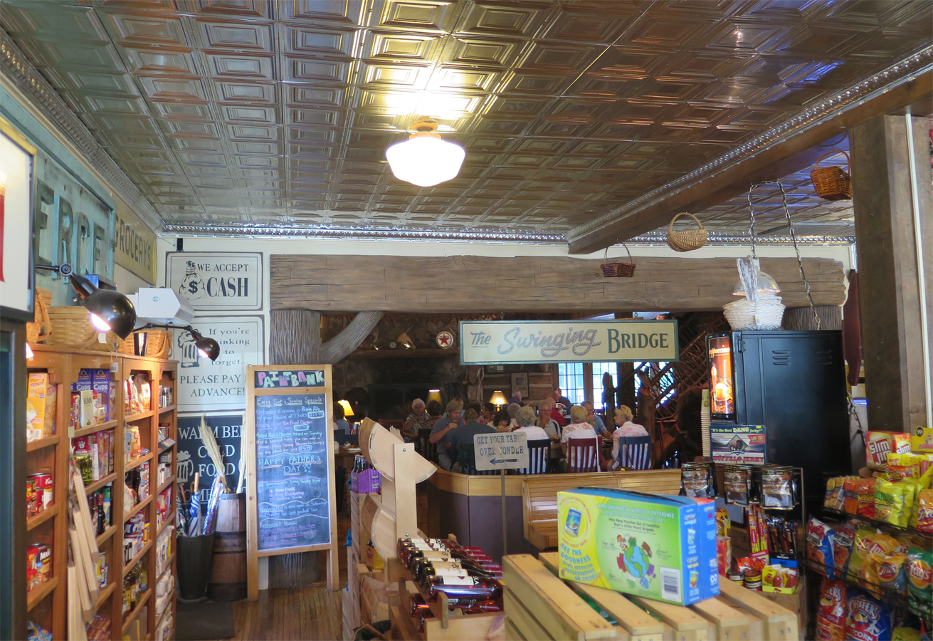
I may have squealed aloud a little when I saw the inside of the store.
Fresh Buffalo
A step back in time, eh?
It was such a cute little place, really.
The Swinging Bridge Restaurant
And guess what? The restaurant served buffalo burgers! (I later learned the proprietors also own the buffalo farm.)
Buffalo burger with fresh-from-the-fryer potato chips.
I ended up lingering far longer than expected. That was by FAR the best meal I’d eaten since leaving home. It was THE BEST buffalo burger I’d ever eaten, too, and I’ve had some good ones across the western US.
Plus, like many general stores, there was also a post office.
This is where I mailed my postcards.
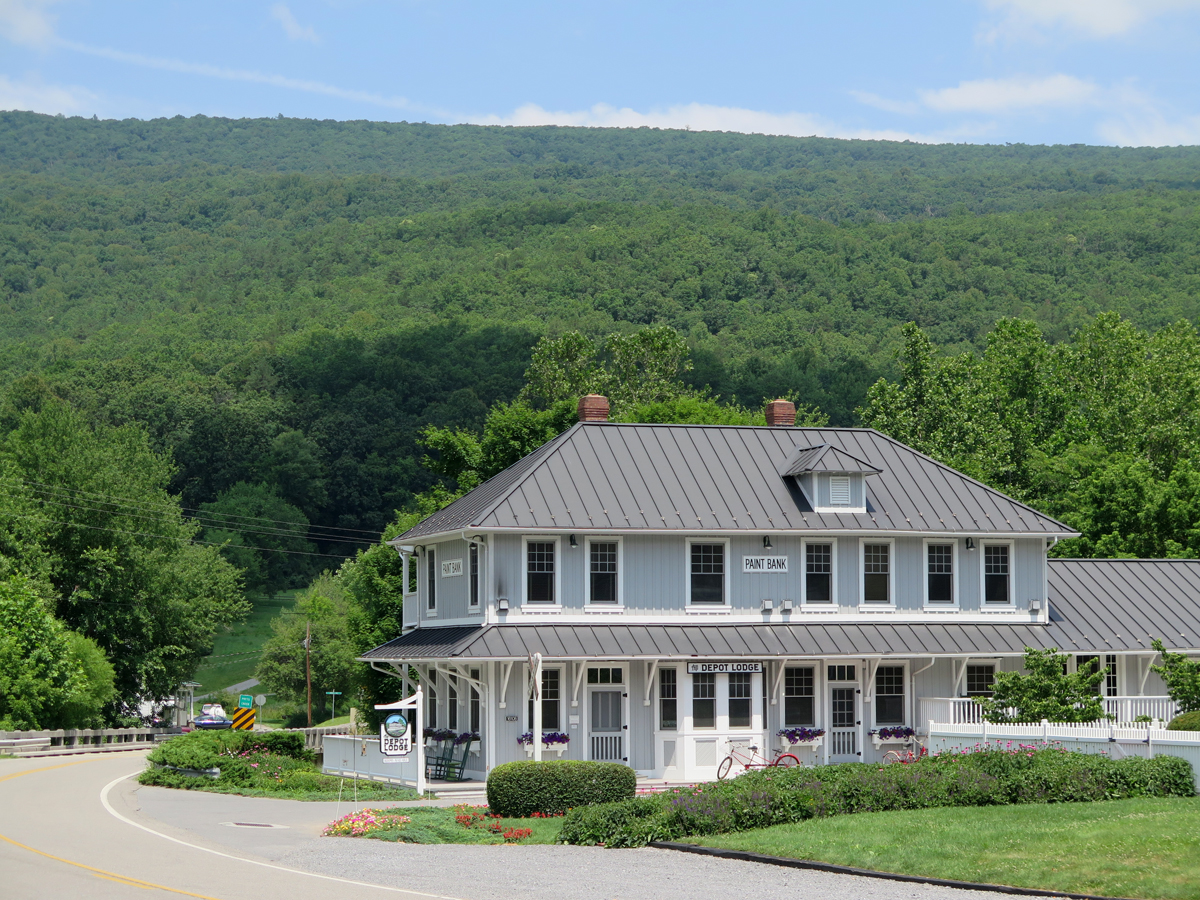
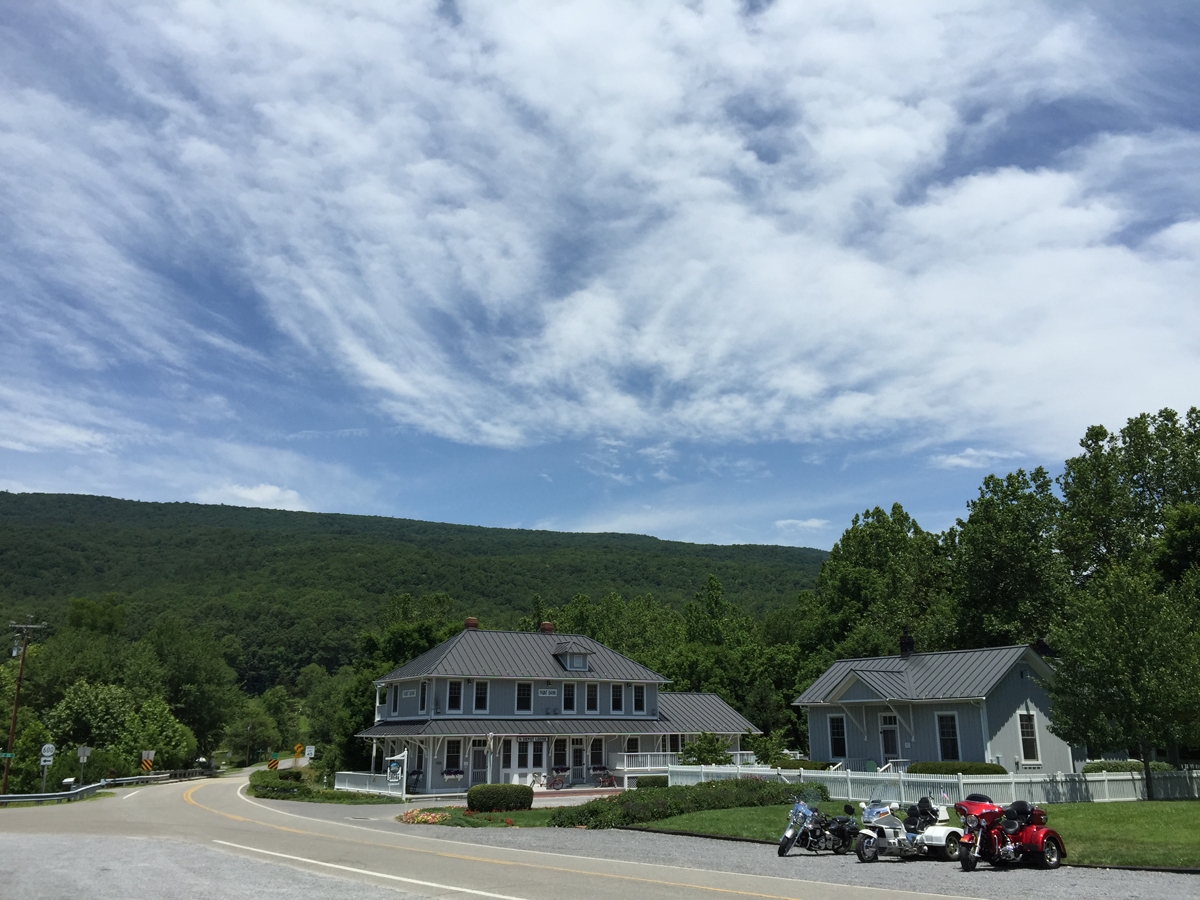
I am definitely going back to Paint Bank one day. With Hubby next time, so we can stay at the awesome-sounding Depot Lodge.
The Depot Lodge (far more than meets the eye here, follow that link above)
What a lovely spot, eh?
The Depot Lodge as seen from the general store’s parking lot.
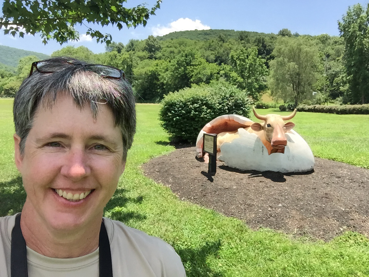
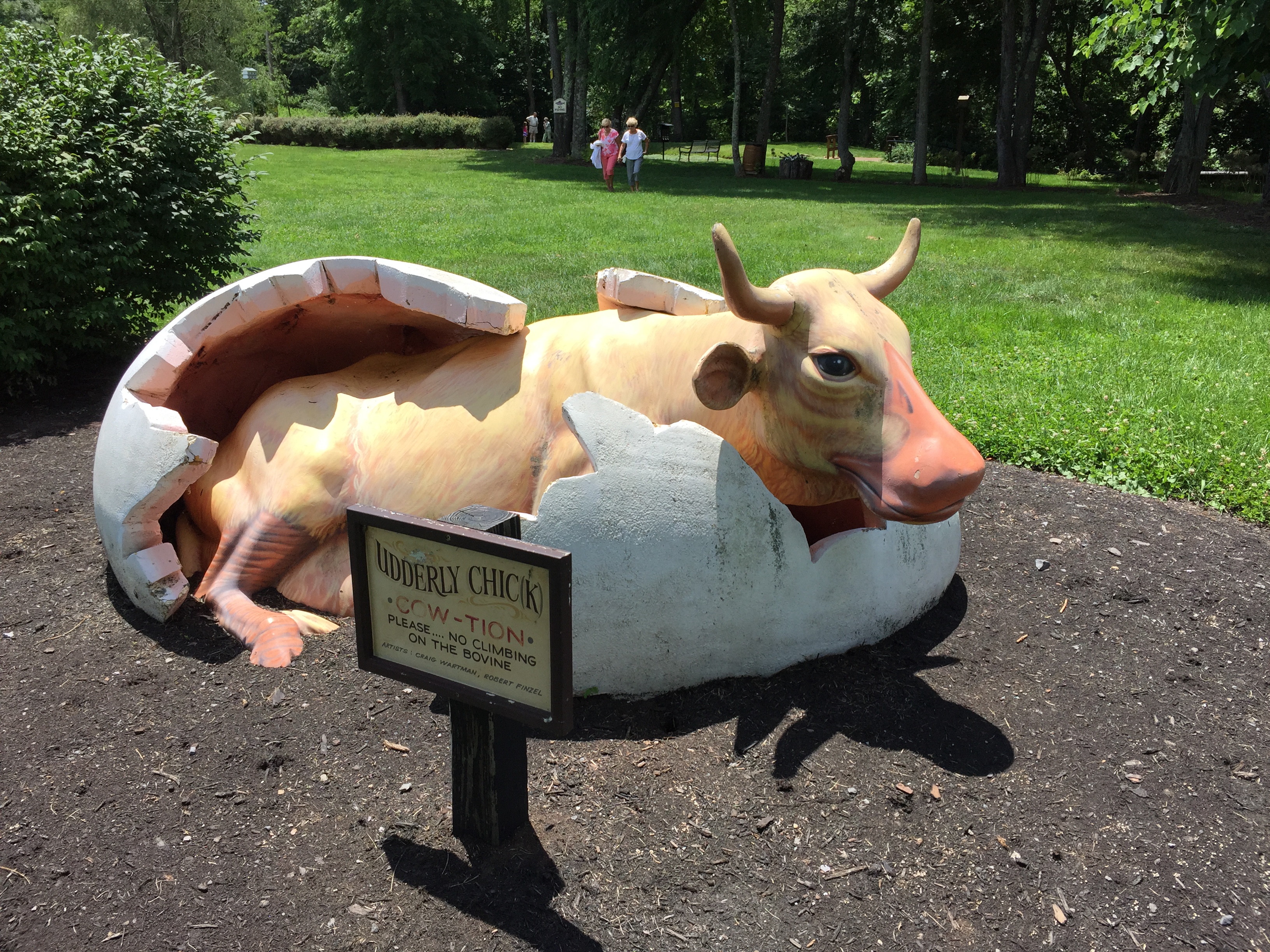
And the general store’s lawn is where I captured this fun selfie.
Selfie with Hatchling Cow
I still don’t know the story behind that unusual sculpture.
Udderly Chick
Some things are better left to to the imagination.
– – – – – – – – – –
If you’re a map person, too, and want to see the location, you can still look at My 2015 Solo Adventure Spotwalla Track.
Finally, the post many of you have been waiting for, or dreading, as the case may be. The unusual stuff that caught my eye during my recent solo road trip.
The stuff falls into two categories. First, attractions I’d noted in advance thanks to RoadsideAmerica.com, “Your Online Guide to Offbeat Tourist Attractions.” The Muffler Men are some of my favorites, so we’ll start there.
A tribe of fiberglass titans, 14 to 25 feet tall, stands watch along the vibrant roadside landscape. The first statues that we spotted held big car mufflers, so we named them “Muffler Men.”
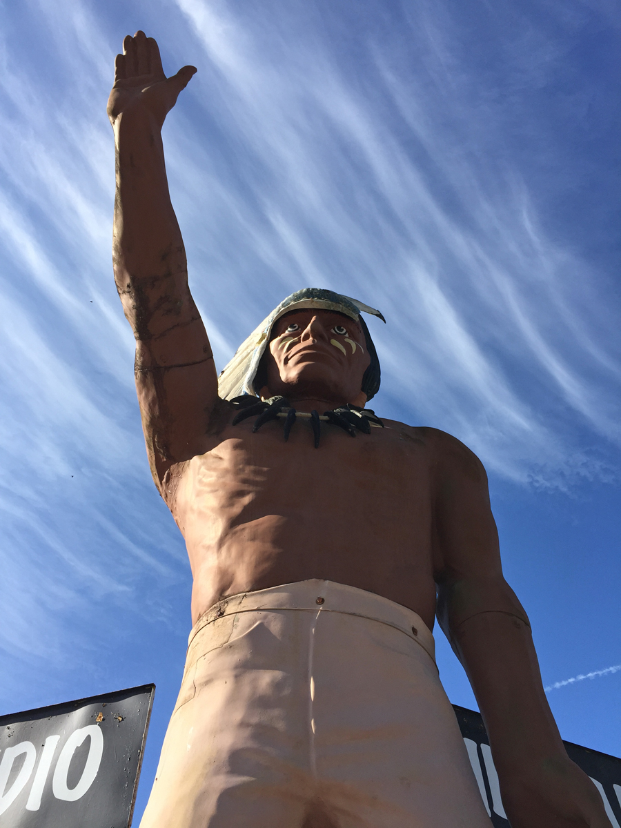
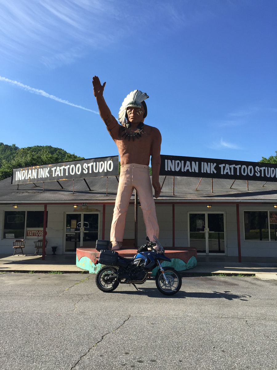
After two days on the Blue Ridge Parkway (BRP), absorbing much natural splendor and scenic beauty, reaching Cherokee, North Carolina was a bit of a treat. Cherokee is what I refer to as a gateway city, i.e., a town that’s adjacent or at least closest to a national park entrance. Gateway cities are typically FULL of kitsche as that’s how the myriad establishments (motels, eateries, souvenier shops, etc.) attracted folks back in the day. Sadly, that “day” has sorta passed, so many of these gateway cities are a bit rundown.
Muffler Man Indian, Cherokee, NC
Fortunately for people like me, who appreciate this charming bit of Americana, many of the surviving icons are lovingly maintained.
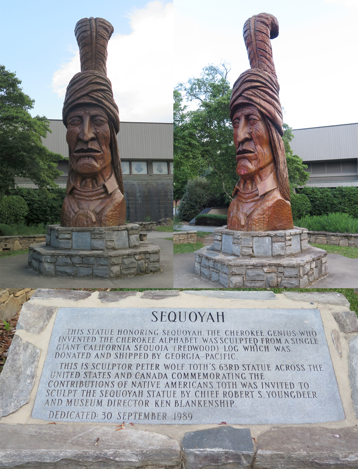
There is also some real artwork on display in Cherokee, like this Whispering Giant.
Sequoyah, one of Peter Toth’s Whispering Giants
One has to see one of the Toth giants up close to see the detail and appreciate the artistry of one of these lovingly sculpted works of art. It’s a majestic piece that evokes emotion while viewing. I hope you are lucky enough to see one one day.
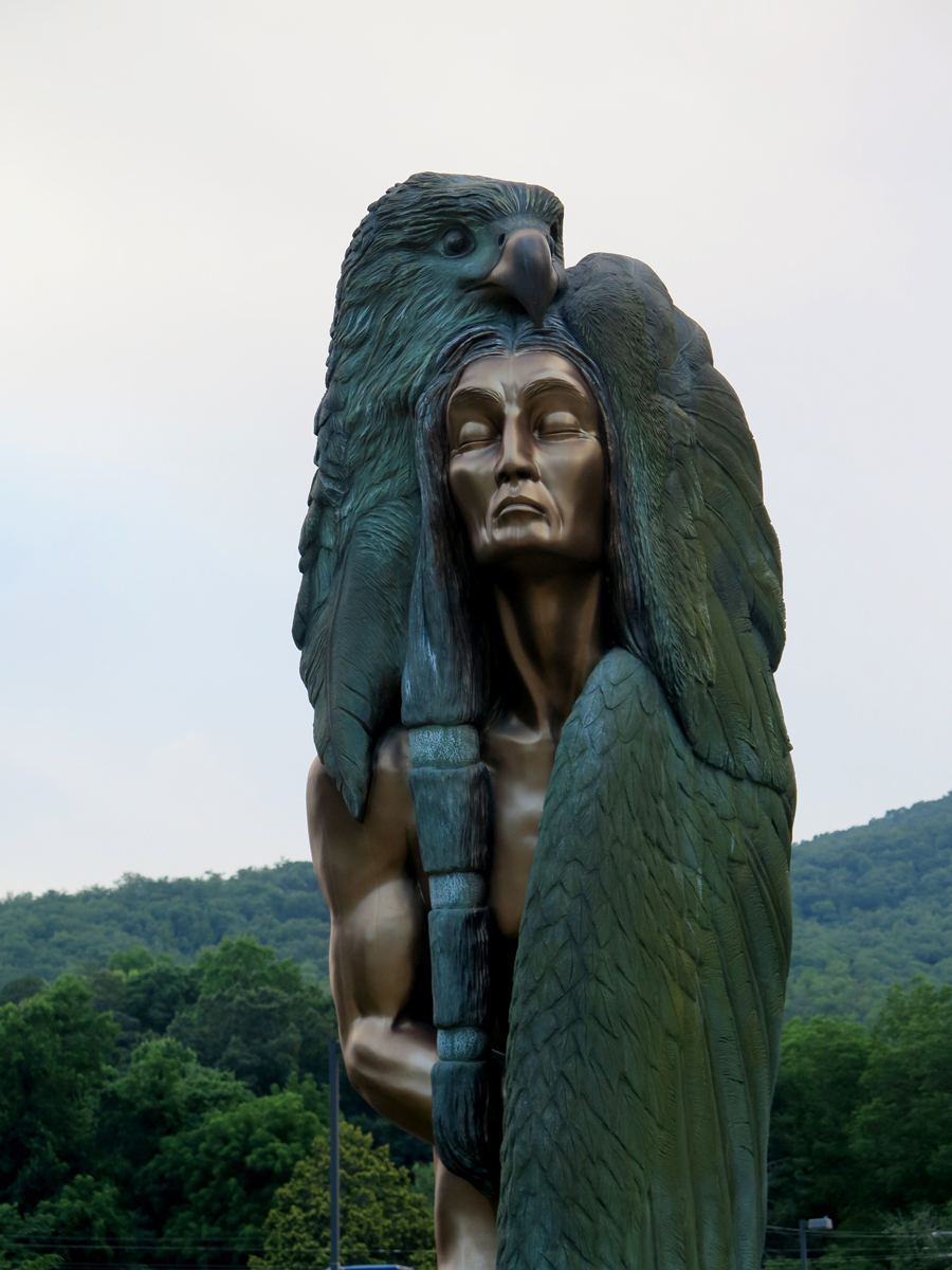
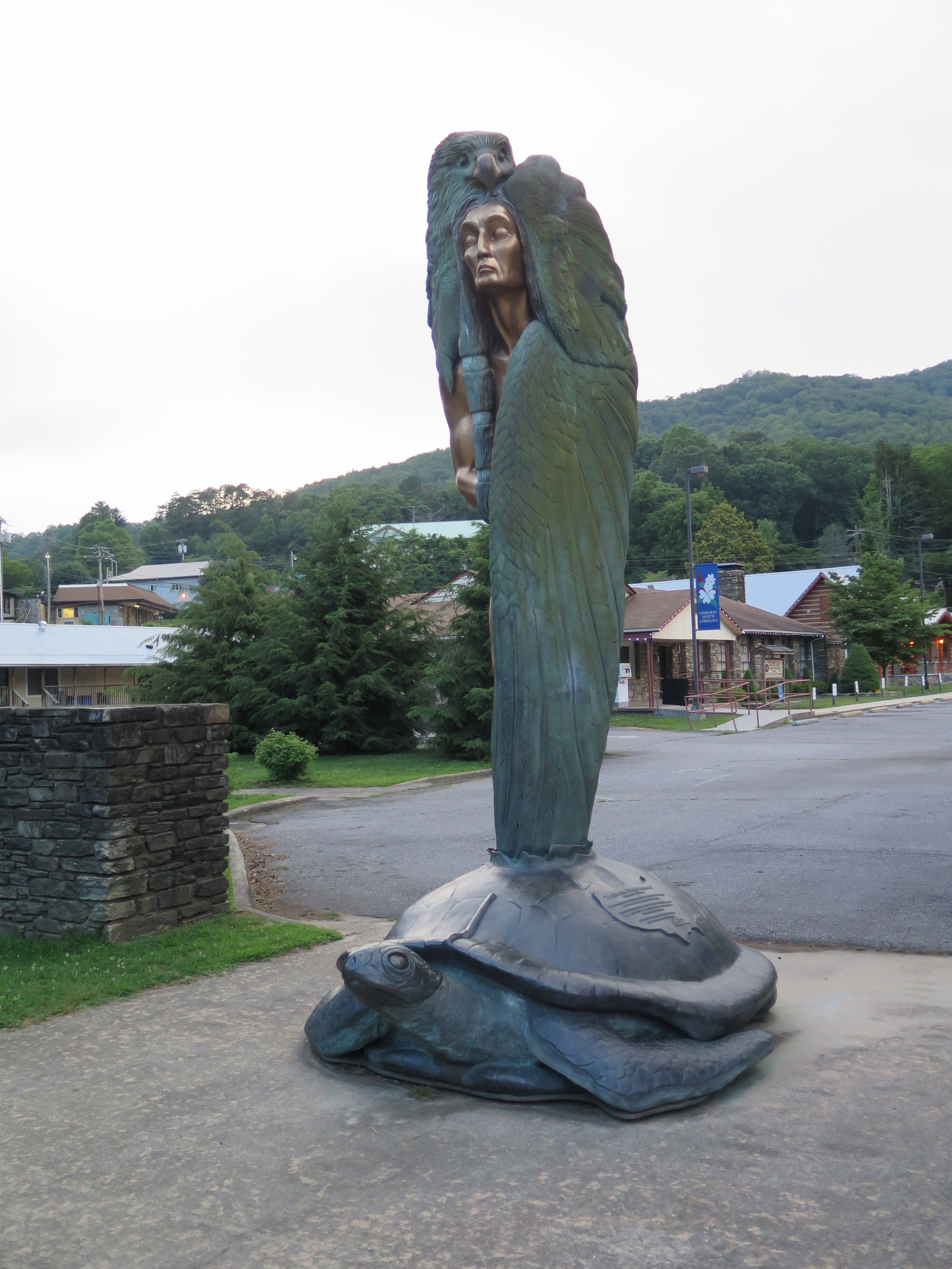
Here’s another work of art, the Eagle Man in Cherokee.
Gold Indian Erupts from Turtle
Sorry I didn’t get a better picture of this one. I’d planned on returning the next day, but after a sweltering ride, I just didn’t have the energy left for more photo captures.
Eagle Man
It really is quite nice in person, despite my lousy pics.
More kitsche I HAD to see…
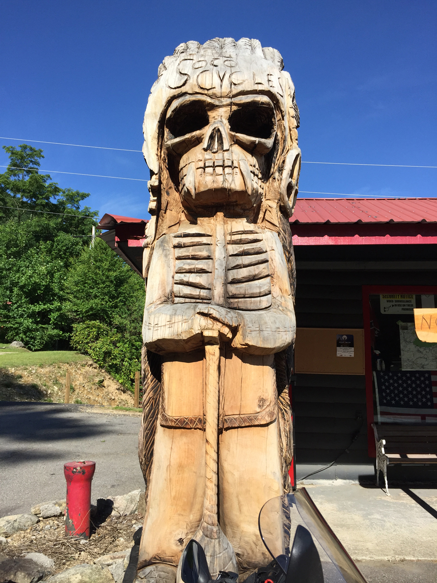
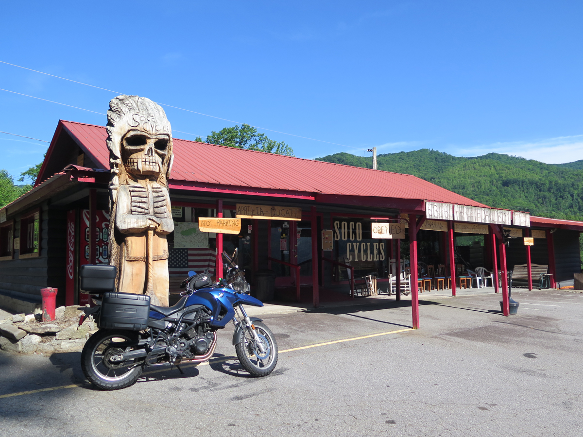
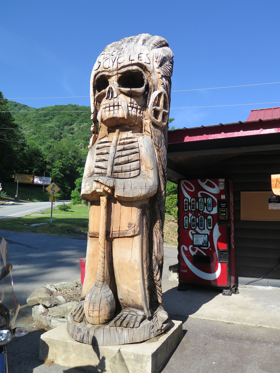
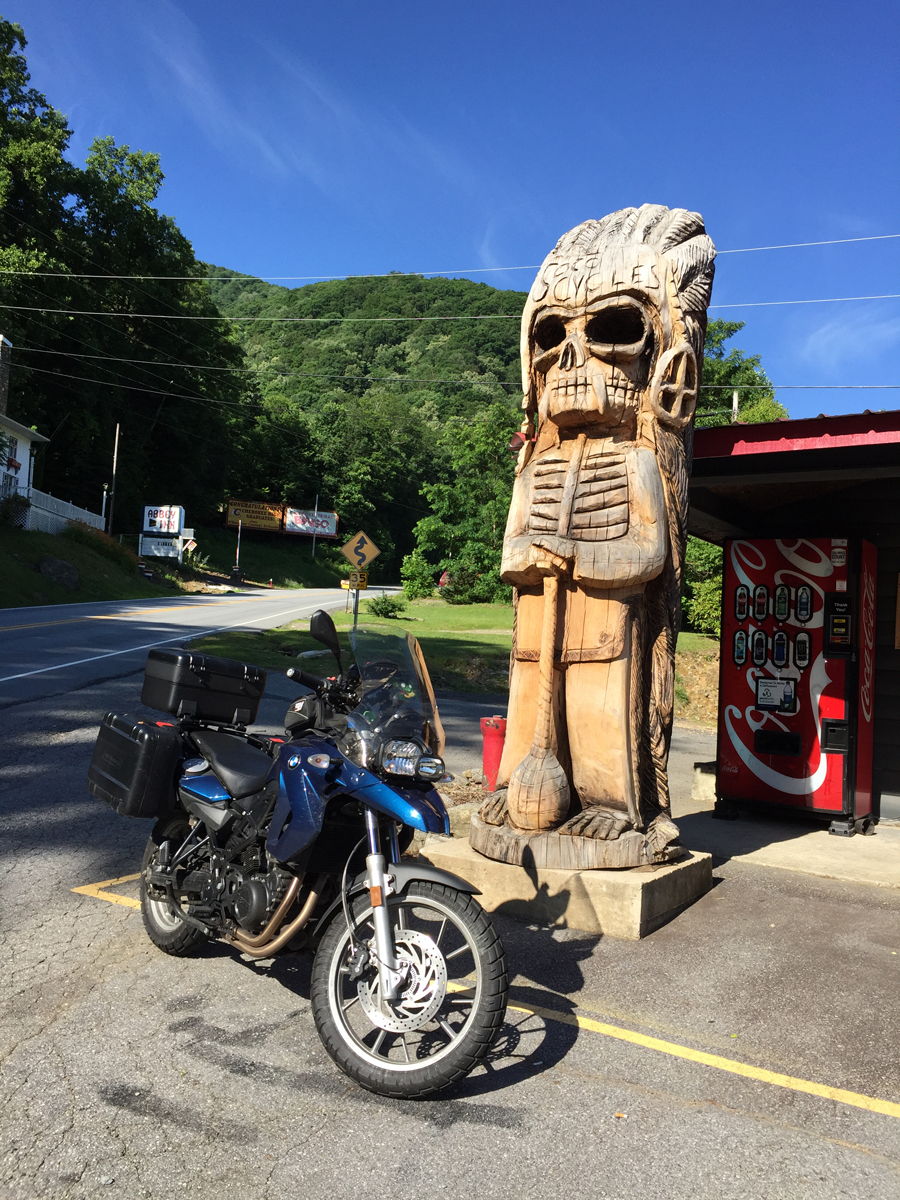
Maniac (official name) Carving at Soco Cycles in Maggie Valley
This guy is billed by RoadsideAmerica.com as the “Indian Death Tiki of Awesomeness.”
Soco Cycles in Maggie Valley, NC
Indian Death Tiki of Awesomeness
You can see that the quality of the carving is nowhere near that of the Whispering Giant shared above, which is what puts this one solidly in the roadside kitsche category.
Kitsche? Yes. Cool? Definitely.
It may not be “art,” but I still like him. 🙂
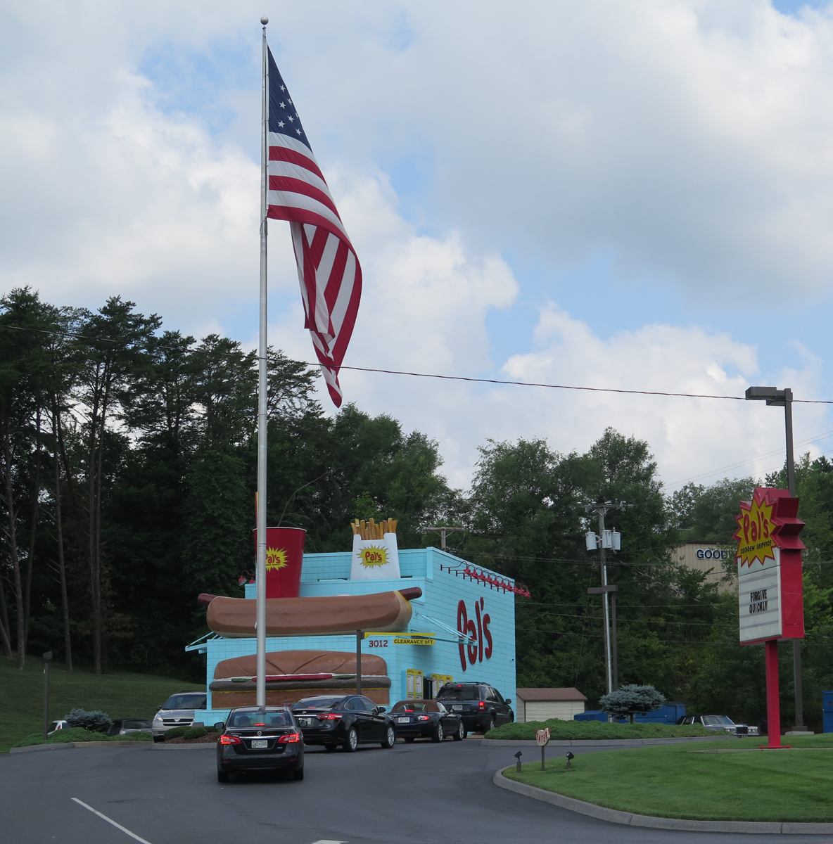
Here’s another Muffler Man spotted during my trip. He’s my favorite.
Hamburger-wielding Muffler Man
That cool-ass burger dude is mounted atop a Pal’s location in Kingsport, Tennessee. Pal’s Sudden Service is a fast-food chain with locations in southwest Virginia and east Tennessee.
Pal’s Unique Architecture
Many Pal’s locations are built using this model. Most that I saw had that architectural style.
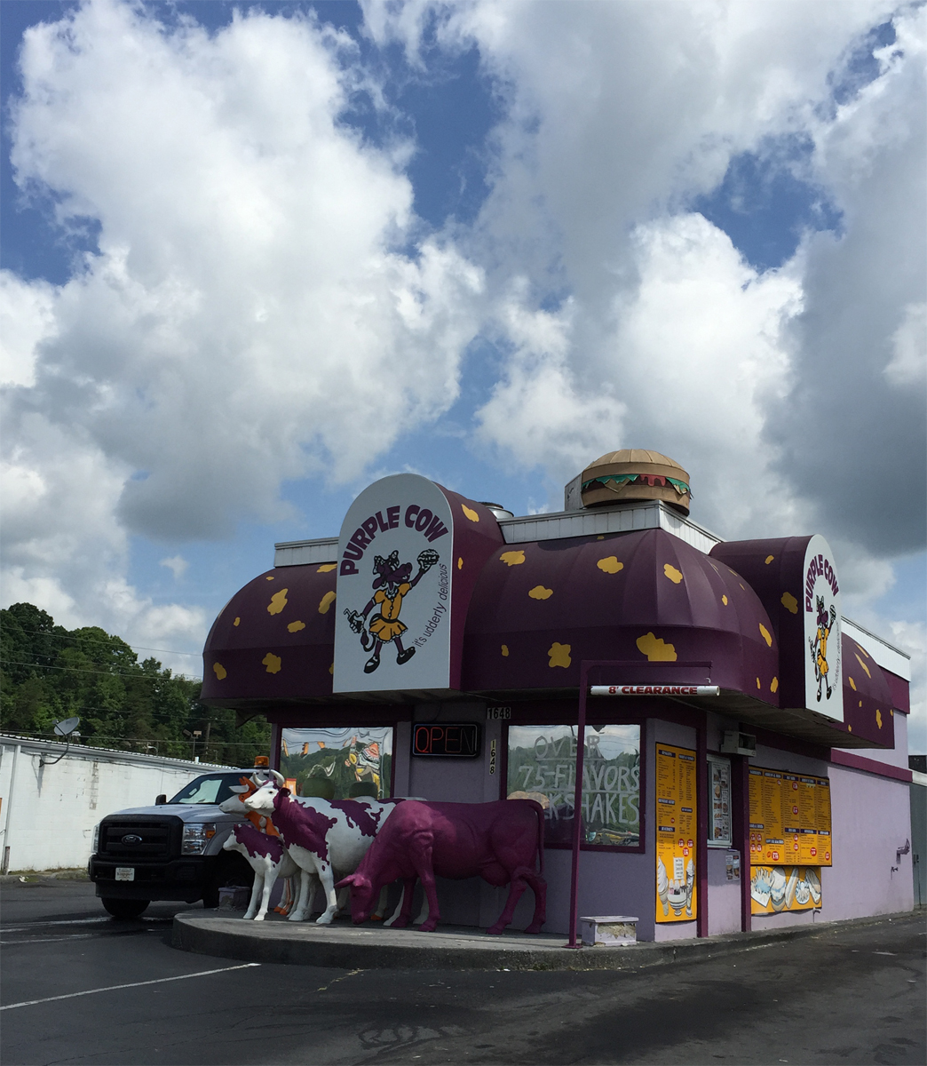
Purple Cow Ice Cream
Another fun spot in Kingsport is the Purple Cow ice cream shop.
It was hot so, even though there was lots more fun stuff to see in Kingsport, I had to pick and choose what I saw. The herd of purple cows and muffler man were musts for me.
Now for some other fun stuff I just happened to see along the way.
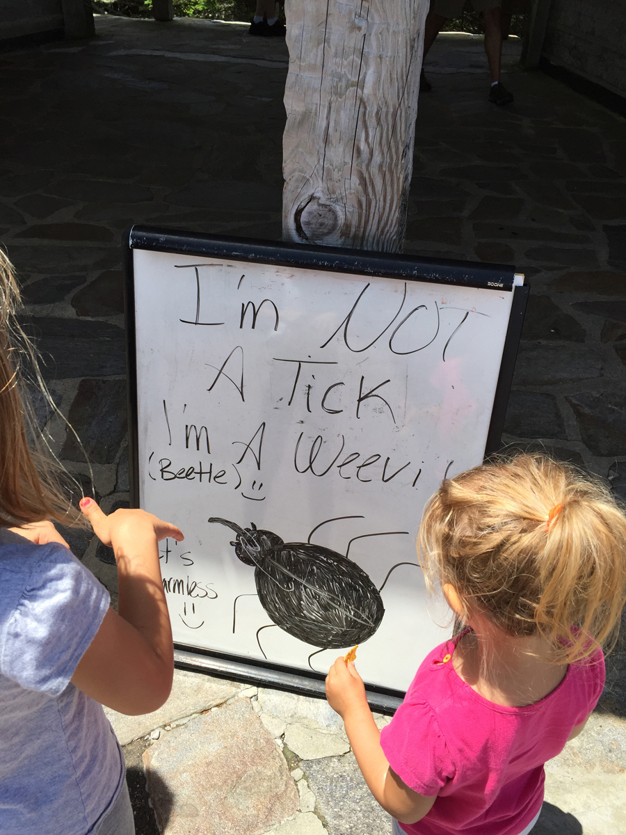
On Sunday, I stopped at Mount Mitchell State Park in NC. It’s located along the BRP. Mount Mitchell is the highest peak east of the Mississippi. Unfortunately, it’s also home to a swarm of weevils.
I did not like the gazillion flying bugs, but did find this sign entertaining.
Bugs!!!
Though harmless, they are EVERYWHERE. They really are about the size of a dog tick. Everyone visiting the summit was covered with weevils. Since I was traveling alone, I had to ask some unknown woman to brush them off of my back.
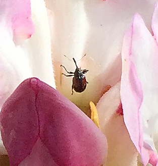
Here’s a weevil I happened to notice on a rhododendron pic I’d captured.
Weevil
My radiator caught more than a few weevils during the course of the journey.
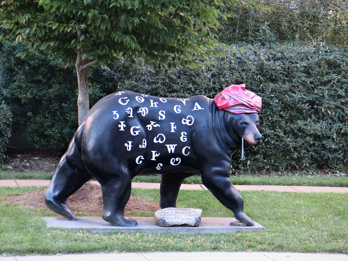
Painted Bear in Cherokee (a community art project?)
Painted Bear in Cherokee (a community art project?)
If we still had a little cabin in the woods, I would have bought one of those for sure. Getting it home may have presented a challenge, though.
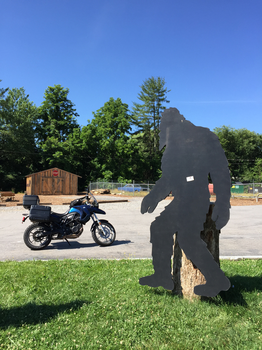
Sasquatch Silhouette For Sale!
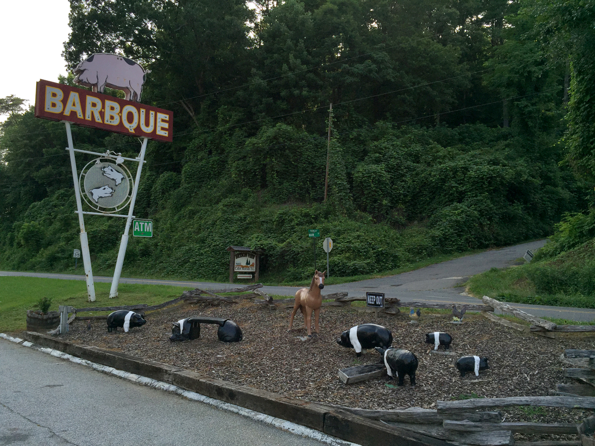
Small Herd of Fiberglass Oreo Pigs at Bryson City BBQ
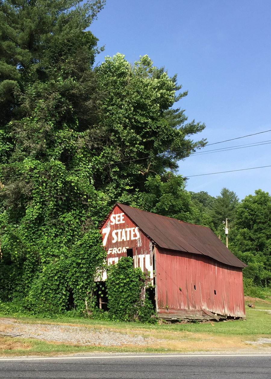
Shack being consumed by kudzu in Bryson City.
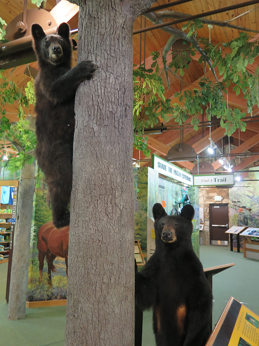
Real, stuffed bears at Pisgah National Forest Visitor’s Center
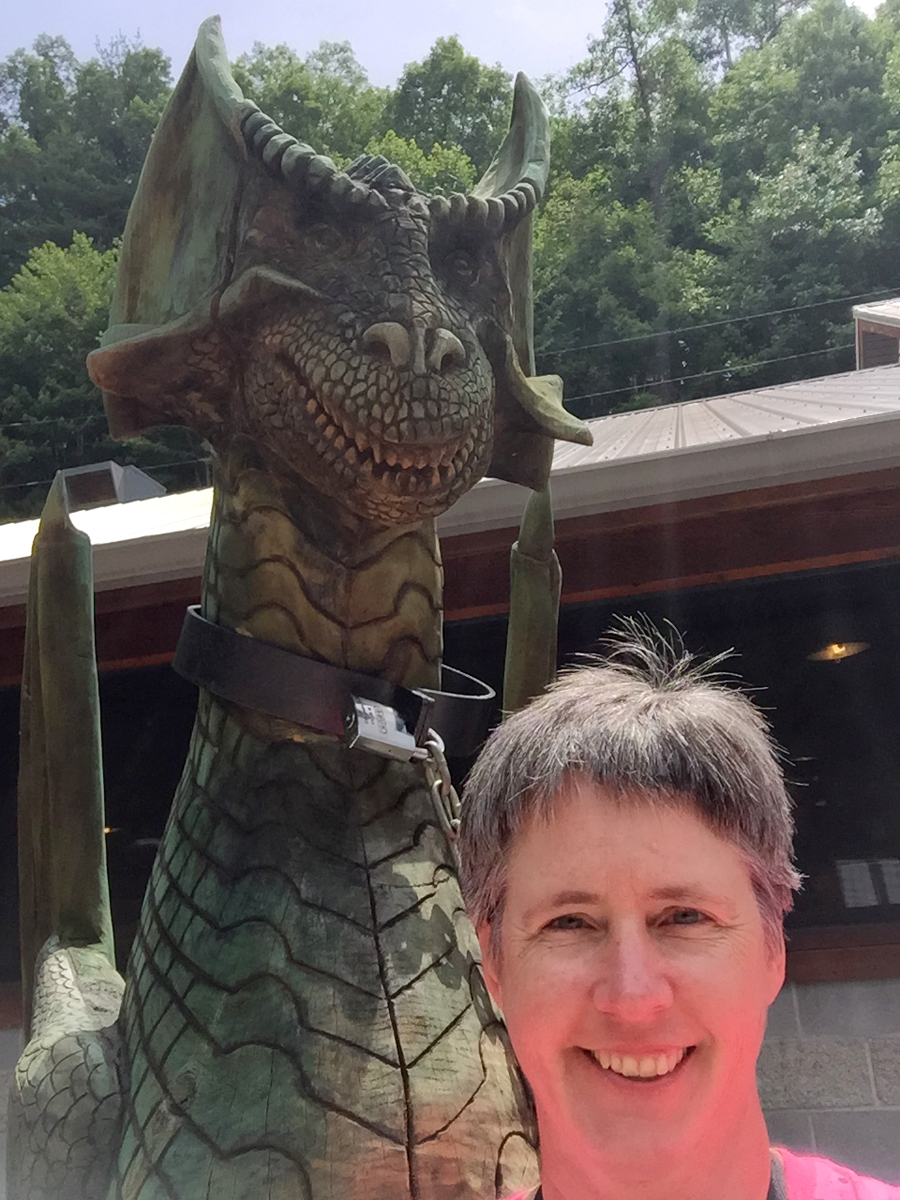
Happy(?) Dragon at THE Dragon (Deal’s Gap Motorcycle Resort)
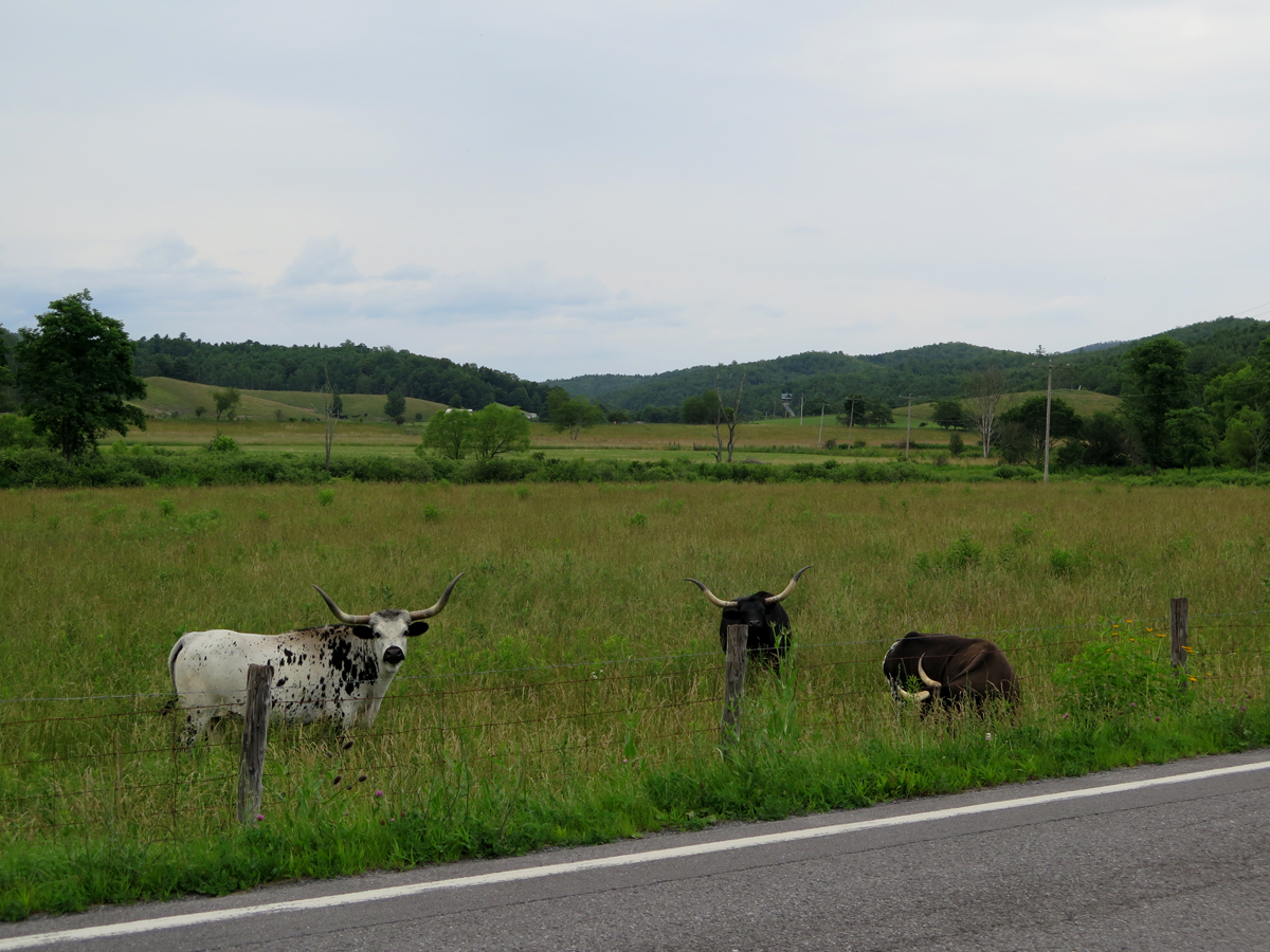
Horned Cattle somewhere in Virginia.
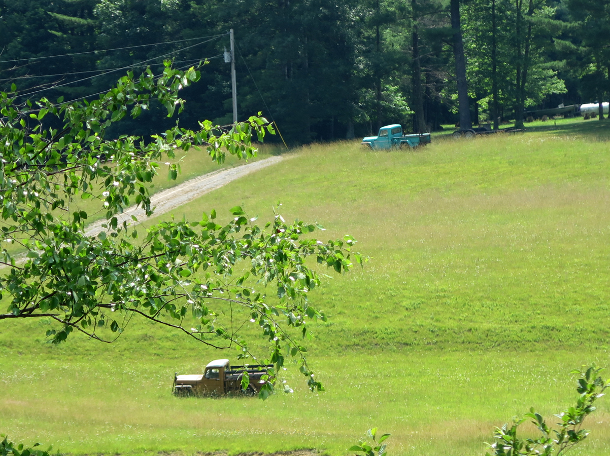
Rural Yard Art somewhere in Virginia.
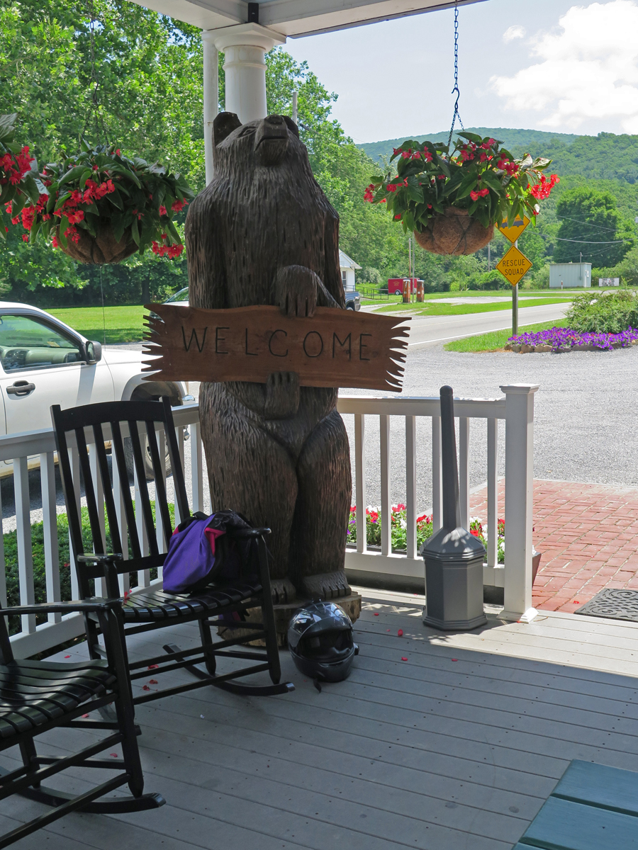
Guardian Bear in Paint Bank, VA
Hatchling Cow (WTF?) in Paint Bank, VA
Wall accoutrement at gas station in Damascus, VA.
Things like that are the norm in many rural gas stations, which also serve as hunting supply and tackle shops, weigh-in stations, general stores, sandwich shops, etc. Really.
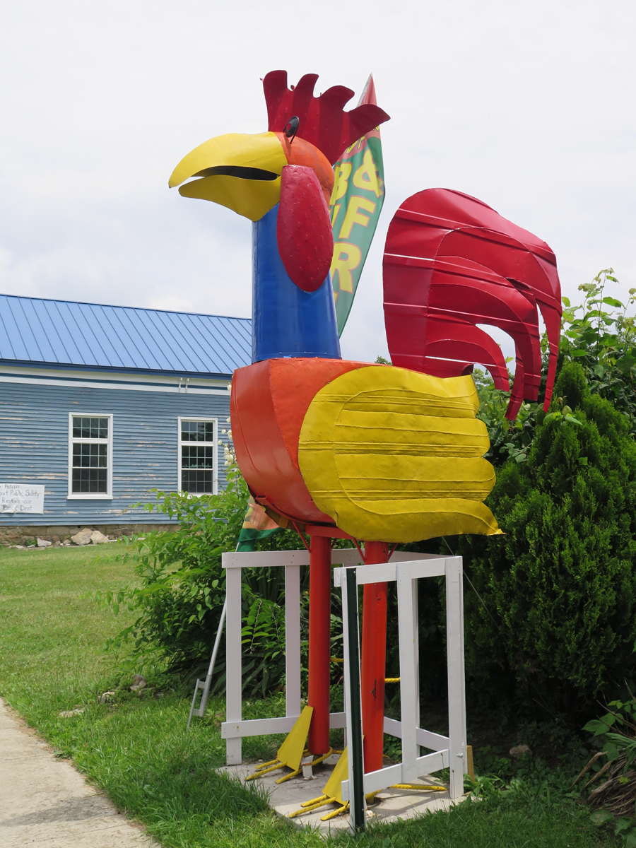
Big Chicken in Wardensville, WV
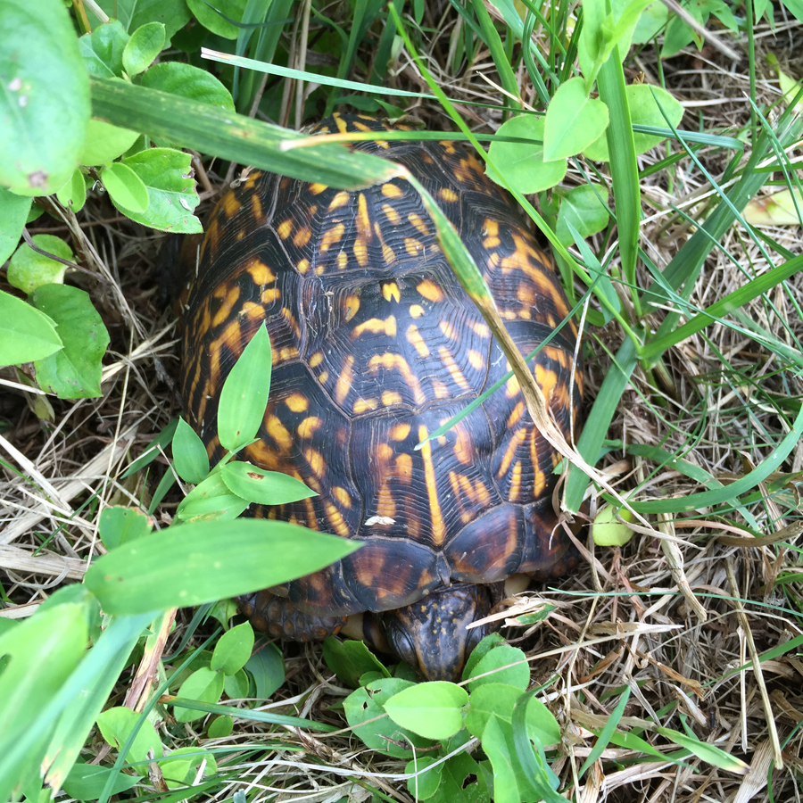
Napping Turtle near Front Royal, VA
I probably would have had more images of oddities to share had it not been for the unrelenting heat and humidity, which was far worse when stopped. So I didn’t stop nearly as much as I would’ve liked to AND avoided more-populated areas with traffic that would have forced me to travel at a slower pace. When it’s above 80 and you’re wearing safety gear, it’s important to keep moving at a relatively brisk pace.
I hope y’all enjoyed seeing at least some of the fun/unusual stuff I saw along the way.
I have lots more pictures of not-so-unusual stuff to share, too. Stay tuned…
Since I spent the first two days of my recent adventure on ONE road — the Blue Ridge Parkway (BRP) — I figure I should give y’all a decent description of the thing. Especially considering that many of you aren’t from this area, or even the US. And honestly? I’ve been on that road once before, but, for some reason, the first time didn’t exactly leave a lasting impression. The second time did.
The BRP is 469 miles (~755 km) long. It’s location is described best on the BRP’s FAQ page , in response to the question, “Where, exactly, is the Blue Ridge?“:
The Blue Ridge is part of the entire eastern Appalachian Mountains and is generally described as stretching from north Georgia into Pennsylvania. From Milepost 0 at Rockfish Gap, VA to Milepost 355 near Mount Mitchell State Park, NC, the Parkway lives up to its name by following the crest of the Blue Ridge Mountains, averaging about 3,000 feet in elevation, and occasionally dipping down into the coves and hollows or crossing low-elevation water gaps. At Mount Mitchell, the Parkway veers westward through the Black Mountains, then into the Craggies before descending toward Asheville. From there, the road climbs to elevations over 6,000 feet in the Balsam Mountains before entering the Great Smoky Mountains National Park near Cherokee.
The more I think about it (what little I can remember from a trip that happened eight years ago, where Hubby planned all of the routes), we only did a piece of the BRP during that ride. We got onto the Parkway around Lynchburg, Virginia, and I think we got off near Asheville, North Carolina to take a shorter/faster route to Robbinsville, NC, where we’d rented a cabin.
If that’s true, we missed the last 90 miles of the BRP, and I think that’s the most dramatic piece. The North Carolina end is where the mountains are tallest and the road is the curviest, anyway.
Don’t get me wrong, I enjoyed the whole Parkway, but the northern end in Virginia isn’t as high elevation-wise, and it’s more forested. There seemed to be a lot more flowers visible from the road in Virginia, too. Oh, and there was less traffic. Maybe because of the rains most folks knew would be moving through?
Anyway… this post is about the road itself. Is it as pleasant as everyone would lead you to believe? Yes, it really is.
There’s a 45 m.p.h. (72 km/h) speed limit, which applies to about 95% of the route. In some places, near visitor centers, exhibits, etc., it drops to 25-35 m.p.h. (40-56 km/h), but those are far and few between.
Blue Ridge Parkway
The road surface is generally good. There are a few rough spots, but not enough to complain about. And it’s very pretty, too, with lots of places to pull off and enjoy the scenic mountain vistas, burbling brooks, or even just a bit of shade.
ToadMama
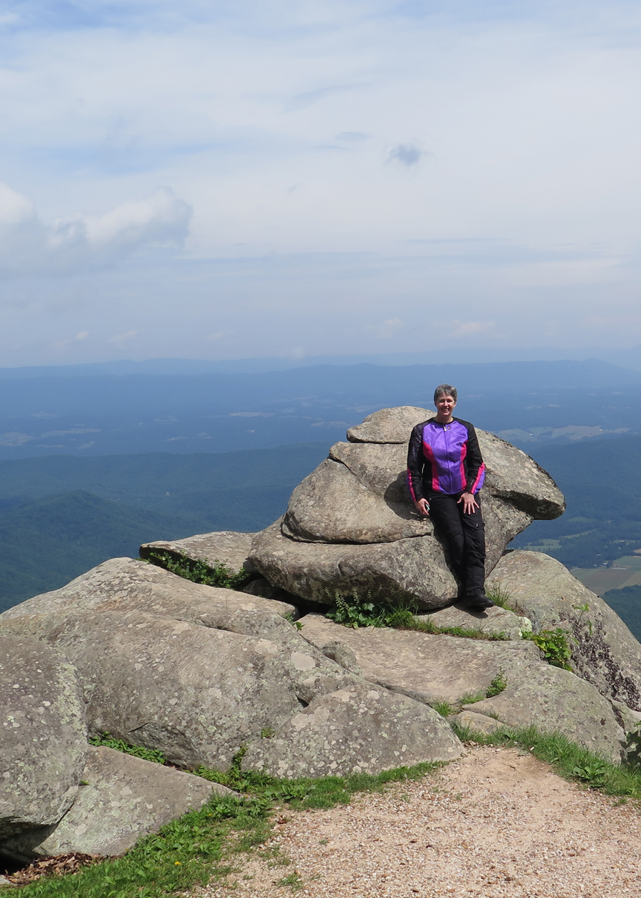
I had to do a quick u-turn after zipping past that awesome rock formation.
What rock formation? The one I’m standing in front of, blocking.
Face Rock
There were two riders from Canada admiring the view who watched me zip past. They looked at me quizzically as, about a minute later, I joined them from the other direction. It was a look that either said, “Is that a girl?” or “Didn’t you just cruise past here?”
“As soon as I saw that face on the rock, I had to turn around,” I said as I removed my helmet. “Face?” one of the guys said before they both turned to see what I was seeing.
How could they NOT see a face on that rock? More proof that people really do see things differently.
Most of the still images shared here were taken in Virginia.
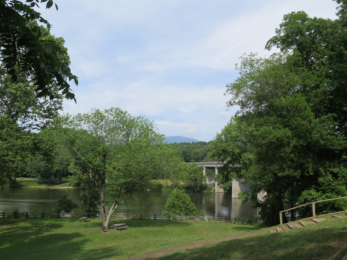
James River Visitors’ Center
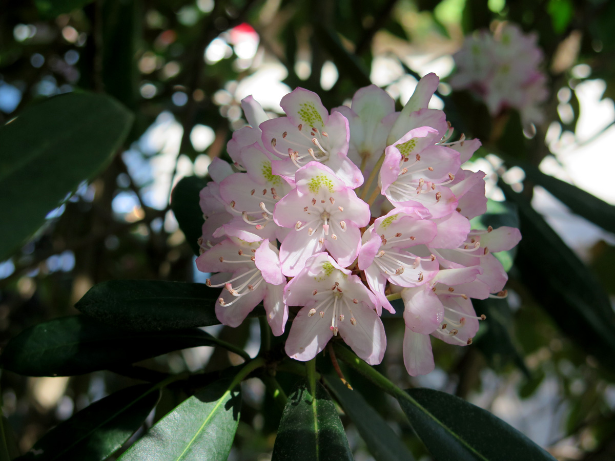
Rhododendrons
I only shared one flower image so, if you watch my video and see me pointing out two lone examples of small bushes in bloom, you won’t imagine that flowers only appear along the drive sporadically. In some spots, the road cuts through literal forests full of rhododendron. It was amazing. I forgot to mention that the BRP cuts through four National Forests (George Washington, Jefferson, Nantahala, and Pisgah).
Shady Stretch Spot
Lunch Spot at the Peaks of Otter Complex
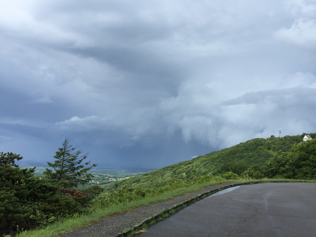
The next picture shows the thunderstorm I managed to wait-out at the tiny little Rocky Knob visitors’ center.
Storm!
I wasn’t the only one thinking, “Uh oh!”
Bicyclist Woes
The storm I rode through.
Saturday afternoon did get a bit stormy, but it was no big deal. That’s why they make rain gear, right? And, actually, it seemed to chase most people off of the road, so there was even less traffic after the rains came. And there was already very little traffic to start! 🙂
The weather on Sunday was much nicer.
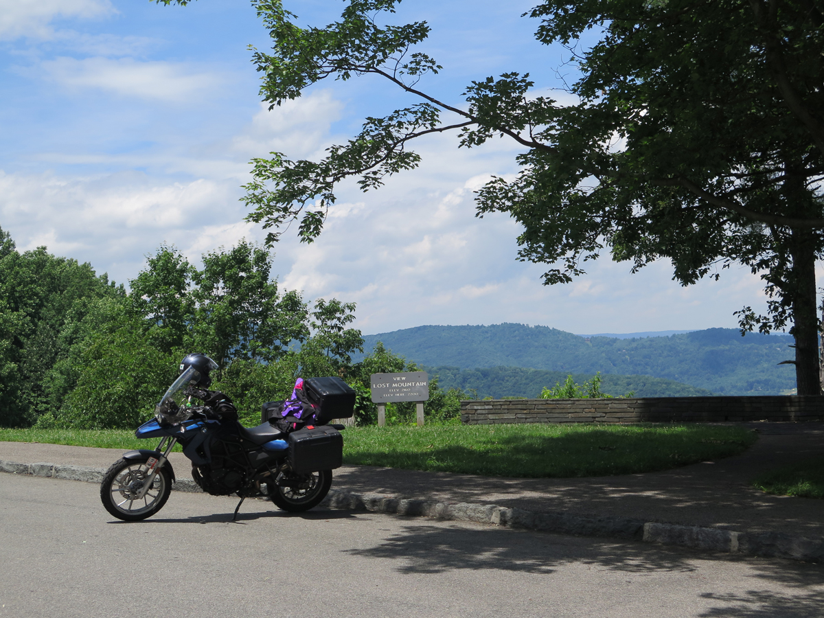
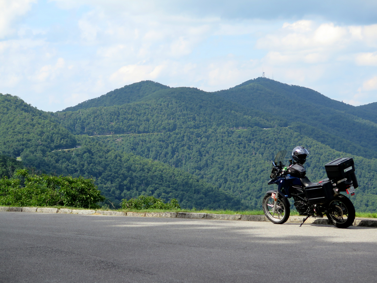
Parked at an overlook in North Carolina, you can see the Parkway on the opposite ridge.
My Favorite Overlook
Pretty Blue Sky
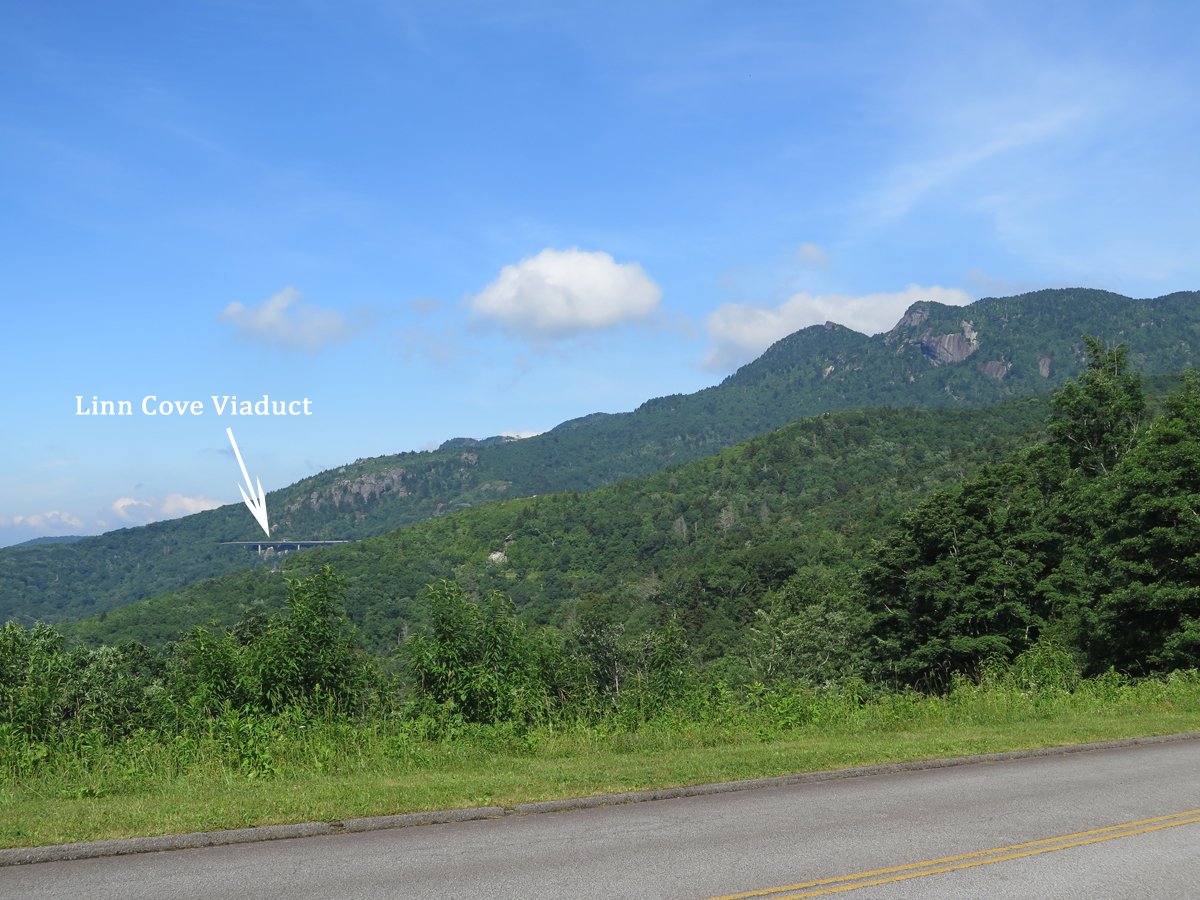
I hadn’t been planning on shooting any video until I reached The Dragon, but, once I saw the Linn Cove Viaduct, which is basically a bridge hanging off the side of Grandfather Mountain, I figured I owed you all more than just a picture. But I’ll start with a picture.
Can you see the grandfather’s face? (He’s laying down, looking skyward.)
The viaduct itself was really cool. After I rode across it, I HAD to go back for the video.
If you have a couple of minutes, you should at least watch the first part, so you can see the viaduct, and the way it’s suspended from the mountain.
If you’re interested, you can learn more about the viaduct’s history and construction HERE.
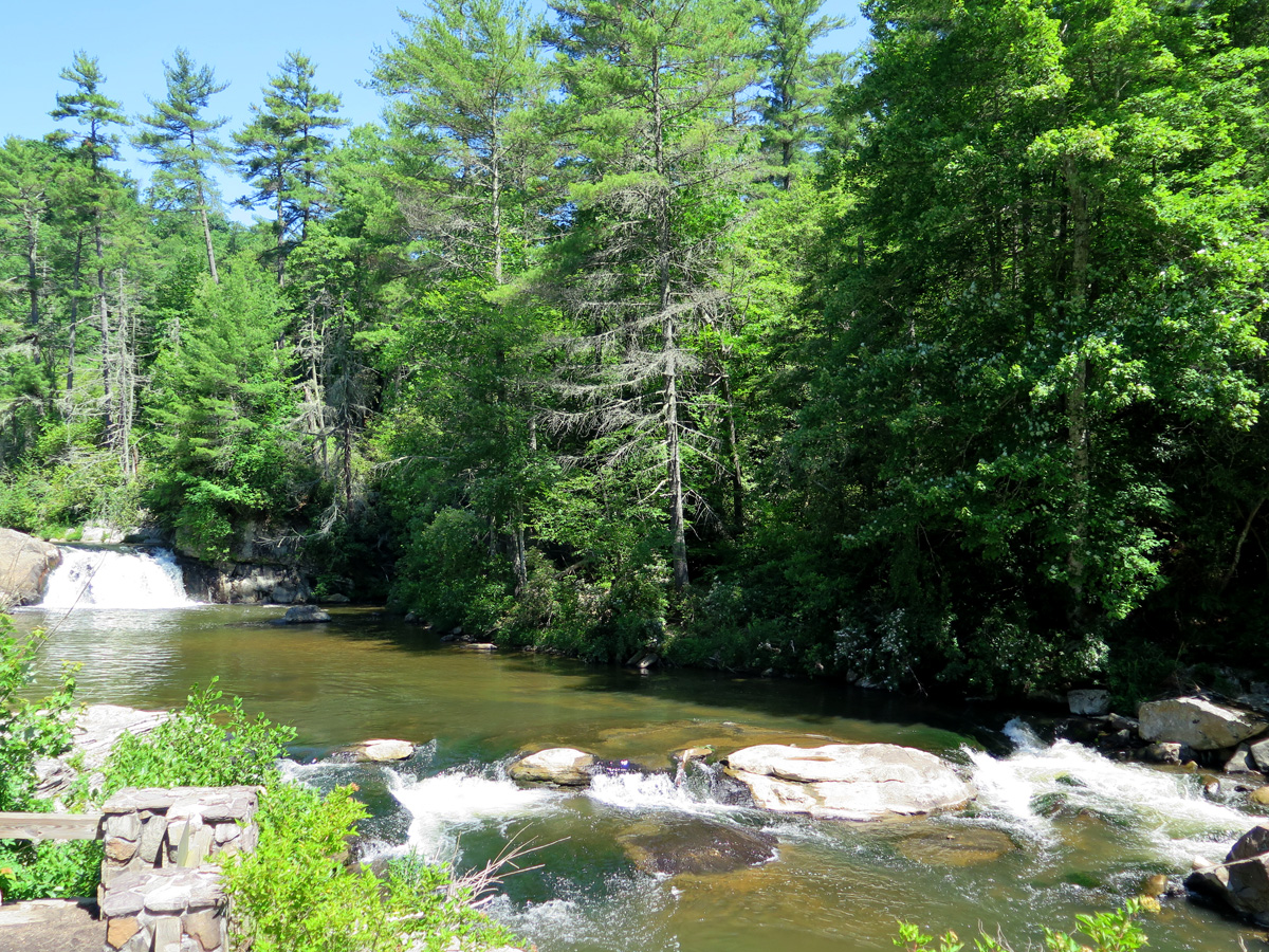
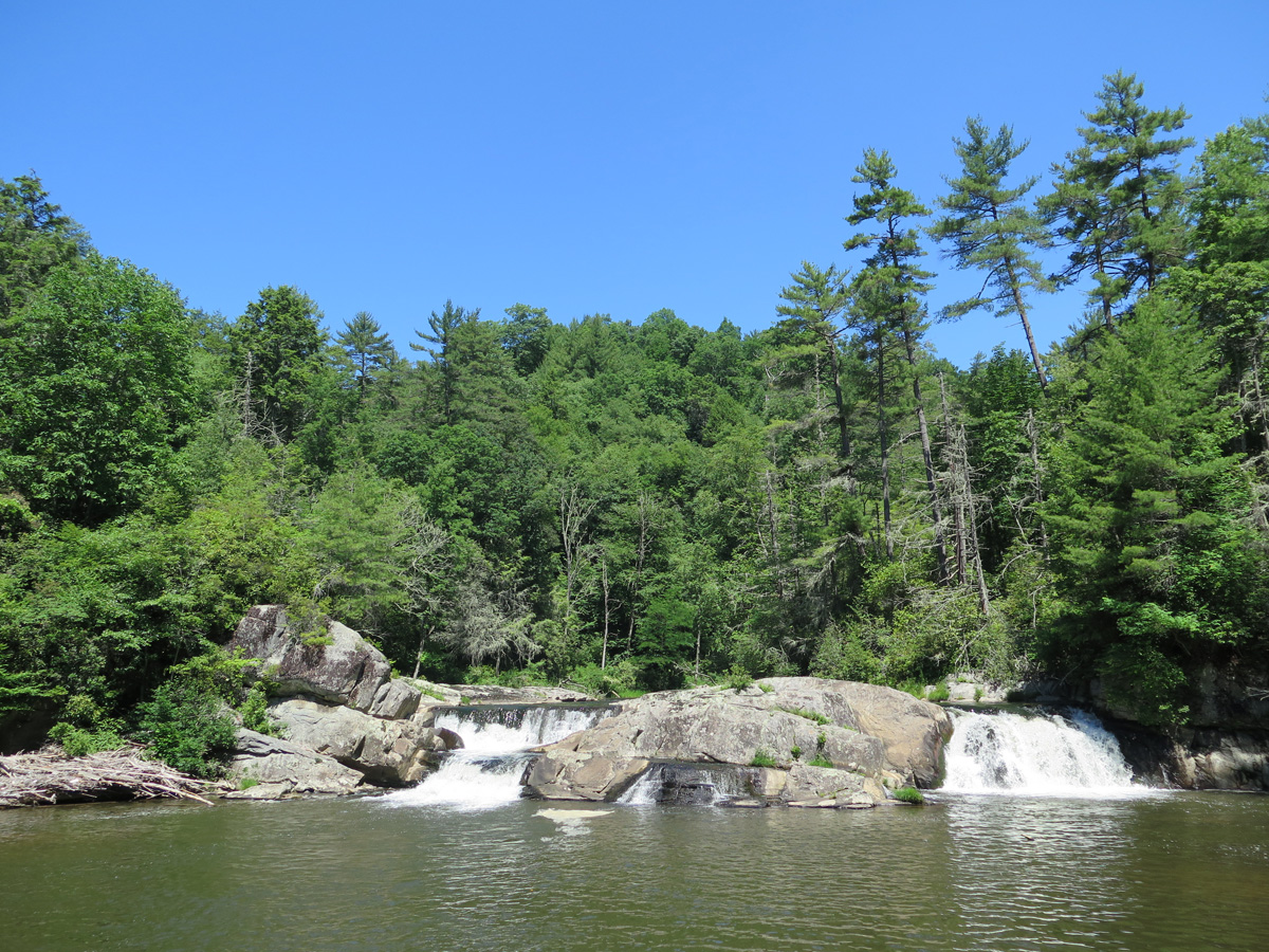
I’ll share more pics eventually, of the flowers and stuff. Oh, and the waterfall. For now, if you’d like more information, here’s a link to the BRP’s National Park Service home page.
I never did snag my own picture of the BRP’s coolest road sign ever, so I’m sharing this one from RoadRunner Travel…
Those of you who have ridden all or parts of the BRP, do you think it’s a must-ride road?

 What a weird name for a town, right? I got so used to it over the years, I forgot how unusual a name it was. Not that I had ever been there before, I just knew it was close to the Great Smoky Mountains National Park (GSMNP). And home to Dollywood, the amusement park Dolly Parton financed and built in/near the town.