
Skyline Drive is one of those roads I often see on “must-ride” lists. It’s nice, but I often feel it’s overrated because it’s not really a “fun” road for me. There’s the 35 mph (56 km/h) speed limit for one thing. And it’s pretty popular, so there’re often lots of cars and big, loud motorcycles putting along. The road does have its merits, though.
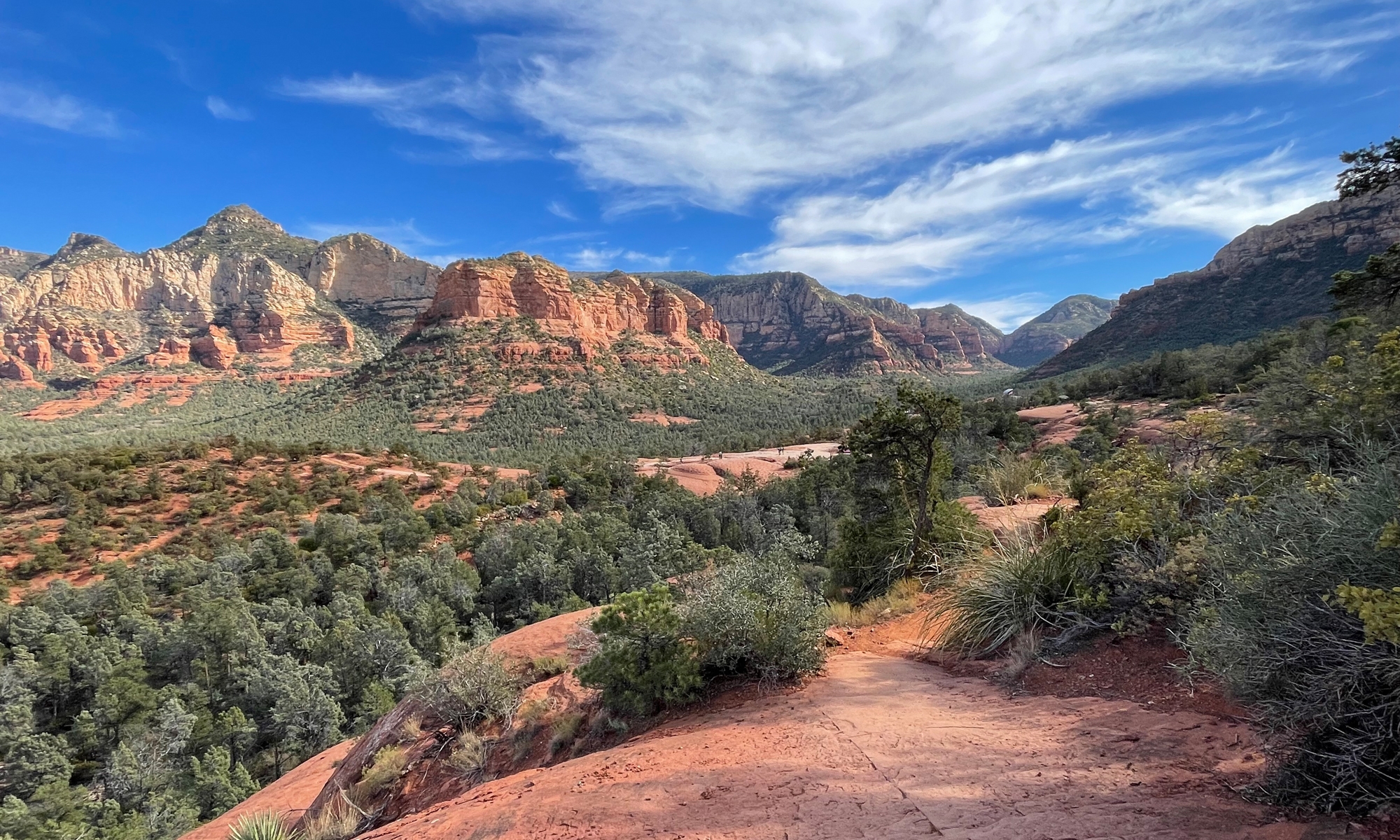
In case you’re not familiar with it, Skyline Drive is a 105-mile (~169 km) road located within Shenandoah National Park (SNP). It’s runs along the ridge or crest of the mountains from Front Royal to Afton, Virginia. (If you’re interested in more stats/facts, click here.) It just so happens that Skyline Drive meets up with the Blue Ridge Parkway (BRP) in Afton. The BRP is another infamous must-ride route for motorcyclists, that runs 469 miles (~755 km), connecting the south entrance of Virginia’s SNPark with the north entrance of the Great Smoky Mountain National Park (GSMNP) in Tennessee. I’ll tell you more about the BRP one day soon.
The biggest attraction of Skyline Drive — here’s a map, by the way — is its natural, scenic beauty. Did I mention that it runs through the forest? And there are 75 overlooks where one can stop, get off of the bike/out of the car and take in sweeping mountain vistas, observe wildlife, and see wildflowers. Depending on the season, of course. (Some of you may remember my recent Winter visit to SNP.)
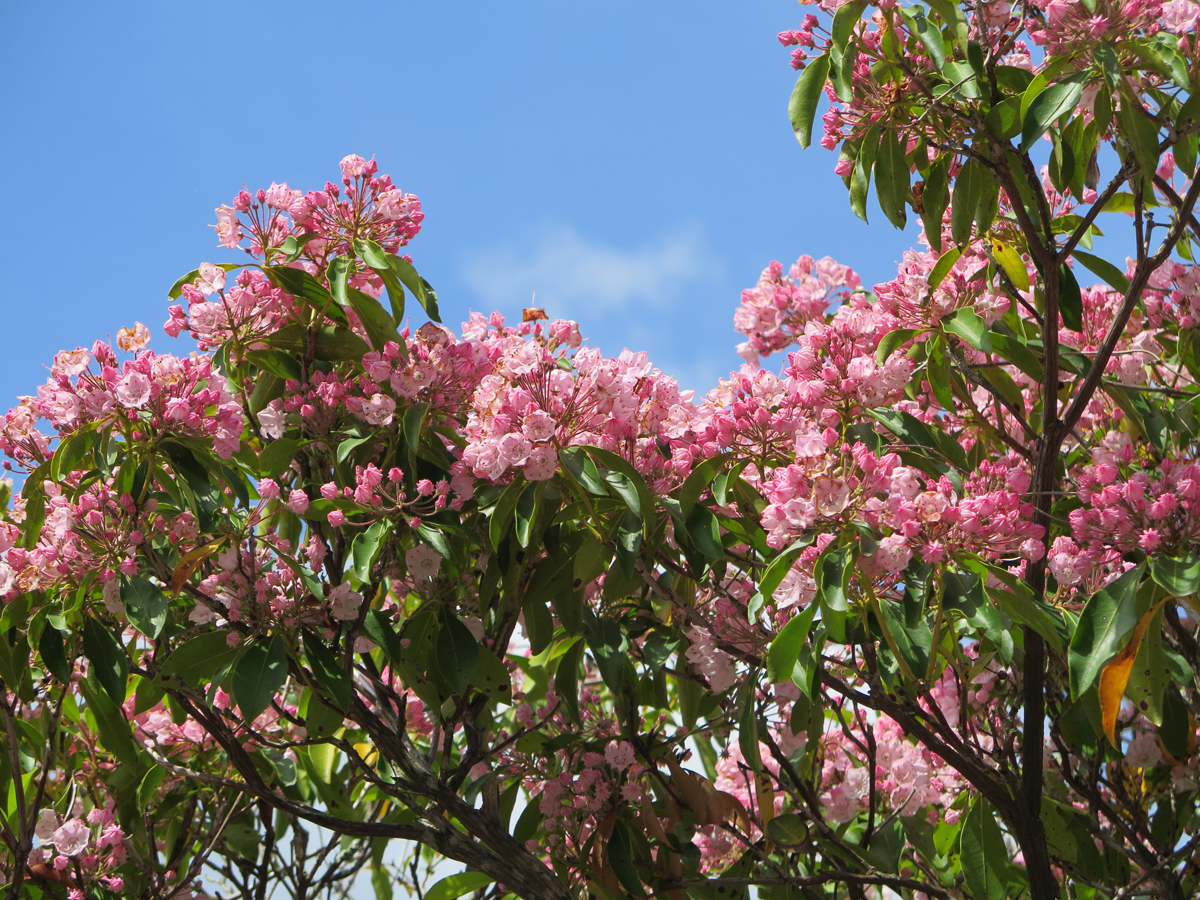
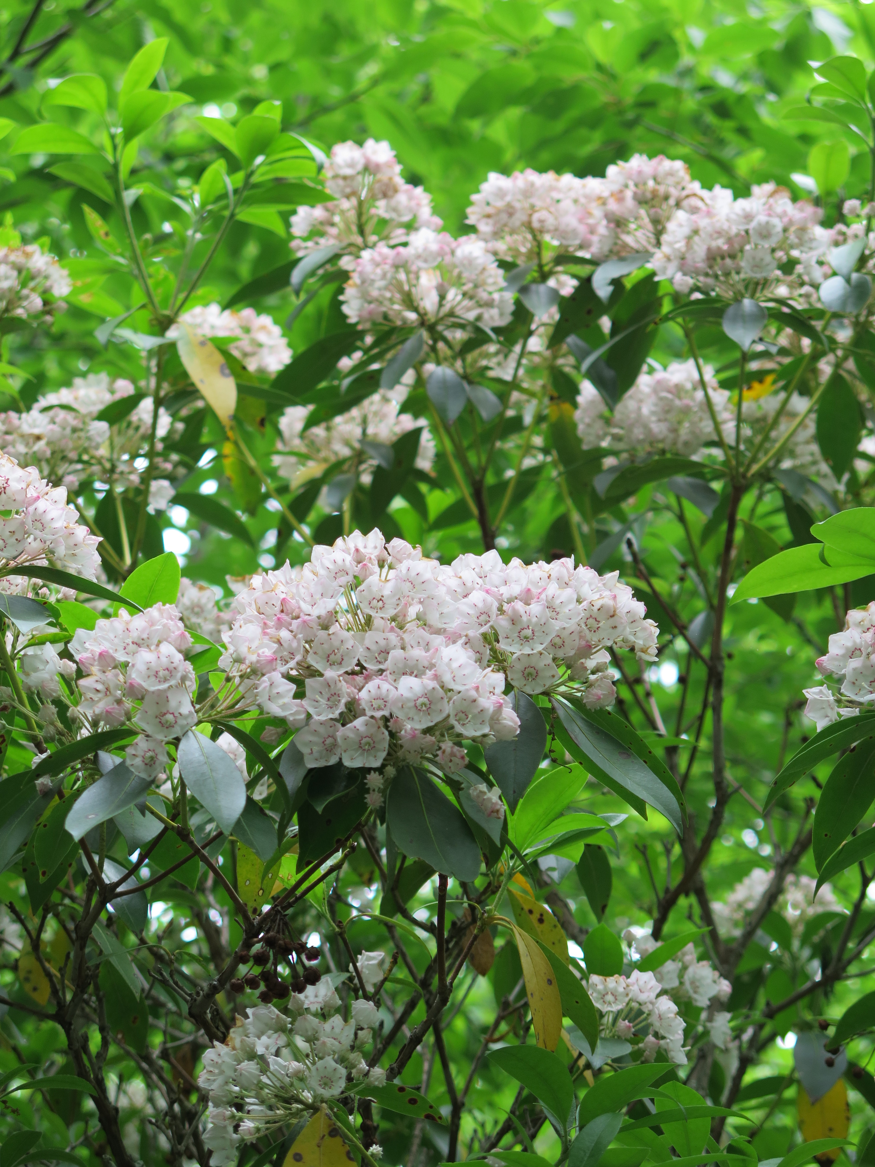
I like flowers. I do. Which is why, since we moved to Virginia in late 2011, I’ve been telling myself that I really need to visit Skyline Drive during the Spring when the Mountain Laurel is in bloom. I had a Mountain Laurel bush in a shade garden at our last house in Maryland, and I really loved seeing the flowers when it bloomed. I could only imagine how pretty a whole grove of Mountain Laurel would be.
Until now.
Lucky for me, I happened to see something on-line last week mentioning that the Laurel was starting to bloom in SNP. Knowing it was going to be HOT on Saturday, I hatched a plan for Hubby and I to leave the house early on Saturday, head west to Luray for breakfast, and then head south through the valley while it was still pleasant and then ride north along the drive during the hotter part of the day.
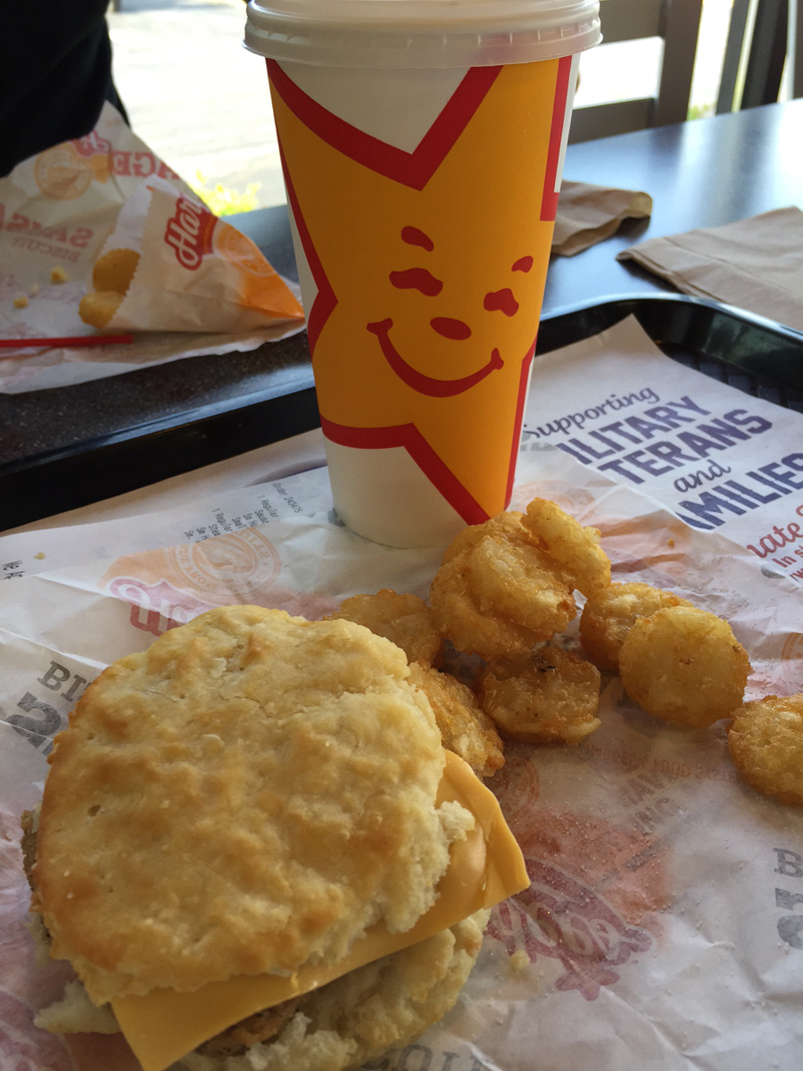
Since Hubby hadn’t managed to get a decent breakfast biscuit sandwich during his recent loop of the US, he was quite happy to hear that Hardee’s was on the itinerary.
It was yummy, if I do say so myself.
From Luray, we headed down Business US-340, through Stanley, and took a left onto River Road just before Alma, a fortuitous, alternating tree-lined and pastoral alternate route I discovered quite by accident on my last dog transport. As its name implies, the road runs along the South Fork Shenandoah River for a bit. It was cool and lovely.
I’d told Hubby we would take US-340 down to Waynesboro unless it started getting too hot. River Road intersected with US-340 around Grove Hill. From there, we headed south toward Waynesboro. Unfortunately, temps were starting to climb. At 9:30, it was already around 85 F (29 C), so, at Elkton, we headed east on US-33 to reach the SNP Swift Run Gap Entrance Station.
As we climbed into the mountains, temperatures dropped. By the time we got onto Skyline Drive, temps were a pleasant 65 F (18 C). It was fabulous. But we weren’t seeing any Mountain Laurel. Gasp.
We did see some wildlife, though. There’s a very valid reason for that sometimes-painful 35 mph speed limit. I slowed substantially when I spotted a White-tailed Deer on the right-hand shoulder. She saw me coming, and I figured she’d hop off into the woods. Instead, she hopped off into the road, mere feet in front of me.
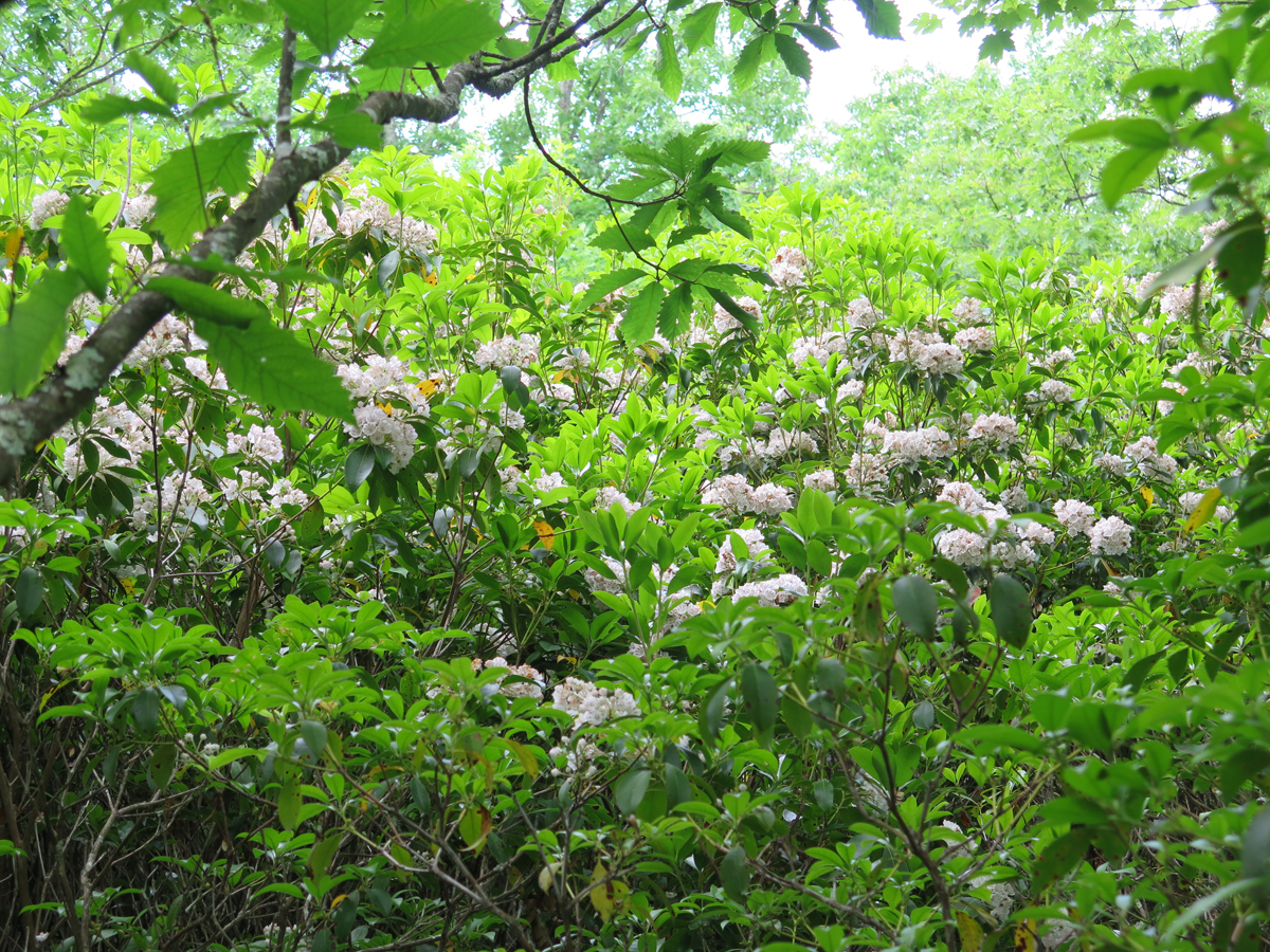
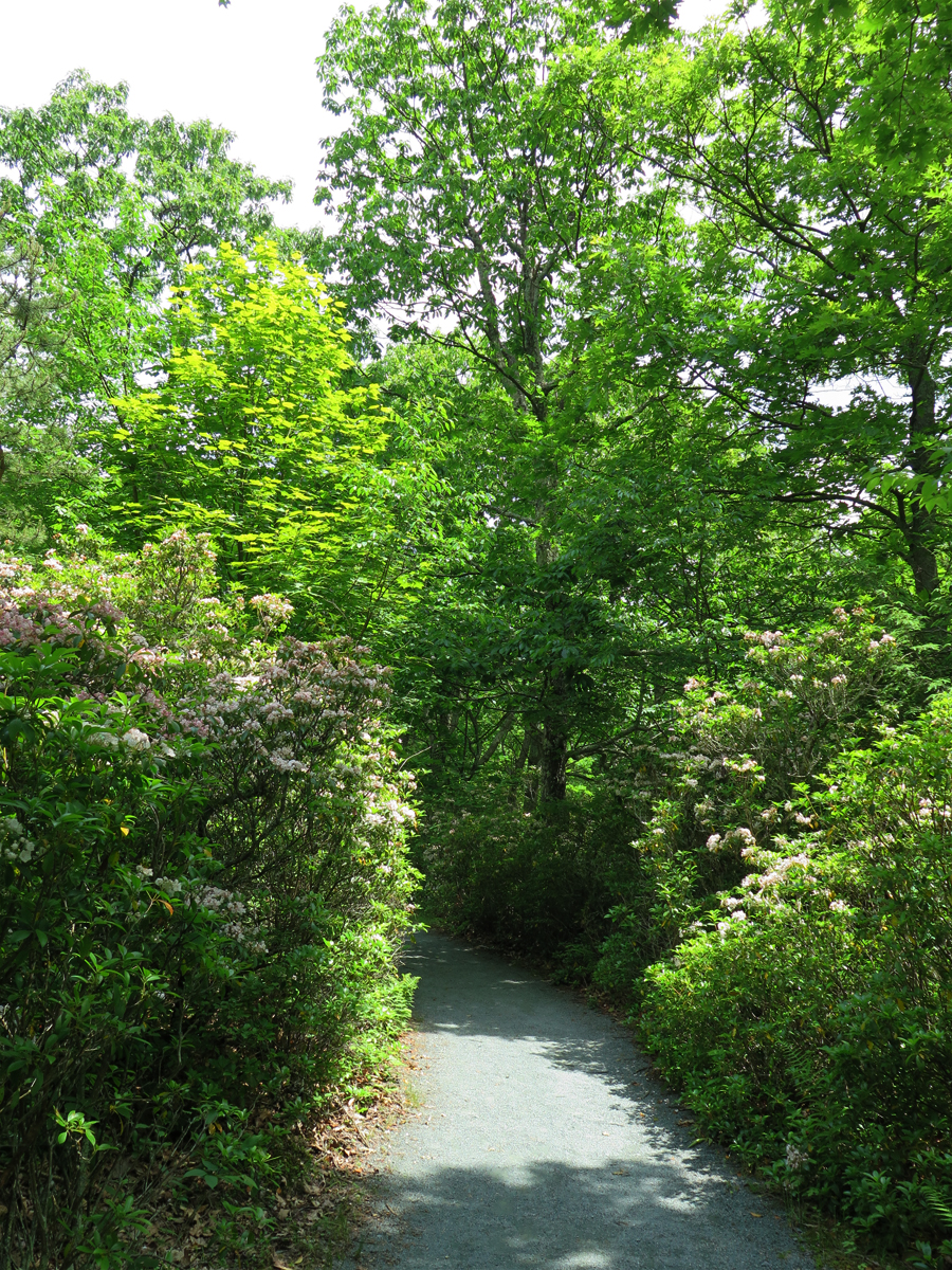
We did eventually start seeing Laurel here and they, among lots of other wildflowers, ferns, and trees. It was so quiet and peaceful, and there were very few cars.
I’d done my research earlier, and knew we’d be stopping at the Limberlost Trail near mile 43, where there’s supposed to be a decent amount of Laurel, so I wasn’t too concerned about missing the bushes we rode past.
We pulled off into a couple of picnic areas, hoping to spot a bear, to no avail. So we just motored along, enjoying th natural air conditioning and lovely views.
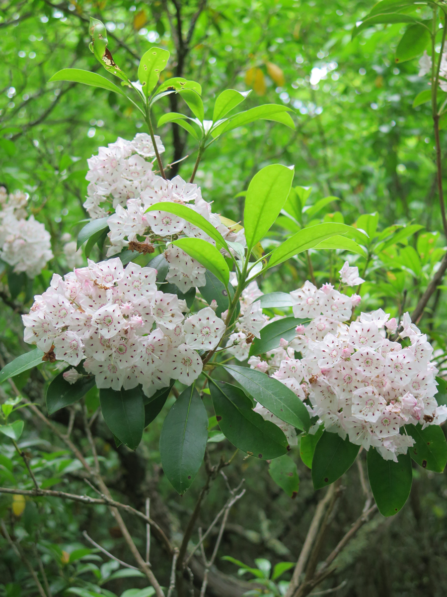
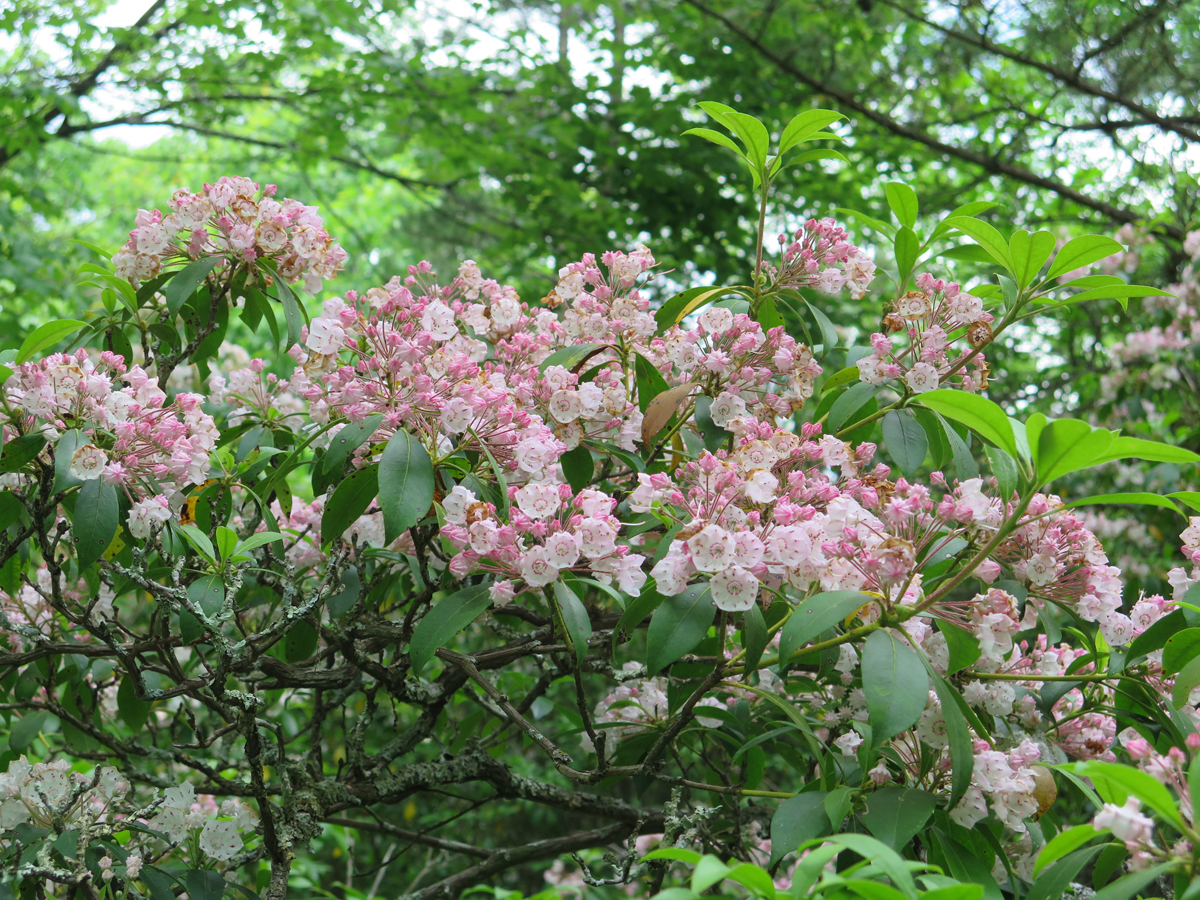
When we stopped at the Big Meadows Visitor’s Center, I was tickled to see a couple Laurel bushes, where I could get a closer look. It’s pretty stuff. Some of it is much pinker than others.

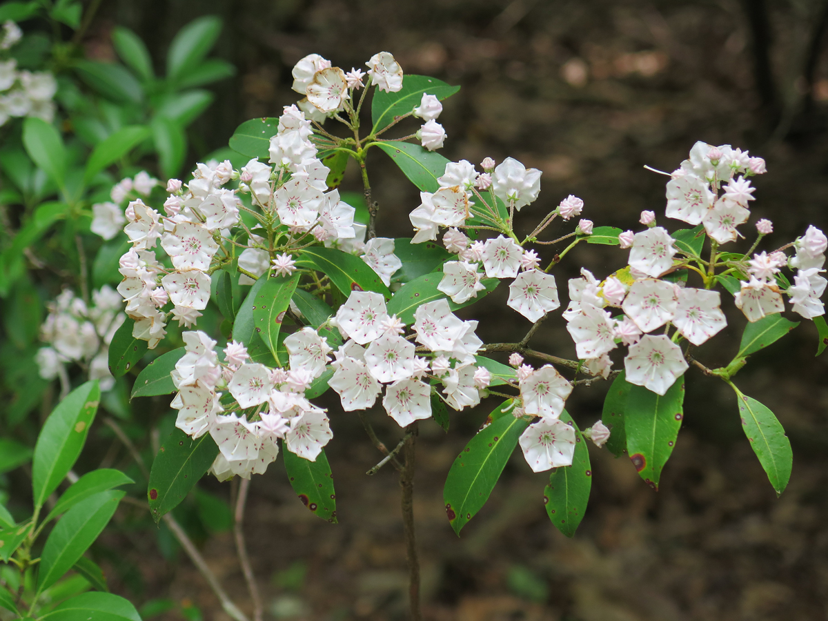
We hung out there for a bit, checking out the gift shop/camp store, visiting the restroom, drinking, and stretching. Then we continued on to Limberlost Trail, where I’d read there was a decent grove of Mountain Laurel.
EDIT: I forgot to mention that we saw a bear just south of the Upper Hawksbill parking area. So cool. I’d only ever seen bear at SNP once before, and Hubby never had. It was in the trees to the right of the road, so we didn’t get a great look, but it was definitely a bear. 🙂


We didn’t walk very far since neither of us were dressed for a hike. Plus, we could feel temps starting to climb. It was still around 75 F (24 C), tops, as we continued north. We’d talked about riding all the way to the North Entrance at Front Royal, but, knowing it would be much warmer once we descended from the ridge, I decided to exit at Thornton Gap.
That was a smart move. Temps were definitely climbing. It was about 20 degrees warmer off the mountain (85 F [29 C] again). And, even though I chose an off-highway route to carry us from Little Washington to Warrenton, it kept getting warmer. And, with temps around 92 F (33 C), we were quite happy when we reached the house around 1:00 PM.
We’d had a nice little ~160-mile (257 km) ride, and I’d FINALLY seen the Mountain Laurel in bloom. Now I can shut up about THAT to-do. LOL.
I sure hope things cool off soon.
Hubby’s been working on his ride report. I hope to be able to share it with you in the next couple of days.
So, what do you all think about the Mountain Laurel?
The pictures are beautiful! I still need to finish up there going south to Afton. So glad you got to see the Mountain Laurel it really is a beautiful flower.
Thanks, Dottie. I’m not sure if I’ve ridden the Southern section. I would’ve liked to on Saturday, but didn’t want to risk the later day heat. Sweating in all that gear isn’t much fun.
Absolutely beautiful laurels. Definitely worth a ride. So pretty. We see Portuguese Laurel and English Laurel here but I’ve never seen pink mountain Laurel.
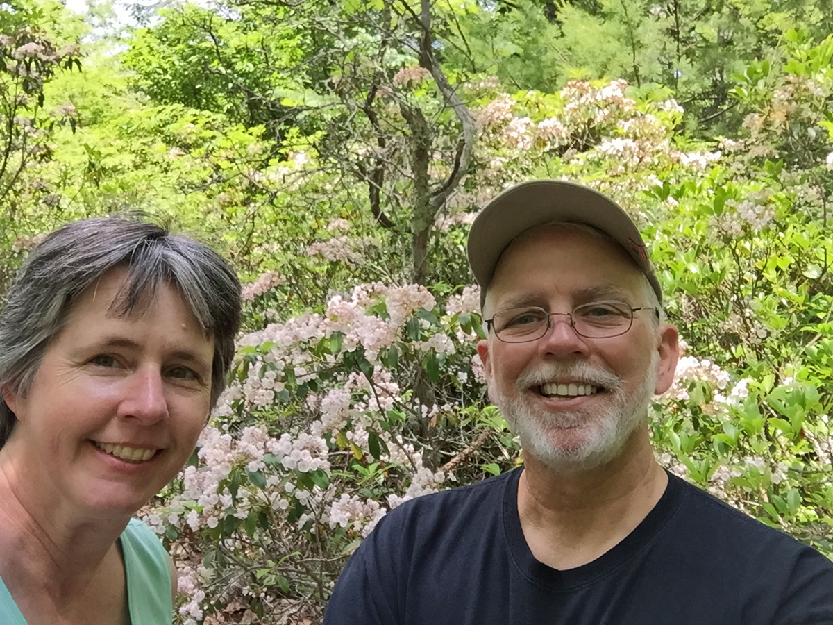
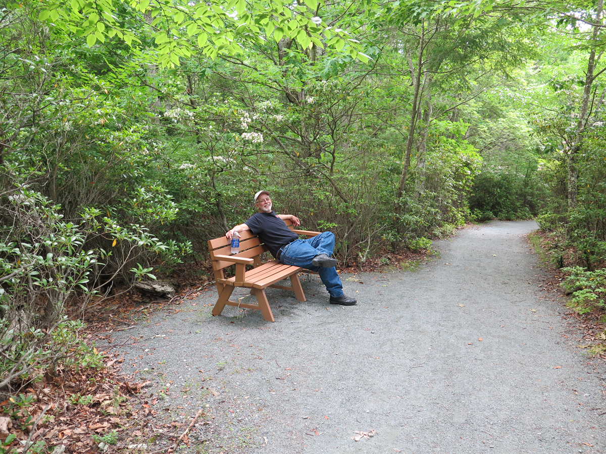
Loved your selfie with them too.
Thanks, B. I didn’t realize until I was writing my post that Mountain Laurel is only in the south and east. I am glad I finally got to see it in bloom, as I have seen it many times before/after blooming, and it’s just not the same. I’m glad you enjoyed my silly selfie, too.
Nice reason to get out and about. I’ve only heard of laurel in stories of Greek Olympians and emperors.
Any reason to get out and about is a good one! 🙂
Those are mighty lovely blooms, something that one certainly wouldn’t find out here in the Wild West (if only). They’re probably just too delicate.
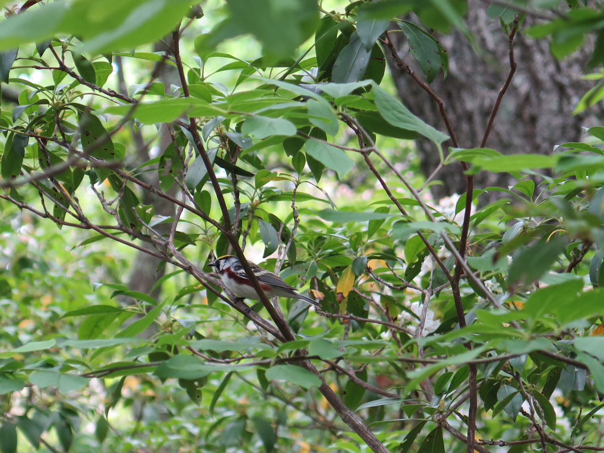
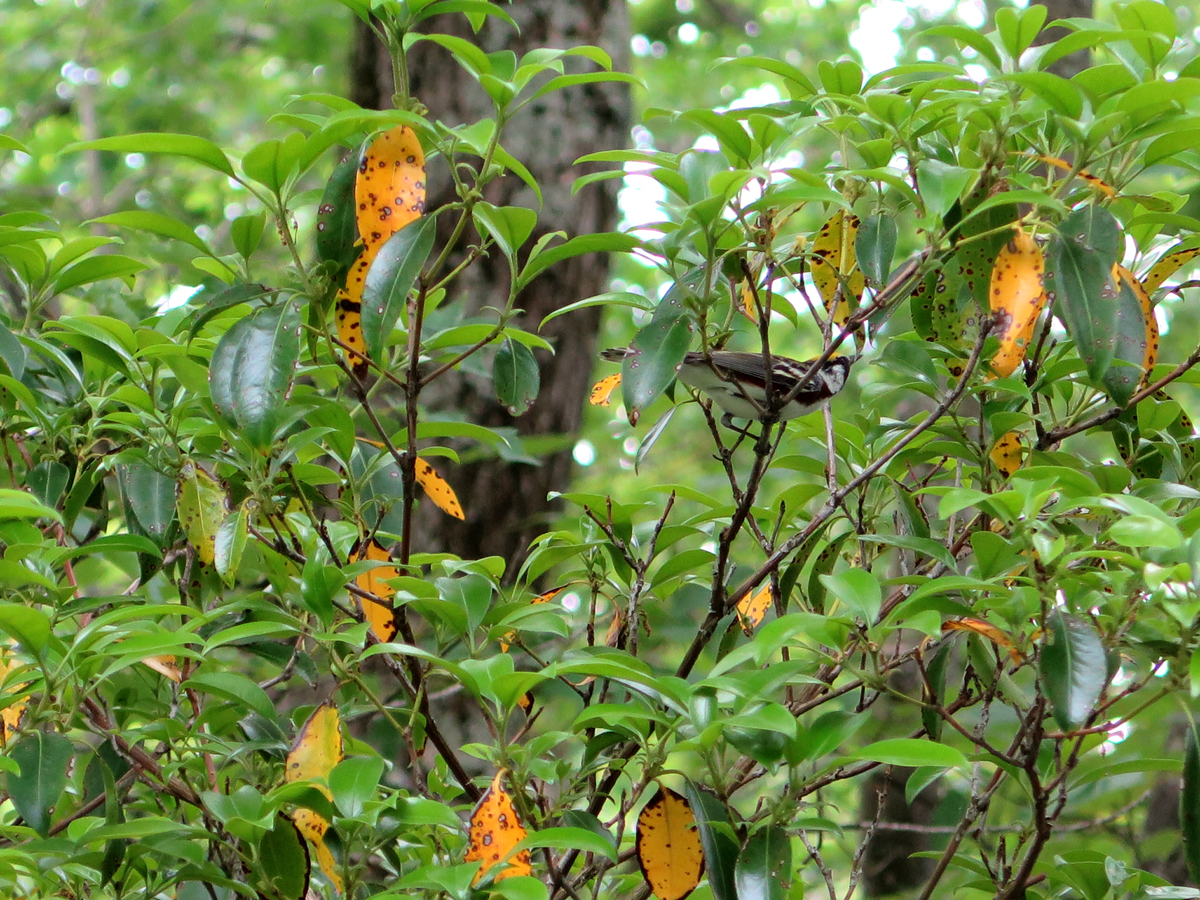
It looks to me that you might have spotted a chestnut-sided warbler… Not that I’m much of a birder–I just happen to have my book here at the kitchen table. Apparently, the brownish-red stripe down its side is a pretty distinctive marking.
I’m looking forward to Mike’s ride report. It’s cool that he agreed to do a guest post.
Thanks, Ry. I didn’t realize until I was writing my post that Mountain Laurel is only in the south and east.
You’re right about the bird. I asked someone on the SNP page, since I have no idea where my bird book has gotten off to.
Love the photos of Mountain laurel. Of course we have it down here in NC/TN/GA and we enjoyed it about two weeks earlier than you did. I guess we are more southern, LOL.
Also, do you have any other suggestions for riding around SNP that you would share? We have some friends going riding there in August and I don’t really know the area to suggest much other than Skyline. 🙂
Lynne, I was surprised to see lots of Mountain Laurel in bloom along the BRP and even down into South Carolina. I guess elevation has as much to do with bloom time as latitude? There are quite a few rhododendrons in bloom, too. Cool to see.
I have lots of suggestions for VA rides. You’ll just have to let me know where they are staying and what kind of roads they like. The GS is great in the switchback roads, but that — lots of switchbacks — gets tiring for big cruisers.