LOVE Captured on Valentine’s Day

While daydreaming about fun warmer weather excursions recently, I came up with an idea for my own little scavenger hunt.

Who doesn’t LOVE a scavenger hunt? Especially if it means getting out on the motorcycle (or in the car; I’m easy on my “rules”).

The tourism folks in the state of Virginia — our motto being Virginia is for Lovers — are behind a push to have LOVE artworks erected throughout the state. I’d seen a couple already, and LOVE the idea, so I thought it would be fun to try and capture pics of each one this year.

Virginia is a big state — on the map, I’m about 3/4 inch SW of Washington, DC — but I think it’s doable. I’ve actually captured three already.

LOVE_map
Click on the map to visit the VA LOVE Web site.


I helped out on a dog transport yesterday. A “transport” is when a rescue needs to get a dog or dogs from point A to point B, usually over a long distance. Along the way, folks volunteer to drive 50- to 100-mile segments. It’s like a big doggie relay.

I was responsible for picking up two dogs in Staunton, VA and taking them to Strasburg, VA. They started off in Ferrum, VA and were headed to Conesus, NY. I believe their previous owner had health issues, which is why they were surrendered.

Anyway… I decided to multi-task on the mini road trip. It was Valentine’s Day, after all, and LOVE was on my mind. Sort of. (We don’t celebrate Valentine’s Day. Only because we both think it’s sorta a contrived holiday, not because there’s any lack of love.)

LOVE_Waynesboro
LOVE in Waynesboro, VA (captured on Valentine’s Day)


I really liked the fishing theme of the Waynesboro piece.

Once I arrived at the site, I got out of the car to snag a few pics. A youngish couple got out of their car and asked me to take a picture of them. Of course, I obliged. They got one of me, too. Then, oddly, said, “Maybe we’ll run into you again.”

I must have given them an odd look, because the guy quickly explained that they were spending their weekend visiting LOVE spots throughout Virginia. That made my heart happy. What a great way to spend Valentine’s weekend, eh?

LOVE_Culpeper
LOVE in Culpeper, VA


Culpeper is about a 30-minute drive SW of Warrenton (my hometown). Hubby and I went there for lunch a couple of weeks ago.

LOVE_Luray
LOVE in Luray, VA


I captured the Luray LOVE sign back in January, while en route to another Staunton-to-Strasburg transport. I’ve only seen three LOVE pieces so far, but the Luray sign is my least favorite. It doesn’t exactly stand out.

I’m actually excited about seeing more, especially since there are some located near family members I don’t often get to see. And there are others in places I wouldn’t normally visit.

There are a couple more LOVE pieces I could have captured yesterday, but they’re along an awesome motorcycle road, so I decided to save them for later. Maybe Hubby can share that LOVE with me. LOL.

Speaking of awesome motorcycle roads, it was sort of torturous to be in the middle of prime motorcycle riding country AND seeing the mountains. I was excited to be out and about, though.

Did you know that Waynesboro is near where Skyline Drive ends and the Blue Ridge Parkway begins? And Strasburg is actually near Front Royal, which is where Skyline Drive begins. I had to go through Front Royal to get home, anyway, so I decided to drive the northern segment of the drive, from Front Royal to US-211 at Thornton Gap.

It was cold, but quite interesting. We had an arctic cold front push through yesterday afternoon, so the skies for most of the day were quite moody, to say the least.

I’ll save the other pics I captured yesterday for my next post.

LOVE_Waynesboro_with_ToadMama


West Virginia Revisited

My friend, Dottie, who just got her motorcycle license earlier this year, has been itching to go for a ride with me. Since my usual riding partner was otherwise engaged with chores, Sunday seemed like a good day to do just that.

IMG_9574Why not take her along on Saturday? Not only did she have other plans, she hasn’t been riding for long, tires easily, and is quite sensitive to cold. So I knew the trek I had in mind on Saturday might just do her in.

Sunday’s weather wasn’t nearly as nice as it was on Saturday. Mainly because it was really windy. But it was still pretty.

I thought the temperature was just right, but Dottie was freezing. She still hasn’t figured out her proper gear combination. It takes experience for a person to know what to wear in different conditions to keep oneself comfortable. But she toughed it out, and we had a pleasant day.

When it came time to plan the route, I figured I’d take her outside of her usual riding zone and head over into West Virginia. I hadn’t been over there on my bike since early May. And even that was just a brief visit. I miss my old haunts.

We didn’t go far into West Virginia, but I did enjoy seeing that little corner of the George Washington National Forest again. But I’m getting ahead of myself.

Wardensville, West Virginia was our first stop.

IMG_9573
Star Mercantile


There’s a funky little country restaurant there — the Star Mercantile — that I like and thought Dottie might enjoy.

IMG_9563


It’s cute, kitschy, and their food is decent. The waitress can be sorta grumpy, but that’s part of the charm.

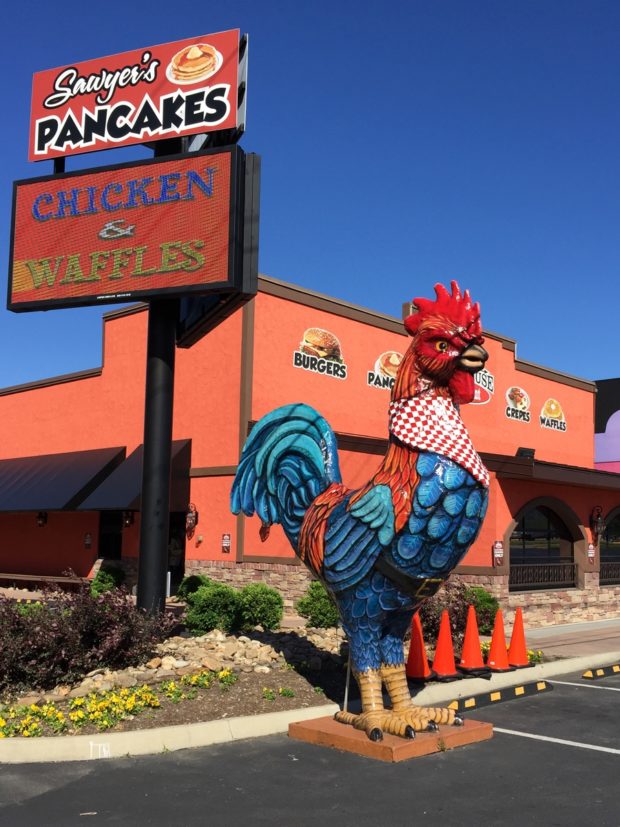
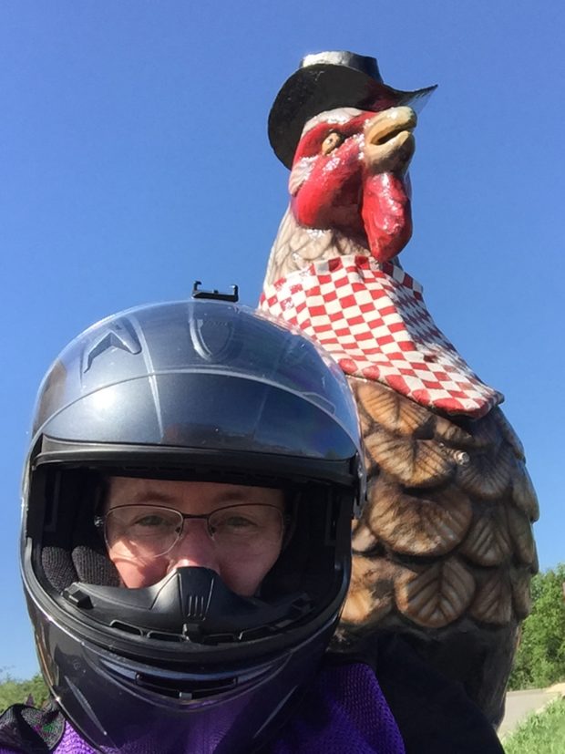
I was excited to see some new artsy additions in town. Like this giant rooster, across the street from the restaurant.

IMG_9571
Giant Rooster


And this interesting “mural” a couple blocks west of the Star Mercantile. Upon closer inspection, I was delighted to see it was made out of old bottle-caps.

IMG_9569
Bottle-cap Art


I didn’t know what the heck it was supposed to be — honestly, I thought from afar that it was a pig — but found out later from Dottie’s daughter, Ashley, that it mimics The Son of Man, a famous Rene Magritte painting.

Wardensville getting artsy? Huh.

After a nice, long lunch so Dottie could warm up, we ventured into the George Washington National Forest via Trout Run Road.

Trout Pond
Trout Pond


We stopped for a quick peek at Trout Pond, which was still a bit colorful.

And then we continued through the forest. My memory isn’t as good as I thought. We did a bit of circling before we finally made it to Wolf Gap. But at least they were scenic circles.

DSCN0441
Near Lost River, West Virginia


DSCN0440
Near Lost River, West Virginia


DSCN0442
Near Lost River, West Virginia


Dottie didn’t enjoy the forest roads nearly as much as I did. They are narrow, have no shoulders or no shoulders (drop-offs), were a bit covered with fallen leaves, and the bright sun through the trees made it hard to see.


DSCN0444
Wolf Gap


In addition to being where the West Virginia/Virginia borders meet, there’s an overlook, which I have never visited, where you can see a mountain named Big Schloss.

After that, we headed home.

I did stop outside of Flint Hill, VA, on Ben Venue Road, to capture this image of the old slave quarters, rare because they are made of brick.


IMG_9583
Former slave quarters on Ben Venue Road.


What felt like a brief ride to me — I logged 175-miles — may have been Dottie’s first 200+-mile day. She lives about 20 miles from me and we met at my house, so she covered a few more miles than I did.

It was nice being back in West Virginia, but it has left me itching for more. Hopefully, Hubby and I will get a chance to head out that way before winter really settles in. Fingers crossed…

A Bold Adventure

DSCN0364
Bold Rock Ride

This past weekend I was supposed to go to the beach with my girlfriend, Diana, for a three-day weekend. But work has been a bit crazy, and I couldn’t get off early on Friday, which would have meant for a very late arrival. Since she had to be home relatively early on Sunday, it would have made for a severely compacted weekend. And we only get together once a year. So we decided to re-schedule for mid-November.

That husband of mine had already made plans to work in his sorely neglected workshop. Which meant I had a completely free weekend.

You know what they say, when life gives you apples, make apple cider. Or something like that…

Anyhoo, a couple of weeks ago, I plotted a route for a motorcycle ride that looped south and west through Virginia. My mapping software said it would take about eight hours, not including stops. That really means about 10 hours, since you all know I like to stop.

Temps were a bit colder the weekend we’d been considering that route, so we decided to put it on hold until a later, more temperate date.

Having suddenly found myself with nothing else to do this past weekend — yay, me! — I figured Saturday was as good a day as any to do that ride. Especially since temps were forecast to be in the upper 60s/low 70s and the foliage was looking quite nice. I did shorten the route a bit, though, by opting for the most-direct route to my first stop, the Bold Rock Cidery in Nellysford, Virginia.

overview map
Bold Rock Ride Overview Map


Don’t worry, I wasn’t going there for samples, I’d just always wanted to see the place because I knew it was in what appeared to be a pretty location.

I was right. It was gorgeous.

DSCN0342
Maple Trees Across from Cidery’s Parking Lot


IMG_9510
To-go Bottle


bold rock collage
Bold Rock Cidery Collage (click for bigger view)

Apparently Rockfish Valley Highway is where all the cool brewers/wineries are located. In addition to Bold Rock, there were several smaller establishments I’d never heard of along with the Starr Hill Brewery and Devil’s Backbone Brewing Company.

Alas, I wasn’t there to visit a bunch of breweries, I was there to ride. And that’s what I did.

From the cidery, I continued south on VA-151, which itself was a beautiful road, and then headed east on Jonesboro Road, CR-666, to VA-56, Crabtree Falls Highway. As it turns out, there’s actually a waterfall — Crabtree Falls — along that road, which follows the Tye River through the George Washington National Forest, so it’s sorta heavily traveled. Um, keep in mind “heavy” is a completely relative term when you’re riding in rural areas. Unfortunately there was lots of loose gravel. Even a special warning sign for motorcyclists. But that was okay, I wanted to take my time and enjoy the lovely mountainous, many-hued, forested scenery anyway.

I wasn’t dressed for hiking, so I rode right on past the jam-packed falls trailhead parking lot. I did stop a bit later, however, to snag a few pics.

IMG_9519
Looking East on VA-56


IMG_9517
Many trees were past peak color, but there was still lots to see.


IMG_9513
Looking west on VA-56, a road I MUST revisit.


I think I was still southeast of Vesuvius, VA at that point (how’s that for a town name?), but I’m not sure. I do believe it was still VA-56, though.

As I rested for a bit (and took pictures) a group of about 20 Porsches zoomed past, followed a few minutes later, by a smaller group of Mazda Miatas. I guess it really is a popular road, and for good reason.

Sorry to brag, but I have to say, I know how to pick good motorcycle roads. Another splendid stretch was VA-39. The following pics were captured near Goshen Pass, southeast of the town of Goshen, VA.


IMG_9532
Fun Road


IMG_9534
Lovely Scenery


DSCN0377
The Maury River


I couldn’t linger long. But I will definitely visit that spot again one day.

From there, I continued west on VA-39 to CR-678, Indian Draft Road. That’s what it was called at the southern end anyway. County roads like that tend to change names, and sometimes even numbers, when they cross county lines or other major landmarks. It makes wayfinding a bit more challenging, but that’s all part of the adventure.

I think CR-678 was the best road yet as far as scenery goes. It was stunning. It ran along the Cowpasture River for a ways and then, at some point, it became Bullpasture River Road. Perhaps near Williamsville, which is where the Cowpasture River forked off to the right. Then the road ran alongside the Bullpasture River for a time.

I literally laughed out loud when I saw the sign proclaiming that I was on Bullpasture River Road. And I said to myself, “Next sign you see, you’ve got to stop for a pic.”

In a very weird twist of fate, this is the next sign I saw…

Bullpasture River Road and Fuzzys Path


What are the odds that the very next signpost would be at the intersection with Fuzzys Path? I knew my pal, Rachael (FuzzyGalore), would get a kick out of that one.

I LOVED that road. Really. It’s my favorite kind of road (what I call a putt-putt road). It winds through a beautiful valley dotted with farms and flanked by mountains. All 27+ miles of CR-678 were pure ToadMama heaven.

I’ll share more pics after I’ve gone through them. Here are a few for now to tantalize your virtual ride-along imagination.

DSCN0390
Toward the southern end when it was still Indian Draft Road.


DSCN0395
Slow and steady was the perfect pace for this narrow, winding path.


For the record, “slow” was about 45 m.p.h. This isn’t the sort of road on which you want to be zipping along, carving turns. County roads aren’t always equipped with warning signs, so you need to be a bit cautious as the sharp curves can really sneak up on you. Trust me on that one, okay?


DSCN0393
Along Bullpasture River Road


DSCN0403
Cows along Bullpasture River Road.


DSCN0406
Pretty church and barn near the northern end of Bullpasture River Road.


DSCN0414
Quilt barn near the northern end of Bullpasture River Road.


It was starting to get late and I was still several hours from home, so I had to get rolling. Lucky for me US-250, the Highland Turnpike, was next. It’s a fast, super-sweet section of changing-elevation twisties that are to be savored. Quickly. I did say “fast,” right? LOL.

Check the road out with Google Street View. It is NOT a putt-putt road.

Lucky for me, US-250 runs through the national forest, so I got to stop at Fort Edward Johnson for a potty break. The fabulous road continued…


DSCN0418
Looking west from the parking lot at Fort Edward Johnson.


The light was fading fast, so off I went again.

After that, I only stopped one time somewhere along VA-42 south of Harrisonburg to check my text messages (Hubby checking in)…

DSCN0425
See my shadow in the middle of the frame?


…and then I stopped in Luray for a very quick dinner. I took my good ole time crossing Thornton Gap in the cold darkness — sharp, descending-radius curves — and made it home right around 8:00 p.m., a mere 318 miles and roughly 10 hours since leaving the house that morning.

It was such an amazing day.

It’s been a long time since I’ve set off on a long, solo adventure like that. Some people think I am bold and/or brave for doing trips like that alone. I don’t agree. I think I’m normal. Relatively speaking again.

I can’t imagine NOT wanting to go for rides like that, alone or otherwise. There’s so much more of Virginia and the surrounding states that I/we still have yet to see.

I’m already looking forward to the next long, exploratory journey.

Blue Ridge Lunch

It’s Fall. My favorite time of year. The air is cool and the landscape is colorful. Notice I didn’t just say trees? The grasses and other ground plants change, too, which just makes for an even more-dramatic landscape.

Have I mentioned that I love Fall?

I planned a ride for Saturday. Hubby planned yesterday’s ride.

He’d mentioned on Friday that he wanted to go to Flint Hill for brunch on Sunday at Griffin Tavern and Restaurant, our go-to restaurant in that area.

I knew I wanted to go to Syria, which isn’t too far from Sperryville, so I thought we could eat at the Thornton River Grille. It’s got a 4-star Yelp! rating and we’ve never eaten there, so I figured it was about time.

Unfortunately, I forgot to factor in the leaf peepers. I also didn’t consider the Graves’ Mountain Apple Harvest Festival in Syria. (Only because I didn’t know of it.) We were mired in traffic in Syria for a bit as a result. Sperryville is very close to Shenandoah National Park, and was quite congested. And the Thornton River Grille was way too crowded (there was at least a 30-minute wait for a table), so we went to nearby Headmaster’s Pub, which has a 3.5-star Yelp! rating.

It was busy, too, but much smaller, so we thought we’d be okay. The food was good, but we had to wait a REALLY long time (about an hour after arriving) for our meal. Since we’d gotten so delayed, we nixed the second half of the route I’d planned, but did take the scenic route home.

Anyway… it was still a nice ride. Here are my favorite pics from around Syria, a lovely little spot just outside of Shenandoah National Park (SNP). For those who don’t know, SNP is the home of Skyline Drive, which is always extra-crowded at this time of year.

syria_va
CR-643/Etlan Road in-between Syria and Etlan, VA


DSCN0294
CR-643/Etlan Road in-between Syria and Etlan, VA


DSCN0298
CR-643/Etlan Road in-between Syria and Etlan, VA


DSCN0297
CR-643/Etlan Road in-between Syria and Etlan, VA

See why I wanted to go to Syria? It really is a pretty spot, especially in the Fall.

DSCN0300
VA-231/F.T. Valley Road, headed north toward Sperryille, VA


DSCN0317
Unknown location, but very pretty.

Sorry, but I can’t remember where that shot was taken. At one point, I started snapping pics with my point-and-shoot while riding.

Those pics are all from Saturday.

On Sunday, Hubby took the lead, so I decided to wear my helmet cam. Lucky for me, I’d remembered to charge the battery (for a change).

Here’s a slideshow for you. I added music, which you may or may not like, so be sure to check your volume before clicking play.


If I’m being honest, his route was nicer. Plus, we got to stop at the Griffin Tavern in Flint Hill for brunch.

Now I need to get rolling on today’s new, long, solo adventure.

All Good Things Must Come to an End

Who knew our recent weekend road trip would be the LAST time Hubby and I rode together on our twin bikes?

Not me. Although, if I had thought about it, I probably would have known. Since Hubby had been talking about that Victory for quite some time. (If you have no idea what I’m talking about, you probably missed this post.)

Anyways… it dawned on me this morning that I never finished my trip report. So here’s the Sunday re-cap.

First, we woke up. LOL. (Why, yes, I do crack myself up.)

IMG_8556
Overcast… lingering clouds from a storm that passed during the night.


That was the sight that greeted me when I left the room to snag some coffees.

It had rained during the night and our bikes were soaked. Good thing we both travel with micro-fiber towels, which I used to dry the bikes off later. But first things were first… COFFEE.

IMG_8548
Smallest coffee cups EVER.


Yes, I know not to expect much of the free continental breakfast offered by chain hotels. But those are seriously the smallest cup of coffee I have ever seen. I had no idea Styrofoam espresso cups were available in America.

For sake of comparison, here’s the hotel cup next to small and large cups we got with our Hardee’s breakfast.

See how little?
See how little?


Here’s a map of the route I plotted. It’s 304 miles and should take 6.5 hours, not including stops.

Day 3_princeton-home
Princeton, WV to Warrenton, VA


We lingered a bit after breakfast, giving the roads plenty of time to dry off a bit. And then we were off.

Excited Travelers
Excited Travelers


Can you tell we were both looking forward to another fabulous day of riding?

A mere 18 miles outside of Princeton, we hopped on US-219, which is one of many fabulous roads in that area. Really, US-219 through WV is something every motorcyclist should experience at least one in their life. It may not be the Italian or Swiss Alps, but it’s sweet. Trust me.

As we rode south, approaching Lewisburg, WV, we were amazed at the sheer number of fifth-wheel trailers that were passing us. Headed in the opposite direction, of course. We were both quite thankful for that. US-219 is full of twisties. Getting stuck behind even one mammoth fifth-wheel-in-tow would have plain SUCKED.

Here are some pics from our first stop along US-219.

DSCN3289
Bucolic Farmland


DSCN3290
Wildflower Stump


DSCN3291
Sweet Road (much of 219 is like this)


DSCN3294
Aren’t we cute? Notice the RV rounding that curve.


DSCN3292
Hubby and the Twins


DSCN3302
Old Barn (one of my favorite pics)


We sure picked a pretty spot for that break. After a brief rest, we continued north. It was only when we reached Lewisburg that we realized it is home of the West Virginia State Fair, which I’m pretty sure is where the RVs were coming from. We did encounter some north-bound RVs in and around Lewisburg, but, lucky for us, they all seemed to get onto I-64 just outside of town.

Inevitably, we caught up to a few further north on US-219. But that just gave us another excuse to stop.

DSCN3296
US-219


I’m being completely truthful when I say much of US-219 in West Virginia looks like this. It’s a great road. So great, neither of us minded it being a repeat road for us. In fact, neither of us would mind repeating it again. Soon.

IMG_8564
A spot along US-219 in West Virginia (looking south)


IMG_8563
A spot along US-219 in West Virginia (looking north).


If you’ve been lucky enough to enjoy that route, I can’t imagine you’d disagree.

Continuing north, we reached Marlinton, WV, which is where we left US-219 to head east. We could have continued on US-219, but I wanted to see the National Radio Astronomy Observatory in Green Bank, WV, a place I’ve been meaning to see for years.

But first, look at this cute little country store we happened upon in Dunmore, WV, appropriately named the Dunmore Country Mart and Bakery.

IMG_8574
Hubby waiting patiently.


Not only did they have a potty, which I really needed at that point, Hubby discovered that they had home-made treats.

IMG_8566
Chocolate-covered Cannoli


I didn’t want Hubby to feel bad, so I selected something for myself, too.

IMG_8569
Deep-fried cheesecake? Yes, please.


I’ve said this here before… I’ll never be a skinny chick.

DSCN3303
Dunmore, West Virginia


The skies were looking a bit ominous, so off we rode, reaching Green Bank about 20 or so minutes later.

DSCN3312
Really big astronomical telescope.


I’d always pictured one telescope on a hill-top. There was more than one telescope-looking thing, but they weren’t all that big, and they were on the valley floor.

DSCN3310
Other apparatus.


DSCN3313
Mike and Me


Again, since the skies were threatening, we didn’t linger long.

A short distance north of there, I HAD to stop and get a picture of this.

DSCN3315
Quilt Barn (another favorite capture)


I’d only ever seen quilt barns in Kentucky, as far as I can remember, but noticed quite a few during the course of the weekend. This one was close to the road AND there was a place to pull off the road. (Wanna know more about barn quilts)?

Notice the dark sky? We still had a lot of ground to cover. We weren’t so much worried about getting wet — we DO carry rain gear — we just knew that I’d saved Mike’s favorite road for last, and we wanted to get there before it rained.

But, before we got to that road, which is US-33 by the way, we rode a fabulous piece of US-250, another repeat road for us, from a ways west of and through Monterey, Virginia, across another set of mountains to McDowell, Virginia.

Right before this next shot was taken, we saw a young black bear running along the left hand shoulder of the road. We slowed down enough to get a good look at the little guy (or girl), but there was no safe place to pull off. So, as excited as we both were to see the bear, we opted to play it safe and continue.

DSCN3318
US-250 in the George Washington National Forest


Once we reached McDowell, VA, we turned left onto VA-654, which is labeled on my map as Doe Hill Road. We followed it north through a stunningly picturesque and hilly valley. At the WV/VA state line, the road becomes WV-23. The name changes to WV-25 near and through Dahmer, and then becomes and stays WV-21 near, through, and beyond Sugar Grove. The whole route paralleled the George Washington National Forest until beyond Sugar Grove, where it entered the forest.

Amazing scenery. For serious. I MUST return. Must, must, must.

We finally reached Brandywine, WV, where we’d planned on getting gas. The only pumps in tow were out of order and we were pretty low. Our choices were to ride 12 miles to Franklin, WV and double back — Mike’s favorite road is just east of Brandywine — or, traverse the pass with what we had, hoping we made it to the other side.

DSCN3322
Closest gas station was 12 miles away in the wrong direction.


We made it. Barely. According to Hubby’s on-board computer, he had 3 more miles to ride. I think mine said 12.

Once we filled up, we continued through Harrisonburg with home on our minds.

We did stop at this cute little restaurant in New Market, VA to eat and rest.

southern_kitchen
The Southern Kitchen Restaurant in New Market, VA


That stretch of US-33 was good, but disappointing as traffic was pretty heavy when we finally arrived. I did a post, with video, about that road last year if you’re curious. I shot video this time, too, but it probably isn’t worth editing down to share. We’ll see.

By the time we got home, we were both pooped. We’d covered 679 miles since Friday. Many of those miles were on technical roads.

We split a big, ice-cold beer — is there anything as refreshing as that after a long ride? — and then I headed off to retrieve our girls from the pet sitter.

I know this sounds repetitive, but it really was an awesome weekend. I hope you enjoyed reading about the end.

If you’re ever in the area and want a guided tour, let me know. It’ll require some advance planning, but it sure would be fun sharing my pretty little corner of the planet with y’all.

Me and Hubby
Me and Hubby

My Latest Blonde Moment

IMG_8655 copyMy friend Dottie and I went for a ride on Sunday.

The weather was perfect. Especially for a Sunday in late August. It was in the low- to -mid-seventies (Fahrenheit, which is 21-24 C). The skies were blue, too, with lots of clouds and a very low ceiling, but no threat of rain.

We were happy ladies. At first…

The total route was about 140 miles. We started in the foothills then, since Dottie had never been before, decided to do a piece of Skyline Drive.

Here’s a link to the Google map of the route (Dottie joined at point B). We were traveling in a clockwise direction.

Dottie has had her license for less than a year. She hasn’t done any overnights yet and tends to ride on fair-weather days. Which is fine, except she hasn’t learned how quickly the weather can turn and, as a result, that she should make sure she has appropriate layers along.

I don’t get cold easily. In fact, I think mid-60s weather is perfect for riding. To me, there’s nothing worse than sweating under my gear. Ugh.

Dottie, on the other hand, has fibromyalgia and is particularly sensitive to cold.

map


ToadMama
ToadMama


In the foothills, we were at about an average 600-foot elevation. As we headed west, we started to climb. The Swift Run Gap Entrance Station is at about 2,000 feet. At that point, temps were in the mid- to upper-60s.  Dottie was already cold. We stopped just outside of the entrance so I could put my wind liner in, because I knew it would be getting colder. That’s when Dottie discovered that she didn’t have her wind liner along, and no extra clothes. I checked my bags, but didn’t have any extra for her either.

She just decided to tough it out, and off we went. We headed north on the drive, which quickly climbed to about 2,800 feet. The higher we got, the lower the temps. And remember that low cloud ceiling I mentioned? We hit it. 🙂

Into the Clouds
Into the Clouds


IMG_2765
Signage


I’ve said before that Skyline Drive isn’t my favorite road. That’s mainly because of the strictly enforced 35 MPH speed limit. I know why the limit is low — critters! — but that doesn’t mean I have to like it.

IMG_2771
Low Clouds and Wildflowers


I do, however, love the views.

IMG_2777
Wildflowers


I’m a mountain girl in general. And I like dramatic skies, too. So I was quite content. Poor Dottie was fuh-fuh-fuh-freeezzzzing! Temps were in the upper 50s by then. Actually, it averaged 59 F (15 C) most of the time we were on the drive (my bike has a thermometer).

The Big Meadows visitor center was only about five miles away from the overlook where we’d stopped, so off we went. We decided to grab some lunch — suprisingly good chili for me, soup, a hot dog, and coffee for DG — and putter around a bit before covering the next 20 miles to Thornton Gap.

Shortly after we left, I gained new appreciation for that painfully low speed limit when a big-ass Whitetailed Deer (doe) jumped from out of nowhere right into the middle of the road. About 30 feet or so in front of me. I only had time to tap my brake before she was gone. Luckily, there were no little ones traveling with her.

We stopped at the Mary’s Rock Overlook, too, since DG had never been to Skyline Drive before. Not even by car.

IMG_2779
View from the Mary’s Rock Overlook


IMG_2792
A thoroughly chilled DG, trying to look happy.


IMG_2794
View from the Mary’s Rock Overlook


Soon enough we were at the Thornton Gap exit/entrance and headed back down into the foothills. It wasn’t long before I started feeling the heat. We stopped in Little Washington so I could get rid of my liner. Have I told you yet how much I love my summer-weight mesh jacket?

The temperature in Little Washington was 76 F (24.5 C). Quite a difference, eh? DG was loving it.

The town’s name is really Washington, but, because we’re so close to Washington, DC, everyone calls it “little.” It’s a super-cute village, home to the infamous Inn at Little Washington, a restaurant where I will likely never have an opportunity to dine because it’s world-renowned and pricey. I’ve heard it’s completely worth it, though.

IMG_2795
Part of the famous Inn


IMG_2797
Looking west down Main Street


IMG_2798
Love that color!


IMG_2800
Flowers


IMG_8672 copy
What’s wrong with this picture?


After soaking up some heat, DG and I said our farewells and went our separate ways. (She lives about 30 minutes outside of town and was READY to get home to her blankets, poor thing.)

It wasn’t until I’d gotten home that I noticed my “driver’s side” pannier (hard saddlebag) was missing.

What!?! Damn, damn, damn!

Those things are not cheap. How could I NOT feel or hear the dang thing fall off while riding?  It’s not like someone could have taken it off during the ride, so it must have fallen off, right?

I was NOT happy.

After telling Hubby about it, I was on my way to the car to backtrack and look for my fallen luggage when something in the garage caught my eye.

My pannier. Sitting on the floor of the garage.

It hadn’t fallen off after all. It had been sitting there the whole time. (Hubby had removed it during the week when he replaced my tire.)

I’m not sure what was greater, my relief to see that it wasn’t lost, or my amazement that I had ridden ALL DAY LONG, mounting/dismounting multiple times, taking pictures of the bike, and even looking through all of my bags for warm gear for DG, without once noticing it was missing.

Wow.

I mean, really. How could I not notice that!?! DG hadn’t commented either.

Talk about being unobservant.

If you look at the pics of my bike, you can see the bag is clearly not attached. DOH.

A blonde moment for sure.

But it didn’t dampen a splendid day. LOSING that bag would have, for sure.