I mentioned in my Whole Lotta LOVE post that there’s no quick or easy way to get to Virginia’s Eastern Shore from here.
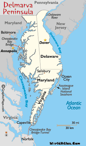
I’m a lover of maps, so here’s a quick geography lesson for you… Virginia’s Eastern Shore is at the southern tip of the Delmarva Peninsula.
Without getting too technical, Delmarva is essentially a large peninsula occupied by most of Delaware as well as portions of Maryland and Virginia. That part of Maryland is simply known in these parts — at least by people like me who grew up in Maryland — as “The Eastern Shore,” not Maryland’s Eastern Shore. The Chesapeake Bay separates the peninsula from the mainland.
From my house, to reach any point on the peninsula, I’d either have to go north and east into Maryland to cross the Bay Bridge near Annapolis or south and east through Hampton Roads/Tidewater Virginia to cross the Bay Bridge-Tunnel.
Of course, if my destination is the northern portion of the peninsula, I’d head up I-95 into the far northern portion of Maryland and head south across the Chesapeake & Delaware Canal, the digging of which technically made Delmarva an island. Oh wait, I said I wasn’t going to get too technical, didn’t I?
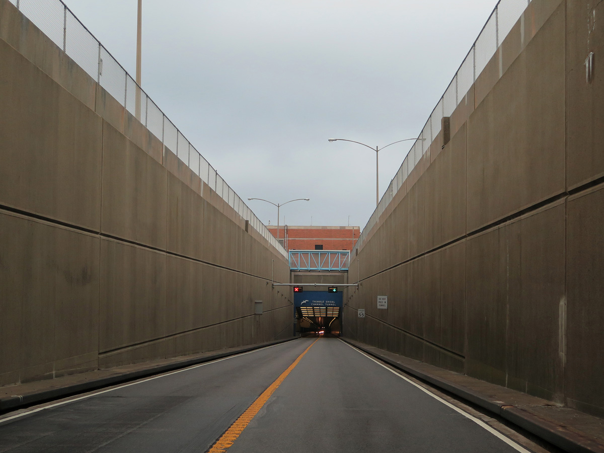
Anyway… I elected to take the southern route to reach the peninsula, which made my trip pretty much a counter-clockwise loop. After capturing all of the LOVEworks in Virginia Beach, Newport News, and Norfolk, I headed north across the mouth of the bay via the Chesapeake Bay Bridge-Tunnel (CBBT), “the 17-mile link between Virginia Beach/Norfolk and Virginia’s Eastern Shore.”
Crossing isn’t cheap. The fee schedule is a bit complicated, so let’s just say it’s $13 for a car (or motorcycle) to cross off peak. Each way. Unless your return trip happens within 24 hours, then it’s only $5 to return, making it $18 round-trip.
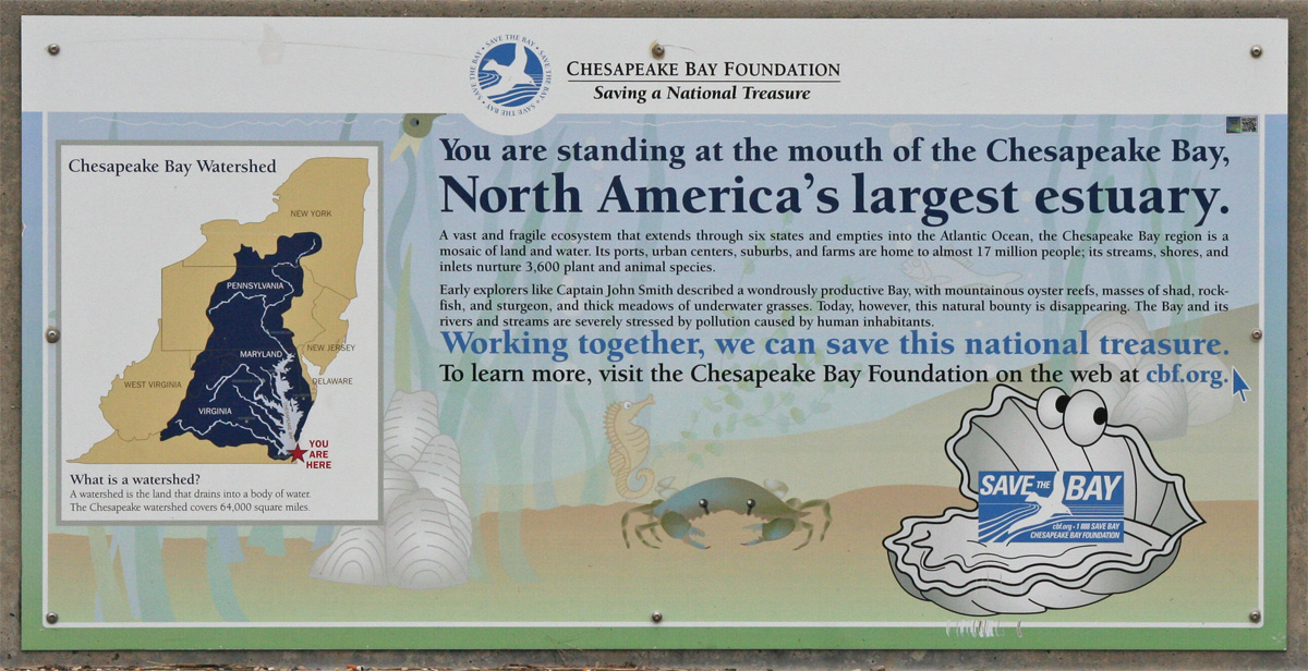
I guess that’s not horrible, considering you get to drive across the mouth of North America’s largest estuary.

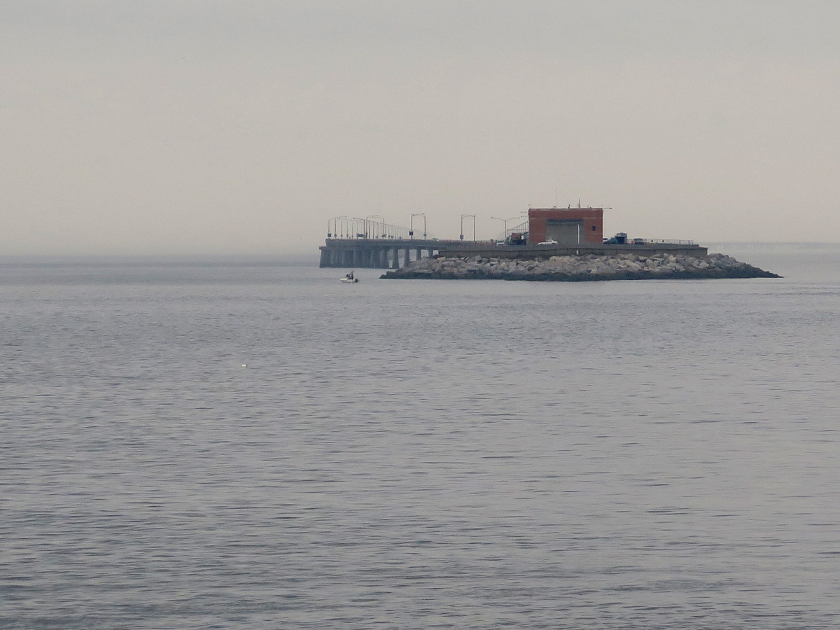
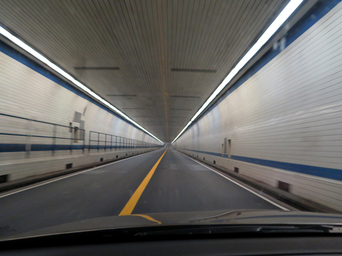
As explained on the CBBT’s website, “From shore to shore, the Bridge-Tunnel measures 17.6 miles (28.4 km) and is considered the world’s largest bridge-tunnel complex. Construction of the span required undertaking a project of more than 12 miles of low-level trestle, two 1-mile tunnels, two bridges, almost 2 miles of causeway, four man-made islands and 5-1/2 miles of approach roads, totaling 23 miles.”
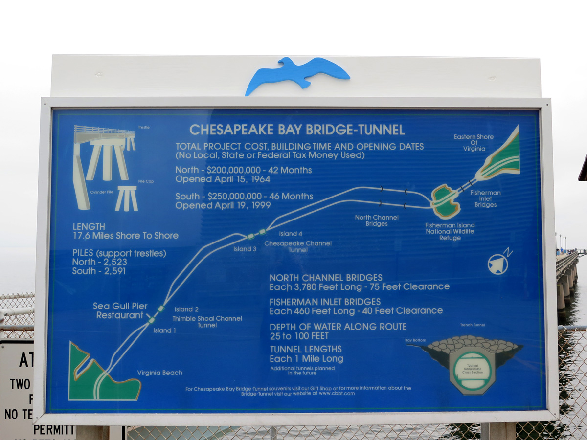
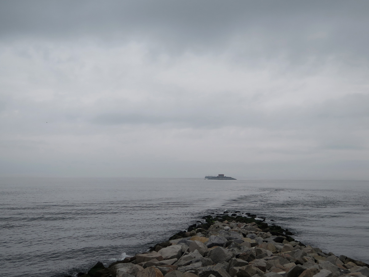
On the southernmost of the four man-made islands (Island #1), 3-1/2 miles from Virginia Beach, there’s a rest area where travelers can stop, stretch, and gawk. You can also grab a bite to eat, fish (there’s a 625-foot fishing pier), watch birds and/or boats/ships, or just take in the natural beauty and sounds of the Chesapeake Bay. The tunnel leading from there to Island #2 goes under the channel that Navy vessels use regularly. So if you’re lucky, you could actually watch an aircraft carrier, submarine, and/or other ships and boats pass out to sea. Wouldn’t THAT be cool?
Traffic was very light, so I was able to capture pics during my crossing without risking life and limb. Sorry, but the weather wasn’t great for pictures.

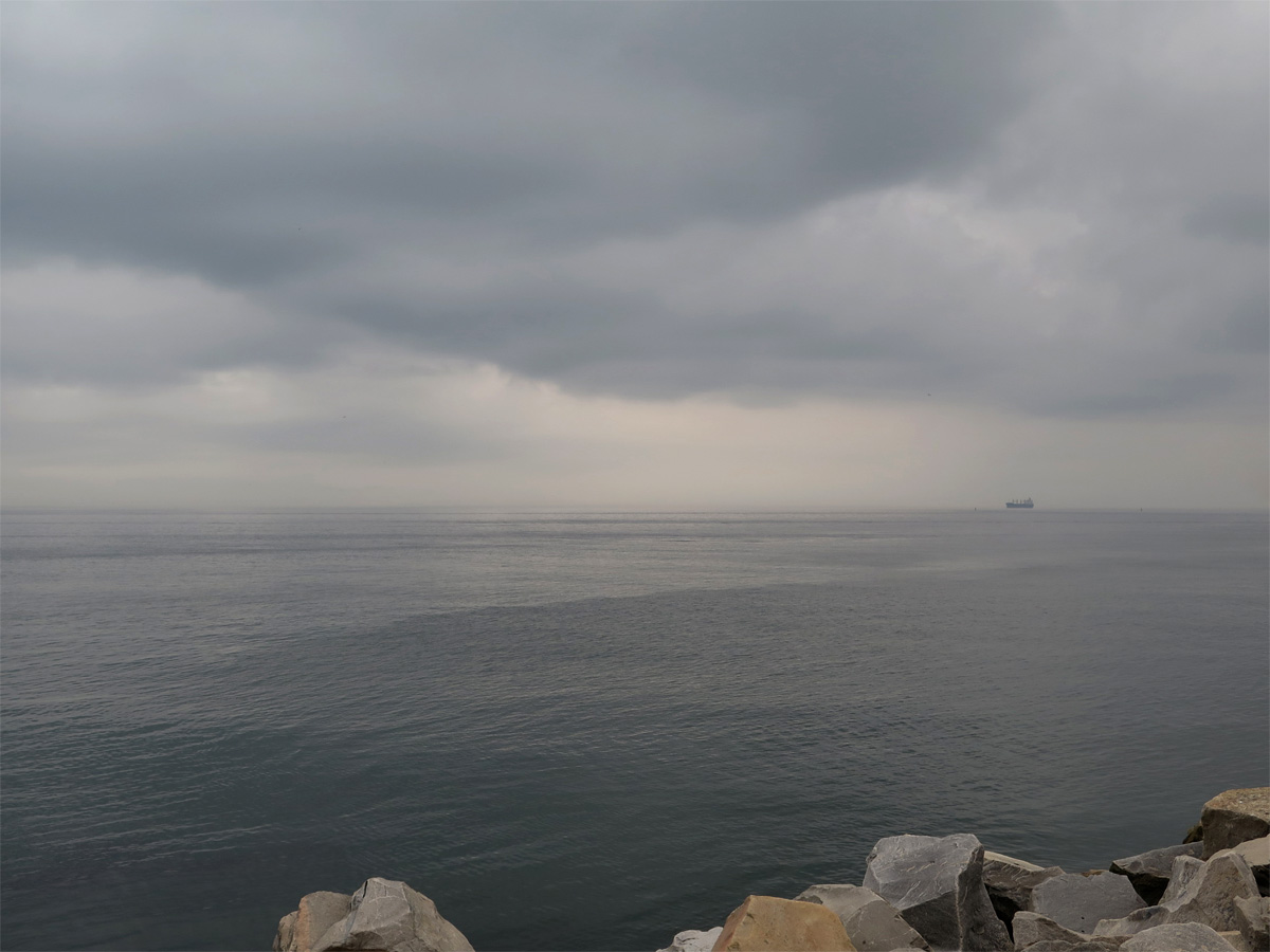
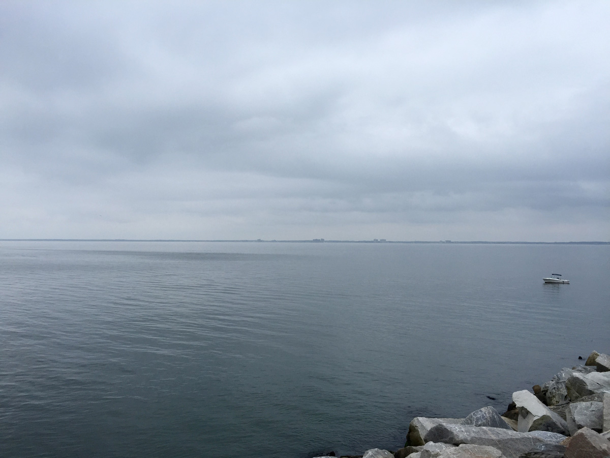
I was surprised to see how smooth the water was, especially considering that storms were definitely nearby and getting closer with every passing second. I’ve been on the bridge before when seas were so rough that waves were splashing up onto the bridge deck through the storm drains/grates.

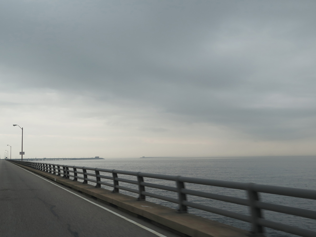
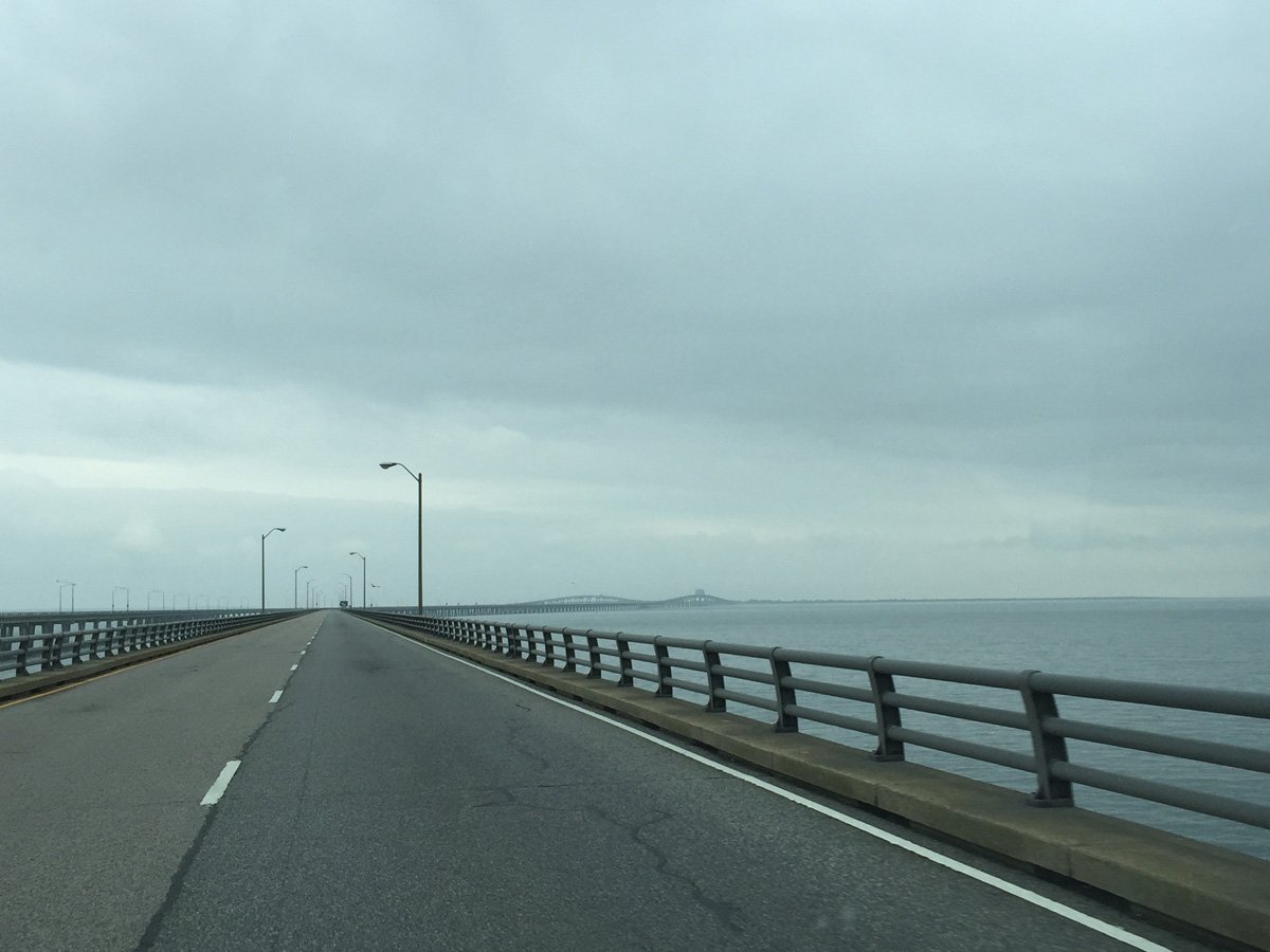
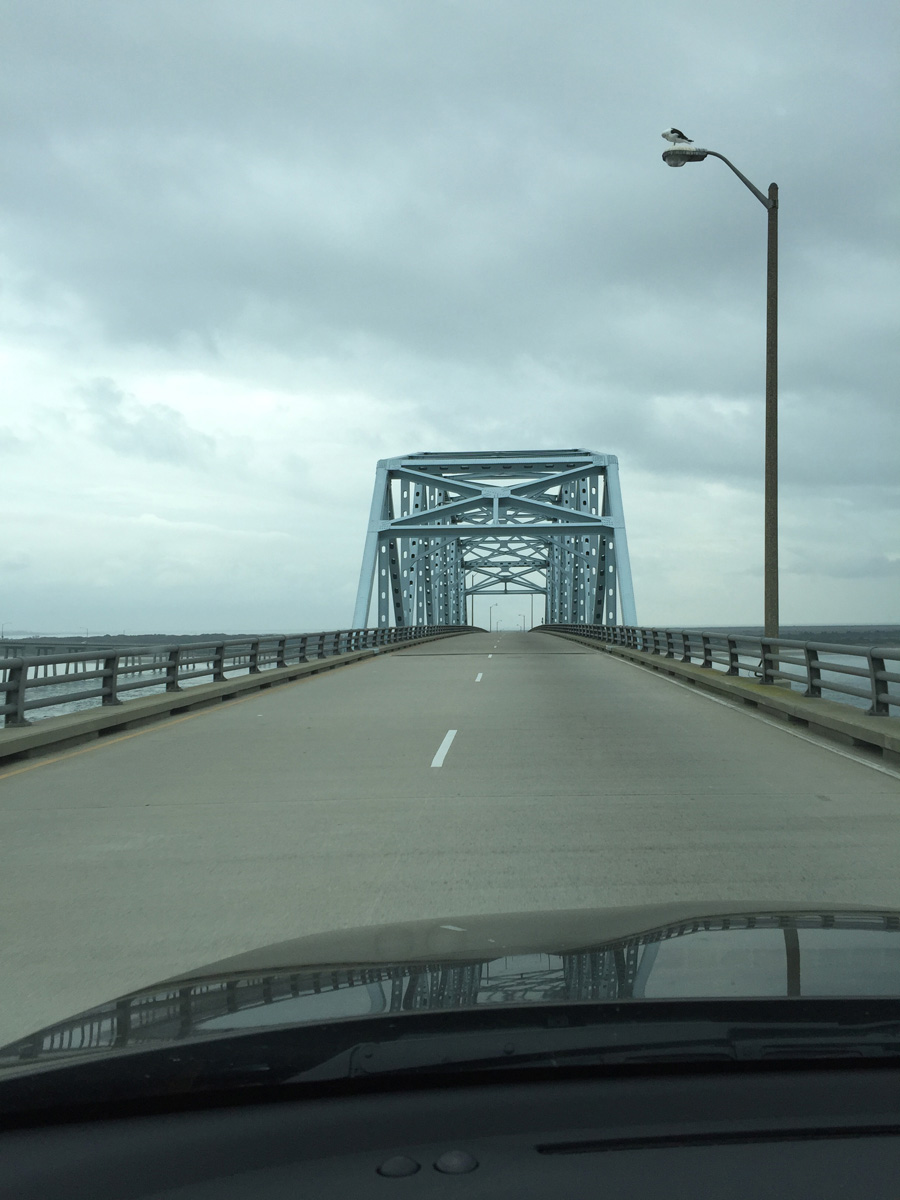
It’s really a shame that it was so foggy and cloudy during my crossing. Imagine how pretty it would be at sunrise and/or sunset.
The Virginian Pilot featured a great multimedia piece in April 2014, When Men Split the Sea, all about the building of the bridge-tunnel.
Here’s a brief video from the History Channel for those of you less-inclined or too pressed for time to read that long article:
It really is a different world on Virginia’s Eastern Shore when compared to areas west of the Chesapeake Bay.
Overview map of Virginia’s Eastern Shore
(note the odd names)

In future posts, I’ll share some images and pics from Cape Charles at the southern end and Chincoteague at the northern end.