The Beach at Daybreak

Thanks to the alarm on my phone, I was able to get out of bed before sunrise on Saturday. I never use an electronic alarm at home, I have two canine alarms.

Neptune was just as lovely in the morning light as I thought he would be. I’d figured the sky would make a nice backdrop for him.

IMG_0138
Neptune at Daybreak

I took several shots, naturally. The one below would be my favorite if it weren’t for the playground equipment in the lower left-hand corner. If you want a closer look, just click on any of these images and a bigger version will open.

IMG_0142
Neptune from Another Angle

As for the sunrise, I captured a bunch of sunrise images, too. Not every frame I captured is worthy of sharing.

None of my followers come to mind when I say this… people who routinely share every single frame they capture make me crazy.

IMG_0149
Cloudy Morning

It was quite cloudy that morning (Saturday, November 7). Clouds can be good and bad. Too many, and the sunlight is obscured. I like some clouds because I think it makes the sky more interesting.

IMG_0156_SOC
Sunrise, Straight Out of Camera (SOC)

I don’t always edit (aka PhotoShop) my pics beyond re-sizing before posting. With sunrises/sunsets over water or some other flat horizon, I usually have to. Because no matter how hard I try, I can almost never get the horizon level enough.

I mention editing, because it’s easy to make a good picture look better with image editing software, as shown below, using the same image as shown above, adjusted for light.

IMG_0156_DK
Sunrise, Adjusted for Light

Sometimes, I’ll adjust for composition, too. Below is the same image again, cropped so the sun is in the right third of the frame and the reflection of the sun on the water is in the lower right-hand quadrant.

IMG_0156_DK+CR
Same Image, Cropped

Why am I telling you this? So you’ll understand that when I say an image is straight out of camera or SOC, it means I think I and my camera have captured it perfectly. That’s not an easy feat.

IMG_0164_SOC
SOC with Slanted Horizon

The horizon isn’t horribly slanted, but it’s slanted enough that I notice.

IMG_0164_STR
Same Image with Horizon Leveled

Leveling makes a difference, doesn’t it? (Sorry if I have just cursed you with the needing to have a level-horizon thing.)

There’s a lot to think about when trying to get a good picture — composition, light, focus, level horizon, etc. — and leveling the horizon is the one I forget and/or fail at most often.

IMG_0159
Captured with the Point and Shoot (SOC)


IMG_0169
My Favorite Capture of the Morning (SOC)


IMG_0173_STR
My Third-favorite Capture (SOC with leveled horizon)


IMG_0171
Another Nice Shot (SOC)

When using an automatic camera, the point at which you focus will determine the amount of light captured in your shot.

IMG_0178
My Second-favorite (SOC)

The wider focus in the above shot made the camera let in just enough light to capture the foreground detail, but still leave some blue in the sky.

IMG_0176
Now, that is a sunrise! (SOC)

In the images immediately above and below this paragraph, zooming in/focusing on the brightness of the sun meant the camera let less light in, which is why everything else is darker.

IMG_0175
Loving all the colors. (SOC)

Achieving just the right balance takes practice and experimentation, too. The angle of the light is also important.

IMG_0190_STR
SOC with Leveled Horizon

That shot would have been nicer with a slightly darker sky, but then you wouldn’t have been able to see my footprints in the sand. I can use PhotoShop to darken the sky a bit if I want.

All of the images shared thus far were captured on my point-and-shoot, i.e., automatic, camera. It has a variety of manual options, but I have yet to learn how to use them. I can be a lazy photographer at times.

The next few images were captured with my digital SLR camera (interchangeable lenses, easier-to-use manual settings, manual focus, etc.).

IMG_3140
This could be a tad darker, I think. But it’s still a decent image.


IMG_3142
Sasquatch Tracks


IMG_3144
SLR Capture (SOC)

Playing with the light settings and using manual focus let me capture those wispy little clouds in front of the dark, background clouds.

IMG_3143_SOC
My Favorite SLR Capture (SOC)

In the SOC version, you can’t really see the sun’s rays like you can (subtly) in the below version, which I adjusted slightly for light.

IMG_3143_DK
My Favorite SLR Capture (after light adjustment)

Not surprisingly to me, I captured more shots worth sharing with the point-and-shoot than I did with the SLR. I’m out of practice. It takes thought to get the right light settings on that thing, and I am very rusty.

All of the pics would have been better had I thought about using the tripod. I did say I can be a lazy photographer…

I could’ve stayed longer to watch as the sky continued to change and capture more images, but I knew I’d gotten a few good ones. AND I had things to do.

It’s hard to pic a favorite, isn’t it?

IMG_3146
Those fish make me smile.

Next up, some fun images captured in and around Virginia Beach.

Beach or Bust

As I was planning my latest road trip, I had a few simple goals in mind. One, capture pics of all nine LOVE signs. Mission accomplished.

Goal #2, see three roadside oddities I’d selected on RoadsideAmerica.com and one cool town hall. Check!

Goal #3, spend the night close enough to the beach that I could watch the sunrise. That’s why I drove so far/was in such a hurry on the first day. I really wanted to make it to the beach.

There were a couple of other general goals, too. Enjoy some alone time and see what I could see. When you take time to look, interestingness almost always presents itself.

IMG_0108
Along the road from Farmville to South Boston, Virginia.


IMG_0113
A South Boston building that could use some TLC.


IMG_0115
South Boston’s Town Hall


IMG_0116
Downtown South Boston

Look closely at the above pic. See anything odd? I’d just happened to park near something unusual on that street.

IMG_0118
A large, metal giraffe!

What are the odds of my parking by a large metal giraffe — about 15′ / 5 meters tall — simply by chance. I laughed out loud when I saw it.

I stopped at the Halifax County Visitors’ Center as I was leaving South Boston. Mainly because those places usually have bathrooms. It was actually a very nice visitors’ center with all sorts of nice displays, brochures, etc., but it was late in the day and the lady needed to be somewhere so was anxious to leave. BUT, she did ask what brought me to the area. When I told her about the LOVEwork, she told me there was one in Boydton, which I’d be passing through.

IMG_0119
Boydton, Virginia

I looked for it, I did. Especially since it’s NOT on the current list and may be added soon. But I couldn’t find the dang thing. 🙁

I didn’t see a whole lot of other interesting stuff in my push towards the coast, mainly because it got dark. I did, however, drive past Virginia’s largest lake, Buggs Island Lake, also known as the John H. Kerr Reservoir. I wasn’t expecting that.

Here’s some fun stuff I saw when I reached my destination for the night, Virginia Beach.

IMG_0125
Pink Fish (yes, I know it looks red)


IMG_0128
Friends of the Pink Fish


Bi-color Fish
Bi-color Fish

Those fun fish were right next to my hotel, which was oceanfront. Yay!!! Gotta love traveling off-season when you can snag an oceanfront room for under $60.

I’ve been to VA Beach before, but just to visit the beach (as in sunbathe and swim), I’d never really looked around. I had no idea there’s a public art program, and that there are fun displays like the school of fish (est. 1993) scattered around the city.

IMG_4610
Large Concrete Conch Shell

And a cluster of big-ass Hermit Crabs.

IMG_4616
Hermit Crab

I love kitschy souvenir shops. Most of them were closed, unfortunately (it was around 9:00 when I reached VA Beach). I couldn’t resist snapping a shot of this colorful display as I made my way to eat dinner.

Colorful Stuff!
Colorful Stuff!

Speaking of colorful stuff… I was tired. I wanted something quick and easy for dinner, so was happy to see a pizza restaurant that was open AND served beer. By complete coincidence, it happened to house an “oddity” I’d seen mentioned on RoadsideAmerica.com, but had deemed not interesting enough to go out of my way for.

Hippy Bus!
Hippy Bus!

It’s listing on RoadsideAmerica.com is titled, “Hippy Bus in Pizzeria.” Had I read the listing instead of just scrolling past it, I’d have realized it’s creator was Mark Cline, a name many lovers of large fiberglass Americana will recognize. He created Foamhenge, which I still need to visit, and “has been building fiberglass monsters, dinosaurs, and freaks for the tourist attractions of America for decades.”

Dinner
Dinner

It was weirdly warm at the beach — mid-70s! (mid-20s in C) — so I was able to enjoy my modest but yummy dinner on the outside patio.

Then I went to visit one of my targeted attractions… King Neptune. 🙂

IMG_0133
King Neptune

I’d selected my hotel specifically with this guy in mind.

As RoadsideAmerica.com describes him…

The statue of Neptune is 34 feet tall and weighs 12.5 tons. It was unveiled along the beach in 2005. The bronze scowling Neptune holds a trident in one hand and a turtle in the other. Sculptor Paul DiPasquale also created the Arthur Ashe statue in Richmond in 1992, which is generally loathed as a work of art, but he seems to have gotten Neptune right. – See more at: http://www.roadsideamerica.com/tip/23107.

I was really looking forward to seeing him at sunrise, but couldn’t resist one or two quick night shots.

As for the sunrise… was it worth it?

IMG_4621
ToadMama’s Shoes on Beach

Find out next time…


Farmville, Not a Game

Until recently, Farmville was just the name of a town I’d seen on road signs. It probably stuck in my head because of FarmVille, the farming simulation social network game (I have never played).

As I was planning my trip, I did a quick little bit of research on every targeted LOVEwork location to see if there was anything interesting enough that I could see quickly on my way through. I didn’t read much about each location, just sorta browsed images of the area to see what I might see. Of course, I also checked RoadsideAmerica.com to see if anything stood out. Because, you know, if I am going to be in a certain neighborhood, I should at least know what awesome oddities are nearby.

IMG_0058
Heading SE into Farmville on US 15 (business).

In addition to the LOVEworks, there were only four other things I noted as must sees. Along the entire 800-plus-mile route. One of those was this cool mural in Farmville, which is part of the Paint Farmville Downtown program.

IMG_4585
Cool Mural in Farmville

I don’t know why, but I sorta pictured the majority of the route to Farmville being flat, straight, and uninteresting. It wasn’t. I was pleasantly surprised at the nice roads and pretty scenery. It helped that there are more colorful leaves on the trees south of us.

drive
Very pretty drive.

Images of the car as part of the landscape don’t quite have the same appeal as images with the bike, do they?

IMG_0063
Nowhere near as interesting as a shot of the bike.


IMG_0082
Grumpy Man with Mole

I immediately saw a face when I spotted that building. How about you?

IMG_0102
Heading NE into Farmville on US 15 (business).


IMG_0085
Main Street (it was rush hour on a Friday)


IMG_0090
Main Street


IMG_0094
Repurposed Warehouses

I really liked Farmville. It’s definitely on my list of “need to re-visit and spend more time” places. It’s obvious that a lot of love and effort were put into renovating the downtown. Not only is it visually pleasing, there are all kinds of cool shops and eateries along Main Street, too. Oh, and a really, really cool bicycle/walking path, which is a 31-mile rails-to-trails conversion.

Check this out… High Bridge Trail State Park and/or watch the nifty video embedded below to see how the park got its name. Kudos to whoever planned/designed the park plaza on Main Street. Even the bathrooms are amazingly well done and charming. No crap. LOL.

Rather than post too many pics here, I decided to upload them to Flickr for sharing. To see more pics in and around, follow this link to my Farmville album on Flickr.

Do you find it easier to see the pics on Flickr, or would you rather I just added them to the post?

More Farmville links:

It’s a charming place, really. Most definitely worth further exploration.

farmville_love_small
LOVEwork in Farmville (#LOVEVA)


A Whole Lotta LOVE

I know I owe y’all some other pics from our last moto-ride weekend, but I just finished a fun road trip and have to share some of those pics first.

I’m still working on that self-imposed LOVEworks scavenger hunt. You know, the one where I visit and photograph all of the LOVE sculptures around Virginia that are part of the state’s “Virginia is for Lovers” campaign? As their website says…

We’re out to prove that “love is at the heart of every Virginia vacation” in a BIG way by having giant “LOVE” artworks pop up in many different and unexpected places across Virginia.

Ever since seeing that there’s a LOVEwork in Chincoteague, I’d been pondering how and when to capture that one. Chincoteague is a town on Chincoteague Island, which is off of Virginia’s Eastern Shore. There’s no quick way to get there from here. I’d either have to head north and east through Maryland, crossing the Chesapeake Bay Bridge near Annapolis or head south and east to cross the Chesapeake Bay Bridge Tunnel near Norfolk/Virginia Beach. Either way, it’s about a four-hour drive, much of which is via highway.

Rather than re-tracing my steps, which was one option, I preferred doing it as a loop, as shown below.

map
The Route

I’d hoped to do it on the bike, but it’s getting late in the year and the days are shorter, not to mention colder and sometimes wetter. Since the weather was sketchy for the weekend and I wanted to cover as much ground as possible, I took the car.

Of course, I included a “few” other LOVEworks sites I hadn’t yet visited. In all, I captured nine LOVEworks this weekend — yay, me! — bringing my total captures to 36. Pretty good, eh? I only have 11 more to capture and I’ll have seen all of the big ones, assuming no other new ones get added anytime soon. Three new ones were just added to the list on Thursday, the night before my journey began.

Anyway, the trip was a complete success. I saw all of the LOVEworks I’d planned on seeing AND lots of other fun stuff along the way. My Instagram feed over the last few days is full of odd stuff, LOL.

It was a hurried, but fun, trip. The best thing about this wacky scavenger hunt of mine is seeing parts of the state and/or towns I may never have seen otherwise, revisiting places I don’t get to often, and getting to visit places I’d been wanting to see, but never had a compelling enough reason to go.

Anyway, here they are, in order of capture.

farmville_love_small
Farmville LOVEwork
south-boston_love_small
South Boston LOVEwork
emporia_love_small
Emporia LOVEwork
VA-Beach_love_small
Virginia Beach LOVEwork
newport-news_love_small
Newport News LOVEwork
norfolk-lafayette-park_love_small
Norfolk (Lafayette Park) LOVEwork
norfolk-airport_love_small
Norfolk International Airport LOVEwork
cape_charles_love_small
Cape Charles LOVEwork
chincoteague_love_small
Chincoteague LOVEwork

If Chincoteague (pronounced like shin-cuh-teak, said quickly) sounds familiar to some of you, it’s because the town is known for the Chincoteague Ponies. The ponies and the annual Pony Penning Day are the subject of Marguerite Henry’s book, Misty of Chincoteague. It was one of my favorites as a kid. The ponies are actually on neighboring Assateague Island, which I’ll explain later. Chincoteague deserves a post of it’s own.

One of the coolest things about the Chincoteague LOVEwork, which I first visited Saturday evening, is the welcoming committee that greeted me.

You’ll need to have your sound on to appreciate this quick video.

I enjoy seeing the diversity of these sculptures/art pieces. Which of these nine is your favorite? I’m sort of partial to Farmville, with Cape Charles and Chincoteague tied for a close second. But, really, I LOVE them all. 🙂

More “Big 60 Ride” Pics

I’m woefully behind on blog posts. Hubby’s birthday ride feels like it was ages ago. Jeez.

I’ll spare you the lame excuses. And, because there’s a backlog, I won’t bog this post down with commentary. Basically, we woke up on Saturday, packed up, ate, and rode. It was a glorious day.

I didn’t take nearly as many pictures as I could have. It was a beautiful area. Truly.

IMG_0051
I just HAD to stop for this one.


IMG_0053
Looking out over the Grayson Highlands.


IMG_0055
Country


IMG_0059
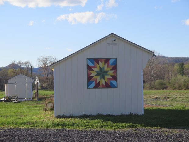
Barn Quilt and Tree Farm


IMG_0062
More Barn Quilts


IMG_0063
Grayson Highlands in Virginia


IMG_0076
We were very close to the VA/NC border. I have no idea which state this was in.


IMG_0077
A Closer Look at the Barn Quilt


IMG_4386
Pretty Barn Quilt


IMG_0070
Along a North Carolina Road


IMG_4390
Barn Quilt on a Hardware Store in West Jefferson, NC


IMG_4387
Giant Cows in West Jefferson, NC

I don’t make Hubby stop much, but I knew we HAD to stop in West Jefferson to see the giant cows at the only cheese factory in NC. I’m glad, too. The town is adorable. It’s on my list of places I absolutely must re-visit.

dinner
Perfect end to a fabulous day.

I actually chose our lodging for the night because it was within easy walking distance of this BBQ place, which had great Yelp! reviews. We weren’t disappointed. The food was delicious.

IMG_4396
Frost!?!


IMG_0079
Mount Airy, NC (Any Griffith’s birthplace and inspiration for the fictional Mayberry)


IMG_0085
Flashback


IMG_0084
Kitsche


IMG_0083
Dork


IMG_0109
Nice spot for a stretch break.

We were going to visit the D-Day Memorial in Bedford, but we were hungry, I was a bit chilled, and daylight was waning. It’s another place we must re-visit.

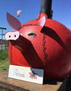
I did pop into the visitor’s center to see if their bathrooms worked and was quite tickled to see this mini-LOVEwork with a cool pig in the foreground.

IMG_4400
Mini LOVEwork at Bedford’s D-Day Memorial … suh-WEET! 

Next up… the other place we HAD to stop. Hubby wasn’t thrilled, but it was early in the day and we’d just eaten breakfast, so he humored me.

Here’s a sneak-peek.

Doesn't he look happy?
Doesn’t he look happy?

That’s love.

Charity Highway

DCIM100GOPRO
ToadMama

There are pros and cons to using a helmet camera while riding. One of the cons being that you end up with a TON of images to sort through, which takes time. That’s why some of my images never get viewed by anyone other than me.

Yesterday, as I sorted through pics captured on October 18, the last day of Hubby’s birthday weekend ride, I came across a series of shots showing Virginia’s Charity Highway.

It is definitely one of my favorite stretches of road enjoyed that weekend. The 21 or so miles from Woolwine, the western end of VA-40, to just before the town of Ferrum were the best. We only went as far as Rocky Mount, so I can’t tell you whether the other end of the highway is good or not.

Charity Highway_woolwine-ferrum

Like many roads, that “highway” got its name because it passes through the town of Charity. The posted speed limit was 55 MPH, but it was so curvy, I can’t imagine being able to maintain that speed for long.

That section of VA-40 parallels the Blue Ridge Parkway (BRP). It would be a great alternate route on days that the BRP is fogged-in, too darn crowded, or you just need a change of pace. Remember, the 45 MPH speed limit on the BRP is strictly enforced.

When riding, I am often amazed at how little traffic uses many of the back roads we enjoy. Some folks have even asked, after watching another of my slideshows/videos, if we even have traffic.

The answer is yes, we do. I just usually omit slides/video segments where I’m stuck behind some other vehicle. Who wants to look at the ass-end of a car or truck?

This time, I decided to keep it real and include ALL of the 330+ slides from that stretch of road. Images were captured every 5 seconds, so it’s about 28 minutes of ride time condensed into a slideshow that’s 3:28 in length. You’ll get to see all of the traffic we encountered and the annoying sun glare as well as the road and some pretty nice scenery.

The slideshow is relatively quick. I added music, so you may want to mute your speakers if you’re watching in stealth mode.

For you map lovers, here’s a link to GOOGLE Map: Charity Highway, ~21-mile portion of VA-40 between Woolwine and Ferrum, Virginia. I have no idea how long those links stay active so, if it’s broken, just open GOOGLE Maps and search for Woolwine, Virginia.

I hope you enjoyed the slideshow.