Midway Geyser Basin

I did say we got lots of geyser pics that day (September 14), right?

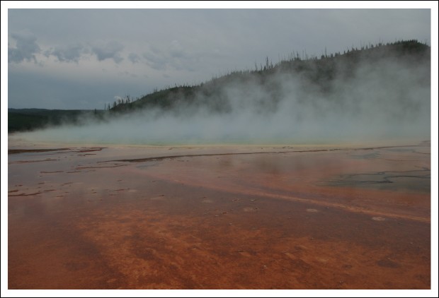
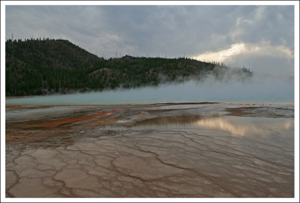
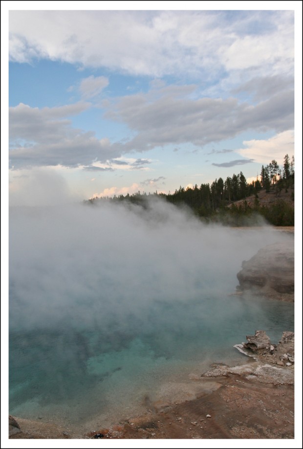
The last stop of the day (in the park) was the Midway Geyser Basin. There are actually a few features at the Midway Geyser Basin, but the granddaddy of them all — and Hubby’s favorite — is the Grand Prismatic Spring. At about 300 feet across, Grand Prismatic is the largest hot spring in Yellowstone. It’s also considered to be the third largest in the world (there are two larger hot springs in New Zealand).

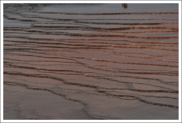
Grand Prismatic sits atop a wide, spreading mound. The water flows evenly on all sides and has formed a series of small, step-like terraces. Grand Prismatic is named for its wide variety of colors (best experienced from the air, as shown in the photo below).
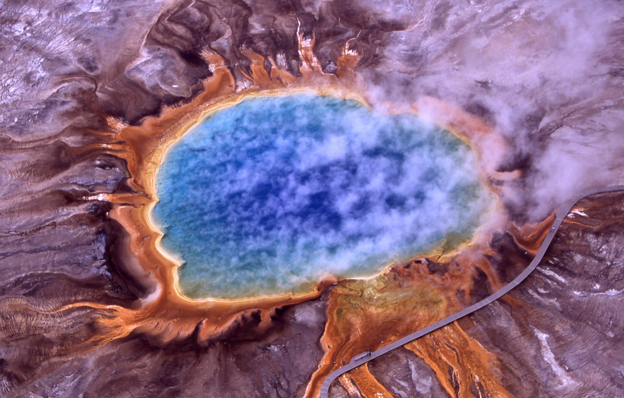
Aerial view of Grand Prismatic Spring; Hot Springs, Midway & Lower Geyser Basin; Jim Peaco; July 2001

That line across the lower left of the frame is the boardwalk. Those dots on the line are people. It’s really quite big.

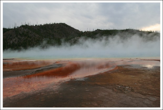
As described by YellowstoneNationalPark.com, “The colors begin with a deep blue center followed by pale blue. Green algae forms beyond the shallow edge. Outside the scalloped rim a band of yellow fades into orange. Red then marks the outer border. Steam often shrouds the spring which reflects the brilliant colors. Grand Prismatic discharges an estimated 560 gallons per minute.”
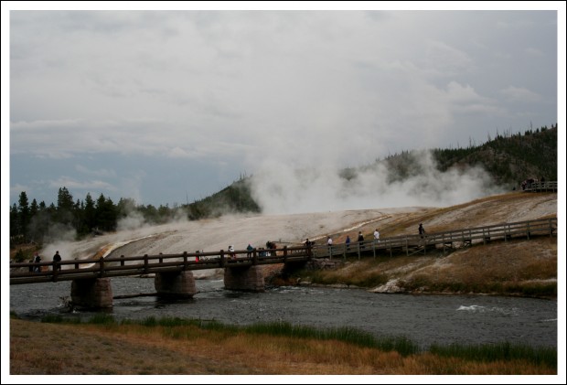
View from Parking Lot
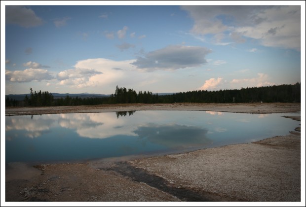
Reflective Moment
Terraces
The Big Kahuna of Hot Springs... Grand Prismatic
Mesmerizing Colors and Textures
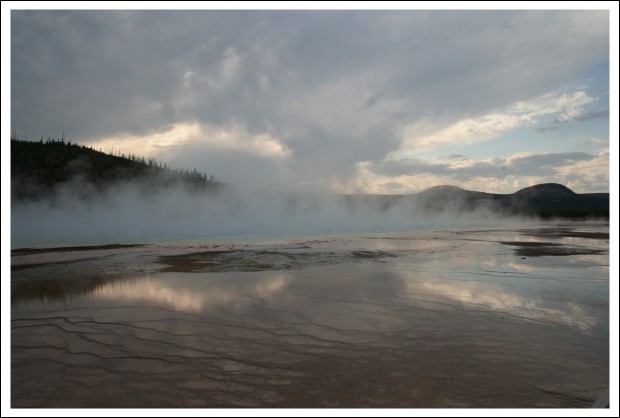
More Reflections
Eye Candy
Pool at Midway
Disappearing Men
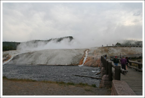
Leaving Midway Geyser Basin

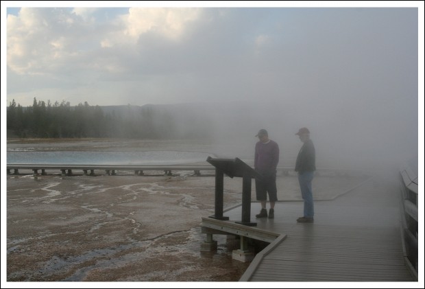
I’m not sure why that one is Hubby’s favorite, but it is. Maybe it’s the size? Or the colors? Perhaps it’s how, depending on wind direction, you can be completely enveloped by fog.

It was a very long, but very good day. One of many on a vacation filled with amazing stuff. Including fabulous company. We couldn’t have asked for better travel companions. We’ll soon have to start planning our next big trip.

Any guesses where we might be going?
 

Yellowstone’s Upper Geyser Basin

In yesterday’s post, I mentioned that our friends Annelies and Yves were excited about seeing some geysers, right? We were all excited, really. As I continued digging through the folder of pics from that day, two things struck me.

First, I couldn’t believe I forgot to post one of the shots we did in front of our Grand Teton cabin. I mean, really. Look how happy we all look.

Annelies, Yves, Hubby, and Me

Second, I forgot just how many super-cool geysers and other geothermal stuff we saw that day.

After we left West Thumb on September 14 (the subject of yesterday’s post), we headed to the Upper Geyser Basin. That won’t mean anything to most of you unless I add that Old Faithful is located in the Upper Geyser Basin.

Everyone’s heard of Old Faithful, right? Even if you’ve never even thought about taking a trip to Yellowstone.

Old Faithful is famous not because it’s the biggest geyser, but because it’s the most predictable. Hence the name. It generally erupts every 90 minutes or so. Day and night. All year round.

But Old Faithful is just the tip of the iceberg. The Upper Geyser Basin, which is where Old Faithful is located, has a land area of about two square miles and “contains the largest concentration and nearly one-quarter of all of the geysers in the world.” That quote and all the other educational/informational/boring info about geysers in this post is courtesy of the Upper Geyer Basin page at YellowstoneNationalPark.com (not the official NPS site).

Still, seeing Old Faithful erupt is like the quintessential Yellowstone experience. So we had to go watch.

Waiting for a Geyser to Erupt is BOOOORRRRRING

You ever stood by a stove waiting for a pot to boil? That’s about how much fun it is waiting for a geyser to blow. Usually.

That day there was an odd undercurrent of excitement in the air. And it all seemed to be focused on some other stuff nearby.

The Sleeping Giantess

See that little puff of steam toward the left of the frame? That’s the Giantess.

You know I HAVE to share more than the name, right?

GIANTESS GEYSER, temperature 200.7°F, interval of 0 to 41 eruptions per year, duration 3-43 hours, height 150-200 feet. “Giantess is unpredictable with long dormant periods. When it does erupt, the first hour is generally the most spectacular. An eruption has two phases-a water and steam phase. Water periodically jets to 200 feet high during the first hour and as the water phase subsides steam begins and roars from the 15×20 foot crater, sending a large column of steam into the atmosphere. Giantess’ vent has been probed to a depth of 62 feet below the lip. Subterranean connections exist between other Geyser Hill features and after an eruption, nearby Beehive Geyser may be triggered to erupt.”

So, while seeing Old Faithful was cool and all…

Thar He Blows! (Old Faithful)

… seeing Giantess erupt would REALLY be something. There was quite a buzz going through the crowd. Seriously. Up to that point, Giantess had only erupted two times in 2011.

Once in early January, shortly after midnight. And once in May.

Then it also erupted on September 14. And we got to watch.

Giantess Erupts

Remember, the last time it had erupted was in May. So we had Old Faithful and Giantess erupting at practically the same time.

And did you read that bit about the neighboring Beehive?

BEEHIVE GEYSER, temperature 199°F, interval of 7 hours to days, duration 4-5 minutes, height 150-200 feet. This geyser is appropriately named after its beehive-shaped cone, which is three and a half feet high and four feet in diameter. “Beehive, considered one of the largest active geysers in the world, erupts to a height of 200 feet. However, since its discovery, it has been unpredictable. It has eruptive intervals of eight to twelve hours, but it has infrequent eruptions as long as 3 to 10 days and dormancy of weeks to months. A small vent located a few feet east of Beehive, called Beehive’s Indicator, erupts 6-10 feet usually 10-20 minutes before an eruption. An eruption begins with occasional splashing, then small surges. These progress into an eruption as the ground rumbles and a narrow, straight fountain of water jets upward.”

Yep, it erupted, too.

Beehive Geyser Erupting

Like Annelies said at the time, there were so many geysers going off, we didn’t know where to look next!

Beehive Geyser

Those folks were a bit too close for comfort if you ask me.

Beehive Geyser

After we took a gazillion pictures, we walked along the pathway that winds in among the geysers and other thermal features in the basin.

It’s amazing to see just how many shapes, sizes, and colors there are.

Small Bubbling Pot (I can't remember the real name)
Anemone
Hot Spring

That’s one of my favorite shots. Look how you can see down into the pool. Remember, click on the image and you’ll get a bigger version to peruse. And look at that sky. It had been threatening rain off and on all day.

Quite an Unusual Landscape
Love That Reflection!
Depression Geyser?
Color Galore
Firehole River

I kept telling everyone the rainy, gray skies were going to make for some dramatic lighting. Other than re-sizing, these are all pretty much SOOC shots.

Colorful Pool

I don’t remember the name of that one either, but it was sure interesting watching it bubble.

Color and Bubbles

I am so glad we took our time and really looked at all of this stuff closely. It was amazing.

In Too Deep

That one isn’t very colorful, but I love the way you can see down into it.

That’s it for Upper Geyser Basin.

But that’s not the end of the geysers for that day. There were more. Next stop… Midway Geyser Basin.

Know what’s there?

The Grand Prismatic Spring. The big daddy of all the pools.

On Our Way to Midway

Do you have a favorite shot from this post? Hard to pick, isn’t it? I think I like the river ones the best. But then there’s Hot Spring with the dramatic sky in the background. And the Colorful Pool.

Sigh…

I’m trying to mentally prepare myself for this year’s “favorite shots” post. Last year, it was the top 10 of 2010. I think this year I’ll do my favorite 11. Narrowing them all down is really going to be tough.

West Thumb, Yellowstone National Park

Since I STILL haven’t finished sharing vacation pics, here’s another installment for you. I actually started this post yesterday, December 14, which is why I selected the folder from September 14 to share. Looking at these pics, it seems like just last week that we were in Wyoming with Annelies and Yves. Other times, it feels like so long ago…

Anyway, I toyed with the idea of just using “West Thumb” as my post title. To see if y’all would be perplexed. Then I realized none of you probably give my post titles an iota of thought. So I decided to be all forthright and add the Yellostone National Park bit.

Did you know Yellowstone was the world’s first national park? It includes 2,219,789 acres, which makes the park larger than Rhode Island and Delaware combined. That’s big. And because it’s so big, it is very diverse.

There’s a great overview map someone posted, which might give you some idea as to the size of the park. If nothing else, it’ll help you understand how West Thumb, on the left (west) side of Yellowstone Lake, got its name.

Annelies and Me

Wait, doesn’t that sign say “Grand Teton National Park”? And didn’t I saw I was highlighting Yellowstone?

Normally, I’d post that pic with the GTNP pics, but I’m sharing by day, remember. And I really like that shot. It was actually taken on our way from GTNP to YNP. The two are only about 40 miles apart.

There’s the YNP sign.

Don’t you just love national park entrance signs?

Recovery

YNP is most-famous for its glaciers and other geothermal features. But there’s just so much beauty to behold there. In every direction. Even in spots like this where you can see a bunch of dead trees. Those trees were burned in the massive forest fire that swept through the area in 1989.

Recovery

It was a rather gray day when we started out. And a bit chilly. But sometime gray is good. If I’d taken this shot in the bright, midday sun, most of those colors in the grass would have been all washed out.

I think those pics were captured around Moose Falls, which is just north of the south entrance to the park. The first really exciting stop for the day, West Thumb Geyser Basin, was yet to come.

Annelies and Yves were quite excited. They’d never seen geysers before. And although West Thumb Geyser Basin is one of the smallest geyser basins in Yellowstone, which also makes is less-known, its location along the shore of Yellowstone Lake makes it the most scenic.

Spectacular Colors

I can’t remember if we stopped at West Thumb when we were vacationing with the kids. It was gorgeous. Color, color everywhere. And I love color.

Geothermal = HOT

Hubby was looking into the pool. They really are quite hot. And, in some cases, a bit stinky.

This next shot is really cool. Not because of the image quality, or lack thereof, but because of what is shows…

Swim Party

… swimming elk! Who knew elk liked to swim?

They weren’t doin a we’have-to-do-this-to-cross thing. They were swimming for fun.  They’d go in, swim around a bit, then get out. It was awesome.

Small Pool

The hot spring pools come in many shapes, sizes, and colors. I love how you can see down into the pools. This one was only about a foot across. The colors are actually algae and bacterial growth.

Submerged Cone

Those cones are actually underwater in the lake. Doesn’t that sort of look like a tropical island?

Larger Pool

That pool was much bigger. And very orange. I guess there was lots of iron in the soil.

Yellowstone Lake

Those cliffs are from mineral deposits that have built up over millions of years.

Very Colorful Pool

That’s one of my favorite shots. I just love those colors! It’s the edge of a fairly large pool. If you look closely at the blue areas, you should be able to see how deep the pool is.

Another Big Pool

Actually, that might be a different section of the same pool featured in the previous shot. You can really see the depth there.

Pools with Lake

There you can see the lake and some mountains in the background.

Color!

And some more interesting colors. Annelies and I both took gobs of pictures at West Thumb.

Color!

I couldn’t help myself. I just love, love, love all the different colors.

Happy Travelers

That’s one of my favorite captures from the trip. We had such a good time.

There are actually a lot more pics from September 14. Rather than make this a really long post, I’ll save them for later. The next post maybe? We’ll have to see. I have lots to do and little time to fit everything in!

Do you have a favorite among today’s pics?

Bryce Canyon National Park

I’m continuing with the random sharing of holiday pics. The date I chose for this post was September 10, which had us enjoying Bryce Canyon National Park in Utah.

Bryce Canyon is like no other place on Earth. And, thanks to Annelies, we experienced it in a very memorable fashion. Instead of just looking at the canyon from its rim…

View from the Rim

…which would have been gorgeous enough, we ventured down into the canyon on the Navajo Trail. This trail, as described on the   Bryce Canyon National Park website, is a 1.3-mile loop. That distance may sound easy, but there were lots of ups and downs. It was a bit strenuous at times, but well worth it.

Another View from the Rim

In my last post, I said I like rocks, right? It was the unique rocks in Bryce Canyon that were responsible for it being declared a national park. The spires in Bryce, called “hoodoos,” are formed when ice and rainwater wear away the weak limestone. Erosion also created lots of other shapes like slot canyons (deep, narrow canyons), windows, and fins, all of which are “tinted with colors too numerous and subtle to name, these whimsically arranged rocks create a wondrous landscape of mazes, offering some of the most exciting and memorable walks and hikes imaginable.”

Think that’s a bit of an exaggeration? Think again.

View from Just Below Trailhead

Annelies and Yves had done this hike before, so they knew which end to start from. Descending the seemingly never-ending series of switchbacks was difficult enough, climbing out of the canyon that way would have been torture.

Hubby on the Trail

I wish I would have counted the number of switchbacks that carried us down into the canyon.

Switchbacks
Looking Up and Out of the Canyon

If you click on any of the images in this post, you’ll get a larger version to peruse. In the shot immediately above, those dots in the lower middle part of the frame are other hikers coming down the switchbacks we had just navigated.

Flat Spot in the Canyon

There were hoodoos everywhere, not just on the walls of the canyon.

I'm Guessing This is a Fin?
Blue Skies Peeking Through
Me, Annelies, and Yves
Blue Skies Made Quite a Dramatic Backdrop
Interesting Shapes and Colors were Everywhere
More Cool Shapes and Colors
The Ground Didn't Stay Flat for Long
Gorgeousness
One of My Favorite Shots

It almost doesn’t look real, right?

Climbing Out of the Canyon
Me and Hubby
Annelies, Hubby, and Yves
Beauty on a Grand Scale

That spot in the lower, right-hand corner is a person. I left her in there so you could get a better idea of the enormous scale of the place.

See what I mean about it being memorable? That’s definitely a vacation moment/experience I will never forget.

Eeeney, Meeney, Miney, Mo

It seems a bit weird, having been back from vacation for more than a month now, to launch into a series of “here’s what we did on our vacation” posts. So I won’t.

I will share a few pics, though. Just because I like them.

Colorado National Monument

Colorado National Monument was one of our surprise finds. We actually only went there because we were in the neighborhood. None of us really had any idea just how breathtaking the place was.

This is not the sort of landscape you picture when you think of Colorado, right? As you can see on this map, it’s pretty close to Utah. We only did a drive-thru visit, really. We were on our way to Moab after all. But we HAD to stop and take some pictures.

Capitol Reef National Park

The next pleasant surprise was Capitol Reef National Park. I mean, how interesting could a “reef” be in the desert Southwest?

VERY interesting.

Capitol Reef National Park

The scenery was amazing. If you’ve never been out West, it’s hard to comprehend just how much wide open space there is. And fantastic scenery. It’s a bit mind-boggling, really.

Capitol Reef National Park

That image immediately above is one of my favorite landscape captures.

Capitol Reef National Park

This is another of my favorites. I love rocks anyway. Especially red rocks. And the lines, angles, and colors captured here really intrigue me.

If you click on any of those images, you’ll get a larger version to examine more closely if you like.

These are just a few of the really good images I am thinking of entering into a calendar contest sponsored by my employer. The problem is, I can only submit ONE shot.

Do you have any idea how hard it is to choose? Sigh…


Swan Lake Trail

During our recent visit to Grand Teton National Park, we decided to do an easy hike. It started near our cabin, went along Jackson Lake (the big one) and through the woods on relatively level ground past a couple of smaller bodies of water.

Colter Bay in Jackson Lake

Have I said before that Grand Teton National Park is one of my favorite places on Earth?

As you can see from the pics, we got pretty lucky with the weather. Mornings were cool, but the days warmed-up nicely.

Heron Pond

After leaving the shore of Jackson Lake, we wound through the woods to the much-smaller Heron Pond. Heron Pond is only separated from Jackson Lake at one point by a narrow strip of land. If you look at the center of the image above, the lake in the foreground is Heron Pond while the water in the background (in front of the mountain) is Half Moon Bay in Jackson Lake. This MAP will give you a better idea as to the scale of this place.

My companions laughed at me when I was shooting the image above. In order to capture those flowers in the foreground of my shot, I had to get down on my hands and knees with my butt up in the air and face almost on the ground. Sure, I looked stupid. (Annelies took a picture to prove it!) But I got a great shot, right?

After a bit, we continued on to Swan Lake (pictured below).

Reflections at Swan Lake

Even though you can’t see the Teton Range (mountains) in this shot, I like it for the cool cloud reflection.

I captured another version of the same scene in the image below.

Swan Lake Reflections

I like the second shot better. I like how much depth it has thanks to the grass in the foreground.

Hubby isn’t a fan of images shot in the portrait orientation used for the second image. He prefers the wider, landscape view.

Which one do you like better?

Perfectly Positioned Log

The stunning view of Swan Lake captured in those images is what we saw from this log. I sat there for a while, too, which is why there’s a gap between Hubby and Annelies. But I just couldn’t sit still with those very cool cloud reflections just waiting to be captured.

Finishing the Hike

Our men were great sports about letting us take pictures to our hearts’ content. After a few more shots and some leisurely poking around, we finished our hike.