As I mentioned in an earlier post, I knew we would drive Annelies crazy if we spent too much time at the house while she was working, so I planned a little excursion up to the UK. I wanted to explore the Cotswolds, a mostly rural area in south central England known for its stone-built villages, historical towns, stately homes, and sheep. And Hubby loves to see old stuff. We both really enjoy visiting cathedrals, too. So after a bit of research into roughly where in the Cotswolds we’d end up the first night, I picked some cathedrals to visit.
I only laid-out the rough plan for the UK visit a day or so before we left for Belgium. And Annelies booked our ferry passage the night before we left.
It’s tempting to do day-by-day posts to get this vacation re-cap finished more quickly. But some places are so special, they need a post of their own, like Canterbury Cathedral, our first planned stop in the UK.
According to the brochure, worship has been taking place daily at Canterbury for over 1,400 years.
Try as I might, I couldn’t fit the whole building in one frame. The place is massive. And the town was built right up around the property.
I had to rely upon this aerial view, captured by AD Photographics of Kent, England, to give you a better appreciation of its size. You can see how the town surrounds the cathedral property.
We were able to find a parking spot on a street several blocks away from the cathedral. We could see the towers, of course, but had no idea how to get to the property, which is surrounded by walls and buildings.
When you’re walking up close, like on the street immediately adjacent to the property, you can’t see the cathedral.
So, clueless tourists that we were since I hadn’t done proper advance planning, we were walking up Burgate Street wondering how to find the cathedral. Hubby was still a tad stressed after navigating the labyrinth of small, busy streets whilst driving on the wrong side of the road. By stressed I only mean his brain was too numb to focus. After another block or so, I saw this…
I vaguely remembered having read that you had to go through a gate. Doesn’t that sort of look like the facade of a haunted house that you’d see on a beach town boardwalk? Until you look more closely, that is.
Remember, click on any image and a larger version will pop up. Use your back button to return to this page.
Um, that’s a rather famous gate. (I am no historian. I just like seeing cool, old stuff.)
This is what you see after walking through the gate (and paying your entrance fee).
The whole back half of the building is missing from that shot. Really.
Here are a few exterior images.
Maintaining and restoring this building, much of which dates to about the 11th century, is a constant and ongoing process.
Now, how about some interior highlights?
Not to diminish the grandeur of that window or anything, but do you see the Little Mermaid?
Or is it just me?
Here’s something a little different for you…
I took the following quick(ish) video to try and illustrate the scale of this place.
Here are a few final pics…
The rest of my Canterbury pics are lumped into a UK Day 1 Flickr album, starting here.
The cathedral actually has a great Web site. You can even enjoy your own virtual tour, which I highly recommend. Not only will you see more of this amazing place, you’ll get the historical details.
As for us, after leaving the cathedral, we were off to Oxford. On the wrong side of the road again.
Would you prefer I share fewer pics in a post? Or do you have an opinion? Do share, please.
Who knew our recent weekend road trip would be the LAST time Hubby and I rode together on our twin bikes?
Not me. Although, if I had thought about it, I probably would have known. Since Hubby had been talking about that Victory for quite some time. (If you have no idea what I’m talking about, you probably missed this post.)
Anyways… it dawned on me this morning that I never finished my trip report. So here’s the Sunday re-cap.
First, we woke up. LOL. (Why, yes, I do crack myself up.)
That was the sight that greeted me when I left the room to snag some coffees.
It had rained during the night and our bikes were soaked. Good thing we both travel with micro-fiber towels, which I used to dry the bikes off later. But first things were first… COFFEE.
Yes, I know not to expect much of the free continental breakfast offered by chain hotels. But those are seriously the smallest cup of coffee I have ever seen. I had no idea Styrofoam espresso cups were available in America.
For sake of comparison, here’s the hotel cup next to small and large cups we got with our Hardee’s breakfast.
Here’s a map of the route I plotted. It’s 304 miles and should take 6.5 hours, not including stops.
We lingered a bit after breakfast, giving the roads plenty of time to dry off a bit. And then we were off.
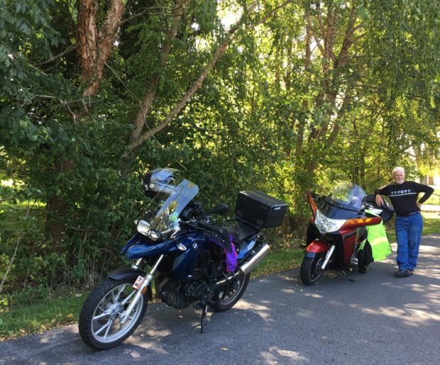
Can you tell we were both looking forward to another fabulous day of riding?
A mere 18 miles outside of Princeton, we hopped on US-219, which is one of many fabulous roads in that area. Really, US-219 through WV is something every motorcyclist should experience at least one in their life. It may not be the Italian or Swiss Alps, but it’s sweet. Trust me.
As we rode south, approaching Lewisburg, WV, we were amazed at the sheer number of fifth-wheel trailers that were passing us. Headed in the opposite direction, of course. We were both quite thankful for that. US-219 is full of twisties. Getting stuck behind even one mammoth fifth-wheel-in-tow would have plain SUCKED.
Here are some pics from our first stop along US-219.
We sure picked a pretty spot for that break. After a brief rest, we continued north. It was only when we reached Lewisburg that we realized it is home of the West Virginia State Fair, which I’m pretty sure is where the RVs were coming from. We did encounter some north-bound RVs in and around Lewisburg, but, lucky for us, they all seemed to get onto I-64 just outside of town.
Inevitably, we caught up to a few further north on US-219. But that just gave us another excuse to stop.
I’m being completely truthful when I say much of US-219 in West Virginia looks like this. It’s a great road. So great, neither of us minded it being a repeat road for us. In fact, neither of us would mind repeating it again. Soon.
If you’ve been lucky enough to enjoy that route, I can’t imagine you’d disagree.
Continuing north, we reached Marlinton, WV, which is where we left US-219 to head east. We could have continued on US-219, but I wanted to see the National Radio Astronomy Observatory in Green Bank, WV, a place I’ve been meaning to see for years.
But first, look at this cute little country store we happened upon in Dunmore, WV, appropriately named the Dunmore Country Mart and Bakery.
Not only did they have a potty, which I really needed at that point, Hubby discovered that they had home-made treats.
I didn’t want Hubby to feel bad, so I selected something for myself, too.
I’ve said this here before… I’ll never be a skinny chick.
The skies were looking a bit ominous, so off we rode, reaching Green Bank about 20 or so minutes later.
I’d always pictured one telescope on a hill-top. There was more than one telescope-looking thing, but they weren’t all that big, and they were on the valley floor.
Again, since the skies were threatening, we didn’t linger long.
A short distance north of there, I HAD to stop and get a picture of this.
I’d only ever seen quilt barns in Kentucky, as far as I can remember, but noticed quite a few during the course of the weekend. This one was close to the road AND there was a place to pull off the road. (Wanna know more about barn quilts)?
Notice the dark sky? We still had a lot of ground to cover. We weren’t so much worried about getting wet — we DO carry rain gear — we just knew that I’d saved Mike’s favorite road for last, and we wanted to get there before it rained.
But, before we got to that road, which is US-33 by the way, we rode a fabulous piece of US-250, another repeat road for us, from a ways west of and through Monterey, Virginia, across another set of mountains to McDowell, Virginia.
Right before this next shot was taken, we saw a young black bear running along the left hand shoulder of the road. We slowed down enough to get a good look at the little guy (or girl), but there was no safe place to pull off. So, as excited as we both were to see the bear, we opted to play it safe and continue.
Once we reached McDowell, VA, we turned left onto VA-654, which is labeled on my map as Doe Hill Road. We followed it north through a stunningly picturesque and hilly valley. At the WV/VA state line, the road becomes WV-23. The name changes to WV-25 near and through Dahmer, and then becomes and stays WV-21 near, through, and beyond Sugar Grove. The whole route paralleled the George Washington National Forest until beyond Sugar Grove, where it entered the forest.
Amazing scenery. For serious. I MUST return. Must, must, must.
We finally reached Brandywine, WV, where we’d planned on getting gas. The only pumps in tow were out of order and we were pretty low. Our choices were to ride 12 miles to Franklin, WV and double back — Mike’s favorite road is just east of Brandywine — or, traverse the pass with what we had, hoping we made it to the other side.
We made it. Barely. According to Hubby’s on-board computer, he had 3 more miles to ride. I think mine said 12.
Once we filled up, we continued through Harrisonburg with home on our minds.
We did stop at this cute little restaurant in New Market, VA to eat and rest.
That stretch of US-33 was good, but disappointing as traffic was pretty heavy when we finally arrived. I did a post, with video, about that road last year if you’re curious. I shot video this time, too, but it probably isn’t worth editing down to share. We’ll see.
By the time we got home, we were both pooped. We’d covered 679 miles since Friday. Many of those miles were on technical roads.
We split a big, ice-cold beer — is there anything as refreshing as that after a long ride? — and then I headed off to retrieve our girls from the pet sitter.
I know this sounds repetitive, but it really was an awesome weekend. I hope you enjoyed reading about the end.
If you’re ever in the area and want a guided tour, let me know. It’ll require some advance planning, but it sure would be fun sharing my pretty little corner of the planet with y’all.
A brand-new, big-ass motorcycle, that is. And he couldn’t be happier.
It’s a brand-new, 2013 Victory Vision Tour.
He has been wanting a Victory touring bike since he first saw them in 2008.
He used to have a Kawasaki Vulcan Nomad 1500cc touring bike. Which he traded in and instantly regretted when we bought our BMW F650GS bikes in early 2011.
Don’t get me wrong, he always enjoyed riding his GS, but they’re not the most comfortable bikes. Especially over long periods. And Hubby does enjoy long-distance motorcycle excursions.
I’m so excited for him.
Speaking of excited… the guys at the Victory dealership sent a t-shirt home for me.
And I’m a t-shirt girl. So, yay!
Wanna see something that’s more exciting than the shirt, but not at all Victory-related?
Yep, that’s our eldest, Shannon, carving up the turns on a California highway.
I don’t know the name of that road, but it’s one of those “gotta-ride” routes so popular among motorcyclists.
Unbeknownst to Shannon, there’s a photographer there who takes pictures to sell to riders. A friend of hers, who did know about the shooter, went on-line a bought this image for her.
I am now a Dragon Master.That’s what they call folks who have ridden Virginia’s Back of the Dragon, a sweet 30+-mile stretch of road that crosses three mountains between Marion and Tazewell, Virginia.
It’s the sort of route motorcyclists like me daydream about. Here’s a Google Maps link of the location.
We started at the southern end on VA-16 outside of Marion, VA, just north of US-11, and rode north.
I ended up with about 42 minutes of video, which I edited down to this video, which is just under 10 minutes long.
There’s music, so check your volume before clicking PLAY.
Do let me know if you enjoyed the virtual ride-along.
It always amuses me when, after a motorcycle trip, people ask, “Where did you go?” It’s not the asking, it’s the look I get when I answer with something like, “Nowhere, really.” Or, as in the case with our last trip, “Just west and south through Virginia and into West Virginia.”
It’s non-riders I speak of. Riders, who’ve heard tales of the roads and terrain in those areas, get it. Most non-riders don’t.
Sometimes I do use the bike to get from point A to point B. But usually I ride just for the sake of riding.
Most trip planning involves a bit of research. And maps, definitely maps. I also use Web sites — Motorcycle Roads is one of my favorites — blogs, magazine articles, RoadsideAmerica.com, and even my memory.
Some roads are magnets for motorcyclists. They’re infamous among the riding community, having gained such a reputation over the years that most motorcyclists have either been there already or want to go there. Like the Beartooth Highway that traverses the Montana/Wyoming border, just northwest of Yellowstone National Park. Or Deal’s Gap aka “The Dragon,” an 11-mile stretch of road with 318 curves at the Tennessee/North Carolina border.
Neither of those are close to Central Virginia. Skyline Drive and the Blue Ridge Parkway are pretty famous, but I find those roads, particularly the strictly enforced, low speed limits and crowds, tiresome at times. Especially when the foothills are criss-crossed by roads that are just as sweet and curvy, but FAR less populated with cars, trucks, RVs, SUVs, and even big-ass pokey motorcycles.
For our latest adventure, I wanted to go to the mountains. I thought about heading up and into western West Virginia to see Prabhupada‘s Palace of Gold, but I knew Hubby would be less than thrilled by the place and wouldn’t want to linger as I would have. Plus, I knew our ride time on Friday evening would be limited. So I started looking west. Then I realized we’d been on many of those roads before. Why do repeat roads when there are so many new routes to discover?
That’s when I remembered the Back of the Dragon. I’d read about Virginia’s version of that more-distant, infamous Dragon several times. I found it on the map, noted the vast mountainous terrain between it and our home, then plotted the routes.
That route may not look all that exciting, but it took us west on US-211 and across Thornton Gap and the New Market Gap. Originally, I’d planned on using US-11 for the last leg of the trip. But, since we started out much later than anticipated thanks to work commitments, we got on I-81 at New Market instead to shave-off some time, and made it safely to Staunton, Virginia around 9:00 PM. Since we were both tired and famished, we opted for a quick fast-food dinner and then went to bed.
Saturday morning dawned cool, bright, and clear. After a quick Hardee’s breakfast, and a re-check of the map, we were on our way.
As you can see on my map, we didn’t take the direct route. Instead, I’d chosen some promising-looking back roads through parts of the George Washington National Forest and Jefferson National Forest.
I picked well.
Virginia 42 made for a fabulous ride. We did encounter some stretches of gravel, thanks to recent road work, which is always annoying, but the good pieces made the gravel bits worth it.
We emerged from the forest around Bland, Virginia. Hubby, who was leading, consulted his GPS and found a hilltop restaurant. Or what once used to be a restaurant, as we discovered upon arrival. But the parking lot had a few oddities and a nice-enough view and I wasn’t complaining.
There was a very busy Dairy Queen at the base of the hill. It was just off of I-77, which I guess was the reason for the crowds.
After lunch, we continued on VA-42 briefly then hopped onto a VERY sweet stretch of US-52. Curvy, hilly, smooth, and newly-resurfaced. It doesn’t get much better. Except there’s a popular overlook, which we avoided since it was crawling with people and bikes, so traffic was the heaviest we’d encountered up to that point. Not heavy by urban standards, just more cars than we liked to see.
The final leg over and down to US-11 and Marion was uneventful. Although I must say, we saw a higher concentration of mobile home communities than either of us had EVER seen before!
The Web site describes it as a “two lane ribbon over the three mountains between Tazewell and Marion, Virginia.”
Is it worth the hype? Absolutely.
The Back of the Dragon is almost three times longer than its southern cousin, and the curves aren’t as densely packed, but it is a great road. It hasn’t quite caught on among motorcyclists yet, which is fine by me. There was very little traffic of any sort. We didn’t see one law enforcement vehicle either.
I shot a video, but it needs to be edited down before sharing. The raw footage is about 30 minutes long. Or more.
We were both feeling tired by that point, but still had about 35 miles to cover between Tazewell, VA, where we’d stopped for a break, and our hotel. We were both getting hungry. And, if I’m being honest, I REALLY wanted a margarita. So we pushed on.
As much as I hate chain restaurants, the last thing we wanted to do after a long day in the saddle was get back on the bikes to ride for dinner. We opted instead for Applebee’s, one of several chains within walking distance that easily won out over Bob Evans and Cracker Barrel since neither of those serve alcohol. I told you I wanted a margarita.
I’ve had an ugly-ass pie safe sitting in my dining room for a while. I did a post about the pie safe shortly after I bought the piece.
I never did like the color. The more I looked at it, the more I hated it.
This is not a valuable antique. (My Dad thinks anything old is valuable.)
I probably paid too much for the thing. But that’s okay. I wanted it. It spoke to me. The piece had character. And that’s exactly what sucked me in.
The old, rusty, original, stamped tins. The knot-holes. The wonky doors.
It’s not a very-well-constructed item. In fact, I think either a kid built the thing or some poor pioneer/farmer.
Not only was it clumsily made, upon close inspection I realized it had been built of scrap wood.
It wasn’t exactly square. And the joinery was some of the more amateurish work I’ve seen.
Adding insult to injury, someone removed the original hinges and replaced them with very basic, brass, surface-mounted hinges. If you click on the image and zoom in, you’ll see what I mean about the hinges.
So why did I buy the thing? I knew I’d give it new life one day.
It sat in my dining room for a little more than two years. I wanted to paint it, really. But it’s a big piece — at least five feet tall and about three feet wide — and I knew it would take a decent chunk of time. Large, uninterrupted chunks of time are a rare commodity around here.
Still, I can’t believe I left that thing sitting there looking ugly for so long!
Finally, I decided to get that thing done. With Hubby’s help, of course.
Step one was to empty-out the piece.
Where to put all of the stuff that we’d crammed in there? On the dining room table, of course.
Hubby and I carried the thing to the basement, where he removed and repaired the doors so he could install new, more-appropriate hinges. He actually had to cut a chunk of the old wood away and replace it with new wood to make the hinges work.
I painted the cabinet before he replaced the doors. Remember, I liked the character of the piece. I wasn’t trying to make it look new. Just better. So I covered that minty (or sea-foam green) green paint with a single, not-so-neatly-applied layer of Old Ochre chalk paint. In some places, I used two layers. But not many.
Once the entire piece was covered, I realized it needed something else. Some sort of oomph. Something to make it “pop.”
So I added some color to the interior.
There’s nothing symmetrical about this piece of furniture, so I applied the red (Primer Red) and blue (Napoleonic Blue) in an uneven pattern. I didn’t even use tape, I just eyeballed it. Tape would have made it too straight. Too perfect.
This is not a perfect-type piece.
I wasn’t sure if I was going to use dark wax on the piece, but that stuff really highlights imperfections. And since this pie safe is full of imperfections, I used both clear and dark wax.
I just love the way the dark wax settles into all the nooks and crannies.
Then it was time for Hubby to hang the repaired doors.
Here’s another clear wax-only vs clear and dark wax comparison.
Some of you may hate this rustic look. I like it.
I decided to make the drawer face red.
One day, my kids will either be fighting over this piece or happily lugging it to the dump.
Sorry for the grainy pics. I used the phone camera.
I’m not crazy about those too-white knobs, so they’ll be replaced one day.
It’s great to have our dining room back.
Here’s a reminder of what it looked like before.
It’s SOOOO nice to have our dining room back. I am not a neat freak, but all of that clutter made us both feel as if the walls were closing in on us.
Not only does the pie safe look better, it actually matches the table and chairs.
So, do you hate the old, rustic look? If that’s just not your style, I hope you can at least appreciate the new life I have given these old pieces of junk. 🙂