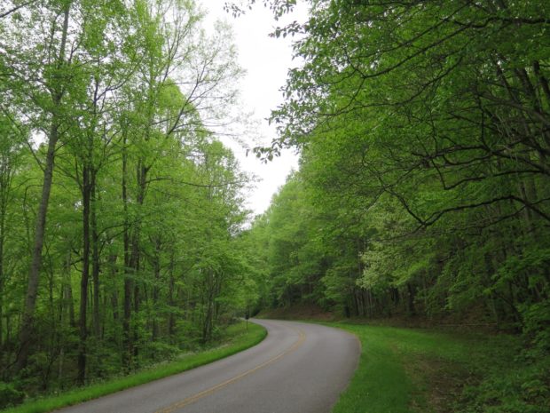
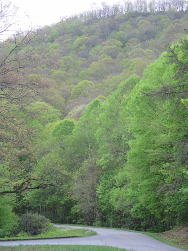
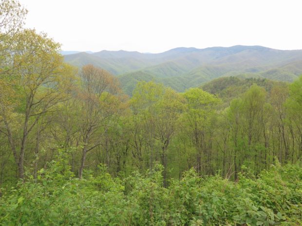
Is there such a thing as a good turnpike? You betcha! And, surprise surprise, it’s not too terribly far from my house.
The Snickersville Turnpike, which runs between Bluemont and Aldie in Virginia is the best turnpike ever. Really.
It’s not a highway. It’s a road dating back to the late 18th century that some very smart folks have elected to preserve.
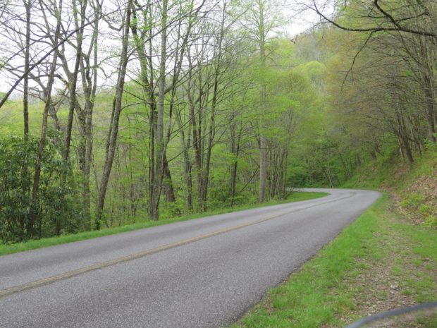
The road surface is a bit rough. It’s relatively straight, too. So what makes it so great? The scenery.
It’s only about 14 miles from Aldie to Bluemont (about 25 minutes) along the road, which is also known as VA-734. I prefer to follow it in an east to west direction, heading toward the mountains, which is part of what makes it special. Plus, The Bluemont Store is a great place to store for a drink, snack, and/or lunch.
I was really kinda hungry and should have had some soup, but Hubby wasn’t quite ready for lunch. So I just got some cookies (okay), a brownie (yum!), and a mini sandwich to hold me over.
From there, we hopped onto VA-7 for a brief bit, then headed south on VA-601 / Blue Ridge Mountain Road for a short but fun jaunt to Paris. (Our founding fathers apparently struggled to come up with unique place names.)
My favorite road in Fauquier County — VA-688 / Leeds Manor Road — begins/ends along US-17 just south of Paris, so we took that west and south to VA-647 / Crest Hill Road for a spirited ride into Flint Hill, which is where we decided to grab lunch.
We’ve actually eaten at the Griffin Tavern & Restaurant quite a few times. The food is always good, there’s not usually a wait, and the property is pretty. Yes, there are other eateries in Flint Hill, but we haven’t tried them.
That was actually the first time Hubby and I had dined there on a day other than Sunday. We were actually surprised to see that it was much busier than usual, but there was still plenty of room for us, and the service was just as good.
Hubby got the “bar burger” he’d been craving, and I had a Cuban sandwich. I was a bit disappointed at the lack of care that went into the preparation of my sandwich — the contents were all lopsided and spilling out one end of the bread — but it still tasted good. I guess the kitchen staff were feeling rushed?
I’m sort of particular about my sandwiches. The innards ahould always be evenly distributed, not lumped haphazardly in the middle or spilling out the sides. In my opinion.
We were surprised to see this in the parking lot…
See how sloppy this sandwich looks? Eating it was a messy challenge.
Hubby was pleased, as usual, with my picture-taking.
He was actually quite a good sport about giving me a disgusted/impatient look on command for that shot.
By the time we’d finished lunch, it was getting a bit warm. We continued on my planned route, which took us west on VA-641 / Fodderstack Road (becomes VA-606 not far west of town and later turns into VA-628) through Little Washington to US-211. We hung a right there, continuing west toward Sperryville. That’s where we headed south and back east on US-522.
If you’d like to zoom in on the Spotwalla map, CLICK HERE.
The scenery along US-522 is quite lovely as the road undulates across the low foothills east of the ridge.
I’d actually planned to go a bit further east, but since it was getting hot, I opted to head north from Culpeper toward home.
All in all, it was a good day. The girls weren’t at all disappointed that we got home a little sooner than planned. And I still had time to get to the local farm market before it closed to buy some fresh corn on the cob.
We’re both looking forward to the upcoming three-day weekend. Monday is the Labor Day holiday here in the US. Although I do hope to get some chores done and may have a little doggie rescue driving to do, I am hopeful that we’ll get in at least a couple of good rides.
Last Sunday, August 23, Hubby planned a ride for us. We’d discussed it briefly the night before, so I knew it would involve a jaunt across the mountains to Luray (pronounced LOO-ray, by the way) for a Hardee’s breakfast. I had no idea where we’d be going after that. But, as many of you know, when you’re on a motorcycle, it’s not usually about the destination, it’s about the ride.
Before we left, he did tell me the route plan included breakfast AND lunch, but that was it. He also mentioned that our route would cover about 200 miles (~322 km), and he may have mentioned it would take about five hours. But I didn’t really care. I was willing to just follow along.
Sometimes, it’s good to just follow with no conscious thought required. Of course, there’s always thought required when riding, but there’s a huge difference between thinking about where you’re going/when your next turn is coming up and letting your mind just sorta wander.
Those of you who don’t ride and wonder whether thought’s required to operate the motorcycle, not really. I’ve been riding for quite a few years, which means it’s all become sort of intuitive. Kind of like driving a car with a manual transmission. You just sorta know when to switch gears, which gear is required, what gear you’re in when you’re moving, etc. My eyes are always scanning the road, shoulders, and vehicles up ahead AND checking the mirrors to see what’s to my rear, but that doesn’t require thought either. It’s all rather automatic.
Sometimes, letting your mind wander is good. That day, I was having a very hard time getting into the zone. In fact, what I’d really wanted to do was hole-up in a dark room and just sleep the day away. The days leading up to Hubby’s Food Ride had been challenging, to say the least. But that’s not me. I know I’m much better off wrenching myself out of the depressive depths — it’s what’s best for me — so I rode along.
On Wednesday, I’d gotten word from Carol, one of my besties since childhood, that her sister had died. Only a year or two shy of her 60th birthday, this sister had struggled with horrible substance abuse issues, compounded by anxiety and depression, for just about all of the 35+ years that I’d known her and her family. I didn’t know the sister well personally, since she was about 10 years older than Carol and I, but I’ve been around her many times over the years and I knew of the havoc and turmoil her family experienced as a result of the sister’s struggle with her many demons.
It’s a tight-knit family, though, and despite the struggles and pain she’d caused, that sister was much loved by Carol, her Mom, her brothers, son, husband, nieces and nephews, friends, extended family, etc. That list goes on and on. It was heartbreaking, to say the least, seeing the family trying to cope in the wake of the sister’s tragic, accidental death. Friday night, I went to the viewing. The funeral was on Saturday. One day I might write about the complex swirl of emotions tied to those events. But there’s a whole lot that goes with it, well beyond the death of someone I didn’t really know personally, but whose family are all as close to me as my own family. For now, just trust me when I say that mentally, on Sunday, I wasn’t in a very good place.
We were HOURS into the ride before I even took my first picture, a scene which Hubby actually said he’d like to have captured. Imagine that!
Yep, that’s the place I’d visited the prior weekend. I didn’t mind doing a repeat road so soon, though, since Dyke Road is awesome.
From there, we continued meandering through the lovely Virginia Piedmont. And, much to might delight, we stopped in Culpeper for linner (late lunch-early dinner) at Uncle Elder’s BBQ.
I may have mentioned this place before. I even took all of these other pics months ago, but never got around to sharing them with you.
Uncle Elder’s is a small place. There’s an outdoor seating area, but we’ve always dined indoors. The pulled pork BBQ is quite good, but my favorite menu offering is the fried pickle appetizer.
I know I’ve mentioned that here before. I think Dar was even brave enough to try it for herself. My friend Annelies says Americans will fry anything, and she’s right.
If you like pickles, try them fried. They’re best when the pickles are cut into chips, as opposed to spears, and the pickles have to be the really tart kosher dills.
Hubby likes them just as much as me, but he’d never say, “OMG, we HAVE to go to Uncle Elder’s for some fried pickles.” He’d be more like, “I’m hungry for BBQ.”
I keep forgetting to check and see if they serve beer, which wouldn’t matter if traveling to and fro by bike, but I’ve been telling my local friends that we need to go there for dinner.
It turned out to be a decent day. Riding is great therapy. Truly.
These two are good for helping lift spirits, too.
They don’t look particularly sympathetic, do they? This is their “is it time for our walk” look. But that always makes me smile. I enjoy our walks almost as much as they do.
We went for another ride yesterday, which was awesome, but I’ll save that for another post.
Hubby told me on Thursday that the weather folks were forecasting pretty high and uncomfortable temps on Saturday and Sunday, so he’d be doing some chores around the house, NOT riding. With that in mind, on Friday morning I decided it would be a good time to capture some more LOVE. So I plotted a 300-mile loop from my home south and west to the tip of Virginia’s Northern Neck, then down to the Middle Peninsula and back home. (If those regional references confuse you, click here.)
The mapping software estimated about 6.5 hours and 300 miles. Ambitious, yes, but I would have captured seven LOVEworks (assuming none have been removed).
It sounded like a good plan, especially since I’ve never been beyond George Washington’s Birthplace on the Northern Neck. And that was years ago.
The high temps (near 90F, 32C) forecast for the day and the fact that I had to leave my house at 5:30 p.m. for a dog transport were the major factors that had me re-think my plan. The 6.5-hour time estimate didn’t include stops for photos, gas, food, and more photos. Timing-wise, even if I left the house at 7:00 a.m. as planned, I’d be cutting it very close. Plus, the Northern Neck is rather flat and I’d be going through some areas typically congested with traffic, so there’d be little relief from the heat.
That’s when I decided to head to the mountains and the hamlet of Love, Virginia. I’d first learned of Love’s existence while reading a book purchased at one of the Visitor Centers along Shenandoah National Park’s Skyline Drive, Backroads; Plain Folk and Simple Livin‘, by Lynn Coffey. It was really quite interesting reading for this gal who loves exploring back roads and often wonders, “Why would people ever have settled here?”
I didn’t formally map-out a route. Knowing its general location, south of Waynesboro in the mountains along the Blue Ridge Parkway (BRP), I knew roughly how to get there. I figured once I was near Afton at the northern end of one of my favorite roads, the Rockfish Valley Highway, I’d just put Love into the Google Maps app on my phone and follow the spoken directions. It was a relatively good plan.
The weather was perfect as I left the house shortly before 9:00 a.m. I bid Hubby farewell, telling him a bit about the different kind of love I’d be seeking.
This first shot was taken as I headed east along VA-230 / Wolftown-Hood Road, my favorite shortcut from US-29 to US-33 in Stanardsville.
I think you can see why I enjoy that shortcut.
I couldn’t resist stopping in Hood for this shot of the general store, which also houses the Post Office.
And check out this view, captured from the right side of the store.
I’ve been on that road many times, so I didn’t stop for more pictures until I reached territory I’d never before covered.
The next few images were captured along VA-810 / Dyke Road.
Dyke Road sort of parallels Skyline Drive between US-33 and I-64.
The next shot is one of my favorite captures for the day. 🙂
There really is a town named Dyke.
VA-810 between US-33 and Crozet has firmly earned a spot on my mental list of favorite Virginia roads.
I stopped in Crozet, which is just north of US-250 / Rockfish Gap Turnpike, to consult the map and determine the rest of my route. I headed west on 250 toward VA-151, the Rockfish Valley Highway, another one of my favorite roads.
That’s where I zipped past this scene…
I HAD to pull a U-turn to get a closer look.
Yep, some landowner with a sense of humor placed this family of bear statues next to a pond.
Shortly after that, I turned south on VA-151, which I planned to follow south to Jonesboro.
VA-151 is SUCH a pretty ride. The road itself, which parallels the BRP, is more meandering than straight and doesn’t have many significant curves or hills, but it passes through absolutely gorgeous terrain. There is one sweet section of twisties, the proverbial icing on the cake, as it crosses Brent Gap.
In Jonesboro, I turned right onto VA-666 / Jonesboro Road, my favorite shortcut to another favorite road, VA-56 / Crabtree Falls Highway. Yes, I know I keep saying “favorite,” but these roads are seriously awesome to me.
All along my ride down VA-151 the Google Maps chick kept telling me to turn right, but I knew I wanted to at least ride to Jonesboro. I imagine she was sorta relieved when I finally did head in the proper direction.
As I zipped west on VA-56, I got nailed in the middle of the face-shield by yet another butterfly. My field of vision was rather obscured, so I was actually looking for a shady spot to stop when my map friend said I should turn right.
Yes, I felt horrible about killing butterflies, but they fly like drunkards and kept crossing my path.
Looking at the map on my phone, I saw that I could either continue on VA-56 to the BRP to get to Love, a longish loop, or take the much shorter path via VA-814 / Campbells Mountain Road suggested by Google.
I opted for the shorter route, figuring I’d save lots of time. Shortly after setting out on VA-814, a sign warned, Unpaved Road Ahead. I almost decided to turn around. Then I looked at the map again and said out loud, “What kind of adventure-bike-rider would you be if you let a short stretch of gravel road scare you? This is all part of the adventure.” Besides, even if the road was gravel, I could tell it was well-traveled, not to mention lined sporadically with cabins. So on I went.
Keep in mind, I had no cell signal, so the map data was limited. I could see the roads on my phone, but I couldn’t zoom in much, and there was no time or distance info, which is included in the maps below. There was no terrain view either.
I had no idea I’d be climbing 1,800 feet (~549 m) on about a two-mile stretch of gravel road, complete with a full 180-degree switchback or two. OMG.
Even at very low speed, it was harrowing. Check out this terrain view. The southernmost switchback around 2,000 feet almost got me, but I managed to keep the bike from falling over. It was close. I was quite proud that I pulled that one off.
For you non-riders who may be reading this, that wouldn’t have been a crash and/or involved injury. There are times when a bike is at a stop or just barely moving when it falls over, usually due to road conditions, like gravel and/or uneven surfaces, both of which I experienced. Falls aren’t a big deal with a bike like mine built to take some knocks without much damage. But you have to pick the back up after it falls. A challenge for me on a flat hard surface that would have been next to impossible on that hilly bit of gravel.
Needless to say, I was relieved when I reached the paved BRP. Then, within minutes, I was in Love!
Here are some pics of Love for you.
From there, I went back to the BRP and headed north toward home. Temps in the high elevations were perfect, generally ranging in the low- to mid-70s (~24C).
Love is only about 17 miles (~27.5 km) from the northern entrance of the BRP. It was such a pretty day, I decided to stop at the Raven’s Roost Overlook to see what I could see.
From there, I continued north on the BRP and even chose to ride the southern portion of Skyline Drive, which I knew had to have cooler temperatures than in the valley.
I stopped once at the Loft Mountain Wayside for a potty break. I captured a few nice butterfly pics, which I’ll share in another post.
I would’ve like to stay on Skyline Drive, but I was running out of time. I exited the Drive at Swift Run Gap on US-33 and made a beeline for home. It was hot, just as I expected it would be. After stopping for gas and some food, I managed to reach the house at about 4:45, which only gave me 45 minutes to rest a bit and re-hydrate before heading out for my dog transport.
It was a long, but lovely day. 🙂
Today I’ll be catching up on chores. And that’s okay, since it’s currently (just before noon) 86 degrees with 60% humidity. Ugh.
Back in 2011, Hubby and I ventured east from the WV place, passing through a place by the name of Star Tannery in Virginia. That name has stuck with me over the years, and I’ve had an urge to revisit the place.
I tried to revisit Star Tannery back in July, but missed a turn somewhere. Once I realized I’d missed a turn, it was too late to circle back.
Sunday, we were able to revisit Star Tannery, which isn’t much more than a speck on the map. With such an unusual name, I figured it must have some history. I did a brief Google search with no significant result. There’s not much there.
Zepp Road is another landmark that stuck with me. It goes through the community of Zepp, Virginia. Calling Zepp a town would be a real stretch, trust me. Not much there either. Really.
So, why would I want to return? For the roads, of course.
Few of the roads were phenomenal motorcycle roads. In other words, speed demons would have been bored. But the roads were nice. And it was definitely a pretty day, weather-wise.
Our route from home in Warrenton did include Thornton Gap, that fun stretch of US-211 I mention often that crosses the mountains at Skyline Drive. I also got to share a road with Hubby I’d recently traveled for the first time, which leads up and over the mountains north of Luray and into Edinburg. There was a sweet stretch of Back Road, which is quite picturesque, in the Shenandoah Valley. Zepp Road is quite twisty as it climbs up and over Fetzer Gap with a 2000′ elevation. There was also Fairground Road / VA-661 to Morgan Ford Road / VA-624, north of Front Royal, which took us across a low-water crossing on the Shenandoah River. (I’m pretty sure the last image on the Wikipedia low-water crossing page also depicts this crossing at Morgan Ford Road, but the water looks much higher in that shot.)
We stopped for a VERY mediocre meal at the Front Royal Diner — we will not be going back — then ended the ride on VA-288 / Leeds Manor Road (my favorite road in Fauquier County).
According to that terrain map I shared above, it appears that Zepp is actually within the George Washington National Forest. I must say, I do enjoy living in such close proximity to so many natural spaces.
For you map-lovers, here’s a peek at our route, a screen shot captured using Microsoft Streets & Trips.
I’ve told y’all about Kudzubefore, right? It’s an invasive vine, not native to the United States, that’s slowly, but surely, consuming the South.
During our ride last weekend, Hubby and I traveled one of the roads I’d ridden during my solo adventure in June. I’d remembered seeing some pretty alarming kudzu growth along that route and decided to stop and capture a few pics for you all.
Those runners are a lot like English Ivy (the climbing type) and Virginia Creeper. They really dig in.
Kudzu does have some interesting uses, as explained in the following short video.
It can grow up to a foot (~30.5 cm) a day!?! Wow. That really is fast.
I came across the next video at the Duke Today Web site. It’s a bit longer, but has a really cool, artsy, time-lapse element in the second half that I enjoyed. You should watch it if you have time.
Click the link if you’d like to read the full article about the making of the video. The article includes this intro:
To make a film showcasing the landscape of his North Carolina upbringing, Josh Gibson turned not to beaches or mountains or towering Longleaf pines.
Kudzu-covered objects can be sort of cool-looking, but it hurt my heart to see the overly aggressive invader choking out a bunch of rhododendron in the Jefferson National Forest.
According to that first video I shared, it’s gotten further geographically than I’d thought it had. Do you have Kudzu in your state?