I’m An Aquaholic

I’m loving the watery life on Dauphin Island.

If you’ve seen our “places” map and list created by Mike, you know we’ve been hanging out in the southeastern US since we became full-time RVers in May. We arrived at our current location — Alabama’s Dauphin Island — on October 1 and will be here until December 1. This is the place I’d been most looking forward to as it has the best of both worlds for both of us. Endless beaches and other water activities for me and plenty of flatland and bicycling opportunities for Mike.

Everything I’d read before arrival said October was the best month to be here, weather-wise. We had some 80+ degree days early in the month with high humidity, but most days were in the upper 70s with night temps only dropping into the 60s. The sea temperature was 79 when we got here and has only dropped to 75. Compare that to the water temperature in Ocean City (OC), Maryland, the beach closest to where I grew up, where the water usually only hits 75 in August. In OC, the water starts cooling off again at the end of August/early September. Now, in OC, the water is already in the mid-60s. So 75 still feels warm(ish) to me.

We did have some strong storms pass through late last week, which brought about half a day of heavy rain and several days of strong winds. Yesterday, the weather was perfect. Temperatures only reached the low-70s and there was little to no wind. It was a great day for kayaking.

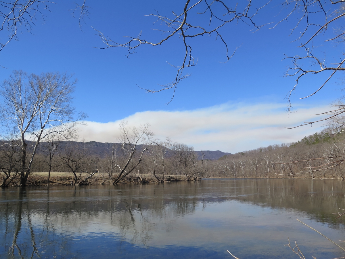
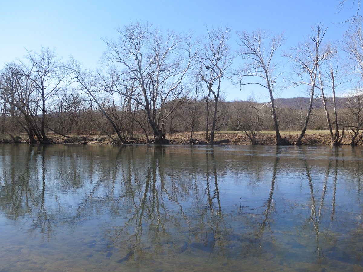
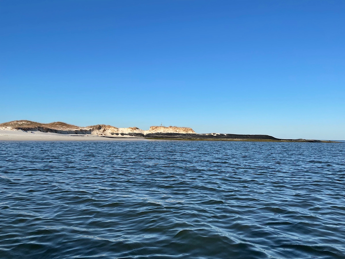
When I started out, there was no wind. Zero. The water was not only flat (no swells or waves at all), it looked like glass. The only surface movement happened when fish jumped out of the water or schools of fish fluttered just beneath the surface. Of course, my paddle made noise and caused ripples as I made my way across the surface, too.

Every now and then, as I made my way across Dauphin Bay, I would stop paddling and just sit still watching the world around me. At one point, with the surface still in its glass-like state, I saw a pair of large birds flying straight toward me, about 10 feet (a little over three meters) above the water. As they got closer, I could see they were Brown Pelicans. When I realized it was so quiet that I could hear their wings flapping, I chuckled and said, “Hello, pelicans!” My voice startled them a bit so they veered slightly off course, but otherwise continued on their way.

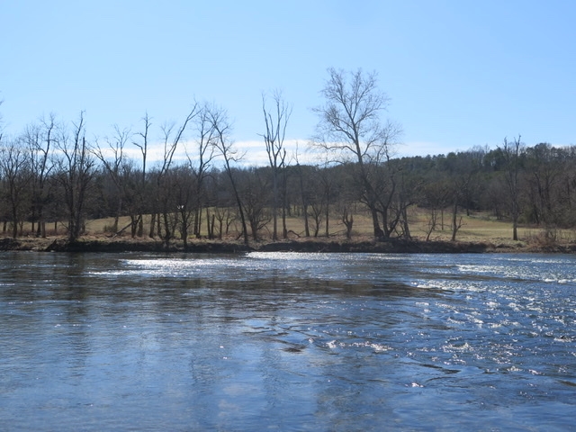
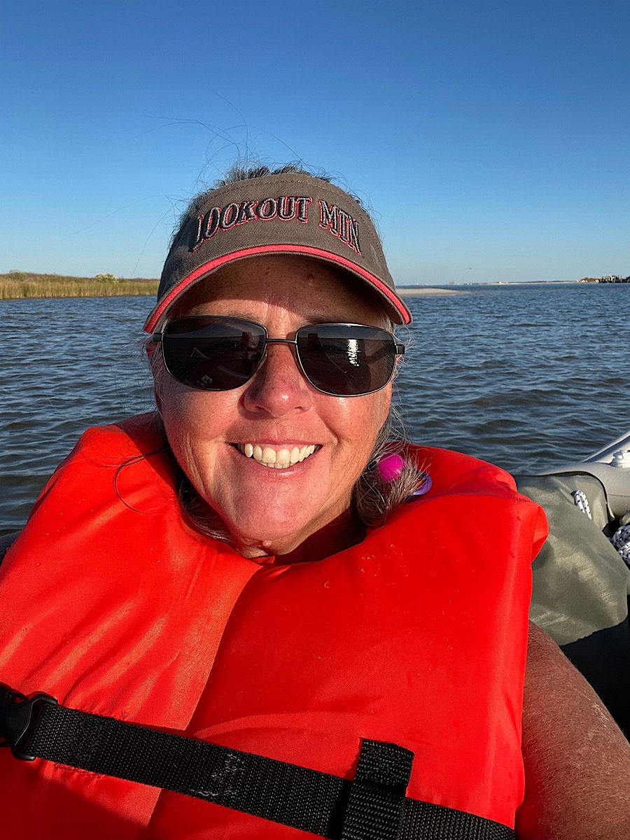
The wind did eventually resume. Lucky for me, it was blowing toward the direction from which I’d set off! I turned around after covering a few nautical miles and alternately drifted and paddled my way back toward home. It was very peaceful and relaxing. In the image below, you can see the water was still pretty flat, but no longer like glass.

Pass Drury on Dauphin Bay

Even if I never get to use my kayak again, I will forever be grateful that I took the plunge and made that purchase. Yes, it and its accoutrements eat-up valuable basement storage space, but getting to experience magical days on the water like yesterday is priceless.

This Earth of ours is such an amazing place!

The inflatable kayak creates a couple of logistical challenges. It does deflate and can be folded for relatively compact storage, but it’s sort of heavy. I bought a hand-truck so I could carry it to the water, but that meant I’d have to deflate it every time I used it. What I really wanted, especially when we are camped in close proximity to water, was to be able to leave it inflated and transport it to and from the water. That’s why I bought a two-wheeled kayak cart. I’m happy to say, it works exactly as I’d hoped.

The kayak cart is sitting to the left of the kayak.

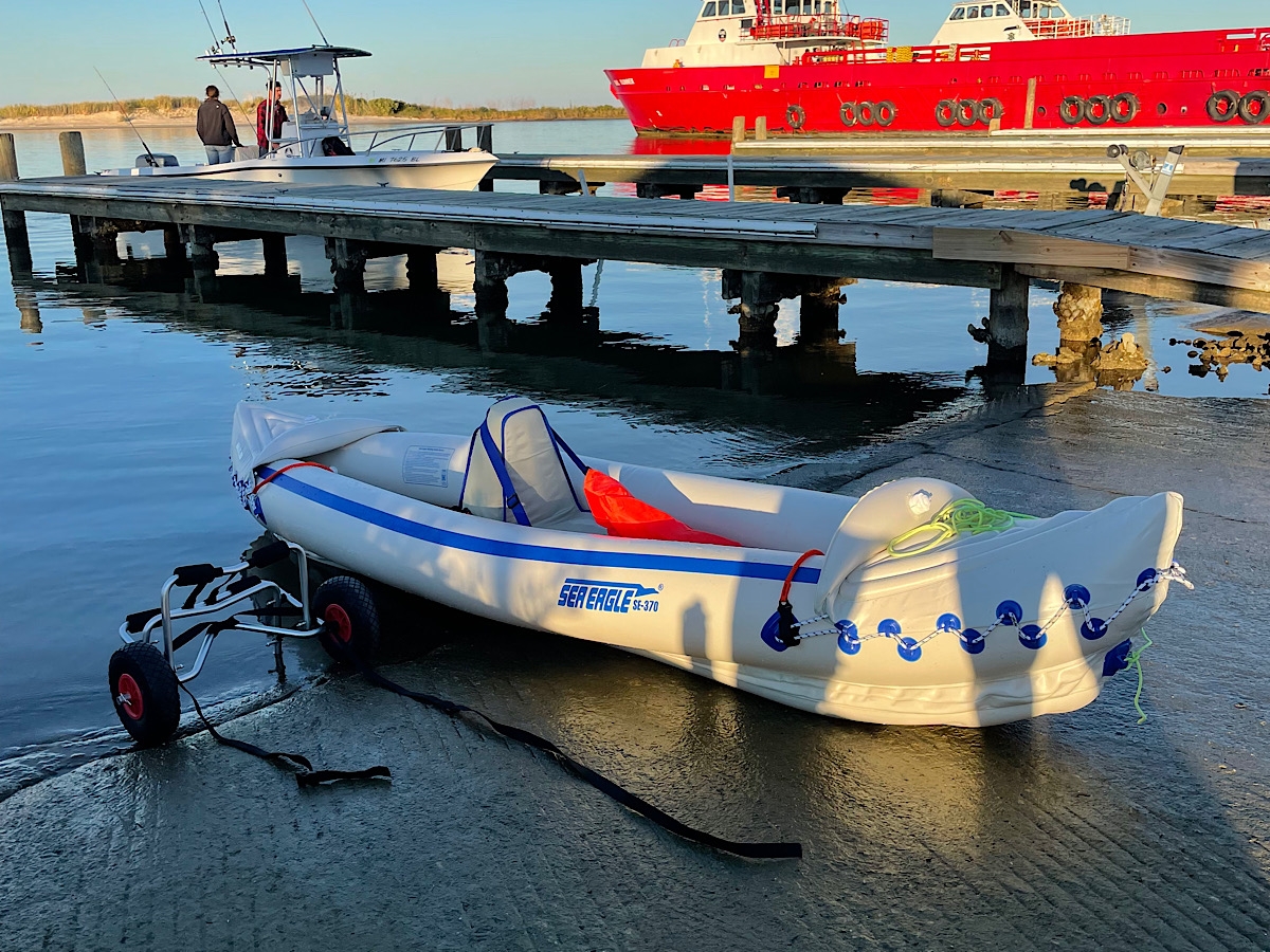
The trick is, getting the cart positioned just-so under the boat to keep the ass-end from dragging on the ground. That’s where a couple of stabilizing fins hang down, like the keel on a sailboat, to make the inflatable vessel more stable in the water.

Cart strapped into place.

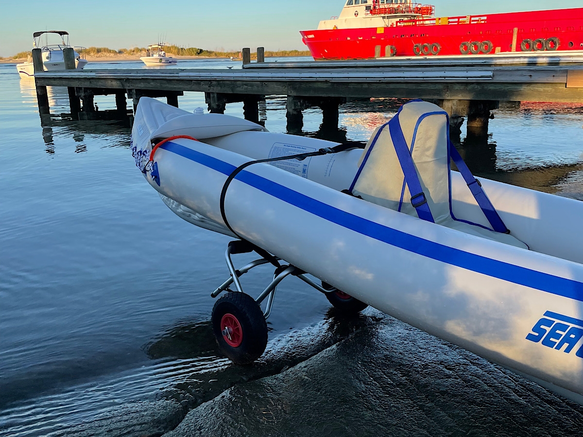
Once the wheels are in place and properly oriented, I can grab the kayak from the rope handle on the front and walk, easily pulling the kayak behind me. The first time I used the cart, it did take a couple tries to figure out the optimal position of the cart.

Back at camp.

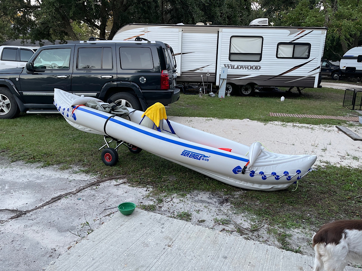
Yesterday, I happily made it to and from the boat launch without any issues. I am totally tickled to be able to walk with my kayak from our campsite to the water and back.

When my arms have rested, I’ll cart it out to the beach and do some kayaking there, conditions permitting. Dauphin Bay is relatively protected and safer for this beginning kayaker. Boating from the beach means I’m out on the more-open Gulf of Mexico. There is, however, a US Coast Guard station across the street from the campground should I need rescue.

Wouldn’t THAT make a fun story?

Now I am really, REALLY looking forward to returning to Florida in December. Not only will I be able to kayak on the Suwannee River, I’ll be able to go out on various springs and see Manatees. I hope.

Pretty in Pink

Pink Dogwood in nearby yard.

Yesterday, I ventured out into the world for provisions. I wore a mask and rubber gloves when I went into the doctor’s office to pick up a written prescription. I did not wear the gloves in all of the stores, but I did keep the mask on. I still stayed away from people, sanitized carts and hands, washed hands when I got home, etc.

As far as shopping goes, Costco seems to have things most under control (compared to other establishments). As much as they can, anyway. It was an awesome experience. They are limiting the number of people who can go in at any one time, spraying all of the carts with disinfectant before people can take them inside, making sure social distancing guidelines are being followed, limiting quantities on items people have been hoarding, etc.

I could only buy one bag of flour, but it was a 25-pound (just under 12 kg) bag!

I admit, being out and around people was creepy. Lots of folks are wearing masks now. There are still some who are not. Social distancing was being followed, which means the store wasn’t crowded and people were getting out of my way/not crowding me. Many businesses are closed. Supply chain disruptions mean temporary outages of some products. Overall, the mood seemed relatively calm. I guess people are adjusting to this new normal, which seems to change a little bit daily.

I am not stressed out about the virus. Maybe because I’ve spent the last few months learning how to be calm? LOL. That doesn’t mean I’m being irresponsible. I know I CAN catch it and am doing everything in my power not to get exposed.

This is such a surreal period in our lives. I really, truly believe that the world is going to be a better place once the crisis has passed. People are more aware of each other now, more in-tune with their surroundings. We have all had pieces of our lives changed, some more dramatically than others. This virus seems to threaten people of various ethnicities equally. People are starting to recognize the value of jobs like grocery store clerk, food delivery drivers, shelf stockers, etc. I believe a lot of folks may come out the other side of this with a different set of priorities.

There doesn’t seem to be a sense of panic. To me, it seems like people are aware, concerned, and doing their part in terms of minimizing contact with others. Are people I encountered hiding their fear and panic? Probably. Am I projecting the way I want to believe others are feeling and behaving? Maybe.

It’s okay to be scared. The trick is admitting that you’re scared, but continuing to function until the pandemic has passed.

I have a feeling the world is going to be a much nicer place once we get past the crisis stage has passed. Until then, I’m living one day at a time, enjoying every one of them as much as I can.

Yesterday’s highlight for me was getting a close look at a beautiful Pink Dogwood tree in a nearby yard. I even got a few pics to share.


There is a lot of beauty in the world if you take the time to look.

Have you ever watched the sky changing colors before, during, and after the sun rises or sets? For me, seeing sunrise or sunset is not just about watching the sun itself rise above or dip below the horizon, but observing how the entire sky changes, slowly, as the sun moves. Technically, it’s the Earth that’s moving, but I think y’all know what I mean.

Clouds make sunset more interesting.


Zoomed-in, fuzzy look.


Soft, evening light.


Surreal scene.

And then there’s this sign.

What could they possibly be using? Is it a legit offer? Or scam to prey on peoples’ fears? I don’t know. What I do know is that it’s yet another creepy sign of the times.

Stay safe, friends. Be kind to yourself and your loved ones. Make the best of every day. This crisis will pass. I sincerely hope everyone reading this makes it through to the better world I believe is waiting for us.

Virginia Bluebells

Virginia Bluebell

I wish I could remember where I first read about Virginia Bluebells, a Spring wildflower that grows in moist woodlands. Maybe it was while reading the literature about the Shenandoah River State Park. Or perhaps I read about them while researching Texas Bluebonnets in preparation for this trip to Texas in 2014.

Whatever the source of my fascination with the flower this year, I finally got to see them in bloom. It took three thrips to Shenandoah River State Park, but was worth it to see the otherwise brown woods carpeted in a lovely blanket of green interspersed with flowers in various shades of blue, pink, and purple.

I will let the images speak for themselves. Click on any of the images for a larger version.


The logs pictured in the last image are where I decided to sit and eat lunch. I sat at the end of the top log, on the right-hand side, atop the bank. It was a lovely, peaceful spot. The woods on both sides of the little stream were carpeted with Bluebells.

I hope you enjoyed seeing the Bluebells. Here’s hoping each and every one of you are safe, healthy, happy, and finding creative ways to spend time with your loved ones during this very unique time in our history.

Quality Time

In my last post, I mentioned that Hubby and I have been spending more quality time together. I figured I’d share some pics of the various stuff we’ve been doing.

The weather has been delightfully mild, so we have been enjoying outdoor activities as much as possible, such as hiking and bicycling at Shenandoah River State Park.

I’d been wanting to visit that park for some time. I’d seen signs and had read about it previously, but hadn’t managed to visit. It’s only 43 miles slightly north and west of our home in north, central Virginia (about a 52-minute drive). But it’s along a stretch of road we had never traveled. Or maybe we’d traveled that piece of road once, long ago.

Anyhoo… we FINALLY visited Shenandoah River State Park (SRSP) a couple weekends ago. It’s really a lovely place.

We only walked on some of the trails at the park during our first visit. Then, the following weekend, we returned with our bicycles.

Some hiking pics…

Sign at trailhead.


Trail marker.


Side trail from canoe launch to Bluebell Trail.


Shenandoah River


Fungus (on a live tree)


Fungus (on downed log)

I always thought that fungi growing on trees was squishy, sorta like a dense mushroom. This one looked and felt just like wood. It really intrigued. It’s almost like the fungus invaded the actual cells of the tree and grew, together into a wood-like appendage.

Shenandoah River


Artsy


Virginia Bluebells (one of the few plants in early bloom)


Pretty, little flower.


Pretty, little flower with my glasses, for scale.


Beautiful, blue sky.


River Clams(?)


The water was very clear.


Pretty, clear water.


Walking


Lovely place for a stroll.


My Honey


Pretty view.


Reflection


Virginia Bluebell, emerging.


Tree, growing on riverbank.

I hope you enjoyed the pics. According to my Honey, I stop to look at the weirdest shit. LOL.

The following week, we returned to the Bluebell Trail, where we’d hiked during our first visit. I was hoping to see more flowers in bloom, but it was still too early. Because we were on the bikes, I didn’t stop nearly as much for pictures.

Parts of the trail are a bit rough for bicyclists like us, accustomed to riding on paved or more groomed/well-maintained trails, but it was still fun. It felt a lot like riding through the woods when I was a kid. Bumpy, but fun.

Bluebell Trail (rougher surface than River Trail)

The River Trail is smoother and more out in the open. No dodging trees and/or trees roots. We did encounter some horses, with riders, so had some road apples to dodge along the way.

Hubby on the River Trail


Nice rest spot along the River Trail.

I believe that’s the primitive group camping spot in the above pic, behind where Mike is sitting. The park also has an RV campground, rental cabins, and other primitive campsites. There are also multiple river access points along the river so people can easily enjoy the 5+ miles of river frontage.

Pretty spot to stop.

I have no idea if that cabin is for rent. It was very close to the river and River Trail, but didn’t have any sort of signage.

Hubby, at trail’s end.

I am going to try to get back to SRSP when the bluebells are in full bloom. If I do, I’ll be sure to share some pics here. Social distancing is easiest when outdoors.

It’s Only Natural

It was supposed to be raining when I woke up in Maggie Valley. When I’d decided to hunker down for the day, to sit-out the storm, I had visions of sleeping late, enjoying a long leisurely meal or two, and just, you know, hanging out.

So why is it that my first thought upon seeing dry pavement was, “I can ride today after all.” Maybe it’s a sickness.

Since I was close to Great Smoky Mountains National Park (GSMNP), and I had yet to make it to Clingman’s Dome — highest point in GSMNP — I figured that would be a good destination. Once it did start raining, I told myself, I’d be close to shelter.

It didn’t take long at all — 20 minutes? — for me to reach the park entrance, which is near the southern terminus of the BRP. Unfortunately, when I did, I was greeted by a sign proclaiming US-441 to be closed. The Oconaluftee Visitors Center is just inside the park entrance, so I went in to find out exactly where the closure began, hoping I could reach the summit. But it was not to be.

“Actually,” one of the rangers manning the desk told me, “the Tennessee side of the park is currently being evacuated.” What?!?

The weather on the Tennessee side of the park was much worse. There were reports of trees down all over the place, falling on people and cars.

So I headed back toward Maggie Valley. I couldn’t resist stopping for some pics along the way, figuring I might as well make the most of my outing while the weather held. Here are some snapshots I judged to be worthy of sharing. Many are grainy because it was so overcast.

SD_IMG_0134

It was interesting to see the difference in the foliage at lower and higher elevations. I hadn’t expected to see so many bare trees. You’ll see the change as I move from lower points near the end of the Parkway, up and into the mountains.

SD_IMG_0135


Ferns
Ferns


Mountain Laurel
Mountain Laurel


Mountain Laurel
Mountain Laurel


Natural Heart
Natural Hearts


SD_IMG_0150
Still pretty green, right?


SD_IMG_0151
Looking a bit browner.


SD_IMG_0158


SD_IMG_0160


SD_IMG_0167
Teeny Tiny Little Blossoms


SD_IMG_0163
Green at lower elevations.


SD_IMG_0164
The hilltops were still mostly brown.


SD_IMG_0169
Odd name for a tunnel.


SD_IMG_0174
You can see the sky getting grayer.


SD_IMG_0183
Pretty little yellow flowers.


SD_IMG_0189
Moss and lichen-covered trees.


SD_IMG_0199
Moss and lichen-covered trees.


SD_IMG_0222
Not much green at all.


SD_IMG_0215
Tiny purple flower.


SD_IMG_0206
Wintry-looking.


SD_IMG_0205

If nothing else, I got to see some pretty cool clouds moving in. It was getting colder, too.

SD_IMG_0223
Menacing Clouds


SD_IMG_0226
Menacing Clouds


SD_IMG_0228
It sure looked like I was about to get rained on.


SD_IMG_0236
Cool Clouds


SD_IMG_0241
Hints of Pink


SD_IMG_0242
Roadside Cascade


SD_IMG_0243
Same cascade.

Temps were in the upper 40s by the time I decided to head back to my motel. So that was my morning.

Final note… this post has been in the works for a week. I caught a stupid head cold/upper respiratory think that’s had me coughing/hacking/gagging and blowing my nose for a week. As an extra bonus, each day ended with a pounding headache, too. Last night’s was so bad, I thought maybe I was dying. Needless to say, we didn’t do any riding over the long, holiday weekend. Maybe this coming weekend I’ll feel better.

Fall Color Found

treeFall is my favorite time of year. I love the cool, crisp air, but I especially love seeing all of the colorful leaves.

This year, either I am too anxious to see color and it seems like it’s taking FOREVER, or the change is a bit later than usual. I think it’s the latter, but it doesn’t really matter. What does matter is that I finally got to see some amazing color on Friday, but I had to work for it.

After being laid off from my job without warning (don’t worry, that’s old news), I suddenly felt like I had lots of free time on my hands. That’s not entirely true, because I had to find a new job, and that takes a lot of work. But working to find a new job didn’t prevent me from daydreaming about taking a motorcycle ride through the mountains. And since I typically work for contract research organizations, and there are several of those in North Carolina, I came up with a plot to schedule things carefully and line-up a bunch of interviews next week in NC.

Sounds like a great plan, right? I thought so. But then I was offered a job with a company in Charlottesville, Virginia. And I start on Monday. That’s tomorrow.

It’s an opportunity I couldn’t pass up, even if it does mean I can’t go to North Carolina. So I planned a trip to West Virginia instead. I was going to go on Thursday and spend the night on the road, but the areas I wanted to see were forecasting rain, which would have been miserable, so I went on Friday. Just for the day.

1_-img_0042
The drive into Dolly Sods on FR75.

I revisited the Dolly Sods, a place Hubby and I had gone to by car from the WV Place in 2010. The Dolly Sods is a wilderness area that sits at an elevation of about 4,000 feet atop the Allegheny Plateau. It is one of many areas of interest in the Monongahela National Forest. The Dolly Sods is significant because of its elevation and what that means to the flora and fauna.

Much of West Virginia is pretty mountainous, but the mountains aren’t very high (the highest peak is only 4,863 feet). It’s been said that many areas of the Dolly Sods are like high-alpine regions in Canada. The snowshoe hare can even be found there.

We’ve ridden our motorcycles near the Dolly Sods many, many times, but never ventured into the actual wilderness area because it is known for its rough, dirt and gravel roads. It is a wilderness, after all. Descriptions of the route into The Sods said something to the effect of “the road climbs the Allegheny Front.”

dolly-sods-terrain
Terrain map showing the Allegheny Front.

In 2010, we entered from the southern end. Yesterday, I entered from the north. The road goes up, and up, and up — five miles from the hard-surface road — before you finally reach the top of the Allegheny Plateau. Hubby’s GPS software plotted a graph showing our elevations at various points on the trip down and back, which clearly shows the extreme elevation change entering and leaving the Dolly Sods.

Hubby's 2010 GPS track of the elevation change.
Hubby’s 2010 GPS track of the elevation change.

In all, it’s just over 18 miles of hard-packed dirt, gravel, and rock (as in boulders embedded in the ground) road. It’s full of some very large potholes, with washboard ruts in many places because it’s a very well-traveled road. The ride up was so bumpy, I bet I stood for about a third of the climb.

It was so worth it, though. Far too many pictures follow as proof.

If you come here mainly to read my words, you may want to stop scrolling now. 🙂

Remember, click on any image for a bigger view.

2_img_0043
The forest along FR75 into Dolly Sods.


3_img_8696
Northern entrance at the edge of the plateau.


4_img_0045
Looking north from just inside the entrance.


5_img_0049
Looking west across the plateau.


6_img_0052
A riot of color.


7_img_0053
I couldn’t get enough of the color.


8_img_0058
The blue sky makes a perfect backdrop.


9_img_0061
It’s usually windy, hence the one-sided tree.


10_img_8707
Looking east from atop Bear Rocks.


13_img_0064
I took lots of pictures.


11_img_8708
One of the most-photographed rocks.


14_img_0066
Looking north and east.


12_img_8709
Not a bad spot for my picnic lunch, eh?


16_img_0074
I couldn’t have picked a prettier day.


15_img_0071
The red bushes are blueberries and/or cranberries.


17_img_0075
Very large conglomerate rocks.


18_img_0085
Rocks and color.


19_img_0089
One-sided tree (from the wind).


20_img_0090
I really couldn’t get enough of the reds, greens, and blues interspersed with rocks.


21_img_0096
Yes, I realize this is repetitive.


22_img_0097
This is one of my favorites, I think.

I DID warn you there were lots of pictures, right? I’m not done sharing yet. LOL.

25_img_0110
Seriously, isn’t the color amazing?


26_img_0113
See my bike? I bet the place was mobbed on Saturday.


27_img_0114
The colors just made me so happy!


28_img_0120
Quaking Aspens! In West Virginia!


29_img_0119
Yet another color shot.


30_img_0130
The clouds were pretty cool, too.


31_img_0135
Trail into the forest.


32_img_0137
Trees and cotton-top flowers (or something like that).


33_img_0139
The scenery was just breathtaking.


34_img_0141
More Color


35_img_0144
Cotton-top flowers (or something like that).


img_0146
Beaver Pond


img_0149
Same pond, slightly different angle.


img_0155
Looking North


img_0156
Looking South from the Same Spot


img_0159
More Color


img_0162
The reds were really vibrant.


img_0167
Straight out of the camera.


img_0180
The yellows were pretty bright, too.


img_0177
Pretty, right?


img_0179
Pretty Yellow Tree


img_8727
RED!

It was darn pretty atop that plateau, but it was nice on the way down, too. The next pics were captured along the road at the south end.

img_8735
Headed down FR19.


img_8728
Tunnel of Color


img_0205
Colorful Forest


img_0233
Maple!


img_0187
I love being in the woods.


img_0176
The tunnel of color continued for miles.


img_0184
Pretty Foliage


img_0220
I slid to a halt when I saw that multi-colored tree.


img_0225
The view as a whole wasn’t bad either.


img_0219
Looking east from near that multi-colored tree.


img_0191
And on the tunnel continued…

That’s it for the Dolly Sods pics. But here’s one last capture from not far south along US-220/WV-28…

img_0235
Champe Rocks, just north of Seneca Rocks.

Even in West Virginia, the color is still spotty at lower elevations. But it’s slowly, but surely, getting more and more colorful closer to home.