Chincoteague National Wildlife Refuge

IMG_4689I thoroughly enjoyed my visit to the national wildlife refuge (NWR), but I didn’t get many pics worth sharing. It wasn’t for lack of trying. The light just wasn’t right.

The Chincoteague NWR is actually on Assateague Island, a National Seashore. About two-thirds of Assateague Island — the northern end — is actually in Maryland. I’ve been to the northern end many times, and have seen the ponies there, so I wasn’t too terribly disappointed that I only saw a few ponies during this visit. The few I did see were too far away for a picture, so you’ll just have to trust me.

IMG_0346
Trail to the Lighthouse


IMG_0333
Informational Plaque

It was a lovely, easy walk to the lighthouse. There’s sound in the video, believe it or not.


IMG_0367
A Bit of History


IMG_0337
Assateague Lighthouse


IMG_0347
Egrets on the Marsh


IMG_0375
Lighthouse in the Distance

I was hoping to see some Snow Geese, but it was too early in the year. I’m really going to try to get over to the Eastern Shore in December or January to see the Snow Geese.

IMG_0382
Cool Sky


IMG_0384
Pony Pen

It’s a shame I didn’t get more “keeper” pics, but I enjoyed my morning at the refuge. It was cold, but peaceful. Few people were around, so the only sounds I heard were waves crashing on the shore, the wind blowing through the trees/reeds, seagulls and other birds squawking, and the crunch of leaves under my feet.

After the museum, which I told you about in my last post, I had one final stop before heading off of the island and, eventually, toward home.

The Town of Chincoteage

In my previous post, I said I’d share pics from Cape Charles and Chincoteague, but, truth is, since it was raining, I did a really piss-poor job capturing images of Cape Charles. So you’ll just have to Google that one if you are really curious.

I did, however, get to spend a decent amount of time in Chincoteague. I got to poke around the town a bit — it’s bigger than I anticipated — and spend some time on the national wildlife refuge.

To get to the town of Chincoteague, which is on Chincoteague Island, you head east for about 11 miles on VA-175 from US-13. The landscape becomes rural pretty quickly after leaving US-13, so one would expect it to be less and less populated, with trees giving way to marsh as one approaches the Chincoteague Island (CI). And that’s sort of what happens. But first, you have to drive past Wallops Island, “NASA’s principal facility for management and implementation of suborbital research programs.”

Despite knowing I’d be passing the NASA facility, seeing the field full of radar antennas and other high-tech-looking stuff on one side of the road and a few smallish rockets on the other side of the road just felt odd.

IMG_4688
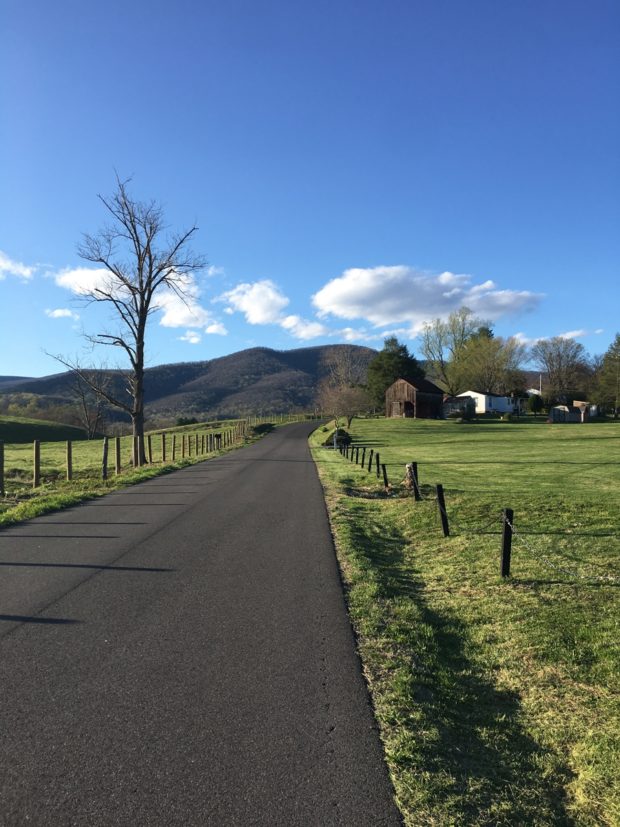
Heading into Chincoteague

Also odd was the number of billboards along the north side of the road leading to CI. For what seemed like a few miles, there was a billboard about every 50 yards (~150 meters) or so. They were all the same height and seemed to be positioned at the exact same angle in relation to the road. Weird.

It was late in the day when I reached CI, so I headed right for the Chincoteague National Wildlife Refuge, which is located on neighboring Assateague (ass-uh-teak) Island.

IMG_4689
I LOVE Wildlife Refuges

The rain had slowed down a bit, but it was pretty windy and cold. And, with the skies so overcast, there wasn’t much light for pictures.

IMG_4693
Snowy Egret in the Marsh


IMG_0285
Autumn Splendor at the Marsh

Fall at the marsh is lovely to me, with all of the contrasting colors.

I made it to tow before it was fully dark and captured a picture of the LOVEwork, then proceeded to my motel.

After a long, relaxing evening, I headed back to the refuge early Sunday morning. (I’ll share those pics in my next post.) I planned my day around the 11:00 a.m. opening of the Museum of Chincoteague, which is very close to the refuge entrance. I did poke around town a bit after leaving my motel.

IMG_0301
Misty statue in the downtown waterfront park.


IMG_0304
Main Street


IMG_0303
Main Street


IMG_0307
As seen in a store window on Main Street.

With CI being a beachy destination, there was a certain amount of kitschy beach-themed and other stuff typical of east coast resort towns.

IMG_0319
Seasonal Seafood “Restaurant”


IMG_0325
Hippy Eatery


IMG_0321
Giraffes

It seemed odd to me that I saw at least one giraffe every day during my brief journey. In a recent exchange with my buddy Fuzzy about the sudden appearance of giraffes in my life, she said something to the effect that maybe they’ve always been there and I’d just never noticed them.

IMG_0322
Flirty Giraffe

Perhaps. But why have I all of a sudden started noticing giraffes?!?

I’ll have to file that question under unsolved mysteries of the universe. Oh, and hope I don’t continue seeing giraffes.

IMG_0318
Chincoteague Island Mural

The lighthouse in that mural is the iconic Assateague Lighthouse, which was completed in 1867.

In addition to the refuge and one other must-see island sight, the Museum of Chincoteague was a must-visit destination for me.

I’d been wanting to visit Chincoteague since I was a kid and read Marguerite Henry’s book, Misty of Chincoteague. Henry followed with other books, but Misty always played a key role, whether as a character in the book or as the head of a long line of island ponies.

IMG_0415
The Famous Misty

Look what’s at the museum. Or maybe I should say look “who” is at the museum.

Misty! In the flesh.
Misty! In the flesh (Kind of. Is it still called flesh after death?)

I’m still sort of torn between being creeped-out that they’d stuffed Misty and pleased that I actually got to see her.

IMG_0418
Misty

She looked so real. I mean, I know it is her, but in the above image, she almost looks alive, doesn’t she? She’s much smaller than I’d imagined. Of course, I was much smaller, too, when actually imagining Misty.

IMG_0414
L-R, Stormy (Misty’s foal) and Misty

The museum is on the little side, but very well done and lovingly maintained.

IMG_0411
First Order Fresnel Lens from the Assateague Island Lighthouse (c. 1866)

Apparently, that lens was used in the lighthouse until 1961 when it was replaced by a more-advanced directional coded beacon.

IMG_0429
Close-up of the lens.


IMG_0421
Seafood is still very much a part of island life.


IMG_0312
Drawbridge (route to the mainland)

It’s a lovely place. I’m not sure how I’d feel about it in the heat of summer amidst throngs of tourists, but it is certainly a charming place to visit in the off season. I hope to return. One day…

The Mouth of the Bay

As I start to write this post, I realize I could potentially bore some of you to tears pretty quickly. So I’ll try to be brief. Why bother posting if I know in advance it’ll be of little if any interest to some? Because crossing the mouth of the Chesapeake Bay was an important part of my most-recent trip. Not that it was symbolic or anything, it’s just an interesting feature of this area I’d like to share with you. Some of you may have seen it on a postcard and others may have actually crossed the thing.

I mentioned in my Whole Lotta LOVE post that there’s no quick or easy way to get to Virginia’s Eastern Shore from here.

Delmarva Peninsula

I’m a lover of maps, so here’s a quick geography lesson for you… Virginia’s Eastern Shore is at the southern tip of the Delmarva Peninsula.

Without getting too technical, Delmarva is essentially a large peninsula occupied by most of Delaware as well as portions of Maryland and Virginia. That part of Maryland is simply known in these parts — at least by people like me who grew up in Maryland — as “The Eastern Shore,” not Maryland’s Eastern Shore. The Chesapeake Bay separates the peninsula from the mainland.

From my house, to reach any point on the peninsula, I’d either have to go north and east into Maryland to cross the Bay Bridge near Annapolis or south and east through Hampton Roads/Tidewater Virginia to cross the Bay Bridge-Tunnel.

Of course, if my destination is the northern portion of the peninsula, I’d head up I-95 into the far northern portion of Maryland and head south across the Chesapeake & Delaware Canal, the digging of which technically made Delmarva an island. Oh wait, I said I wasn’t going to get too technical, didn’t I?

Anyway… I elected to take the southern route to reach the peninsula, which made my trip pretty much a counter-clockwise loop. After capturing all of the LOVEworks in Virginia Beach, Newport News, and Norfolk, I headed north across the mouth of the bay via the Chesapeake Bay Bridge-Tunnel (CBBT), “the 17-mile link between Virginia Beach/Norfolk and Virginia’s Eastern Shore.”

Crossing isn’t cheap. The fee schedule is a bit complicated, so let’s just say it’s $13 for a car (or motorcycle) to cross off peak. Each way. Unless your return trip happens within 24 hours, then it’s only $5 to return, making it $18 round-trip.

I guess that’s not horrible, considering you get to drive across the mouth of North America’s largest estuary.

Click for a larger image.


Toll Booth on VA's Eastern Shore
Toll Booth on VA’s Eastern Shore

As explained on the CBBT’s website, “From shore to shore, the Bridge-Tunnel measures 17.6 miles (28.4 km) and is considered the world’s largest bridge-tunnel complex. Construction of the span required undertaking a project of more than 12 miles of low-level trestle, two 1-mile tunnels, two bridges, almost 2 miles of causeway, four man-made islands and 5-1/2 miles of approach roads, totaling 23 miles.”

Overview Map
Overview Map

On the southernmost of the four man-made islands (Island #1), 3-1/2 miles from Virginia Beach, there’s a rest area where travelers can stop, stretch, and gawk. You can also grab a bite to eat, fish (there’s a 625-foot fishing pier), watch birds and/or boats/ships, or just take in the natural beauty and sounds of the Chesapeake Bay. The tunnel leading from there to Island #2 goes under the channel that Navy vessels use regularly. So if you’re lucky, you could actually watch an aircraft carrier, submarine, and/or other ships and boats pass out to sea. Wouldn’t THAT be cool?

Traffic was very light, so I was able to capture pics during my crossing without risking life and limb. Sorry, but the weather wasn’t great for pictures.

IMG_0238
Headed north toward Island #1.


IMG_0248
Looking out over the Atlantic Ocean from the island.


IMG_0243
Island #2 as seen from Island #1.


IMG_0245
Zoomed-in look at Island #2 from Island #1.


IMG_4650
Looking back at Virginia Beach from Island #1.

I was surprised to see how smooth the water was, especially considering that storms were definitely nearby and getting closer with every passing second. I’ve been on the bridge before when seas were so rough that waves were splashing up onto the bridge deck through the storm drains/grates.

IMG_0252
Descending into the Thimble Shoal Channel Tunnel.


IMG_0253
Entering the tunnel.


IMG_0255
Inside the tunnel.


IMG_0259
Back on the surface, approaching Island #3, the Chesapeake Channel Tunnel, and Island #4.


IMG_4654
Approaching the North Channel Bridges.


IMG_4662
Crossing the easternmost North Channel Bridge.

It’s really a shame that it was so foggy and cloudy during my crossing. Imagine how pretty it would be at sunrise and/or sunset.

The Virginian Pilot featured a great multimedia piece in April 2014, When Men Split the Sea, all about the building of the bridge-tunnel.

Here’s a brief video from the History Channel for those of you less-inclined or too pressed for time to read that long article:

It really is a different world on Virginia’s Eastern Shore when compared to areas west of the Chesapeake Bay.

Overview map of Virginia’s Eastern Shore

(note the odd names)

Virginia’s Eastern Shore

In future posts, I’ll share some images and pics from Cape Charles at the southern end and Chincoteague at the northern end.

Odd and Interesting Fun

Having successfully captured King Neptune and the beach at daybreak (see previous post if you missed it), I set out to capture the other two oddities on my list and six remaining LOVEworks.

The Virginia Beach LOVEwork was first, then I was off to see “‘Hugh Mongous,’ the simian mascot of Ocean Breeze Waterpark.”

IMG_0198
Hugh Mongous

How can you NOT smile at him? He’s one big, colorful, smiley gorilla dude.

It was only later when scrolling through pics and seeing the previously unshared selfie of Hugh and I that I realized we are wearing the same glasses.

IMG_4635
Matching Eyewear!

What can I say? The big dude has style!

From there, I headed inland to capture the LOVEworks in Newport News and Norfolk. On the way, since I’d be passing Mount Trashmore, I decided to stop and see the Whispering Giant (big carved Indian, more on that later) that’s been there since 1976.

IMG_0211
Whispering Giant at Mount Trashmore


I found the Newport News sculpture without incident. The first one in Norfolk was a bit of a challenge. I ended up at the Virginia Zoological Park, adjacent to Lafayette Park (the park where I was supposed to be). That’s where I saw this sculpture…

IMG_0218
Elefly or Butterphant?

A VERY cool, life-sized elephant, fashioned of butterflies, holding a butterfly.

IMG_0220
How cool is that? Click on it for a closer look at the butterfly skin.

I know I use the word “cool” too much. I can’t help it.

I was on my way back to the car when I spotted this peeking through the bushes at me.

IMG_0222
Sad-looking, Abandoned Giraffe

Another giraffe. How odd. I never see giraffe sculptures then, in less than 24 hours, I see two. Hmmm. (I had to manuever a bit to get that picture.)

I eventually found my way to the appropriate spot in Lafayette Park, thanks to the helpful lady at the zoo info desk. I captured the final Norfolk-area LOVEwork at the airport, which felt a bit weird. Who visits airports just to see stuff?

That’s where I realized I’d neglected to take my ATM card along on the trip. I had $5 cash and no ATM card. Crap. Oh well, I’d survive, hopefully without having to get a cash advance on the credit card.

From there, I headed north across the mouth of the Chesapeake Bay via the Chesapeake Bay Bridge Tunnel, an engineering marvel I’ll describe another time.

I forgot to mention that the skies had been really overcast all morning. It finally started raining shortly after I reached Virginia’s Eastern Shore. By the time I reached Cape Charles, the next-to-last LOVEwork location, the skies let loose. A downpour. Ugh.

IMG_0277
Lighthouse Water Tower in Cape Charles, Virginia

I did manage to capture a picture of the lighthouse water tower, which is one of the RoadsideAmerica stops I’d planned before leaving home.

Oh, and I was really tickled to see this as I was leaving Cape Charles…

IMG_0279
Cotton!

I’d never actually seen cotton growing before. To the best of my knowledge, anyway.

IMG_0280
It was still raining quite hard.

I shot those pictures very quickly, since I had to pull into someone’s driveway to do so.

As I continued north, I passed another oddity I had NOT planned on stopping to see. But, since I did actually see it, I figured I should stop for a pic.

IMG_4685
Lady Liberty with My Car

Again, road trip pics with the car are not nearly as interesting (romantic?) as road trip pics with the bike. 🙁

I’d been planning on grabbing lunch in Cape Charles, but the rain changed my mind. The further north I drove, the hungrier I got. I was half-hoping I’d see a Bojangles. The other half of me was thinking I’d just eat in Chincoteague, my destination for the day.

Then I saw a pretty big and interesting billboard advertising The Great Machipongo Clam Shack (web site) in Nassawaddox, Virginia.

The name makes me sorta giggle for some reason. also, I like clams. So I told myself that, if I passed it and the parking lot was full enough, I’d stop. Sure enough, there were quite a few cars parked at the place, so I hung a U-turn and visited the The Great Machipongo Clam Shack.

IMG_4668
“Healthy” Eats? I was thinking fried clams and french fries!

I’m glad I stopped. The food was delicious.

IMG_4678
Fried clams, shrimp, and scallops with sweet potato fries.

The sweet potato fries were served sprinkled with sugar instead of salt. I’d never heard of that, but those fries were damn good. I may never eat them with salt again. The shrimp were, by far, the best fried shrimp I’ve ever eaten.

IMG_4681
Crab / Be Kind to Everyone

The crab on the window had caught my eye on the way in, so I snagged a pic before I left.

From there, it was about an hour to Chincoteague. I was anxious to get to the island before dark so I could scope-out the wildlife refuge and maybe see a cool sunset from the marsh. But it was still raining. Perhaps I’ll get to see another marsh sunset sometime soon.

IMG_0285
Marsh at the Chincoteague National Wildlife Refuge

I’ll tell you all about Chincoteague and Assateague Islands in an upcoming post.


The Beach at Daybreak

Thanks to the alarm on my phone, I was able to get out of bed before sunrise on Saturday. I never use an electronic alarm at home, I have two canine alarms.

Neptune was just as lovely in the morning light as I thought he would be. I’d figured the sky would make a nice backdrop for him.

IMG_0138
Neptune at Daybreak

I took several shots, naturally. The one below would be my favorite if it weren’t for the playground equipment in the lower left-hand corner. If you want a closer look, just click on any of these images and a bigger version will open.

IMG_0142
Neptune from Another Angle

As for the sunrise, I captured a bunch of sunrise images, too. Not every frame I captured is worthy of sharing.

None of my followers come to mind when I say this… people who routinely share every single frame they capture make me crazy.

IMG_0149
Cloudy Morning

It was quite cloudy that morning (Saturday, November 7). Clouds can be good and bad. Too many, and the sunlight is obscured. I like some clouds because I think it makes the sky more interesting.

IMG_0156_SOC
Sunrise, Straight Out of Camera (SOC)

I don’t always edit (aka PhotoShop) my pics beyond re-sizing before posting. With sunrises/sunsets over water or some other flat horizon, I usually have to. Because no matter how hard I try, I can almost never get the horizon level enough.

I mention editing, because it’s easy to make a good picture look better with image editing software, as shown below, using the same image as shown above, adjusted for light.

IMG_0156_DK
Sunrise, Adjusted for Light

Sometimes, I’ll adjust for composition, too. Below is the same image again, cropped so the sun is in the right third of the frame and the reflection of the sun on the water is in the lower right-hand quadrant.

IMG_0156_DK+CR
Same Image, Cropped

Why am I telling you this? So you’ll understand that when I say an image is straight out of camera or SOC, it means I think I and my camera have captured it perfectly. That’s not an easy feat.

IMG_0164_SOC
SOC with Slanted Horizon

The horizon isn’t horribly slanted, but it’s slanted enough that I notice.

IMG_0164_STR
Same Image with Horizon Leveled

Leveling makes a difference, doesn’t it? (Sorry if I have just cursed you with the needing to have a level-horizon thing.)

There’s a lot to think about when trying to get a good picture — composition, light, focus, level horizon, etc. — and leveling the horizon is the one I forget and/or fail at most often.

IMG_0159
Captured with the Point and Shoot (SOC)


IMG_0169
My Favorite Capture of the Morning (SOC)


IMG_0173_STR
My Third-favorite Capture (SOC with leveled horizon)


IMG_0171
Another Nice Shot (SOC)

When using an automatic camera, the point at which you focus will determine the amount of light captured in your shot.

IMG_0178
My Second-favorite (SOC)

The wider focus in the above shot made the camera let in just enough light to capture the foreground detail, but still leave some blue in the sky.

IMG_0176
Now, that is a sunrise! (SOC)

In the images immediately above and below this paragraph, zooming in/focusing on the brightness of the sun meant the camera let less light in, which is why everything else is darker.

IMG_0175
Loving all the colors. (SOC)

Achieving just the right balance takes practice and experimentation, too. The angle of the light is also important.

IMG_0190_STR
SOC with Leveled Horizon

That shot would have been nicer with a slightly darker sky, but then you wouldn’t have been able to see my footprints in the sand. I can use PhotoShop to darken the sky a bit if I want.

All of the images shared thus far were captured on my point-and-shoot, i.e., automatic, camera. It has a variety of manual options, but I have yet to learn how to use them. I can be a lazy photographer at times.

The next few images were captured with my digital SLR camera (interchangeable lenses, easier-to-use manual settings, manual focus, etc.).

IMG_3140
This could be a tad darker, I think. But it’s still a decent image.


IMG_3142
Sasquatch Tracks


IMG_3144
SLR Capture (SOC)

Playing with the light settings and using manual focus let me capture those wispy little clouds in front of the dark, background clouds.

IMG_3143_SOC
My Favorite SLR Capture (SOC)

In the SOC version, you can’t really see the sun’s rays like you can (subtly) in the below version, which I adjusted slightly for light.

IMG_3143_DK
My Favorite SLR Capture (after light adjustment)

Not surprisingly to me, I captured more shots worth sharing with the point-and-shoot than I did with the SLR. I’m out of practice. It takes thought to get the right light settings on that thing, and I am very rusty.

All of the pics would have been better had I thought about using the tripod. I did say I can be a lazy photographer…

I could’ve stayed longer to watch as the sky continued to change and capture more images, but I knew I’d gotten a few good ones. AND I had things to do.

It’s hard to pic a favorite, isn’t it?

IMG_3146
Those fish make me smile.

Next up, some fun images captured in and around Virginia Beach.

Beach or Bust

As I was planning my latest road trip, I had a few simple goals in mind. One, capture pics of all nine LOVE signs. Mission accomplished.

Goal #2, see three roadside oddities I’d selected on RoadsideAmerica.com and one cool town hall. Check!

Goal #3, spend the night close enough to the beach that I could watch the sunrise. That’s why I drove so far/was in such a hurry on the first day. I really wanted to make it to the beach.

There were a couple of other general goals, too. Enjoy some alone time and see what I could see. When you take time to look, interestingness almost always presents itself.

IMG_0108
Along the road from Farmville to South Boston, Virginia.


IMG_0113
A South Boston building that could use some TLC.


IMG_0115
South Boston’s Town Hall


IMG_0116
Downtown South Boston

Look closely at the above pic. See anything odd? I’d just happened to park near something unusual on that street.

IMG_0118
A large, metal giraffe!

What are the odds of my parking by a large metal giraffe — about 15′ / 5 meters tall — simply by chance. I laughed out loud when I saw it.

I stopped at the Halifax County Visitors’ Center as I was leaving South Boston. Mainly because those places usually have bathrooms. It was actually a very nice visitors’ center with all sorts of nice displays, brochures, etc., but it was late in the day and the lady needed to be somewhere so was anxious to leave. BUT, she did ask what brought me to the area. When I told her about the LOVEwork, she told me there was one in Boydton, which I’d be passing through.

IMG_0119
Boydton, Virginia

I looked for it, I did. Especially since it’s NOT on the current list and may be added soon. But I couldn’t find the dang thing. 🙁

I didn’t see a whole lot of other interesting stuff in my push towards the coast, mainly because it got dark. I did, however, drive past Virginia’s largest lake, Buggs Island Lake, also known as the John H. Kerr Reservoir. I wasn’t expecting that.

Here’s some fun stuff I saw when I reached my destination for the night, Virginia Beach.

IMG_0125
Pink Fish (yes, I know it looks red)


IMG_0128
Friends of the Pink Fish


Bi-color Fish
Bi-color Fish

Those fun fish were right next to my hotel, which was oceanfront. Yay!!! Gotta love traveling off-season when you can snag an oceanfront room for under $60.

I’ve been to VA Beach before, but just to visit the beach (as in sunbathe and swim), I’d never really looked around. I had no idea there’s a public art program, and that there are fun displays like the school of fish (est. 1993) scattered around the city.

IMG_4610
Large Concrete Conch Shell

And a cluster of big-ass Hermit Crabs.

IMG_4616
Hermit Crab

I love kitschy souvenir shops. Most of them were closed, unfortunately (it was around 9:00 when I reached VA Beach). I couldn’t resist snapping a shot of this colorful display as I made my way to eat dinner.

Colorful Stuff!
Colorful Stuff!

Speaking of colorful stuff… I was tired. I wanted something quick and easy for dinner, so was happy to see a pizza restaurant that was open AND served beer. By complete coincidence, it happened to house an “oddity” I’d seen mentioned on RoadsideAmerica.com, but had deemed not interesting enough to go out of my way for.

Hippy Bus!
Hippy Bus!

It’s listing on RoadsideAmerica.com is titled, “Hippy Bus in Pizzeria.” Had I read the listing instead of just scrolling past it, I’d have realized it’s creator was Mark Cline, a name many lovers of large fiberglass Americana will recognize. He created Foamhenge, which I still need to visit, and “has been building fiberglass monsters, dinosaurs, and freaks for the tourist attractions of America for decades.”

Dinner
Dinner

It was weirdly warm at the beach — mid-70s! (mid-20s in C) — so I was able to enjoy my modest but yummy dinner on the outside patio.

Then I went to visit one of my targeted attractions… King Neptune. 🙂

IMG_0133
King Neptune

I’d selected my hotel specifically with this guy in mind.

As RoadsideAmerica.com describes him…

The statue of Neptune is 34 feet tall and weighs 12.5 tons. It was unveiled along the beach in 2005. The bronze scowling Neptune holds a trident in one hand and a turtle in the other. Sculptor Paul DiPasquale also created the Arthur Ashe statue in Richmond in 1992, which is generally loathed as a work of art, but he seems to have gotten Neptune right. – See more at: http://www.roadsideamerica.com/tip/23107.

I was really looking forward to seeing him at sunrise, but couldn’t resist one or two quick night shots.

As for the sunrise… was it worth it?

IMG_4621
ToadMama’s Shoes on Beach

Find out next time…