Pearl Harbor and Waikiki

I am the family travel planner. It’s always been that way. Either because I’m so good at doing it or Mike doesn’t care where we go, what we see, and/or what we do while we are traveling. Maybe he’s just happy to be on the move?

More than once, people have told me I could make a living as a travel planner. I disagree. Travel is a very personal thing. Everyone has particular likes and dislikes that must be considered to make a trip a success. From things to see and do, type of lodging, preferred methods of getting around, type of food, experiences, tourist spots, etc., to amount of time allotted in any one spot and locations to avoid. There are a lot of factors to be considered. Especially when visiting a place like Hawaii with its multiple, diverse islands. You have to know yourself and your travel companions very well to “get” what they like or not because many people have a difficult time articulating all of the little details or nuances that can make or break a trip.

I always start trip preparation by asking Mike to let me know if there’s anything in particular he wants to see and/or do in a particular spot or area. His list for Hawaii was short; Pearl Harbor and Volcanoes National Park. Easy-peasy. For me, it was Volcanoes National Park, beaches, beaches, and more beaches. Because the island of Oahu is so populated, if it weren’t for the fact that Pearl Harbor is there, we may have skipped the island altogether.

Hawaii is pretty much in the middle of the Pacific Ocean.

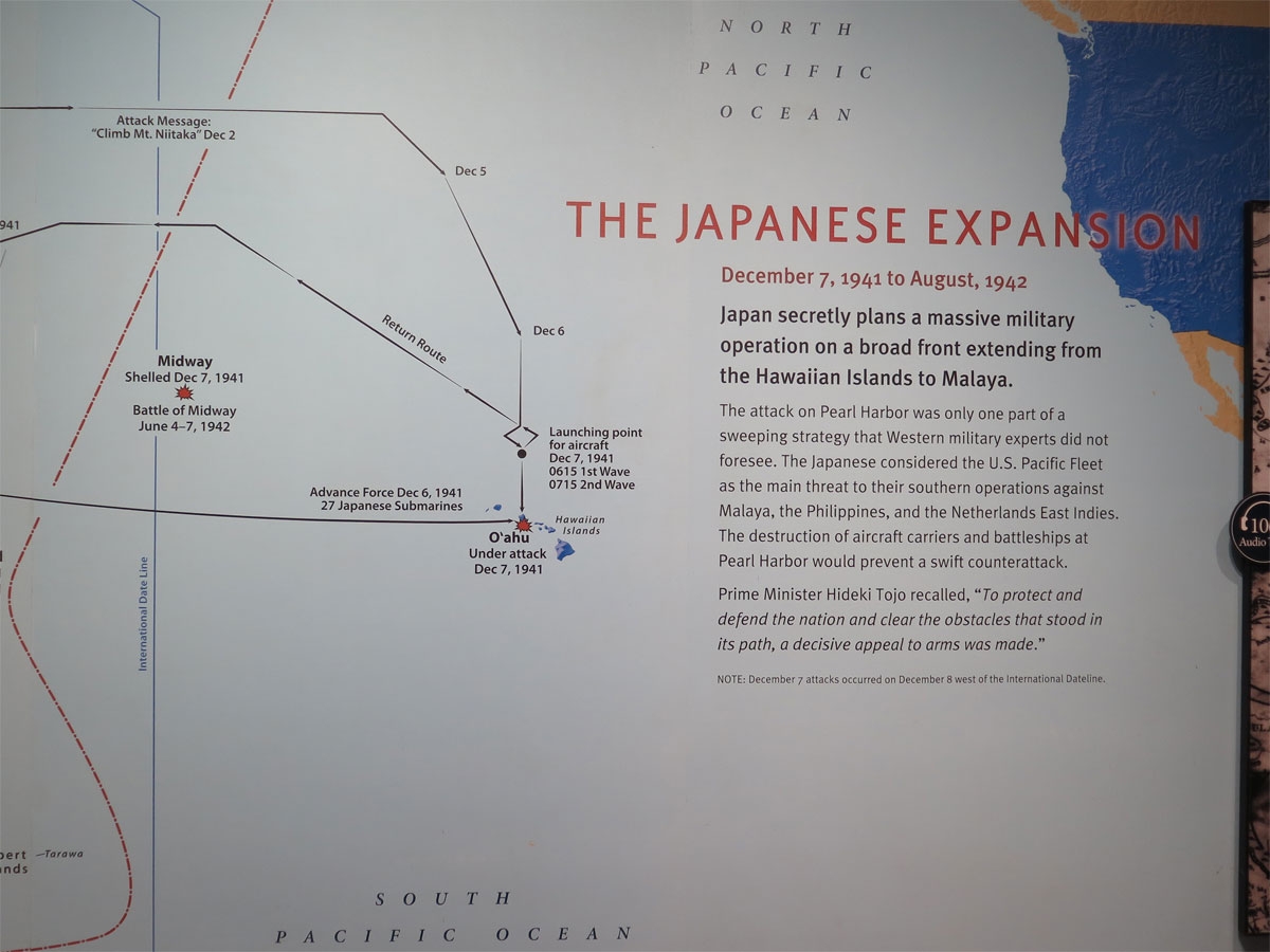
I’m glad we didn’t skip Oahu, of course. Even I wanted to see where Japan attacked the US in 1941.

Pearl Harbor is a beautiful place.

One can’t help but try to imagine what it must have been like to have been there during the firestorm. Planes flying low overhead, bombs dropping and exploding, fire and smoke belching and billowing out of structures, people lying dead, dismembered, or maybe only injured. Imagine the myriad sounds and smells…

It’s hard to image such a beautiful place under attack.

I imagine there were a lot of screams, too. It wasn’t just the military under attack, although that was the focus. There were many, many civilians in the area, too. Women and children. Elderly people. All going about their normal lives.

Interpretive displays near the memorial.

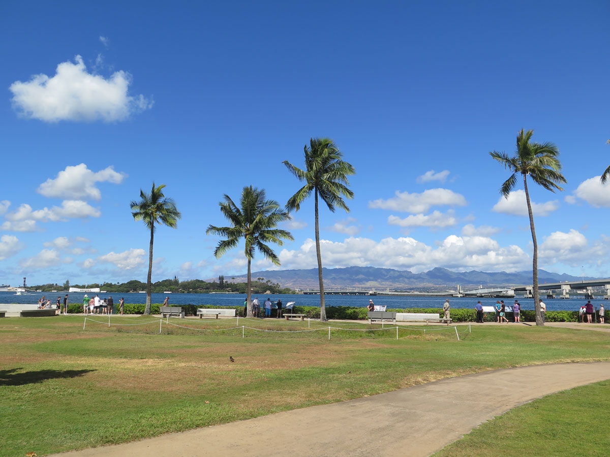
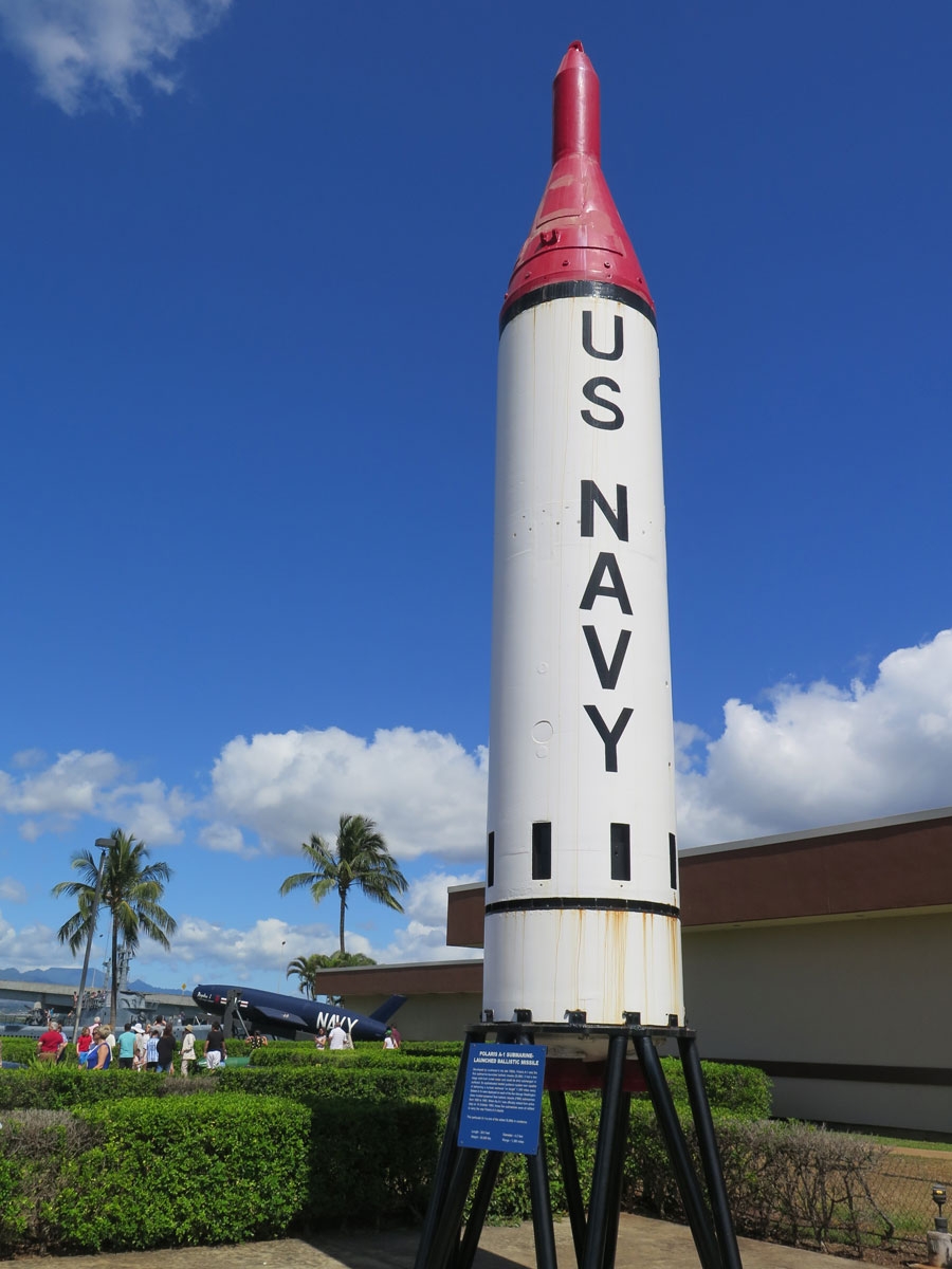
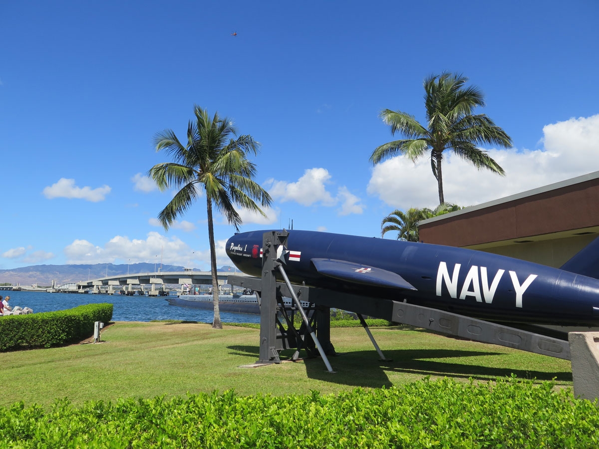
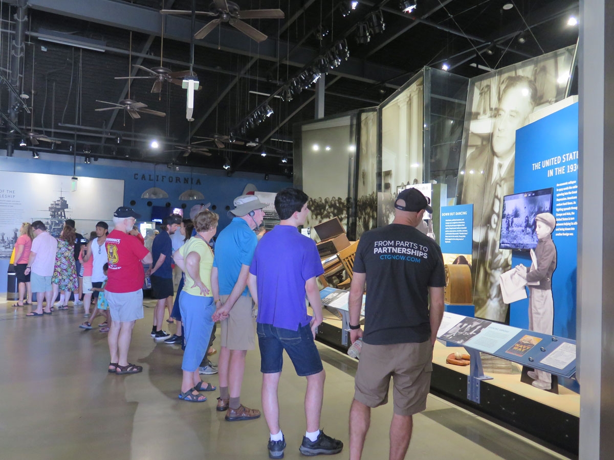
The National Park Service (NPS) always does a good job helping people understand the places the NPS was created to protect. There were a number of displays, photographs, artifacts, etc., as well as various videos playing interviews with people who had been there that fateful morning and survived to tell about it. Powerful stuff.

Scale model of the Arizona Memorial.

As explained on the NPS website:

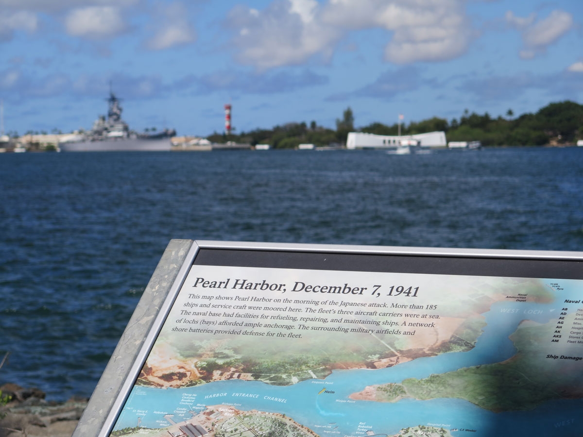
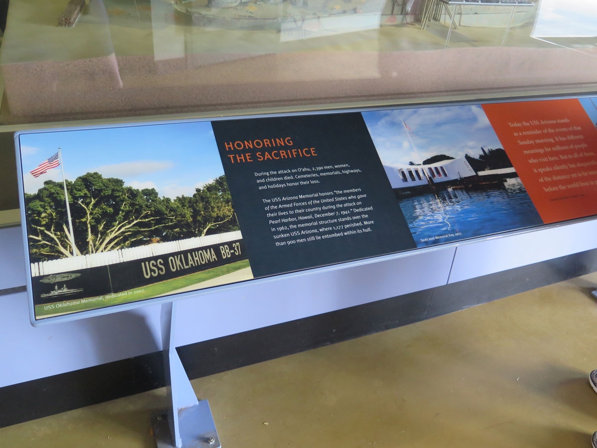
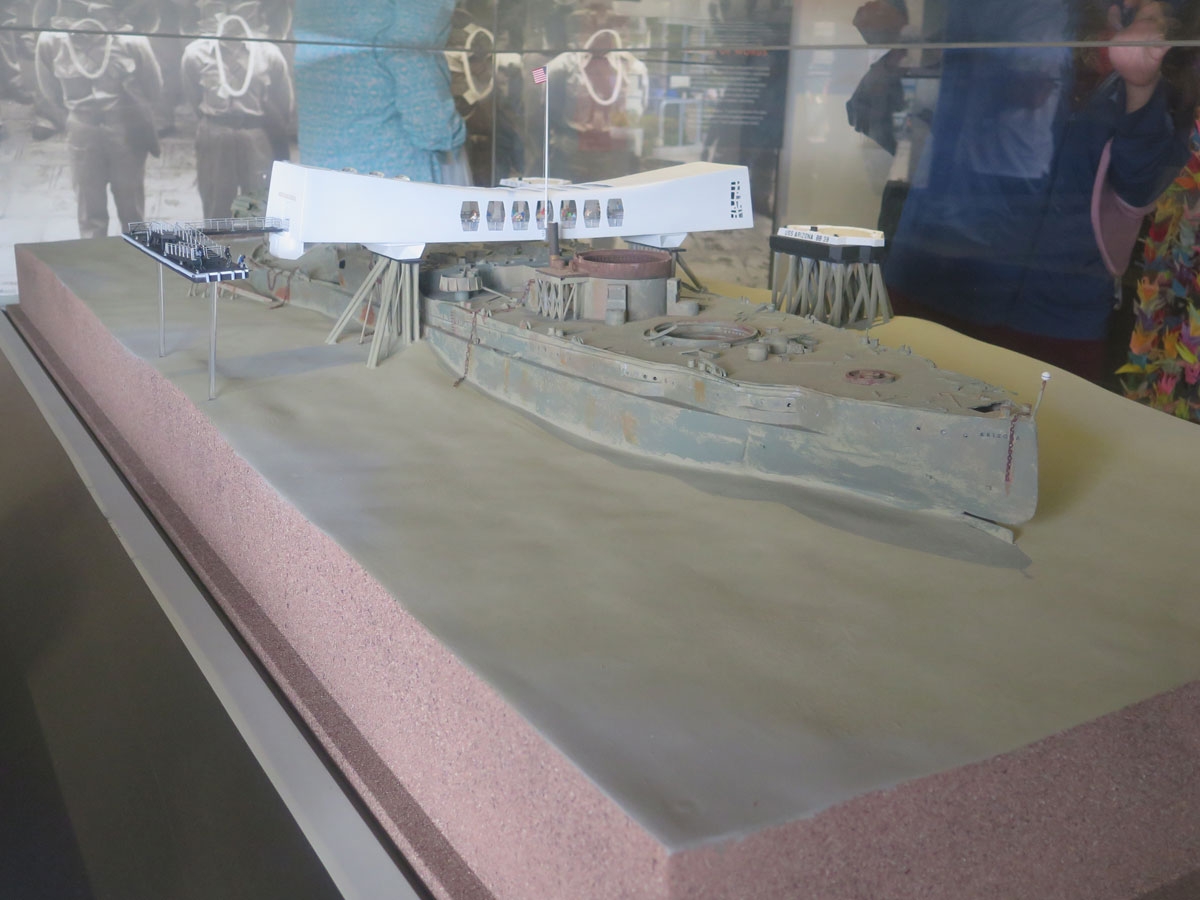
The Battleship USS Arizona was bombed on December 7, 1941, about 15 minutes into the Japanese attack on Pearl Harbor, killing 1,177 sailors and Marines. Over 900 could not be recovered from the ship and remain onboard. Today, Arizona rests where she fell, submerged in about 40 feet of water just off the coast of Ford Island.

Designed by Honolulu architect Alfred Preis, the USS Arizona Memorial was built in 1962 on top of (but not touching) the sunken USS Arizona. The memorial honors the memory of the crew of the USS Arizona, as well as all the other service members and civilians killed in the attack. A total of 2,341 sailors, soldiers, and Marines died as a result of the attack, as well as 49 civilians.

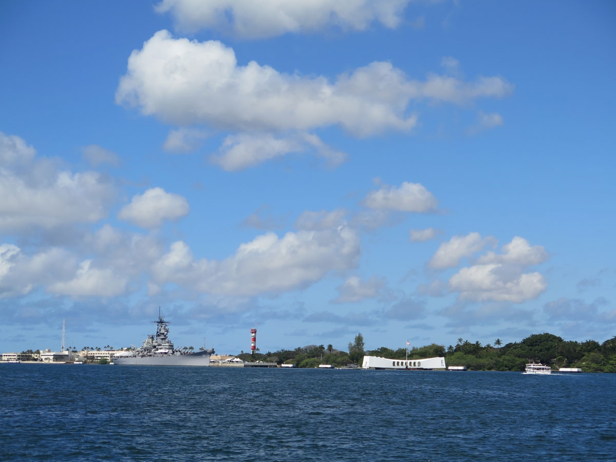
If you’d like to learn more about the memorial and see how it looks from the air, with the sunken ship visible underneath, CLICK HERE.

Approaching the memorial by boat.

The pier at the actual site is in need of repair, so we could not go inside the structure and look down upon the ship, which is mostly intact and resting on the harbor floor with about 900 bodies entombed inside.

Arizona Memorial


Battleship


Arizona Memorial


Arizona Memorial


As seen from a boat in Pearl Harbor.

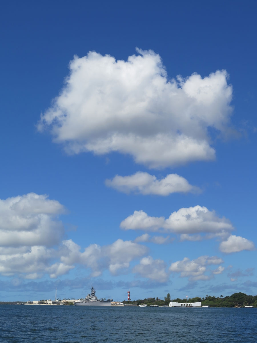
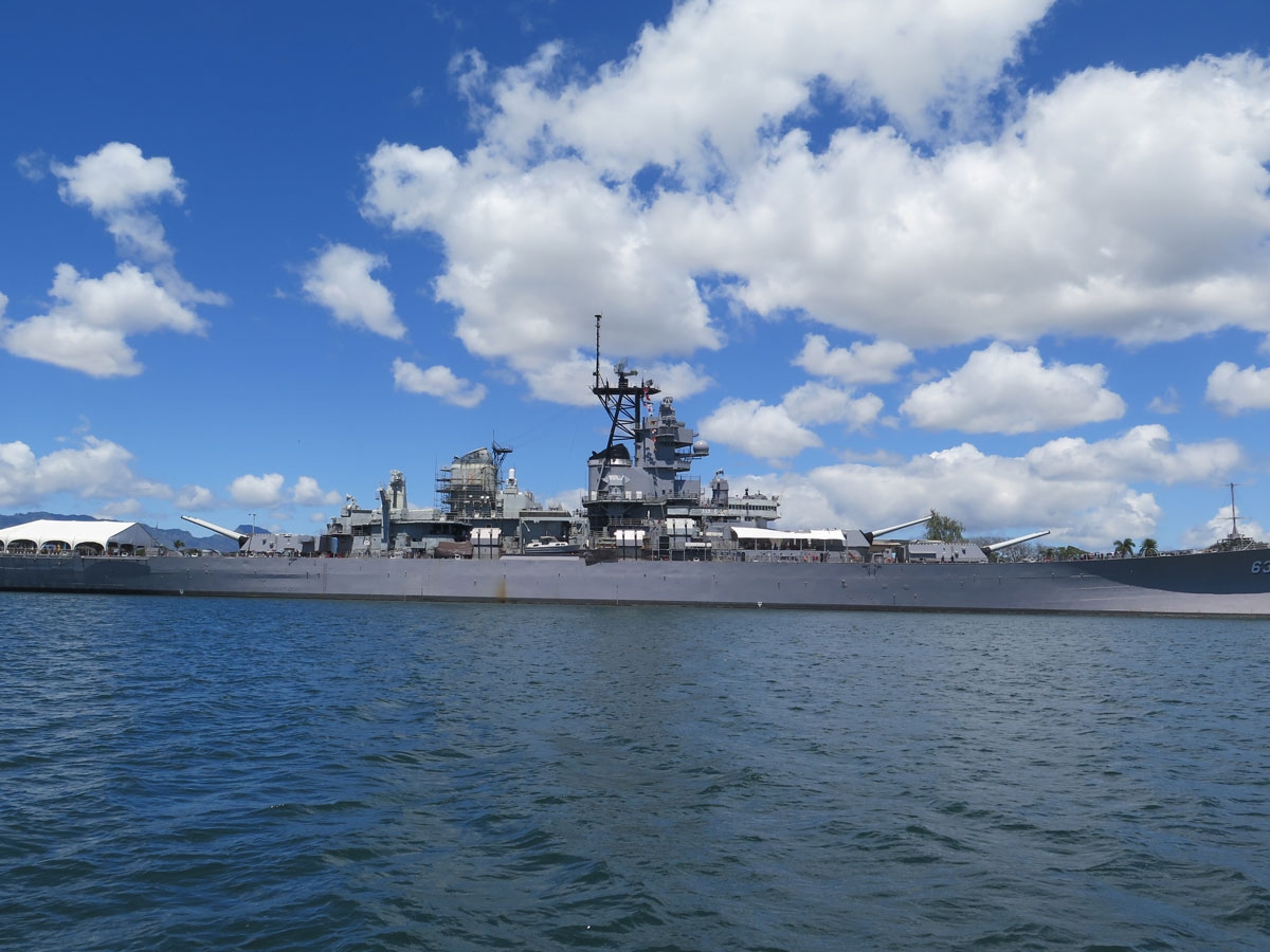
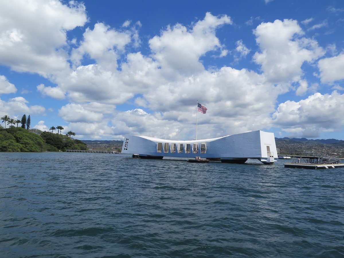
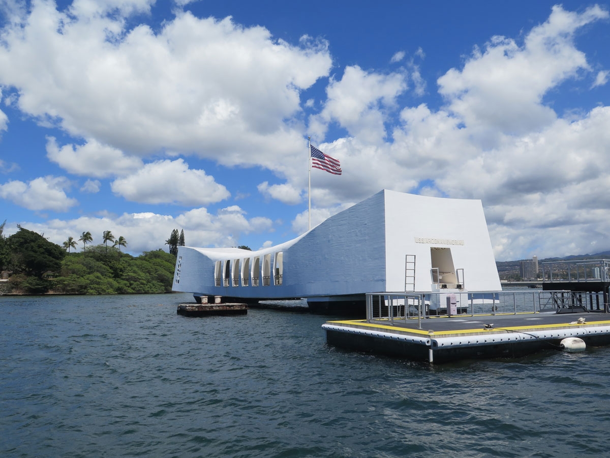
It was a beautiful day for a boat ride.

As seen at the visitor’s center.


As seen at the visitor’s center.


As seen at the visitor’s center.


As seen at the visitor’s center.

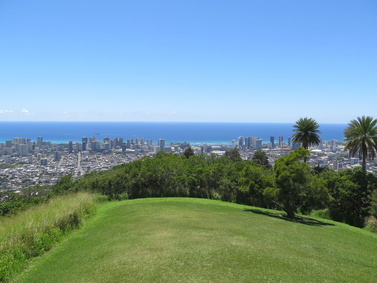
After a few sobering hours at Pearl Harbor, we were both ready to move on. Our next stop was the Pu’u ‘Ualaka’a State Wayside, a state park I read about in a travel guide, which is described on its website as, “Conveniently located close to downtown Honolulu, Puʻu ʻUalakaʻa State Wayside provides a beautiful, panoramic view of southern Oahu from Diamond Head to Pearl Harbor.

Who can resist a good panoramic view?

The road to the top was interesting.

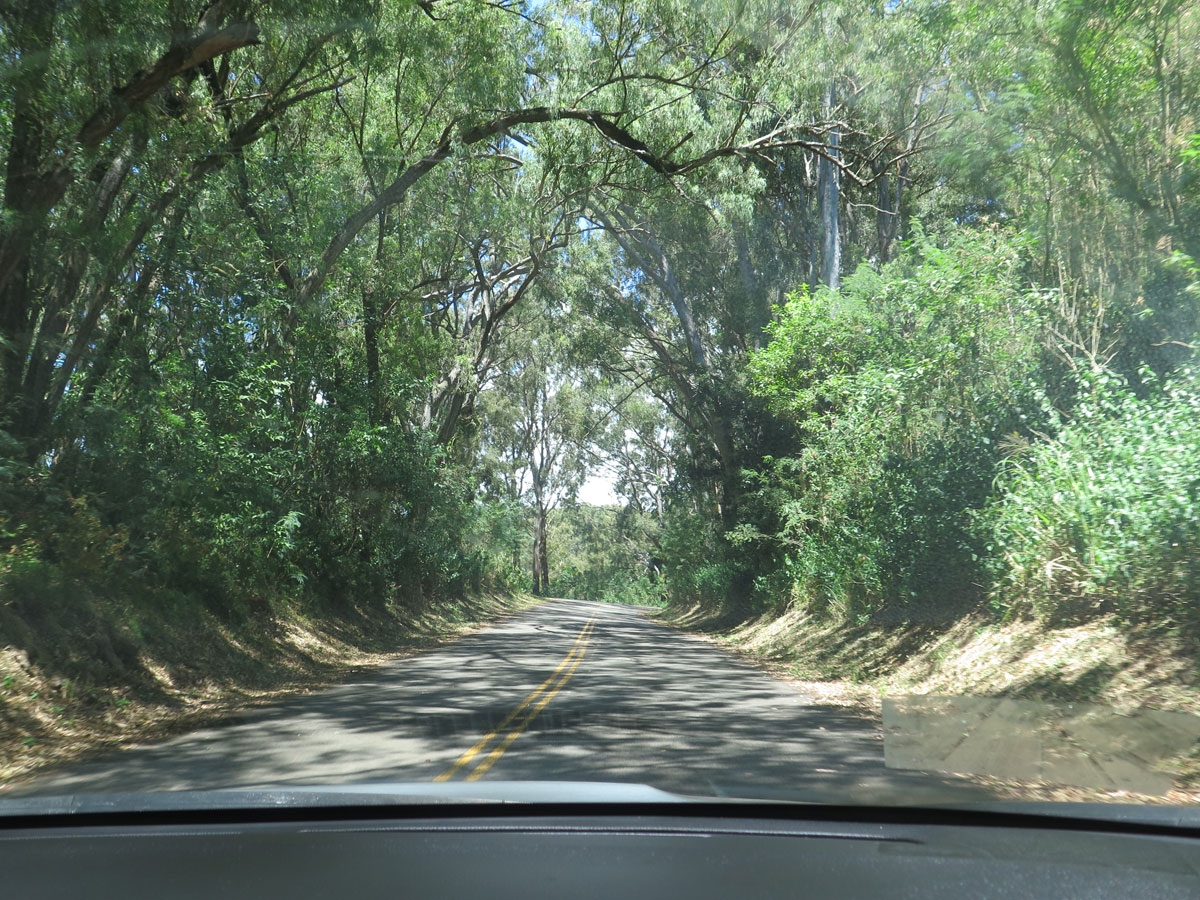
I hadn’t seen pictures, I had only read a little bit about the park. It was a winding, twisty, steep, narrow drive to get to the top. Essentially, we were driving through a jungle. The road was paved and in relatively good condition as there are homes scattered along the route, but the vegetation was very thick and dense.

Hint of what was yet to come.

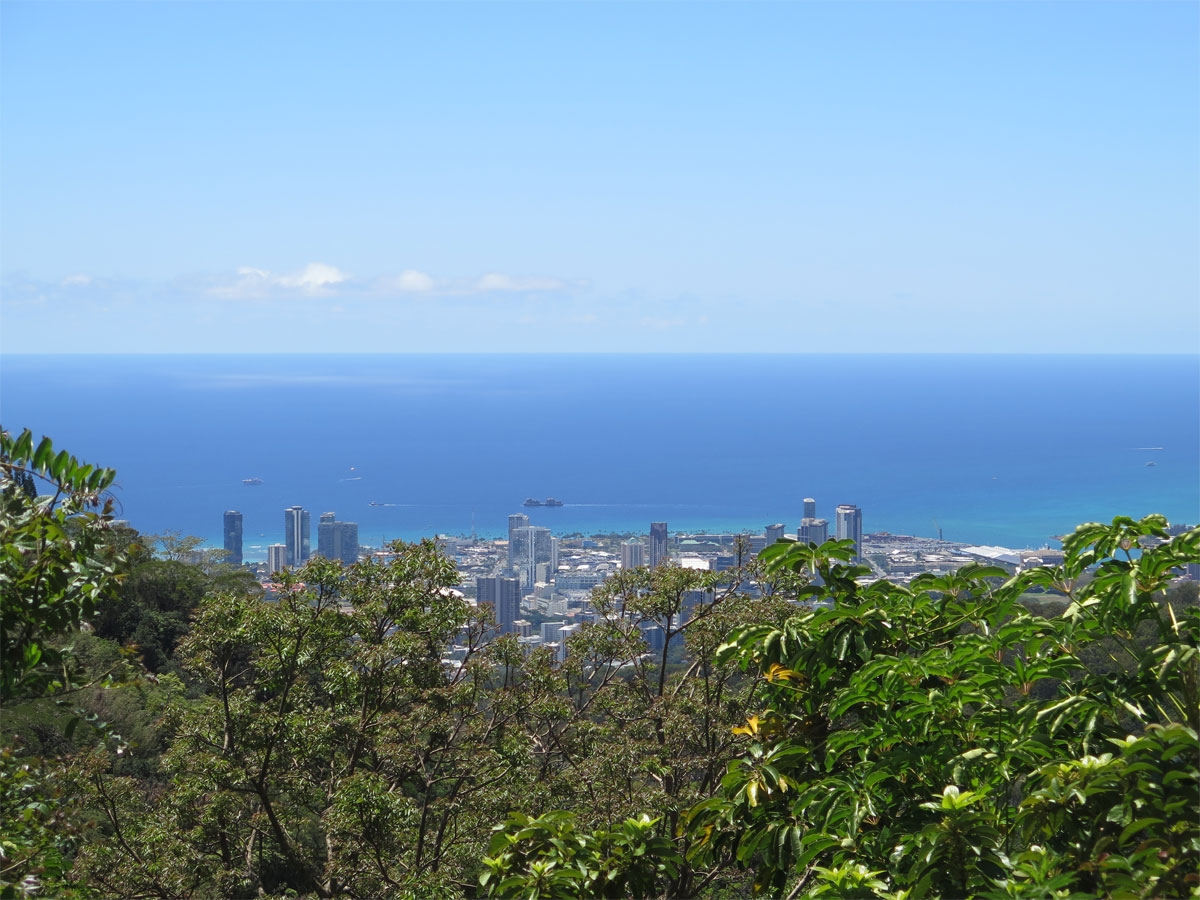
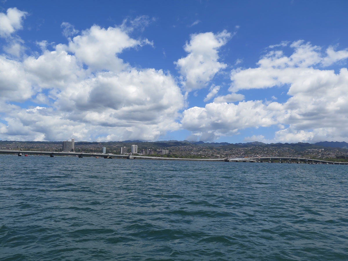
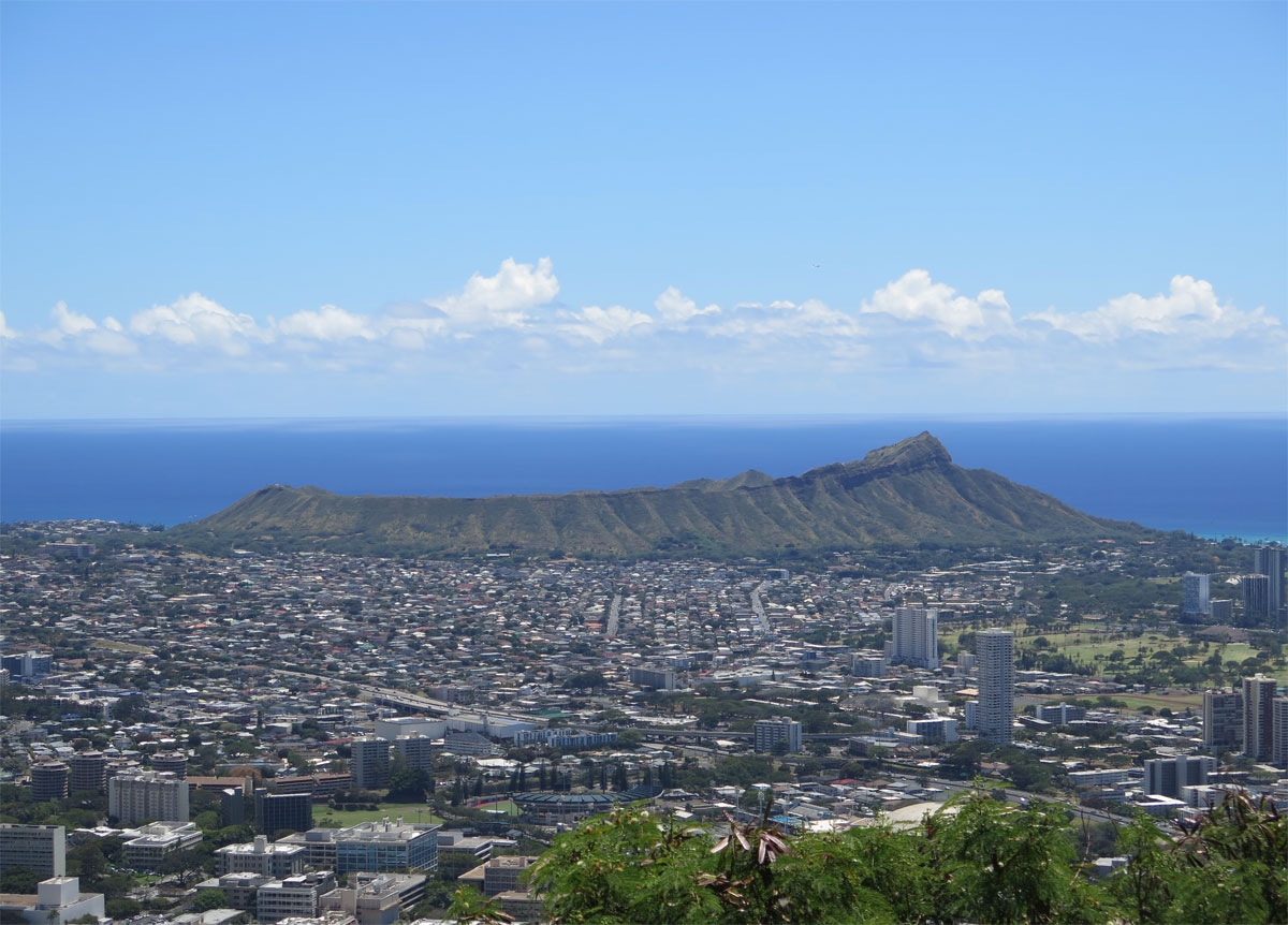
We finally came to a pull-off where we could get out and see. That’s Honolulu in the shot above.

Diamond Head

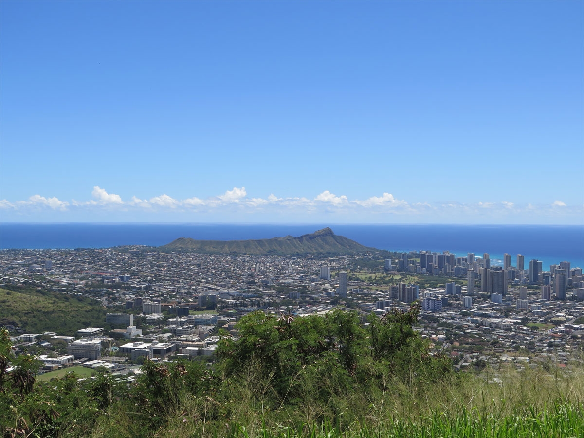
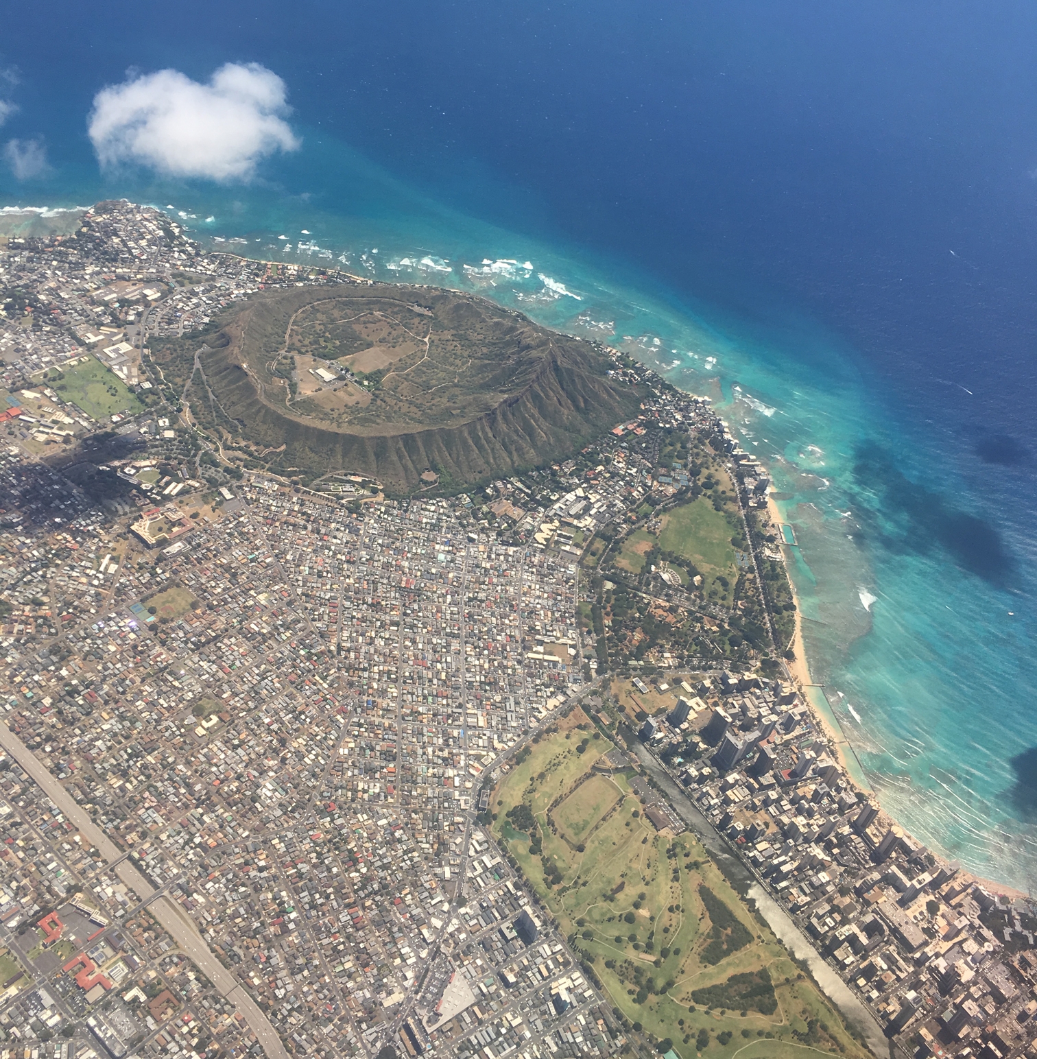
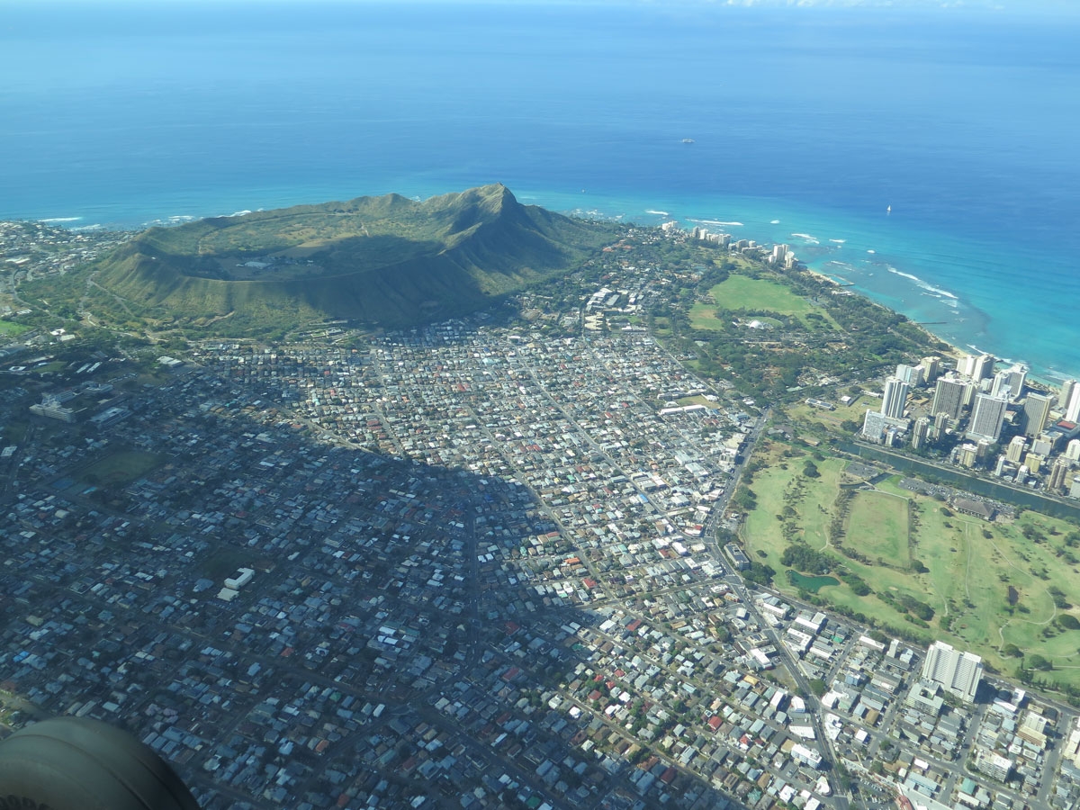
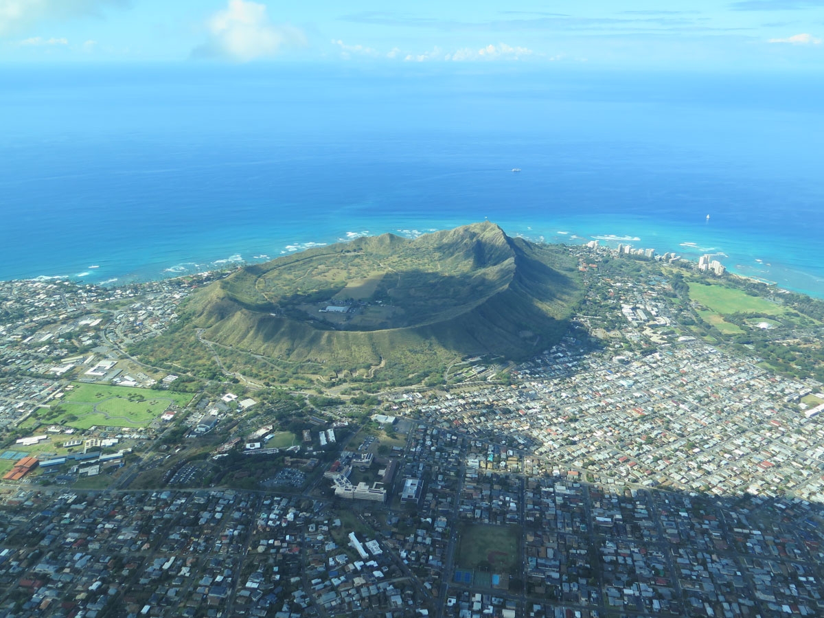
According to the state’s website, “Diamond Head is a defining feature of the view known to residents and tourists of Waikīkī. The volcanic tuff cone is a State Monument. While part of it is closed to the public and serves as a platform for antennas used by the US government, the crater’s proximity to Honolulu’s resort hotels and beaches makes the rest of it a popular destination.”

Close-up of the Diamond Head cone.

There are trails for people to climb to the top of Diamond Head, but we weren’t feeling quite that energetic.

Lovely view. Waikiki is on the left.


Honolulu Airport


It’s a very densely populated area.


Pretty blue water visible on Waikiki Beach.

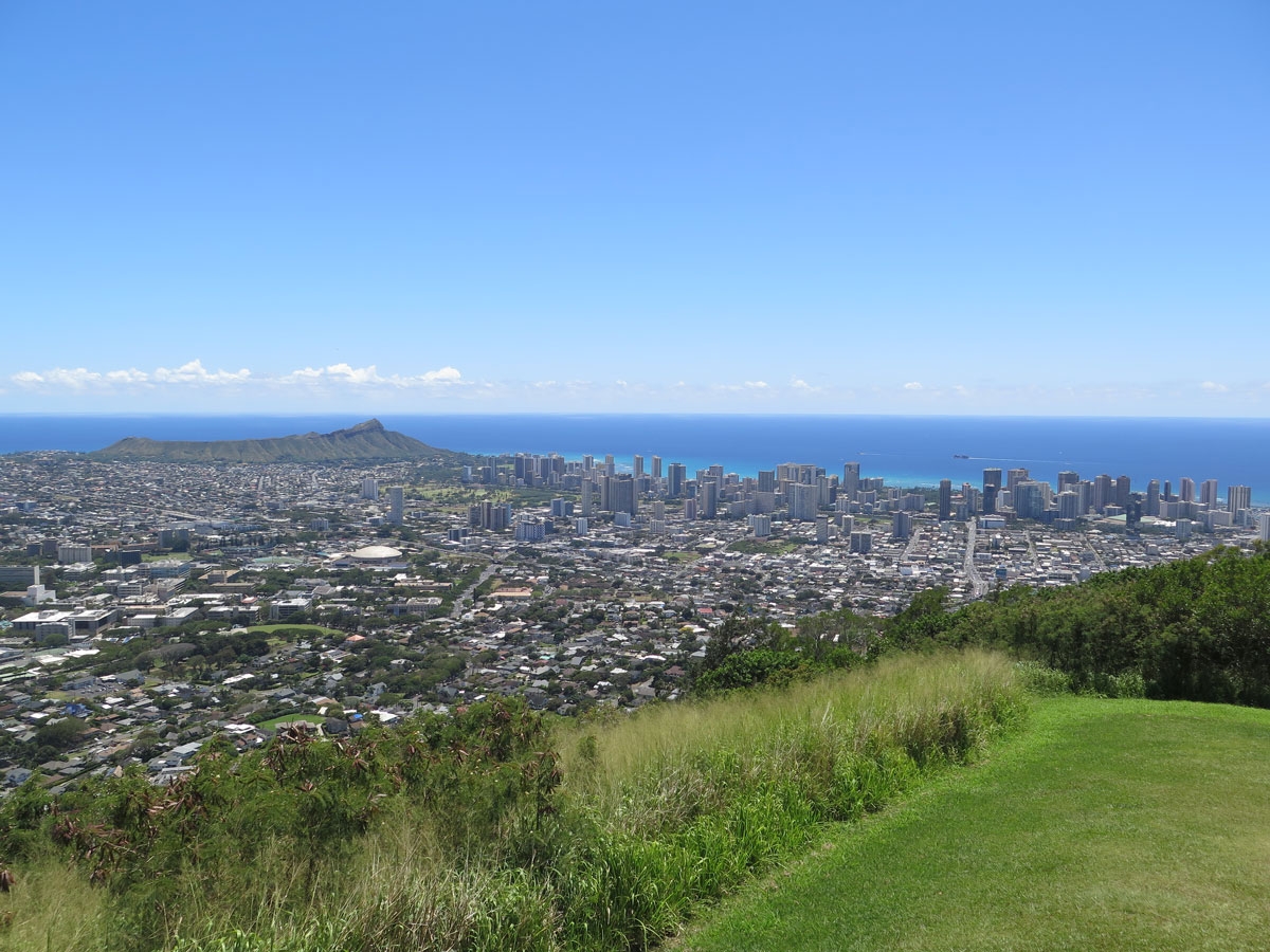
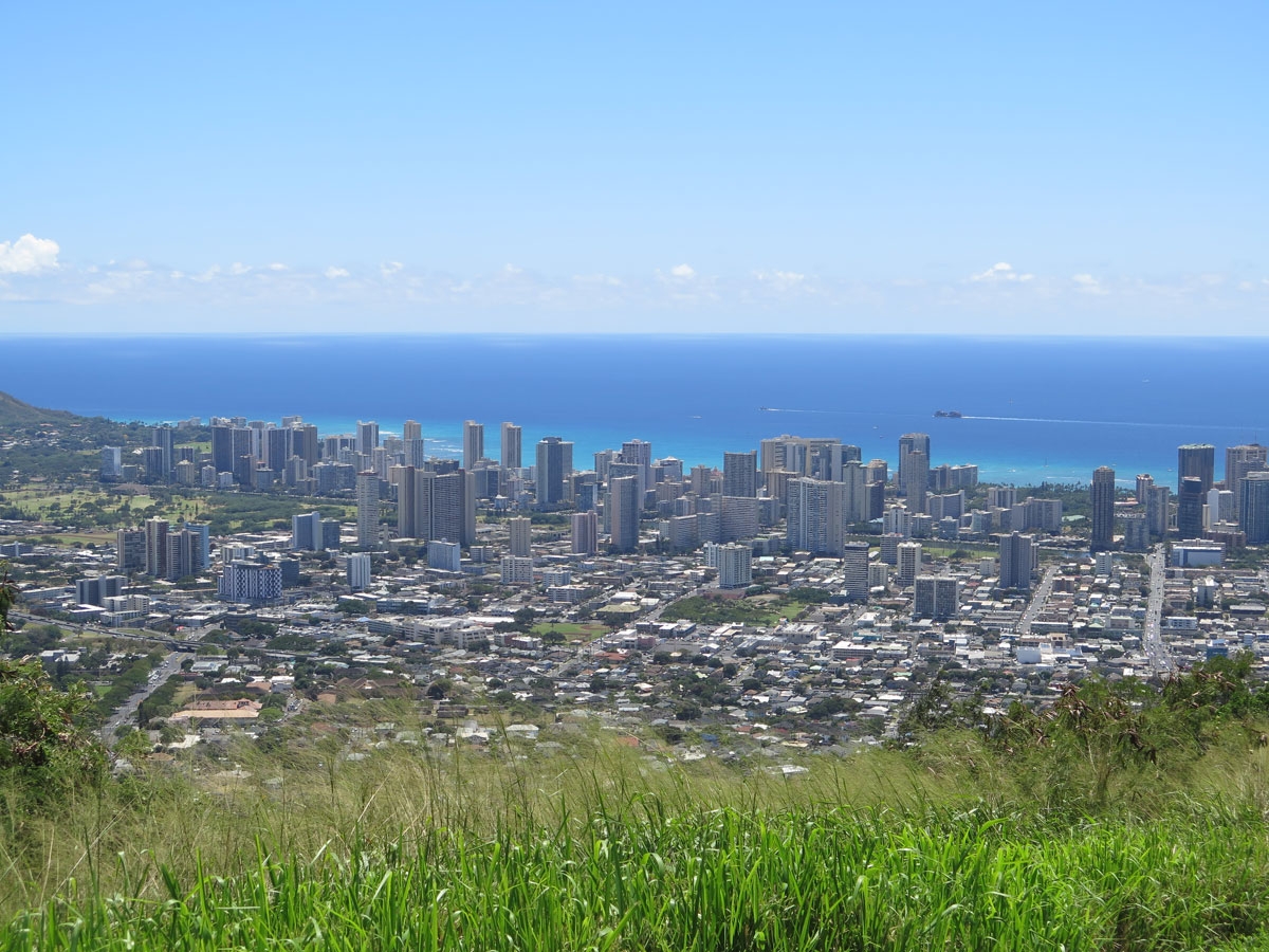
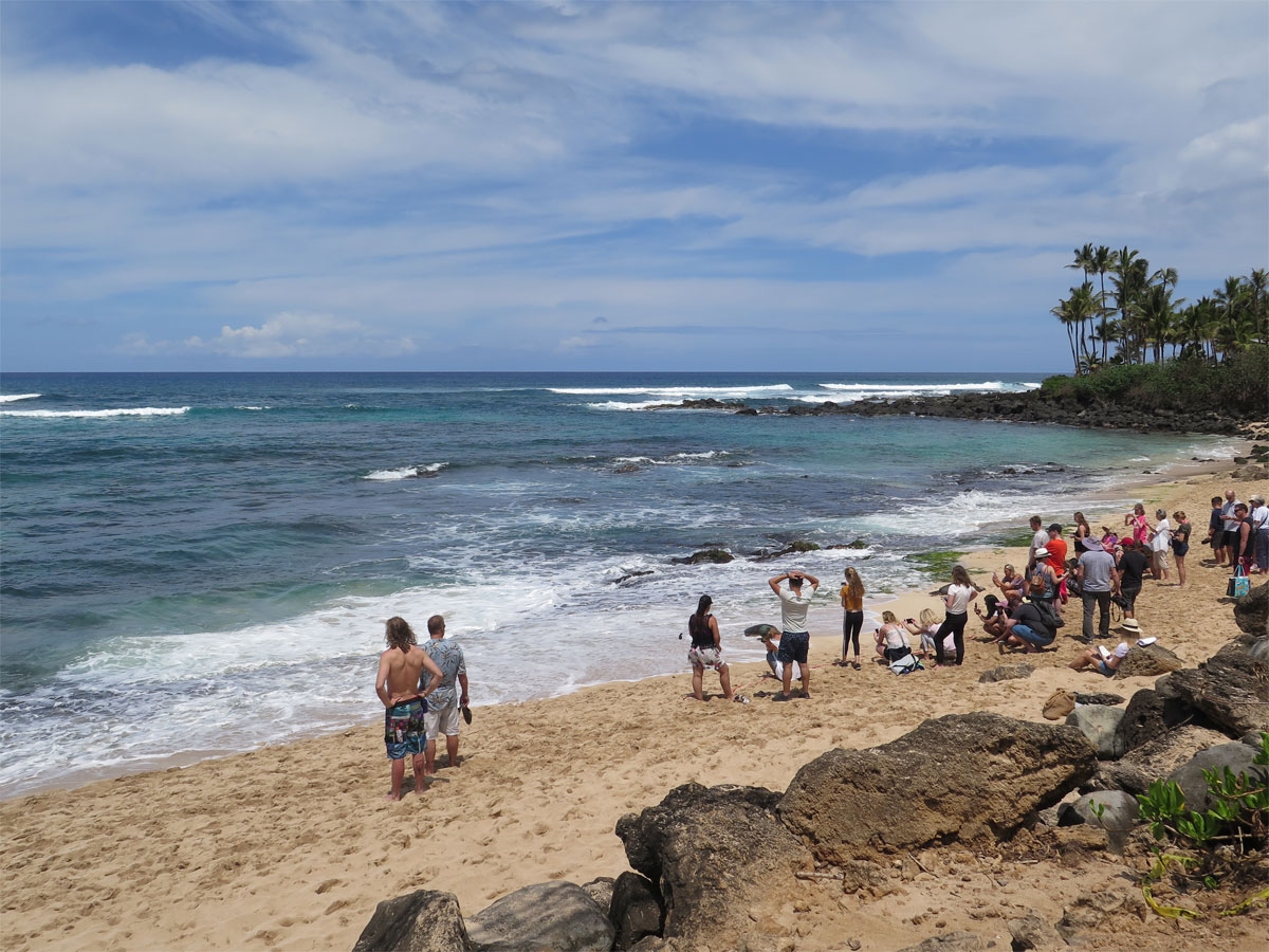
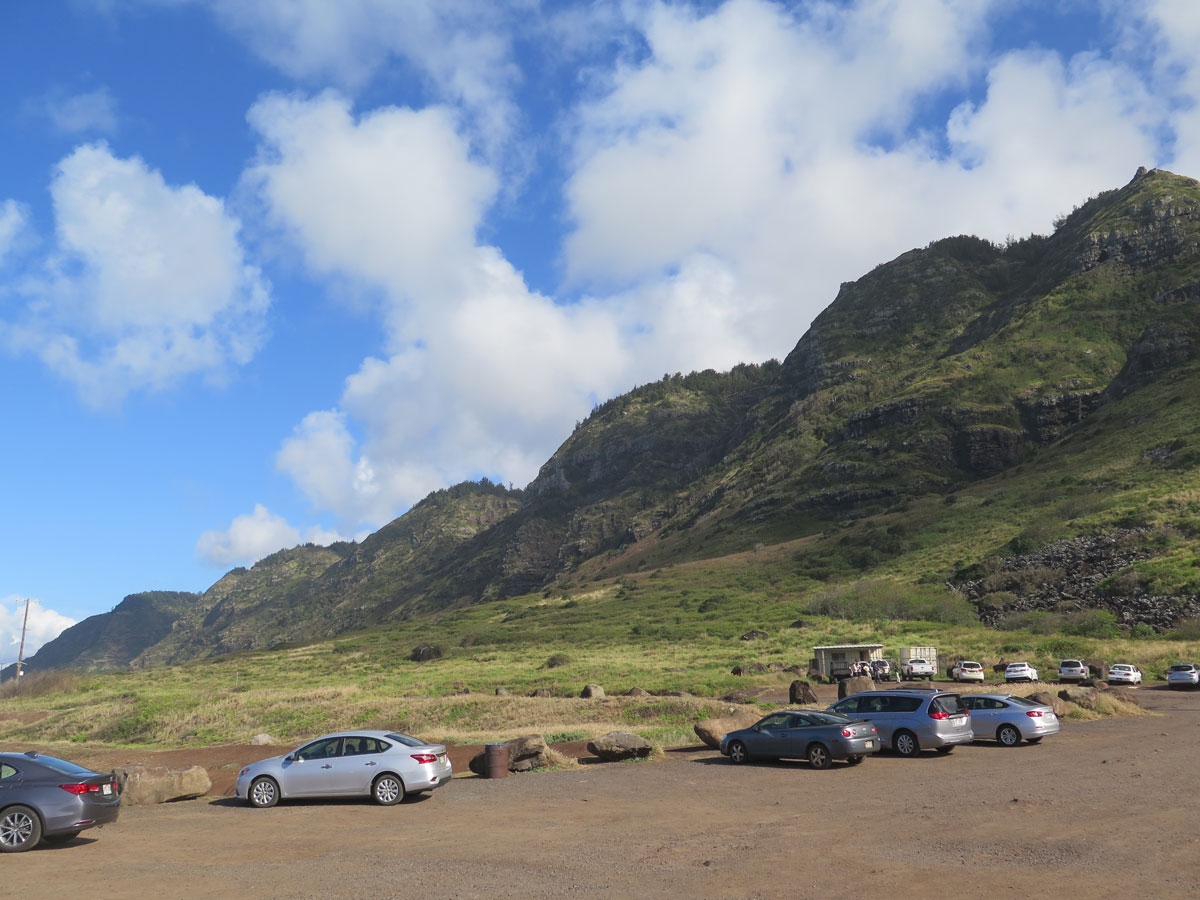
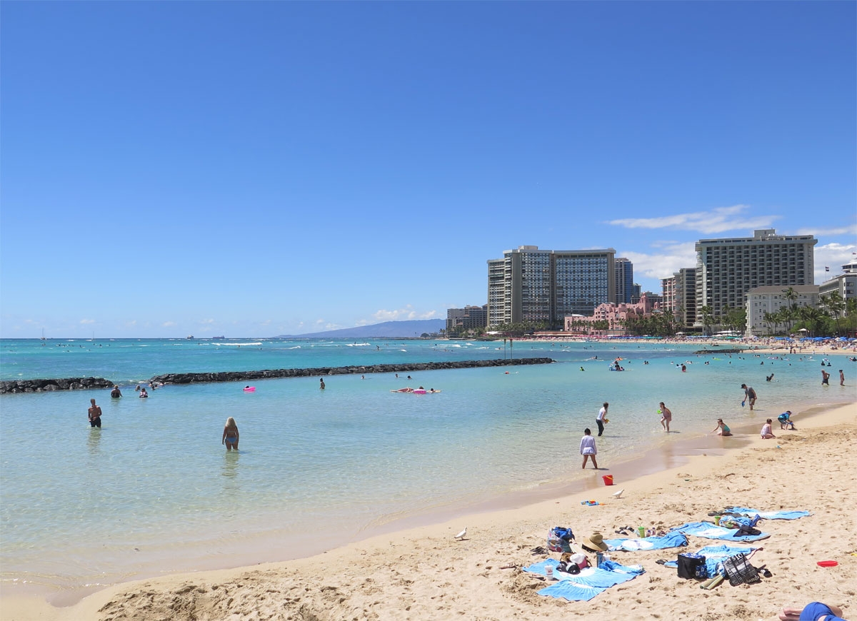
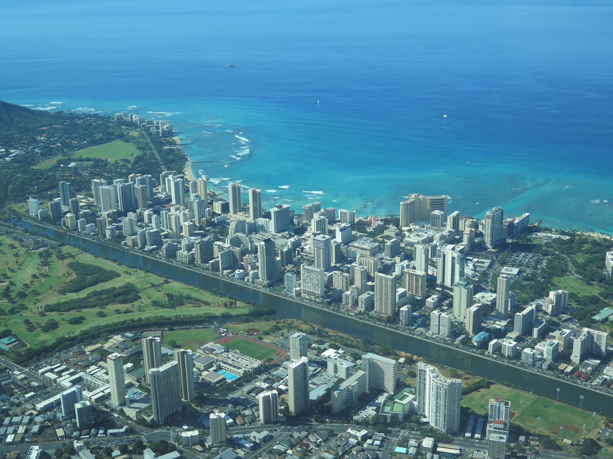
Perhaps it’s clear why we wanted to stay on the other, “wilder” side of the island? It just looked like a big city from afar. So much so that I almost said, “screw visiting Waikiki.” Almost. But we were THAT close to a world-famous beach, I figured we really should make our way through the concrete jungle and its masses of people for a closer look.

Waikiki Beach

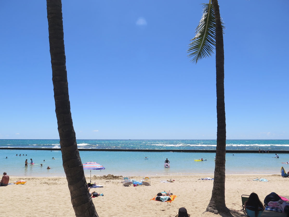
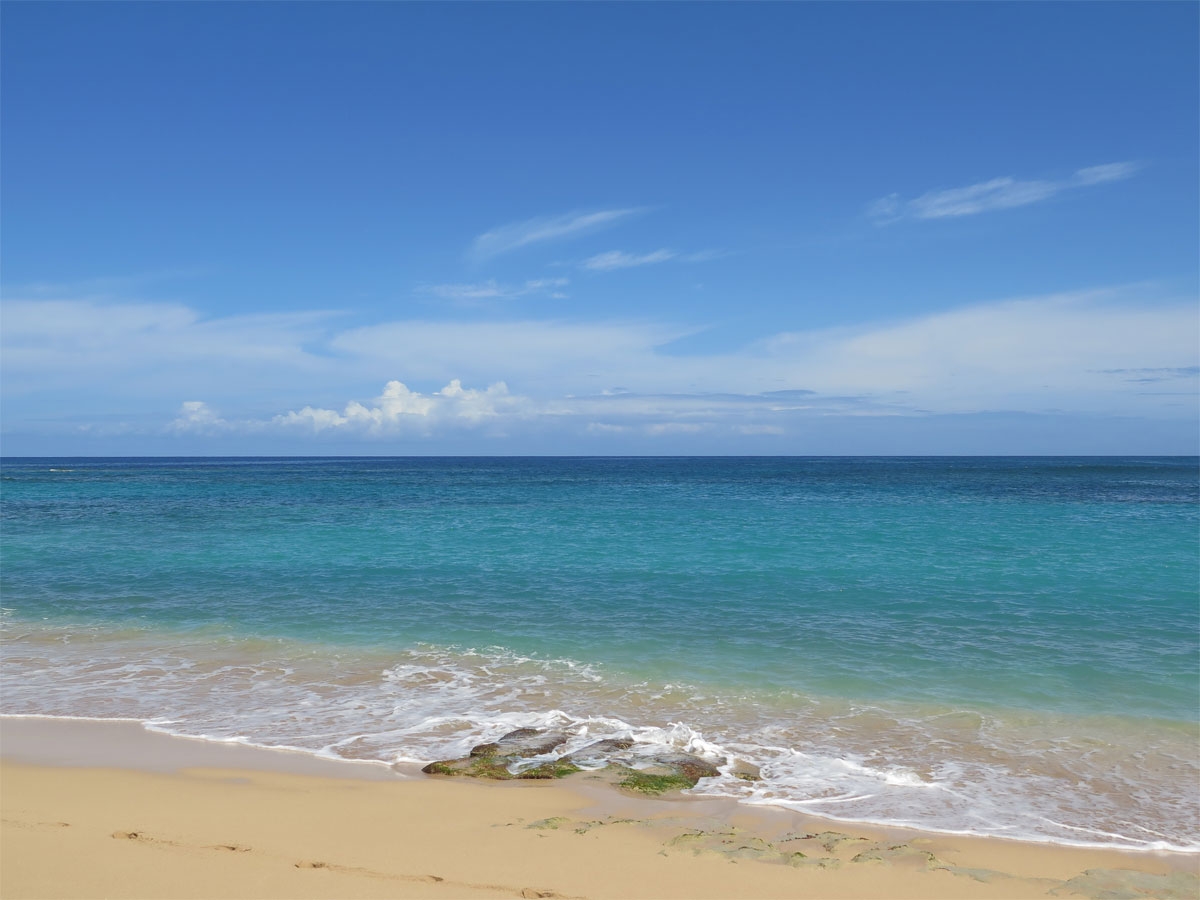
The view out over the water from the beach was lovely. I can certainly see the appeal of the beach to people who are visiting the city and have no car and/or no desire to explore less-populated places on the island. But the view looking inland from the beach was just like the view of any other big city except maybe a bit more-colorful, especially since lots of folks were wearing Hawaiian shirts.

Waikiki Beach

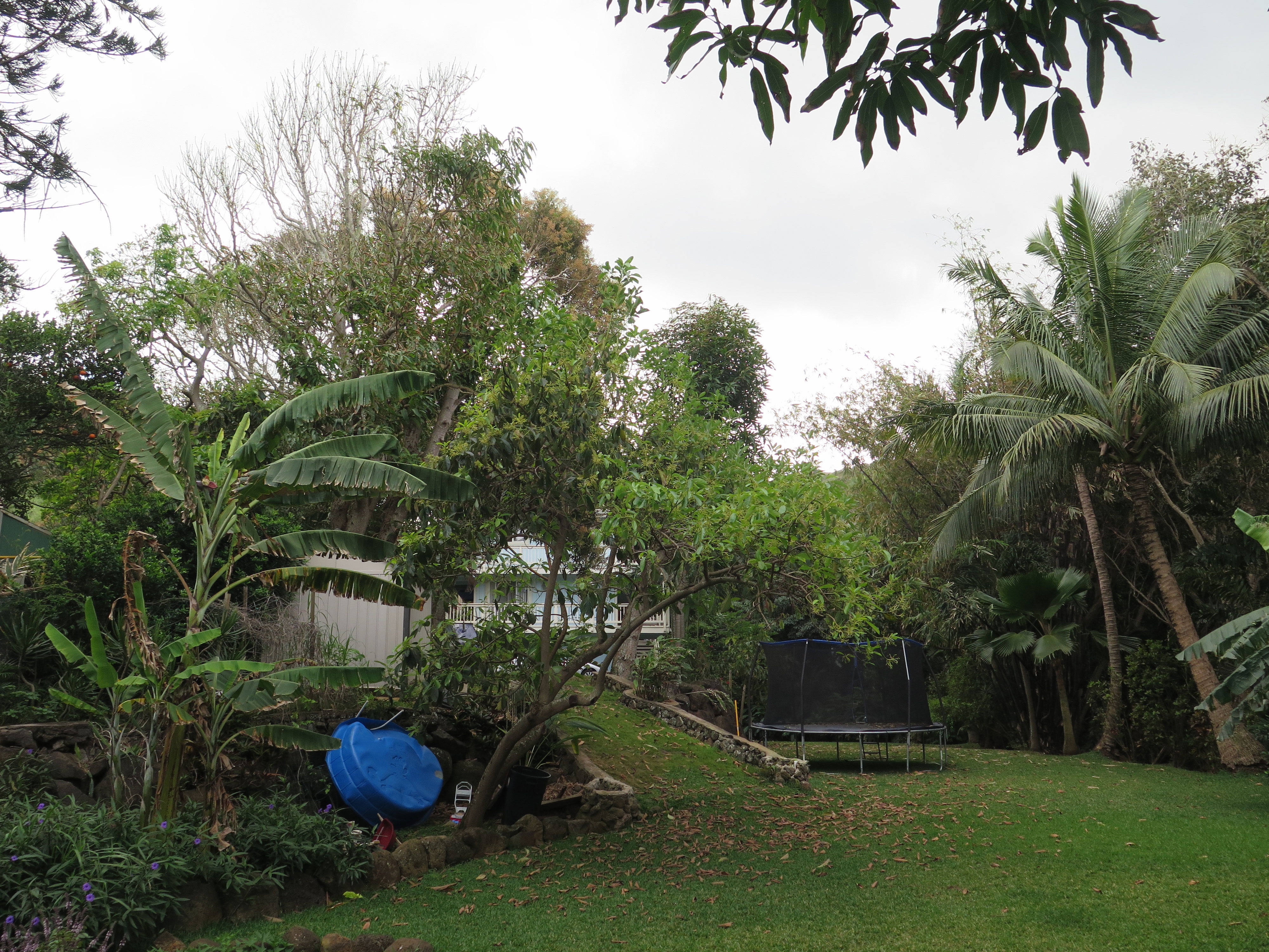
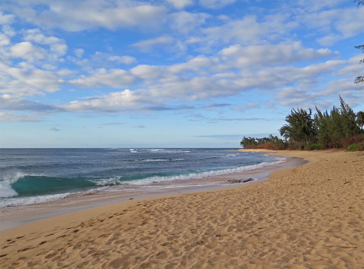
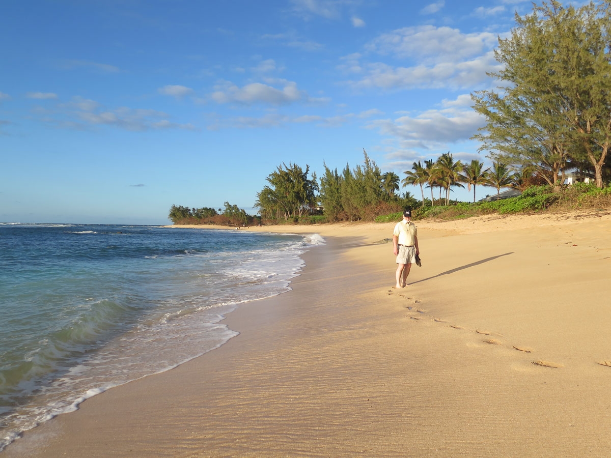
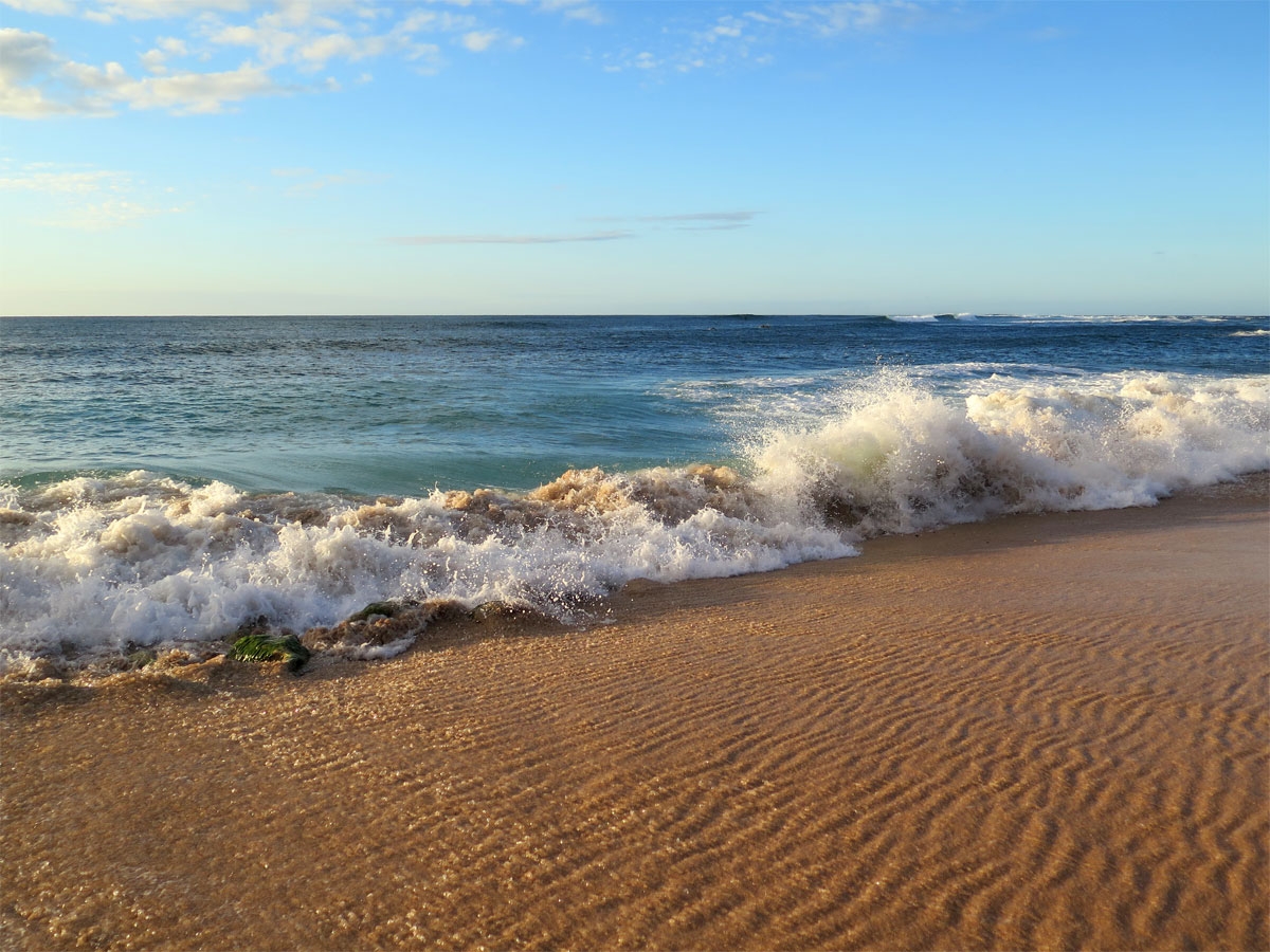
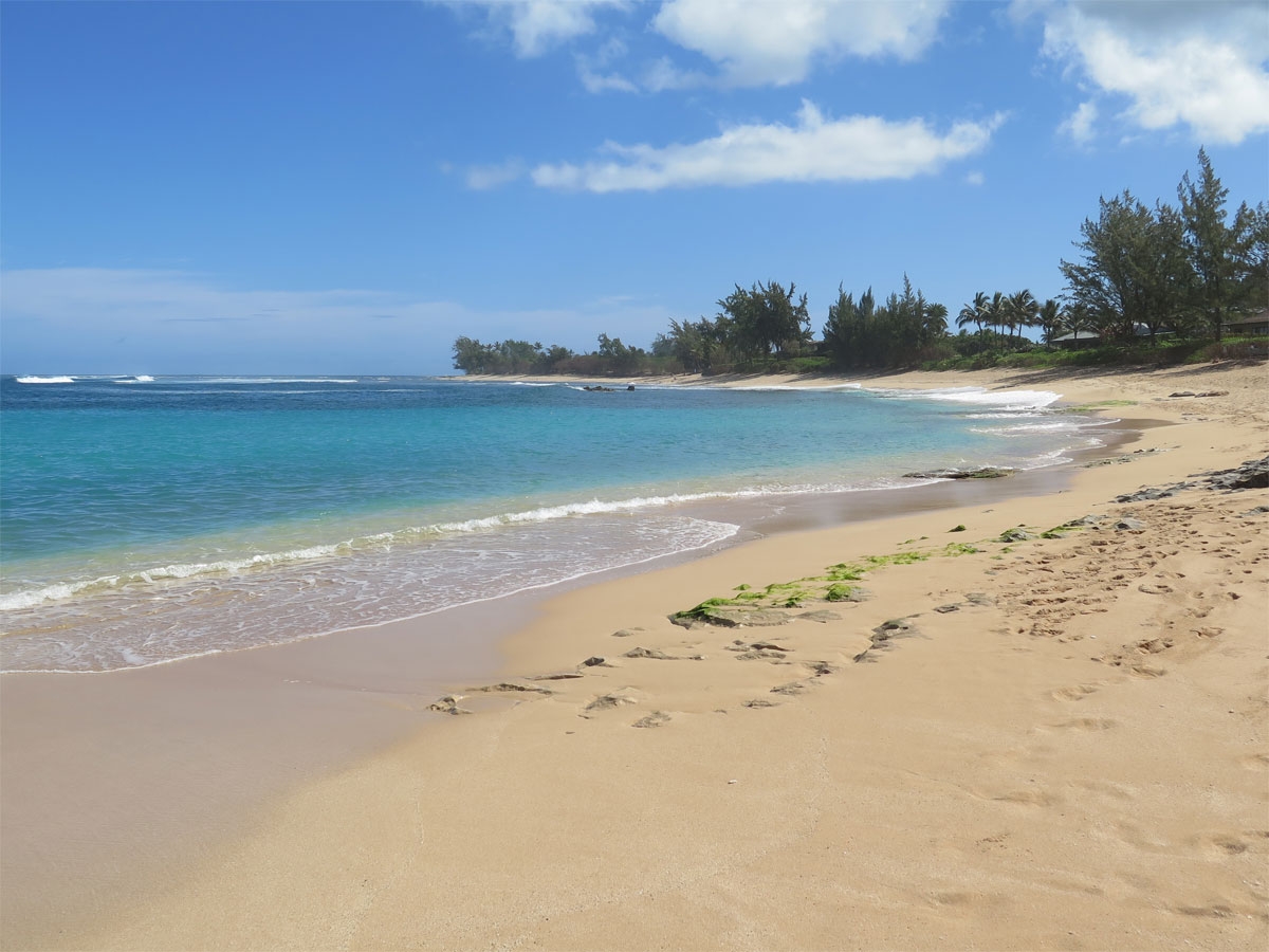
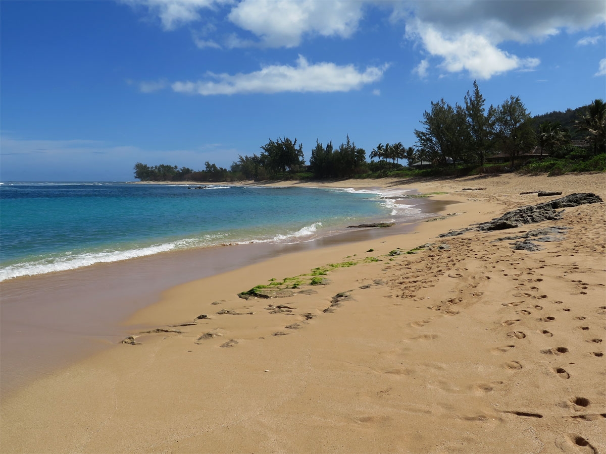
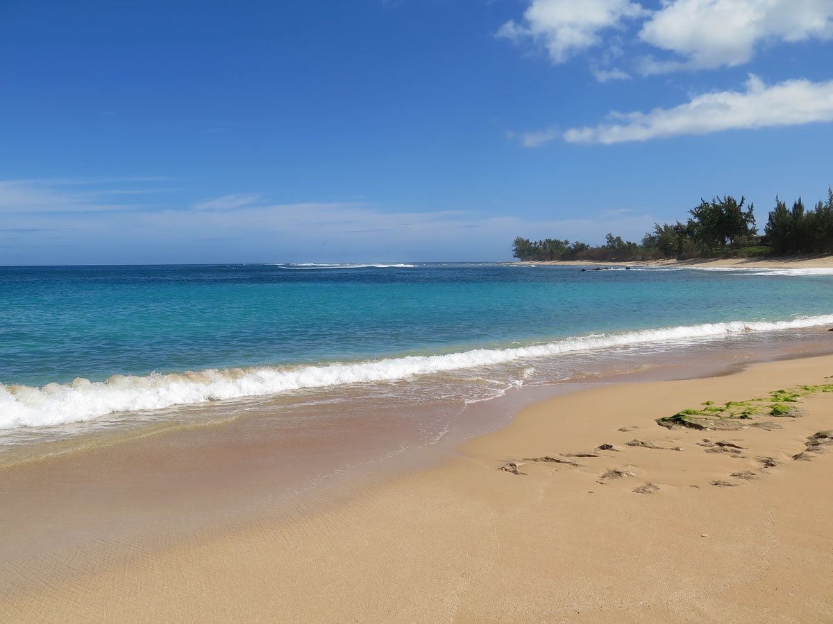
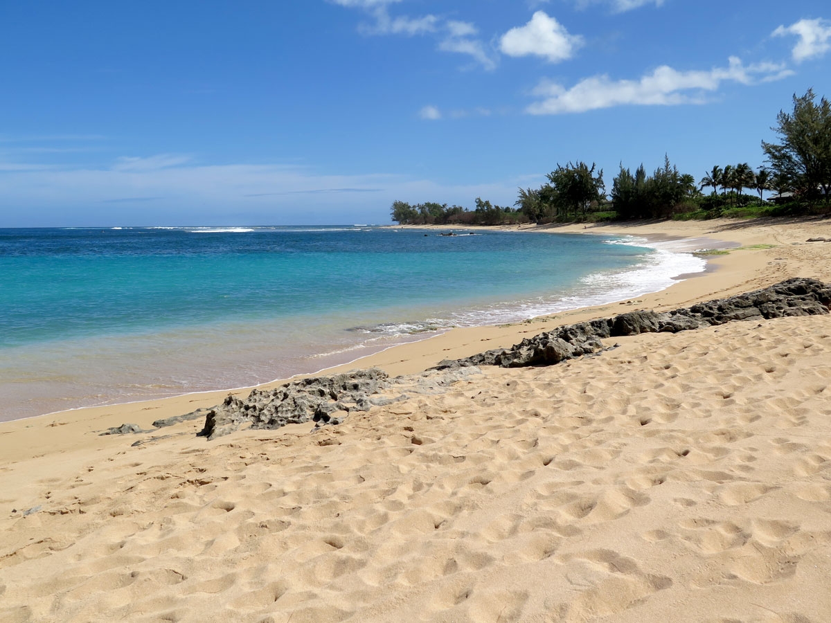
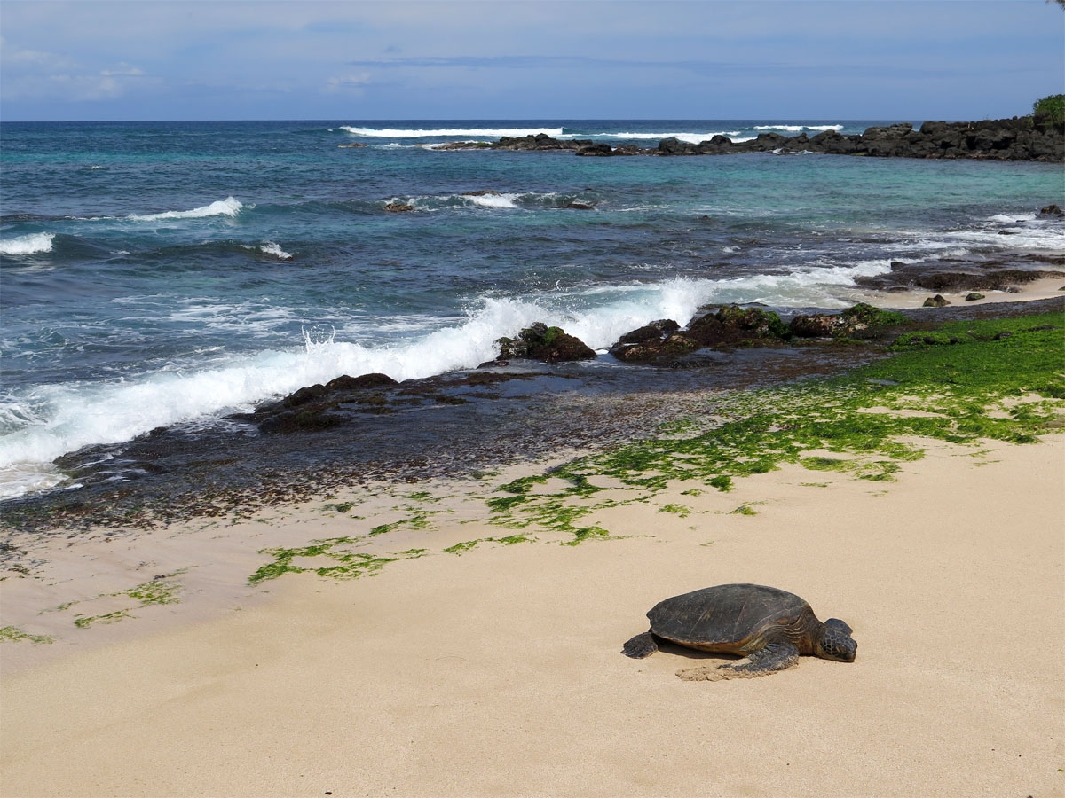
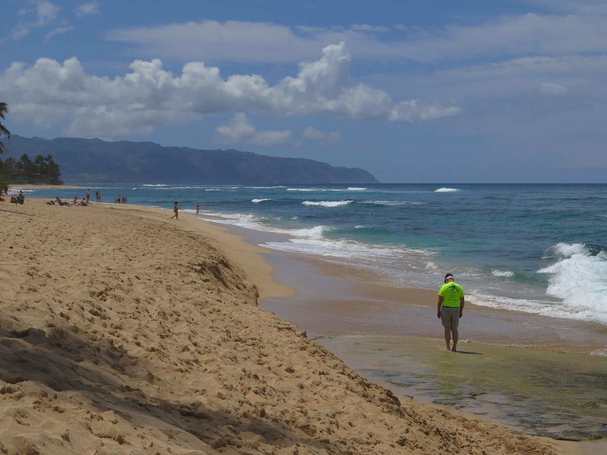
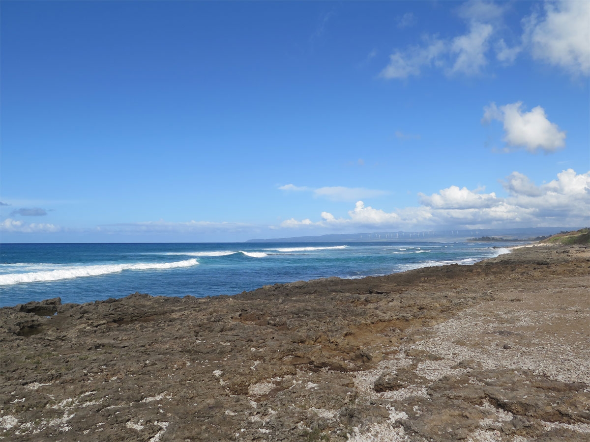
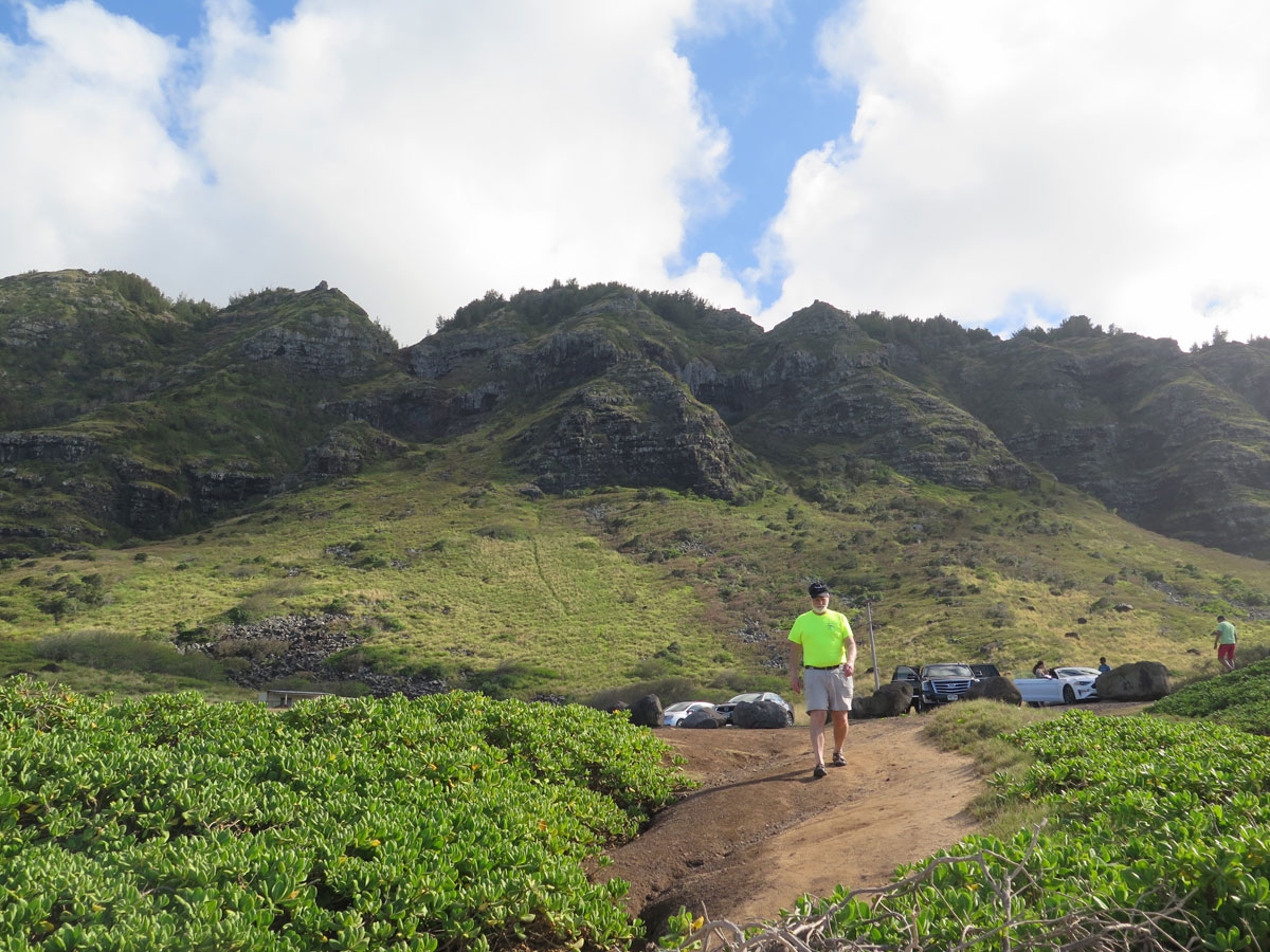
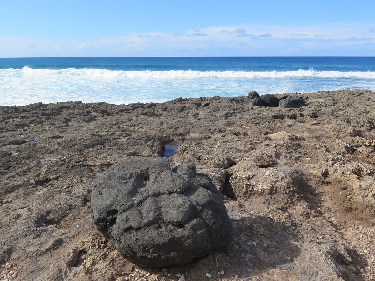
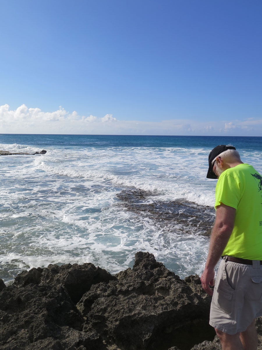
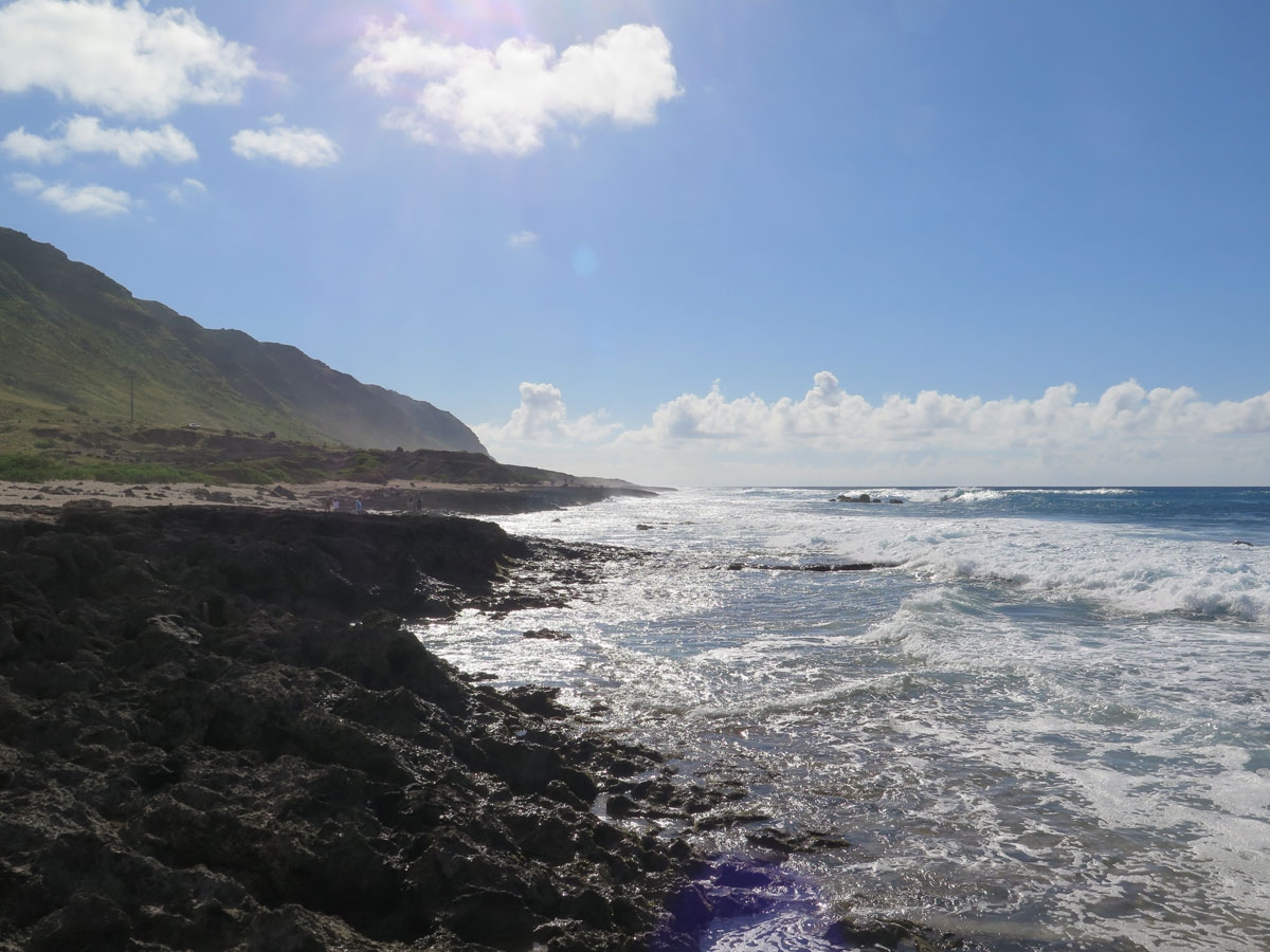
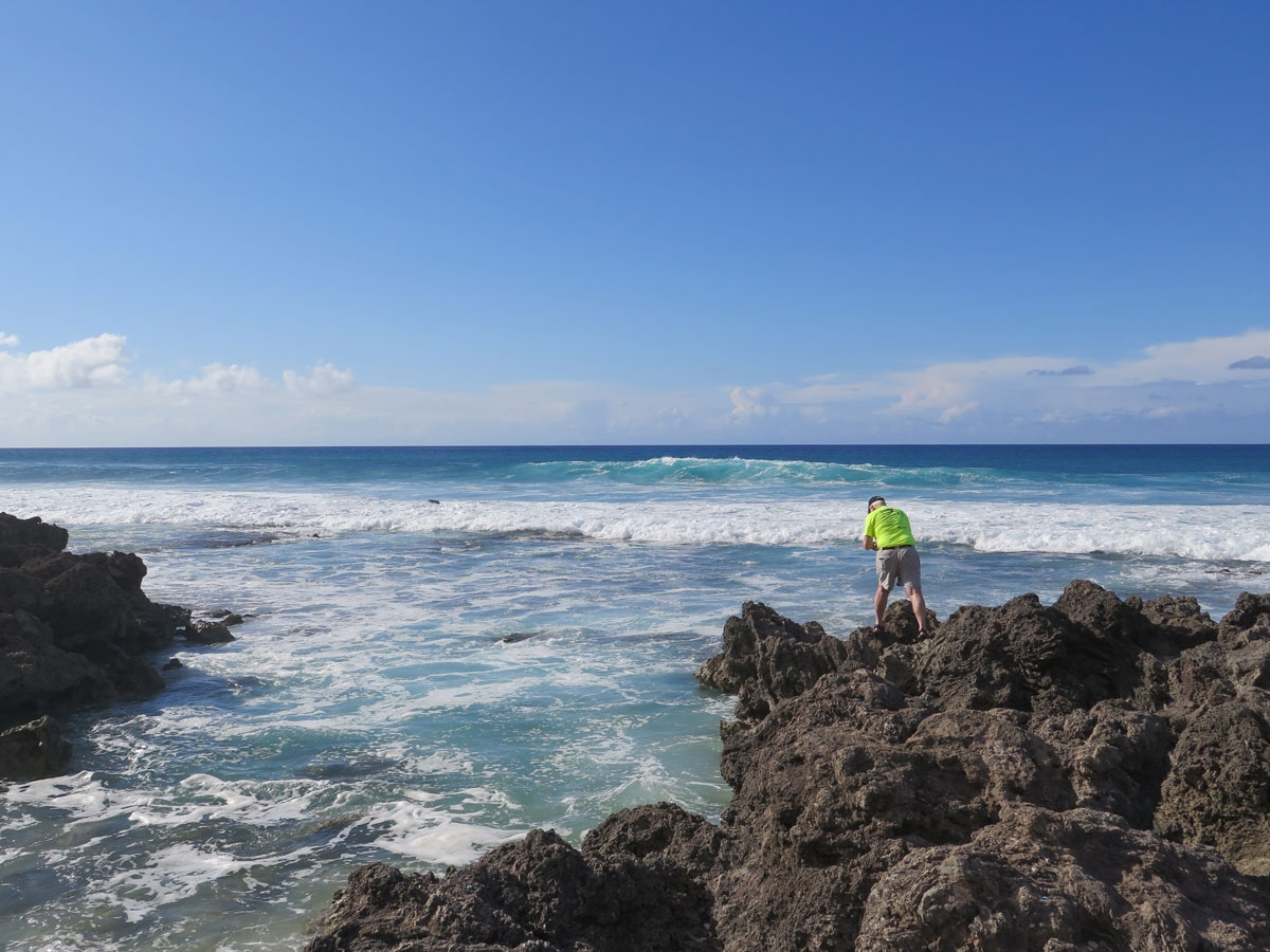
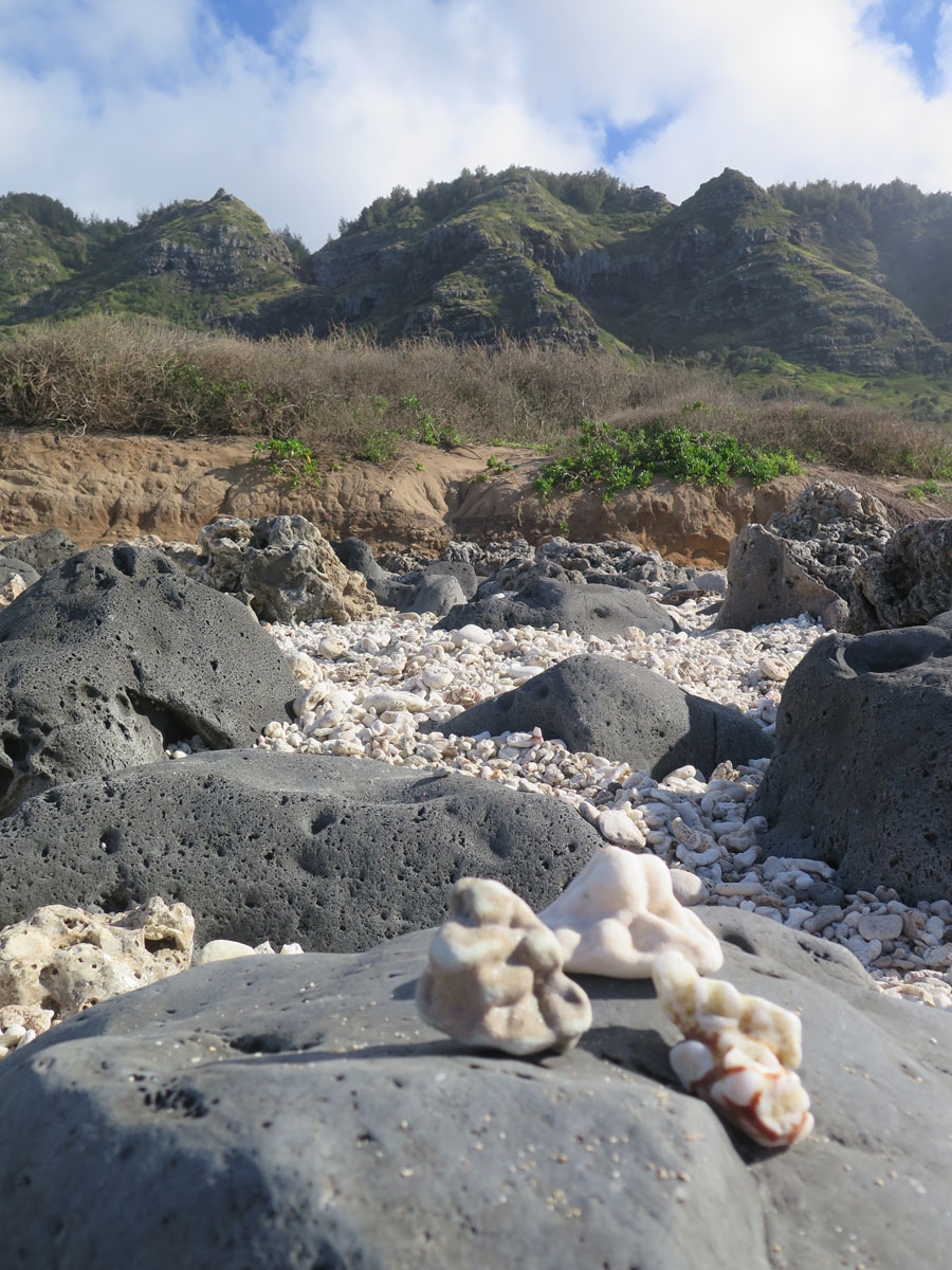
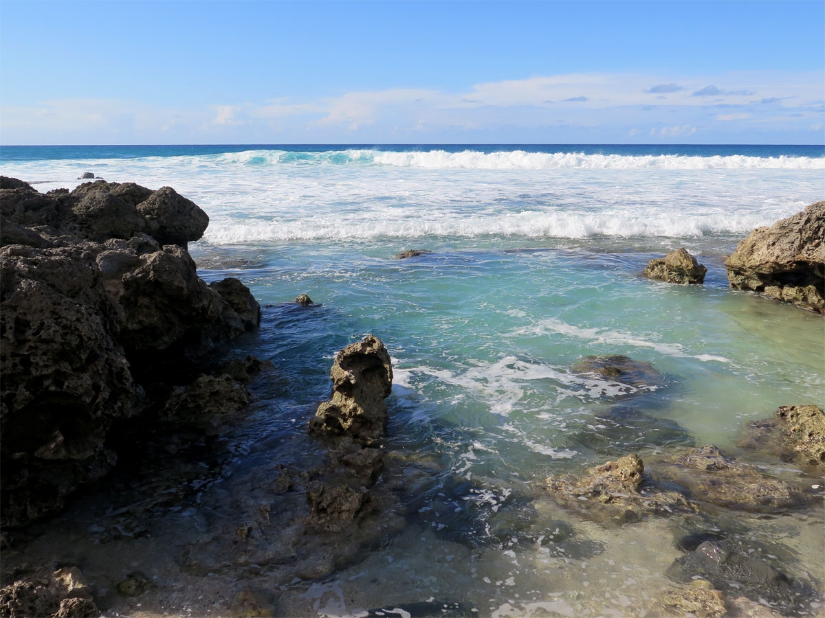
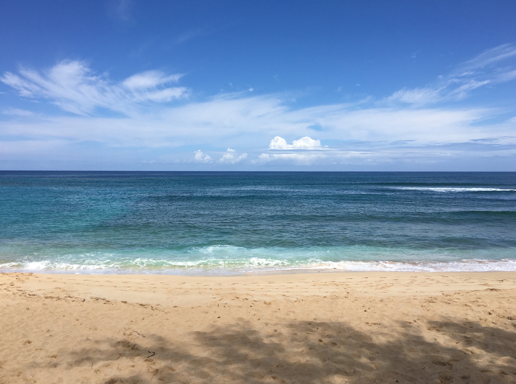
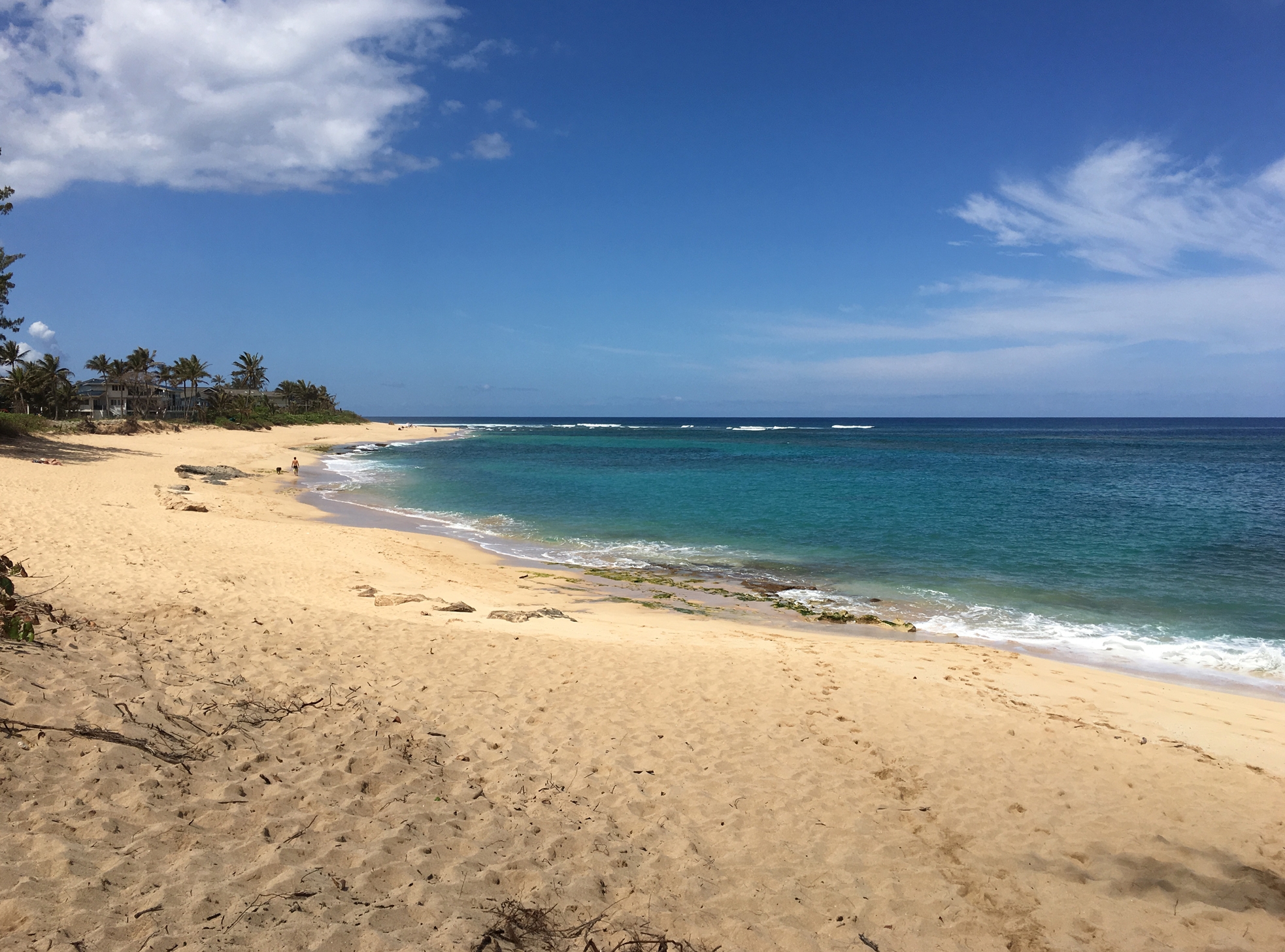
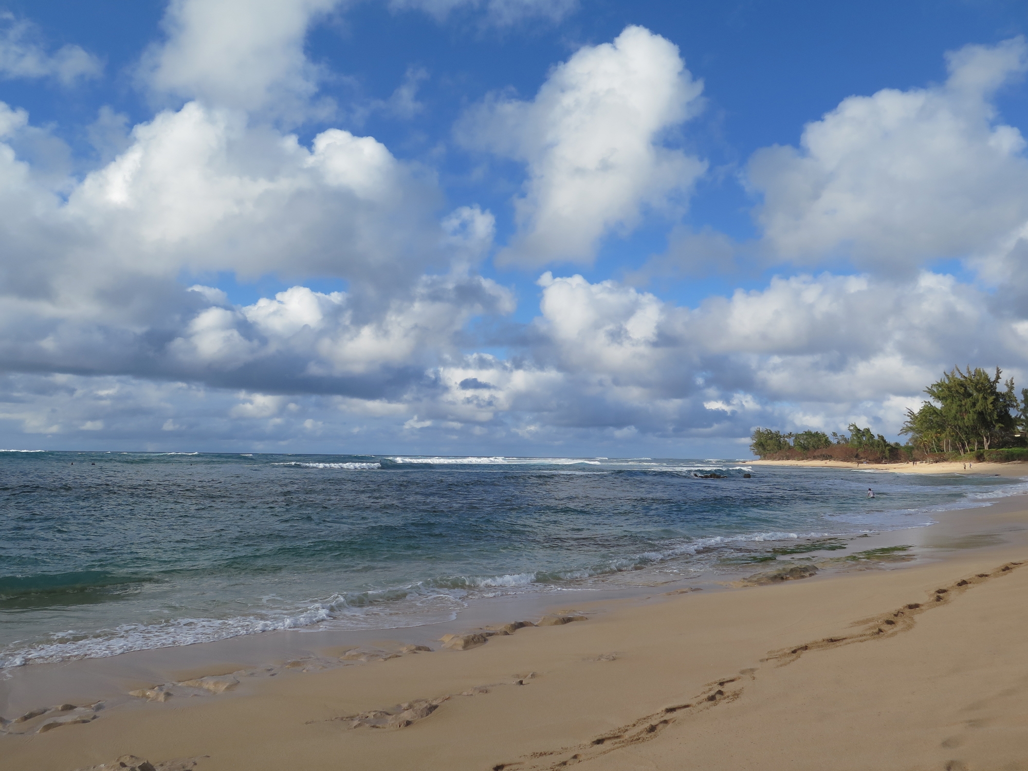
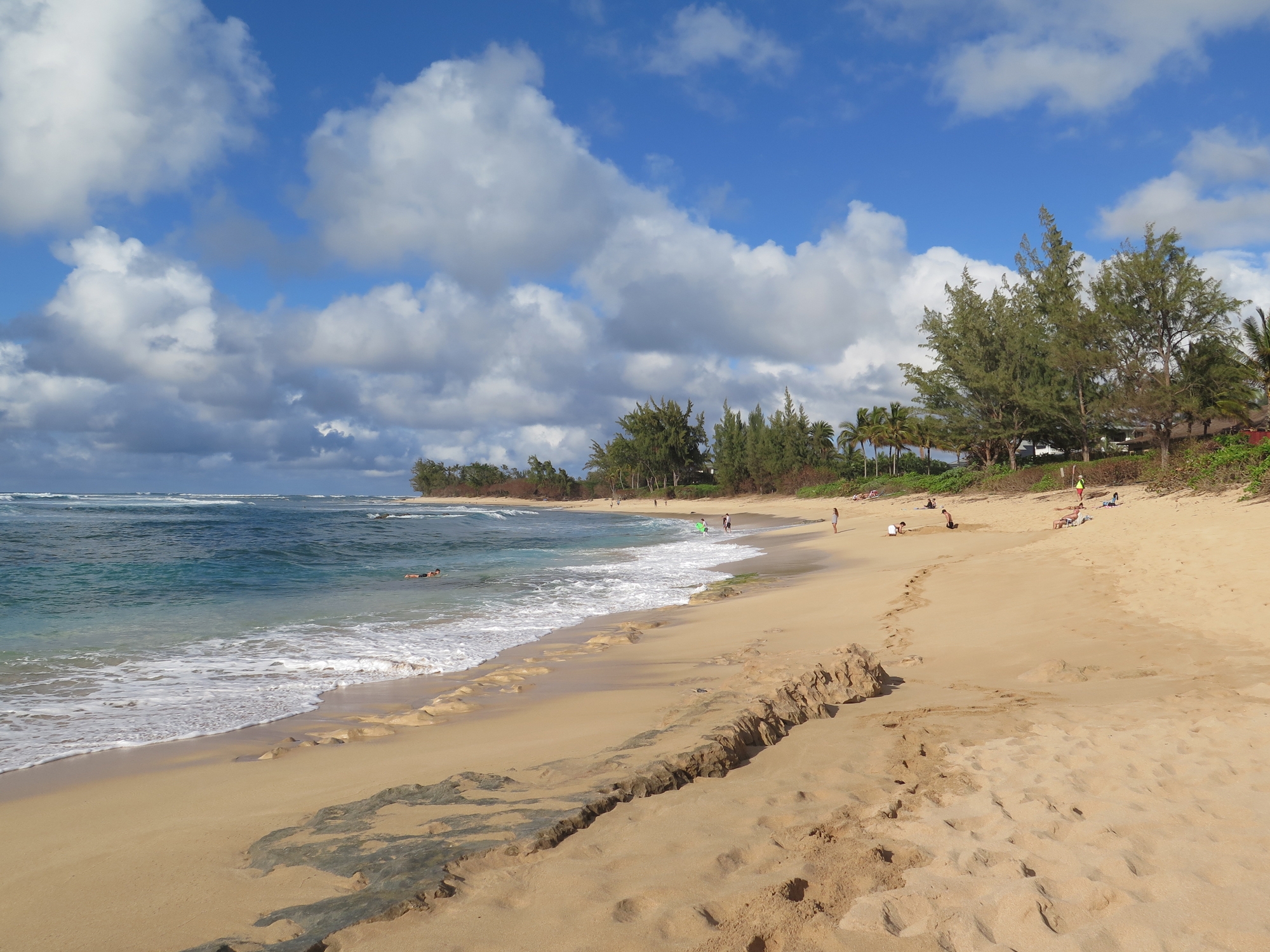
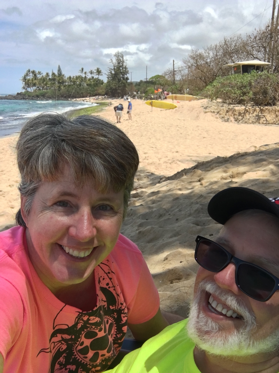
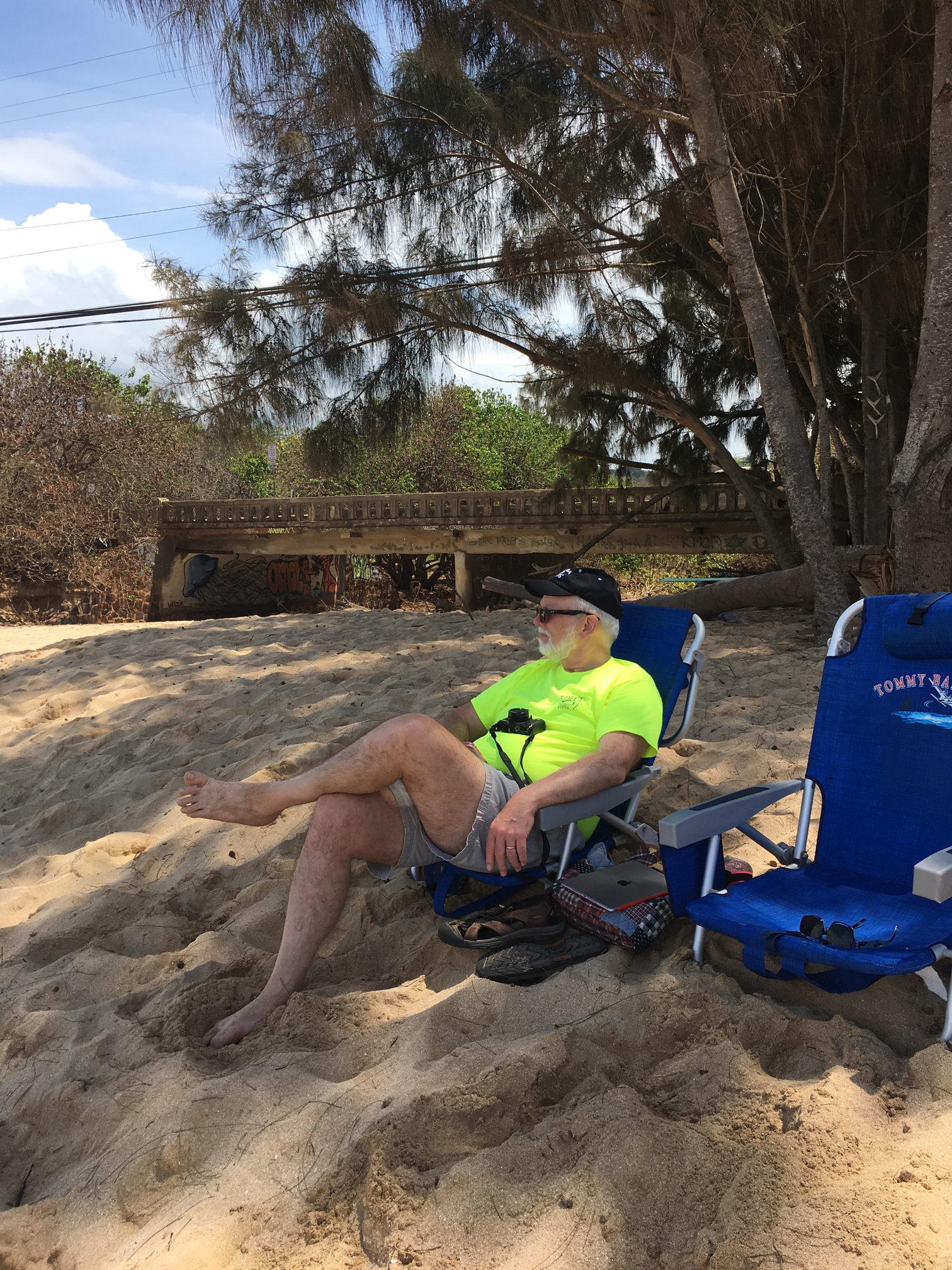
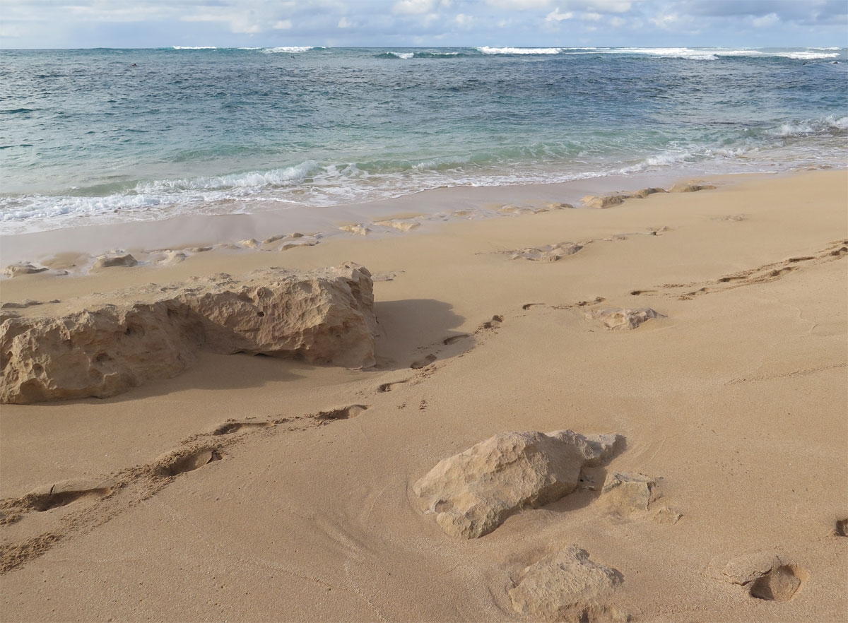
I much prefer the wilder side of things.

“Our” wilder North Shore Beach

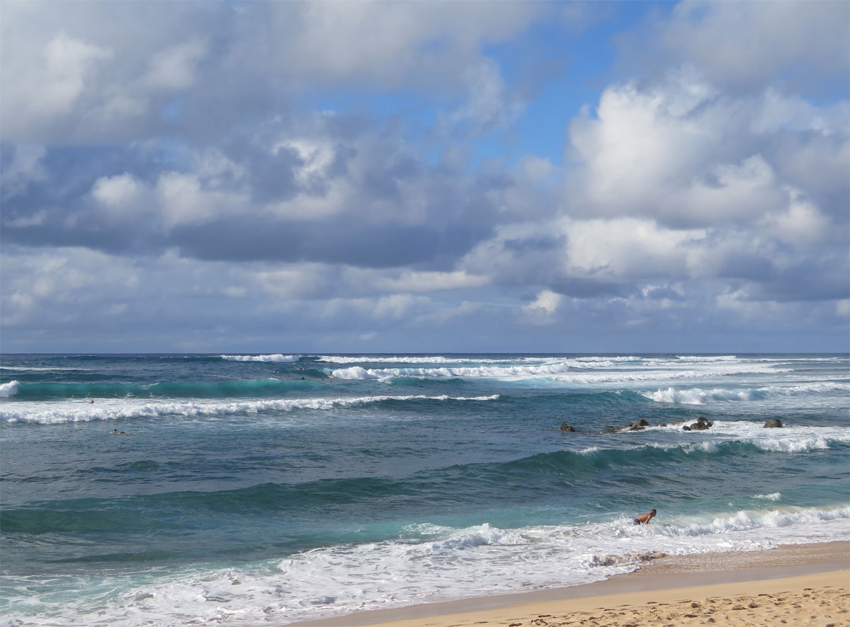
It may not be as gentle a place for swimming, but it was definitely more peaceful.

My footprints on the beach.


Mid-afternoon crowd on the beach.

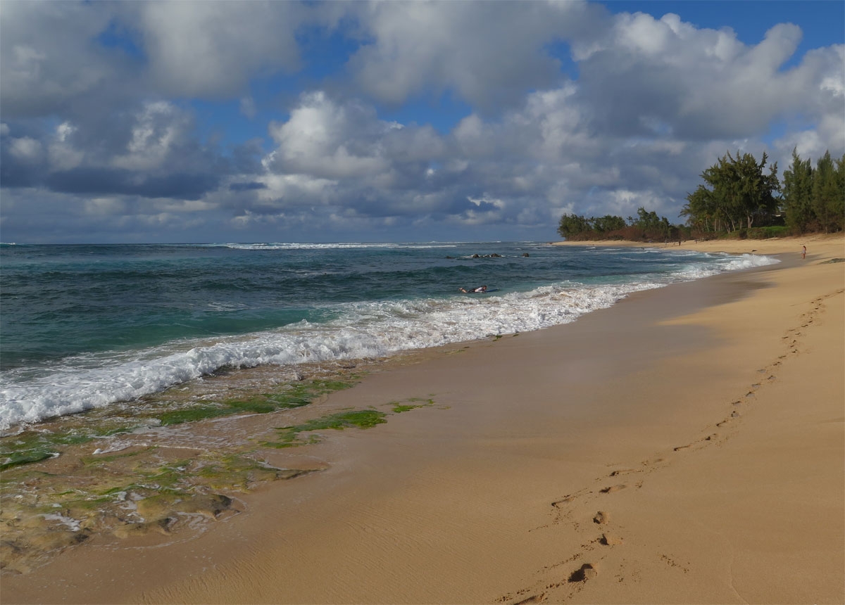
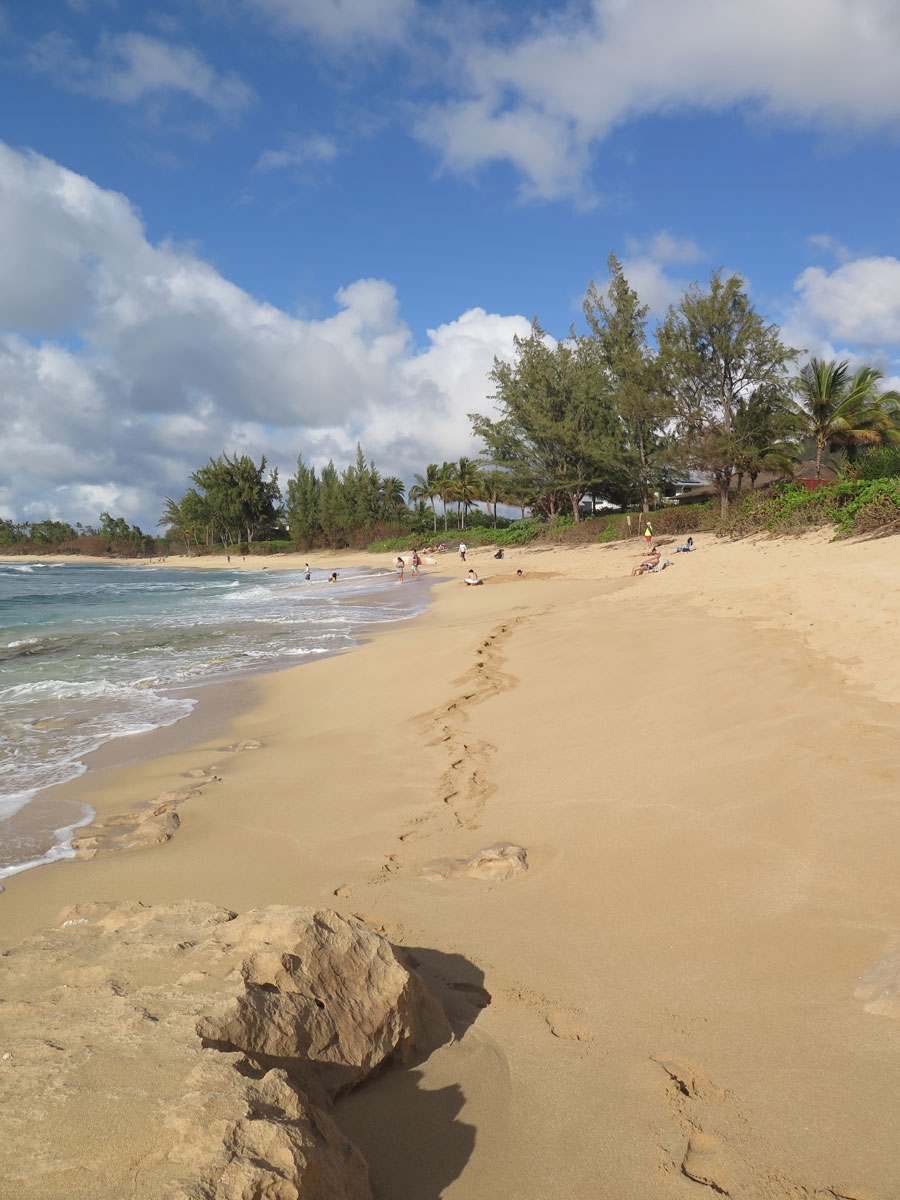
Even though the beach was more-crowded at that point than we’d ever seen it, I still preferred it to the beach in the city.

Giant sand boulders.

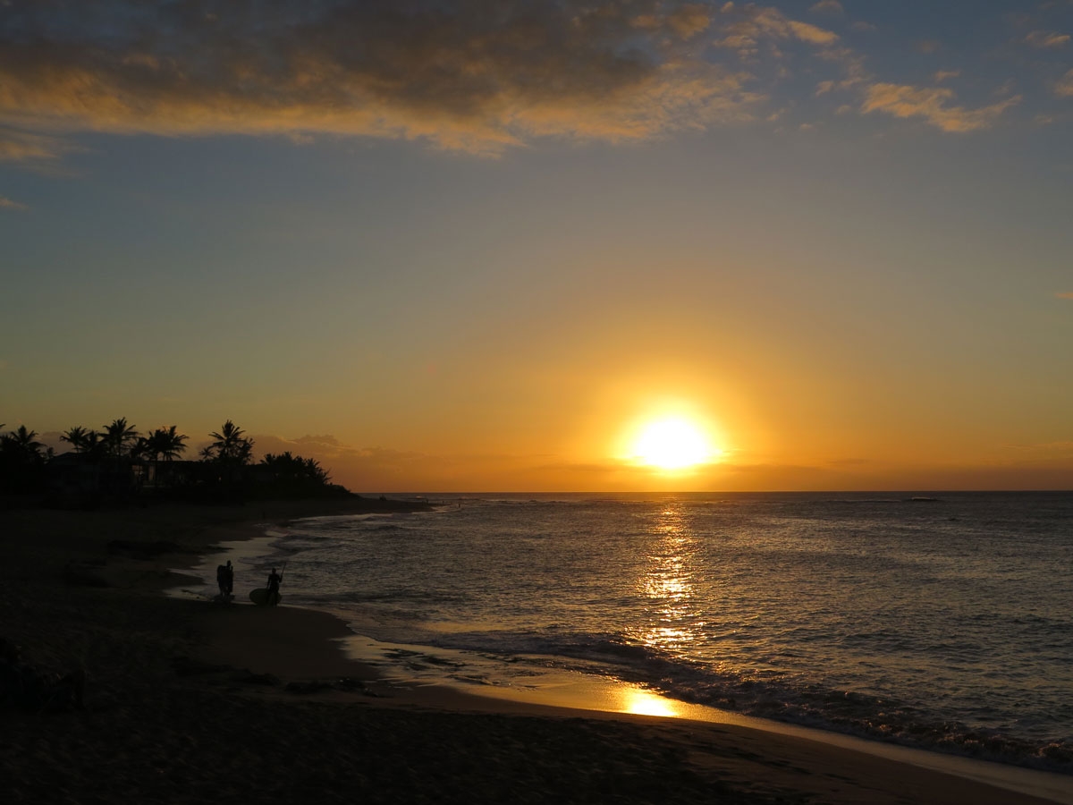
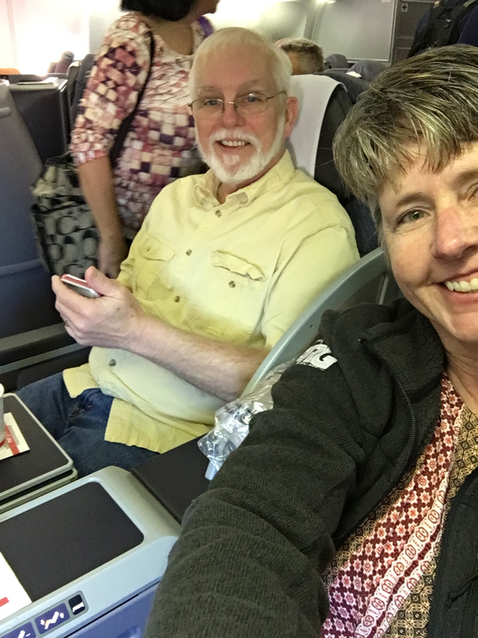
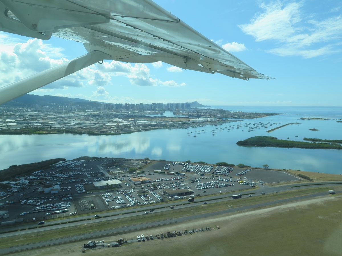
It was a long, busy day for both of us. We had a nice, relaxing late-lunch/early dinner, drank some beer, napped, drank some beer, and then started packing in preparation for our first island hop over to Molokai the next morning.

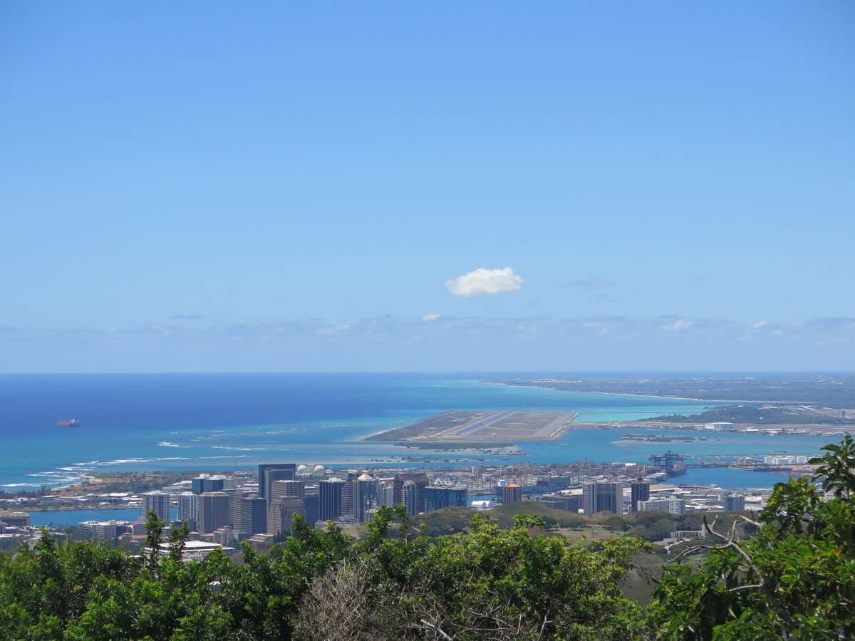
We did capture some interesting pics from the plane the next day.

View of Honolulu from just above the airport.


More of the city, which wasn’t visible in my pics from that wayside overlook.


Waikiki Beach from the air.


Diamond Head cone from the air.

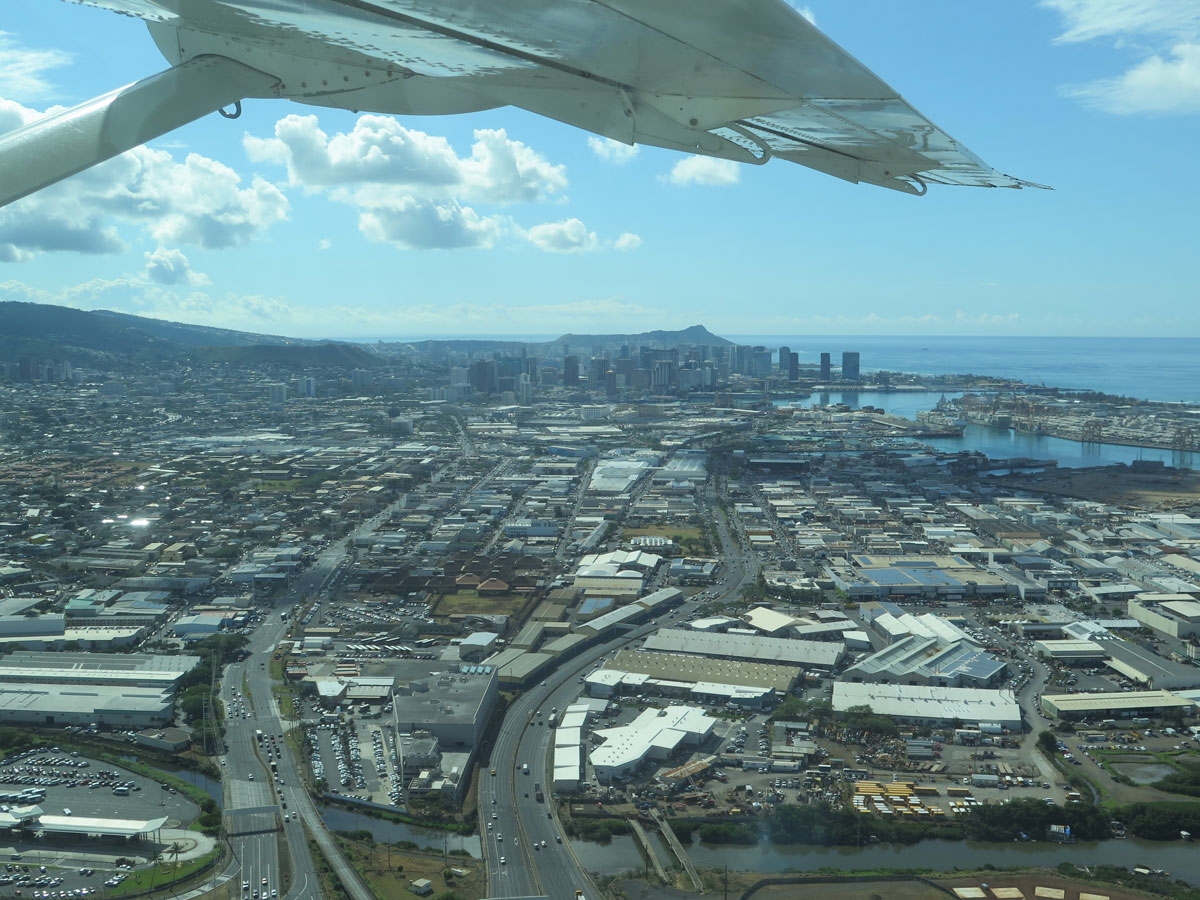
It wouldn’t be the worst place in the world to live, I guess. But it certainly will not be my first choice if I ever need to relocate to Hawaii.

Best Diamond Head capture, thanks to Mike.

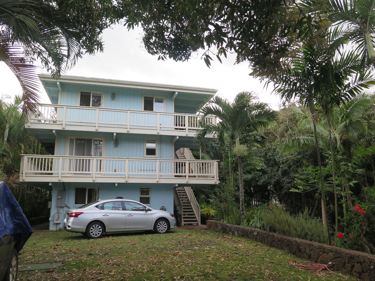
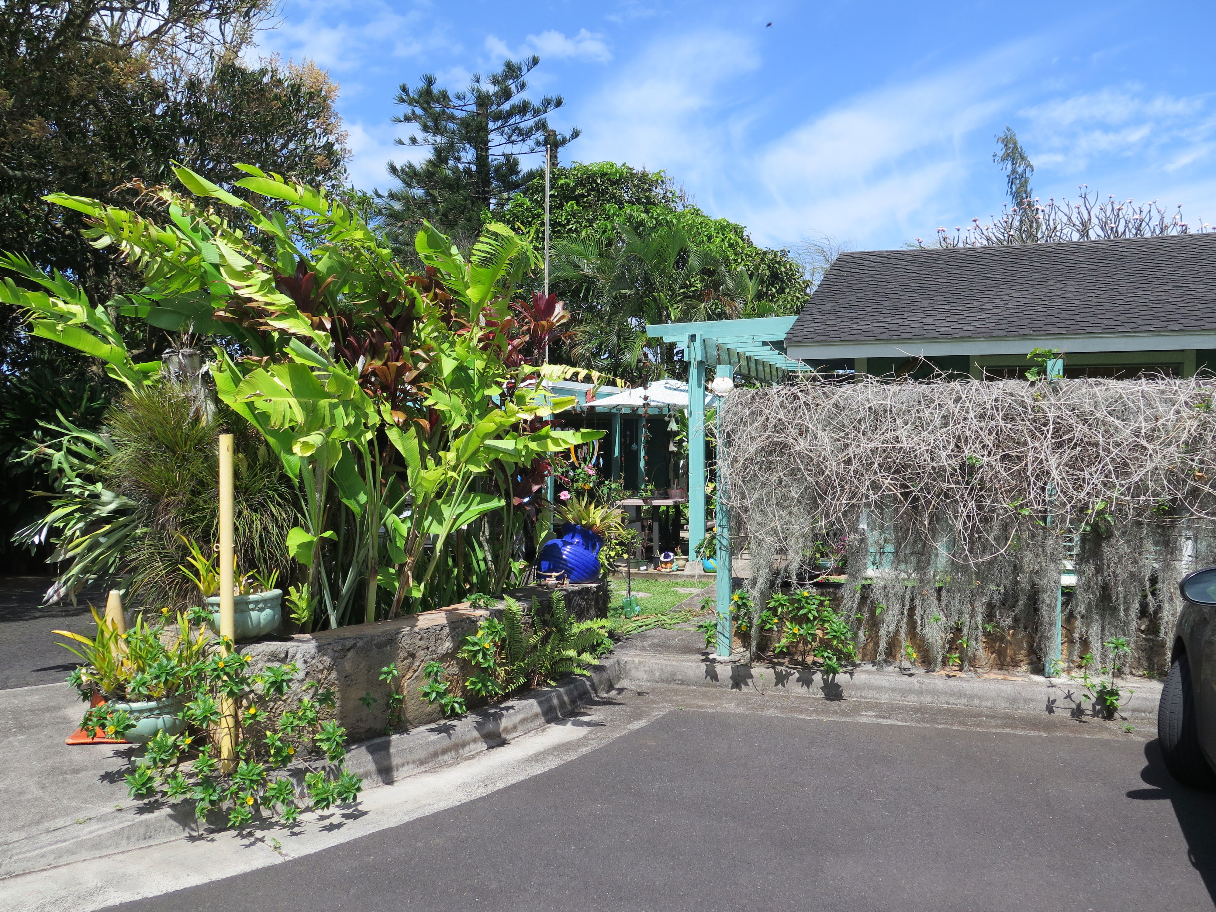
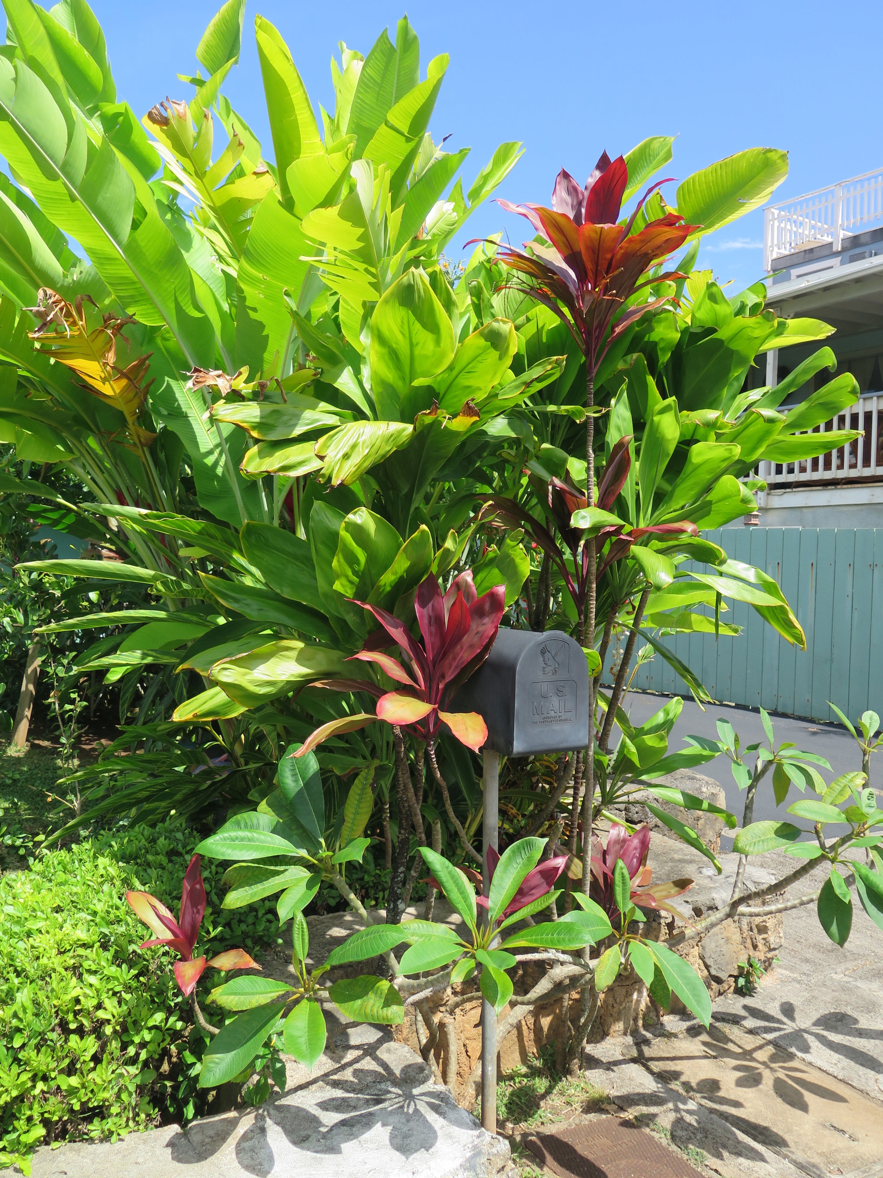
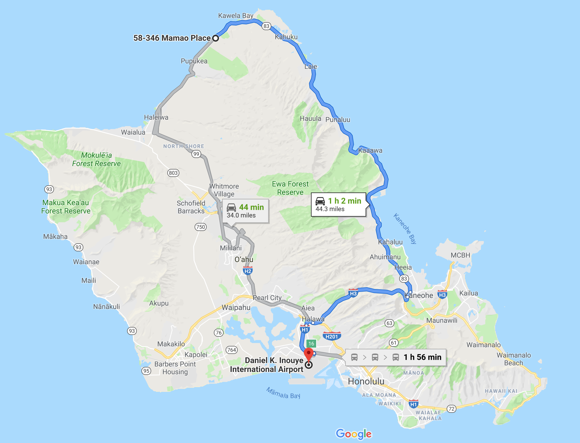
I’ll have to tell you about the whole island-hopping experience on small airplanes in another post. I was not sad to leave Oahu behind, because I was really, REALLY looking forward to seeing the gem of a cottage I found for us to spend five nights of complete quiet relaxation on Molokai. It made even the North Shore look like a densely populated place in comparison.

North Shore Neighborhood

The North Shore apartment we rented was not fancy. It was the first floor of a family’s home, although we never actually saw the family. We did see and hear their dogs. And, during the last full day of our stay, a group of men were working on a project in the backyard. The best thing about the place was its location, specifically that it was just a five-minute walk to the beach. Other than the dog noises and those workmen, the house was relatively quiet and was situated in a lovely yard full of tropical plants.

Our apartment was the entire first floor.

There may have actually been two different families living in the spaces above us. There were at least two dogs.

Tropical plants filled the yard.

It’s always interesting seeing shrub-sized plants like these growing outdoors. Where we live, one only ever sees very small specimens of tropical plants like that growing in pots at garden centers or many indoors at a large botanical garden.

Lizard

We have lizards near us, but none that look quite like the one pictured. There were several of them in and around the garden.

Bird of Paradise

There was almost always a breeze going while we were on Oahu. Every photo I captured of a Bird of Paradise flower in full bloom was blurry. But I think this bud is interesting enough to share.

Yard


Pretty Flowers


Plant


More Plants


Pretty Red


Yard


Papayas?


More Tropical Plants

Apparently there are a lot of different kinds of palm trees.

Palm Trees

The next picture was capture behind the apartment.

More Tropical Plants

The rest of the images shared here were captured during a walk to and from the beach.

Nice-enough stroll.

The image on the far-left of that collage was taken from the beach, heading toward the apartment.

Neighbor’s House

The yard of the next-door neighbor was meticulously maintained. I saw the homeowner on several occasions, carefully tending to the many plants.  It was pretty amazing.

Neighbor’s House


Neighbor’s Mailbox


Pretty Colors


Pretty Colors

The scene captured in the next two images made me chuckle aloud.

Creative Power-washing

I imagined the person doing the power-washing, a chore that can be quite time-consuming, wanting to get done quickly, so they decided to make wave patterns on the concrete. It’s sort of appropriate, since the house is near the beach, but have you ever seen patterns left behind like that?

Creative Power-washing

I really just think the person doing the power-washing could only think about the beach, i.e., how much they love the beach, how happy they are to live at the beach, how badly they wanted to get back to the beach to swim or surf or whatever, so they came up with this very creative way to do just that. Once they saw how long it took to get the sidewalk really clean, as pictured at the bottom of the image, they said “screw this!” and improvised. I suspect they didn’t really set out to make wave patterns on the sidewalk, they just wanted to get the job done faster so they could get back to the beach. Quite clever, if you ask me.

That was our North Shore neighborhood. In my next post I will be sharing pics from the other, more densely populated side of the island, captured the day we visited Honolulu, specifically Pearl Harbor and the world famous Waikiki Beach.

Oahu’s Wild Side

The North Shore of Oahu is definitely the wilder side of the island. It is far less-populated and less-developed than the south side of the island, which is where you’ll find the city of Honolulu.

I’m happy to report that the “lost” folder of images has been found. The image below is the first one I captured with my point-and-shoot camera. This beach is the one I refer to as “our beach” because it was only about a five-minute walk from the apartment we rented.

Our Beach on Oahu

I didn’t mention in my previous post just how ready I was for a vacation. Mike and I are blessed in so many ways, but life has presented some challenges of late. Our parents are aging and their health is declining. My Dad is worse off than my mother-in-law (MIL). He’s been dealing with side-effects of pelvic radiation he underwent about 13 years ago to treat prostate cancer. It, along with my mother’s death, has taken a toll on his mental health. Not only am I not sure how to help him, I’m not entirely convinced that he wants help. I mean, I’ve been able to spend some time with him and help address some of the issues, but we need to come up with a long-term solution. My brother has spent some time up there, too, but he lives even further away than we do.

The new job has also been challenging. There are some other family and friend issues I don’t really want to get into here. Just trust me when I say I’ve been quite stressed all year and REALLY needed a break from everything.

Mike on our beach.

The entire time we were in Hawaii, I blocked reality out of my brain. I refused to let my mind linger on any troubling thoughts. It wasn’t easy, but I did it, and it was sooooo refreshing. It did feel a little selfish, but I think I needed that mental break even more than the physical relaxation.

Patterns in the Sand

There was certainly enough visual interestingness to help keep me distracted.

Our first Hawaii sunset.

That first sunset was a little disappointing. It was beautiful, don’t get me wrong, it just wasn’t the most dramatic sunset I’ve ever seen. What was cool however was seeing just how many people appeared on the beach specifically to watch the sun dip below the horizon. I guess it’s just what people do in paradise.

Our Oahu Beach

I took lots of pictures. I was trying really hard to capture that one perfect beach image.

Vivid Colors

The sky was so blue. And the water, with its varying shades of blue, was absolutely mesmerizing. Pictures don’t do it justice.

Beautiful Water

Being right there, standing on that beach, was definitely an immersive experience. Couple the stunning visuals with the sound of the waves gently lapping at the shore. The warm sand caressing my feet. The tingling feeling on my skin. I swear, it was almost as if my skin were singing as it soaked up the sun’s warming rays. There was a cooling breeze, too. And birds singing. Not seagulls, songbirds.

Low Tide

I really did spend a lot of time on that beach.

I love the color of that water.

I did eventually return to the apartment where Mike was perfectly content to be reading and relaxing. Later, though, we got in the car and made our way a little west of our apartment to see Turtle Beach (not its real name).

Yes, there really was a turtle there.

Turtle Basking in the Sun

It almost looks dead, right? Apparently, a lot of people who happen upon turtles like that think they ARE dead.

Turtle Basking in the Sun

Because I was careful taking both of those pictures, you can’t tell how many people are milling around the poor thing, gawking. You can see what I mean in the next shot.

Annoying Crowd of Onlookers

We couldn’t bear to stand there amongst the throng. So we got our chairs out of the car, walked further down the beach and found a shady spot to sit and chill.

Away from the Crowd
Beautiful Beach
Quiet Time

We sat there for an hour or so. I actually lost track of time, which is a good thing. Then we went and had a late lunch before continuing west to an even more-remote part of the island.

Wilder Beach

That was where we got our first real look at a bunch of lava rocks.

More-remote beach on Oahu’s northern shore.
Black and reddish-brown lava rock.
Looking at tide pools.

There weren’t as many critters in the tide pools as we expected, I guess because the waves are so strong.

Wild Beach


Exploring the Rocky Shore


Coral


Rocks


Water


Away from Civilization

It was really a lovely place. You can’t tell from the pics that it was very windy there. The waves were crashing against the rocky shore. It was definitely music to me ears. 🙂

A Whole Lotta Nothing on Oahu

Diamond Head Crater

When Mike and I married in 1993, we decided that we would take a “big vacation,” one that involved air travel to a faraway place, every five years. The first trip was to Arizona in 1998. The second trip was to California in 2003. In 2008, we went to Alaska.

The plan got derailed a bit when we started vacationing with friends. We enjoyed a vacation in 2013, it just wasn’t specifically considered a 20th anniversary trip. We were both okay with that. The unspoken point of the plan has always been to make sure we travel and make time for us. That was particularly important in 1993 when we married. Between us, we had three young children. Our marriage was more than the joining of two people, it was the blending of two families, which came with its own unique set of challenges.

I have always been the one doing most of the planning. It’s always been up to me to do the research, find accommodations, and come up with the overall plan for each trip. Our the trips have gotten more and more interesting as the years have passed. Not only have our likes and dislikes evolved, there are far more tools available and a wider variety of choices in terms of accommodations. In 1993 when we got married, a trip to Cancun with Apple Vacations seemed really exotic. It wasn’t. It was fun, but Cancun caters to tourists and has a very American feel. Some people like that. We don’t.

Typical “touristy” vacations are not our thing. We don’t like crowds. We hate waiting in long lines. Neither of us like noise either, something that’s really hard to escape when visiting popular vacation hot spots. We tend to avoid cities, too, which is probably because of our aversion to crowds, waiting/lines, and noise!

As our 25th anniversary approached, I actually dreaded the whole Hawaii plan. To me, nothing says “touristy” like a trip to Hawaii. I mean, it’s one of those things many, many people say they want to do. Not just Americans, either, people from all around the world aspire to visit the remote island paradise. It is a busy, year-round destination, so I knew that avoiding crowds would be a real challenge. So much of a challenge, that I really was not all that interested in going. I mean, I wanted to go, a trip is a trip, I was just dreading the touristy part. But it was the last US state Hubby had to visit before he could say he’d been in every state and it was also the last state he had to explore on two wheels before he could say he’d ridden a motorcycle in every US state. So we HAD to go.

All the research I did revealed that early April and the month of September are the least-popular times to visit Hawaii. If we were going to go in April 2018, I would have had to start the real planning, buying plane tickets,  booking rental cars and accommodations, in January and February. Since we’d learned just before Christmas that our dog, K, was terminally ill and we had NO idea how long she would be with us, I was reluctant to make plans to travel in April. I knew that I would not want to leave her if she was still hanging on in April, so we put the plans on hold.

We could have gone in September 2018, but doing so would have meant doing the aforementioned “real” planning in June or July. My layoff in early June nixed that. So that’s why we ended up celebrating our 25th wedding anniversary near the end of our 26th year as a married couple.

There are not many direct flights to Hawaii. Lucky for us, United has direct flights from Dulles, our home airport. Direct flights are typically less of a hassle, but the duration was a bit concerning. Ten and a half hours on one airplane, in one cramped seat, is a very long time. So, when United reached out via e-mail a few weeks before our departure, offering discounted upgrades to first class, I decided to splurge. It was a big celebration, after all. And we don’t usually spend money frivolously.

I’m glad we did, too. It wasn’t the standard first class seat, it was actually an upgraded business class section that United has been adding to some of its long-haul flights. Not only is there a wider seat and more legroom, the seat reclines to a fully flat position, like a little bed.

It was so worth the extra expense. We arrived in Hawaii more-relaxed than I’ve ever felt even after a two- or three-hour flight. The premium seats were largely responsible, coupled with the fact that families don’t usually sit in the premier cabin, so we didn’t have to listen to anyone else’s children. A HUGE plus.

Map of our drive from the airport to the North Shore.

Once we landed on Oahu, all we had to do was retrieve our luggage, pick up our rental car, and drive to the North Shore, as far away from the large city of Honolulu as we could get while staying on that island.

It was midday, local time, when we arrived (Hawaii is six hours behind our home state of Virginia), so I decided to direct Hubby to take a route around the island instead of driving across the island. I thought it would be more-scenic. Looking at the map, it looks like the road follows the coast. The road DOES follow the coast, but there are houses all along the beach, many of which are fenced-off for privacy. It wasn’t scenic in the sense that we got to enjoy uninterrupted views of the water, but we did get to experience a bit of Oahu off the beaten path.

After about an hour, we reached our rental unit. It wasn’t a fancy place, just a one-bedroom apartment on the first floor of someone’s house. But it had everything we needed and it was just an easy five-minute stroll to the beach.

“Our” Oahu Beach

I seem to have misplaced the pics I captured in and around the yard of our apartment, which is a shame. The yard was really nice. It was full of interesting vegetation. There were lizards, too. But the nearby beach was the best part.

Hawaii’s North Shore

The North Shore gets hit with really big waves during the winter months. In fact, this little beach isn’t far from the infamous Banzai Pipeline with its 20+ foot waves.

Beautiful Day on the Beach

The color of the water was mesmerizing.

Beautiful Day on the Beach

I really could just sit, watching and listening to the waves all day long.

Mesmerizing.

Not far west of where we were staying was a beach where sea turtles like to hang out. Some of the pics I captured at that beach are with the misplaced apartment images. We did see a couple of turtles, but, because the beach was right beside the road, it was thronged with people. Seeing the turtle was cool, but it didn’t feel very “wild” seeing it surrounded by a large circle of gawking people. So we just walked a ways down the beach, found a shady spot for our chairs, and sat for an hour or two.

Turtle Beach (the turtles and people are off in the distance).

Temps were in about the mid- to upper 70s, and there was a lovely breeze. One thing that surprised me about Hawaii was the absence of seagulls. It was unusual, but very nice, to sit on the beach listening to the sound of waves mingled with the voices of songbirds instead of the loud, grating squawk of seagulls.

Interesting Sand

The beach was visually stunning. There were quite a few rocks and many places where the sand had been compacted into giant, pockmarked boulders. I’m not sure if that’s coral, or if it’s sand that was baked into a solid, massive sheet at some point by a volcano.

Turtle Beach Selfie

Sitting on the beach in Hawaii under the shade trees is much nicer than baking on the beaches like we are used to doing on the East Coast of the US.

Our shady spot on Turtle Beach.

I’m hoping we can locate the misplaced folder of images captured with my camera during the first couple of days in Hawaii. If not, we will just have to go back and do it all over again. 🙂

Exciting Times

It’s been an eventful month for me. I figured I should give y’all an update. I will warn you, however, that I’m using my tablet, so there may not be many images. Or the format of this post could be mucked up. We shall see.

I’ve been doing little stuff around the house to keep myself busy. One of those things was starting to neaten-up my side of the basement. I didn’t finish because I got sidetracked by a couple of projects.

The first project was making LOVE. Hubby helped. 😎

My town is a bit late to the Virginia LOVE program. There’s a LOVEwork outside of town at the Airlie House and Farm (that’s where Earth Day was born!), but I would really like to see one in the historic downtown. I’d heard that the Town Council quashed plans for a LOVEwork in Old Town Warrenton (OTW) so I started kicking-around the idea of making my own. Hubby had enough scrap plywood for three of the letters, but I wanted to figure out an easy way to make a different sort of “O.”

Back in July, when I was having my hair done, my hairdresser was telling me how the move to her house and unpacking was coming along when she mentioned needing to remove an old satellite dish the previous owner had left behind.

“Can I have it?” I immediately asked. She looked at me like I had a few heads and asked why I would want that. I swore her to secrecy then explained that I needed something to make the fourth letter in my own personal LOVEwork.

A couple of days later, there was an old, dirty satellite dish and hardware in my backyard, much to Hubby’s chagrin. We no longer have cable TV and are perfectly happy with analog TV and streaming other entertainment, so he had no idea why I would want or need an old satellite dish!

I outlined the letters on the scrap plywood and Hubby cut them for me. Then I painted everything and hung it on the wall in front of our house. It turned out quite cool, in my opinion.

I had a bit of fun with the thing. I even texted pics to all of the kids, saying “Look, we made love last last week and I am sharing pics!”

Other people like our LOVE, too. So much so that we made the local news. If you’d like to read the article, this link will take you to the story on FauquierNOW.

The next project was painting this old end table that’s been in the to-do queue for a long time. I decided it would make a nice table for the porch, and I added a Barn Quilt to the top. It turned out so nice, I think I may keep it in the house.

Speaking of barn quilts… a friend and I have decided to start a barn quilt trail. We are just in the planning stages now, so I can’t say much. I thought it would be fun to have one here in Fauquier County. In July, we met with the ladies behind the Blue Ridge Barn Quilt Trail in nearby Greene County. Their trail already has about 70 barn quilts in all shapes and sizes and it’s only been around for about a year and a half. The one pictured below is at the visitors’ center.

Barn quilt LOVE in Greene County, Virginia. #blueridgebarnquilttrail

A post shared by Kathy Kirkpatrick (@vatoadmama) on

That is a barn quilt LOVEwork. How cool is that? 😊

I’ve been visiting LOVEworks, too. I’m now up to 96! My log page is not completely up-to-date since I turned in my work computer. You know, the one that belonged to my former employer. They were kind enough to let me borrow it for a couple of months so I didn’t have to conduct my job search from this tablet.

It’s been pretty hot, so we have not done much motorcycle riding. Instead, we’ve been visiting breweries in our spare time.

Another date night with Hubby. ❤️

A post shared by Kathy Kirkpatrick (@vatoadmama) on

Visiting breweries is a much more expensive hobby. Local breweries don’t give you tours and such like big commercial brewers do, it’s really all about tasting their beer. We’ve both decided it’s fun tasting so many different beers.

Last weekend, we actually did something really different. We did a long weekend centered around bicycle riding. We drove to Farmville, Virginia, about two and a half hours south of here.

I’d been to Farmville a couple of times previously, once to see their first LOVEwork and then just passing through. I knew there was a bicycle trail there with a cool bridge and had said several times I wanted to return. So that’s what we did. They have a second LOVEwork now, too.

It’s a LOVEly day for an adventure. LOVEwork 90! #loveva

A post shared by Kathy Kirkpatrick (@vatoadmama) on

The High Bridge Trail State Park was the center of our visit. I pasted the description from the state park’s website below:

High Bridge Trail is 31 miles long and ideally suited for hiking, bicycling and horseback riding. Once a rail bed, the trail is wide, level and generally flat. Its finely crushed limestone surface and dimensions make it easy to enjoy. The park’s centerpiece is the majestic High Bridge, which is more than 2,400 feet long and 125 feet above the Appomattox River. It is the longest recreational bridge in Virginia and among the longest in the United States. High Bridge, a Virginia Historic Landmark, is on the National Register of Historic Places.

It’s a really nice trail, and the bridge was fun to see.

A post shared by Kathy Kirkpatrick (@vatoadmama) on

Check out out this short video from the bridge:

A post shared by Kathy Kirkpatrick (@vatoadmama) on

We visited a few breweries, too. Trapezium in Petersburg had my favorite beer, a white ale. The brewery in Farmville — Third Street Brewing — was nice, too, and in walking distance from our hotel.

The LOVEwork just happened to be in the vicinity of a brewery or two.

A post shared by Kathy Kirkpatrick (@vatoadmama) on

Hubby was kind enough to drive about a three-hour loop on Saturday to see some more LOVEworks while we were in the area. Then Sunday, we detoured through Bedford, Virginia, on the way home to visit the National D-Day Memorial. I created a Google Photos album of the pics from the D-Day Memorial, which was even more impressive than I anticipated. Click Here if you would like to see the album.

Next week is my last week of freedom. I start a new job on September 10th. I’m excited about the opportunity, which is similar to what I’d been doing, but slightly different. It’s hot and humid here, so we’ll be playing indoors for the next couple of days. Monday, I’m off to the beach for 3-4 days with a girlfriend. Then on Sunday, September 9, I’m off to Minneapolis for a week of job training, meet-and-greets, etc. Back to reality, in other words. 😎

A different sort of bike vacation!

A post shared by Kathy Kirkpatrick (@vatoadmama) on

Colorado Desert by Accident

I was in the process of deleting the remaining California images from my computer when I came across the ones from Labor Day weekend when Jasper and I traveled inland to escape the heat. They are very different from all of my other pics captured in and around the city, so I decided to share. This should be my last post about San Diego. For now, LOL.

Before going to San Diego, I’d done a Google search for the cutest small towns in California. The one that piqued my interest most was Julian, mostly because it’s only an hour east of San Diego by car.  I’d sort of forgotten about it until just before the long weekend as I was trying to figure out what I could do to escape the heat. It had to be dog-friendly, of course, since I was still on dog-sitter duty. When I saw Julian on the map, I decided to go there. I didn’t bother refreshing my memory first, which is good and bad. Bad because it’s touristy and was crowded. Good because we had an even cooler adventure as a result of wanting to escape those crowds.

Apparently, Julian is the southernmost spot in California where apples are grown, so apple pie is a big thing there. The lines were ridiculously long for apple pie, so I didn’t partake. Instead, I just moseyed around town gawking at things and people and doing a little shopping. The day was overcast and cool, with temps in the mid-60 range, which I thought felt like heaven (San Diego had been in the 90s!). Much to my amusement, quite a few people were wearing coats and knit hats against the “cold” temperatures. Not jackets, COATS. I was among the minority strolling around clad in a t-shirt and shorts.

The town was charming, but there were far too many people there for my comfort. Jasper gets nervous around people when he’s on his leash. It’s easier to avoid crowds, so I looked at the map and was happy to see that there’s a state park east of Julian.

The drive to Julian had been interesting, going from the densely populated coastal city into the mountains east of town, so I figured the drive into the desert would be nice, too. I was right. The road was curvy, which is fun in Shannon’s tiny Smart cart, and the terrain was fascinating. In spots there were huge boulders scattered about the hillsides. There were lots of different varieties of cacti, too, and a surprisingly wide range of colors. The sky even provided some drama as the clouds seemed to be hanging along and west of the mountains, so it got bluer and bluer the further east we went.

I embedded an interactive Google map below if you want to get a better idea of the geography I’m struggling to describe.

I did mention that I hadn’t really planned the whole outing, right? It really was a spur-of-the-moment thing. Which is why I hadn’t bothered to check how much fuel the car had. We were about halfway through the Anza-Borrego Desert State Park when I noticed the low-fuel warning light on the dash. I hadn’t planned on going as far as the Salton Sea, but we sort of had to at that point since we did not have enough gas to return or to even explore the park itself as I’d hoped.

Salton City was the closest population center, so that’s where we headed. After gassing-up along the highway, I figured I had to get a closer look at this inland sea while there, so I headed for Marina Road, thinking there’d be a marina at the end. Not only was there no marina, there wasn’t anything. By that I mean, nothing. It was the weirdest “city” I had ever seen! Really. There’s a whole network grid of streets, complete with street signs, but very few dwellings. It is basically a city that wasn’t. Here’s the Wikipedia link if you want to know more.

I did get out and look around a bit, but didn’t linger. The air smelled strongly of rotten eggs. I didn’t find out why until later. It had been unusually hot there, too. Government officials had issued an “odor advisory” for the area due to elevated levels of hydrogen sulfide, which is associated with natural processes occurring in the Salton Sea. Ew.

Even if we’d spent most of the day in the car, with only periodic stops for photos and potty breaks, it was a very interesting day, and it did provide a welcome break from the heat of the city.

As with previous posts, I’ve shared my favorite images below as well as a slideshow followed by a link to the album of images on Google Photos.

A glimpse of interesting colors.


I was quite tickled to see a barn quilt on the way to Julian.


There’s a mini barn quilt in the window!


Overlooking downtown Julian.


Jasper with a bear.


One of the lines for apple pie.


Not far east of Julian as we headed into the desert.


Pretty view.


Cacti


Entering the state park.


Call boxes dotted the roadside since there was no cell service.


So many different varieties of cacti!

The state park is supposed to be stunningly beautiful in the Spring when the cacti are in bloom.

Jasper looking at the Salton Sea.


On the shore of the Salton Sea in Salton City.


Headed back west. San Diego County is HUGE.

I have learned that when someone tells you they live in San Diego, it probably does NOT mean in the city of SD itself. It’s just easier for them to say San Diego.

Looks a bit like the Badlands in South Dakota, doesn’t it?


Spindly cacti.


Just a nice scene.


More cacti.

On a future trip, I want to actually explore the state park and drive on to Joshua Tree National Park. I really wanted to visit the national park, but just didn’t feel right doing so without Mike. Plus, it gets REALLY hot there and probably would not have been fit for me or the dog.

Below is that slideshow of images.

If you’d prefer to see them one-by-one, check out the shared album on Google Photos.