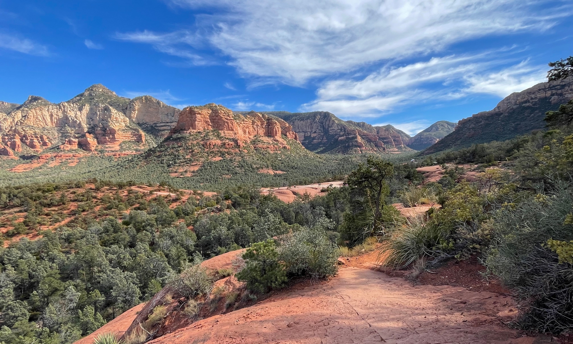
It Doesn’t Get Any Better

Sunday was a picture-perfect day for motorcycling. After freezing our asses off on Saturday, both Hubby and I were a bit noncommittal about venturing out on Sunday. But after driving into Romney for breakfast at McDonald’s on Sunday morning, I told Hubby the weather was so perfect it would be almost criminal not to ride.

So I mapped out a route for us. Whether using old-fashioned paper maps or newfangled mapping software, route planning is not a perfect science. While county roads are fun, sometimes they are not paved. But we manage, as long as the gravel and/or dirt roads are in good condition.

I couldn’t resist stopping at the Post Office just off US-220 South of Old Fields, WV after seeing the flowers growing there. After that brief pause, we headed West on Old Fields Road [CR-2/5] into Williamsport, WV.

Here are some images from that road…


We proceeded West and, after hitting Williamsport, headed North on CR-5 [Patterson Creek Road]. From there, the plan was to continue West on Poplar School Road (or Popular School, depending on which map software you believe). But there was a problem.

That road was not only not paved, it looked like this…

It’s a pretty little scene, right? Do you see the problem?

This shot shows the trouble a bit better. The road went right through Harness Creek!

Had we been in the truck, we could have forded the smallish waterway. Fording creeks, however, is never a good idea on big-ass, 800-plus-pound street motorcycles.

Traversing dirt and/or gravel roads is enough of a challenge. Driving over slimy wet rocks in a creek? Uh, no.

I couldn’t resist snapping some pics before consulting my trusty West Virginia Atlas & Gazetteer (by DeLorme Publishing) to find an alternate route. Now, I knew where I was and could’ve gotten us home without a map, but it was too nice a day to quit so early. So we headed West to Greenland Gap Road, which goes right through the Greenland Gap Preserve.

Both this and the following images were from a previous trip I’d taken there without Hubby.

I did stop long enough so Hubby could see the gap as shown in the above image. You can’t appreciate the size of the cliffs when traveling the road from East to West.

From there, we headed East on SR-93 then East on US-50 back into Romney.

Riding weather doesn’t get much better than temperatures in the mid-70s, with very low humidity and sunny skies.

As much as I love Fall, I really hate to see the riding season end.

It’s Coming

What’s coming? Fall, of course. It will be here very soon. We experienced a bit of Fall weather this weekend. More on that later in this post…

It’s not obvious at this point. But if you look closely, you’ll see it. Some of the trees have already started changing.

The grass is getting red.

Seed pods are dropping.

Other grass is turning brown.

And I’ve been seeing more and more colored leaves on the ground. Actually, at higher elevations, there are quite a few maples that have already turned red.

Speaking of higher elevations…


View Romney to Aurora, WV in a larger map

If you click on the above map or link and zoom in, you should be able to see the terrain and elevation markings. You’ll have to zoom in enough to see US-50.

Why am I showing you this? So you understand why Hubby and I had a very cold bike ride on Saturday.

We wrongly decided to head west. The WV place is at about a 1,000 foot elevation. We ended up in Aurora, West Virginia, which is only about 50 miles west of Romney, but at about 2,800 feet.

It was around 70 degrees in Romney and overcast. Heading west, as soon as we hit about 1,500 feet, the temperature started dropping. And dropping. And dropping. Hubby finally stopped so we could add some layers of clothing and our gloves.

Aurora was not the planned destination. We stopped there for lunch. When we went into the restaurant, it was a little foggy. As we ate, we both agreed we’d better head back east. It’s a good thing, too. By the time we finished our meal, the temperature was hovering at 59 degrees (not so bad until you sit on a motorcycle at 60 mph!). The fog had gotten so thick that our face shields and windshields were covered with a pretty thick mist.

Not great motorcycling weather by a long stretch. We were both very happy to hit a lower elevation and warmer weather.

Luckily, Sunday was better. But I’ll talk about that in a later post.

Motorcycling At Its Finest

One of our goals for this long weekend was to get some ride time in on our motorcycles. I am happy to report, we accomplished our goal.

On Saturday, we went to visit our friends’ new property. We did more visiting than riding. But we took the long way back to our place to make up for it. Then Sunday, that was the best day, we did a 160-mile loop north into Maryland, then Pennsylvania, then back into Maryland and finally to our place in West Virginia.

It was a fabulous ride, if I do say so myself. I got to do all the route planning this weekend ’cause Hubby left his GPS at our Maryland home. That’s one difference between Hubby and I… he’s more than happy to use nothing but electronic maps for route planning. I like good old, ordinary, paper maps. There’s just something about having a map in hand, Plus it gives you a wider picture.

Anyway…

We left our place in Romney and headed north on Route 28. At Springfield, we continued north on CR-1, which took us across that cool old toll bridge and into Oldtown, Maryland. That’s where we got onto Bear Hill Road then Town Creek Road, which took us to Flintstone, Maryland. From Flintstone, we got on Black Valley Road, which quickly becomes PA-326 at the Pennsylvania line.

PA-326 runs along Warrior Ridge, at the base of which is Bedford County Bridge #29, better known as the Hewitt Bridge.

The bridge, originally constructed in 1879, was refurbished in 2000. So it’s in pretty good shape. There are 14 covered bridges in Bedford County, PA. We’ve seen a few of them previously. But maybe in the Spring we can do a bridge tour where we see them all in one day.

From the bridge, we continued north on 326 to Bedford, through Buchanan State Forest. We did stop at Sportsman’s Lake, just north of Charlesville, for a picnic lunch. At first glance (from the highway with my head in my helmet and earplugs playing tunes), it looked peaceful. I mean, it was a tiny mountain lake.

So we pulled into the boat launch area and parked. As soon as I cut my engine and the tunes, I heard it. Gunfire. Lots of gunfire. It seems Sportsman’s Lake is home to a pretty active hunting and fishing club. And there were about 20 men there at their range shooting. Said range was only a couple hundred yards from where we parked. So we ate lunch surrounded by gnats and serenaded by gunfire. Lovely, eh? It really wasn’t bad. And the quality of the roads more than made up for that.

Just outside of Bedford, we headed east on US-30, then south on PA-26, which eventually became PA-484. All three of those roads were amazing. Smooth surface, hills, sweeping curves, lots of twisties. A motorcyclists wet dream.

From PA-484, we dropped into Hancock, Maryland. We made a quick stop at the C&O Canal then headed south across the Potomac River on US-522 into Berkeley Springs, West Virginia. In Berkeley Springs, we headed west on WV-9. That’s another awesome motorcycle road. Especially the 25-mile section between Berkeley Springs and WV-29, just south of Paw Paw. From there it was south on WV-29 then west on CR-3, which is the Springfield-Millesons Mill Road. That brought us back to WV-28, just a few miles from home.

We were gone for about 4.5 hours. It was a lovely ride. One we’ll definitely have to do again. Maybe we can even convince some of our biker friends to join us.

It’s Coming…

Fall is in the air. The nights have gotten cool. Crisp.

I can see it, too. Last weekend, I saw my first fallen, colorful leaf. This weekend, I can see the trees starting to turn.

You can see it, too, if you just look closely.

Here are some leaves on the ground. An isolated incident? Nope. Check this out…

The ground was littered with them.

I call this shot, “Last Daisy Standing.” It’s only about 8 inches tall. Standing alone. Struggling to survive. Reaching for the light.

As the days get shorter, the sunlight becomes less intense. Which makes for fabulous pink-sky sunsets. I’ll have to try and catch an image or two of those. It’s hard in the mountains, being surrounded by trees and all. But I’ll do my best.

Enjoying the Long Weekend

It’s Labor Day weekend here in the US. The unofficial end of Summer. Boy, has this summer flown! The best thing about Labor Day weekend is that Monday is a holiday. Three-day weekends are always, ALWAYS welcome.

Today, we set out on our motorcycles from the WV Place to visit some new neighbors/old friends.

Our long-time buds, Kathy and Barry Spice, bought a chunk of land a bit north and west of Cumberland, MD. It’s only about a 35-mile drive from us. Which is cool. I call it the Spice Mountain Retreat. In my head anyway. I’m not sure what they’ll call it. But I think Spice Mountain Retreat has a nice ring to it. Sort of like they own a mountain on which they built (or are going to build) a retreat.

They have just started clearing a “driveway.” They have their work cut out for them. It’s a great piece of land in a very nice location, but it is a bit overgrown.

They spent the morning using weed whackers to clear a path. They’d like to be able to access the place easily enough to camp there this Fall. That’s Hubby waving in the above picture.

There’s a nice view from their driveway, too.

Here’s the happy couple with their faithful pal, Max. Since we rode our motorcycles to visit, we didn’t get to take Meg and Belle along.

Max would have enjoyed their company. He was happy enough hanging out with us humans, but nothing beats canine companions. Especially when they’re girls.

Speaking of girls… Hubby snapped this shot of Kathy Spice (on the left) and me. We don’t have many pics of the two of us together. It isn’t bad, either. Especially considering that I have helmet head and she’d been weed whacking all morning.

We’re hoping to do some more riding tomorrow. The weather has been absolutely gorgeous. We need to take advantage of it while we can.

You Call This a Highway?

What do two motorcyclists do when there are places they want to go and it’s raining? They hop in the truck and go, of course. We saw some cool stuff, too.

The coolest and most unexpected was Capon Springs Resort in West Virginia. We were riding down what we thought was just another country lane, skirting a national forest, when we came upon this beautiful, 100-year-old resort.

It was raining, so I didn’t get many pictures. I’ll have to go back for sure. It was really quite interesting.

We’re still scoping out real estate possibilities in Virginia. Today we ended up exploring parts of Shenandoah County. Fort Valley, to be specific. Hubby plotted the route. I had no idea we’d actually be driving through a friend’s town. We’ll have to stop in for a visit next time.

The whole area was very pretty. We were very thankful that we were not on motorcycles, though, as originally planned. Because we were on lots of rough dirt/gravel roads. It seems we saw a nice chunk of the George Washington National Forest.

We were on this very narrow gravel road that I kid you not must have been chiseled into the side of the mountain. According to Hubby’s GPS, we were on “Highway” 691. It was unlike any highway I’ve ever seen, but we enjoyed it.

That’s where I snapped one of what I call my Rainy Shenandoah images. The other one is below. There’s a term for clouds hanging over valleys like this, but it has escaped me.

As we were driving, I said to Hubby, “See. If I were a Forest Ranger, I’d get paid to drive on roads like this all the time.”

He said I’d get tired of it. I think not.

Though, if I did work here, I’d have to contact the company that supplies maps to the GPS system companies. I’d send them the following image and say…

“Dude. According to you people, this is HIGHWAY 59. Does this look like a highway to you? Yeah, it’s pretty. But it should be labeled a forest road, or a gravel road, or maybe even an unimproved county road.”

It was a nice road, really, but it’s definitely not a road we’d want to be traveling on motorcycles in the rain.