Where’s ToadMama Today?

I’m in a different state again.

But this time, I am happy about it.

It really looks like Fall here. As far as the foliage goes, it is most definitely past peak. In fact, many, many leaves are on the ground.

Fall is Here

The girls are all very happy to be here, too. As usual. They LOVE running through these woods.

See Meg smiling?

Since it was almost 10:00 when I got home last night, we drove to the WV place this morning. It’s actually pretty chilly. I think it was in the low 50s when we arrived. Now it’s in the 40s. And it’s only about 3:00 PM. I have a feeling tomorrow morning will REALLY be cold when I am out walking.

Fall is in the air.

See how bare those trees are? Meanwhile, back at the cabin…

Hubby clearing the leaves off of the front porch.

…Hubby was struggling to get the leaf blower to run. As you can see, he succeeded.

"I don't like that noise, Mama."

Belle was not thrilled with the leaf blower.

Smile!

I did somehow manage to get Belle and K to sit still for a picture. Belle wouldn’t look at the camera, but look at K smiling!

That moment of stillness didn’t last long.

And they're off!

I’m making chili for dinner. It’s a chili kind of day.

They’re forecasting snow for the mountains just west of here tonight.

Brrr…

Gimme A Pinch

Yesterday at about the same time, I was walking down our driveway in West Virginia.

Belle waiting for Mama and K.

Or getting ready to. Meg was already down the driveway. Belle was waiting for Mama (that’s me).

And K?

World Class Mouser

K wasn’t thinking about the driveway. Or Mama. K was thinking about the mouse or mice cowering under our propane tanks.

Driveway in Autumn

We finally left without her. She did eventually come along. If you look REALLY closely, you can see Meg is already at the end of the driveway.

Half-empty (or Half-full?) Tree

Our morning walks are a WV routine. I’m hoping the girls can convince Hubby to walk with them. Since I’m currently sitting in a hotel room in New Jersey.

Meg smiling as she walks.

Sometimes it’s weird to think about where life takes us. Saturday, I was in a place that looked like the Alaskan tundra. Sunday, I was happily strolling through the woods with my three favorite canines.

Belle, with her favorite raccoon, waiting for Mama.

Now Monday finds me in Somerset, New Jersey.

This morning, early, I sat alone in the hotel dining room eating breakfast. I was surrounded by very serious-looking people in business suits. This was at 7:00 AM. They were all suited up and raring to go. I had just thrown some clothes on (after showering, I should add) and gone down primarily to chug-a-lug some coffee.

I had a USA Today to peruse while I ate. One poor woman at a nearby table had her laptop out and was working. There was a “chef” in the corner frying up some eggs. Waiters were milling around, doling out coffee and orange juice, clearing empty plates, etc.

It was only a five-hour drive from the WV place, but it feels like a different world.

A much nicer view.

I’d much rather be strolling through the woods with my dogs. And having that instant-oatmeal breakfast with my Hubby.

Don't you just love these colors?

A girl’s gotta work, right? It just doesn’t seem real sometimes. You know?

The Dolly Sods

Hubby suggested we go for a car ride yesterday. Since we’re at the WV place (we haven’t hung out here for a few weeks), I seized the opportunity to say, “Okay, but I want to go to The Dolly Sods.”

The Dolly Sods is a wilderness area that sits at an elevation of about 4,000 feet atop the Allegheny Plateau. It is one of many areas of interest in the Monongahela National Forest. The Dolly Sods is significant because of its elevation and what that means to the flora and fauna.

I’ve wanted to visit for YEARS. Ever since 2005 when we started our “little” WV project. During what little down time we had, I read a lot about the area. And I liked what I read. 🙂

While all of West Virginia is pretty mountainous, the mountains aren’t very high. The highest peak, in fact, is only 4,863 feet. It’s not far at all from The Dolly Sods. It’s been said that many areas of the Dolly Sods are like high-alpine regions in Canada. The snowshoe hare can even be found there.

Hubby's GPS tracked the elevation changes.

We’ve ridden our motorcycles near The Dolly Sods many, many times, but never ventured into the actual wilderness area because it is known for its rough, dirt and gravel roads. It is a wilderness, after all, and they want to keep it that way. In fact, descriptions of the route into The Sods said something to the effect of “the road climbs the Allegheny Front.” If you look at this terrain map of the area, you’ll see what I mean. In short, the road went up, and up, and up before we finally reached the top of the Allegheny Plateau. Hubby’s GPS software plotted a graph showing our elevations at various points on the trip down and back, which clearly shows the extreme elevation change entering and leaving The Dolly Sods.

Climbing the Allegheny Front (Think 6 miles of washboard-rutted road; I am NOT exaggerating.)
Some of the scenery on the way up, below the tree line.
More scenery on the way up.
Welcome to the high alpine world. (Pronunciation = Ma-non-ga-heel-ah)

The foliage at this altitude peaked some time ago and is mostly gone.
The view from the top.
It was quite rocky. There were large bolders strewn wide and far.
The winds on the plateau are virtually constant.
The boulders were covered with lichen.
There were blueberries galore (the short, red plants).
Blueberries! (Dolly Sods is a popular place in July and August.)
More blueberries.
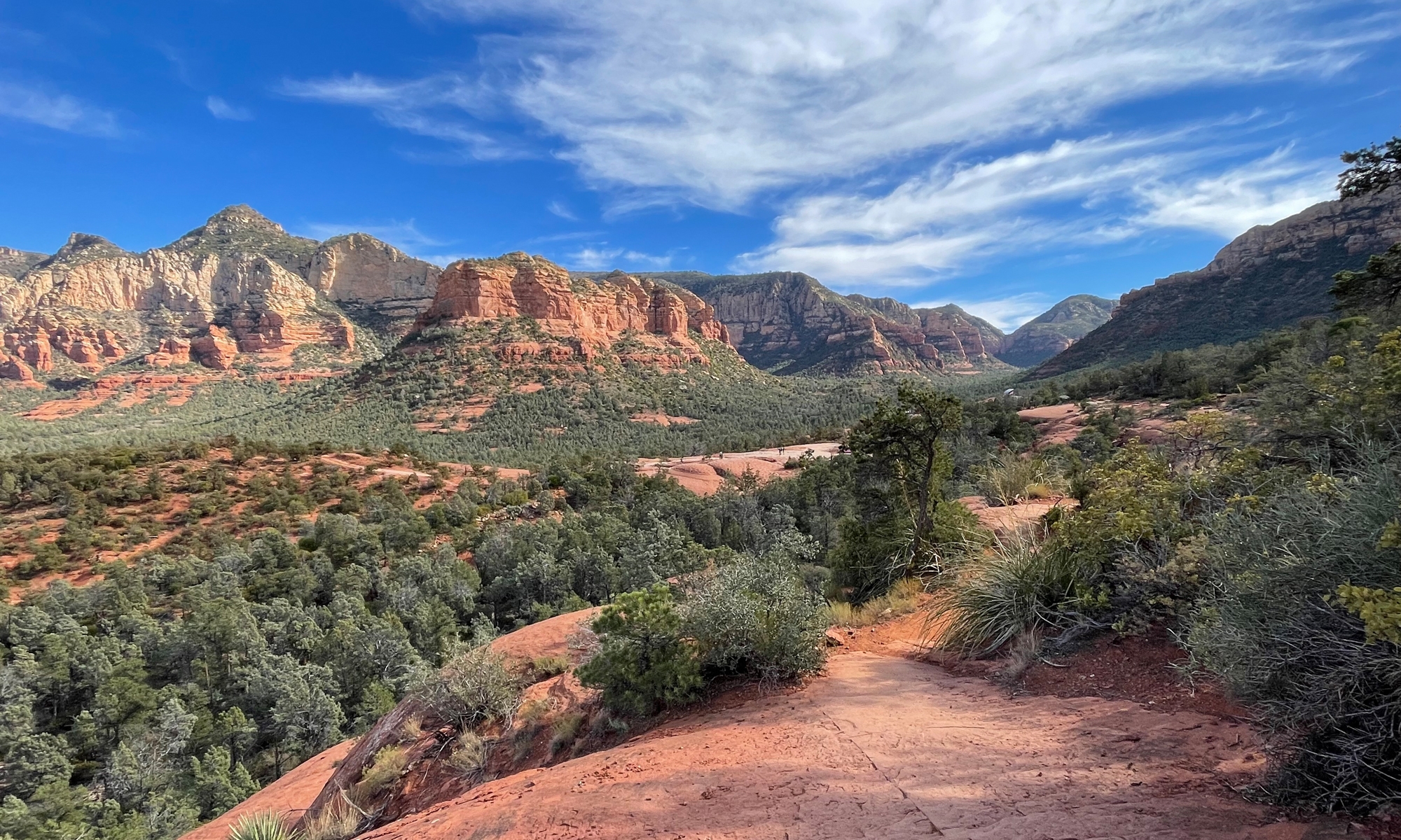
The further north you go, the more it starts looking like the Alaskan tundra.
You can see the "tundra" off in the distance.
Bear Rocks (what this particular area is called)
I was digging all the boulders. Those are people way out in the center of the frame.
Looking out over the valley from atop the Eastern Continental Divide.
A closer look at the tundra.
Another close-up of the tundra.
The road down. It was a rough ride, but well worth it, if you ask me.

I’m not sure Hubby enjoyed the ride through the Sods. It really was rutted and full of potholes. But it was really picturesque. I could spend an entire day just walking around taking pictures. These are all just snapshots. I hate making Hubby wait around while I do the photography thing.

He’ll probably read this and think, “Wait a minute, isn’t that what you were doing?” The answer? Nope. If I were doing the photography thing, I would’ve had my tripod. And more lenses. The wide angle one would have been nice to have.

I’d love to do some hiking there, too. There are a lot of trails through the Sods, but they are rugged and not recommended for novice hikers. So I’ll need to take that orienteering class first (how to use a compass and topographical map to get around).

I hope you enjoyed your virtual journey with us through the Dolly Sods!

Home Sweet Home

We made it back to the West Virginia place. It was only 441 miles. We left Natural Bridge, Kentucky at 8:30 AM and arrived here around 7:30 PM. That includes three gas stops and one stop for lunch.

Temps were in the THIRTIES when we left this morning. That is really damn cold when you’re on a motorcycle. Trust me.

It did warm up eventually. But not until a couple of hours after we’d been on the road.

It was foggy, too. For about the first hour, we alternated between pea-soup fog and blinding sun, freezing the whole time. It was fun. Fortunately we were on a parkway (highway) and not some crazy, windy, mountain roads.

After the short stint on the highway, we dropped onto some amazing country roads. Really. Today we experienced some of the best roads of the entire trip. So even if it did start out colder-than-cold, it was all worth it. The roads were that good.

More detail tomorrow when we’re at the Maryland home. Right now, I am beat. And these pictures I’m trying to upload aren’t uploading.

So that’s all for now.

Mountainous, Interesting, and Curvaceous

Wednesday morning I was quite dismayed to see thick fog blanketing the area. QUITE dismayed. We were at the Cumberland Gap. I wanted to see mountains. And, quite frankly, we were both tired of being cold.

Lucky for us, by the time we’d finished breakfast and packed up all of our stuff, the fog had cleared. The sun was out, too. It was quite a refreshing change.

I’ll do a more-thorough trip report once we get home and I can use a full-sized computer with good photo editing software. For now, some highlights to tantalize you.

Cumberland Gap was definitely mountainous.

The Pinnacle Overlook at Cumberland Gap.

Hubby and I were in Virginia when this picture was taken. The mountains to the left of the frame are in Tennessee. The mountains to the right are in Kentucky.

Our favorite kind of road...

When we left Middlesboro, we didn’t want to do it on repeat roads. So I plotted a different track. We encountered some SERIOUSLY curvy, mountainous roads. Not fun roads, though. Challenging roads.

Wanna know what made these roads through coal country even more challenging?

Big-ass coal trucks that were sharing the roads. There’s nothing quite as disconcerting as going through a blind, hairpin turn at full lean going about 45 mph than seeing an 18-wheeler coming toward you at high speed, taking up half of your lane.

You should have seen the potholes sink holes that dotted this one stretch of road. Oh. My. GOD.

We both have big bikes, but these sink holes were large enough to eat either one of us alive.

Soon enough, however, we were entering the Daniel Boone National Forest on perfect stretches of gently curving, hilly asphalt. We were still dodging coal trucks, just not as many. We stopped at Cumberland Falls for a nice picnic lunch.

ToadMama atop Cumberland Falls.

From there it was on to our very cool destination for the evening. This was a place I didn’t tell Hubby anything about. It was a bit further west than I would’ve originally planned on heading, but once I read about the place, I couldn’t resist a visit.

Shaker Village of Pleasant Hill

I haven’t said much about our accommodations. I like staying in unique places. This particular spot is about as different and as interesting as they come. We spent the night at Shaker Village of Pleasant Hill, a restored Shaker village on a 3,000 acre piece of property.

I’m not talking a couple of buildings here people. I’m talking an entire community. Multiple buildings on a sprawling piece of real estate amidst rolling farmland. The area reminded me a lot of Lancaster County, Pennsylvania. Minus the Amish folk.

Moo!

The place is run by a non-profit corporation. There are not only buildings, but gardens and animals, too.

I have lots of pics to share. Later.

Thursday morning dawned even more gorgeous than the previous day. Which is good, because it was time for us to head back to the mountains.

Hubby and I on top of a huge rock outcrop.

We climbed on the bikes once again and motored east, back to the Daniel Boone National Forest. The place is FULL of giant rock cliffs. I’m talking several hundred feet tall. I’ve never seen so much rock in one state before.

We’re staying at the Natural Bridge State Park for the night. It’s a resort park, which means there’s a full-service lodge here like there was at Pipestem in West Virginia. But this one is much nicer.

Hubby enjoying our balcony.

Our room has a balcony overlooking the forest. The door is open as I am typing. It’s dark outside, so all I hear are tree frogs, insects, and falling acorns. Soon enough I’ll hear Hubby snoring.

I guess I’d better end this post now. We’re not sure where we’ll end the day tomorrow. There’s about 450 miles between here and our WV place. If we have the energy, we’ll ride all the way. If we don’t, we’ll just stop somewhere for the night. As long as we’re back in Maryland at some point on Saturday…

– – – – – – – – – –

One more thing. Today is my Mom’s birthday. I did not forget. I just don’t have a picture handy here to post. But I can still say…

Happy Birthday, Mawsie!!!

Another State Added

We made it to Kentucky!

You’ll have to click here to see the picture. I’m unable to upload pics right to the blog for some weird reason.

At 9:30 AM, when we left Pipestem, West Virginia, it was 43 degrees and cloudy. It wasn’t raining, but since the ground was still wet, Hubby recommended that we don the rain gear.

I’m glad I have such a smart Hubby. Because it wasn’t long at all before we were getting rained on. The rain didn’t last long, but the roads were pretty much wet all day. It was cold, too.

I have pictures to share, but I can’t upload them for some reason. I decided to do a post anyway so y’all know we’ve arrived.

We’re in Middlesboro, Kentucky, which is just outside of the Cumberland Gap National Park.

Tomorrow we’re going someplace very cool, but very rustic. They do not have Internet access. In fact, I don’t even think they have TV.

So you won’t hear from us again until Thursday when we’re at Natural Bridge State Park.

A few shots from the day…

Hubby trying to warm his hands.

This is pretty much how the sky looked all day.

Here’s a look at a graph showing our elevations for the day. There were A LOT of peaks and valleys. The day was wet and cold, but still very interesting.