
General Area: Romney and Lost River, West Virginia
Date: May 2010
Hubby had some chores to do at the house, so I set off alone to investigate a particular road I’d never been on. We were going to try it a couple of years back, but were afraid it was gravel. It isn’t. But I’m getting ahead of myself!
High temperatures for the day were only predicted to be in the mid-60s (Fahrenheit) and it was to be very windy all day. But the humidity was low and the sky was a gorgeous blue, so I couldn’t resist a ride. I was very happy, however, to be wearing my leather coat, gauntlet gloves and chaps as it really was pretty chilly.
I set out heading west from Romney on US-50. Not even a mile from the center of town, I hung a right on CR-10/Grassy Lick Road. This is one of my favorite roads in the area. It’s full of twisties, has plenty of elevation changes and alternates between tree-lined and shady (in the valleys) to sunny with gorgeous views (on the ridge-tops).
Grassy Lick goes through Kirby where it meets CR-7/Ford Hill Road then bears right to continue south toward Rio. (Every time I drive through there, that Duran Duran song of the same name pops into my head!)
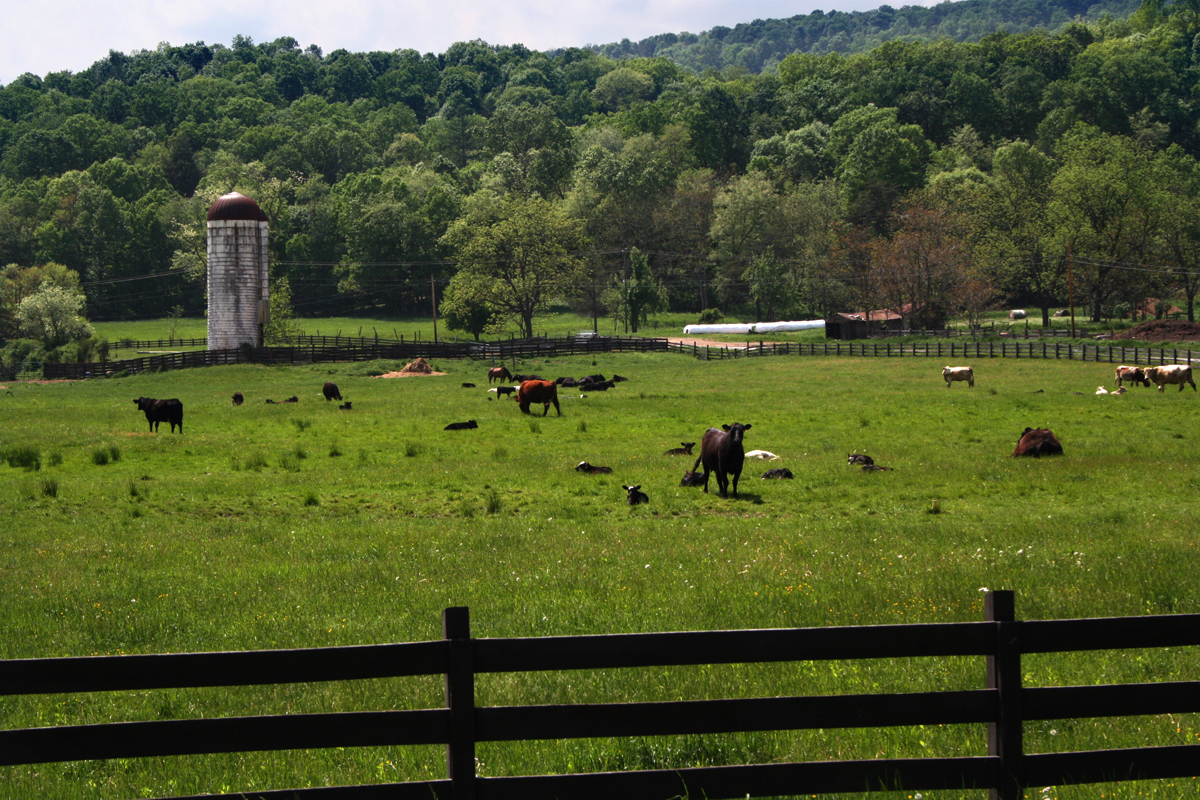
Just before Rio, I turned right on 29, enjoying a scenic ride through a valley full of farms (mostly livestock and poultry) and surrounded by picturesque mountains.
 |
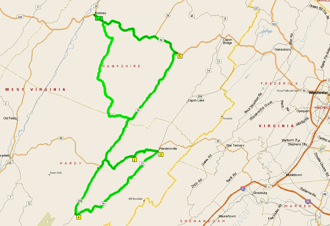
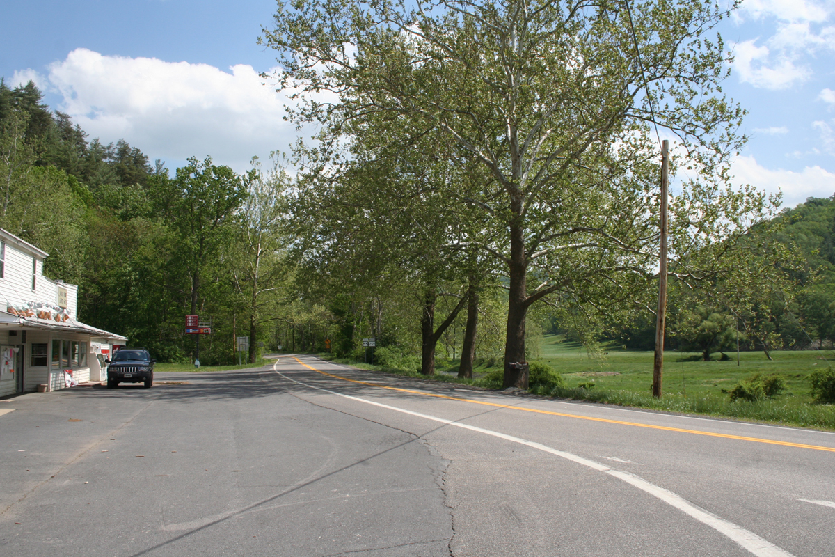
| Looking West at WV-29/55/259 split. |
When I reached the WV-29/55/259 split, I turned left, taking 55/259 east into Wardensville.
 |
| Looking East at the WV-29/55/259 split. |
In the picture shown above, I would’ve been coming in from the left of the scene and making a left turn to pass in front of the white country store. The bikers shown in this picture are actually turning onto 29 north heading toward Rio.
When following this route, you need to avoid the superhighway version of 55/259 (not shown on Microsoft Streets & Trips), known locally as the Corridor H road. Stay on OLD 55/259 (thanks to Google you can see the smaller road on the map here) to continue your very pleasant, winding country road journey. The old route takes you down through the valley where you’ll actually go under the very tall highway bridges at least twice.
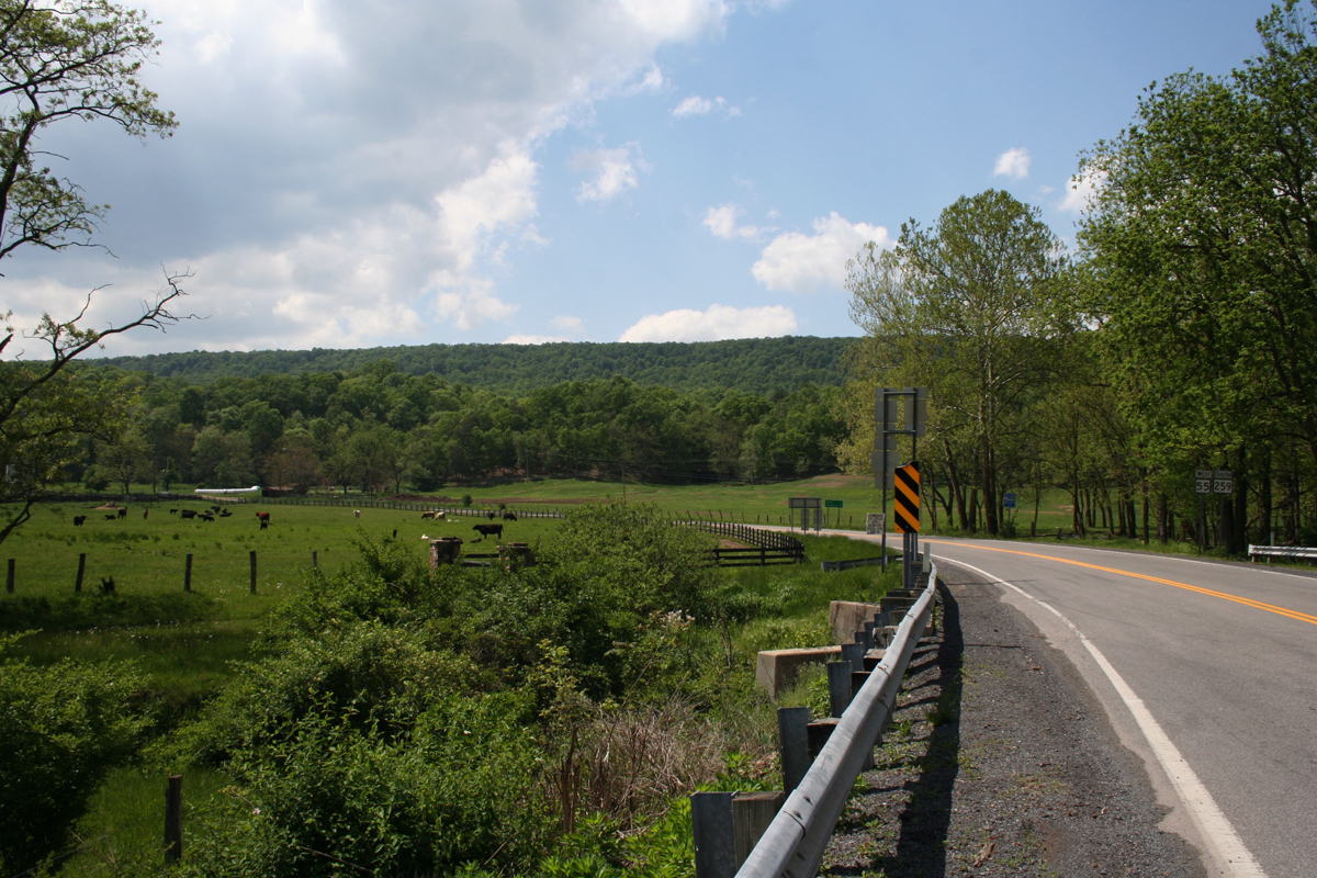
I then turned left where old and new 55/259 are rejoined. After about a mile, inside of Wardensville, I turned right onto CR 23-10. I was thrilled to discover that it wasn’t gravel. It was actually quite smooth, well-marked blacktop. Several miles further along, I made a sharp right onto CR 16, where there’s a sign guiding you toward Trout Pond.
 |
| CR 16 heading toward Trout Pond. |
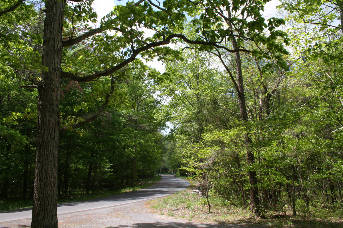
This portion of the road was a bit more narrow, but I could still maintain an easy 35-45 mph. I did have to keep my eyes peeled for downed tree limbs as a result of the wind I mentioned earlier.
 |
| CR 16 looking back in the direction from which I’d just ridden. |
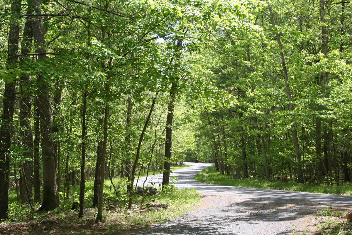
It wasn’t long at all before I encountered a sign welcoming me to the George Washington National Forest. When I saw a sign for Trout Pond Campground, which I hadn’t been expecting, I turned in. Where there are campgrounds, there are usually coffee download stations (toilets), which I needed at that particular moment. I was also hoping to see what Trout Pond actually looked like.
 |
| My very dusty motorcycle. |
I reached the entrance station after a mile or two of winding mountain road. I wasn’t thrilled to learn there’s a day use fee. I forked over the cash, however, since it goes toward helping maintain the facilities and the forest. Not only is there a very nice little campround, but there’s a great childrens’ play area, picnic area, and even a beach.
 |
| Rockcliff Lake at Trout Pond Campground. |
There was a nature trail I would love to go back and explore one day.
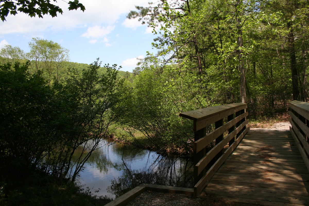 |
| Nature trail at Trout Pond Campground. |
After briefly exploring the campground (I never did see Trout Pond), I headed back out to a left on CR 16, which soon became Mill Gap/Thorn Bottom Road. I followed the slowly-narrowing and very pleasant road through the Lost River settlement and back out to WV-259 where I turned right headed north and slowly closing my loop.
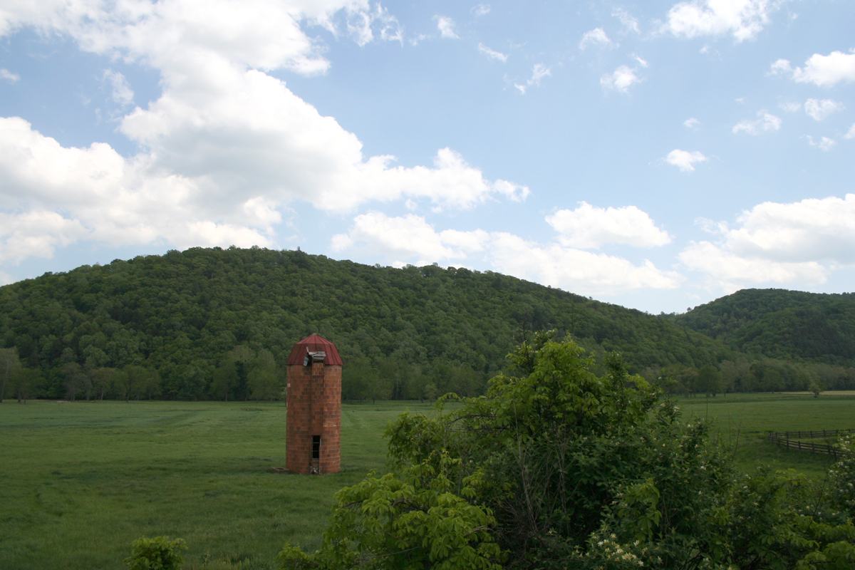 |
| Abandoned silo in the valley along WV-259 near Baker, WV. |
I thoroughly enjoyed my leisurely 55 mph ride on the smooth and gently curving WV-259, passing a wide variety of farms along the way, old and new, including this curious free-standing silo. I’m guessing there was a barn attached at some point, but it must’ve been a LONG time ago, because the silo is all that remains.
 |
| Another old farm building across from the silo. |
Shortly thereafter, I was back at the WV-29/55/259 split. This is actually when I stopped and took all of the pictures in that particular spot, including those at the beginning of this post.
 |
| Scared cow giving me the WTF look. |
 |
| Looking south at the split. |
 |
| Looking east at the split, toward Wardensville. |
Remember, I was doing a loop (more of a figure eight than a circle), so I turned left and headed north on 29 retracing my steps for a short time. Instead of turning at Rio, I continued north as I’d actually never been on that portion of WV-29 between Rio and US-50.
I hadn’t gone far when I saw this old barn. I just had to stop to get this picture. There’s just something about old barns, especially when the sky is blue, blue, blue and full of big, white, puffy clouds.
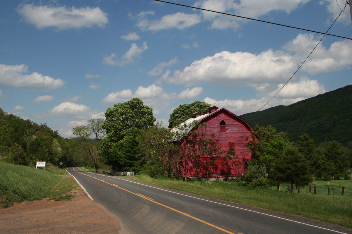 |
| Old Barn Near Baker, WV. |
I stayed on WV-29 to Hanging Rock, turning left where WV-29 joins US-50 for a bit. At that point, I was 19 miles east of Romney. Instead of continuing on WV-29 toward Paw Paw, I continued into Romney, closing the final loop.
The trip was about 100 miles total. It took me about 3.5 to 4 hours, but I stopped a lot for pictures and to explore the campground. If you were in a hurry, you could probably do it in about 2.5 hours. But then you couldn’t soak up the lovely scenery, which is one of the things I love so much about this area of West Virginia.