
I spent a couple of hours looking at my various maps. Hubby hates doing too many repeat roads. But after living here for five years, there are few undiscovered roads left. Or so I thought.

We had to do some repeat roads. But that’s okay. Because there are a few roads around here that I just LOVE. Grassy Lick Road (CR-10) is one of those roads. Grassy Lick runs from just east of Romney where it intersects with US 50, south and east through Kirby to where it ends at Augusta Ford Hill Road (CR-7 in Hampshire County and CR-253 in Hardy County).
Continuing south and east, we turned right on Augusta Ford Hill Road, right on WV-29 at Rio and then left on old WV-55. You may remember me mentioning in a previous post that old WV-55 is a motorcyclist’s dream road. Corridor H is what locals call “new WV-55,” which is essentially a little-used superhighway that runs east / west between Wardensville and Moorefield, West Virginia.
I made darn sure we stayed on old 55 until we were just outside of Wardensville. That’s where we turned right onto 259/55 and then hung a very quick left (100 feet?) onto Trout Run Cutoff (CR 23/12). After only about a mile we turned right onto Trout Run Road (CR-10).
I’d been on Trout Run Road before (remember Trout Pond Campground from my Lost River Loop). Hubby hadn’t. Before long, we were in the George Washington National Forest. Instead of turning on CR-16 headed toward Trout Pond, we just stayed on Trout Run Road. From that point on, it was all new road. In this case “new” just means road we’d never traveled. At least not on the bikes.
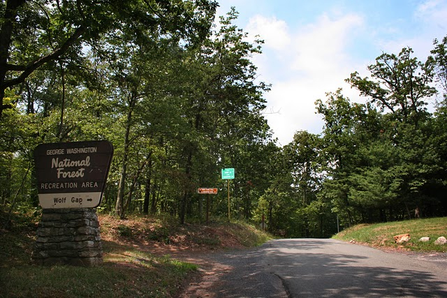
That lovely, smooth, tree-lined road meanders through the forest and ends just inside the Virginia border at Wolf Gap Road.
From there it was left on SR-675 to another left on SR-623/Back Road, which is where we started heading sort of north again. That road kind of parallels I-81, but you’d never know it. It’s lined with farms and is quite picturesque.
I’m really bad about stopping to take pictures when Hubby is with me. I feel like I’m inconveniencing him. So you’ll just have to trust me when I say it was a pretty little spot.
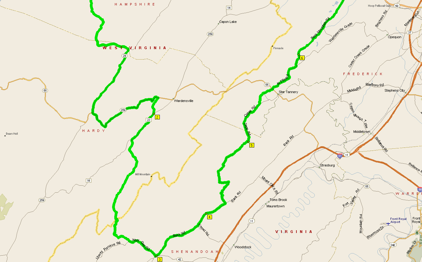 |
| Southern half of my Star Tannery route map. |
We followed SR-623 until just west of Toms Brook, Virginia where we turned left onto Zepp Road. Now THAT was a super-cool little stretch of road that took us up over the smallish North Mountain just southwest of the Devil’s Backbone State Forest and into Star Tannery, Virginia. There’s not a whole lot of information on the Web about Star Tannery, but I did find an interesting Wikipedia stub about the state forest, which also explains how Star Tannery got its unusual name.
Zepp Road became Oates Road for a very short stretch, and then became Pifer Road after we crossed WV-55. It stayed SR-600 that whole time, even when it turned left and became Back Mountain Road.
It’s taken us a while to get used to these road naming conventions. Looking at a map and seeing a road name does NOT mean you’ll see a street sign showing the road’s name. More often than not, especially in rural Virginia, you’ll just see a sign with a number, which in this case was 600. Keep that in mind when planning your next route or even following this one. Okay? Again, trust me.
Soon after that we came to the SR-600 / SR-614 split (a Y in the road). SR-600 continued left, unnamed, and Back Mountain Road became SR-614. We missed that little turn, but at that point we were close to US-50, so I just decided to forge ahead.
At US-50, where our new, previously undiscovered road experience ended, we turned left heading back toward Romney.
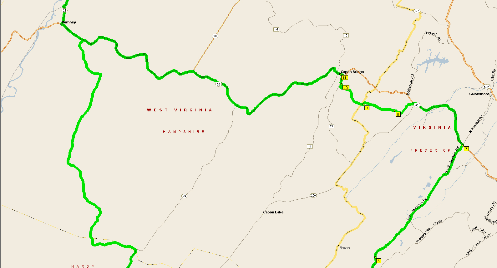 |
| Northern portion of my Star Tannery route map. |
Heading back into Romney was the plan anyway. That’s what is shown on the northern segment of this map. But it was SUCH a nice day and we were having so much fun that we decided to prolong the ride just a little bit. And wow, were we ever glad we did.
In Capon Bridge, West Virginia, we turned right on CR-15 / Springfield Grade Road. This road heads out of town along the Cacapon River for a bit before cutting west toward Springfield. It’s a road we are very familiar with.
Google maps shows this road with another name on the Springfield end (CR-45/20). But the road sign in Capon Bridge says Cold Stream Road. That’s actually a VERY appropriate name as the road runs right past Ice Mountain, which is a geological wonder maintained by the Nature Conservancy (follow that link for more info). The road runs through North River Mills, an odd abandoned-looking but very well-maintained TINY town.
Now, were the road not closed for repairs, we could’ve followed it all of the way into Springfield. However, lucky for us the road is still closed. Why lucky? Because that meant we had to take Jersey Mountain Road (CR-5) south from Springfield Grade to get back to US-50.
And Jersey Mountain Road was awesome. Seriously awesome. Like Springfield Grade, it alternates between tree-lined and cutting through farms, but it is always smooth and twisty and hardly has any traffic at all.
What more could a motorcyclist ask for?
All told, we rode about 150 miles. We were taking our time, too, and were gone for just over four hours.
If you are anywhere close to this route and have the time to spare, GO. Really. You won’t regret it.
Wanna add that little extra piece on Springfield Grade / Cold Stream Road from US-50 in Capon Bridge through Slanesville to Points and then south on Jersey Mountain Road to get back to US-50? It’ll add about 30-45 minutes, but is so worth it.
One Reply to “Star Tannery, Virginia”