
After all, destinations aren’t usually the reason we go for rides. The ride itself is usually the motivation. Fun destinations/stops are icing on the proverbial cake.
My recent trip was no exception. I kid you not, it started out with my wanting to get some breakfast. Soon enough it morphed into a 144-mile loop ride through some downright pretty country. (Wanna see the Google map?)

I’ll never forget seeing this sign for the first time. It was actually near the highest point of the road through the gap. It unnerved me a bit, but we didn’t have any trouble.
US-211 is an old road. It wasn’t built for speed. The curves can be a bit challenging, especially if you aren’t anticipating the radius to change mid-curve like it does on several of the turns.
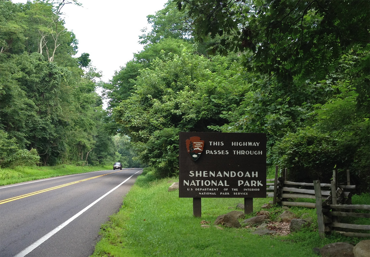
It still tickles me to know we’re so close to SNP, home of Skyline Drive. Among other things. Skyline Drive is a pretty road, but it has a 35 m.p.h. speed limit, which is hard to maintain. It can sometimes be crowded, too, so I don’t use the drive often. There are plenty of other great roads in the vicinity, though.
I took a sorta direct route from Luray, where I ate breakfast, to Quicksburg, which is where the Shenandoah Caverns complex is located.
Since I had actually remembered to charge the GoPro, I wore it. I used some of the pics captured along the way to create a slideshow, shared later in this post. I didn’t include the piece of US-211 that crosses Thornton Gap and Skyline Drive since I’ve shared that road several times previously. (If you REALLY want to see that road, click on this video link and jump to the 2:00 mark.)
But first… here are a few other pics I wanted to share.
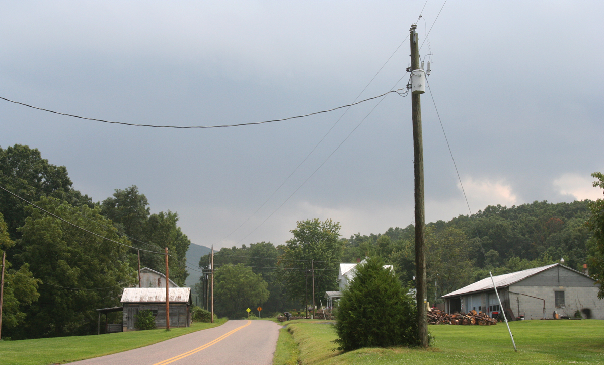
It was starting to sprinkle a bit as I got close to Edinburg, VA on US-11. And the sky to the east, which of course is where I was headed, looked quite ominous.
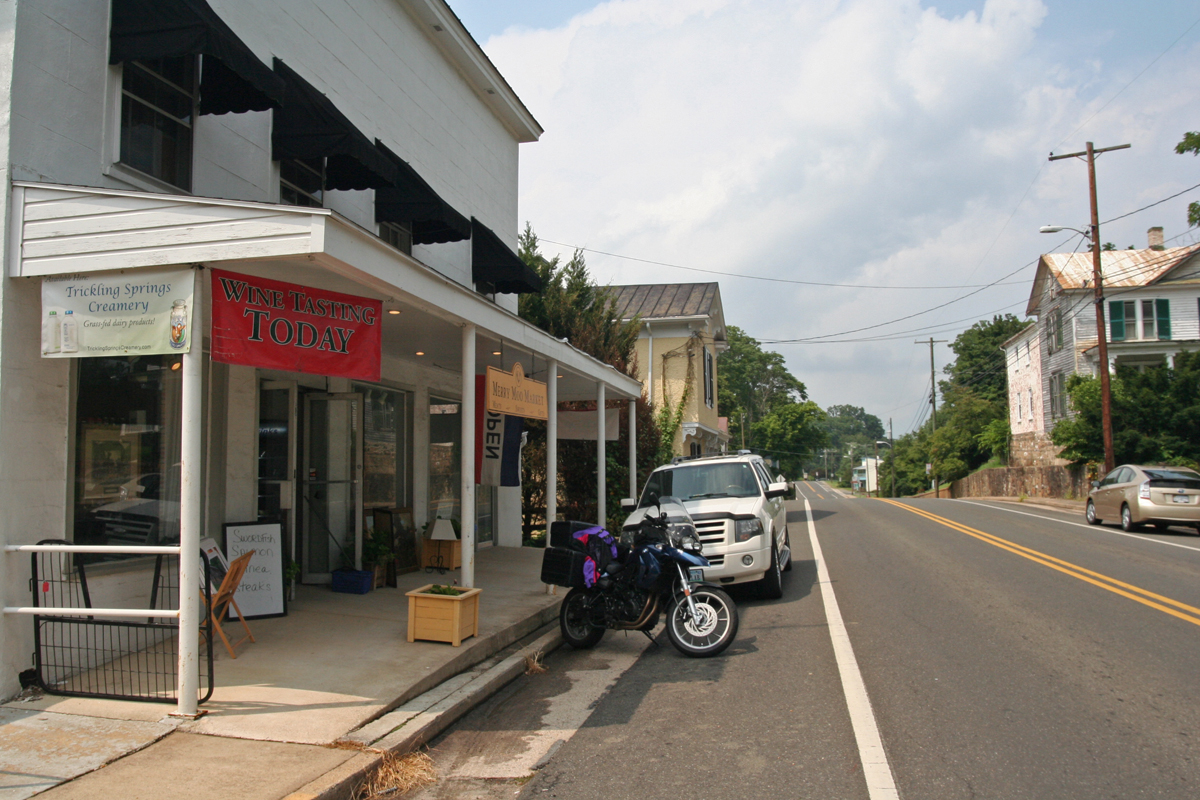
When I saw this fishing shop, which is owned in part by a guy who fostered our first dog, I decided to stop and pay him a visit.
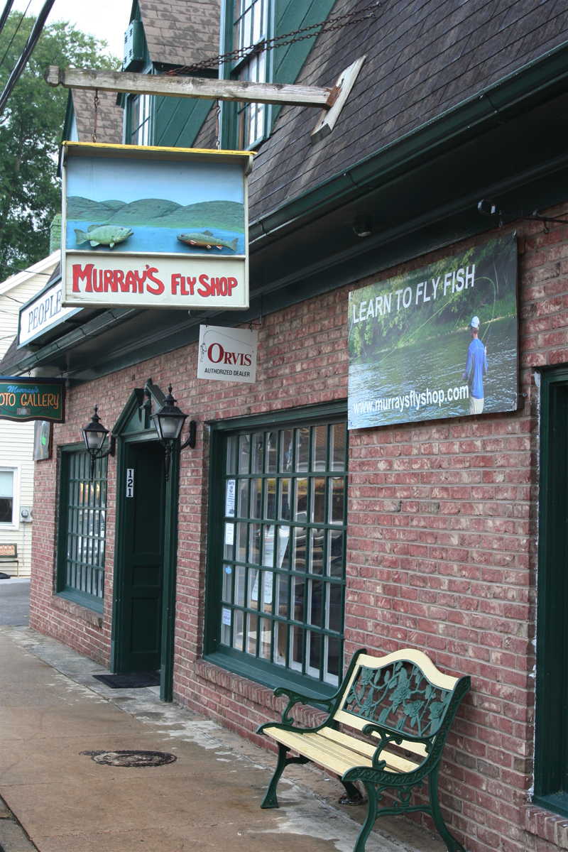
I JUST missed seeing the guy, of course. But, by the time I got back outside, it had stopped raining. A quick check of the radar (what did we EVER do before mobile phone weather apps?) led me to believe I’d be following the storm. And since it was quite warm and humid, I opted not to don the rain gear.
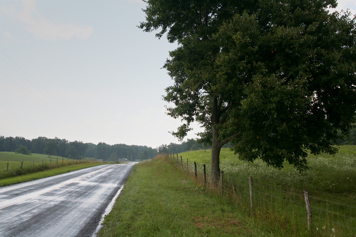
Sounds like a sure way to get wet, right? I actually got very lucky and, quite literally, followed the storm most of the way home. The 10-degree temperature change in the wake of the storm felt delightful.

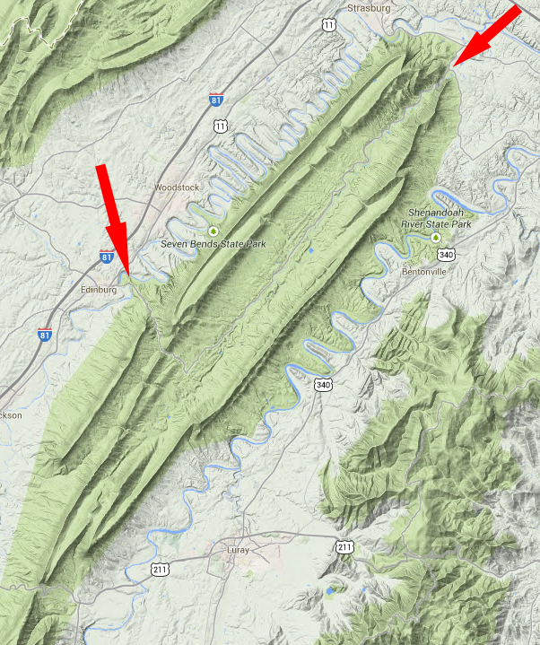
Fort Valley is a geographically interesting place. As the terrain map shared below shows, it is a valley within a valley. The wider Shenandoah Valley includes the Massanutten Mountain range (between the north and south forks of the Shenandoah River). Fort Valley is a valley within the Massanutten Mountain range.
I think it looks cool on the terrain map. We actually considered living there at one point. It’s really very picturesque. But there’s no wired Internet access, which we need, and we didn’t like the fact that there are only two ways to get into or out of the valley by road, either at Edinburg Gap on the southwestern side or at the northeast head of the valley.
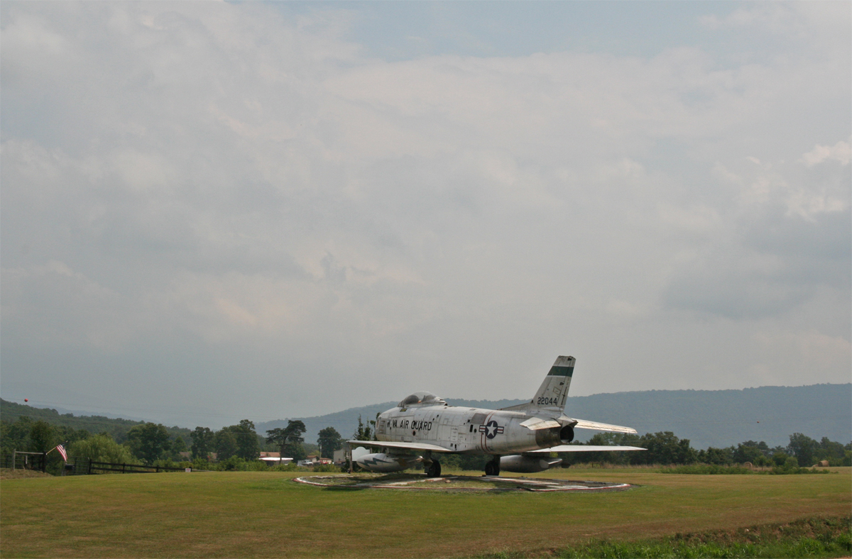
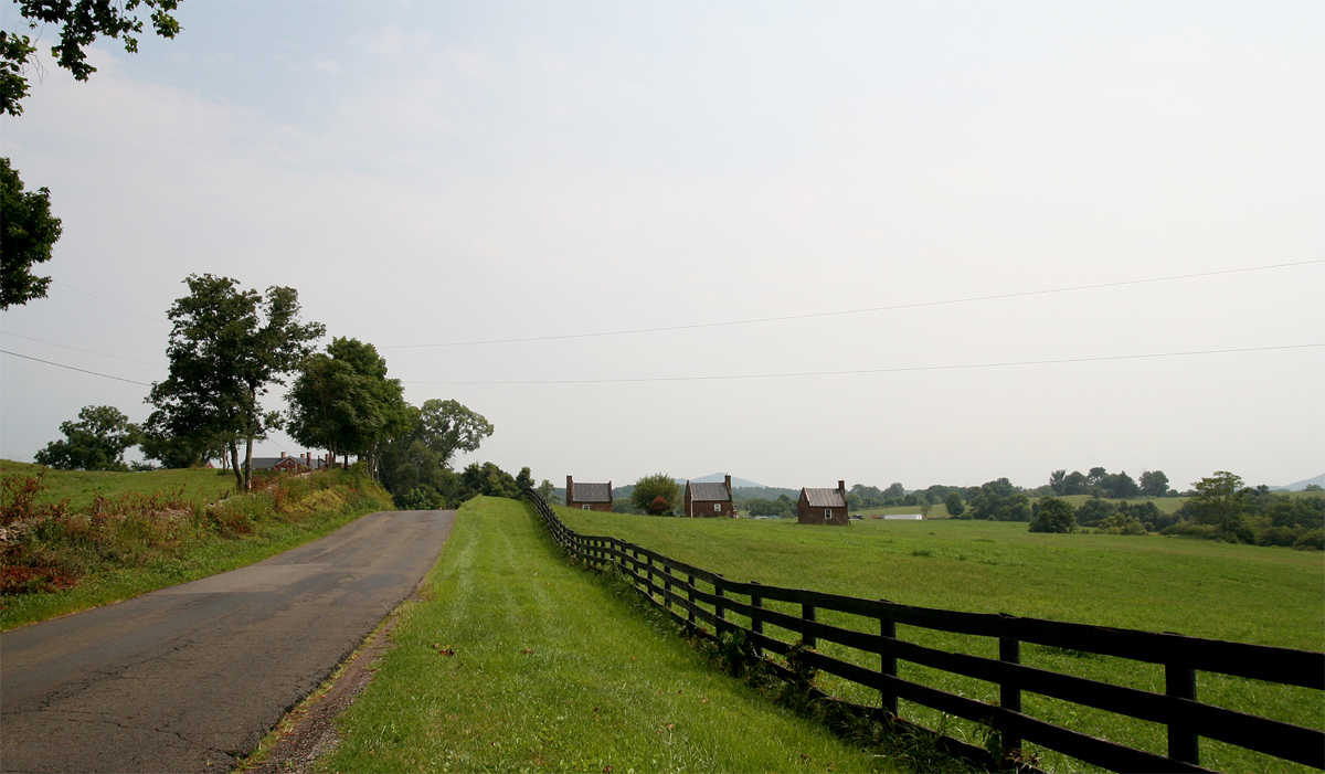
After exiting at the valley’s north end, I headed east toward US-340. I did not expect to see this as I traversed the mountain…
Slave quarters, circa mid-1800s, at Ben Venue, Virginia. If you would like to read more about the property, click here.
And, finally, that slideshow I promised you. There’s music, and it isn’t great, so you may want to hit that ole mute button before you watch.
The first nine slides are on US-211 heading west from Warrenton, VA. The rest of the slides are between Quicksburg (Shenandoah Caverns) and the Elizabeth Furnace Recreation Area on Fort Valley Road (678).
Weather-permitting, we’ll probably do some two-wheeled exploring this weekend. Exploring which is LONG overdue.
Love the stormy sky pics. How dramatic.
It did make for some interesting views. 🙂
Beautiful country! You think a place called Merry Moo would have a large cow sculpture somewhere. Btw I liked the fiddle music, it suited the slide show.
Dar, I’m glad you enjoyed the music. I did, too, but figured some would hate it, hence the warning. The shop has no space for a giant cow, but you’re right, with a name like that, it would be fitting.
Kathy:
I can’t get over lack of traffic, nor lack of shoulders on your roads. Those looked like nice roads and then you get to go through those small towns. You have such nice riding areas where you are
bob: riding the wet coast
Bob, riding in our part of Virginia is amazing. West Virginia is even better. You’ve commented about our lack of shoulders before. I think that’s because it’s a lot of rural roads? I’m so used to it, I don’t really notice.
Traffic is MUCH heavier near the cities. Back roads are definitely the way to go.
Sort of amazing that we’re relatively close to Washington, DC, but rural, too.
That sign would scare the bejeezus outta this newbie rider, yikes! I’m hoping to get some riding in this weekend, too, but so far I haven’t actually asked anyone if they’d be interested so…hmmm…I should get goin’ on that!
Yes, Shan, get busy! Or ride solo for a bit. 🙂
Looks like I’ll be taking the Otay Lakes Rd to Tecate on Sunday morning. A map can be seen here. A general map, anyway; I don’t know the exact route we’ll take. 😉
It’s kinda cool that you can ride your bike to Mexico. Except sitting in long lines in the hot sun is never pleasant. Have fun!
No border crossing, so no long lines. 🙂 Doesn’t mean the sun wasn’t hot, though!