Y’all know I don’t usually subject my Hubby to really weird stuff that I know he won’t appreciate or enjoy, right? But sometimes, I can’t help myself. Especially when there’s something that is just SO up my amusement alley, in a location we’re not likely to re-visit anytime soon. Which is why, after leaving Mount Airy, North Carolina on our recent trip, I included a stop at Slick’s Pottery in the neighboring town of Slate Mountain. I may or may not have planned the route specifically because it passed through that particular locale. 🙂
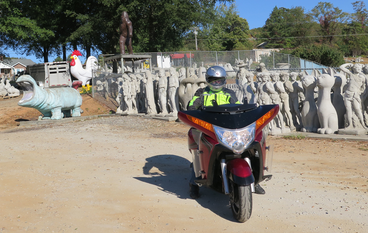
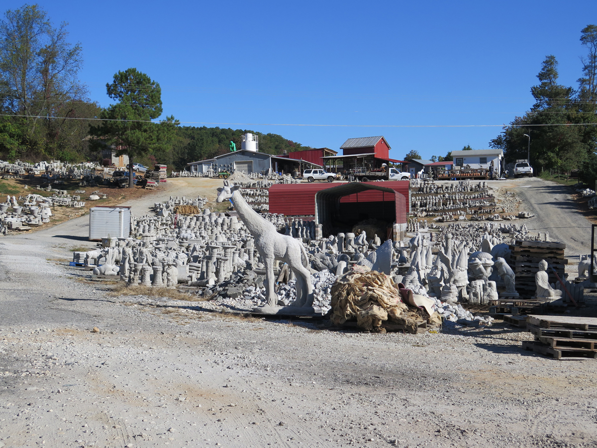
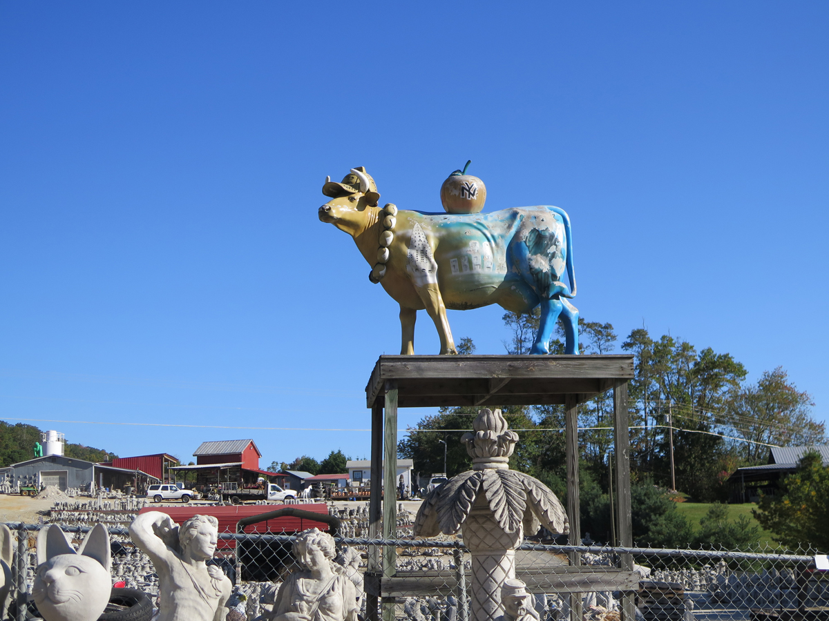
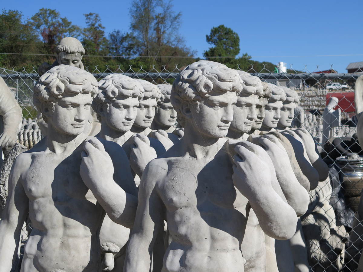
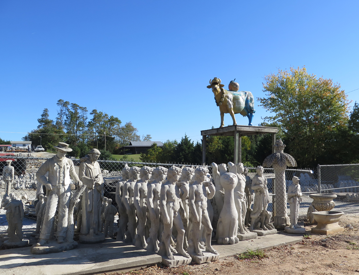
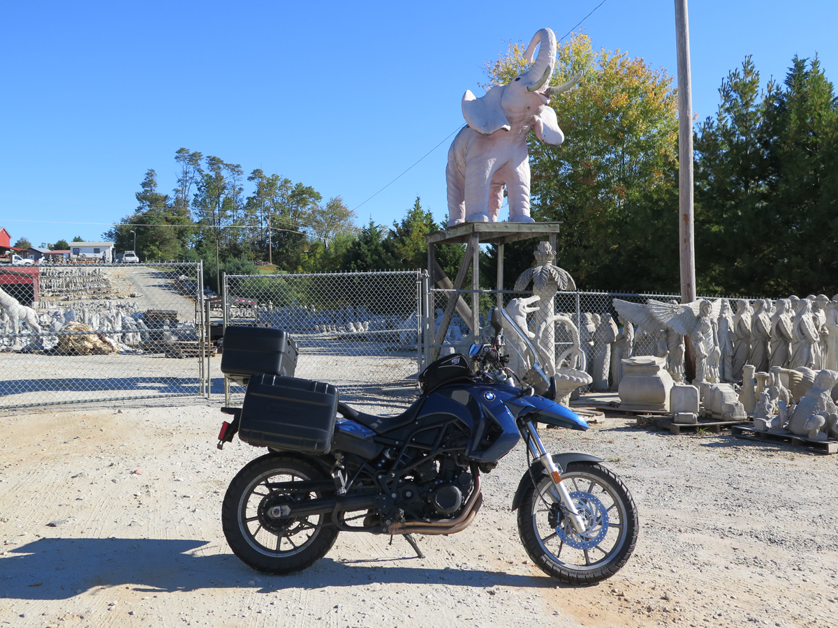
Along a rural road, an unexpected army of concrete warriors, animals, and Jesi crowd a hillside below a concrete statue factory. The selection no doubt varies continually, but on the day that we stopped by we saw what Americans apparently crave for their lawns and gardens: a dragon, lion, eagle, Indian chiefs, enraptured worshippers, armless Venuses, a pink elephant, an Amish buggy, and a cow up on a pole painted as a tribute to New York City. And there were many more statues arrayed in ordered battalions back from the road, up to the factory. It’s all about the latest ironic juxtaposition waiting to be photographed.
How could I pass THAT up? I would’ve been kicking myself indefinitely if we hadn’t stopped, always wondering what amazing wonders we could have seen.
And, in the end, we only spent five minutes there.
Yes, I can work fast when required.
I think he even enjoyed the visit. A little, anyway.It really was a small hillside full of statues.
The business was closed while we were there (a Sunday morning). 🙁
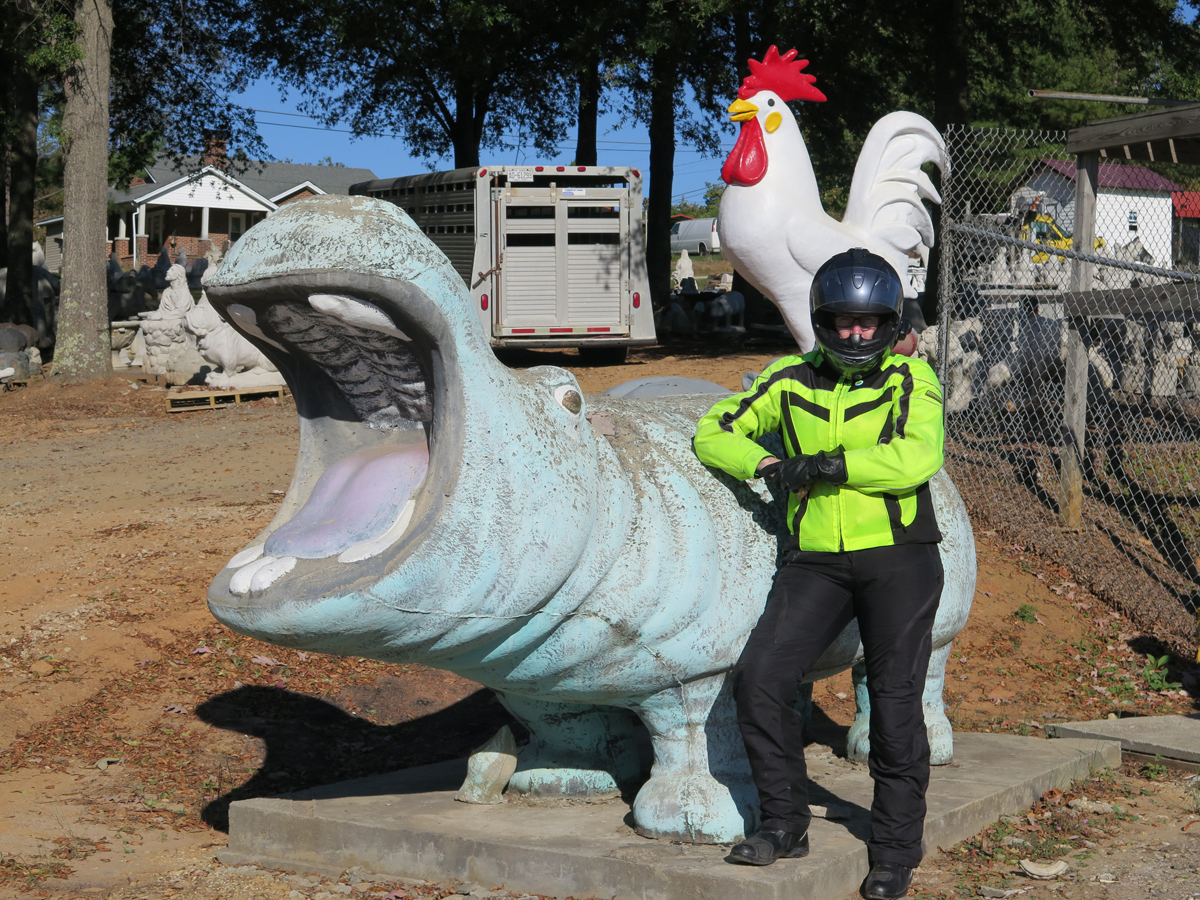
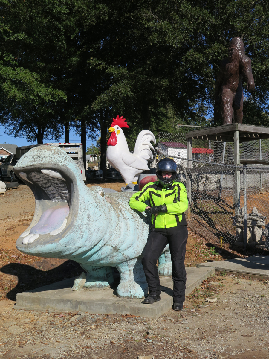
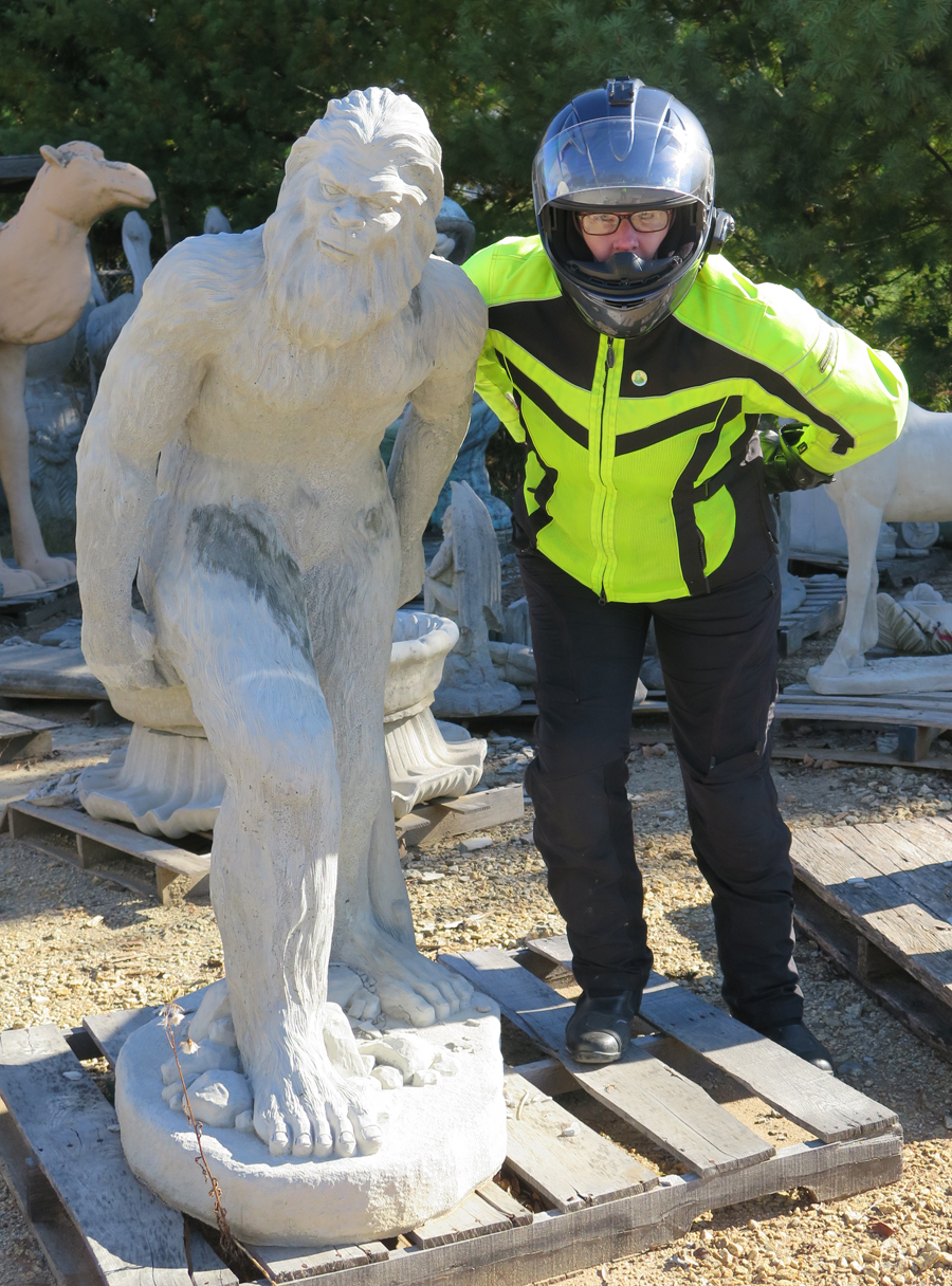
ToadMama with Hippo and Chicken
Of course, when I saw the above picture of me was missing an important third component, I requested a re-do.
ToadMama with Hippo, Chicken, and SasquatchYankee CowArtsy ShotThere was quite an assortment.Obligatory Bike ShotToadMama with Soldier (and mooning photobomber on left)I found one for my yard!This is actually the mooning photobomber.
I read somewhere that the four-foot-tall Sasquatch is one of their biggest sellers.
Hubby spotted the giant green rooftop ape.Another concrete hippo. And a camel.Pink Elephant on Platform
Wasn’t that a fun stop? If only Slick’s place wasn’t so far from home.
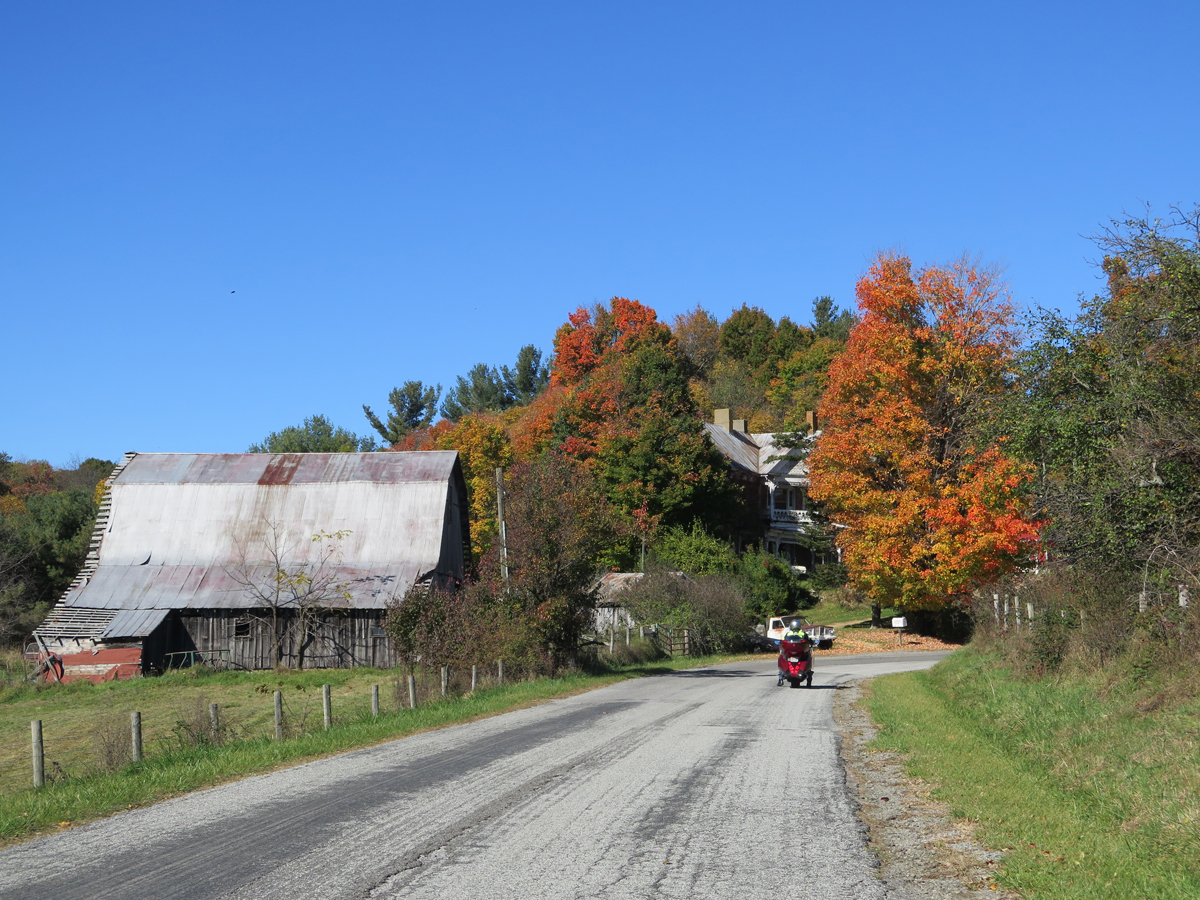
I’m woefully behind on blog posts. Hubby’s birthday ride feels like it was ages ago. Jeez.
I’ll spare you the lame excuses. And, because there’s a backlog, I won’t bog this post down with commentary. Basically, we woke up on Saturday, packed up, ate, and rode. It was a glorious day.
I didn’t take nearly as many pictures as I could have. It was a beautiful area. Truly.
I just HAD to stop for this one.
Looking out over the Grayson Highlands.
Country
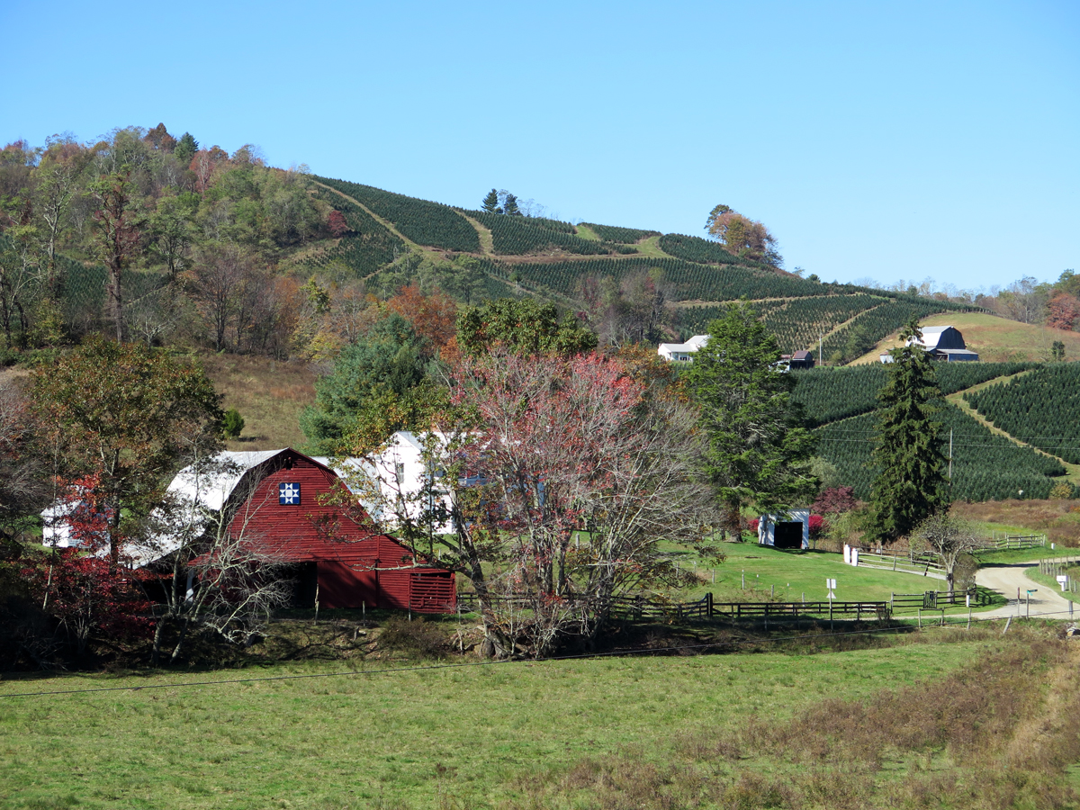
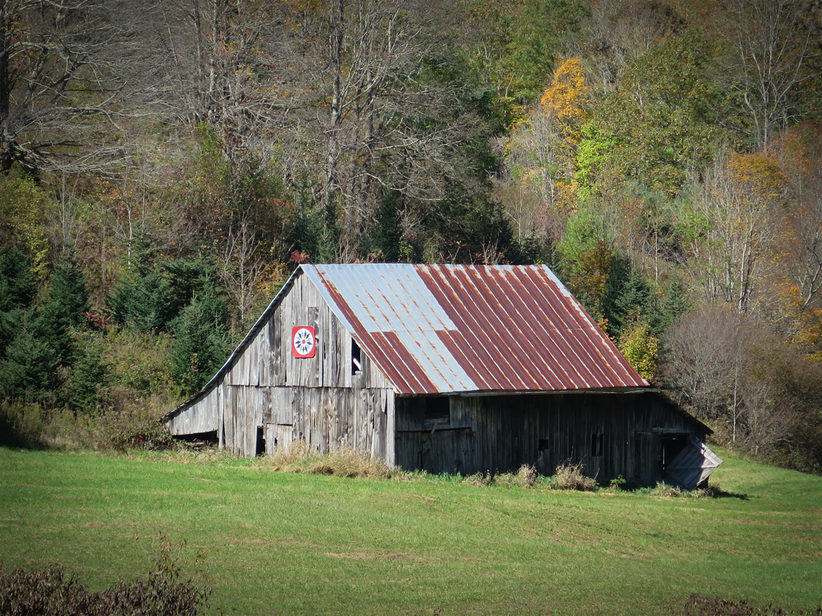
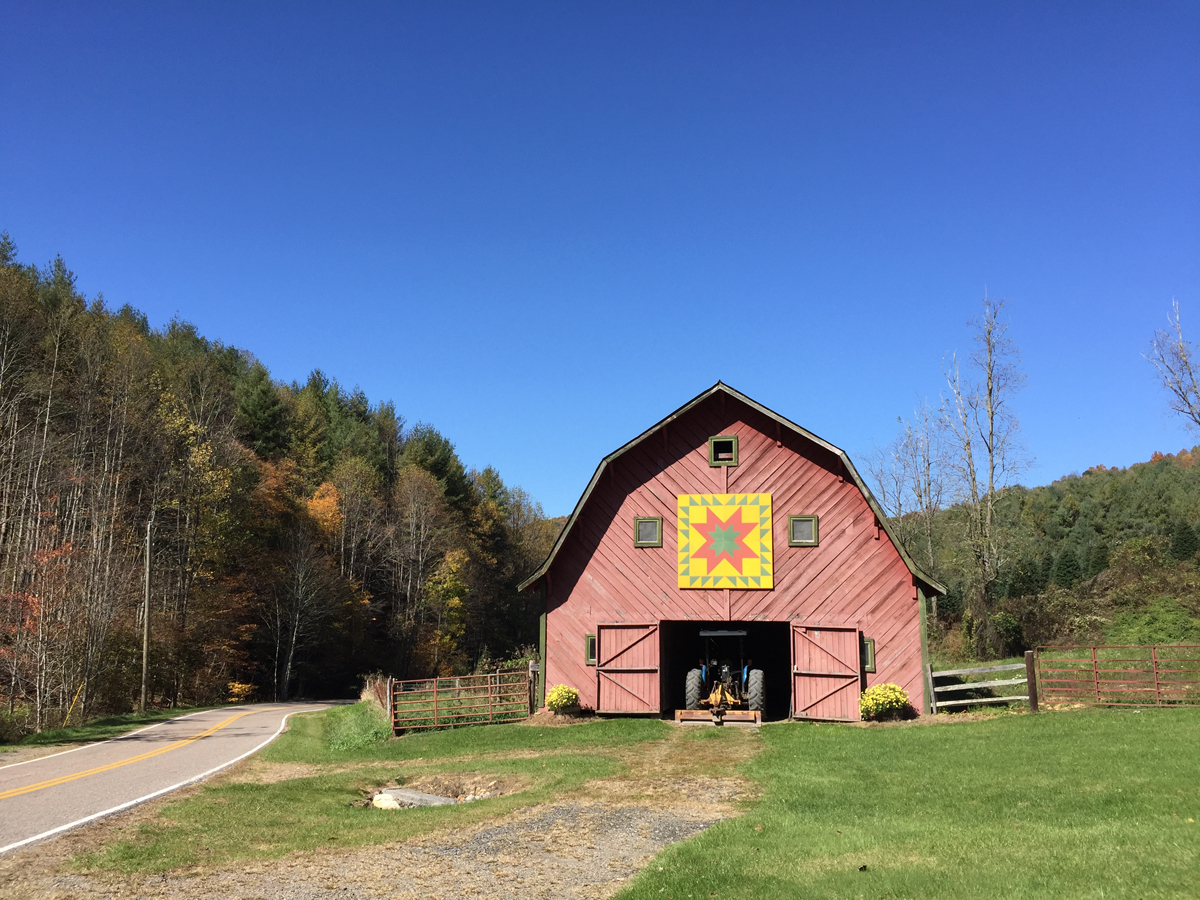
Barn Quilt and Tree Farm
More Barn Quilts
Grayson Highlands in Virginia
We were very close to the VA/NC border. I have no idea which state this was in.
A Closer Look at the Barn Quilt
Pretty Barn Quilt
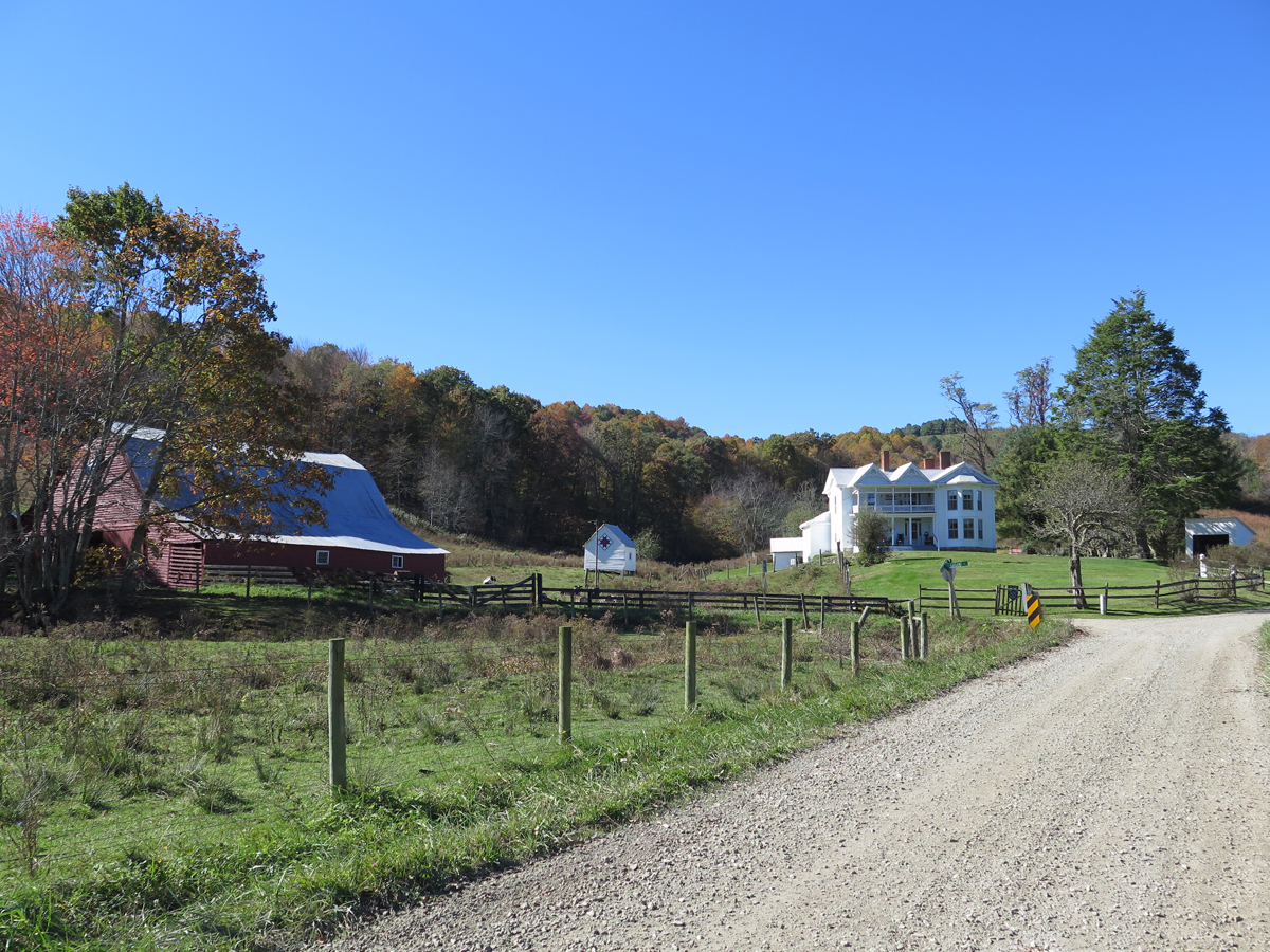
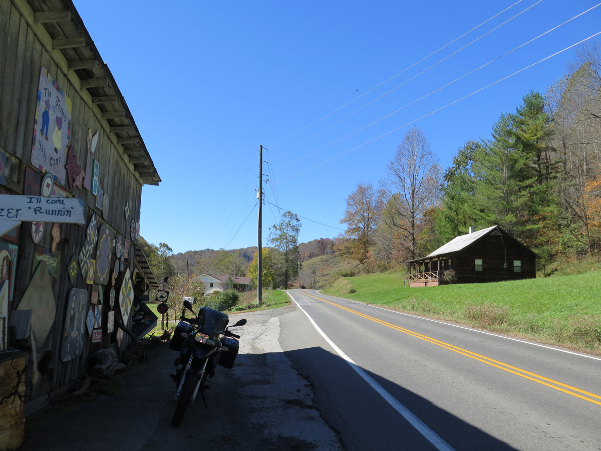
Along a North Carolina Road
Barn Quilt on a Hardware Store in West Jefferson, NC
Giant Cows in West Jefferson, NC
I don’t make Hubby stop much, but I knew we HAD to stop in West Jefferson to see the giant cows at the only cheese factory in NC. I’m glad, too. The town is adorable. It’s on my list of places I absolutely must re-visit.
Perfect end to a fabulous day.
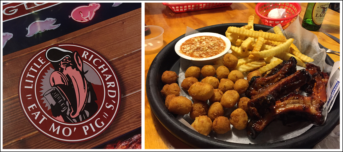
I actually chose our lodging for the night because it was within easy walking distance of this BBQ place, which had great Yelp! reviews. We weren’t disappointed. The food was delicious.
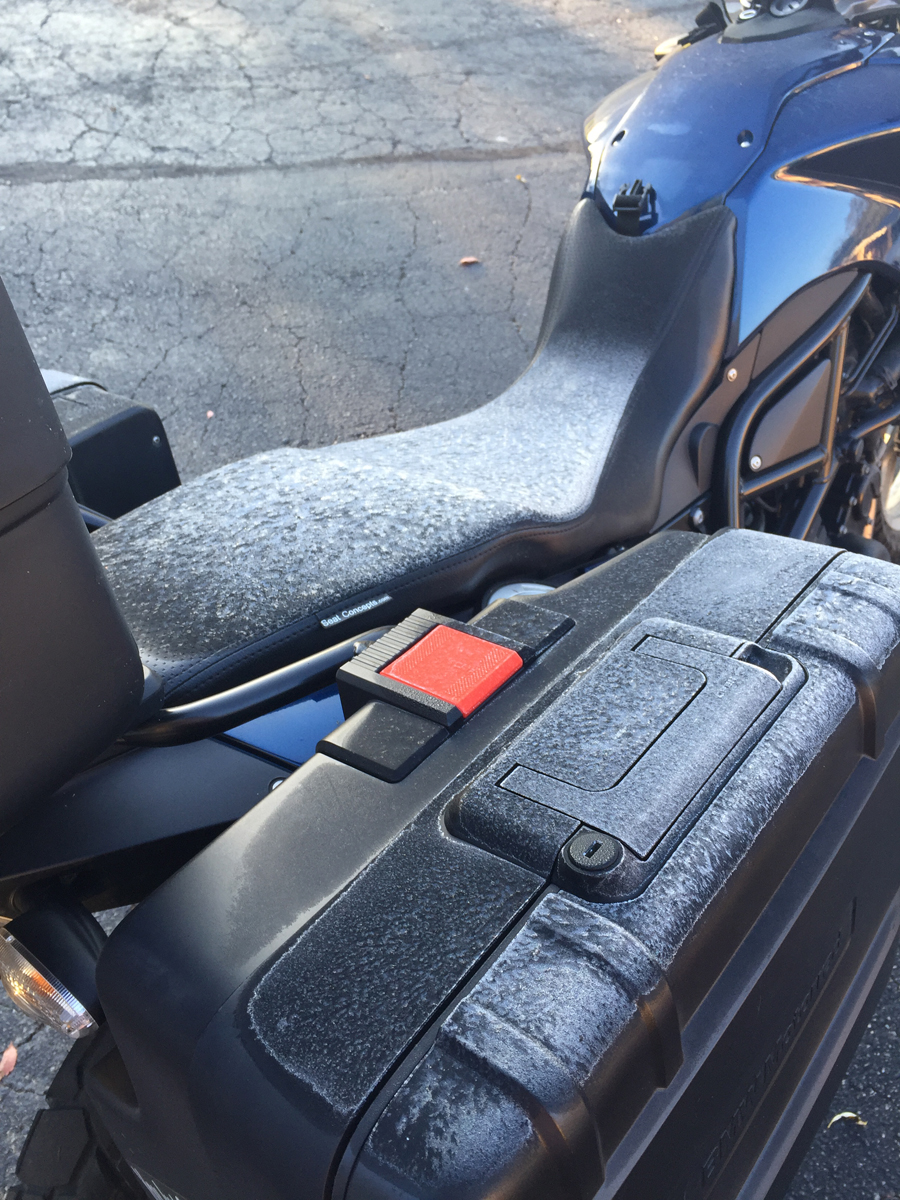
Frost!?!
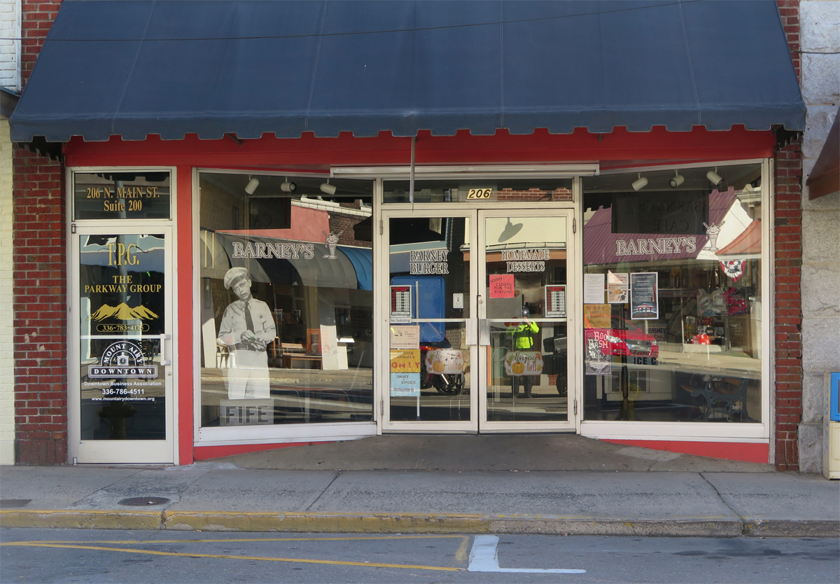
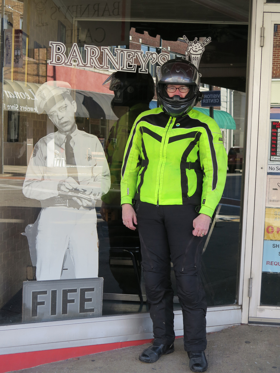
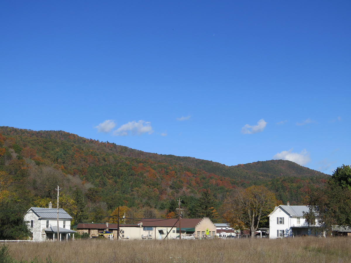
Mount Airy, NC (Any Griffith’s birthplace and inspiration for the fictional Mayberry)
Flashback
Kitsche
Dork
Nice spot for a stretch break.
We were going to visit the D-Day Memorial in Bedford, but we were hungry, I was a bit chilled, and daylight was waning. It’s another place we must re-visit.
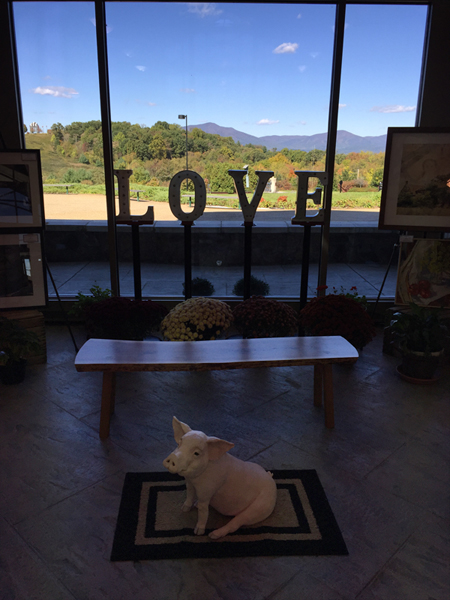
I did pop into the visitor’s center to see if their bathrooms worked and was quite tickled to see this mini-LOVEwork with a cool pig in the foreground.
Mini LOVEwork at Bedford’s D-Day Memorial … suh-WEET!
Next up… the other place we HAD to stop. Hubby wasn’t thrilled, but it was early in the day and we’d just eaten breakfast, so he humored me.
There are pros and cons to using a helmet camera while riding. One of the cons being that you end up with a TON of images to sort through, which takes time. That’s why some of my images never get viewed by anyone other than me.
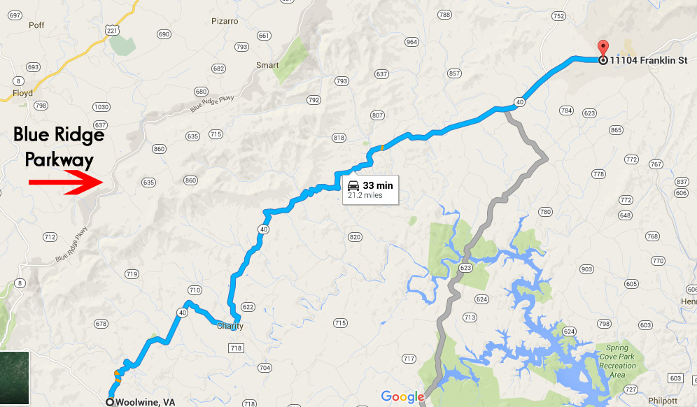
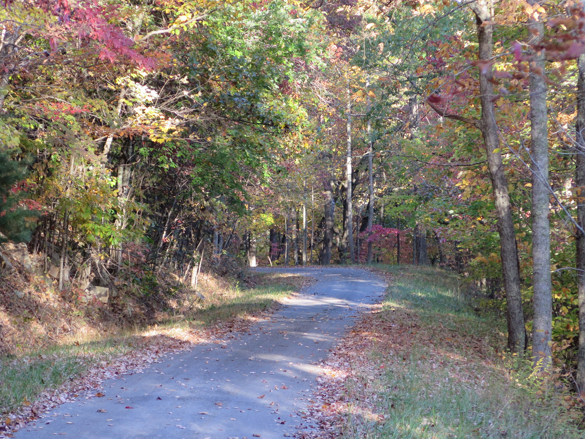
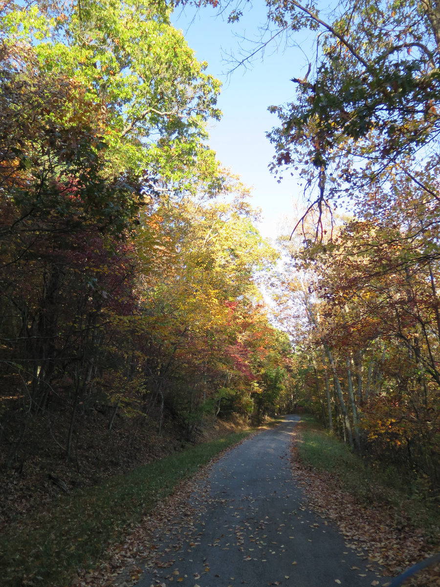
Yesterday, as I sorted through pics captured on October 18, the last day of Hubby’s birthday weekend ride, I came across a series of shots showing Virginia’s Charity Highway.
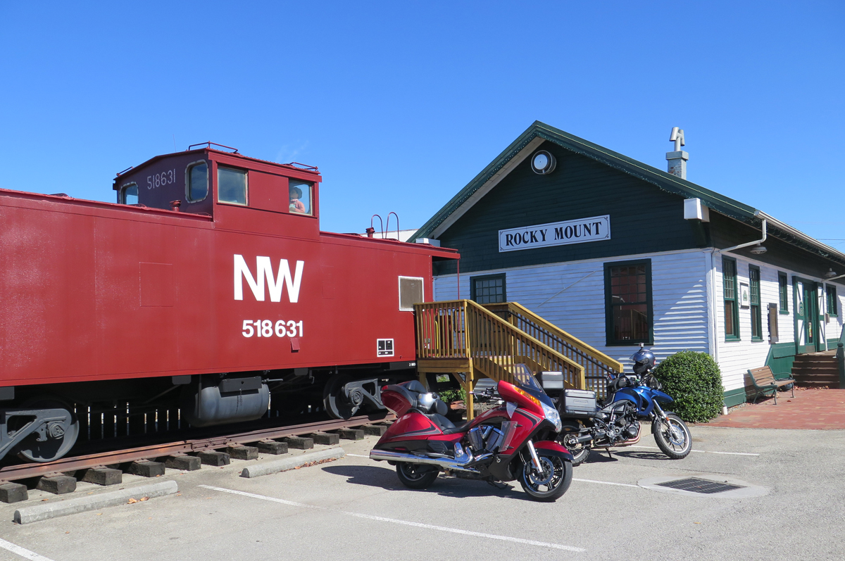
It is definitely one of my favorite stretches of road enjoyed that weekend. The 21 or so miles from Woolwine, the western end of VA-40, to just before the town of Ferrum were the best. We only went as far as Rocky Mount, so I can’t tell you whether the other end of the highway is good or not.
Like many roads, that “highway” got its name because it passes through the town of Charity. The posted speed limit was 55 MPH, but it was so curvy, I can’t imagine being able to maintain that speed for long.
That section of VA-40 parallels the Blue Ridge Parkway (BRP). It would be a great alternate route on days that the BRP is fogged-in, too darn crowded, or you just need a change of pace. Remember, the 45 MPH speed limit on the BRP is strictly enforced.
When riding, I am often amazed at how little traffic uses many of the back roads we enjoy. Some folks have even asked, after watching another of my slideshows/videos, if we even have traffic.
The answer is yes, we do. I just usually omit slides/video segments where I’m stuck behind some other vehicle. Who wants to look at the ass-end of a car or truck?
This time, I decided to keep it real and include ALL of the 330+ slides from that stretch of road. Images were captured every 5 seconds, so it’s about 28 minutes of ride time condensed into a slideshow that’s 3:28 in length. You’ll get to see all of the traffic we encountered and the annoying sun glare as well as the road and some pretty nice scenery.
The slideshow is relatively quick. I added music, so you may want to mute your speakers if you’re watching in stealth mode.
For you map lovers, here’s a link to GOOGLE Map: Charity Highway, ~21-mile portion of VA-40 between Woolwine and Ferrum, Virginia. I have no idea how long those links stay active so, if it’s broken, just open GOOGLE Maps and search for Woolwine, Virginia.
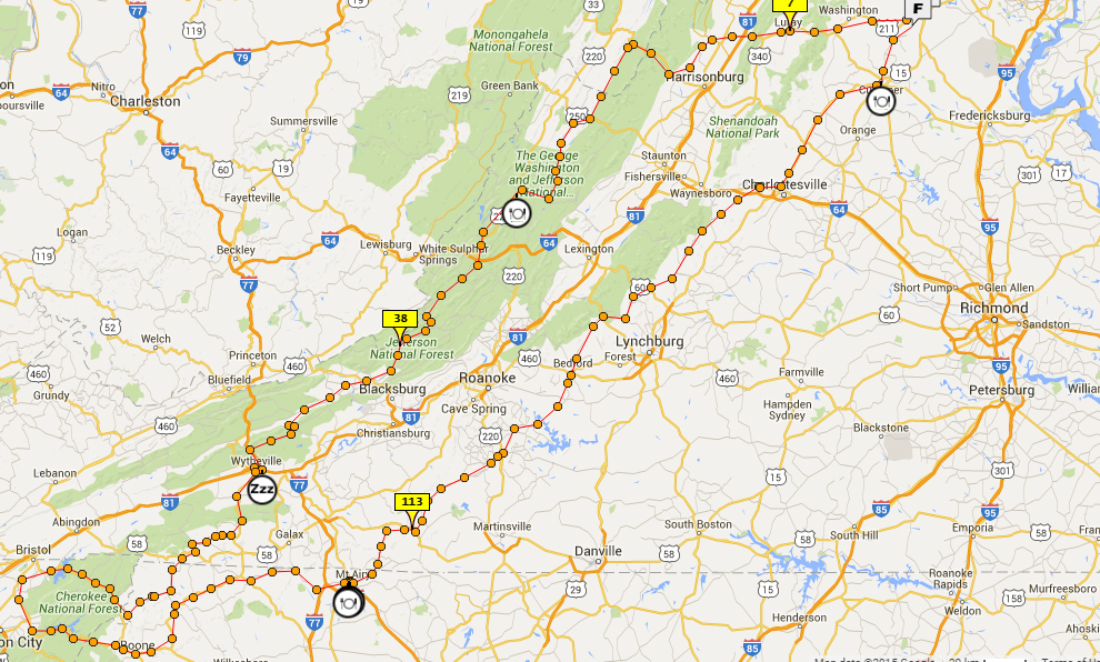
As I mentioned the other day, Mike turned 60 on October 4. We don’t usually make a huge deal over birthdays, but I thought hitting 60 was a milestone that deserved a celebration. And what better way to make merry than spending a long, three-day weekend riding our bikes through the mountains of Virginia and neighboring states?
Overview Map of Route
I worked long and hard planning, and re-working, a route that would take us on some of our favorite roads and let us explore some new roads in the same general regions we’ve been enjoying recently.
One of Mike’s favorite roads is US-33 between Rawley Springs, Virginia and Brandywine, West Virginia. I like it, too, but we were both disappointed to discover recent road work left the pavement, especially in the turns, sprinkled with lots of fine, loose gravel. Not good at all for motorcycles. It was still nice — no traffic! — just not as much fun. That’s okay, though. The ride was just getting started. And it was a lovely day.
Looking at the mountains in Brandywine, West Virginia.
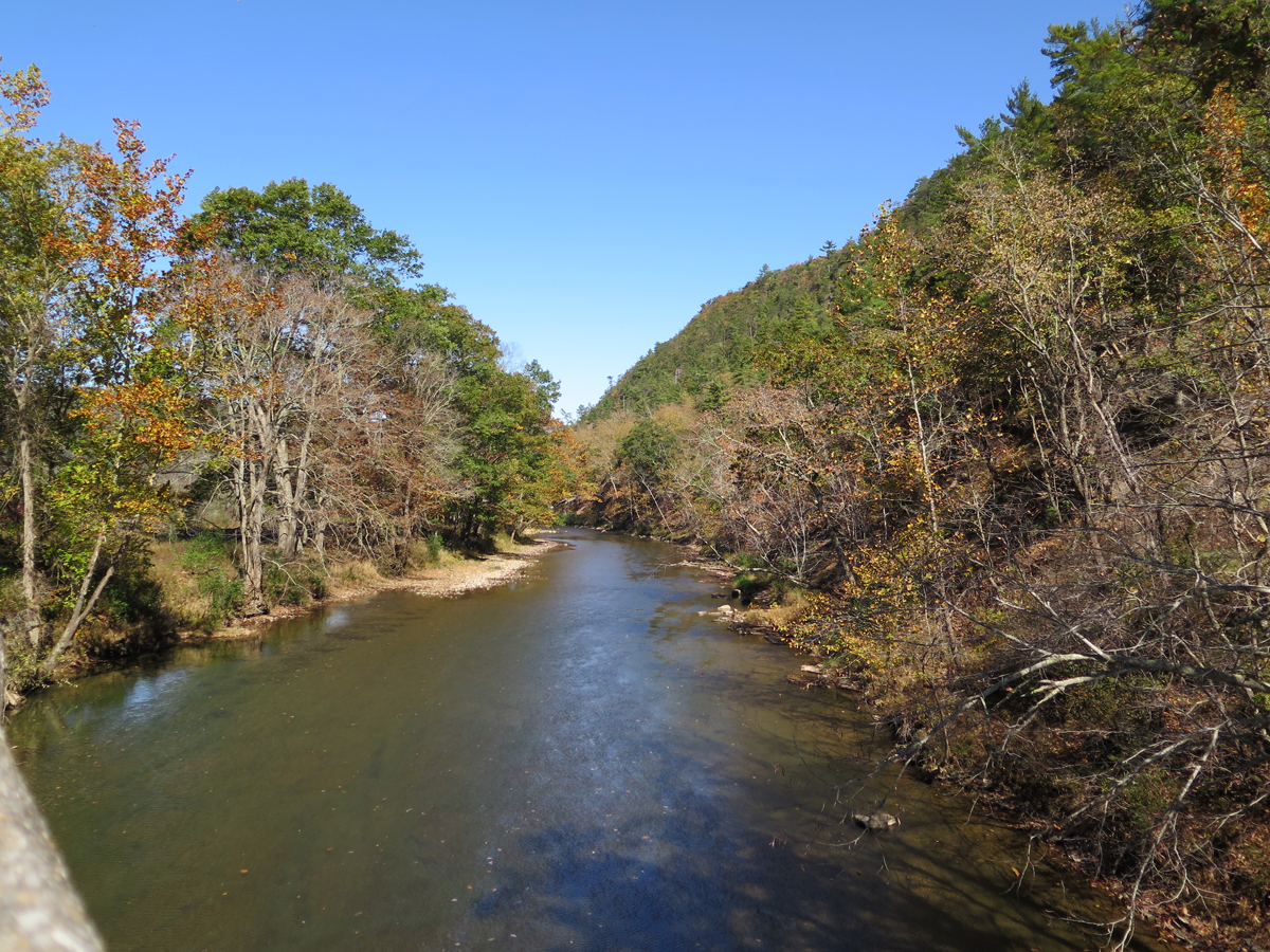
From there, we headed south WV-21/Sugar Grove Road, which becomes VA-614/Cowpasture River Road N after you cross into Virginia. We went west on US-250 then south on VA-678/Bullpasture River Road, which becomes Indian Draft Road before turning into VA-625 / River Road at some point.
Bullpasture River
Hubby waiting patiently.
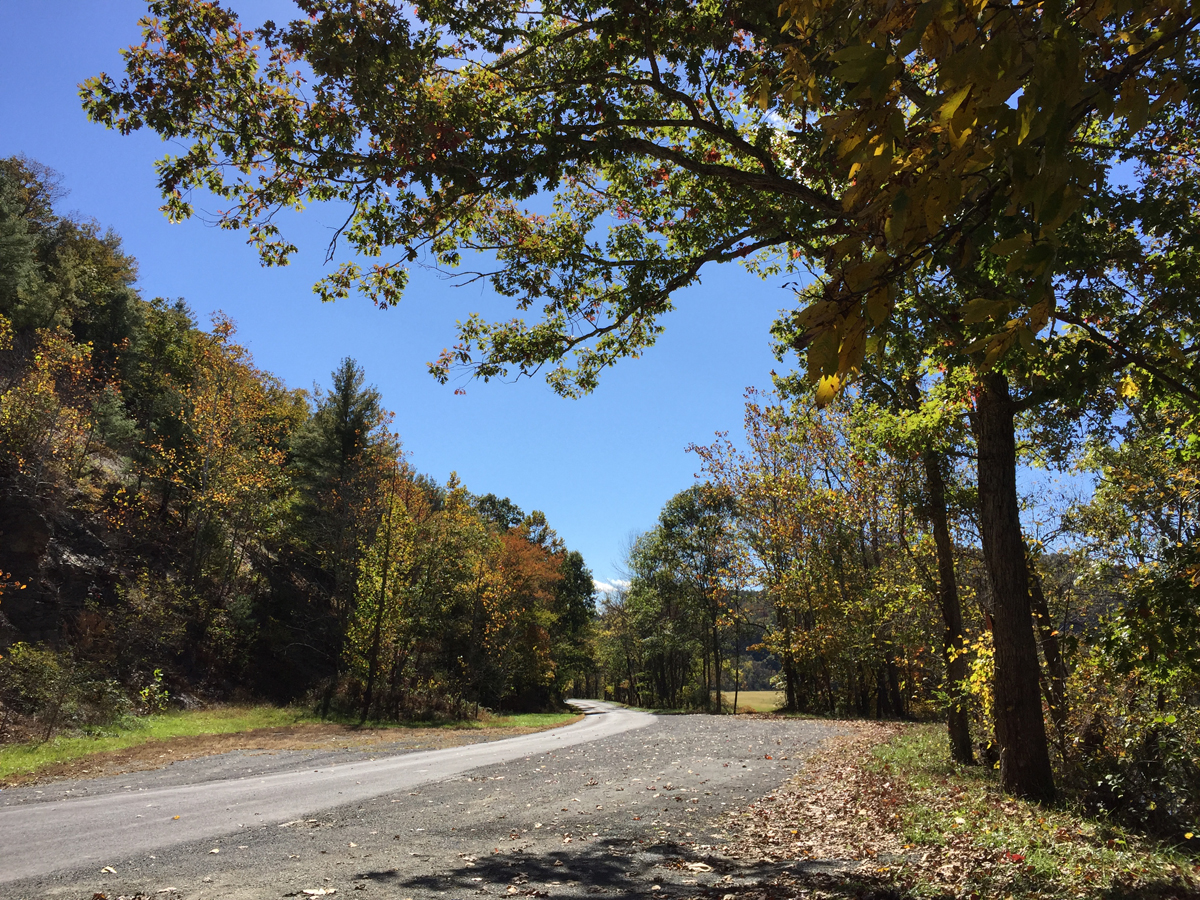
Except for the stint on US-250, those are what I call putt-putt roads. They’re paved, but have no lines, and travel through scenic and very picturesque valleys. There’s not always a posted speed limit, but I tend to max-out at about 45 mph as there’s not a lot of signage and turns tend to sneak up on you.
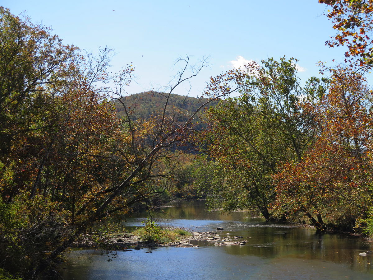
River Road (we’d just crossed the Cowpasture River).
Looking east over the Cowpasture River.
Looking west over the Cowpasture River.
They’re not fast roads, but that combo is definitely going to be included on my official list of favorite roads (as opposed to the mental list, where they’ve been included for a while).
From there, we headed west on VA-39, a fast and fun road. After that long stretch of putt-putt roads, I was happy to roll on the throttle and enjoy some curves. I was a bit amazed to see a car in my rearview mirrors doing a pretty good job of keeping up with me as we zipped along. I laughed out loud then thought “uh oh” when I realized, after about five minutes, it was a Virginia State Police car. All was good, though. Either the officer hadn’t been watching the speedometer or they enjoyed seeing this “crazy frog lady” (as it says on my bumper sticker) have some fun.
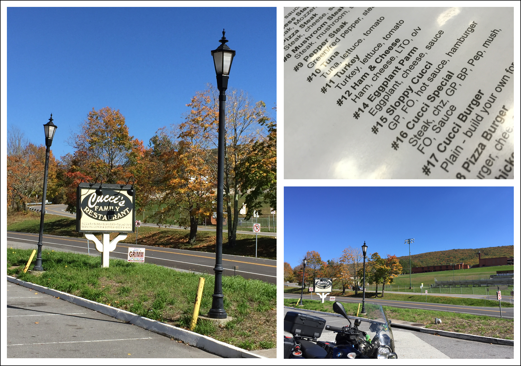
From there, we headed south on US-220 through Warm Springs. By then, we needed gas, and Hubby was hungry, so we pulled into a gas station that was affiliated with or adjacent to Cucci’s Restaurant (pronounced like coochies).
I chose not to order the Sloppy Cucci.
After a quick, okay lunch, we filled up and continued south on US-220 to Hot Springs, veering west on VA-615 / Main Street then south on VA-687 / Jackson River Turnpike.
At some point, I realized I hadn’t re-started my tracker app when restarting the phone at Cucci’s, so we paused for a moment then pressed on. At Falling Spring, we headed back east on VA-640 / Falls Road, to rejoin US-220 just north of Covington. That stretch of US-220 into Covington was a repeat road, because it is delightfully curvaceous. There’s a lovely waterfall just south of where we met back up with 220, but, having seen it before, we didn’t stop.
Just south of Covington, we picked up VA-18 / Potts Creek Road, which was nice, but not as fun as I thought it might be. At Paint Bank, VA, we turned toward the east on VA-311 — a definite favorite road — and then headed south again on VA-658 / John’s Creek Road, continuing on VA-658 when it became Dicks Creek Road. (Both of the creek roads were excellent recommendations from my America Rides Map.)
Along Dicks Creek Road north of Maggie, VA.
Dicks Creek Road north of Maggie, VA.
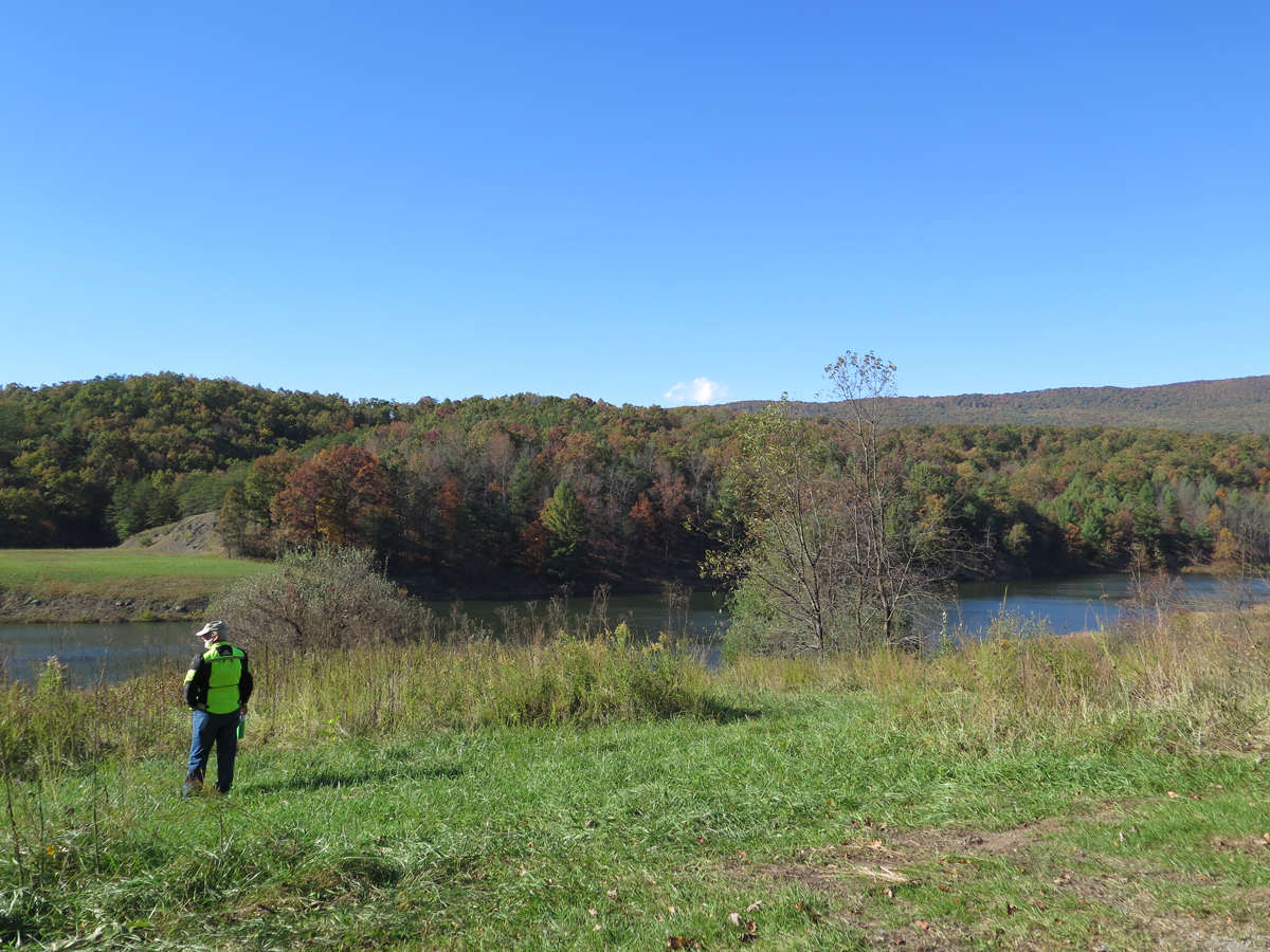
After a brief stretch-break, we continued making our way south and west, hopping on VA-42 — always lovely — then took US-460 west to VA-730 / Eggleston Road (another excellent America Rides Maps recommendation). We re-joined VA-42 eventually, then took an intriguing-looking shortcut I’d noticed on the map — VA-738 / Robinson Tract Road — which would take us closer to Wytheville, our stop for the night.
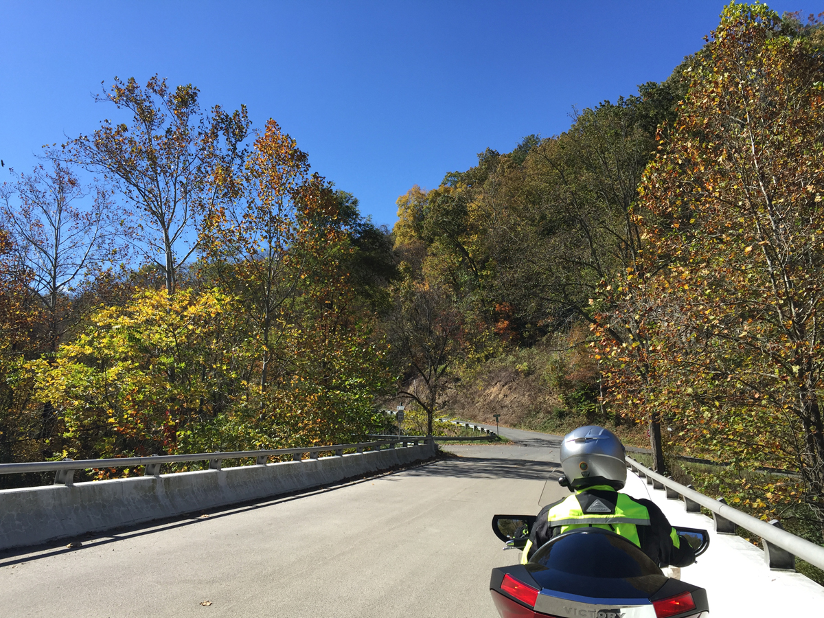
OMG, what an odd road. It crosses Walker Creek then runs along the Pecker Branch for a little ways before going up and over the mountain. It was paved, thank goodness, but was little-used, as evidenced by the fact that the pavement was almost completely covered with fallen leaves in places. And there were stacked switchbacks, steep enough that I could see Hubby making his way down the mountain a few turns below me.
VA-738 / Robinson Tract Road
VA-738 / Robinson Tract Road
It was definitely one of those “why is this road here” moments.
We continued making our way south and west towards Wytheville. The roads were lovely, but the sun was brutal. Both of us were practically blinded by the light as we wound our way along VA-601 / Little Creek Highway. Hubby had a close encounter with a fast-moving deer we’re convinced was goaded by his buddies into playing chicken with Mike. I watched that crazy critter angle at full speed alongside then across the road in front of Hubby. The deer could have easily crossed between us. Hubby said there were inches to spare between him and the deer. And, thanks to the glaring sun, he hadn’t seen it until it was right in front of him.
We were both quite happy to reach our hotel in Wytheville. That sun really had been brutal. And we were both tired after a long, fabulous day. The roads had been amazing. But I knew some of the best were yet to come.
If you’d like to see the Spotwalla tracker map, CLICK HERE.
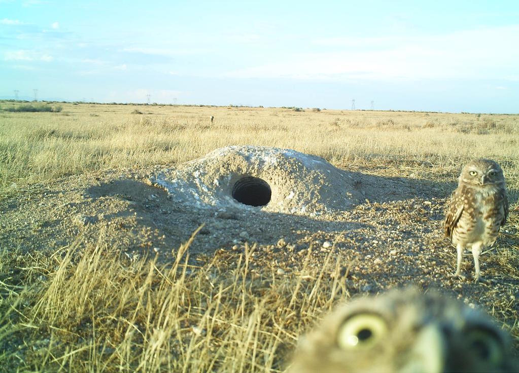
I’ve said here before that my Hubby, Mike, doesn’t share my appreciation for roadside oddities. He doesn’t really “get” my signature selfie pose either. Or my need to take pictures to support this blog habit of mine. All of those things together are what make this picture so absolutely perfect. Even down to that grumpy look on the background owl’s face!
If Mike and I were owls.
Oddly enough, it was Mike who found the picture. He visits some unique Web sites.
He and I are very different people, but we’ve managed to stay married for 22+ years. Every couple needs to have a normal and not-so-normal partner, right?
I just have to keep reminding myself of one very important thing. It isn’t his fault that he’s not-so-normal.
I had to laugh the other day when we stopped for lunch. I’d really been enjoying the ride, especially seeing all the different-colored leaves. So when he said, “It’s really been a great ride,” I responded with an excited, sorta lengthy bit of chat/rant that went something like this…
“Oh my GOD, I know! It’s been so pretty, with the beautiful clear, blue sky. And all the different-colored leaves. It’s like we’re riding through a tunnel of color. And the sun is so bright, I just love it when the sun comes through the trees and hits the red leaves and the yellow leaves. You know, so they’re like backlit and sort of glow or shine or whatever as they hang down over the road. It’s like a kaleidoscope or something. Amazing. It really has been fabulous. I’ve picked some awesome roads.”
He looked at me with a very subtle smirk on his face and said…
“I just meant because the roads are smooth and curvy.”
Remember… he can’t help it.
I think it was during that same conversation when I asked him if he didn’t have me to ride with, whether he’d join a motorcycle club/riding group. Not a biker gang, just a club like those folks who have regular ride-to-eat meet-ups or maybe a Victory Owners Group. (He could be a VOG! If there is such a thing.) You know, so he wasn’t riding alone all the time.
Want to know what he said?
“I don’t do that whole ‘people’ thing.”
He didn’t actually use air quotes, but he did emphasize people, with a look of distaste on his face as he spoke. Cracked. Me. Up.
I HAD to type that quote on my Notepad IMMEDIATELY so I’d remember it exactly.
Mike is a nice enough guy, once you get to know him, but he’s shy (I refuse to use that over-abused “i” word.). He can be moody, too, especially when hungry. Oh, and I can’t forget opinionated. He’s a smart-ass, too. And not very patient when it comes to certain things, e.g., character traits like self-centeredness and laziness, and loud/rude behavior(s).
Yes, despite all of that, I still love him. He has lots of good qualities, too.
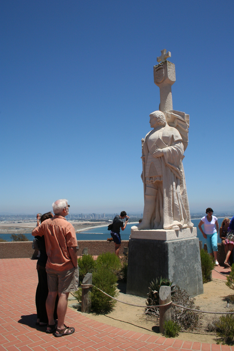
I’d asked him to “pose by the statue for a picture with Shannon.”
We laugh a lot, that’s for sure.
Are you and your significant other very much alike? Only a little? Or complete opposites like us?
This past weekend, Hubby and I went on a three-day ride from Virginia, into West Virginia, North Carolina, and Tennessee, then back into Virginia, the state we call home.
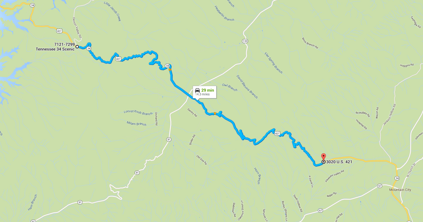
When planning the trip, I tried to include some new roads along with a few of our favorites. One of the roads we enjoyed on Saturday was Tennessee’s US-421 / The Snake.
Later in the day, when discussing our ride, we couldn’t remember if it had been two or three vehicles we’d come up behind that actually slowed down to let us pass. Really.
I know it’s hard to believe. But watching the video confirmed that THREE drivers actually slowed down to let us pass on The Snake. Hubby’s response to my confirming that it had been three separate drivers was, “Good people, all of them!”
Sadly, cars/trucks/buses letting motorcyclists pass is a rarity here in America. Even though motorcycles can usually travel about twice as fast as cars on curvy roads. I guess it’s that whole “me first” or “wait your turn” mentality.
Saturday was actually the second time this year we’d ridden The Snake. The road only got a brief mention after our first visit. This time, I took the GoPro and captured the ride on video.
The Snake’s web page (link shared above) describes the road as 33 miles long with 489 curves as it crosses three mountains and one valley. My video only includes about a 14-mile segment of the road, the really fun part, which is shown on the map below. Sorry, I didn’t count the curves in that portion.
I’m sure the rest of the road is nice enough. As snakes go, though, which would get your adrenaline pumping more, one that’s all stretched out, relaxing in the sun? Or one that’s all scrunched up, unpredictable, and ready to strike?
The video ends about 4 miles from Holston Lake. It’s a pretty four-mile ride to the lake, and the crossing is picturesque, but I wanted to focus on the FUN stuff. I deleted some of the straights in the valley to make the video a bit shorter. It’s running at 2x speed, too.
I was also going to post it at regular speed, but the video was too long for YouTube. If anyone wants to see the video at regular speed, let me know and I can edit it down.