The Beach at Daybreak

Thanks to the alarm on my phone, I was able to get out of bed before sunrise on Saturday. I never use an electronic alarm at home, I have two canine alarms.

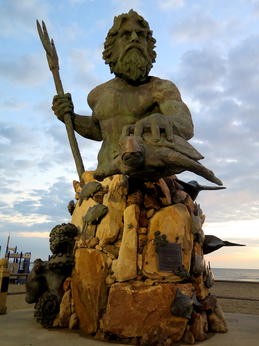
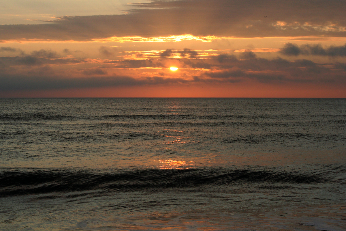
Neptune was just as lovely in the morning light as I thought he would be. I’d figured the sky would make a nice backdrop for him.

IMG_0138
Neptune at Daybreak

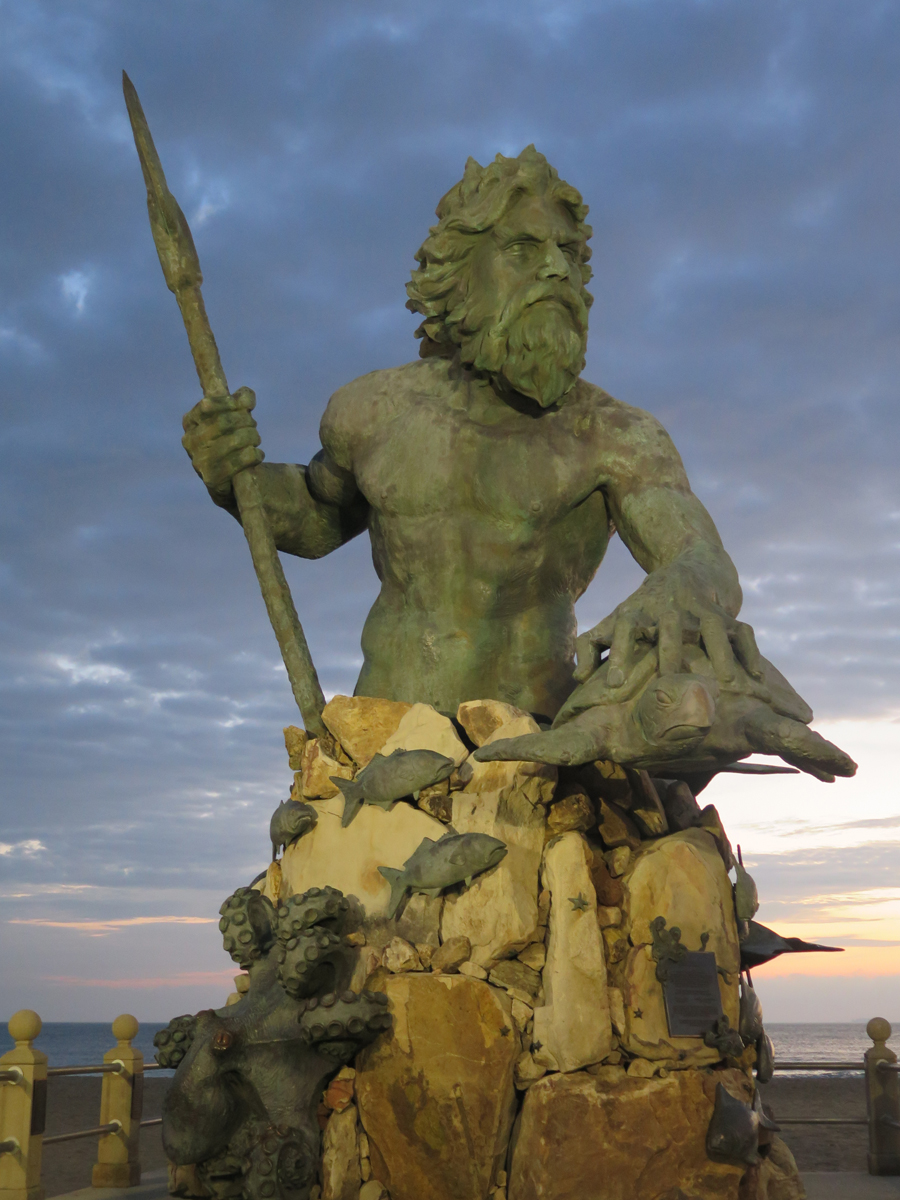
I took several shots, naturally. The one below would be my favorite if it weren’t for the playground equipment in the lower left-hand corner. If you want a closer look, just click on any of these images and a bigger version will open.

IMG_0142
Neptune from Another Angle

As for the sunrise, I captured a bunch of sunrise images, too. Not every frame I captured is worthy of sharing.

None of my followers come to mind when I say this… people who routinely share every single frame they capture make me crazy.

IMG_0149
Cloudy Morning

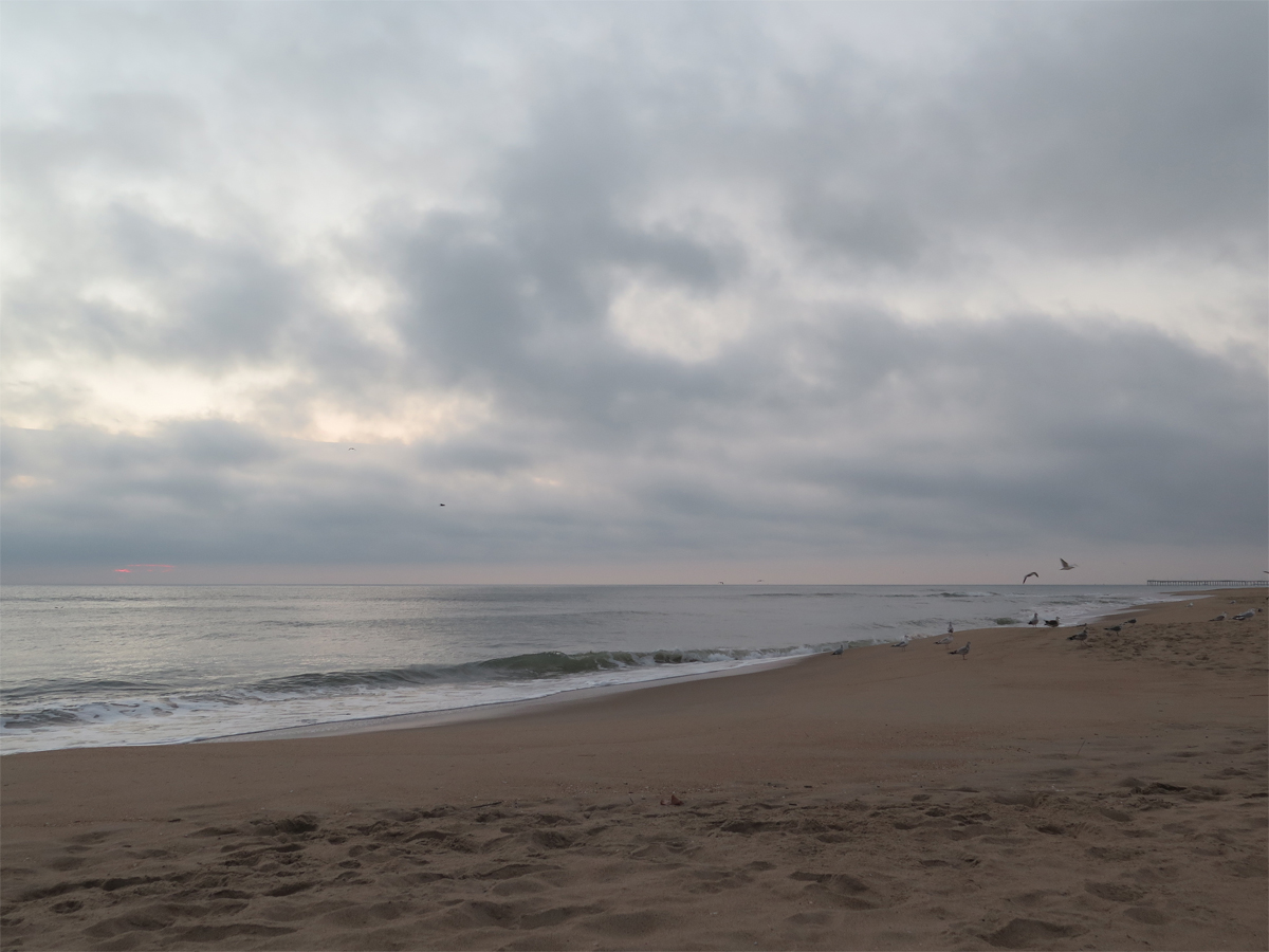
It was quite cloudy that morning (Saturday, November 7). Clouds can be good and bad. Too many, and the sunlight is obscured. I like some clouds because I think it makes the sky more interesting.

IMG_0156_SOC
Sunrise, Straight Out of Camera (SOC)

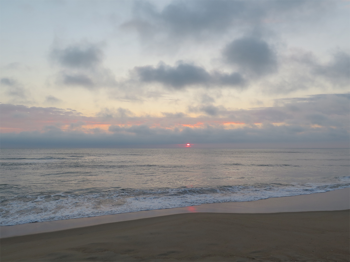
I don’t always edit (aka PhotoShop) my pics beyond re-sizing before posting. With sunrises/sunsets over water or some other flat horizon, I usually have to. Because no matter how hard I try, I can almost never get the horizon level enough.

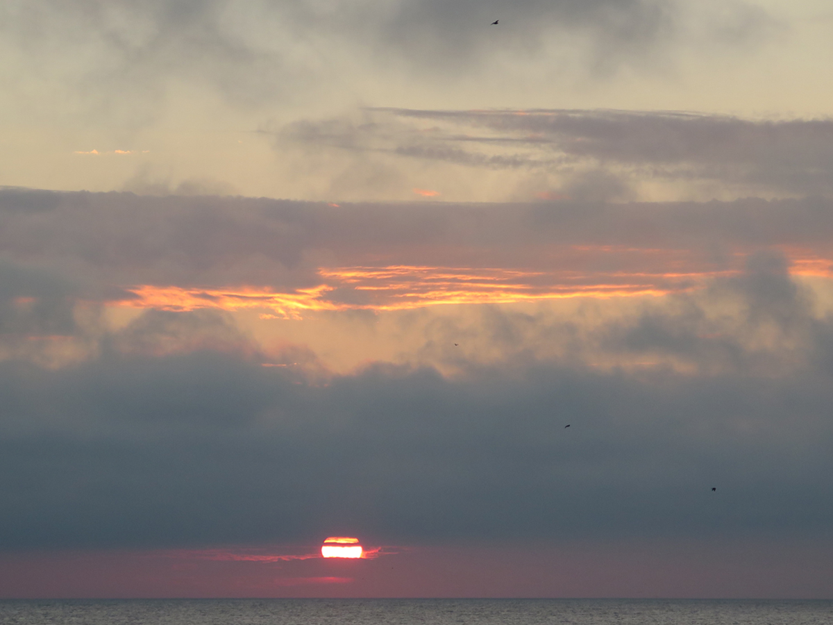
I mention editing, because it’s easy to make a good picture look better with image editing software, as shown below, using the same image as shown above, adjusted for light.

IMG_0156_DK
Sunrise, Adjusted for Light

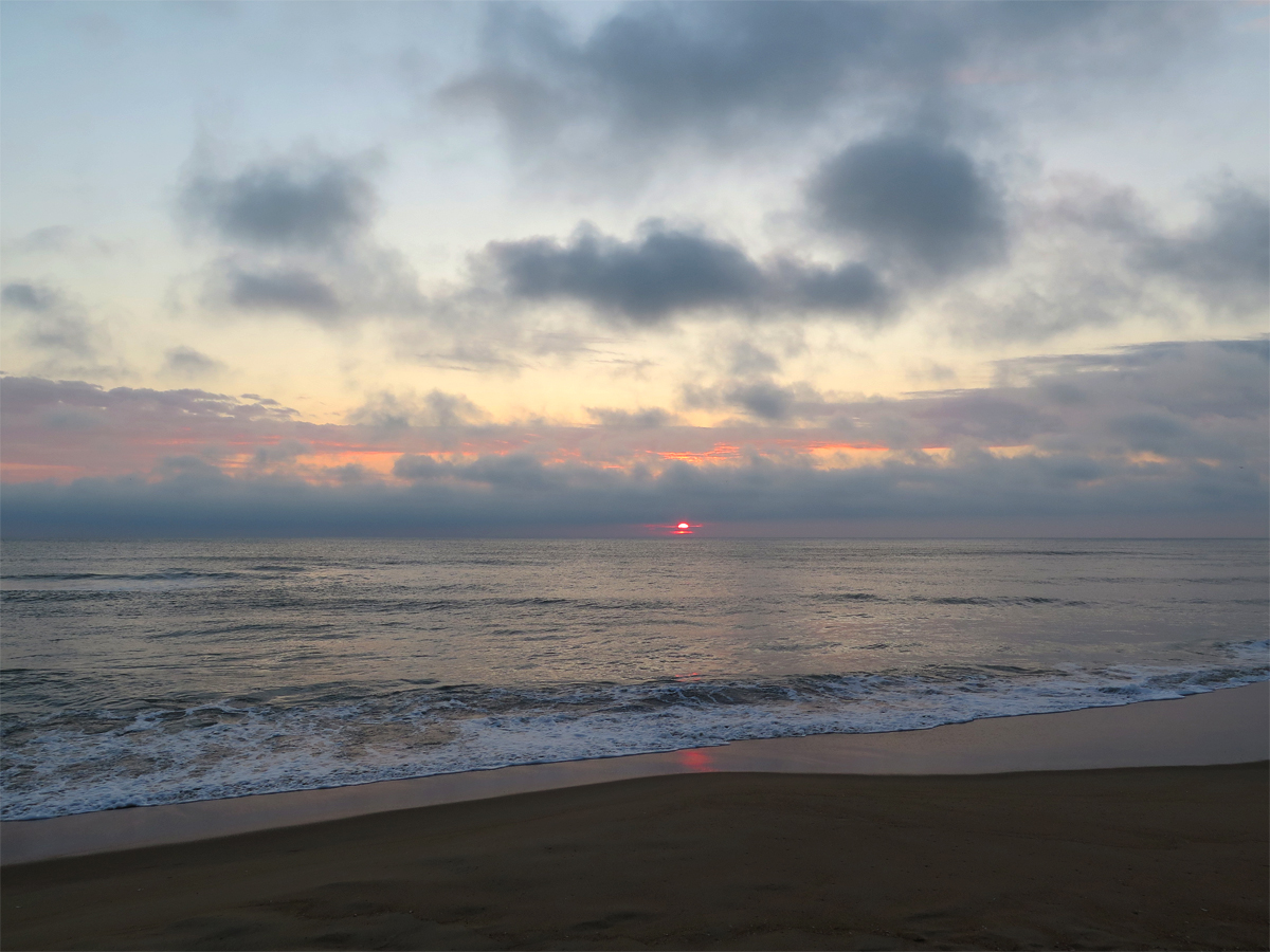
Sometimes, I’ll adjust for composition, too. Below is the same image again, cropped so the sun is in the right third of the frame and the reflection of the sun on the water is in the lower right-hand quadrant.

IMG_0156_DK+CR
Same Image, Cropped

Why am I telling you this? So you’ll understand that when I say an image is straight out of camera or SOC, it means I think I and my camera have captured it perfectly. That’s not an easy feat.

IMG_0164_SOC
SOC with Slanted Horizon

The horizon isn’t horribly slanted, but it’s slanted enough that I notice.

IMG_0164_STR
Same Image with Horizon Leveled

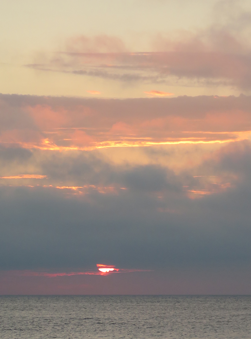
Leveling makes a difference, doesn’t it? (Sorry if I have just cursed you with the needing to have a level-horizon thing.)

There’s a lot to think about when trying to get a good picture — composition, light, focus, level horizon, etc. — and leveling the horizon is the one I forget and/or fail at most often.

IMG_0159
Captured with the Point and Shoot (SOC)


IMG_0169
My Favorite Capture of the Morning (SOC)


IMG_0173_STR
My Third-favorite Capture (SOC with leveled horizon)


IMG_0171
Another Nice Shot (SOC)

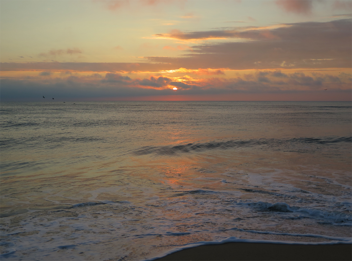
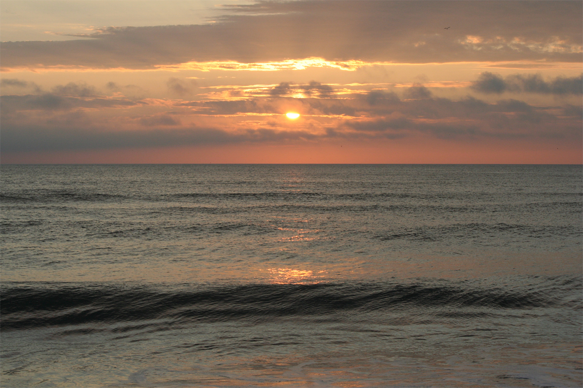
When using an automatic camera, the point at which you focus will determine the amount of light captured in your shot.

IMG_0178
My Second-favorite (SOC)

The wider focus in the above shot made the camera let in just enough light to capture the foreground detail, but still leave some blue in the sky.

IMG_0176
Now, that is a sunrise! (SOC)

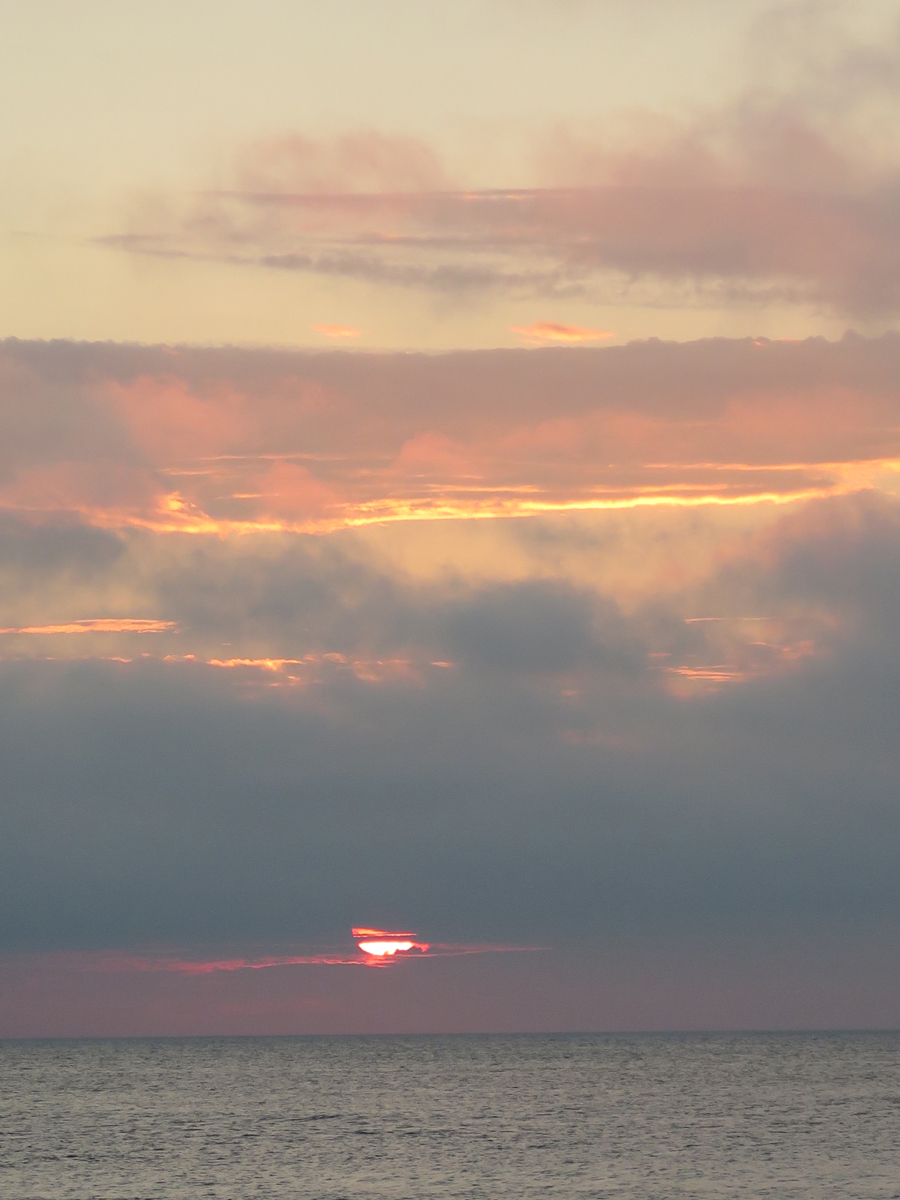
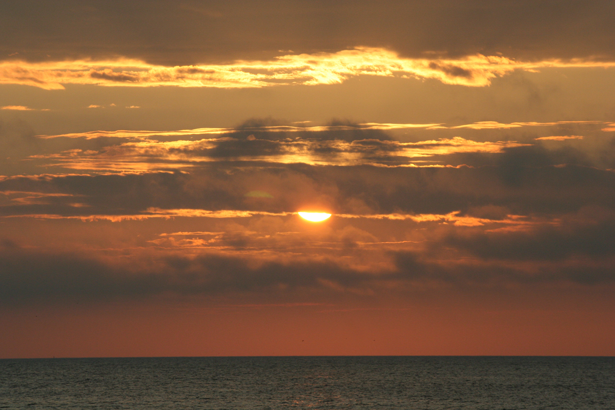
In the images immediately above and below this paragraph, zooming in/focusing on the brightness of the sun meant the camera let less light in, which is why everything else is darker.

IMG_0175
Loving all the colors. (SOC)

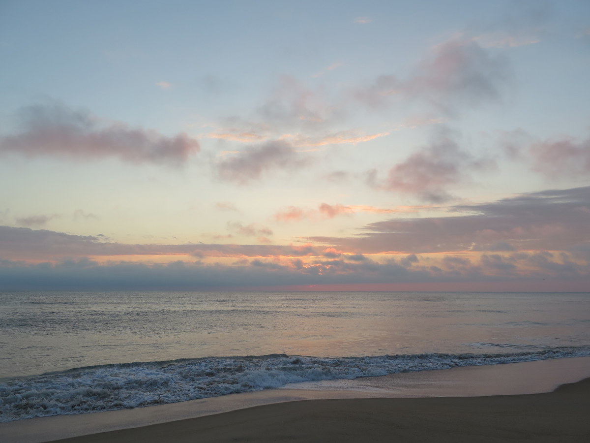
Achieving just the right balance takes practice and experimentation, too. The angle of the light is also important.

IMG_0190_STR
SOC with Leveled Horizon

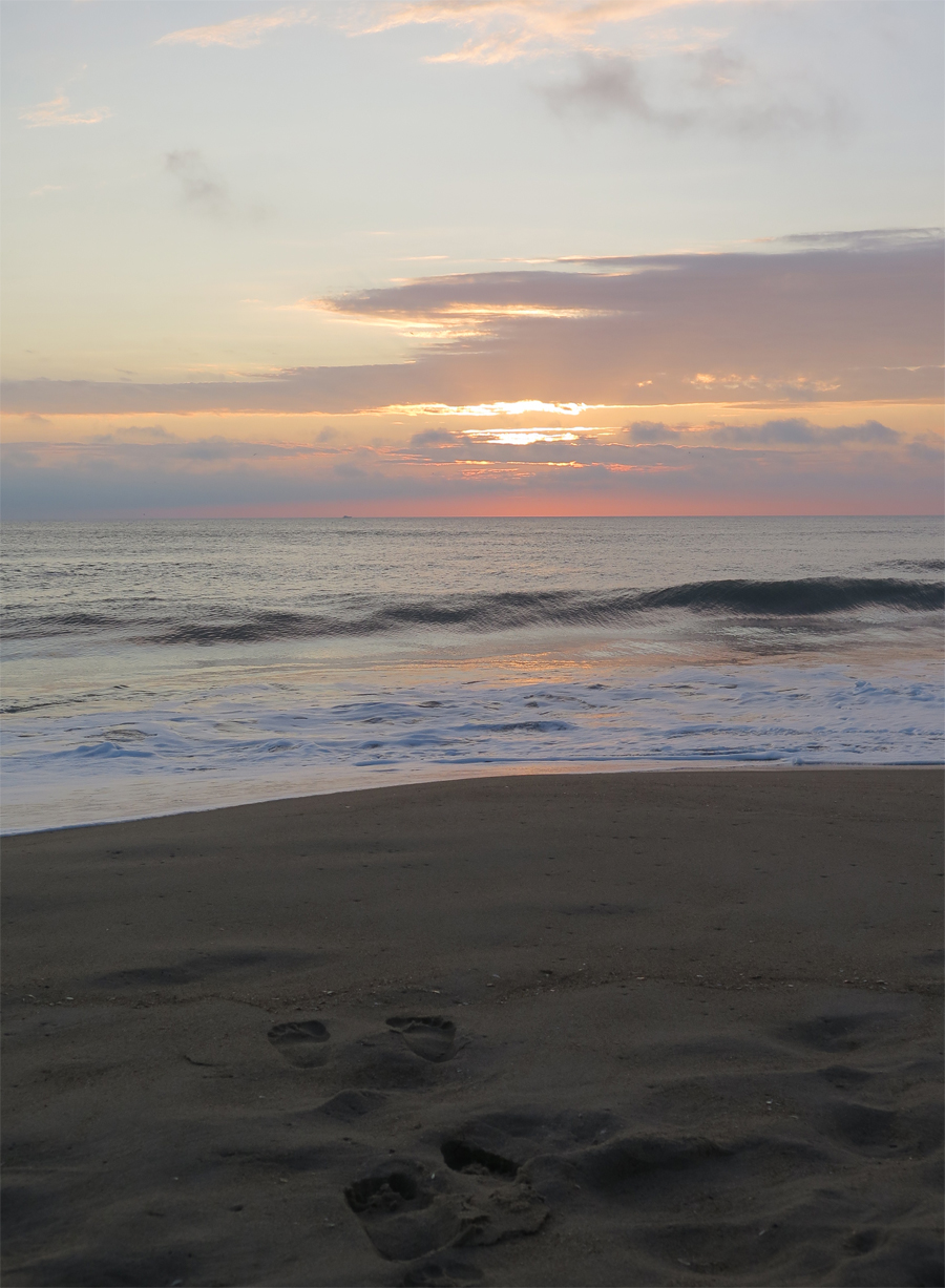
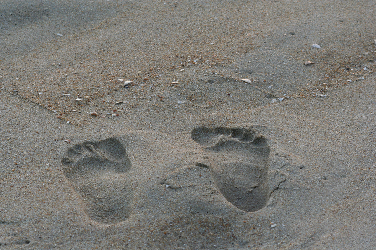
That shot would have been nicer with a slightly darker sky, but then you wouldn’t have been able to see my footprints in the sand. I can use PhotoShop to darken the sky a bit if I want.

All of the images shared thus far were captured on my point-and-shoot, i.e., automatic, camera. It has a variety of manual options, but I have yet to learn how to use them. I can be a lazy photographer at times.

The next few images were captured with my digital SLR camera (interchangeable lenses, easier-to-use manual settings, manual focus, etc.).

IMG_3140
This could be a tad darker, I think. But it’s still a decent image.


IMG_3142
Sasquatch Tracks


IMG_3144
SLR Capture (SOC)

Playing with the light settings and using manual focus let me capture those wispy little clouds in front of the dark, background clouds.

IMG_3143_SOC
My Favorite SLR Capture (SOC)

In the SOC version, you can’t really see the sun’s rays like you can (subtly) in the below version, which I adjusted slightly for light.

IMG_3143_DK
My Favorite SLR Capture (after light adjustment)

Not surprisingly to me, I captured more shots worth sharing with the point-and-shoot than I did with the SLR. I’m out of practice. It takes thought to get the right light settings on that thing, and I am very rusty.

All of the pics would have been better had I thought about using the tripod. I did say I can be a lazy photographer…

I could’ve stayed longer to watch as the sky continued to change and capture more images, but I knew I’d gotten a few good ones. AND I had things to do.

It’s hard to pic a favorite, isn’t it?

IMG_3146
Those fish make me smile.

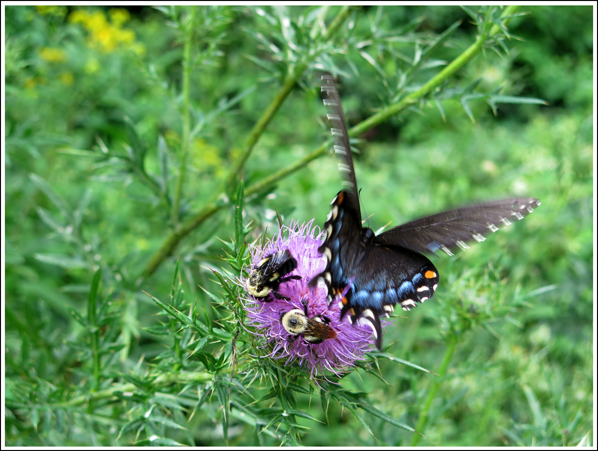
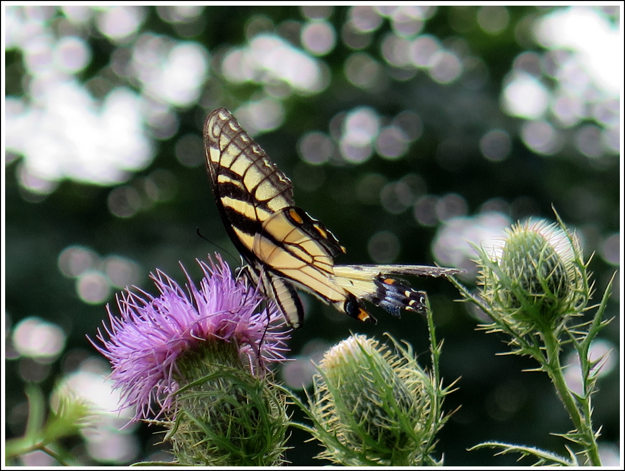
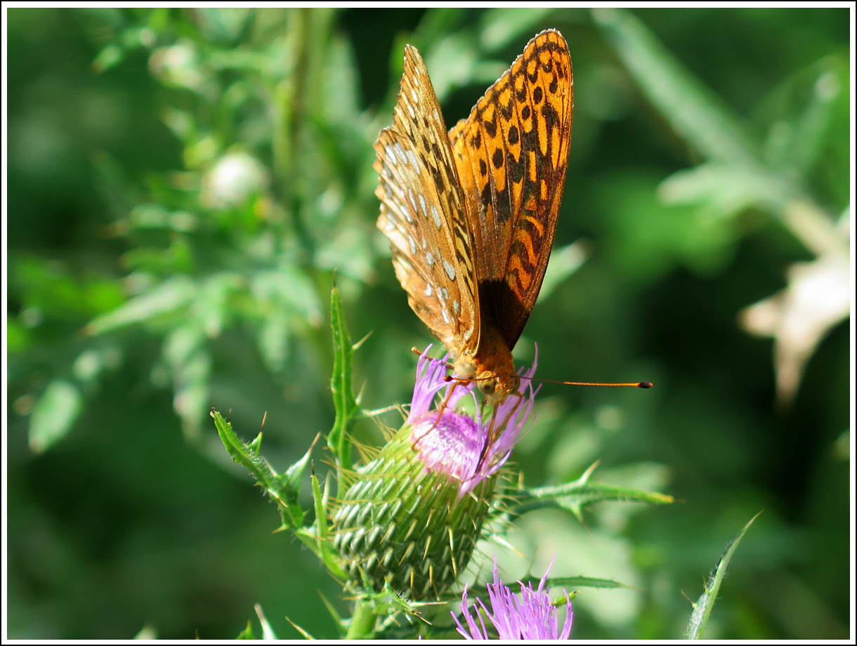
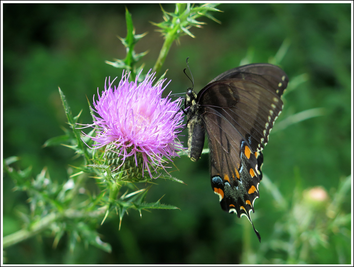
Next up, some fun images captured in and around Virginia Beach.

Butterflies

While enjoying my randomish ramble to Love, Virginia this past Saturday, I stopped at the Loft Mountain Wayside along Skyline Drive in Shenandoah National Park.

As I was preparing to depart, I noticed a large patch of wildflowers on the hill beside the building. Looking a bit more closely, I also observed a bunch of butterflies and bees enjoying said flowers. So I grabbed the point-and-shoot (aka “real” camera) and walked over for a closer look.

I only watched for about 5 minutes. The flowers were in the sun, and it was around 2:30, close to the hottest part of the day. I managed to capture some nice images. The color was a bit washed-out on all of them since the sun was so bright (that’s why midday is not the best time for pics), so I had to adjust the input levels a bit with PhotoShop Elements. I re-sized the pics to post, too.

I hope you enjoy the shots as much as I do. If you click on an image, you’ll get a better view.

IMG_0048
Three’s a Crowd


IMG_0051
Worker Bees


IMG_0039
The Soloist


IMG_0043
Grab Hold


IMG_0045
Seeing Double


IMG_0047
Landing


IMG_0056
Rough Around the Edges


IMG_0042
Uplifted


IMG_0058
Newness


IMG_0057
Accent Colors

My Mom loved butterflies. I can’t help but think of her every time I see one.

Tomorrow marks three years since her passing. She was my biggest fan, and would have enjoyed this post.

The Vine That Ate the South

I’ve told y’all about Kudzu before, right? It’s an invasive vine, not native to the United States, that’s slowly, but surely, consuming the South.

During our ride last weekend, Hubby and I traveled one of the roads I’d ridden during my solo adventure in June. I’d remembered seeing some pretty alarming kudzu growth along that route and decided to stop and capture a few pics for you all.

IMG_3202
The guard rail is completely covered and the road sign has almost been obliterated.


IMG_0292
I’m guessing that’s a stump on the right of the tree that’s in the process of being eaten.


IMG_0294
It’s a very dense and fast-growing invasive plant.


IMG_3203
Guardrail in the process of being eaten.


IMG_3200
Another view of the disappearing guardrail.


IMG_0293
See how dense?


IMG_0295
Look out, Mike! It’s coming for you.


IMG_0296
I wonder how long it would take to start eating my bike?

Those runners are a lot like English Ivy (the climbing type) and Virginia Creeper. They really dig in.

Kudzu does have some interesting uses, as explained in the following short video.

It can grow up to a foot (~30.5 cm) a day!?! Wow. That really is fast.

I came across the next video at the Duke Today Web site. It’s a bit longer, but has a really cool, artsy, time-lapse element in the second half that I enjoyed. You should watch it if you have time.

Click the link if you’d like to read the full article about the making of the video. The article includes this intro:

To make a film showcasing the landscape of his North Carolina upbringing, Josh Gibson turned not to beaches or mountains or towering Longleaf pines.

Instead, he turned to the ubiquitous Kudzu.

Kudzu Vine from Josh Gibson on Vimeo.

Kudzu-covered objects can be sort of cool-looking, but it hurt my heart to see the overly aggressive invader choking out a bunch of rhododendron in the Jefferson National Forest.

According to that first video I shared, it’s gotten further geographically than I’d thought it had. Do you have Kudzu in your state?

Getting High the Natural Way

There’s a natural way to get high that not enough people experience.

When’s the last time you went to a national park “just because”? Or stopped to smell a flower, sit quietly by a babbling brook, or simply look at the sky?

Heady stuff, really.

Even though my recent Appalachian ramble was mostly about riding, I appreciate natural stuff, too. And, heck, the Blue Ridge Parkway (BRP) is a national park of sorts. As explained on the BRP’s FAQ page…

Is the Blue Ridge Parkway a national park? The National Park Service administers a variety of kinds of areas. Some of these are “parks”, some are called “seashores”, some are called “monuments” or “historic sites”, and some are called “parkways.” We wear the same uniform and operate under basically the same rules as Yellowstone, Gettysburg, or Cape Hatteras. Our agency web site at http://www.nps.gov will give you the entire list!

Yes, the road is a good one, but there’s lots of natural beauty to enjoy, too. Like Linville Falls at Milepost 316.

Waterfall!
Waterfall!

I wasn’t exactly dressed for a hike, but the walk from the parking lot was relatively short, and well worth the sweat it induced.

IMG_0072
It sure was green.


IMG_0075
Lower part of the waterfall.


IMG_0076
Different angle.


IMG_0078
Middle section of the falls.


IMG_0081
Upper, twin cascades. (I made up all of these names.)

There were actually quite a few people around, I just framed my shots carefully to exclude the strangers.

IMG_0102
I found THE spot!

And, look at this, you can literally and legally get high, too. For free.

IMG_0125
Couldn’t resist stopping here.

This is the place that was inundated with weevils. You actually get to drive most of the way to the summit. From the parking lot a short, but steep, walk gets you to the high point.

IMG_0116
View from Mount Mitchell


IMG_0130
View from Mount Mitchell


IMG_0121
The road leading back to the BRP.


IMG_0113
Micro Ferns (I made that name up, too.)


IMG_0111
Interesting Plant


IMG_0108
Lichen on a branch.

The plant pics were all taken between the parking lot and the mountain’s actual summit. It was a great way to stop and catch my breath without looking like a total wuss that couldn’t make that short, steep trek without getting winded.

After enjoying the view and having to ask some stranger to brush all the bugs off of my back, I hopped on the bike and headed back to the BRP. A bit later, I stopped at one of the visitors’ centers/exhibit halls to stretch and use the facilities. That’s where I saw this beautiful, huge rhododendron.

IMG_0136
Rhododendron


IMG_0144
Rhododendron


IMG_0146
Rhododendron


IMG_0137
Rhododendron


IMG_0138
Rhododendron

Yes, that’s a lot of pictures of the same flower, but I thought it was pretty.

IMG_0132
On the road again.

It really was a pretty day. I’ll close this post with another of my favorite bike shots.

IMG_0155
High Overlook


There are times when the BRP, being in the mountains, is completely fogged in, making it impossible to enjoy the stunning views that seem to be around most corners.

The weather Gods were certainly smiling upon me that day.

It’s About Time

Flower Selfie
Flower Selfie

Skyline Drive is one of those roads I often see on “must-ride” lists. It’s nice, but I often feel it’s overrated because it’s not really a “fun” road for me. There’s the 35 mph (56 km/h) speed limit for one thing. And it’s pretty popular, so there’re often lots of cars and big, loud motorcycles putting along. The road does have its merits, though.

In case you’re not familiar with it, Skyline Drive is a 105-mile (~169 km) road located within Shenandoah National Park (SNP). It’s runs along the ridge or crest of the mountains from Front Royal to Afton, Virginia. (If you’re interested in more stats/facts, click here.)  It just so happens that Skyline Drive meets up with the Blue Ridge Parkway (BRP) in Afton. The BRP is another infamous must-ride route for motorcyclists, that runs 469 miles (~755 km), connecting the south entrance of Virginia’s SNPark with the north entrance of the Great Smoky Mountain National Park (GSMNP) in Tennessee. I’ll tell you more about the BRP one day soon.

The biggest attraction of Skyline Drive — here’s a map, by the way — is its natural, scenic beauty. Did I mention that it runs through the forest? And there are 75 overlooks where one can stop, get off of the bike/out of the car and take in sweeping mountain vistas, observe wildlife, and see wildflowers. Depending on the season, of course. (Some of you may remember my recent Winter visit to SNP.)

I like flowers. I do. Which is why, since we moved to Virginia in late 2011, I’ve been telling myself that I really need to visit Skyline Drive during the Spring when the Mountain Laurel is in bloom. I had a Mountain Laurel bush in a shade garden at our last house in Maryland, and I really loved seeing the flowers when it bloomed. I could only imagine how pretty a whole grove of Mountain Laurel would be.

The obligatory food shot.

Until now.

Lucky for me, I happened to see something on-line last week mentioning that the Laurel was starting to bloom in SNP. Knowing it was going to be HOT on Saturday, I hatched a plan for Hubby and I to leave the house early on Saturday, head west to Luray for breakfast, and then head south through the valley while it was still pleasant and then ride north along the drive during the hotter part of the day.

Since Hubby hadn’t managed to get a decent breakfast biscuit sandwich during his recent loop of the US, he was quite happy to hear that Hardee’s was on the itinerary.

It was yummy, if I do say so myself.

From Luray, we headed down Business US-340, through Stanley, and took a left onto River Road just before Alma, a fortuitous, alternating tree-lined and pastoral alternate route I discovered quite by accident on my last dog transport. As its name implies, the road runs along the South Fork Shenandoah River for a bit. It was cool and lovely.

I’d told Hubby we would take US-340 down to Waynesboro unless it started getting too hot. River Road intersected with US-340 around Grove Hill. From there, we headed south toward Waynesboro. Unfortunately, temps were starting to climb. At 9:30, it was already around 85 F (29 C), so, at Elkton, we headed east on US-33 to reach the SNP Swift Run Gap Entrance Station.

Iron Mike statue at the Big Meadows Visitor's Center.
Iron Mike statue at the Big Meadows Visitor’s Center.

As we climbed into the mountains, temperatures dropped. By the time we got onto Skyline Drive, temps were a pleasant 65 F (18 C). It was fabulous. But we weren’t seeing any Mountain Laurel. Gasp.

We did see some wildlife, though. There’s a very valid reason for that sometimes-painful 35 mph speed limit. I slowed substantially when I spotted a White-tailed Deer on the right-hand shoulder. She saw me coming, and I figured she’d hop off into the woods. Instead, she hopped off into the road, mere feet in front of me.

We did eventually start seeing Laurel here and they, among lots of other wildflowers, ferns, and trees. It was so quiet and peaceful, and there were very few cars.

I’d done my research earlier, and knew we’d be stopping at the Limberlost Trail near mile 43, where there’s supposed to be a decent amount of Laurel, so I wasn’t too concerned about missing the bushes we rode past.

We pulled off into a couple of picnic areas, hoping to spot a bear, to no avail. So we just motored along, enjoying th natural air conditioning and lovely views.

When we stopped at the Big Meadows Visitor’s Center, I was tickled to see a couple Laurel bushes, where I could get a closer look. It’s pretty stuff. Some of it is much pinker than others.

IMG_0009
Pink Mountain Laurel at Big Meadows


Pink Mountain Laurel at Big Meadows

We hung out there for a bit, checking out the gift shop/camp store, visiting the restroom, drinking, and stretching. Then we continued on to Limberlost Trail, where I’d read there was a decent grove of Mountain Laurel.

EDIT: I forgot to mention that we saw a bear just south of the Upper Hawksbill parking area. So cool. I’d only ever seen bear at SNP once before, and Hubby never had. It was in the trees to the right of the road, so we didn’t get a great look, but it was definitely a bear. 🙂

image2
Limberlost Trailhead


IMG_2248
Me and Hubby in the Laurel grove (yes, I need a haircut)


IMG_0038
Mountain Laurel


IMG_0042
Mountain Laurel


IMG_0026
Mountain Laurel


IMG_0048
Unidentified Bird in the Mountain Laurel


IMG_0041
Hubby found a bench.


IMG_0035
Mountain Laurel


IMG_0049
Another capture of the unidentified bird.


IMG_0062
Limberlost Trail


IMG_0058
Mountain Laurel


IMG_0024
Mountain Laurel


We didn’t walk very far since neither of us were dressed for a hike. Plus, we could feel temps starting to climb. It was still around 75 F (24 C), tops, as we continued north. We’d talked about riding all the way to the North Entrance at Front Royal, but, knowing it would be much warmer once we descended from the ridge, I decided to exit at Thornton Gap.

That was a smart move. Temps were definitely climbing. It was about 20 degrees warmer off the mountain (85 F [29 C] again). And, even though I chose an off-highway route to carry us from Little Washington to Warrenton, it kept getting warmer. And, with temps around 92 F (33 C), we were quite happy when we reached the house around 1:00 PM.

We’d had a nice little ~160-mile (257 km) ride, and I’d FINALLY seen the Mountain Laurel in bloom. Now I can shut up about THAT to-do. LOL.

I sure hope things cool off soon.

Hubby’s been working on his ride report. I hope to be able to share it with you in the next couple of days.

So, what do you all think about the Mountain Laurel?

Not So Cheery Blossoms

Timing really is everything. And sometimes, my timing sucks.

I was hoping to see the cherry blossoms this year. But, as this Web site says, “Crowds are an integral part of Washington DC’s cherry blossom season.” And I hate crowds.

Not to mention the fact that, on a picture-perfect Spring day, I’d rather be riding than doing just about anything else.

Besides, I knew I’d be driving to Baltimore on Tuesday for an annual check-up, and I figured I could drop in to DC on my way home.

Big-ass Cherry Blossoms

Doesn’t look bad, right?

Not up close. But check this out.

003
The blooms were most definitely past their peak.

Did I forget to mention that it was raining? And windy? A bit chilly, too.

007
Washington Monument

Looks downright depressing, doesn’t it?

006
Shades of Gray

There was still color to be seen.

015
Color

And some unique sights. If you are observant like me.

024
Nature’s Art

The throngs of people there this past weekend didn’t get to enjoy the sight of wet petals plastered to every surface did they?

But wait, it gets better.

016
OCPD Monks

When’s the last time YOU caught a couple of OCPD monks in the act? Have you ever? Now, I can say I have.

Since I arrived just before the start of the infamous DC rush hour, and it was raining, it took me two-and-a-half times as long to get home as it would have had there been no traffic.

Maybe next year, my timing will be better.